Cammino di Carlo Magno
The Cammino di Carlo Magno runs from Bergamo to Carisolo (Trentino Alto Adige). It covers about 225 km and is divided into 12 stages.
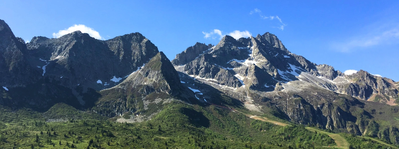
For the most part, the route runs along the half coast of the mountain ranges. Although it is an itinerary of medium difficulty, it still has some fairly challenging climbs and descents, especially near the Alpine passes. The altimetry varies from stage to stage, starting from about 380 meters asl in Bergamo alta to about 1883 meters asl at Tonale.
The direction of the Trail, which retraces the legend of Charlemagne, is unidirectional and takes us towards the mountains: starting from Bergamo Alta, we cross several valleys: valleys D'Argon, Val Cavallina, Val Borlezza, Val Camonica, Val di Sole and Val Rendena. The route skirts Lake Endine, Lake Iseo and Lake Moro.
HISTORY
Charlemagne’s Way takes its name from a 15th-century legend about the ruler’s passage through the Camonica Valley.
Charlemagne traversed the entire valley, conquering the castles of local lords and forcing them to convert, and to celebrate his victories the ruler had numerous churches built (sometimes over the ruins of previously destroyed castles).
The legend is set in a real geography among villages, castles and churches often still visible and existing today or documented by archaeological materials.
Charlemagne’s legendary journey starts in Pavia, reaches Lodi, Bergamo and arrives in Lovere near Lake Iseo. Continuing, the route touches the villages of Gorzone, Esine, Berzo Inferiore, Cividate Camuno and Bienno, where he founds some churches that still exist today. It passes through Breno, Capo di Ponte in the Middle Valley and reaches the Upper Valley from Edolo. Amid battles against pagans and foundations of new churches he passes through Monno, Vezza d’Oglio, Vione and reaches Ponte di Legno. From here it climbs to the Tonale Pass where it continues its journey in Trentino Alto Adige, heading finally to Verona.
The Path follows this legendary route passing through the places mentioned in the text. Obviously, the legend does not describe in detail the steps of the ruler, and so an attempt has been made to find paths or routes, surely already used since ancient times by the various local communities, to move from one place to another.
To date there are no established records of Charlemagne’s passage through the valley, although some of the religious buildings mentioned date back in first construction to the period of the ruler. The route is therefore a real tour through the history and art of the Camonica Valley, along the footsteps of the ancient legend.
Each country traversed is different from the next and has its own characteristics, both artistic and traditional. Walking this route is like taking a plunge into the human history, moving from prehistoric rock carvings, Italy’s first UNESCO site, through the remains of the ancient Roman city of Civitas Camunnorum (now Cividate Camuno), medieval castles and villages, richly frescoed churches in the 15th and 16th centuries, to the art of the 1700s and the remains of the Great War in the Upper Valley.
WATER SOURCES.
In the first three stages of the walk there is water only in the towns, but from the fourth stage the one starting from Lovere and along the entire Camonica Valley there is a great presence of water in fact in every village crossed there are several fountains where you can refuel.
Generally, along the route there are water sources on average every 4 km in the Camuno section.
Along the last stage , Edolo – Ponte di Legno, there are fewer water sources in the Monno-Vezza D’Oglio stretch, as there are more stretches within the forest.
In the Trentino stages, water is present in the towns.
CAPS
Stage 1 – Bergamo- San paolo D’argon 19, 5 km
The Walk starts in Bergamo Città Alta, in Piazza Duomo, exiting through Porta Sant’Agostino and walking along Via Pignolo and then Borgo Palazzo. The legend names several churches in the city, including the ancient cathedral (now destroyed) and the Church of San Michele del Pozzo Bianco (with frescoes from the 13th century onward).
Leaving the outskirts of Bergamo, one heads toward Gorle, with castle and medieval buildings, crosses the ancient bridge of Roman origin and which tradition says was crossed by Julius Caesar. You cross Scanzorosciate, with medieval buildings and later, leaving the plain to climb a hill and enter the woods.
It then continues through fields and vineyards toward Negrone, with the ancient church of San Pantaleone, before plunging back into nature and passing another small rise. Descending the high ground, it crosses Torre de’ Roveri and begins the last climb through the woods to descend towards San Paolo d’Argon.
The stage ends in front of the Benedictine Abbey of San Paolo d’Argon.
The first part of the stage is very urbanized, having to leave a large city, but we soon leave the busier area to follow quieter locations.
*The first stage of Cammino di Carlo Magno is not currently marked with signage, but can be traveled with Gps track, descriptive and detailed maps.
Stage 2 San Paolo d’ Argon -Spinone al Lago 22.8 km
Stage 2 of Cammino di Carlo Magno begins at the Benedictine Abbey of San Paolo d’Argon. The route first travels along forest trails and then some lightly traveled paved roads to reach the village of Cenate Sopra.
Leaving Cenate Sopra begins the ascent on a path through the woods to pass the 800 meters above sea level of the Sanctuary of Santa Maria Assunta in Monte Misma. Once past the religious building the path proceeds first level and then downhill always on a path through the woods, we pass the Sanctuary of St. Anthony and arrive at the village of Luzzana.
The route now proceeds inside some villages, Borgo di Terzo and Vigano San Martino, where we follow a bicycle path that makes us avoid the traffic on Via Nazionale and leads us to the crosswalks. Having crossed the road, we follow traffic-free paved streets that lead us to a few villages in Casazza.
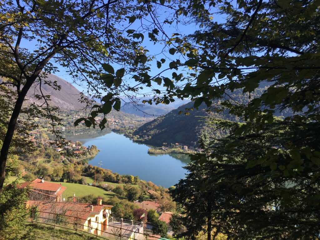
The Path then takes us near the Castle of Monasterolo del Castello where a beautiful nature trail begins, leading us to the beginning of Lake Endine. Skirting the shores of the lake, the stage ends at the Church of San Pietro in Vincoli in Spinone al Lago.
Stage 3 Spinone al Lago – Lovere 20.3 km
Stage 3 of Cammino di Carlo Magno starts from Spinone al Lago. The route climbs into the woods on a cobblestone path that leads to the foot of Bianzano Castle. It passes through the medieval village and then continues back on a path through the woods to the village of Ranzanico. Along the way, Lake Endine can be seen among the trees.
After passing through the center of Ranzanico, proceed first on an asphalt road, with little traffic, and then on a path through the woods to the first houses on the edge of the municipality of Endine Gaiano. It climbs toward the small hamlet of Fanovo and, still on a path through the woods, reaches Località Palate di Endine Gaiano.
The Walk then continues on the paths of the Valle delle Fontane to the first houses of Sovere entering the Borlezza Valley. You pass through the historic center and cross the Borlezza stream.
The stage now continues, first by ways and then by path, climbing Monte Cala to arrive near the Sanctuary of San Giovanni. Scavallando the mountain and descend by cobblestone path to Lovere.
The trail ends in front of the Basilica of Santa Maria in Valvendra in Lovere.
Stage 4 Lovere – Boario Terme, 16.8 km
The stage starts from the port square of Lovere, walking through the alleys of the historic center, we arrive at the Basilica of Santa Maria in Valvendra. We pass through the hamlets of Corti and Volpino in the municipality of Costa Volpino. Arriving at the chapel of San Carlo Borromeo, we leave the asphalt and take a cobbled path that leads us to Castelfranco di Rogno. We descend toward the town of Rogno and reach the Oglio River. Passing through Bessimo, we take a paved road that climbs to Lake Moro and surrounds it to descend to the small village of Capo di Lago. Continuing, shortly after the village, we take a mule track that leads to the hamlet of Corna di Darfo. The stage ends in front of the Terme di Boario spa.
Stage 5. Boario Terme – Breno, 16.9 km.
The stage starting from Terme di Boario continues to the hamlet of Montecchio where the 17th-century bridge over the Oglio River can be seen. The first part of the route follows the Oglio River bike path, which you leave before arriving in the hamlets of Sacca and Plemo in the municipality of Esine. Once in Esine, a stop to visit the Church of Santa Maria Assunta is absolutely recommended. Inside the religious building we can observe the cycle of frescoes by the artist Pietro da Cemmo dating back to the 15th century. The stage continues on a dirt/cobbled road to the Church of the Holy Trinity in the upper part of the municipality of Esine. Continuing on, you pass the churches of San Lorenzo and San Michele in the municipality of Berzo Inferiore. The route returns to asphalt near the municipality of Bienno, where a visit is recommended. The stage ends in the municipality of Breno after crossing the hamlet of Mezzarro on a slight descent.
Stage 6 Breno – Grevo, 17.6 km
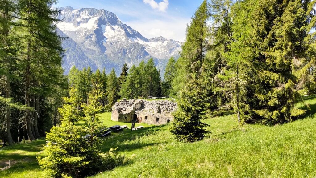
Leaving the historic center of Breno, you follow the road uphill to the Hermitage of San Valentino and enter the woods. You then pass the villages of Niardo, Braone and Ceto, until you reach Nadro and the areas rich in rock engravings of Foppe di Nadro and Naquane. Reaching the edge of Capo di Ponte, still in the woods, we arrive at Grevo where our stage ends. The stage takes place mostly in the woods and on comfortable paths, sometimes cobbled, that give us stupendous views of the valley.
Stage 7. Grevo – Edolo, 20.2 km.
The stage begins in the center of Grevo from where the descent to Cedegolo begins and then the ascent to the village of Andrista. The first part of the stage runs through nature, through woods and open spaces, with beautiful views of the valley below. Arriving near Malonno we drop in altitude and ride along the Oglio River, then climb back up toward Rino and Sonico. Almost at the end of the destination we rise in altitude again, passing through the woods, and then descend again to Mu and Edolo. The stage, in addition to nature, allows you to admire some medieval villages and the Park of Rock Engravings in Sonico.
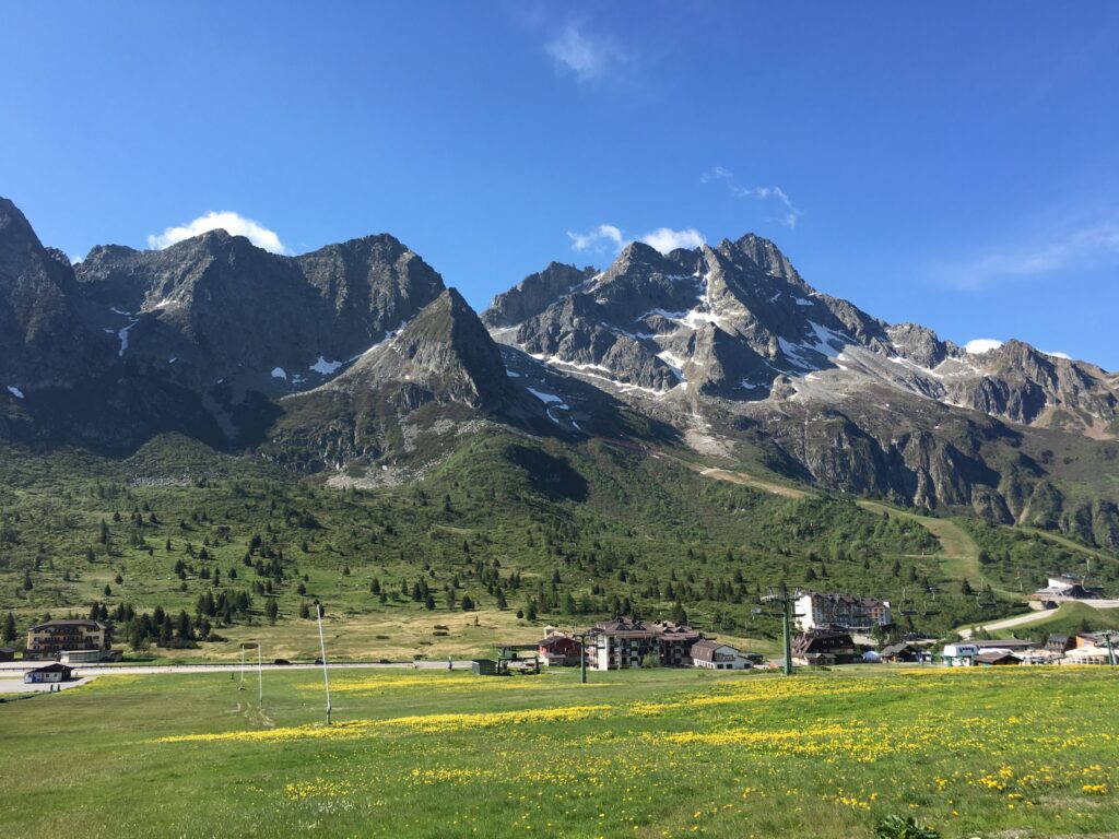
Stage 8. Edolo – Ponte di Legno, 23.2 km
The stage begins in the historic center of Edolo from where the climb begins. The route runs almost entirely in a panoramic position and on comfortable paths. Several villages are crossed: Monno, Vezza d’Oglio, Vione, Temù, Villa Dalegno and finally Ponte di Legno. Stage that allows you to appreciate the natural and historical beauty of the Upper Camonica Valley. Once in Ponte di Legno, the Via di Carlo Magno joins the Via Valeriana, which united in a single route reach the Tonale Pass and then Trentino Alto Adige.
Stage 9. Ponte di Legno- Ossana 23 km.
La stage departs from the Ponte di Legno parish church and following the Narcanello stream heads toward Val Sozzine, where it joins to the route of the Via Valeriana to climb up to the Tonale Pass. Upon reaching the pass, the route climbs by trail to the old St. Bartholomew’s Hospice. The trail descends, first through meadows and then into the woods, in Val di Sole (Trentino).. Along the way you pass the Fort Mero. Before reaching the valley floor, we pass through the hamlets of Vermiglio: Pizzano, Fraviano and Cortina . The stage ends in front of Ossana Castle.
Stage 10. Ossana- Dimaro 13.5km
The stage is mostly flat on the valley floor of the Val di Sole. Following first the bicycle path and then a dirt path that runs alongside the Noce Creek we reach the village of Pellizzano, where there is one of the churches named in the legend. We pass the center of Mezzana and skirting the stream cross the village of Daolasa and then to Almazzago (hamlets of Commezzadura). The Trail then continues to the historic center of Dimaro, at the ancient Dazio House and the Town Hall.
Stage 11. Dimaro- Sant’Antonio di Mavigliola 23.6km
Starting from the Dazio House in Dimaro, one reaches the Venetian Sawmill where we take a dirt path that runs along the Meledrio Stream and leads us to the Pison Waterfalls. The landscape is very fascinating both for the nature that surrounds us and the first views of the peaks of the Brenta Dolomites. Once we arrive at Passo Campo Charlemagne, in Val Rendena, begins the descent to Madonna di Campiglio. The stage ends in the village of Sant’Antonio di Mavignola.
Stage 12. Sant’Antonio di Mavignola – Carisolo 5.3 km
The stage runs mostly downhill, always following the ancient road that led from the pass to the bottom of the Rendena Valley. The route avoids all the hairpin bends until we arrive at the bed of the Sarca di Campiglio River, which we follow to the bridge between the municipalities of Pinzolo and Carisolo. We enter Carisolo and cross the Parco dell’Antico Chestnut Grove you reach the Church of Santo Stefano, the destination of the Cammino, where Baschenis’ fresco depicting the legend of Charlemagne from Bergamo to Carisolo is visible inside.
SERVICES PRESENT STAGE BY STAGE
Supermarkets are present in Bergamo- San Paolo D’argon – Casazza – Lovere-Boario-Breno-Edolo-Ponte Di Legno- Ossana – Dimaro – Carisolo( end of stage)
In Grevo(end of stage) present small grocery store
Pharmacies present in Bergamo- San Paolo D’ Argon-Lovere-Boario-Breno-Edolo-Ponte di Legno(end of stage)
Pharmacy not present in Grevo at the end of the third Stage Breno-Grevo.
SIGNAGE
Signage present along the way plus photos to attach to email
First Leg Bergamo- San Paolo D’argon no signage present- use gps tracks and maps and descriptions found on website www.camminodicarlomagno.it
DANGERS
No danger
ASSOCIATION CONTACTS
email: amiciviavaleriana@libero.it
www.camminodicarlomagno.it
ROAD BOTTOM.
First Stage 60% Asphalt and 40% Dirt
Second Stage 60% Asphalt and 40% Dirt
Third Stage 30 % asphalt and 70 % gravel
Stage 4: 60 percent asphalt and 40 percent dirt.
Stage 5: 45% asphalt 55% dirt road
Stage 6: 30 percent asphalt 70 percent dirt.
Stage 7: 30% asphalt and 70% gravel
Eighth stage 20% asphalt and 80% dirt road
Ninth stage 10% asphalt and 90% asphalt
Tenth stage 50%Asphalt and 50% dirt.
Stage 11 20%asphalt and 80% gravel
Stage 12 70%asphalt and 30% dirt road
CREDENTIALS
Present-Free Credential
To apply for it, fill out the format on the website:


Cammino di Carlo Magno
With the free Cammini d’Italia app, you can plan and walk Cammino di Carlo Magno safely, being able to plan the stages in detail and walk the route thanks to the integrated GPS technology that supports your orientation during your adventure.
⠀Inside the app you will find many other paths present in Italy. Thanks to the georeferenced tracks of many routes, you will be able to study the itinerary that suits you best and also download the GPX tracks of the individual stages offline.
The app also includes a complete digital map of all the paths surveyed to date on our portal, giving you a wide range of choices among the many paths in the Belpaese.
⠀⠀
Cammini d’Italia is the perfect app for those who want to explore the beauty of Italy on foot, discovering hidden places surrounded by nature. Download it for free today and start planning your next adventure!
⠀
⠀
 ⠀⠀⠀
⠀⠀⠀