Cammino di San Vili
The Path skirts the breathtaking spectacle of the Brenta Dolomites, encounters wonderful natural landscapes where water dialogues with rock, passes through fascinating villages with ancient traditions and tasty local products.
The Cammino di San Vili is named after St. Vigilius, the bishop and patron saint of Trent who, according to legend, traveled through it in his evangelization work in the 4th century AD.
HISTORY
Vigilius, bishop and martyr, third in the series of bishops of Trent, died on June 26, 405 AD, at Spiazzo in Val Rendena. Legend has it that, during one of his journeys to spread Christianity in the Giudicarie Valleys, Vigilius while preaching on the banks of the Sarca stream against the summer rites to Saturn of the local people, was challenged by throwing hooves (or hard loaves). Hit, he plunged into the river and was swept away by the current. Architecture still memorializes the martyrdom with the Spiazzo parish church dedicated to him, built right on a boulder by the river. Another striking testimony is the small church on the banks of the Sarca in Tione, which commemorates the place where according to tradition Vigilius’ body was deposited by the current.
Vigilius, of Roman origin, was a man of deep learning. Appointed bishop at a young age, he began assiduous evangelization work in the valleys of Trentino. To be helped in his evangelization he called from Cappadocia the three young men Martyrius, Sisinius, and Alexander, who settled in San Zeno in Anaunia. In this very valley, the three young men found martyrdom .
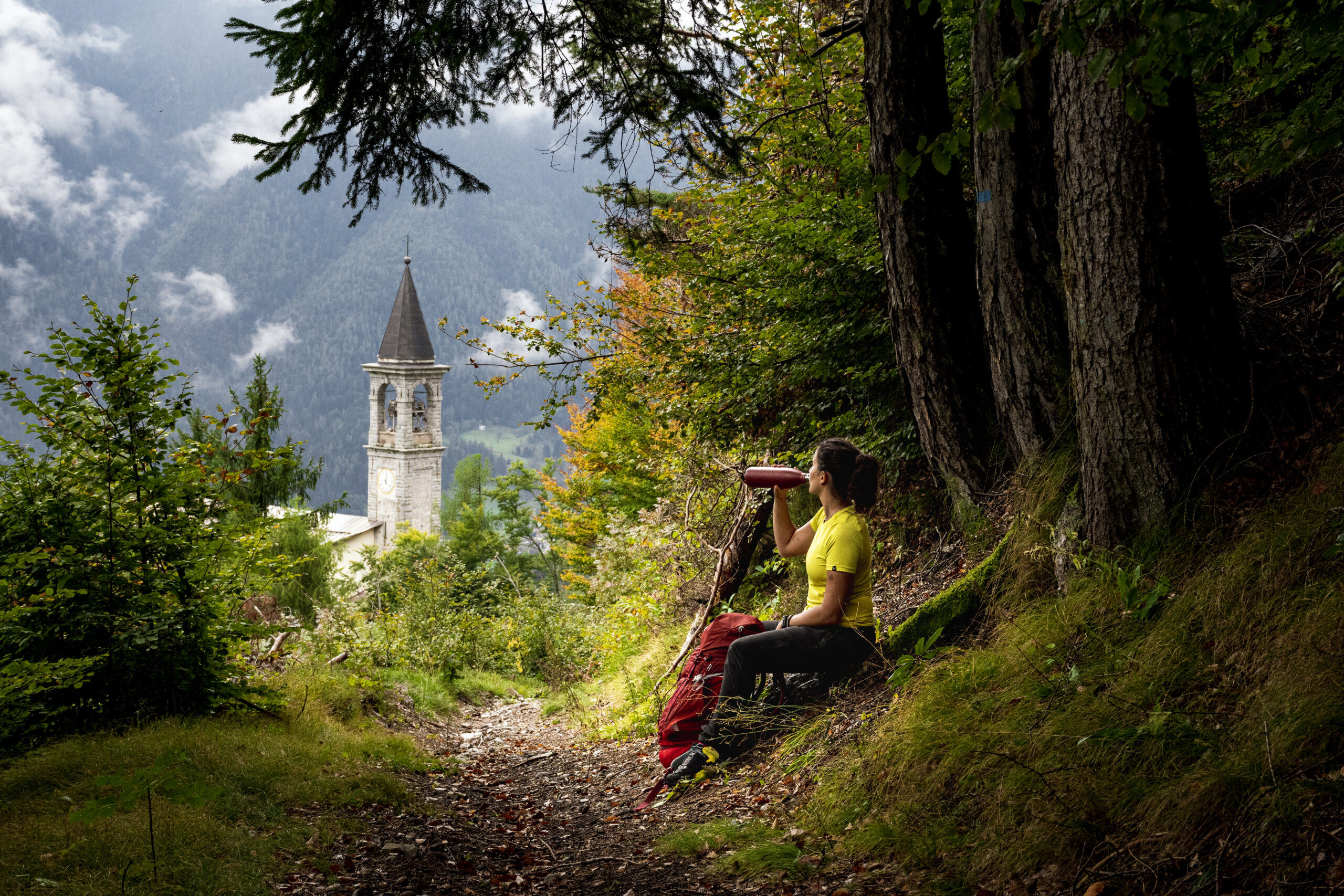
The route followed by Vigilius and the Trentino Christians who brought his body back to the city in funeral procession corresponds to the old Bus de Vela passage, reached from Tione through Ragoli, Stenico, Banale, Ranzo and the Vezzanese. Many chapels are present on the route: St. Vigilius of Spiazzo, St. Vigilius al Vat of Tione, St. Vigilius of Stenico (St. Vigilius of Curé, St. Vigilius of Molveno), the chapel of Ranzo, St. Vigilius of Vezzano to the cathedral of Trent.
WATER SOURCES.
In all stages there are numerous water sources. The only stage without water sources is the last one, from Monte Terlago to Trento. It is therefore recommended to refuel beforehand.
In recent years, drought is also beginning to be felt in Trentino. It may therefore happen to find fountains closed in other areas. Therefore, it is always recommended to inquire about the situation before leaving.
SIGNAGE
Signage present along the way
DANGERS
The section from Deggia to Ranzo is a trail that overlooks the Limarò Gorge, carved by the Sarca River. Caution is recommended.
Brown bears are present in Trentino. For any more information on what to do in case of a sighting, visit the website:
Another animal to watch out for is ticks. Again it is recommended to view the site:
https://www.camminosanvili.it/wp-content/uploads/2021/07/Protezioneprevenzione.pdf
ACCESSIBILITY
Currently, the trail is not accessible to people with mobility disabilities. However, it has been walked by people with visual disabilities. For any further information it is recommended to contact the contact persons of the organization.
ROAD BOTTOM.
The Trail has different percentages of asphalt depending on the areas. Overall, the Low route has about 55 percent asphalt and the High route 45 percent.
CREDENTIALS
The Credential is a document that accompanies the traveler during the Camino. You can pick it up free of charge at the tourist office in Madonna di Campiglio Via Pradalago, 4 or at the Trento city tourist office P.za Dante, 24, 38122 Trento. We recommend that you check the opening hours on the website.
TENT WALK
To camp in tents, it is recommended to lean against the camping areas provided. Not all the route is provided with camping areas. For any information it is recommended to contact the organization.
CONTACTS
Natourism Ltd.
Maura Gasperi 335 8074220
Alessandro Armani 333 4567980
camminosanvili@gmail.com
STAGE 01
STAGE 01: FROM MADONNA DI CAMPIGLIO TO BOCENAGO
Travel time 8h; elevation gain 159m; distance: 22.1km
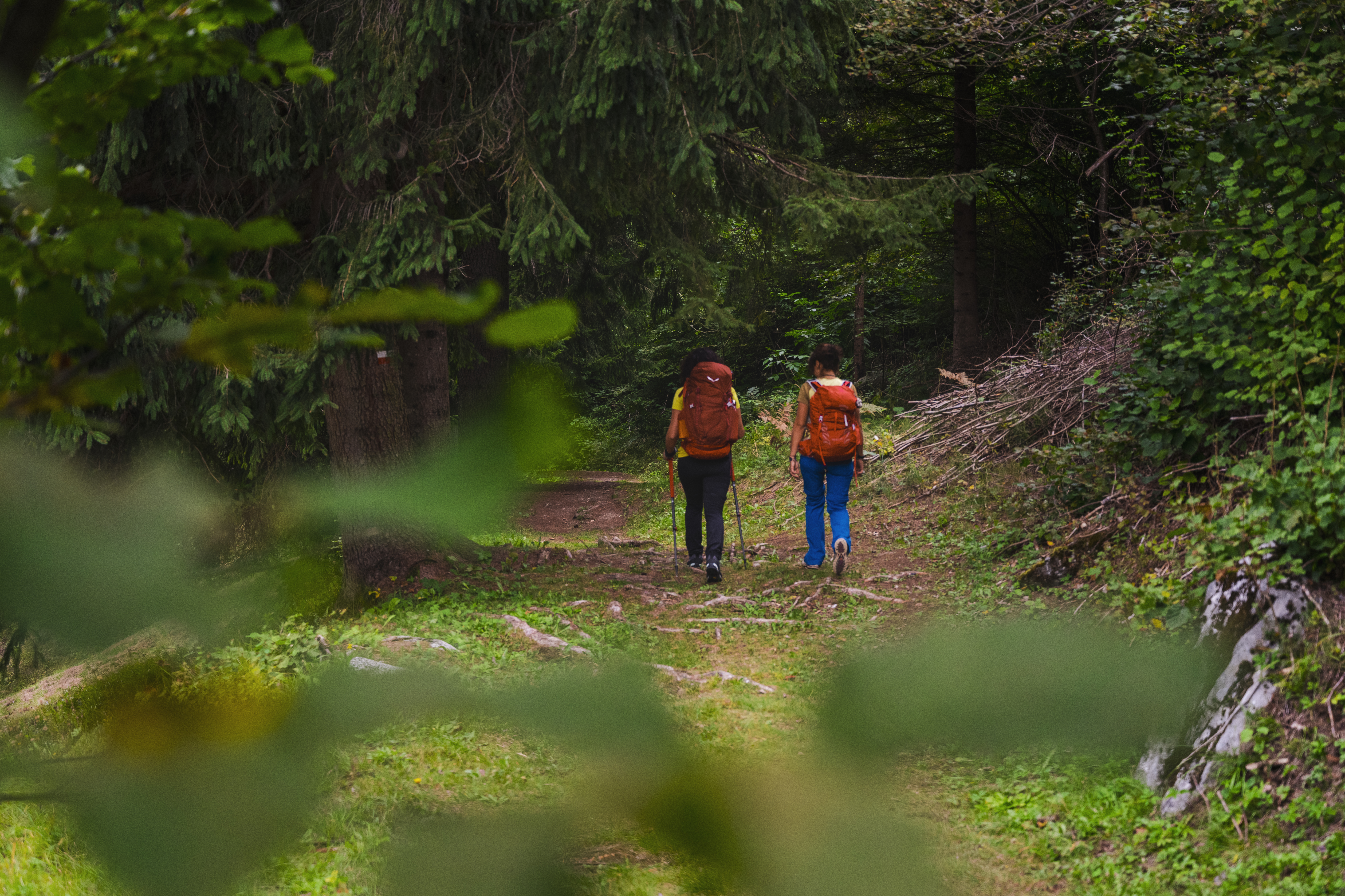
The starting point of the Walk is the church of Santa Maria Antica in Madonna di Campiglio the neo-Gothic alpine church in the historic center. From here you continue southward, admiring the extraordinariness of the Brenta Dolomites, a UNESCO World Heritage Site. Continue to the village of Pinzolo, where you can admire the Church of S. Vigilio, built in 1362 and frescoed by Simone Baschenis with the famous “Dance Macabre.” Leaving the built-up area of Pinzolo, one crosses the Piana di Curio to reach Caderzone Terme, where there is a spa fed by ferruginous type water and then follows to the village of Bocenago.
STAGE 02
STAGE 02: BOCENÀGO TO SAONE – LOW VARIANT
Travel time 5.5h; elevation gain 235m; distance: 19.6km
You cross the whole village of Bocenago and then turn left slightly uphill to continue on a dirt road and then on a path through the forest, characterized by the presence of spruces, beeches and alders. Having reached the vicinity of Fisto, during the descent it is possible to glimpse from above the village of Spiazzo with the Church of San Vigilio, where according to tradition San Vigilio was stoned and thrown into the Sarca River. Continue on, towards Vigo Rendena, where the San Vili Basso continues through the villages from lower Val Rendena to Verdesina. Here the trail enters the forest rich in linden and ash trees. In about half an hour you reach Tione di Trento, and then pass in front of the church of S. Vigilio in Vat, where, again according to tradition, the body of San Vigilio was fished out of the Sarca River. A few more kilometers and you reach Saone.
STAGE 02: BOCENÀGO TO RAGOLI (HIGH VARIANT)
Travel time 7.5h; elevation gain 999m; distance: 22.7km
You cross the entire village of Bocenago and then turn left slightly uphill to continue on a dirt road and then on a path through the forest, characterized by the presence of spruces, beeches and alders. Having reached the vicinity of Fisto, during the descent it is possible to glimpse from above the village of Spiazzo with the Church of San Vigilio, where, according to tradition, San Vigilio was stoned to death. Continue on, heading toward Vigo Rendena where the Path splits. At the bridge over the Sarca River, a steep ascent into the woods begins, with an elevation gain of 700 meters. You pass by some mountain huts with a splendid view of the Carè Alto peak. At the end of the climb you arrive at Passo Daone, called by the locals “Pra da l’Àsan.” From here you descend to the village of Montagne, turn left to the depopulated village of Ceràna, pass under the capitol of Bafàl, where in 1377 the first statute of the Regole di Manéz- civic property-was drawn up. A few more kilometers and you reach the village of Ràgoli.
STAGE 03
STAGE 3: SAONE TO SAN LORENZO IN BANALE
Travel time 7h; elevation gain 826m; distance: 24km
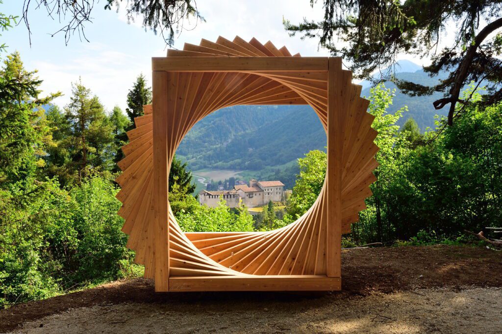
Departing from Saone, you take the bicycle path to the village of Ragoli and then climb to the hamlet of Iron, a village mowed down by the plague of 1630 and, today, with only one inhabitant. You then continue to the village of Stenico, where you walk alongside the Rio Bianco karst waterfall, see the Stenico Castle and the Bosco Arte Stenico, an art-in-nature museum consisting of wooden installations. Continue walking through meadows with a view of the Bleggio and Lomaso plateaus, where Don Lorenzo Guetti, the father of cooperation, was born, to reach Dorsino – San Lorenzo in Banale.
STAGE 04
STAGE 4: SAN LORENZO IN BANALE TO MONTE TERLAGO (LOW VARIANT)
Travel time 7.5h; elevation gain 876m; distance: 26.3km
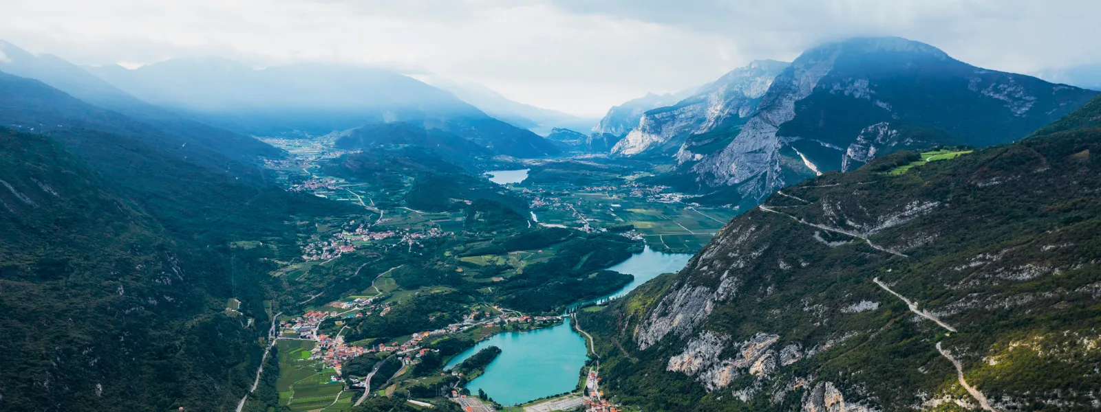
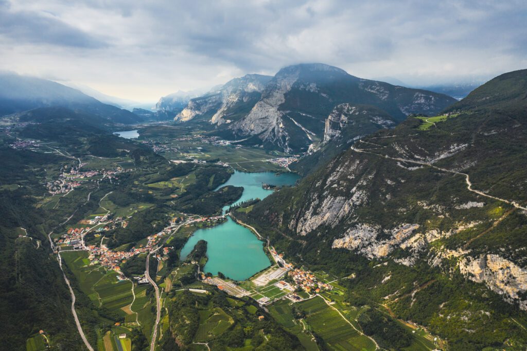
From the town of S. Lorenzo in Banale, you reach the villages of Moline and Deggia, where there is a charming shrine dedicated to the Madonna di Caravaggio. Continue along the very scenic path overlooking the Limarò Gorge carved out over the millennia by the Sarca River, to reach the small church of S. Vigilio in Ranzo erected to commemorate the passage of the mortal remains of Bishop Vigilio. Here the San Vili Basso descends to Lake Toblino, where the presence of a mild climate favors Mediterranean-type vegetation. Many animal species find their natural habitat including the mallard, grey heron and great crested grebe. The walk continues through some of the villages in the Valle dei Laghi valley, such as S. Massenza, Ciago and Covelo and then arrives in the village of Monte Terlago.
STAGE 04: SAN LORENZO IN BANALE TO MONTE TERLAGO (HIGH VARIANT)
Travel time 7.5h; elevation gain 892m; distance: 24.9km
From the town of S. Lorenzo in Banale, you reach the villages of Moline and Deggia, where there is a charming shrine dedicated to the Madonna di Caravaggio. Continue on the path overlooking the Sarca Gorge, paying attention to some somewhat exposed stretches to reach the small church of S.Vigilio in Ranzo erected to commemorate the passage of the mortal remains of Bishop Vigilio. Here the San Vili Alto climbs to the village of Margóne, where “silence is a precious commodity.” We continue walking in the woods skirting the mountain with splendid views of the valleys and peaks of eastern Trentino. It then descends toward Ciàgo to rejoin the lower San Vili and arrive at Monte Terlago
STAGE 05
STAGE 5: MONTE TERLAGO TO TRENTO
Travel time 5.5h; elevation gain 543m; distance: 17.2km
From Mt. Terlago we continue to Holy and Lamar Lakes, the latter characterized by clear waters and set among beech, fir and rock forests and with a wide beach.
Past the two bodies of water, continue walking in the direction of Bocca Paloni, with a spectacular view of the Adige valley below. The trail continues in and out of woods and clearings to reach Sorasass, where some fortified works dating back to World War I are visible. It advances and then begins the descent to Vela, a suburb of Trento. We skirt the Adige River and the church of Sant’Apollinare, cross the bridge of S. Lorenzo to head on via Belenzani and thus arrive at the cathedral of San Vigilio in Trento, the final destination of the Walk!

Insights
Cammino di San Vili
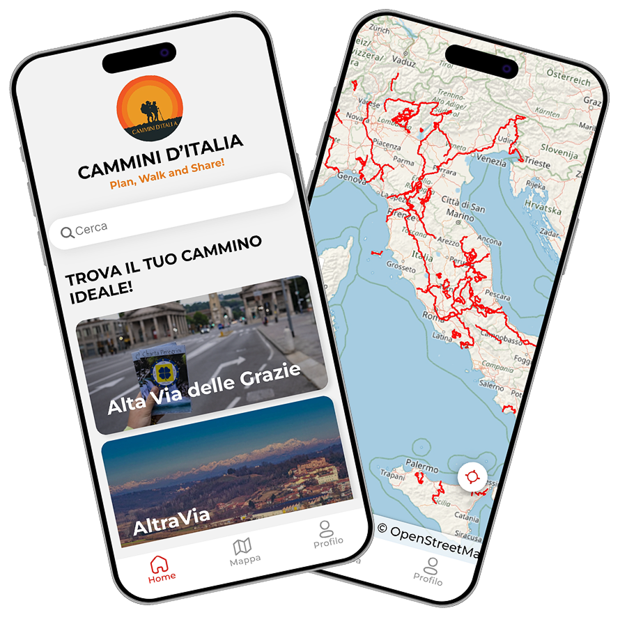
With the free Cammini d’Italia app, you can plan and walk Cammino di San Vili safely, being able to plan the stages in detail and walk the route thanks to the integrated GPS technology that supports your orientation during your adventure.
⠀Inside the app you will find many other paths present in Italy. Thanks to the georeferenced tracks of many routes, you will be able to study the itinerary that suits you best and also download the GPX tracks of the individual stages offline.
The app also includes a complete digital map of all the paths surveyed to date on our portal, giving you a wide range of choices among the many paths in the Belpaese.
⠀⠀
Cammini d’Italia is the perfect app for those who want to explore the beauty of Italy on foot, discovering hidden places surrounded by nature. Download it for free today and start planning your next adventure!
⠀
⠀
 ⠀⠀⠀
⠀⠀⠀