Via Flavia
The Cammino di Dante Via Flavia leads to Italy’s far northeast, to its eastern gateway between Venezia-Giulia and Friuli where, on white limestone cliffs and fine golden sands, Europe plunges into the northernmost point of the Mediterranean.
At the edge of the Gulf of Trieste, where Europe dives into the Adriatic Sea, where waters, languages and borders cross, among shrines, castles and archaeology, crossing nature and wildlife reserves, in the truest Karst and the lagoon of reeds, land of trade, transit of people, travelers and pilgrims, you here leave your trace the Way Via Flavia from an ancient Roman road. Leave your footprints will be delighted.
HISTORY
The Roman Via Flavia originated from Aquileia, according to some sources, while others have it beginning in Trieste, ancient Tergeste. It probably skirted the sea for a stretch, then followed the Istrian peninsula to Parentium, today’s Porec, to reach Pula and up to Tersatica (Rijeka or Rijeka). In modern times it was thought to connect the Slovenian/Italian border on the sea, Lazzaretto precisely, with Aquileia, assuming that in addition to being a commercial and military route, it had been, in ancient times, a pilgrimage route to Rome or Santiago de Compostela.
WATER SOURCES.
It is not difficult to find water sources in the area because of the presentaza of fountains, bars or supermarkets. In summer, it is suggested to refuel well before the fourth STAGE as the above services are rarer.
SERVICES
Are there supermarkets? Of course yes ,except for the fourth STAGE, they are only found at the start.
Are there any pharmacies? There are pharmacies along all the STAGES, for the fourth STAGE you have to lean on the start in Monfalcone.
SIGNAGE
Yellow arrow signs are clearly visible and constantly maintained .You can also find yellow arrow stickers on a blue field, yellow painted vignettes or the new signage with tabs on the pole with the Via logo and arrow sticker.
ROAD BOTTOM.
40% dirt 40% asphalt(on lightly traveled roads) 20% pedestrian/cycle
CREDENTIAL
Via Flavia credentials can be obtained from the following email:
amv.associazione@gmail.com
IN TENT
Where can one camp?There are campgrounds along the route open only in summer.
Permits needed?Some common sense is needed for free camping,some have done it by secluding themselves in the evening and leaving early in the morning.
DANGERS
It is important to pay attention to some stretches of ground that may be uneven or slippery, especially in rainy weather. For this reason, it is essential to wear appropriate footwear. There are no dangerous or stray animals along the trail.
CONTACTS
Association of reference is
amv.associazione@gmail.com or the Facebook page of: “Via Flavia a Way to Go”
Web: http: //www.camminoviaflavia.it/
STAGE 01
STAGE 01: From Lazzaretto (Muggia) to Bagnoli della Rosandra
Departure: Lazzaretto (Muggia)
Arrival: Bagnoli della Rosandra
Distance: 20.4 km
Height difference: +670 m
Exciting route with breathtaking views of the Trieste coast, Istria and Grado in the distance. Green sandstone hills of Muggia and Dolina. You will cross the Rio Ospo valley with its small lakes and through forests to reach Bagnoli with Val Rosandra at the gateway to Classic Karst.
STAGE 02
STAGE 02: From Bagnoli della Rosandra to Miramare (Trieste)
Departure: Bagnoli della Rosandra
Arrival: Miramare (Trieste)
Distance: 20 km
Height difference: +180 m
Leaving the scenic Val Rosandra, following a scenic pedo-bikeway, one reaches the wonderful center of Trieste always having as a reference the blue sea of the gulf with green groves and countryside around it that characterize the city outskirts.
STAGE 03
STAGE 03: From Miramare (Trieste) to Monfalcone
Departure: Miramare (Trieste)
Arrival: Monfalcone
Distance: 26 km
Height difference: +390 m
or
High variant 33.1 km. h.7.30 625m.elevation gain Difficulty: Very challenging.
STAGE 04
STAGE 04: From Monfalcone to Fossalon di Grado
Departure: Monfalcone
Arrival: Fossalon di Grado
Distance: 27.7 km
Height difference: +390 m
The landscape has completely changed and we are immersed in a coastal, sometimes marshy environment that represents an area reclaimed in the last century. There are many points of interest from a naturalistic point of view, such as biotopes, geosites, the Soča Mouth Nature Reserve and the Cavanata Valley Regional Nature Reserve. It is important to take care before departure and stock up on drinks and food.
STAGE 05
STAGE 04: From Fossalon di Grado to Aquileia
Departure: Fossalon di Grado
Arrival: Aquileia
Distance: 21.2 km
Height difference: +35 m
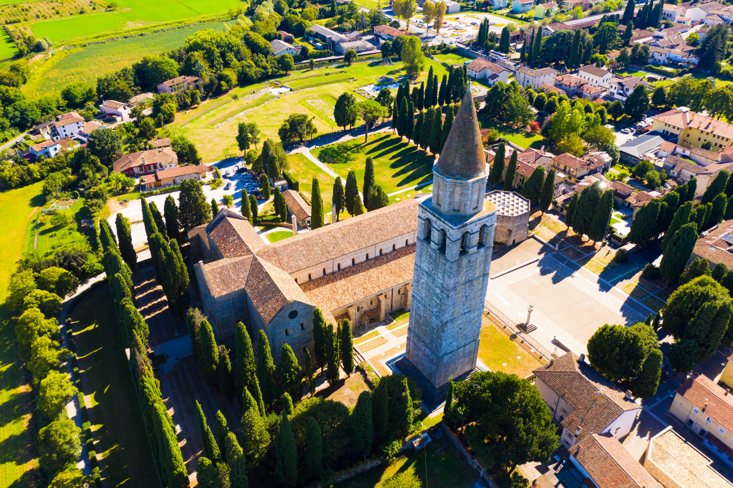
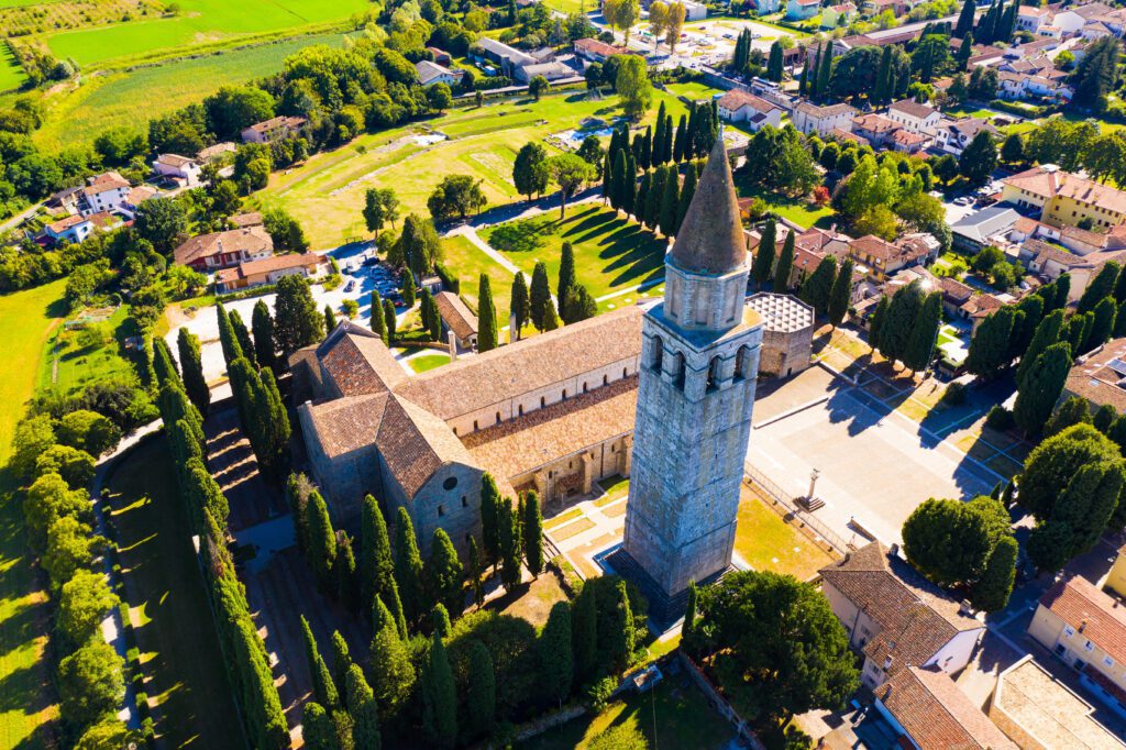
After leaving the reclaimed areas and nature reserves, you arrive in the seaside town of Grado, particularly beautiful in its old part. From here you can take the vaporetto to the island Sanctuary of Barbana and then conclude the Camino in Aquileia, a UNESCO site, where you can admire its Patriarchal Basilica, Roman ruins and visit the tombs of the 10 unknown soldiers, who were not chosen to represent all the fallen of the Italian wars (the one chosen is in the Altare della Patria in Rome).
VIA FLAVIA GUIDE
The path starts in the hills of Muggia and, skirting the Gulf of Trieste, crosses the Rosandra Valley and Miramare Park. From here it enters the rugged and wild landscape of the Karst, reaches the cliffs of Duino, and continues to the headwaters of the Timavo River, the mouths of the Isonzo River, and the Cavanata Valley, until it meets the beaches and lagoon of Grado.
Not only nature: along the way we encounter historical and artistic gems such as the Basilica of Muggia Vecchia, the Cathedral of Muggia, the Cathedral and Castle of San Giusto, the palaces and warehouses by the sea of Trieste, the Castle of Miramare, the Castle of Duino, the Venetian Fortress, and the Great War trenches of Monfalcone.
This is followed by the early Christian basilicas of Grado and the island of Barbana, until the arrival in Aquileia, now a UNESCO site. An itinerary that combines landscape, history and spirituality, part of the network of paths to Santiago and recognized by special pilgrimage credentials.

Via Flavia
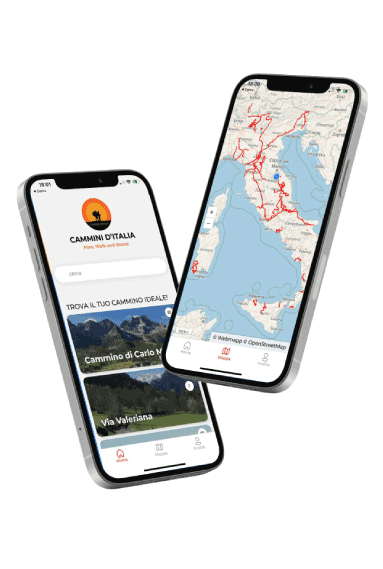
With Cammini d’Italia’s free app, you can plan and walk the Via FLAVIA in total safety, being able to plan the stages in detail and walk the route thanks to the built-in GPS technology that supports your orientation during your adventure.
Within the app you will find many other paths present in Italy. Thanks to the georeferenced tracks of many routes you will be able to study the itinerary that suits you best and also download the GPX tracks of the individual STAGEs offline.
The app also includes a complete digital map of all the paths surveyed to date on our portal, giving you a wide range of choices among the many paths in the Belpaese.
⠀⠀
Cammini d’Italia is the perfect app for those who want to explore the beauty of Italy on foot, discovering hidden places surrounded by nature. Download it for free today and start planning your next adventure!
⠀
⠀
 ⠀⠀⠀
⠀⠀⠀