
Via Vandelli
The path of Via Vandelli connects the heart of Emilia, Modena and Sassuolo, with the Tyrrhenian Sea at Massa retracing the first major communication road after the Roman roads.
The Via Vandelli is an eighteenth-century road, practically the mother of all modern roads: walkers will find long stretches of cobblestones and the structures of ancient inns and post stations, crossing the plains, the mountains of the Frignano modenense, entering Garfagnana and then crossing the Apuan Alps before descending to the Riviera and the sea.
The Via Vandelli was the result of Duke Francesco III d'Este 's desire to connect Modena to Massa and the sea, marking the beginning of an ambitious project led by Domenico Vandelli. This project aimed to cross the Apennines and the Apuan Alps to create the first major road of the Enlightenment. This story involves a diverse range of characters, including nobles, gifted engineers, outlaws and supporters of the patriotic cause, and can be explored on a seven-day walk between the regions ofEmilia-Romagna and Tuscany.
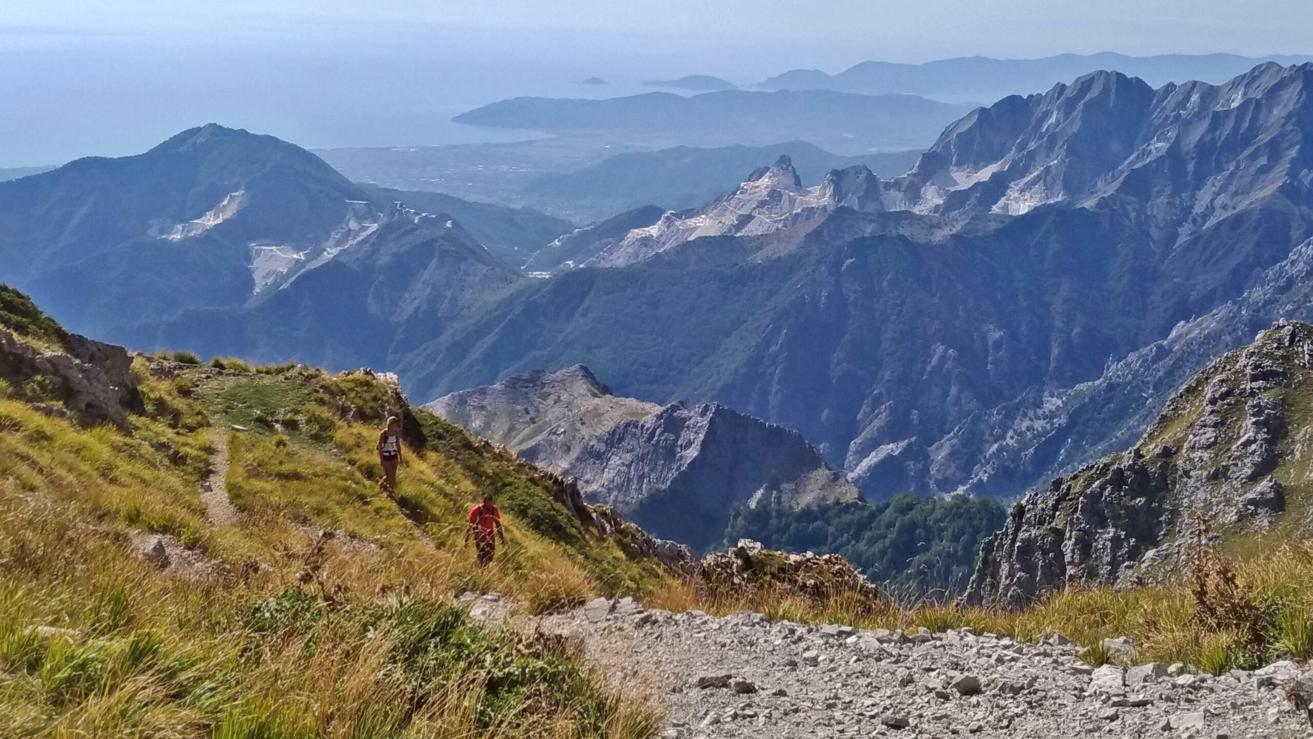
During this journey, you will have the opportunity to pass through charming villages, admire unspoiled landscapes and conquer majestic mountains until you reach the Tambura Pass, from which you can enjoy the panoramic view of the picturesque Tyrrhenian Sea, which is the final destination of this adventurous journey.
HISTORY
In the early eighteenth century, when Francesco III d’Este ascended to the throne of the Duchy of Modena, he wanted a modern road from his capital to the sea outlet he had recently obtained with the acquisition of the Duchy of Massa through the marriage of his son Ercole III to Maria Teresa Cybo Malaspina. This “new road” was to be built in such a way that wagons and carriages could pass for trade and the rapid movement of travelers and the army. It was a visionary work at the time, and he called in the best engineer and geographer of his court to carry it out: mathematician Domenico Vandelli. The genius of the designer is best expressed in the stone hairpin bends that can still be seen today among the Apuan Alps. The Via Vandelli, as it came to be called, was the prototype of modern roads, but it was also shortly afterwards overtaken by the rapid development of carriage roads. It was partly abandoned and partly continued to be traveled intensively by local inhabitants, but in a piecemeal fashion. Until in 2017 Giulio Ferrari with his research pieced together its original historical route, walking it in its entirety and then developing in the following years the hiking path of the Via Vandelli which in large part coincides with the 18th-century one.
WATER
Water sources are present on every STAGE, at the beginning and end and at least a couple along the way. Pay attention to the sixth STAGE: before the ascent to the Tambura Pass make a good supply in Vagli Sopra as you will not find water again until the Nello Conti refuge on the other side.
SERVICES
All the STAGES pass through cities or towns with all facilities. The only STAGES in which to be careful are STAGE 4 where no towns are encountered, but which remain a few kilometers downstream in case of need, and the crossing of the Apuan Alps, that is, the second part of STAGE 6 and the first part of STAGE 7, where between Vagli Sopra and Resceto the only support is the Nello Conti refuge and the area cannot be reached by motor vehicles.
SIGNAGE
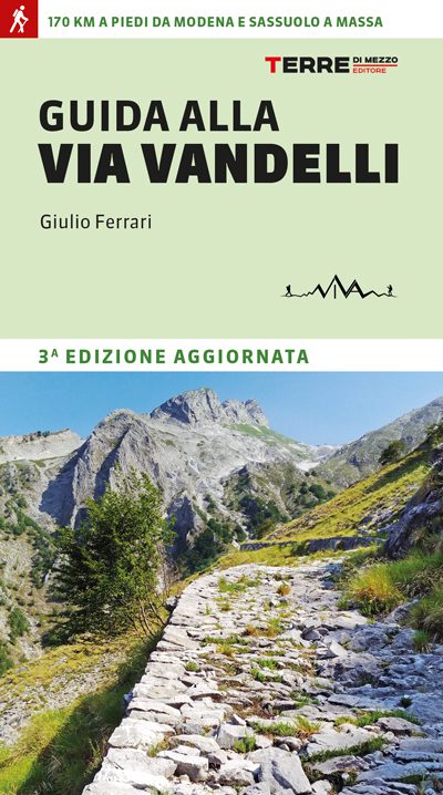
There is CAI signage on the route, but in a discontinuous manner and with multiple numbering changes. While waiting for a unified approach, small adhesive arrows with the association’s logo have been affixed Via Vandelli. The use of the “Guide to the Via Vandelli” by G.Ferrari (Terre di mezzo) and/or the gpx tracks downloadable from the website www.viavandelli.com or follow navigate with theCammini d’Italia app.
DANGERS
No danger. The crossing of the Apuan Alps is done on an alpine-type trail.
The path of Via Vandelli is physically demanding in length and elevation gain, so some preparation is necessary.
ROAD BOTTOM.
60% trail, 40% asphalt
CREDENTIALS
Credential: The wayfarer’s passport, freely downloadable from the website
https://sites.google.com/view/viavandelli/il-passaporto
IN TENT
VIA VANDELLI IN TENT
There are no specially designated areas for tents. Many hospitality facilities allow tents, but they are to be contacted in advance.
CONTACTS
CONTACTS
Association: Via Vandelli APS
Website: www.viavandelli.com
Email: infoviavandelli@gmail.com
Facebook page: facebook.com/viaVandelli
Instagram: instagram.com/viavandellimoms
YouTube: youtube.com/c/ViaVandelli
FB group “the wayfarers of Via Vandelli”:
https://www.facebook.com/groups/
CONTACTS
CONTACTS
Association: Via Vandelli APS
Website:
www.viavandelli.com
Email:
infoviavandelli@gmail.com
Facebook page: facebook.com/viaVandelli
Instagram: instagram.com/viavandellimoms
YouTube:
youtube.com/c/ViaVandelli
FB group “the wayfarers of Via Vandelli”:
https://www.facebook.com/groups/
STAGE 01 - director from Modena
STAGE 01: From Modena to Puianello
Departure: Modena
Arrival: Puianello
Distance: 27.2 km
Height difference: +410 m / – 10 m
Departing from the Este palace in downtown Modena, a mostly flat STAGE in which we leave the city and then follow a long bicycle and pedestrian path alongside the Tiepido stream to the village of Torre Maina, where a short but intense climb to the Puianello Sanctuary begins.
STAGE 01 - director from Sassuolo
STAGE 01: Sassuolo to Serramazzoni
Departure: Sassuolo
Arrival: Serramazzoni
Distance: 19.9 km
Height difference: +895 m / – 230 m
Departing from the summer ducal palace, in a few kilometers we immediately ascend the clay hills that take us through gullies and forests at altitude to the town of Serramazzoni. This stretch of Via Vandelli was built in the mid-18th century, a decade or so after the one from Modena.
STAGE 02 - director from Modena
STAGE 02: From Puianello to Pavullo nel Frignano.
Departure: Puianello
Arrival: Pavullo nel Frignano
Distance: 24.4 km
Height difference: +830 m / – 595 m
Moving STAGE through the hills of Modena, in a mixed landscape of farmland and mountains. At the end of the STAGE is the Este ducal palace in Pavullo.
STAGE 02 - director from Sassuolo
STAGE 02: Serramazzoni to Pavullo nel Frignano.
Departure: Serramazzoni
Arrival: Pavullo nel Frignano
Distance: 12.9 km
Height difference: +285 m / – 400 m
Short stage that rejoins us with the main route of Via Vandelli: again we pass through fields and small villages to the Este ducal palace of Pavullo.
STAGE 03
STAGE 03: From Pavullo nel Frignano to La Santona
Departure: Pavullo nel Frignano
Arrival: La Santona
Distance: 25 km
Height difference: +960m / – 475 m
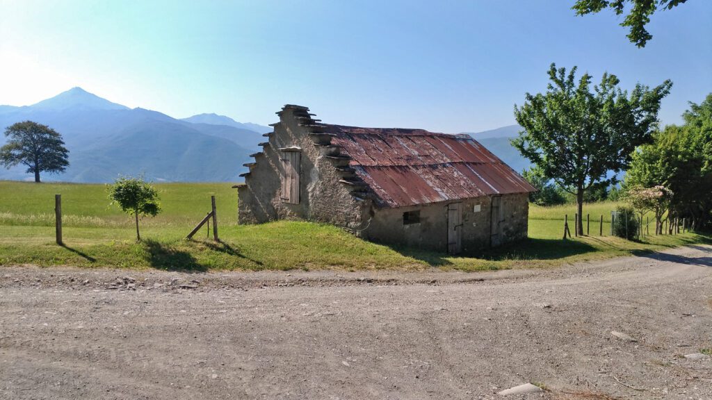
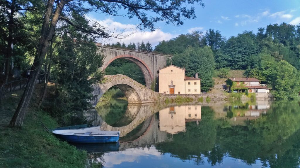
STAGE that goes deep into Frignano, we immediately encounter the castle of Montecuccolo, then the characteristic Ponte del Diavolo (Devil’s Bridge) and other villages that were born thanks to the passage of Via Vandelli, until we plunge into an ancient fir forest before reaching La Santona.
STAGE 04
STAGE 04: From La Santona to San Pellegrino in Alpe
Departure: La Santona
Arrival: San Pellegrino in Alpe
Distance: 25.8 km
Height difference: +895 / – 540 m
STAGE that takes place entirely on the original eighteenth-century route, always at high altitude with splendid views of Mount Cimone. On the route you will encounter the Celtic hut of Cà Guerri, the eighteenth-century post station of La Fabbrica, and when you plunge into the Romanesque forest you will find the most beautiful stone paved section of the entire Via Vandelli Modenese. After the Lagadello pass at 1620m you quickly reach the ancient hospice of San Pellegrino.
STAGE 05
STAGE 05: From San Pellegrino in Alpe to Poggio
Departure: San Pellegrino in Alpe
Arrival: Knoll
Distance: 25.8 km
Height difference: +395 / – 1455 m
STAGE that takes us into the heart of Garfagnana. It begins with a long, steep descent through the woods, where small clusters of houses that have sprung up around 18th-century inns appear at times. After Campori we continue on the long Edron through Pieve Fosciana to Castelnuovo di Garfagnana, the Este capital of the area with its majestic fortress. The STAGE continues along the Serchio River and meets Pontecosi, charming on the lake. Before reaching Poggio, we cross the spectacular Villetta railroad-pedestrian bridge.
STAGE 06
STAGE 06: From Poggio to Campaniletti
Departure: Poggio
Arrival: Campaniletti
Distance: 18.3 km
Height difference: +1380 / – 390 m
This is the STAGE of the great ascent among the Apuan Alps. It begins along the Edron stream to the Vagli Lake dam, which you then skirt until you reach Vagli Sopra. From here you first plunge into a panorama of marble quarries, then rise steeply to the 1620m Tambura Pass, from where you will see the sea. With a short downhill stretch you reach the Nello Conti refuge, the only structure present.
STAGE 07
STAGE 07: From Campaniletti to Massa.
Departure: Campaniletti
Arrival: Mass
Distance: 18.3 km
Height difference: +500 / – 1875 m
Last STAGE begins with the spectacular switchbacks built on dry stone walls to the village of Resceto. After skirting the Renara and Frigido streams, a route begins that retraces ancient mule tracks that unite the villages of the valley until Massa, where the walk ends in front of the Cybo-Malaspina ducal palace. For those who want to enjoy the walk to the fullest, you can go all the way to the sea on the beach, stretching about 6.3 kilometers, ending with an ideal Finis Terræ.

GUIDE OF THE VIA VANDELLI
A duke’s dream, an engineer’s vision, and a path between Emilia-Romagna and Tuscany. The Via Vandelli was born from the intuition of Francesco III d’Este and the genius of Domenico Vandelli, who in the eighteenth century designed the first great road of the Enlightenment to unite Modena with the sea at Massa.

Journey diaries
Via Vandelli
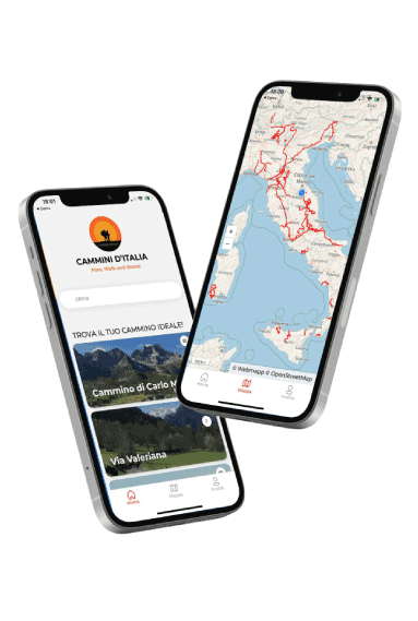
With the free Cammini d’Italia app, you can plan and walk Via Vandelli safely, being able to plan the stages in detail and walk the route thanks to the built-in GPS technology that supports your orientation during your adventure.
Within the app you will find many other paths present in Italy. Thanks to the georeferenced tracks of many routes you will be able to study the itinerary that suits you best and also download the GPX tracks of the individual STAGEs offline.
The app also includes a complete digital map of all the paths surveyed to date on our portal, giving you a wide range of choices among the many paths in the Belpaese.
⠀⠀
Cammini d’Italia is the perfect app for those who want to explore the beauty of Italy on foot, discovering hidden places surrounded by nature. Download it for free today and start planning your next adventure!
⠀
⠀

