
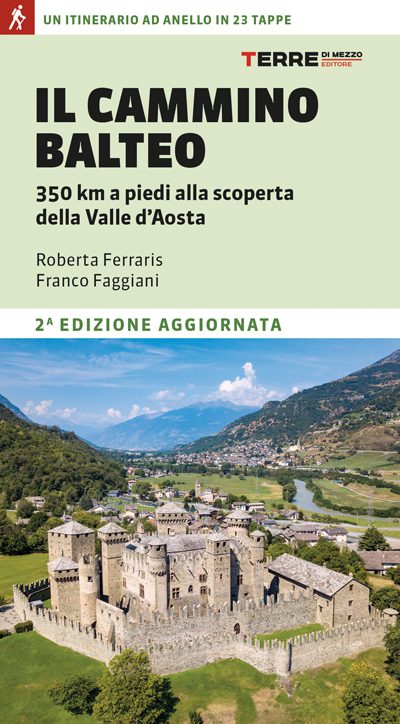
Cammino Balteo
The Cammino Balteo, a route to loop discovering the Aosta Valley. An immersion in culture and history through a territory dotted with ancient villages and imposing castles, immersed in a varied landscape that alternates forests and pastures with gardens and vineyards.
The Cammino Balteo is a loop hiking route of almost 350 km, which can be traveled in both directions. It is a journey into culture and history through an area dotted with ancient villages and imposing castles, immersed in a varied landscape that alternates forests and pastures with vegetable gardens and vineyards.
The trail is mainly on the valley floor and mid-altitude slopes with an altitude of 350 to 1900 meters above sea level, thus practicable for most of the year.
The Camino is divided into 23 STAGES of about 4-6 hours each that can also be walked in several stages or, if necessary, interrupted using public transportation. Each STAGE is an invitation to discovery, moving on foot along paths but also on dirt roads and paved sections, through villages and sites of cultural and natural interest. A proposal for everyone, suitable for sportsmen and women but also for those who want to walk unhurriedly, allowing themselves to be tempted by the many opportunities that invite pause.
HISTORY
From prehistory to Roman times, from the Middle Ages to the nineteenth century, the Cammino Balteo unites important relics of the past into a single narrative: Roman monuments, fairy-tale castles and imposing fortresses, charming rural villages, ancient bridges and places of worship.
There are several places of cultural interest that can be admired or visited along the way.
(Castles and towers, villages and rural architecture, Ancient Rome along the Cammino Balteo, churches and museums)
WATER
In all population centers, even just small hamlets, there is at least one drinking fountain
SIGNAGE
All along the route there is signage marked by an inverted triangle inside which is inserted No. 3
DANGERS
There are no dangerous parts on the way
ACCESSIBILITY
There are no sections that are passable by people with disabilities
ROAD BOTTOM.
30% asphalt
CONTACTS
Office of Tourism:
Tel: (+39) 0165.40532
E-mail: info@turismo.vda.it
Hospitality:
https://bookingvalledaosta.it/i-cammini/
https://balteus.lovevda.it/it/ospitalita
Booking Valle d’Aosta telephone reservation center at 0165 33352.
STAGE 01
STAGE 01: From Pont Saint-Martin to Lillianes
Departure: Pont Saint-Martin
Arrival: Lillianes
Distance: 8.2 km
Height difference: +973 m / – 656 m
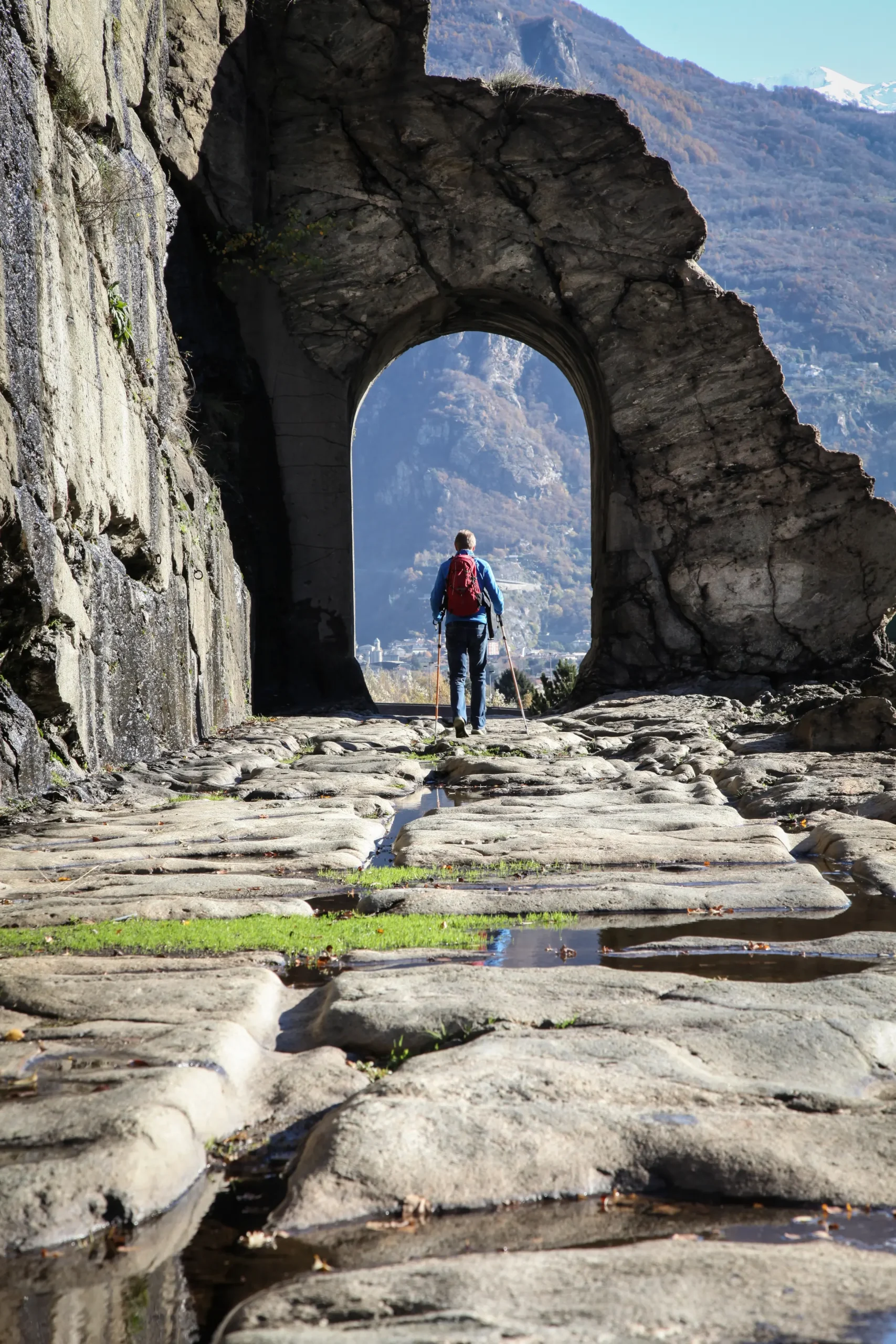
The Cammino Balteo begins here, from Pont-Saint-Martin. A town that owes its name first and foremost to the magnificent 1st-century B.C. Roman bridge and the legend of St. Martin of Tours, who is said to have defeated the devil for building this very bridge. Perloz, a cluster of houses boldly clinging to the rocky slope, dominated by noble houseforts under the protection of the shrine of Notre-Dame-de-La-Garde.
Crossing the Lys, we continue on a half-steep balcony that leads to Lillianes, greeted by the striking stone bridge built in 1733, the only one with four arches in Valle d’Aosta, and the beautiful parish church of San Rocco. A first “taste” of the Gressoney valley.
STAGE 02
STAGE 02: Lillianes to Fontainemore.
Departure: Lillianes
Arrival: Fontainemore
Distance: 16.7 km
Height difference: +1,133 m / – 1,098 m
From the center of Lillianes, the trail gains altitude fairly steeply toward the Sassa mountain pasture. Then the route points northward, gradually descending from the high plateaus to the rural villages. Past the sunny Coumarial plateau, gateway to the Mont Mars Nature Reserve, you reach small clusters of dwellings. It passes near themid-mountain ecomuseum and crosses the beautiful village of Farettaz.
Surrounded by forests and crossed by the Lys, Fontainemore welcomes visitors with its scenic medieval bridge and the pretty church of St. Anthony Abbot. Among the curiosities, the Gouffres de Guillemore, a very deep gorge carved into the rocks, is worth a visit.
STAGE 03
STAGE 03: Fontainemore to Donnas.
Departure: Fontainemore
Arrival: Donnas
Distance: 14.7 km
Height difference: +400 m / – 918 m
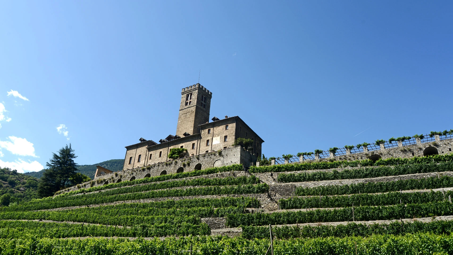
From Fontainemore, through wide and beautiful mule tracks on the orographic right, you reach beautiful villages including, in particular, that of Chemp. An unusual and evocative open-air museum. From Chemp you resume the descent, through the hamlet Marine, to Perloz. After a stop at the shrine of Notre Dame de La Garde, you return to the valley floor along the sunny coast overlooking Donnas, skimming the upper edge of terraced vineyards symbolic of Alpine heroic viticulture. You then reach the historic medieval village of Donnas, which arose on the ancient route of the Roman road of the Gauls that sees its best-known and most spectacular section here. Two small museums bear witness to the local rural tradition of Donnas: the “vine and wine museum” and the ancient “dairy of Tréby.”
STAGE 04
STAGE 04: Donnas to Arnad
Departure: Donnas
Arrival: Arnad
Distance: 12.5 km
Height difference: +1,101 m / – 1070 m
From the village of Donnas, one climbs the rock ridge in the direction of the village of Albard. From here continue to climb toward the sunny grassy plateaus of the Col de La Cou, where it will be possible to see the remains of the fortifications ordered by Napoleon on the occasion of his maneuvers to attack and encircle the Fort of Bard. Passing the war posts of Arbénaz, one reaches the Machaby fort, now converted into a modern hostel. From here you then reach the well-known shrine named after Our Lady of the Snow, surrounded by chestnut groves. Then continue downhill until you come in sight of the village of Arnad and the pinkish bulk of the Vallaise castle (now under restoration). The charming historic center, embellished by the splendid Romanesque parish church of San Martino, is worth visiting.
STAGE 05
STAGE 05: From Arnad to Challand-Saint-Victor
Departure: Arnad
Arrival: Challand-Saint-Victor
Distance: 12.8 km
Height difference: +1144 m / – 890 m
Mountain roses, gorse and alders accompany the ascent from Ville di Arnad, just upstream from Castello Vallaise, to Col Vert via this historic, almost forgotten mule track. The gradual ascent leads to the discovery of beautiful chestnut forests and minute clusters of abandoned houses, nonetheless splendid examples of rural architecture and past peasant life. Zigzagging through patches of rhododendron, you descend toward Challand-Saint-Victor, arriving near the spectacular Isollaz waterfall from which you then climb back up to the village.
STAGE 06
STAGE 06: Challand-Saint-Victor to Saint-Vincent
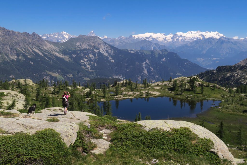
Departure: Challand-Saint-Victor
Arrival: Saint-Vincent
Distance: 15.8 km
Height difference: +873 m / – 1125 m
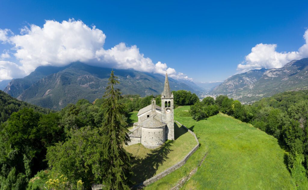
You reach the old dairy turnaria of Challand-Saint-Victor, to take the path that climbs to the remains of the castle of Villa, cradle of the powerful Challant family. Past the cultural site, continue on to the Lake Villa Nature Reserve, characterized by a distinctive wetland environment and with an easy guided trail. From here you gain slightly in altitude to Col d’Arlaz, where your gaze opens onto a wide and airy panorama. You then descend, following the ru d’Arlaz, to Emarèse. Among woods and meadow expanses, you descend gently to Moron di Saint-Vincent, greeted by the precious Romanesque church of San Maurizio. From here continue the descent to Saint-Vincent, passing not far from the old early 20th-century spa, now abandoned, and arriving at the modern building of the present spa.
STAGE 07
STAGE 07: Saint-Vincent to La Magdeleine.
Departure: Saint-Vincent
Arrival: la Magdeleine
Distance: 14 km
Height difference: +1370 m / – 295 m
Leaving the center of Saint-Vincent, from the parish church we ascend toward the hilly area and higher hamlets. Gradually the built-up area will thin out to give way to long stretches of path in the midst of nature, among meadows, pastures, clearings and wooded areas. With a fluid and pleasant zigzag overlooking the underlying course of the Marmore stream and rewarded by a magnificent panoramic view of the mouth of Valtournenche, you will reach La Magdeleine, a quiet village in the middle valley of the Matterhorn. A visit to the eight characteristic mills still in operation is not to be missed.
STAGE 08
STAGE 08: From La Magdeleine to Verrayes
Departure: la Magdeleine
Arrival: Verrayes
Distance: 19.8 km
Height difference: +756 m / – 1486 m
From La Magdeleine we set off, skirting the pretty little lake of Lod and then heading for the village of Hérin to reach the nearby commune of Antey-Saint-André where we visit the beautiful parish church from the Romanesque period. From here there is a particularly impressive view of the Matterhorn, whose majestic bulk appears wedged between the valley walls. Interesting are the remains, almost miraculously attached to the rock face, of the Ru du Pain Perdu, a “heroic” aqueduct built in the 14th century to carry water to Saint-Vincent. Then touching on a series of characteristic hamlets, we reach Torgnon: here the church of San Martino and the charming Petit-Monde ethnographic museum are worth a visit.
We then continue on through dense forests from which to stretch our gaze over the valley floor and the imposing, dominant “rock” of the Matterhorn, until we reach the scenic chapels of Saint-Pantaléon and Saint-Evence in Saint-Denis. From the promontory of Saint-Evence a gradual descent through airy plateaus and vast pastures will begin. It then descends, reaching Verrayes, with its parish church of Saint Martin and the “P. Vescoz” Arboretum.
STAGE 09
STAGE 09: Verrayes to Nus
Departure: Verrayes
Arrival: Nus
Distance: 10.2 km
Height difference: +208 m / – 876 m
From the main town of Verrayes, one reaches the hamlet of Moulin and from there takes a half-steep path that stretches, with little difference in height, almost in a straight line, through meadows, glades and small villages out of time, to Blavy from which one descends, regaining the valley floor at the height of Nus. From here, by public transport, it is possible to reach the Astronomical Observatory of Saint-Barthélemy near which there is also the archaeological site of the protohistoric castelliere of Lignan. In Nus, a walk along the central street will allow you to appreciate the remains of the so-called Castle of Pilate, built by the Lords of Nus in the 12th-13th centuries, and which, according to legend, housed Pilate, in fact, on his way to exile in Gaul after the condemnation of Jesus.
STAGE 10
STAGE 10: Nus to Roisan
Departure: Nus
Arrival: Roisan
Distance: 18.5 km
Height difference: +525 m / – 204 m
Leaving the historic center of Nus, you reach the high hamlets from which you take the path leading to the castle of Quart. Once past the manor house, whose original layout dates back to the end of the 11th century, one keeps halfway up the hillside by taking the Ru Prévôt whose trail will lead easily to Roisan. Along the way you will be able to appreciate the extraordinary medieval aqueduct-bridge of Grand-Arvou, in the locality of Chiou di Porossan. A masterpiece of hydraulic engineering. It then continues on to Roisan overlooking the course of the Buthier stream and enjoying a splendid view of Aosta and the localities of the initial stretch of the Valpelline.
STAGE 11
STAGE 11: Roisan to Arpuilles
Departure: Roisan
Arrival: Arpuilles
Distance: 13.2 km
Height difference: +445 m / – 319 m
Passing the cemetery of Roisan you descend to the left, cross the village of Adret to reach the Rû Prévôt in the direction of Valpelline. Reaching the bridge over the Buthier, go up to take the Rû des Vignes and follow it to the village of Gignod. Overlooked by the sharp profile of the elegant bell tower of the parish church of Sant’Ilario, inside which fine 15th-century frescoes can be appreciated, you reach the center of Gignod from which you climb to gain altitude in view of the return route. The view opens up more to embrace the mighty quadrangular silhouette of the medieval tower of the Lords of Gignod, a severe sentinel of the town for those coming from the valley floor. You then take a pleasant sunny path that, almost always with a flat course, gently accompanies you to the hamlets of Excenex, first, and then Arpuilles, a true balcony overlooking Aosta.
STAGE 12
STAGE 12: Arpuilles to Vetan
Departure: Arpuilles
Arrival: Vetan
Distance: 14 km
Height difference: +1081 m / – 603 m
From the small village of Arpuilles, take the path that proceeds in the direction of Pléod, in the vast municipal territory of Sarre. In an airy setting characterized by a rough and essential nature that offers panoramic views of the valley floor and surrounding peaks, one finally reaches the village of Vetan: a place enveloped in pervasive charm in a suspended atmosphere. On the way, one overlooks from above the extensive vineyards of Saint-Pierre and Aymavilles, having fun spotting the towers and castles that chase each other across the landscape.
STAGE 13
STAGE 13: Vetan to La Salle
Departure: Vetan
Arrival: La Salle
Distance: 18.9 km
Height difference: +893 m / – 1,568 m
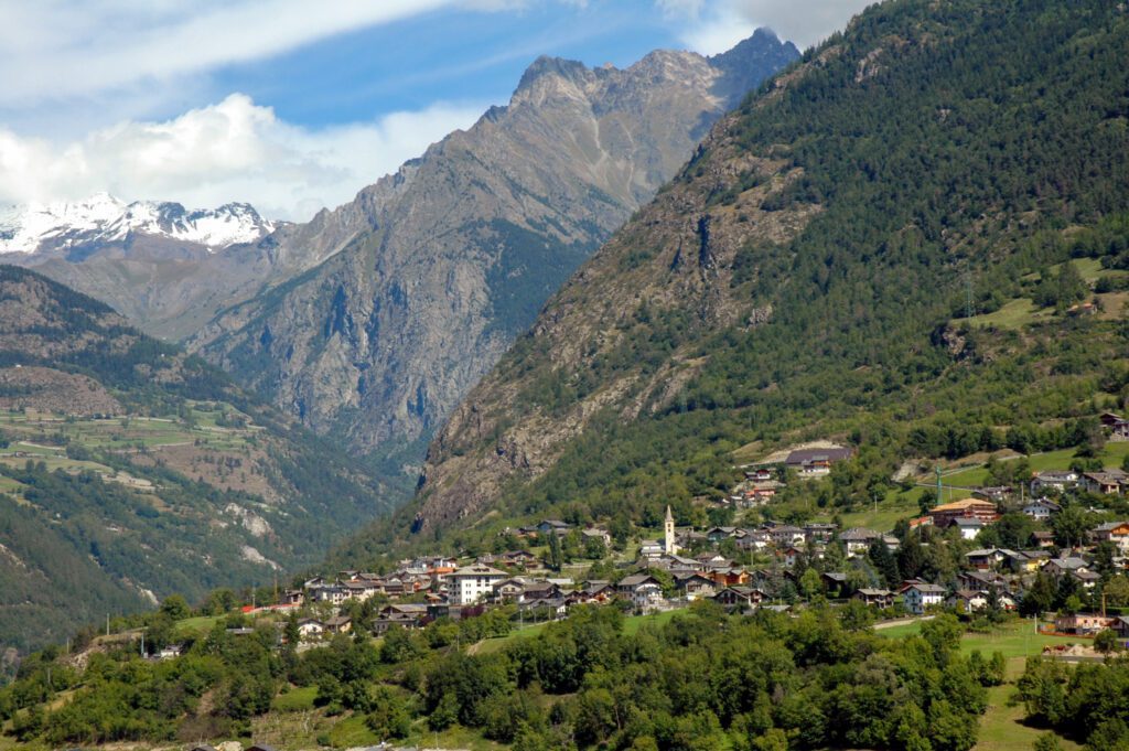
From Vetan you climb in altitude with unforgettable views leading to the small lake of Joux and the picturesque village of Vens. From here, following ancient agricultural paths, you literally fly over the steep territory of Avise: you appreciate, at the bottom of the valley, the narrow Equilivaz where in ancient times the Romans had laboriously built the road passage known as Pierre Taillée and, after a few more challenging stretches, you reach the characteristic village of Charvaz with its old stone houses close to each other and the beautiful chapel with its frescoed façade. Finally, from here, a sharply downhill section skirts the village of Fenêtre and leads to the hamlet of Moras, from which you continue to La Salle through the villages of Echarlod and Ecours, discovering corners of the Alpine Middle Ages and magnificent views of Mont Blanc.
STAGE 14
STAGE 14: La Salle to Avise
Departure: La Salle
Arrival: Avise
Distance: 20.1 km
Height difference: +572 m / – 821 m
From La Salle we continue slightly downhill and then almost flat to discover the many characteristic villages that follow one another along the sunny slope, among rock walls, meadows and heroic vineyards. From La Ruine alta to Villair di Morgex to the last hamlet on the border with the commune of Pré-Saint-Didier: Dailley. From here we turn back down towards the historic center of Morgex, encountering the severe Tour de l’Archet, and the beautiful parish church of Santa Maria Assunta, which contains the oldest baptismal font in the upper Aosta Valley, dating back to the 5th century AD. From here you slightly regain altitude and, following the course of the Dora Baltea, reach the spectacular Lenteney waterfall. You then arrive at the pretty village of Derby with its beautiful Romanesque parish church dedicated to St. Bear, its ancient houseforts and the so-called notary’s palace. Leaving Derby, you reach from above the village of Runaz from where you then descend again to cross the SS26 and gain the village of Avise, announced from afar by its castles and the beautiful church of St. Brizio.
STAGE 15
STAGE 15: Avise to Introd
Departure: Avise
Arrival: Introd
Distance: 16 km
Height difference: +1,184 m / – 1,179 m
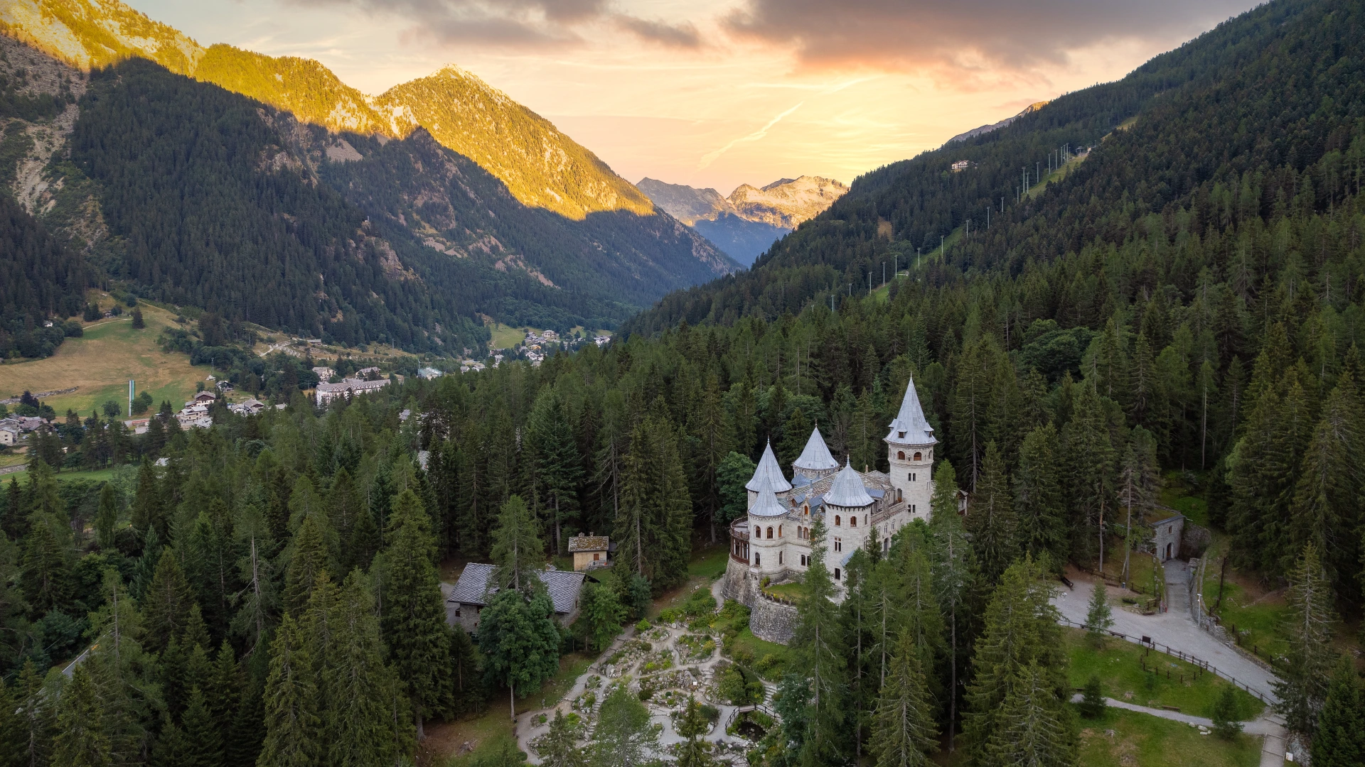
From the pretty Avise, start climbing again along a pleasant path through woods and meadows that leads to Saint-Nicolas, announced by the church visible from afar and stretching out, in a panoramic position, almost overhanging the valley floor. From here it descends again to the vineyards and sunny gorges of the Enfer di Arvier to then enter the village of Leverogne. The center of the village of Arvier is worth a detour, appreciating its church of San Sulpicio and the Chateau La Mothe. From Leverogne, you start climbing again at the turn of the villages of Petit and Grand-Haury, guarded by the grim castle of Montmayeur. And then to Les Combes, a delightful village nestled among vast plateaus, a summer destination beloved by Pope John Paul II and Pope Benedict XVI.
Finally, from Les Combes, a beautiful scenic walk crosses the meadows on a slight but steady descent to Introd, squeezed around its castle and elegant church named for the Conversion of St. Paul.
STAGE 16
STAGE 16: Introd to Villeneuve
Departure: Introd
Arrival: Villeneuve
Distance: 20.1 km
Height difference: +588 m / – 793 m
From Introd you climb following an ancient path that gradually enters the thick woods suspended over the Dora di Rhêmes until you reach, precisely, Rhêmes-Saint-Georges, whose houses chase each other along a slope dominated by the soaring parish church. Crossing the stream, one reaches the microscopic hamlet of Cachoz to attack the descent, still immersed in the forest. Surrounding the promontory of Mont Ruppet, from the hamlet of Soressamont you then take the valley furrow of the Savara stream to the village of Chevrère from where you resume your descent to regain the valley floor at Villeneuve.
STAGE 17
STAGE 17: Villeneuve to Aymavilles.
Departure: Villeneuve
Arrival: Aymavilles
Distance: 12.3 km
Height difference: +837 m / – 1000 m
After passing through the hamlet of Villeneuve, climb up to the charming church of Santa Maria with its baptismal font dating back to the 5th century AD under the gaze of the castle of Châtel Argent. After passing the village of Chavonne, you reach the hamlet of Issogne, from which you start climbing toward the locality of Camagne, from where the view opens up both toward the valley floor and the furrow of the Grand Eyvia stream descending from the valley of Cogne.
From here, we continue along a scenic path, also known as the “butterfly path,” which, past a waterfall, leads among special plant essences to the extraordinary Roman aqueduct-bridge of Pont d’Ael, a masterpiece of hydraulic engineering from the first century B.C. This is an area not only of considerable historical-archaeological interest, but also of naturalistic interest given the presence of as many as 96 different species of butterflies.
From the pretty village of Pont d’Ael you continue to the village of Ozein, a true oasis of history set in dazzling nature. From here you descend in the direction of Champlan and, among forests and meadowy crags, return to the valley floor at the height of Aymavilles.
STAGE 18
STAGE 18: From Aymavilles to Aosta
Departure: Aymavilles
Arrival: Aosta
Distance: 12.9 km
Height difference: +453 m / – 580 m
From the center of Aymavilles, after visiting the churches of Saint Léger and Christ the King, start to climb slightly upstream of the village toward the hamlet of Montbel. Literally immersed in the enveloping vineyards, you reach the border with the forest and keep for a long stretch almost flat on a half slope. Entering the municipality of Jovençan you will be greeted by the medieval core of Pompiod and the characteristic hamlet that accompanies you to the interesting Maison des Anciens Remèdes. Still halfway up the hillside, one will reach the hamlet of Moulin di Gressan, where the ecomuseum Maison de Gargantua is worth a visit, named for the presence of the unmistakable morainic spur known as “Gargantua’s little finger.” Once past the village of Gressan, the trail climbs again along the stream to the hamlet of Château di Charvensod, from where it descends again to return to the valley floor and, once crossed the Dora Baltea, reach Aosta.
STAGE 19
STAGE 19: Aosta to Fénis
Departure: Aosta
Arrival: Fénis
Distance: 19.8 km
Height difference: +387 m / – 382 m
From Aosta one moves on to Charvensod by crossing the Dora Baltea at Pont-Suaz. Upstream from the hamlet of Condemine, take the path heading to Pollein and keep almost level until you reach Fénis. Walking halfway up the hillside, always on the edge of the forest, you can enjoy a panoramic view of the Dora plain and the opposite slopes of the adret. From Pollein to Brissogne, as far as Saint-Marcel where, allowing oneself a stop and extending the STAGE, one could devote oneself to the exploration of its more “high altitude” territory (the mines, the green waters, the Plout sanctuary). Finally, we reach Fénis where, welcomed by the beautiful parish church of Saint Maurice, after a visit to the MAV (the Museum of Valdostan Craftsmanship), all that remains is to devote time to the splendid turreted manor house of the Challant nobles.
STAGE 20
STAGE 20: Fénis to Chatillon
Departure: Fénis
Arrival: Chatillon
Distance: 14.3 km
Height difference: +368 m / – 393 m
From Fénis you reach the neighboring commune of Nus by heading toward the hamlet of Plantayes. From here follow the signs to the nearby villages of Perrinaz and Rovarey and then pass into the territory of the municipality of Verrayes.
We then continue to Chambave, land of great and noble wines including, above all, the well-known Muscat. Overlooked from above by the towered bulk of the castle of Cly (in the commune of Saint-Denis), we cross the entire historic village of Chambave and then continue to the hamlet of Breil di Châtillon where, if desired, we can devote a visit to the Gamba castle, home to the regional collections of modern and contemporary art, surrounded by a magnificent park. From here in a few minutes you can easily reach the center of Châtillon.
STAGE 21
STAGE 21: Chatillon to Verrès
Departure: Chatillon
Arrival: Verrès
Distance: 20.9 km
Height difference: +648 m / – 797 m
From the church in Châtillon, start immediately uphill, reaching the hamlet of Conoz. From here, turn in the direction of Saint-Vincent following the route of an ancient ru (irrigation canal) that runs flat in the mountainside. From the spa town, where a visit to the Romanesque church of St. Vincent with its archaeological site is recommended, continue toward Cillian, where the monumental remains of a Roman-era bridge along the Via delle Gallie can be appreciated . It proceeds halfway up the hillside among small villages, isolated houses, rocky crags and panoramic views of the valley floor below, in some places very similar to a deep gorge wedged between the rocks. You reach Montjovet, passing between the castles of Chenal and Saint-Germain; a series of small ups and downs lead to the hamlet of Torille, not far from Verrès. Here you change slopes and reach Issogne, heralded by the elegant mansion of the Challants to which you should certainly dedicate a visit.
STAGE 22
STAGE 22: Verrès to Pontboset.
Departure: Verrès
Arrival: Pontboset
Distance: 17.2 km
Height difference: +745 m / – 366 m
Verrès, an undiscovered village that has much to tell us. In addition to the ‘fascinating manor house of Ibleto di Challant that dominates it from above with its rough and severe appearance, another real jewel is camouflaged in the historic center: the Prevostura of Saint-Gilles. Its majestic bulk, elegant cross windows, tall tower with clock and curious gargoyles will not fail to attract attention. From Verrès you pass on to Issogne, dominated by the sober elegance of the castle of Giorgio di Challant. From Issogne you then reach Arnad, land of production of the well-known and renowned PDO lard; a village that will amaze you with its timeless atmospheres, its caseforti, the splendid Romanesque parish church dedicated to St. Martin and, finally, the refined Valleise Castle (currently undergoing restoration, therefore temporarily closed to the public). Crossing the river again thanks to the scenic Echallod Bridge (18th century), we keep to the orographic right until the village of Hône. Here the parish church of St. George and its archaeological excavations from the early Christian period are worth a visit. From here you take a path that climbs halfway up the sunny rocky slopes overlooking the Ayasse stream to Pontboset.
STAGE 23
STAGE 23: Pontboset to Pont-Saint-Martin
Departure: Pontboset
Arrival: Pont-Saint-Martin
Distance: 13.4 km
Height difference: +538 m / – 1,044 m
Leaving the small village of Pontboset with its 18th-century bridges and crossing the Ayasse stream, the descent begins to regain the valley floor. Little by little the panorama will offer, toward the north, the spectacle of Mont Mars and Monbarone. Little by little the valley will open with the fan of the villages of Hône and Bard, dominated by its imposing Fort. Reaching then the plain of the Dora, one crosses the village of Bard and enters that of Donnas, passing by the most evocative stretch of the Roman Via delle Gallie. After the built-up area, it climbs slightly to walk among the vineyards to the Bousc Daré locality from which, finally, it returns to Pont-Saint-Martin.

GUIDE TO THE CAMMINO BALTEO
A loop route slowly traversing the Aosta Valley, backpacking between the course of the Dora Baltea river and the heroic vineyards that challenge the mountain, a 23-stage path winds its way through small villages, castles and spectacular landscapes, built stone by stone by generations. This is a path where identity is strong, alive and present: from the Roman bridges to the castles of the noble Challant family, to the “patois” that is more than a dialect, it is the very soul of the Valley.
Each STAGE offers the chance to experience the Aosta Valley at your own pace: those who walk with their families will find suitable stages, those who love running will have a route full of challenges, and those who prefer to walk unhurriedly will be able to enjoy every glimpse of the Alps and breathe in the authenticity of this land.
The guidebook to the Cammino Balteo provides you with everything you need to set off safely: detailed maps, elevation elevations, elevation differences, accurate descriptions of the route, and advice on hospitality and points of interest not to be missed. In addition, you’ll find practical tips for dividing up the STAGE, using public transportation, and customizing the itinerary to suit your needs.
Immerse yourself in the Aosta Valley, discover at your own pace its traditions and breathtaking landscapes. One path, many stories to experience.
Insights
Cammino Balteo
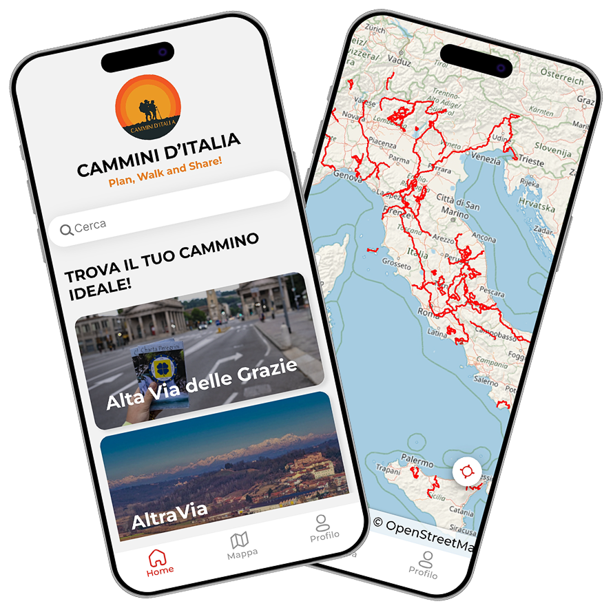
With the free Cammini d’Italia app, you can plan and walk the Cammino Balteo in total safety, being able to plan the stages in detail and walk the route thanks to the built-in GPS technology that supports your orientation during your adventure.
⠀Inside the app you will find many other paths present in Italy. Thanks to the georeferenced tracks of many routes you will be able to study the itinerary that suits you best and also download the GPX tracks of the individual STAGEs offline.
The app also includes a complete digital map of all the paths surveyed to date on our portal, giving you a wide range of choices among the many paths in the Belpaese.
⠀⠀
Cammini d’Italia is the perfect app for those who want to explore the beauty of Italy on foot, discovering hidden places surrounded by nature. Download it for free today and start planning your next adventure!
⠀
⠀
 ⠀⠀⠀
⠀⠀⠀