

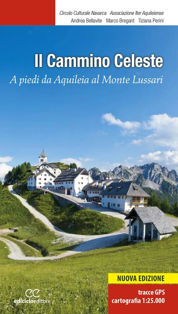
Cammino Celeste
The “Cammino Celeste” is a pilgrimage linking different places of worship such as Aquileia, Maria Saal (in Austria) and Brezje (in Slovenia).
The three routes are divided into the Italian, Austrian and Slovenian routes.
These have a total of 365 km, but the Italian branch is the longest route at 210 km, while the other two are about 80 km long each.
The Cammino Celeste joins Aquileia, titular seat of a glorious patriarchate with a history stretching back thousands of years, to Mount Lussari, in the heart of the Julian Alps, on whose
summit a Marian Shrine has been built; about 200 kilometers long, it is traveled in approximately ten days, mostly on dirt roads,
country lanes and mountain paths.
The Camino allows the hiker to admire the enchanting landscape of Friuli Venezia Giulia in all its transformations, from the sea to the mountains.
HISTORY
The Cammino CELESTE is a pilgrimage created through the initiative of a
group of people belonging to different associations and united by being pilgrims, women and men who physically set out to reach a spiritual goal. It is a Cammino that unites three different countries and is composed of as many routes originating in locations particularly significant to the history and faith tradition of our lands:
– One in Italy: Aquileia where the Gospel was first proclaimed and from where missionaries took the Christian proclamation to the heart of Europe.
– One in Slovenia: Brezje, near Kranj, the most important place of invocation of the Mother of God in Slovenia.
– One in Austria: Maria Saal, above Klagenfurt, a splendid church with origins around the 8th century, a center of great importance for the history of Carinthia and for the cultural and religious identity of so-called Mitteleuropa. The three routes, starting from their respective places of origin, reunite in Camporosso, then ascend Mount Lussari, gaining its summit at 1760 meters above sea level.
SIGNAGE
Signage, the cross and delight of every trail that unravels in places of great naturalistic impact, high “wilderness” and in cold and rainy mountain environments, is “refreshed” every spring. Recently, thanks to a European grant, at major crossroads or near population centers, printed panels and markers have been used that are less deteriorating than the classic blue arrow painted on walls, lanes or trees that distinguishes Cammino Celeste.
DANGERS
From Cividale del Friuli to the destination, we pass through unspoiled areas: wild forests and woodlands, with many streams and small villages spaced apart, rich in wildlife. In some areas foxes, deer, wild boar, some lynx pass through. The route, moreover, grazes areas where rare bears also live, which, however, have never been reported by pilgrims from 2006, when the Cammino was born, to the present.
ACCESSIBILITY
Several sections of Cammino Celeste have been traveled by people with disabilities, in many cases accompanied, drawing significant benefit. Certainly the first few STAGES, all the way to Cormons, are passable to wheelchair users, while other stretches, even uphill, have been walked by people with other types of disabilities, properly accompanied.
IN TENT
Many young people, scout groups, and even tough retirees made the route in tents, receiving good reception everywhere. Except for the campgrounds, places to wait were not surveyed, as currently campers have not reported any problems.
RECEPTION AND SERVICES
The complete list of accommodations stage by stage. On each link you can find accommodations, restaurants, farmhouses, pharmacies, useful numbers and much more
| Prologue | Island of Barbana – Aquileia |
CONTACTS
It is possible to contact the association Iter Aquieleiense through the following contact form or through the e-mail address: camminoceleste@libero.it
Please also send us your opinions and suggestions to the Cammino website: they will always be listened to and contribute to the improvement of the organization of Cammino Celeste.
Associazione Iter Aquileiense
via D Olea 10 – 34070 Mariano del Friuli (GO)
e-mail: camminoceleste@libero.it
President: Giuseppe Poiana
cell: +39 340 842 6869 (only for serious needs)
STAGE 01
STAGE 01: From Aquileia to Aiello
Departure: Aquileia
Arrival: Aiello
Distance: 16 km
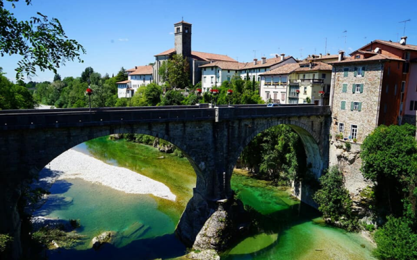
Sixteen and a half kilometers long, it runs through country terrain without encountering any elevation gain. From the Basilica d’Aquileia one passes the Via Sacra to reach the nearby hamlet of Monastero; by country roads skirting the bank of the Natissa River one passes the villages of Borgo Sandrigo and Capo di Sopra. Crossing the state highway to Gorizia, you reach the village of Perteole to arrive after two kilometers in Aiello.
STAGE 02
STAGE 02: Aiello to Cormons.
Departure: Aiello
Arrival: Cormons
Distance: 17 km
It is 17 kilometers long, and also in this STAGE there is no particular height difference. Passing the highway overpass, you reach Crauglio after a kilometer. You then pass the long bridge over the Torre stream, and the village of Versa, and then travel along the left bank of the stream of the same name. Along the embankment, the villages of Medea and Borgnano are skirted and the former railroad variant route is reached, leading all the way to Cormons.
STAGE 03
STAGE 03: Cormons to Castelmonte
Departure: Cormons
Arrival: Castelmonte
Distance: 26.5 km
It has a development of 26 1/2 kilometers. After the village of Vencò, proceed along the dirt roads of the rolling hills of Collio, passing the villages of Lonzano, Scriò and Mernicco until you reach Albana from where you continue along trail 748. After a long uphill stretch through the verdant woods of San Pietro di Chiazzacco, we reach the sanctuary of Castelmonte at an altitude of 618 meters. From Brazzano, it is possible to vary the Camino: traveling an additional eight kilometers, one can visit the medieval Abbey of Rosazzo.
STAGE 04
STAGE 04: From Castelmonte to Masarolis.
Departure: Castelmonte
Arrival: Masarolis
Distance: 26.5 km
Twenty-six and a half kilometers long, from the Sanctuary of Castelmonte you descend along a beautiful scenic road to the village of Purgessimo to reach after about two kilometers the town of Cividale, the ancient Forum Julii founded in the 1st century B.C. by the Romans. A fleeting visit to Cividale’s most expressive historical monuments is recommended. To resume the Camino we climb the ridge of the hill, and along a beautiful scenic road, passing near the small villages of Puller and Spignon, we finally reach the village of Masarolis at an altitude of 661 meters.
STAGE 05
STAGE 05: Masarolis to Montemaggiore
Departure: Masarolis
Arrival: Montemaggiore
Distance: 24.5 km
It travels along a road with varying gradients along the Eastern Friuli Hills that is 24 and a half kilometers long. When you reach the pass with Slovenia’s Robedischis, yes turn left for Prossenicco, past the village, down the mountain until you reach the other pass of Ponte Vittorio. Having then passed the ford of the Natisone River, the path proceeds with continuous ups and downs to finally arrive at Montemaggiore, a small village located 795 meters above sea level.
STAGE 06
STAGE 06: From Montemaggiore to the A.N.A. Refuge.
Departure: Montemaggiore
Arrival: A.N.A. Refuge.
Distance: 18 km
Climb up the Gran Monte mountain on Trail 711, passing through the villages of Cornappo and Monteaperta. Once on the ridge, it is a short stretch to the alpine hut at an altitude of 1468 meters. The length of this day’s walk is 18 kilometers and seven hundred meters. An alternative route is trail 742, which is more direct but advisable only on clear weather days and only for people accustomed to the mountains.
STAGE 6 Bis: Montemaggiore – Loc. Ponte Musi after Pradielis
Height difference in ascent/descent: 290 m / 310 m
Length: 24 km
STAGE 07
STAGE 07: From A.N.A. Refuge to Resia Meadow
Departure: A.N.A. Refuge.
Arrival: Reschen Meadow
Distance: 21 km
It begins with a descent to Tanamea Pass; then proceeding along trail 739 we reach the Nischiuarch Cheese Factory at an elevation of 1182 meters, recently renovated and used as a wildlife observatory. We then descend the mountain slightly to reach first the beautiful little church of St. Anna, and then the plateau of the Gnivizza stavoli, and shortly thereafter the Sella Carnizza. The Cammino then descends along the road into the verdant Resia Valley after passing the villages of Lischiazze and Gniva. After traveling 21 1/2 kilometers it reaches Prato di Resia, located at an altitude of 492 meters.
STAGE 08
STAGE 08: From Prato di Resia to Dogna
Departure: Reschen Meadow
Arrival: Dogna
Distance: 13 km
A route of just over thirteen kilometers and travels along trail 638 to the Sella Sagata chapel located at an altitude of 850 meters, and then descends to Raccolana along a narrow path through the woods. Cross the bridge over the Fella and enter Chiusaforte to continue for a few kilometers to Dogna along State Road thirteen.
STAGE 09
STAGE 09: Dogna to Valbruna
Departure: Dogna
Arrival: Valbruna
Distance: 18 km
It runs basically along the entire length of the Dogna Valley. The valley is 18 kilometers long and climbs from an elevation of 419 meters to the Grego refuge at an elevation of 1392 meters, following a winding road built during World War I by Italian soldiers. We pass the villages of Chiout di Puppe, Chiout Zuquin and Chiout, and proceed uphill to the farmhouse of Pian de Spadovai and finally to the alpine hut of Sella Somdogna. From there it is a ten-minute walk to the Grego refuge and then down about three kilometers to Val Saisera where we find the Montasio refuge.
STAGE 10
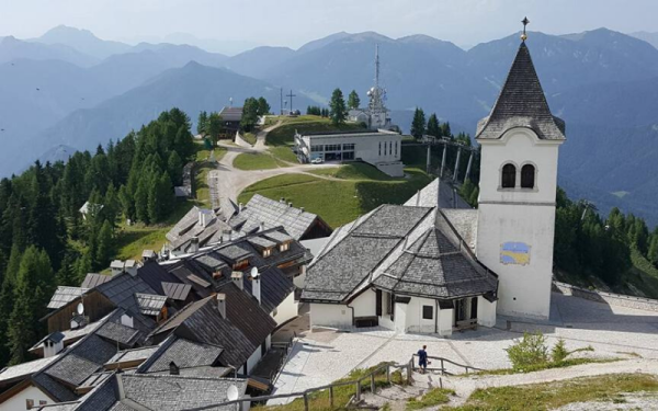
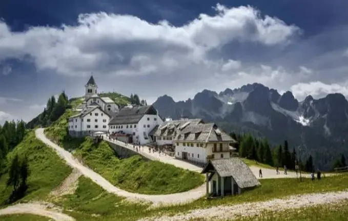
STAGE 10: From Valbruna to the Sanctuary on Mount Lussari
Departure: Valbruna
Arrival: Mount Lussari
Distance: 10 km
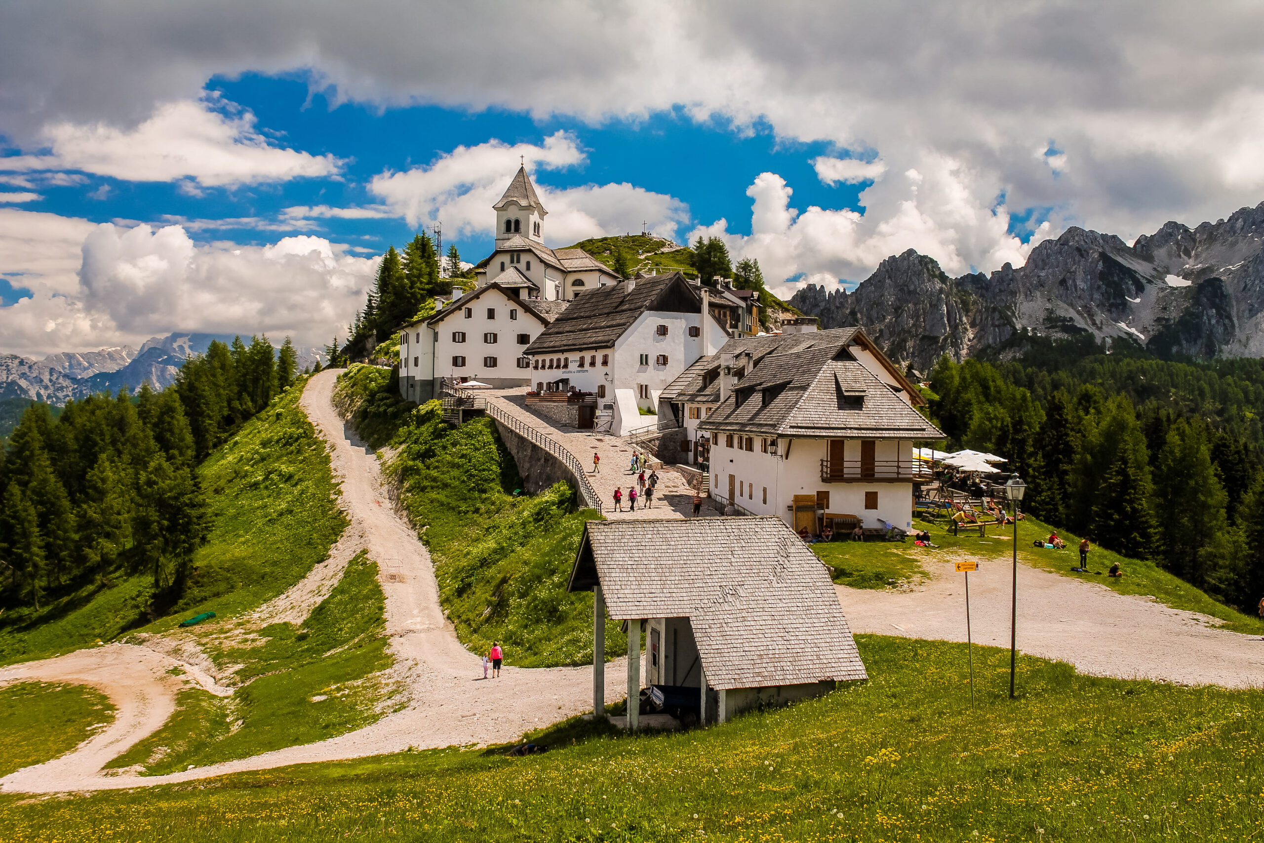
About a dozen kilometers long. From Valbruna we continue for a few kilometers to Camporosso, from where the old pilgrims’ road starts, leading to Mount Lussari at an altitude of 1766 meters, where the Marian Shrine, the destination of our Cammino Celeste. The goal at the Shrine is reached!
GUIDE TO THE CAMMINO CELESTE
The Cammino CELESTE, established in 2006, is a relatively young but already among the most popular itineraries. It stands out as an international route, designed to encourage pilgrims from different countries to meet in a unique place: the sanctuary of Mount Lussari, where a statue of the Madonna venerated for centuries in Friuli Venezia Giulia, Carinthia, Austria and Slovenia is kept. Pilgrims from these lands reached it by following ancient paths that, thanks to the marks left by their faith and creativity, have been partly rediscovered and brought back to light.
The Camino consists of three main routes, departing from places symbolic to the history and devotion of these border regions: Aquileia in Italy, Brezje (Marian shrine near Kranj) in Slovenia, and Maria Saal, north of Klagenfurt, in Austria.
The guidebook describes in detail the Italian route, which runs from Aquileia through Bassa Friulana, Cormòns, Castelmonte, Cividale del Friuli, Gran Monte, and the valleys of Resia, Dogna, and Saisera, until it joins Mount Lussari.

Journey diaries
Cammino Celeste
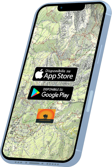
With the free Cammini d’Italia app, you can plan and walk the Cammino Celeste safely, being able to plan the stages in detail and walk the route thanks to the built-in GPS technology that supports your orientation during your adventure.
⠀Inside the app you will find many other paths present in Italy. Thanks to the georeferenced tracks of many routes you will be able to study the itinerary that suits you best and also download the GPX tracks of the individual STAGEs offline.
The app also includes a complete digital map of all the paths surveyed to date on our portal, giving you a wide range of choices among the many paths in the Belpaese.
⠀⠀
Cammini d’Italia is the perfect app for those who want to explore the beauty of Italy on foot, discovering hidden places surrounded by nature. Download it for free today and start planning your next adventure!
⠀
⠀
 ⠀⠀⠀
⠀⠀⠀