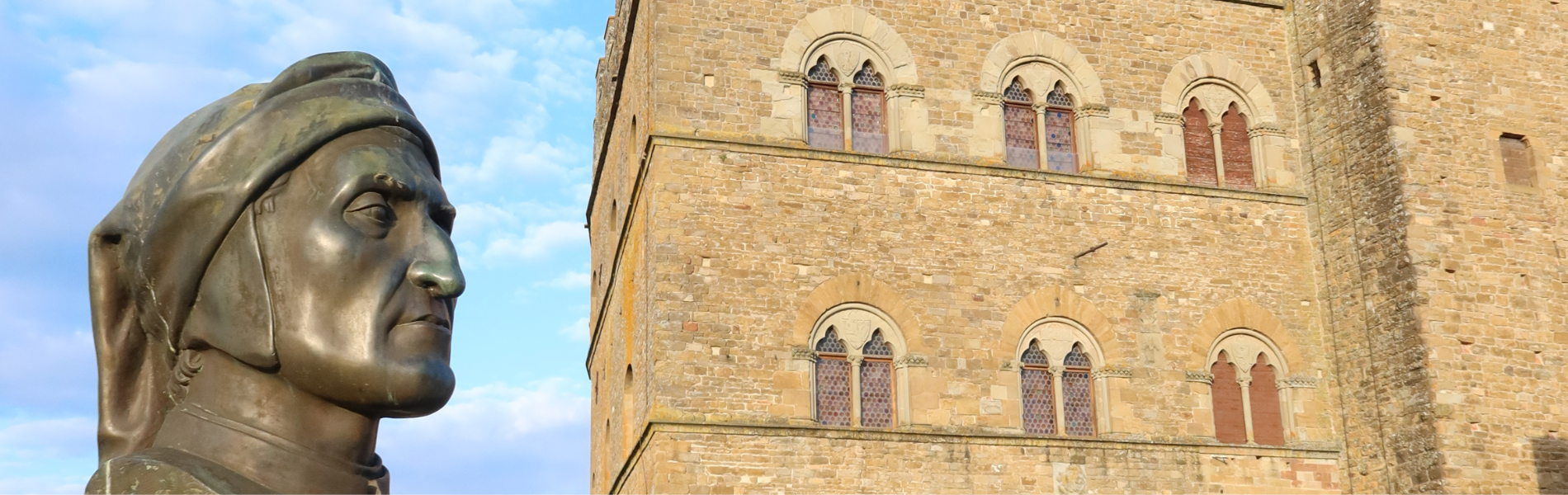

Cammino di Dante
Cammino di Dante is an itinerary through the medieval paths and roads that united Romagna and Tuscany traveled by the Supreme Poet during the time of his exile, a period when he wrote the Comedy.
Cammino di Dante is the first organized journey through the medieval paths and routes that united Romagna and Tuscany traveled by the Supreme Poet during the time of his exile, the period when he wrote the Comedy.
The route aims to rediscover the ancient streets that connect the two cities of the Poet's birth and death and to enhance the figure of Dante by accompanying the wayfarer on a journey that is not only cultural and naturalistic but also literary.
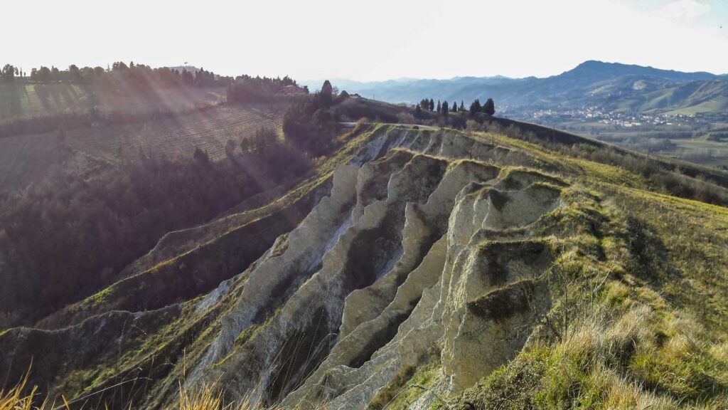
The itineraries we have identified thus wind through those places in the Tuscan-Romagna territory mentioned in the Comedy, or directly experienced by the Poet during his years of exile. The paths that make up the itineraries, in most cases, are “ridge” paths used since the late Middle Ages, until the development of the current road network dating from the late 1800s. In places these medieval paths coincide with ancient Etruscan-Roman roads, easily recognizable by their typical pavements.
Passages through newer roads are planned where necessary to connect the various points of interest. The route is developed through a ring of about 400 km joining Romagna and Casentino, for a total of 20 fixed stages, to be traveled counterclockwise. The two ends of the route-the starting and ending points-are represented by Dante's Tomb in Ravenna, and the Dante's House Museum in Florence.
HISTORY
The Cammino di Dante is the result of years of research and exploration both in the library and in the field. The intuition of a path centered on the figure of the Poet is Giordano Bezzi, from Ravenna. From 2011 to 2015, starting from an idea, he slowly drew the outlines of this path, creating it and in its current form. The work can be divided into three major phases, partly overlapping each other: 1) research and bibliographic study; 2) research and exploration in the field; 3) confrontation with and support of experts (historians and Danteans). This was carried out personally by Giordano Bezzi, with the help of Fabrizio Fantini.
Based on the information gathered through bibliographic research – mainly documents and studies both on the medieval road system in the territory of Tuscany-Emilia and Romagna and on the life of Dante Alighieri – the field research part began, a phase of “physical” exploration that lasted almost five years.
The original work done in the field was to identify the ancient roads that cross the Apennines between Ravenna and Florence; to select places – towns or points of interest – that contained important references to Dante’s life or to the Divine Comedy; and finally to create walkable STAGEs, making sure that everything was linked into a coherent and homogeneous unicum. In practice, Bezzi and Fantini retraced the paths of the Tuscan-Romagna Apennines plausibly connected to the Poet’s life, as well as to the Songs of the Divine Comedy, until they selected the current STAGE. The current proposed route of about 400 km is but a small part of the explored territory, and is the result of thoughtful choices based on criteria of walkability, feasibility, and historical-literary interest.
WATER SOURCES.
Except for the first 3 STAGES, where sources are present only at the start and finish, all other STAGES have water sources along the route.
STAGE
ONE WAY RAVENNA – FLORENCE
STAGE 1: Ravenna – Ponte Passo Vico 19Km
The first STAGE is simple and flat. It starts at Dante’s Tomb in Ravenna. After visiting the Basilica of St. Francis, the renovated Dante teaching center of the Friars Minor, and the many Dante sites in the city, you leave the historic center proceeding along the embankment of the United Rivers, continue along the embankment of the Montone, after which you will find: the San Marco lock, the hamlet of San Marco, San Pancrazio, Chiesuola, and finally arrive at the Passo Vico bridge.
STAGE 2: Pontevico – Oriolo dei Fichi 18.4Km
Stages flat and without difficulty. From Pontevico, still on the riverbank, continue toward the mountains to the highway overpass. You then come under the railroad overpass to reach the intersection with the via Emilia. After crossing Via Emilia continue along the bank of the Cosina stream and take Via degli Ossi. Here turn left and after 250 m turn right onto via Castel Leone, continue along via del Passo and then turn onto via Oriolo until you reach the Oriolo Tower.
STAGE 3: Oriolo dei Fichi – Brisighella 16.8Km
This STAGE is also easy. Leaving Oriolo dei Fichi, one proceeds in the midst of cultivation passing the nearby San Biagio restaurant, descending to the village of Santa Lucia. Afterwards, go along the long via Canovetta until you cross the provincial road of Marzeno. Go up via Tuliero, and continue uphill on the ridge (via Pian di Vicchio). You will then cross the provincial road via Carla, follow it for 250 meters, turn left returning to the ridge between gullies and cultivated fields. Dantesca signs will take you down the valley to via Canaletta. The path continues alternately on the left and right side of the paved road to Brisighella.
STAGE 3bis: Oriolo dei Fichi – Faenza- Brisighella. 28.5Km
STAGE 4: Brisighella – Monte Romano 18.7km
From the center of Brisighella go up the steps of the Rocca, continue along Via Rontana to the Monticino Sanctuary. After passing the Carnè refuge, follow the 505 for 6 km to the junction of the Cai nel Bosco trail. Continue past Cà Malanca, arriving at the Croce Daniele restaurant. We may decide to continue to stay overnight in Gamberaldi. Passing the astronomical observatory, the Chiesuola you will finally reach the path downhill to the farmhouse and the deconsecrated church of Gamberaldi.
STAGE 5: Monte Romano – Marradi 14.2Km
Starting from Croce Daniele we continue on path 505 , continue walking along the ridge. We continue until we cross the path to Marradi. Continue downhill until you pass Poggio Cà del Falco, continue towards Cà del Vento, from here go downhill until you reach Marradi, at the station turn right towards the center, cross the bridge over the Lamone river until you reach the Arco della Volpe, after 80 meters turn left in the middle of the vegetation, after 300 m you will find the farmhouse la Colombaia.
STAGE 6: Marradi – San Benedetto in Alpe 23km
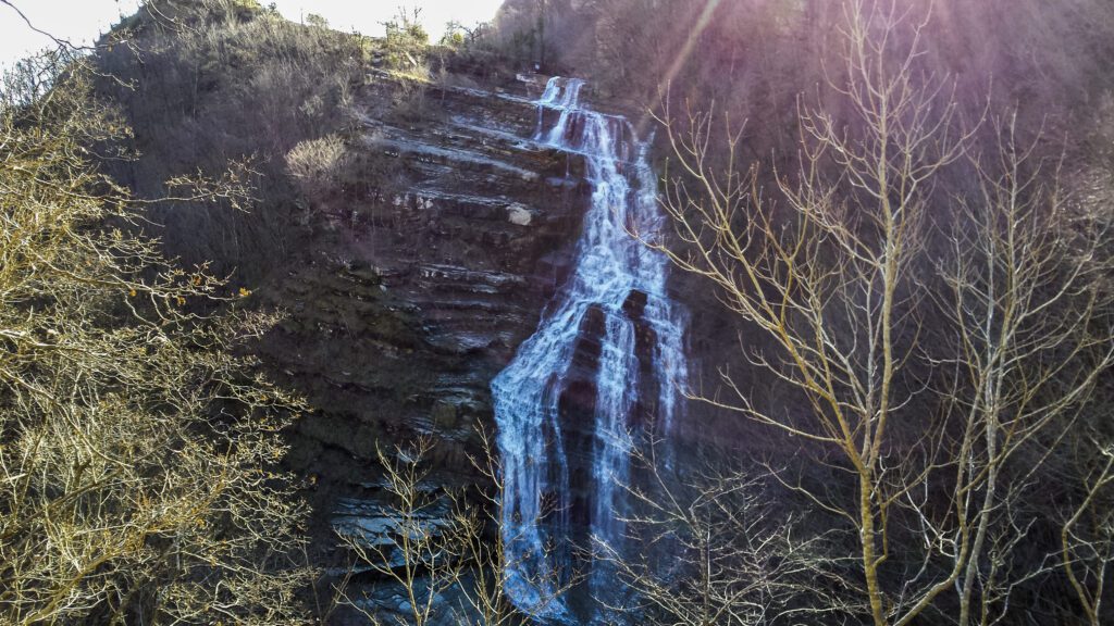
From Marradi we climb along the CAI route (Arco della Volpe or via della Badia). Let’s arm ourselves with great energy for a very challenging STAGE, passing by Eremo di Gamogna, Passo dell’Eremo (Cai 555 and Cai 429) and again up to Poggio dell’Inferno, taking the ridge up to 1077m, then abruptly descending to pian Baruzzoli and finally to Acquacheta. Here we have two directional alternatives of equal distance but different commitment: either continue on the 411 CAI ( 22 SOFT), which will take us uphill to the Toschi hermitage (6 bis), or turn right for the much more pleasant and touristy 407 CAI to S.Benedetto in Alpe (overnight).
STAGE 6bis: Marradi – Eremo dei Toschi 24Km
STAGE 7: San Benedetto in Alpe – San Godenzo 13.2Km
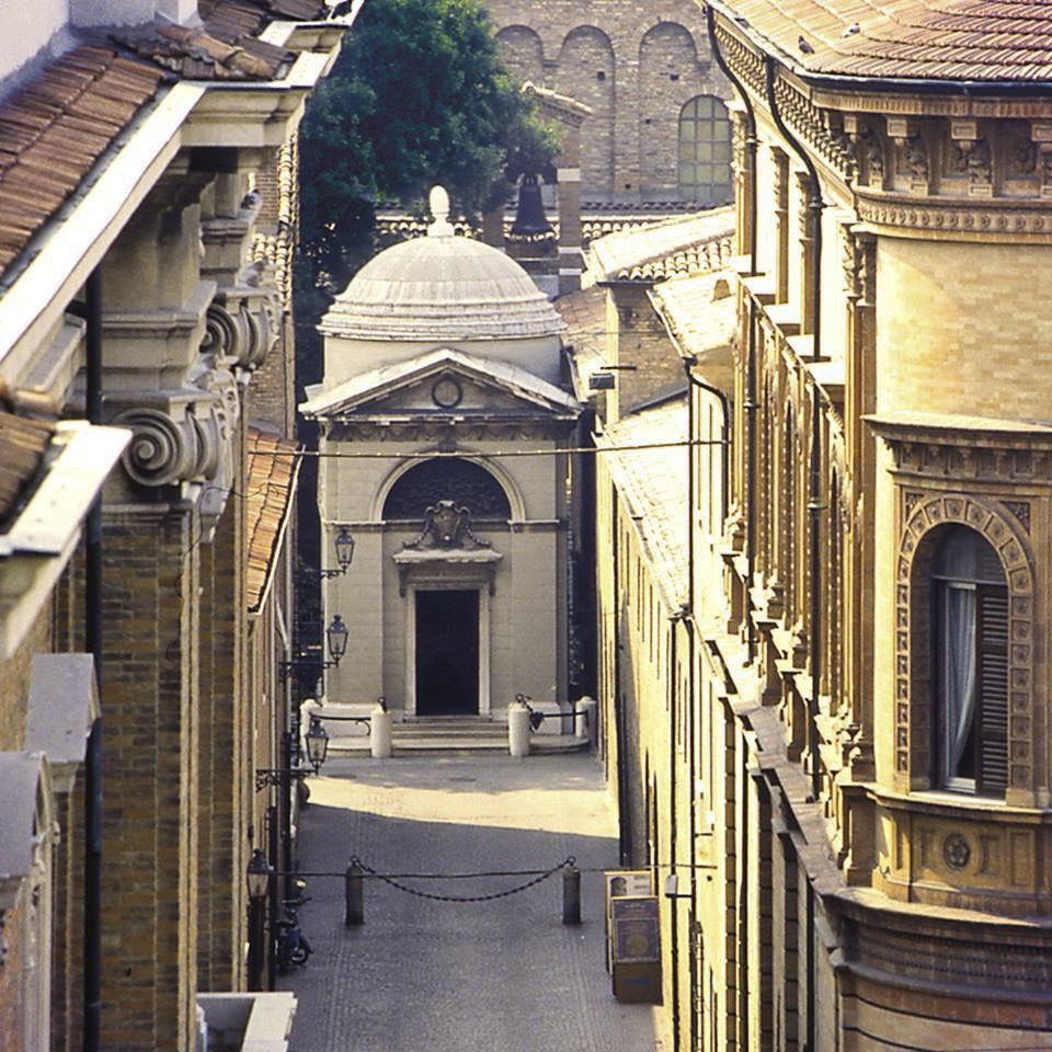
From the small square of the S.Benedetto parking lot, cross the bridge and turn immediately right onto the CAI path, continue uphill until beyond meadow Andreaccio ; you have arrived at the ridge (old medieval road), this path is in all probability the road Dante took to access Romagna. You pass the hermitage of the Toschi, to arrive comfortably at the hill of the Majesty, then straight downhill on the 10 CAI, crossing Moia (lodging) and Castagneto (restaurant) and after a couple of km on the asphalt, pay attention to the right turn in the vegetation to enter the medieval road that will take you to the “Mirror”, site of an old hospice. And finally go up Via Trento to the charming Church of San Godenzo where Dante attended the meeting of the Ghibelline and White Guelph outcasts.
STAGE 8: San Godenzo – Dicomano 16.6Km
Start from the str. Provinciale going to Castagno D’Andrea, turn right up Spaliena, to continue after the last house, amidst age-old chestnut trees, all the way up to the crest of Mount Campaccio, and then downhill past the Chapel of Tizzano. After pervading a few km on a comfortable dirt road pay attention to the junction on the right, a difficult-to-see passage marked by CAI trail 1A, carefully following the signs in the vegetation. Take the ridge again, passing near a repeater, and downhill you will reach the Etruscan archaeological area of Frascole, turn right for the asphalt road (via Frascole), where you will find places to sleep and eat before arriving in the center of Dicomano where you can visit the splendid Etruscan Museum.
STAGE 9: Dicomano – Pontassieve 21Km
From the Dicomano sports field you cross the Sieve River, heading toward Celle. At the end of the village, old cypress trees will point you in the right direction along an uphill slope, you will pass a memorial stone of a cruel shooting, a beekeeper’s farm, and shortly after the start of the descent you will travel about 150 meters of asphalt and then turn left back onto dirt roads between private houses olive fields and excerpts of medieval roads with lots of vegetation. Follow the signs and you will arrive on the Uscioli road (downhill), cross a bridge on the left and immediately right down to the valley. Then right next to Lago d’Argento, turn then right on a path that runs along, on the coast, the Sieve River to Montebonello. Take via Colognolese with little traffic to arrive comfortably in Pontassieve.
STAGE 10: Pontassieve – Rosano – Florence 20.7Km
From the center of Pontassieve we head to the banks of the Sieve River, a promenade that flows into the Arno; continuing on the rival footpath we reach the bridge and crossing it we arrive at Rosano. Next to the Abbey, of Rosano, we take the road that goes up to S.Prugnano; having crossed the asphalt road we enter the woods, continue uphill until we reach some private houses among the fields until we reach the asphalt that we will leave after a shortcut on the right that will take us uphill to the Convent of the Meeting. From here we can admire the whole valley of Florence, we walk keeping the convent on the left, we come to a fork that inserts itself on the right on CAI path 4 downhill, all the way down to Vicchio di Rimaggio, then Rimaggio; finished the descent at the traffic light we cross the road, taking via del Padule we arrive along Arno and then towards the Museo Casa di Dante in the heart of Florence.
Return: Florence-Ravenna
STAGE 11: Florence – Bigallo – Pieve Pitiana 29.2Km
After visiting Florence and the city’s many Dante sites, it is recommended to leave in the early afternoon and arrive in the evening to stay overnight at the hostel Il Bigallo. The next morning we start from the road in front of the hostel, via della Bascula. The path continues right into the woods uphill on the Romanesque pavement to Montecucco, then descends through the woods to the gravel road of Moriano. Follow the signs, now reinforced by the concurrence with the “Ghibellina” route (orange signs). Pay attention to the signs that will make you leave the gravel road by turning left into a semi-paved road and then immediately right into the woods, continue near fields of olive trees, then take the medieval road again that will take you to Bombone. Continue to Rignano, cross the bridge over the Arno, turn left to rival the river to the state highway, cross it and go up the woods, the path continues on paved roads to Pieve Pitiana.
STAGE 12: Pieve Pitiana – Prato di Strada 23.5Km
From the Pieve you climb through olive fields until you intercept the CAI trail, which takes you up the wide CAI 9 climb. Arriving at the large fir trees, you are only a few meters from Vallombrosa. Continue downhill through the woods until you cross Campiano, Montemignaio and Forcanasso. Still on the descent, you pass a small medieval bridge and then climb again to “Picche della Maestà” where you will walk on a Romanesque pavement; continue downhill in the woods until you reach Barbiano (after 400 m lodging), Pagliericcio (lodging), Rifiglio and Prato di Strada (overnight stay).
STAGE 13: Street Meadow – Casalino 17.5Km
The Casentino is rich in villages, castles and Dantesque places, thus numerous variants and alternatives. Go down to Strada (village), after the Pieve on the right, at the end of the gravel road there is a small ford, here you can opt for two alternatives. 1) in the direction of Poppi (follow the orange “Ghibellina” signs) and finally arrive at the Conti Guidi Castle. After the visit to the Castle you will go back along the same path to the crossroads and follow the signs towards Borgo alla collina.2) Or choose to go left to Borgo alla collina, after a cemetery continue then to the edge of fields and meadows on the CAI path ; you will then arrive at Pieve di Romena: continue to the castle of Romena. Go straight ahead again on the Cai path to the center of Pratovecchio. Another variant: in the main square of Pratovecchio head toward the castle of Porciano, or left, continuing the path to Casalino. Once in Casalino proceed to towards the locality Valagnesi (La Capannina lodging).
STAGE 14: Casalino – Calla Pass 18.1Km
After visiting the ancient and charming village of Casalino (Lodging taken the Capannina, locality Valagnesi), take the path CAI, Arrived on the asphalt, after a challenging climb continue to the path 74 CAI, then left not to lose the 74, between fir and beech trees you will arrive back on the asphalt, where you turn left for the Hermitage of Camaldoli. When you arrive in front of the Hermitage, continue along the ridge and after an easy walk at altitude with glimpses of the panorama as far as the sea, you will arrive at the Calla Pass. Cross the road and continue to Chalet la Burraia (overnight stay).
STAGE 15: Calla Pass – Premilcuore 20.6Km
Climb to the top of the large meadow in front of the refuge and continue along the ridge to the Fontanelle refuge. Arriving at Colla pian di Mezzano, descend by fiumicello, on the CAI trail (challenging descent with vintage pavements). Arriving at Mengozzi mill you can admire the waterfalls in the area, 350 m to Fiumicello (Lodgings). Or continue to Premilcuore: after a valley road with little traffic take the path that leads to the bridge over the Rabbi River, turn left to the historic Giumella bridge, you will find to lodge at Ridolla, with the wonders of its river in front of you, continuing you will reach Premilcuore.
STAGE 16: Premilcuore – Portico di Romagna 9.6Km
Leaving the center of Premilcuore, continue to the bridge over the Rabbi River, turn right onto the provincial road to Forli. Continue into the woods, where the trail proceeds along the ridge. At a well-marked trail junction, you will begin the descent, only a few hundred meters from Portico di Romagna the woods will refresh with the path with intact pavement. Along the way we will encounter a mill, the little wall and finally a bridge at Ponte della Maestà , The scenery is wonderful, finally we are at the medieval village of Portico di Romagna.
STAGE 17: Portico di Romagna – Dovadola 27.5Km
Go through the center of Portico and up Via Dei Caduti, after the cemetery and after 50 m from the road sign at the end of Portico, continue on the provincial road to the top of Mount Busca. When you get to Mount Busca turn right on the ridge, proceed on a semi-paved road (be careful you have to turn left for a shortcut :CAI path). Back on the road you will find signs for the Capannina (lodgings), or you can continue left towards Marzanella (lodgings and catering).
STAGE 18: Dovadola – Castrocaro – Forlì 22.6Km
At Dovadola exit onto Via Nazionale, care must be taken as the embankment is narrow, walk through the adjacent fields until you enter the quiet Via Reggiolo on the right: walk it all the way, then turn into Via Raggi as far as Montecchio and Pieve Salutare, turn right, after 100 m up Via Virano, before the cemetery on the right, walk along it and follow the dirt roadway to Castrocaro, go up to the castle and down to Piazza Mazzini, walk along the tree-lined avenue to the skating rink, turn right and enter the Montone River Park (pedestrian friendly). When you reach Terra Del Sole, cross over and take Via Piave, proceed to Via Gaudenzi and again into the river park’s pedestrian walkway, which will take you up the river to Porta Schiavonia in Forlì.
STAGE 19: Forli – Ponte Passo Vico 15.3Km
It proceeds from Porta Schiavonia along Via Isonzo, then up the Montone River embankment to the river park towards Ravenna, proceeding along the right bank until reaching Pontevico where you can stay overnight and eat.
STAGE 20: Ponte Passo Vico Bridge – Ravenna 19Km
We return along the left bank of the Montone River passing by: Chiesuola, S.Pancrazio, S.Marco (headquarters of the Association “Il cammino di Dante”), change at the bridge and cross the embankment, S.Marco’s lock, (back along the left side of the Montone to Ravenna. Welcome back!
STAGE 21: Pineta di Classe – Ravenna 23.8km
A Loop Route that starts from Ponte Nuovo (Ravenna locality), passing through Classe where you can admire the church of S. Apollinare in Classe, then continuing through the pine forest in a path that will lead to the sea. It will then continue along the beach to get to Lido di Dante, then back to the starting point along the embankment of the Fiumi Uniti.
STAGE-BY-STAGE SERVICES
For most of the STAGES, the arrival is in a town center with related services.
DANGERS
After the May 2023 flood event, landslides or mudslides are present in some places throughout the mountainous, hilly, and Po Valley areas of Romagna. Therefore, caution is recommended.
ROAD BOTTOM.
30 percent asphalt and 70 percent trails (in the 30 percent are also considered vicarious roads, dirt roads, or otherwise driveways)
ACCESSIBILITY
Only STAGE 21, which takes place in the Classe pine forest, the first and second stages, where the route runs mainly along the Montone River bank.
TENT WALK
We do not recommend the use of the Tent (except in facilities that allow it), as you may incur penalties. There are strict rules within the Casentino Forest Park. We recommend in case the use of the various bivouacs along the route.
CREDENTIALS
Attendance. They are received following registration directly on the Association’s Website.
CONTACTS
ASSOCIATION CONTACTS
About the path, route and STAGE info :
Cell. +39 345 4540524 (Oliviero Resta)
Info on Registration, route and STAGE at the walk: Cell. +39 328 1337552 (Marcello Bezzi)
WEBSITE: www.ilcamminodidante.it
EMAIL CONTACT: ilcamminodidante@yahoo.it

GUIDE OF CAMMINO DI DANTE
A 380 km journey on foot between Romagna and Tuscany. Poet, politician, unrequited lover, traveler.
Of Dante we know almost everything, and yet, following the traces of his exile, his figure becomes tangible, and the verses of the Comedy come to life: in the roar of the Acquacheta, in the silence of the hermitages of the Toschi and Camaldoli, and in the embrace of the Casentino Forests that envelop us along the way. An extraordinary journey, Dante’s, in twenty stages, from Ravenna to Florence and back, to relive the most significant stages of his life.
With practical details for tackling the route: accurate maps, elevation elevations, elevation differences, trail descriptions, hospitality and must-see places. Completing the experience are “city tours” and insights into the territories traversed by Dante, with references to his work.
In addition, useful suggestions for using public transportation and customizing the itinerary.

Cammino di Dante
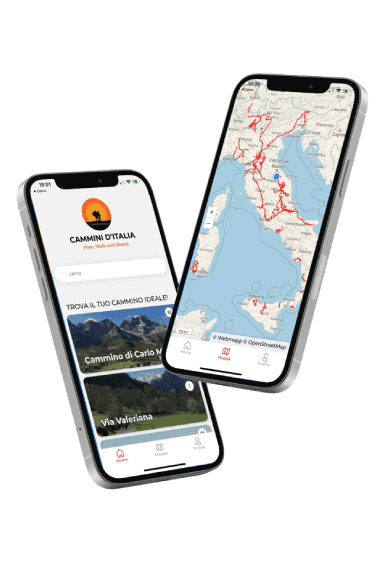
With the free Cammini d’Italia app you can plan and walk the Cammino di Dante in total safety, being able to plan the STAGES in detail and walk the route thanks to the integrated GPS technology that supports you in orientation during your adventure.
⠀Inside the app you will find many other paths present in Italy. Thanks to the georeferenced tracks of many routes you will be able to study the itinerary that suits you best and also download the GPX tracks of the individual STAGEs offline.
The app also includes a complete digital map of all the paths surveyed to date on our portal, giving you a wide range of choices among the many paths in the Belpaese.
⠀⠀
Cammini d’Italia is the perfect app for those who want to explore the beauty of Italy on foot, discovering hidden places surrounded by nature. Download it for free today and start planning your next adventure!
 ⠀⠀⠀
⠀⠀⠀