Cammino di San Rocco
The Cammino di San Rocco is a path made up of people and encounters, where history, culture and nature intertwine along ancient paths and small, cozy towns. 70 km through southern Trentino!
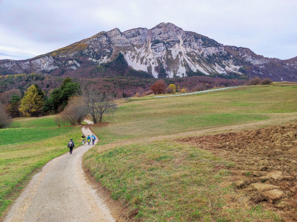
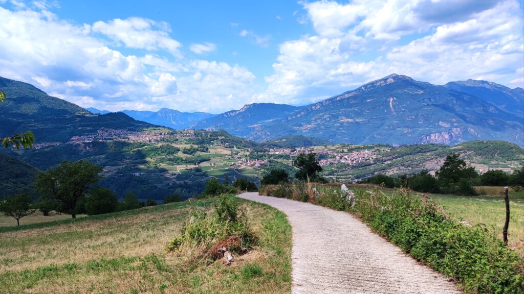
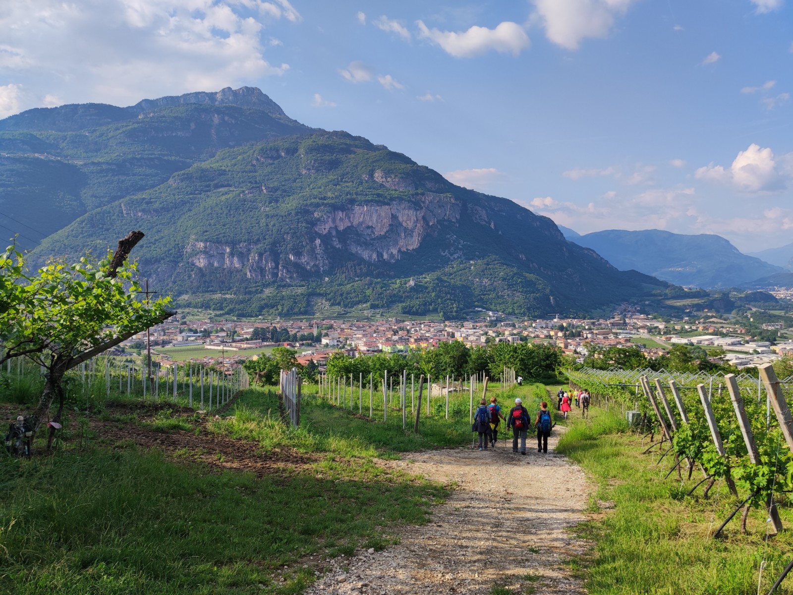
The Cammino di San Rocco is a loop itinerary of about 70 km, divided into 5 STAGES. It winds in southern Trentino, between Vallagarina and Alto Garda drawing a hypothetical infinity between the two sides of the Cameras valley. The entire Camino develops at low and medium mountain altitudes, along ancient paths, through woods and countryside. Starting from the township of Mori, in the first three STAGES we travel through the Val di Gresta, passing through the beech forest toward Bordala Pass to the village of Ronzo-Chienis and the scenic Mount Creino. In Manzano it is possible to visit the impressive trenches of the Nagià-Grom. Returning to Mori, we change sides of the valley and the last two STAGES will have us discover the Brentonico plateau, among chestnut groves, herbs and scents of the extraordinary biodiversity of Monte Baldo Natural Park.
HISTORY
The Cammino di San Rocco is a community and land-use project born out of an ambitious proposal by two local residents in the midst of a pandemic.
The Walk is inspired by and dedicated to St. Roch, in tradition, protector from plague and epidemics, a symbolic figure for volunteers and volunteers, pilgrims and pilgrims, because of the difficult time people were going through in 2020.
The route in fact unites 28 capitals, small churches and other votive signs dedicated to the saint present in the municipalities of Mori, Ronzo-Chienis and Brentonico is designed precisely to let pilgrims touch the small and large signs that popular devotion has had over time dedicated to the saint, allowing them, through the discovery and rediscovery of the territory, to be spiritually involved in the popular veneration of its inhabitants.
WATER SOURCES.
There are numerous fountains along the route, especially on the fourth and fifth STAGE, on the Brentonico Plateau. We recommend that you pay extra attention during the first three stages. The list of fountains present can be found on our website, in the information sheets for each STAGE ( https://camminosanrocco.it/percorso-e-tappe/)
STAGE-BY-STAGE SERVICES
In Mori there are all services and several supermarkets, easily searchable through Google Maps. The towns of Ronzo-Chienis and Brentonico also have grocery stores, pharmacies, and some of the main services.
For more detailed information, on our website, in the information sheets for each STAGE you can find all the services available, with times and location, as well as affiliated accommodations, fountains and points of interest along the way (https://camminosanrocco.it/percorso-e-tappe/)
SIGNAGE
Signage on the trail consists of vertical markings (tables indicating direction and walking times) and trail markers. Both are on a red and white base following CAI-SAT signage criteria, with the Cammino logo (the three colored drops) and the trail stacking number “F20.”
ACCESSIBILITY
The route includes sections on secondary roads with an asphalt surface. In other sections, the route is passable by people with mobility disabilities using joelette.
CREDENTIALS
Cammino credentials can be taken at 6 facilities between Mori, Rovereto and Brentonico for a minimum donation of €5 in order to support the activities of the Association Company of the Cammino di San Rocco.
Along the route there are 11 official stamps of Cammino di San Rocco.
At the end of your walk, by presenting all the stamps affixed to the Credential, you will be able to collect the Certificate of the end of the Camino.
For more information, see the “Before You Go” page on our website: https://camminosanrocco.it/prima-di-partire/
TENT WALK
In the province of Trentino, free camping is generally prohibited on public land. Some contracted shelters make their private land available for camping.
CONTACTS
Web site: www.camminosanrocco.it
e-mail: info@camminosanrocco.it
Phone: +39 3534589390
Instagram and Facebook: @camminosanrocco
Contact persons by STAGE:
- STAGE 1: Antonella Perzolli – 3482227093
- STAGE 2 and 3: Roberta Perini – 3479420475
- STAGE 4: Mario Bianchi – 3474206840
- STAGE 5: Ornello Dossi – 3491239964
STAGE 01
STAGE 01: Mori – Ronzo-Chienis
Length: 16 km
Elevation gain: ascent 1100 m – descent 370 m
The Cammino starts from Cal di Ponte di Mori square, from which we move to the courtyard behind Santo Stefano Church to observe a capital of San Rocco, painted by Mario Galvagni, a Mori painter, and placed in the small gardens near the fountain. From here we set off again, crossing the built-up area of Mori and walking along Via Teatro, one of its historic streets, we reach the entrance to the path that climbs toward Montalbano, where its Sanctuary stands, a panoramic point that looks out over the Valley of the Cameras stream.
Returning to the beginning of the stairway and the main path, continue on the Pipel trail, a steep mule track that leads to the locality of Zele, and then through the sunny area of the villages of Nomesino and Corniano. Above Nomesino you can visit the votive chapel dedicated to St. Rocco; in Corniano stands the church dedicated to St. Agatha, one of the oldest church buildings in Trentino.
Passing through the Grotta degli Appestati (Cave of the Plague-riders), you continue to Mount San Bernardo and then switch to gentler trails to Malga Somator, a point where you can easily admire the town of Rovereto, the Ossuary and the Bell of the Fallen. From there you continue to the base of Mount Biaena and, passing through Pra del Lac, you reach the village of Ronzo-Chienis, at the beginning of which you are greeted by the Chapel of San Rocco.
This first STAGE has an elevation gain of 1100 meters, but they are well distributed and passable without particular difficulty. In any case, if it seems challenging, don’t be discouraged: in Nomesino they are waiting to give you hospitality for one night and thus divide the STAGE into two days.
STAGE 02
STAGE 02: Ronzo-Chienis – Valle San Felice
Length: 15 km
Height difference: ascent 400 m – descent 800 m
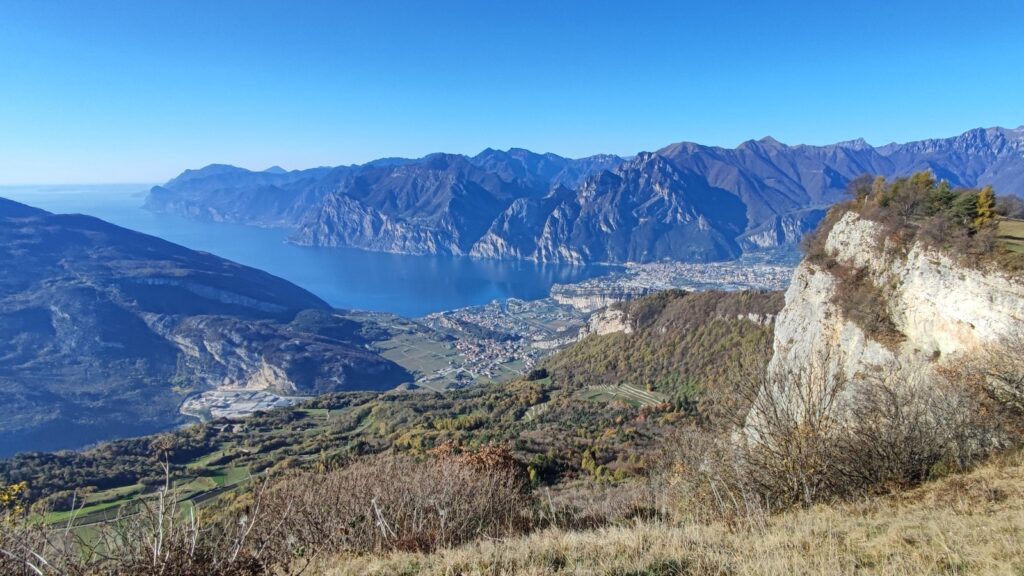
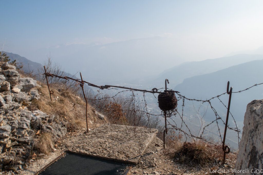
Leaving the town of Ronzo-Chienis, take the Sentiero della Pace (Peace Trail) to reach Mount Creino, an Austro-Hungarian stronghold during the Great War and a vantage point offering a beautiful view of Lake Garda.
Descending we cross the Val di Gresta vegetable gardens and coppice woods, arriving at Maso Naranch from which we continue toward Pannone meeting in the middle of the fields the small church dedicated to San Rocco.
Passing through the village of Pannone, one can admire the ruins of Gresta Castle. Follow the old road to the village of Valle San Felice, where the Church of St. Anne is located.
There are no eateries or bars in Valle San Felice. Affiliated accommodations provide kitchen use.
STAGE 03
STAGE 03: San Felice Valley – Old Moors
Length: 6 km,
Height difference: ascent 150 m – descent 500 m
Starting again from Valle San Felice, one arrives at Manzano, where one can choose to visit the trenches of the Nagià Grom, an Austrian fort from World War I, with a view of Mount Baldo, and then the small church of Sant’Apollonia. Returning to the edge of the town of Manzano, take the ancient Lasta mule track, traveled in the past by the grestane women who transported their produce to the Mori market; you will then arrive in Mori Vecchio, being able to observe the bell tower dating back to the 13th century.
The time required to go directly to Mori is about 2 hours. While visiting the trenches and the small church of St. Apollonia involves a couple of additional hours.
STAGE 04
STAGE 04: Old Moors – Brentonico/Sorne
Length: 10/14 km
Elevation gain: ascent 540 m / 600 m – descent 50 m / 250 m
At this STAGE you can decide whether to stop in Brentonico, center of the plateau of the same name and of the Monte Baldo Natural Local Park, or continue to Sorne locality, where you can stay only at the Social House “Associazione Amici delle Sorne,” a simple hospitality facility.
Leaving Mori Vecchio, one follows the bicycle path to the locality of Pozze, located on the bank of the Cameras stream, and arrives at the village of Sano, from which an agricultural road starts leading to the cross of the locality of Bordina.
The route continues slightly uphill and, after encountering the capital dedicated to San Rocco, you arrive at the center of Castione where you can visit the Church of San Clemente. From here you make a slight detour to glimpse the Chapel of San Rocco, built during the mid-17th century.
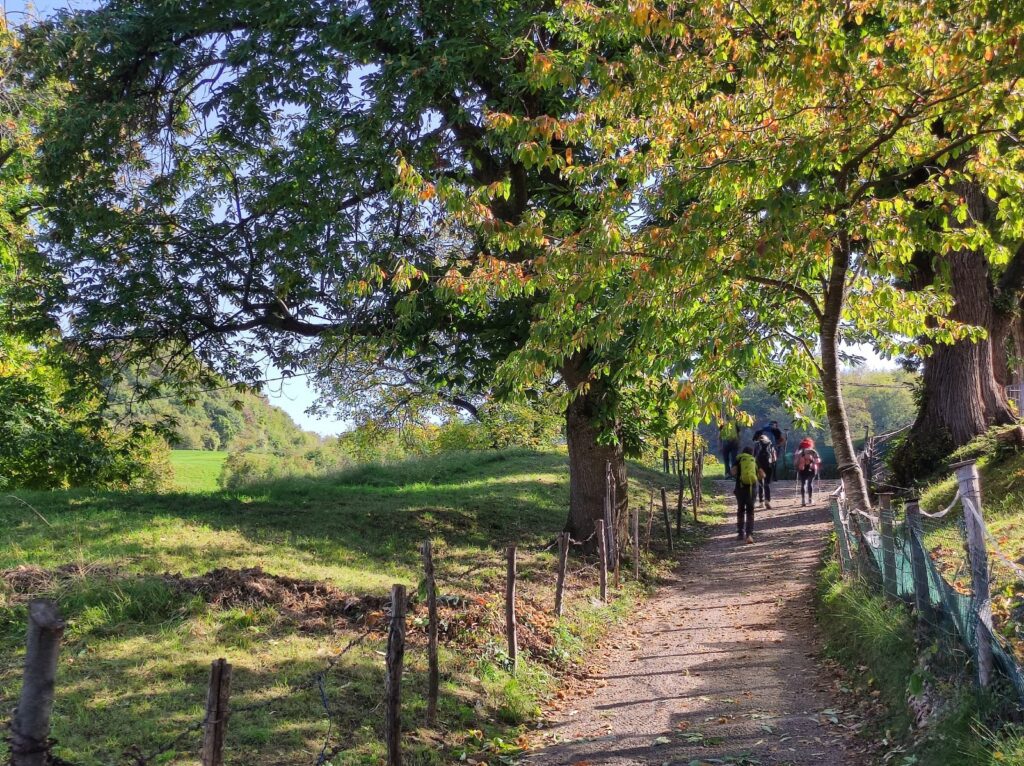
Retracing one’s steps, one resumes the ascent that, crossing the woods of centuries-old chestnut trees, leads to the ruins of the Castle of Dosso Maggiore, from which there is a view of the Baldense basin.
Descending, one encounters another Church of San Rocco, dating back to the 16th century, and an ancient fountain, finally arriving at the large park dedicated to Cesare Battisti, in the heart of Brentonico’s town center.
One can either stop or continue to get to the Sorne. Starting again from the center of Brentonico, you will encounter the parish church, built in 1500, and the old Eccheli-Baisi palace; then take the Via Lunga to reach the hamlet of Fontechel and, on a path through the meadows, you will arrive at the village of Sorne.
STAGE 05
STAGE 05: Brentonico/Sorne – Moors
Length: 24/20 km
Elevation gain: ascent 800 m / 740 m – descent 1300 m / 1100 m
Depending on the choice made on the previous day, you also have two options on the last STAGE.
The last STAGE takes us back to Moors through a varied up-and-down route.
Starting in Brentonico, one encounters the parish church, built in the 1500s, and the old Eccheli-Baisi palace; one then takes the Via Lunga to reach the hamlet of Fontechel and, on a path through the meadows, arrives at the village of Sorne.
From the Sorne, the trail climbs up to the village of Prada and then reaches the center of Saccone; from here it continues to Corné, from where it descends through typical alpine landscapes until it reaches the gorge of the Sorna torrent; here you can bathe and cool off in its clear, green waters. After crossing el Pont del Diaol, the trail climbs along ancient vineyards leading to the villages of Cazzano and Crosano.
From here it is a final descent passing through Besagno (at the traffic lights it is possible to take a short scenic variant towards the locality Visnà), Castel Palt and Tierno before returning to the starting point of the Camino: the Piazza di Mori.