

ALTRAVIA
AltraVia is a fascinating 200-kilometer route connecting Turin and Savona. A journey between nature and history, through the most striking landscapes of two regions.
AltraVia is an itinerary that runs from Turin to Savona, immersed in nature and characterized by enchanting landscapes stretching to the Alps.You can travel the path on foot or by bicycle, passing through the picturesque regions of Monferrato, Roero, Langhe and the Ligurian mountains.
With its 206 kilometers and 9 STAGES, it offers you the opportunity to discover some of the most fascinating territories of two regions. Along the way, you will have the chance to admire historic castles, battle sites, picturesque perched villages, ancient fossil-rich seabeds, lush forests and rolling hills. You will also enjoy local gastronomic specialties and fine wines.
AltraVia is an innovative experience in the panorama of Italian paths, which will make you discover an area rich in history and natural beauty.
HISTORY
AltraVia was born from a bet: to trace another route that would unite, by traveling slowly through them, heterogeneous territories: famous cities and towns with unknown villages, areas with crops from which world excellence is obtained with inaccessible forests, unknown even to the locals.
Definitely another route in the panorama of Italian paths and itineraries, but another thing compared to most of them.
LOGISTICS AND TRANSPORTATION
HOW TO REACH THE STARTING POINT
BY CAR
For those arriving by car, the most convenient reference to set up is Piazza Gran Madre di Dio or Corso Casale. Turin is well connected to the highway network in northern Italy, making it easy to access the starting point for those coming from the east as well as those arriving from the northwest or south of Piedmont.
BY TRAIN
Turin is easily reached by train, particularly by referring to the Porta Nuova and Porta Susa stations, both of which are well connected to the rest of Italy. Once in the city, the Gran Madre di Dio can be reached by urban transportation, cab or even on foot with a walk through the historic center. The Gran Madre area is served by the urban GTT network, with dedicated stops in and around Piazza Gran Madre.
BY AIR
The airport of reference isTurin-Caselle Airport. From the airport it is easy to reach the city center either by train, with a connection to Turin Porta Susa in about half an hour, or by bus with dedicated services to the center and the main railway stations. From there it is then on to the Gran Madre by urban transport or cab.
PARKING
There are parking areas in the immediate vicinity of the Gran Madre, but many may not be ideal for a multi-day stop. For those making the entire walk, the most practical solution is to leave the car in a structured parking lot in the Torino Porta Nuova area and then reach the starting point by public transportation or on foot. One useful option is the FS Park Torino Porta Nuova, at 3 Via Paolo Sacchi corner Corso Vittorio Emanuele II.
HOW TO GET BACK TO TURIN FROM SAVONA
ALTRAVIA’s arrival is in downtown Savona, and the rail reference for the return journey is Savona station. From here, one can return to Turin Porta Nuova by train; in fact, RFI timetables show direct connections to Turin. Once back in Turin, one can reach the Gran Madre again by urban transport or by cab to retrieve the car.
HOW TO START OVER IN SAVONA
At the end of the journey, Savona makes it fairly easy to continue on to the main Italian routes. By train it is well served to Turin and Genoa, which are the two most useful junctions for arranging a return or continuing the journey. For those who need to travel to Central and Southern Italy, the most natural route remains the Tyrrhenian, generally passing through Genoa and then continuing on to other cities on the peninsula.
For those who wish to depart by air after the walk, the most practical stopover is usuallyGenoa Cristoforo Colombo Airport. From the Savona area, one can reach Genoa by train and then use the dedicated Genova Airlink to the airport, which operates daily.
USEFUL NOTE: Since schedules, connections and parking availability can change, it is always advisable to check the updated train, bus and stop solutions on official portals before departure.
WATER
Along the route there are water points in each town and refueling points along the way.
SERVICES
Each AltraVia STAGE, except the penultimate one, ends in a town where all essential services (pharmacy, stores, bars and/or restaurants) are present.
ACCESSIBILITY
There are plans to make the trail usable by people with disabilities by leaning on the bike route.
ROAD BOTTOM.
40% dirt roads, 20% trails, 40% municipal roads, 5% provincial roads.
CREDENTIAL
For ALTRAVIA, the Walker’s Passport is available, designed as a travel companion along the route through the provinces of Turin, Asti, Cuneo and Savona. The passport allows people to collect stamps during the project’s events dedicated to walking and to access a progressive reward system. At each event, participants can request the stamp from staff, fill out a post-event questionnaire and, based on the number of events completed, receive increasingly rich sustainable gadgets. The initiative is part of the project “AltraVia: walking or biking between nature and self-seeking from Turin to Savona,” promoted by Associazione Turismo in Langa to enhance the territory through outdoor activities, environmental education and collaboration between local realities.
Read the regulations: Regulation_walker’s passport
CALENDAR UPDATING ON WWW.TURISMOINLANGA.IT: click here
IN TENT
In general, you can stay in secluded areas away from trails, houses and roads from dusk to dawn, taking care not to light fires or leave traces of your passage. Campsites or tent areas are available in some centers.
PAPER GUIDE.
“AltraVia. The Official Guide to the AltraVia from Turin to Savona,” Gianni Amerio and Dario Corradino, Morellini Editore.
CONTACTS
info@altravia.info
Tourism in Langa – Corso Torino 4, Alba (Cn)
Tel 0173.364030
SMS 331.9231050
info@turismoinlanga.it
STAGE 01: TURIN - ANDEZENO
Departure: Turin
Arrival: Andezeno
Distance: 23.6 km
Height difference: +600 m/ – 517 m
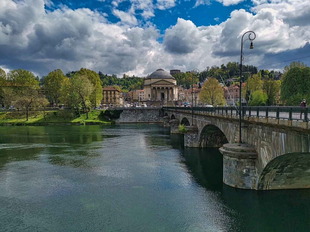
AltraVia begins from a flight of steps, that of the Church of the Great Mother of God, overlooking the Po that flows a few meters away. We do not cross it, as if to emphasize that the sea that awaits us will not be the Adriatic but the Ligurian. We then skirt the river for a few kilometers, and as we walk along the bank, the city takes on an unusual perspective. When we leave the bank, after a few city blocks a path begins to climb, immersed in the forest. We are accompanied by ever-widening glimpses of the regular urban layout, crowned by the Alpine range. Here, at one point, the dome of the Basilica of Superga is revealed among the vegetation. After a falsopiano stretch, we find ourselves descending the other side of the Turin hill, less impervious and more sloping. The panorama opens onto soft country undulations, which we follow along ridges or descending and re-emerging from wide valleys. At the end of the STAGE, the village of Andezeno appears in front of us, on a rise: an ancient town of Celtic-Latin origin.
Water sources:
-45.06342563801441, 7.7000359227826385 (toret – fontanella)
-45.06881431060807, 7.717387132881511 (toret – fontanella)
-45.070132858088044, 7.723920165744598 (toret – fontanella)
-45.078455170223585, 7.732736122056911 (toret – fontanella)
-45.0785044144469, 7.737354885994651 (toret – fontanella)
-45.077877494448344, 7.738022756032919 (toret – fontanella)
-45.08117346655768, 7.767533298039705
-45.078485931913036, 7.771663899916322
-45.073884286754826, 7.78177030362867
-45.06084875453998, 7.784238682133044
Pharmacies: Turin and Andezeno
ATMs: Turin and Andezeno
Groceries: Turin and Andezeno
Municipalities: Turin, Baldissero T.se, Pino T.se, Chieri, Andezeno
Countries crossed: Turin, Andezeno
STAGE 02: ANDEZENO - CORTAZZONE
Departure: Andezeno
Arrival: Cortazzone
Distance: 22.4 km
Height difference: +184 m/ – 272 m
We leave the built-up area of Andezeno and immediately plunge back into the countryside. We allow ourselves to be lulled by the delicate movements of the ground, which lead us up and down for a few kilometers, almost imperceptibly, giving us fantastic views of the Alpine range.
One lands in the town of Buttigliera d’Asti, with its characteristic square plan of medieval origin. It derives its name from the term butticularia, that is, boundary stone. We have actually entered the province of Asti; we leave behind the plains of Turin to enter the hills of Monferrato.
From here to our arrival we will walk through woods and cultivated fields, traversing terrain with reliefs that begin to become more pronounced. We will encounter ancient and modern testimonies of faith, whose most significant representatives are the Basilica of San Giovanni Bosco and the church of San Secondo, with its enigmatic iconographies.
We will finally arrive to catch a glimpse of the silhouette of Cortazzone Castle, perched atop the hill that houses the main nucleus of the village, the site of today’s arrival.
Water sources:
-45.022343508683214, 7.950703594543358
-45.015487638022876, 7.956175301043566
-44.99633007846015, 8.027865383417705
-44.98446885638365, 8.052876827985061
-44.98081867701352, 8.058369992058248
Pharmacies: Andezeno, Buttigliera d’Asti, Cortazzone
ATMs: Andezeno, Buttigliera d’Asti
Grocery stores: Andezeno, Buttigliera d’Asti, Cortazzone
Municipalities: Andezeno, Arignano, Mombello di Torino, Moriondo Torinese, Buttigliera d’Asti, Capriglio, Montafia, Cortazzone
Countries crossed: Buttigliera d’Asti, Bagnasco (Montafia), Cortazzone
STAGE 03: CORTAZZONE - SAN DAMIANO D'ASTI
Departure: Cortazzone
Arrival: San Damiano d’Asti
Distance: 24 km
Height difference: +323 m/ – 340 m
STAGE schematically divisible into three, completely different parts. The first takes place along a quiet track, which leads us through dense forests. Far from inhabited centers, we are enveloped by magical atmospheres from which unexpected surprises arise.
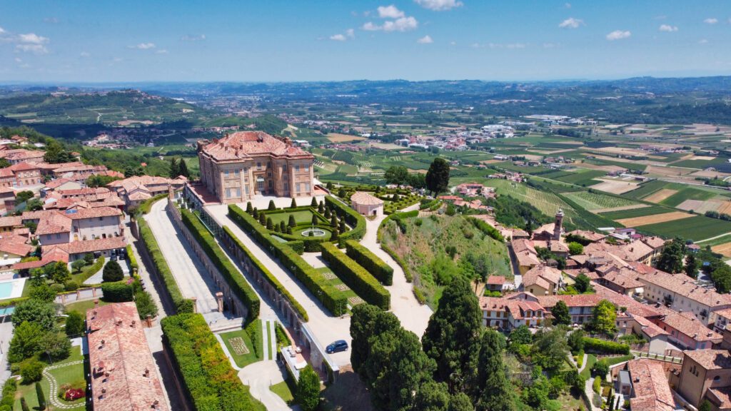
Then begins the intermediate stretch. Climbing and descending between hills and valley floors, we admire castles, noble palaces, churches. We pass through villages arranged on ridges or lying at the foot of hills. On the high ground stretches, the eye is gratified by ever-changing views, passing between rows of vines and hazelnut groves.
Concluding our STAGE is the quiet approach to the town of San Damiano d’Asti, one of the most beautiful villages in Piedmont, where Alto Monferrato borders Langhe and Roero. A double arcade accompanies our arrival in the center of the town, with its square plan of oppidum defensive.
Water sources:
-44.93836777083707, 8.072919484590528
-44.92423494379309, 8.074348188704962
-44.89129851999225, 8.088471803630304
Pharmacies: Cortazzone, Monale, Baldichieri d’Asti, Tigliole, San Damiano d’Asti
ATMs: Monale, Baldichieri d’Asti, Tigliole, San Damiano d’Asti
Grocery stores: Cortazzone, Monale, Baldichieri d’Asti, Tigliole, San Damiano d’Asti
Municipalities: Cortazzone, Camerano Casasco, Cinaglio, Monale, Castellero, Baldichieri d’Asti, Tigliole, San Damiano d’Asti
Countries crossed: Monale, Castellero, Baldichieri d’Asti, Tigliole, San Damiano d’Asti
STAGE 04: SAN DAMIANO D'ASTI - ALBA
Departure: San Damiano d’Asti
Arrival: Alba
Distance: 22.3 km
Height difference: +374 m/ – 414 m
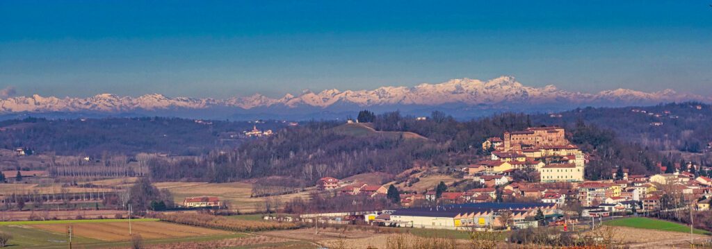
We enter the heart of the lands declared a UNESCO World Heritage Site: it will not be difficult to understand why. After a quiet start, descending from San Damiano d’Asti we plunge into a wide valley that, among meadows, crops and hazelnut groves, takes us through the village of Priocca, the first town in the Roero and the province of Cuneo that we encounter. We climb further and reach Magliano Alfieri and its castle, steeped in historical and literary memories, overlooking the Tanaro valley.
We descend and ascend among rows of vines, which fade away on either side of us, giving us evocative views. The route arrives at Guarene with its castle, which dominates the Tanaro valley from above. Here appears at our feet, on the bank of the river, the town of Alba, capital of the Langhe.
We descend as we approach, among ever-expanding hazelnut groves, until we enter the historic center of the city of a hundred towers, famous for its white truffles, tonda gentile hazelnuts, fine wines and its gastronomic tradition, the heart of our itinerary.
Water sources:
-44.76689931692323, 8.068089745015731
-44.76667028636601, 8.067303632136325
-44.740608979027364, 8.034017562429794
-44.737971158022965, 8.03128737455991
-44.702203923073526, 8.032837544793514
Pharmacies: San Damiano d’Asti, Priocca, Magliano Alfieri, Castagnito, Guarene, Alba
ATMs: San Damiano d’Asti, Priocca, Magliano Alfieri, Castagnito, Guarene, Alba
Grocery stores: San Damiano d’Asti, Priocca, Magliano Alfieri, Castagnito, Guarene, Alba
Municipalities: San Damiano d’Asti, Govone, Priocca, Magliano Alfieri, Castagnito, Guarene, Alba
Countries crossed: Priocca, Magliano Alfieri, Castagnito, Guarene, Alba
STAGE 05: DAWN - BOSSOLASCO
Departure: Alba
Arrival: Bossolasco
Distance: 24.3 km
Height difference: +633 m/ – 82 m
For a long, interminable straight stretch, we move away from Alba, as if to emphasize how, for two days, we will remain far from major communication routes, crossing a plateau between the Tanaro and Belbo valleys, a land of wheat, corn, hay, chestnuts and grapes.
In the first half of the STAGE we will slowly climb from 200 to 700 m, and on this altitude we will remain until the finish, contemplating endless expanses of vineyards and hazel groves on our sides. This will allow us to better endure some somewhat “asphalt-like” stretches, and to finally reach, as a reward for today’s toil, the beautiful Bossolasco, the town of roses, a romantic resort town also frequented by Beppe Fenoglio.
But before we arrive we will pass by the iconic Serravalle Langhe, set on top of a hill from which four fertile valleys branch off.
Watersources:
-44.68771685516257, 8.034339051223222
-44.57672953282259, 8.071282662067675
-44.56033433778711, 8.057202872553287
-44.53997163353148, 8.047483606367043
-44.52990179820988, 8.050126422141515
-44.52854127843393, 8.053030872705625
Pharmacies: Alba, Serravalle Langhe, Bossolasco
ATMs: Alba, Bossolasco
Grocery stores: Alba, Tre Cunei (Lequio Berria), Serravalle Langhe, Bossolasco
Municipalities: Alba, Diano d’Alba, Rodello, Lequio Berria, Arguello, Albaretto della Torre, Cerreto Langhe, Serravalle Langhe, Bossolasco
Countries crossed: Tre Cunei (Lequio Berria), Serravalle Langhe, Bossolasco
STAGE 06: BOSSOLASCO - CEVA
Departure: Bossolasco
Arrival: Ceva
Distance: 23.6 km
Height difference: +280 m/ – 411 m
We continue our route, which will remain at high altitude until we descend and find the Tanaro, crossed two days ago. We approach more and more the Belbo valley, which stretches out on our left. Vast views will accompany us throughout the STAGE, and we will enjoy them as if from a balcony.
The environment around us is changing its characteristics as we approach the Alpine range. The villages are all down below on either side of us, and so we travel the entire distance without encountering significant settlements, except for the small hamlet of Torresina, which has a crystalline surprise in store for us.
Passing through Napoleonic sites, we finally descend on Ceva, a prelude to a further paradigm shift in our journey, sighting from above, for the first time, the Turin-Savona highway.
The city, of Proto-Romanesque origins, will manage to amaze us with its monuments and quaint old town.
Watersources:
-44.51229868676245, 8.043950529978114
-44.432221069330616, 8.034512635513861
-44.38616746132131, 8.035108954942487
Pharmacies: Bossolasco, Ceva
ATMs: Bossolasco, Ceva
Groceries: Bossolasco, Ceva
Municipalities: Bossolasco, Bonvicino, Murazzano, Paroldo, Torresina, Roascio, Ceva
Countries crossed: Torresina, Ceva
STAGE 07: CEVA - MILLESIMO
Departure: Ceva
Arrival: Millesimo
Distance: 24.4 km
Height difference: +534 m/ – 472 m
The forest is the dominant element of this STAGE, which takes us from the Tanaro valley to the Bormida hydrographic territory. But we do not only find nature in profusion. Halfway through the STAGE, we can take a break in the small town of Castelnuovo di Ceva, lost in a basin among the mountains, with its historical evidence. Shortly after, we leave the Piedmont province of Cuneo and enter the Savonese area, crossing a small rivulet. And then the castle of Roccavignale, the lakes of the Dolmen, prehistoric evidence, and finally the medieval village of Millesimo, all to be discovered.
Sources Of water:
-44.373977210219756, 8.061212526461642
-44.363836103281585, 8.086400850007244
-44.35389483932519, 8.128991435780163
-44.35933962164244, 8.182621093701117
Pharmacies: Ceva, Millesimo
ATMs: Ceva, Millesimo
Groceries: Ceva, Millesimo
Municipalities: Ceva, Sale delle Langhe, Priero, Castelnuovo di Ceva, Roccavignale Millesimo
Countries crossed: Costa (Piero), Castelnuovo di Ceva, Roccavignale, Millesimo
STAGE 08: MILLESIMO - MONTENOTTE SUPERIORE
Departure: Millesimo
Arrival: Upper Montenotte
Distance: 23.6 km
Height difference: +827 m/ – 507 m
First STAGE of the two entirely in Ligurian territory. We cross the Upper Bormida Valley, touching the three constituent branches of the river: the Bormida of Millesimo, Pallare and Mallare. After passing by the castle of Cosseria, we walk on a scenic ridge, parallel to the highway route, until we reach the colorful town of Carcare. Here, as is the case with the mountainous section of the highway, the route splits. Route A passes through Adelasia Park and is recommended for hikers. B passes through Altare, preferable for bikes.
A) We skim through the woods to the Ferrania area, with its important industrial history, arriving at a historic Abbey. We then leave the inhabited areas to enter the splendid Adelasia Park, climbing up surrounded by nature. We stop for a rest in a mountainous setting, at the highest point of ALTRAVIA, now a stone’s throw from the sea. This will be the only time we will stop outside an urban center.
B) Traveling along the valley floor we arrive at Altare, an ancient town whose history is inextricably linked to the art of glassmaking, where we may decide to stop. Continuing on, a long but steady ascent will take us first to the Bocchetta di Altare, a point traditionally indicated as the demarcation between the Alps and the Apennines, and then to rejoin itinerary A, after passing through the high borders of the Adelasia Park.
Water sources:
-44.359413477732886, 8.28924052345716
-44.358287027443396, 8.290342035482617
-44.35585682932582, 8.29145409759495
-44.35738783291193, 8.308498833342371
-44.36829502772636, 8.322740702329993
-44.37104079001285, 8.336054709482665
Pharmacies: Millesimo, Carcare, Altare (B)
ATMs: Millesimo, Carcare, Altare (B)
Groceries: Millesimo, Carcare, Altare (B)
Municipalities: Millesimo, Cosseria, Carcare, Altare, Cairo Montenotte
STAGE 09: UPPER MONTENOTTE - SAVONA
Departure: Upper Montenotte
Arrival: Savona
Distance: 17.4 km
Height difference: +202 m/ – 928 m
Last STAGE, easy and short: the sea awaits us. Linear the route, which takes place almost entirely on scenic ridges, progressively and steadily descending to the waters of the Ligurian Sea. Except at the finish, we will not cross any towns or footholds, but will travel along quiet roads and paths, often in the shade of the forest. We will approach the built-up area of Savona and dive into the center from above, ending our journey under the arcades of Via Paleocapa, to arrive at the city’s symbolic monument: the Torretta.
Watersources:
-44.308421855091794, 8.486200515089209
Pharmacies: Savona
ATM: Savona
Grocery: Savona
Municipalities: Cairo Montenotte, Albissola Marina, Savona


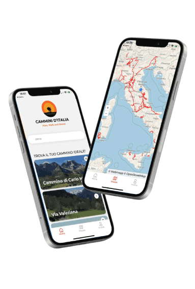
Discover our app!
With the free Cammini d’Italia app, you can plan and walk the AltraVia in complete safety, being able to plan the STAGE in detail and walk the route thanks to the built-in GPS technology that supports you in orientation during your adventure.
Within the app you will find many other paths present in Italy. Thanks to the georeferenced tracks of many routes you will be able to study the itinerary that suits you best and also download the GPX tracks of the individual STAGEs offline.
The app also includes a complete digital map of all the paths surveyed to date on our portal, giving you a wide range of choices among the many paths in the Belpaese.
⠀⠀
Cammini d’Italia is the perfect app for those who want to explore the beauty of Italy on foot, discovering hidden places surrounded by nature. Download it for free today and start planning your next adventure!
 ⠀⠀⠀
⠀⠀⠀