Cammino dei Mille
Cammino dei Mille is inspired by General Garibaldi’s Expedition and faithfully retraces the last ten days of Garibaldi’s epic, those that led to the liberation (conquest for some) of Palermo on May 27, 1860.
In fact, the Camino ends right in the heart of the Sicilian capital passing by the Ponte dell' Ammiraglio,Piazza Rivoluzione and Palazzo Steri; places that still maintain the memory of those days.
Excluding the short urban stretches of the small towns that it passes through and the arrival in Palermo, the path runs entirely through mountainous and hilly areas with vast stretches of woodland alternating with pastures and agricultural areas, mostly arable land, vineyards and olive groves, but also vast citrus orchards that even beyond the middle of the last century were the typical crop of the Palermo area and from which the famous appellation “conca d'oro” descended.
Just outside Monreale, in fact, we enter an adult coniferous forest that is being attempted to be converted to deciduous trees.
Coniferous forest, with some remnants of ancient deciduous forests, is characteristic of the mountains surrounding Palermo.
Much of the first four STAGES will take place in the shade of these trees, fragrant with rich undergrowth. Quite different is the context of some of the subsequent STAGES. In fact, the sixth and eighth STAGE take place almost entirely within the “Bosco della Ficuzza, Rocca Busambra, Bosco del Cappelliere and Gorgo del Drago Oriented Nature Reserve,” evidence of the evergreen Mediterranean forest that once covered these areas.
Here The deciduous oak forest consists mainly of the species belonging to the group of downy oaks, which are associated with cork, field maple and southern ash. Throughout the mountainous area you pass through and particularly in the Ficuzza nature reserve numerous is the fauna, and you will be surprised to discover that this too is Sicily. From Marineo to Palermo via Misilmeri and Gibilrossa you will be surprised to discover unique landscapes rich in history and how these places are truly the synthesis of the Risorgimento that had its true fulfillment in Palermo.
HISTORY
It all began with the historical reading of the Visitor’s Vademecum of the places where Giuseppe Garibaldi’s military operations took place from his arrival at Renda to Pietro Merenda’s assault on Palermo.
The book almost prompted us to reconstruct the itinerary and to realize its scenic, naturalistic and cultural value. It also prompted us to delve deeper into the history of the Thousand, to gather news from other texts, to listen to voices that were at times even contradictory, to immerse ourselves within the dynamics of the expedition and also in the logic, reasons and emotionality of the protagonists. This is also the origin of the symbol of the Cammino, the tricolor Arrow, precisely to indicate a direction of Unity, peace and passion; furthermore, a tree, a Holm Oak, already present in the coat of arms of Italy and intended to recall Art 9 of our Constitution, also appears in the logo.
Reconstructing Cammino dei Mille was quite a long work, it also left us time to reflect on the dynamics of Sicilian history with a broader consciousness, less bound to current events: it is the added value of a historical Path that can continue in books.
WATER SOURCES.
By logging on to www.ilcamminodeimille.it you will find the trail and drinking fountains available along most of the route
STAGE
STAGE 1: Monreale- San Martino. km: 9.38 positive elevation gain 540, negative elevation gain 299
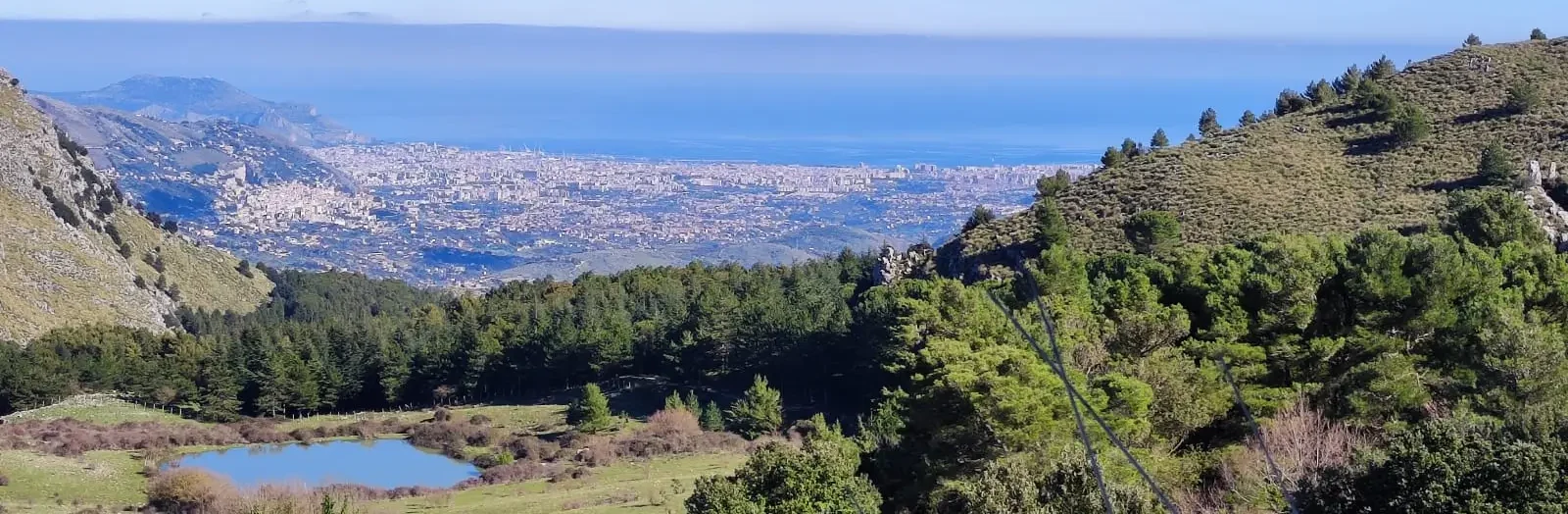
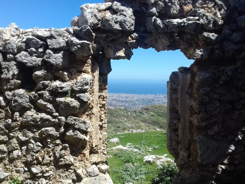
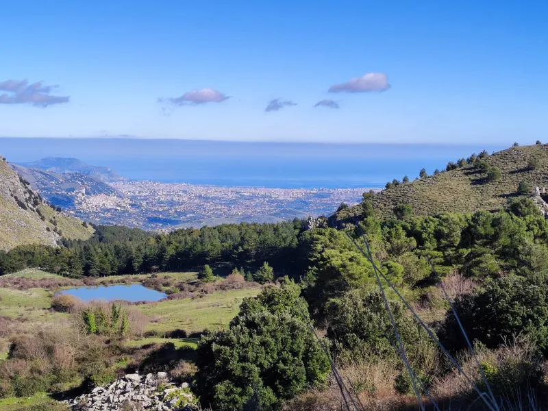
We set off from Via Umberto I passing through the historic neighborhoods of Monreale, Pozzillo, San Vito and Bavera, a veritable kasba from which we soon emerge to overlook the Conca d’Oro: in front of the walker is the amphitheater of mountains that surround Palermo, in the background is the sea and the beauty of its gulf that will accompany you for several STAGES.
You will soon plunge into a forest (from the third km) from which you will exit only at the end of the teppa. The route in the wooded part is on dirt road and paths in good condition that will lead to the ruins of the monument to Rosalino Pilo (indicated with the tricolor arrow symbol of the path) and the niviera. There are no refreshment opportunities during the STAGE, so equip yourself to feed and quench your thirst.
Hospitality and support:
https://www.prolocomonreale.it/ilcamminodeimille/le-tappe/tappa-1/
Stage 2: St. Martin to Poplar km 13.28 Negative elevation gain 574 Positive elevation gain 501
Only trails and dirt roads are traveled on this STAGE, which do not present any particular difficulties beyond elevation changes. Also on this STAGE, no population centers or refreshment points are encountered.
You immediately go up Via Franzoni and immediately enter the San Martino forest, then along Valle Corta down to Valle Cuba. You then ascend to the Casaboli woods on the slopes of Monte Gibilmesi. At km 5.6, indicated in the elevation profile, you can make a detour of about one km to visit an adventure park for which you will find specific signage. You then continue through the woods, with slight ascents and descents, until you again overlook the Conca d’Oro: all that remains is the descent to Poplar with spectacular aerial views.
Hospitality and support:
https://www.prolocomonreale.it/ilcamminodeimille/le-tappe/tappa-2/
Stage 3: Poplar to Poggio San Francesco Km 13.40 Positive elevation gain 594 Negative elevation gain 297
This STAGE is very varied, the landscape is wider, passing through olive groves, pasture areas and woods. Halfway through the town where the Carabinieri barracks are located you will have the option of going through the whole town or choose the Trekking variant that goes up a very short flight of steps and then along a path through olive groves and ancient terracing that will take you to higher ground from there you will reach Piano Renda, where the Thousand bivouacked and strategies for the conquest of Palermo were worked out. At Piano Renda (km 4.3) you will meet the Mirto farmhouse, an opportunity for refreshment but also for an overnight stay. Continuing on, from Piano Renda you climb along a dirt road that in the first part is in good condition. Then, as indicated in the elevation profile, there is a stretch of about a kilometer that after the rains becomes particularly muddy and steep, as well as a bit bumpy. Past this section the ascent ends and you enter the wooded valley of Margio Li Cassari cross the Sentiero Italia CAi. Continue downhill to Valle Nespola where you will encounter a small unmanaged refuge and continue along a track that coincides with the Sentiero Italia you will arrive at Portella della Paglia. From here you continue on asphalt on a very low-traffic, pleasant road to the Maria Immacolata Center at Poggio San Francesco.
Hospitality and support:
https://www.prolocomonreale.it/ilcamminodeimille/le-tappe/tappa-4/
STAGE 4: Poggio San Francesco to Altofonte to Piana degli Albanesi Km 14.48 Positive elevation gain 688 Negative elevation gain 788
You go down along SP 89 for about 1 km. Then you divert to contrada Canalotto and, crossing pasture areas and olive groves, always downhill, you arrive in Altofonte. Once you arrive we suggest you visit the small town and, if you wish, contact the Cammino referents to discover the wonders of the place. Once you finish your break go up the narrow streets you will cross a fountain and wash house and right there is Via Campo dei Mille where Giuseppe Cesare Abba tells of his dialogues with the young Father Carmel. Next you go up Calvary (via crucis) the same stretch of the magna Via Francigena to the little church of Addulurata and then to Garibaldi’s Obelisk, to Cozzo di Crasto where the Thousand bivouacked. follow the signs that take you all the way up. From here you continue inside the Orienta Serre della Pizzuta Nature Reserve Resta a final stretch of typical hill country with cherry, olive and almond trees. The only rest stops are in Altofonte, which, however, offers no overnight opportunities. If you want to go to the Agriturismo Argomesi, you must detour as soon as you leave the RNO Serre della Pizzuta; as soon as you reach the paved road, turn left and continue until you meet the signs.
Hospitality and support:
https://www.prolocomonreale.it/ilcamminodeimille/le-tappe/tappa-4/
Stage 5: From Piana Degli Albanesi to Santa Cristina Gela to Ficuzza Km 20.03 Positive Elevation Difference 449 Negative Elevation Difference 455 ( From this STAGE the Variante Breve also includes the arrival in Marineo shortening the Way a lot)
As can be seen from the elevation profile, a good part of this STAGE takes place on paved roads with very low traffic. it is in any case a wonderful route rich in food and wine, religious and cultural traditions and pleasant surprises. with regard to the road surface, an exception is an easy dirt section before Santa Cristina Gela and, immediately after, a stretch of dirt road and uphill path that is a bit steep, in some places muddy after the rains: we are on the slopes of Monte Leardo. However, the trail soon reaches the saddle and, after a stretch in a narrow valley, overlooks the wide valley that offers a spectacular view of the Bosco di Ficuzza overlooked by Rocca Busambra. Beginning the descent, one soon encounters the only refreshment and overnight points along the trail: the Sant’Agata farmhouse and, a little further on, with a small detour, the Rossella farmhouse.For those arriving at the end of the STAGE, they will not fail to be gently accompanied by the view of the fields and the many Horses that joyfully and peacefully freely graze just before the arrival.
Hospitality and Support:
https://www.prolocomonreale.it/ilcamminodeimille/le-tappe/tappa-5/
STAGE 6: Ficuzza to Mezzojuso Km 16.96 Positive elevation gain 402 Negative elevation gain 541
For the naturalistic and scenic aspect, this is a unique STAGE that differs from all the others and stands out from all the other Sicilian CamMINO DI DANTE, mostly on dirt tracks and paths in the Ficuzza reserve. The route is for a first stretch of comfortable dirt road (km 2.7), then turns right onto a somewhat more challenging path to the Pulpit of the King. Continuing up to the Hedgehog Lake, the trail is mostly comfortable except for the short stretch before reaching the pond that crosses a wetland that can be a bit muddy in periods following heavy rains. From the pond you continue uphill for a while to a convenient dirt road. From there, the trail continues on dirt tracks deep in the forest, occasionally skirting suggestive cliffs overlooking quiet green valleys. One important thing in August especially parts of the forest have the big “problem” of Horseflies it is not recommended to go there unless properly equipped (in any case feel free to contact us and contact the STAGE contact persons).
Hospitality and Support:
https://www.prolocomonreale.it/ilcamminodeimille/le-tappe/tappa-6/
STAGE 7: Mezzojuso to Villafrati, Cefalà Diana and Godrano Km 18.36 Positive Level 756 Negative Level Difference 601
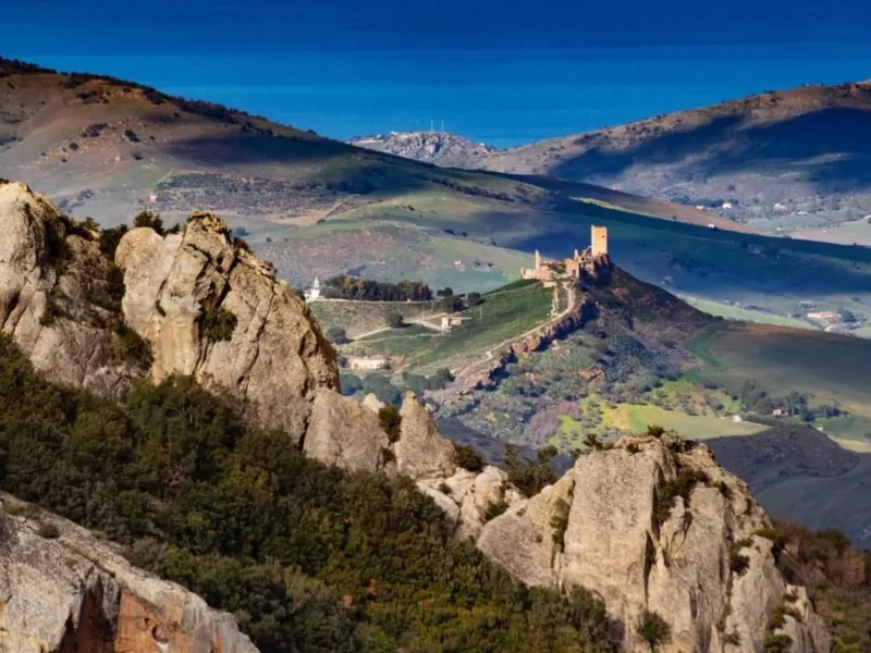
It is among the longest STAGES and is also the most difficult when considering the elevation gain to be faced. On the other hand, there are no sections with difficult bottoms and it passes through as many as two villages, where food and drinks can be bought. The Arab baths, moreover, are really worth the effort and a stop. The landscape is very different from the previous STAGE: we are out of the woods, olive groves alternate with pastures, and the suggestion of strategic sites such as the castle of Cefalà Diana interrupts the tranquility of the area with the memory of other times.
You leave Mezzojuso by small roads and steps and descend along a paved road until you cross the Palermo Agrigento freeway follow the arrows and cross the underpass. After Villafrati you continue for a while on a paved road. Then turn right onto a dirt road of the Nature Reserve “Bagni di Cefalà Diana e Chiarastella” that, bypassing Pizzo Chiarastella, leads to Bagni Arabi. The place is perfect for a stop before tackling the climb to the Castle of Cefalà Diana: a challenging climb, with a first unpaved section and then on asphalt, but the place is of great beauty. We then descend to the (beautiful) village, which retains corners evocative of a rural past of great isolation.
The route continues: by ups and downs over hills that are wooded in places and on mostly dirt roads, to Via Giuseppe Garibaldi, which leads to the main square of Godrano. For an overnight stay you will have to walk a little more because there is still no hospitality for walkers in the village, but at Agriturismo Gorgo del Drago you will be welcomed magnificently.
Hospitality and Support:
https://www.prolocomonreale.it/ilcamminodeimille/le-tappe/tappa-7/
STAGE 8 : Godrano to Marineo Km 15.02 Positive elevation gain 313 Negative elevation gain 492
This STAGE is also largely on dirt roads that present no difficulty, within the Ficuzza reserve. The trail immediately climbs a plateau, but the initial effort is soon repaid by crossing areas of great naturalistic interest: first the Gorgo del Drago and then, further on, the Cappelliere forest. The final descent to Marineo is on a paved road, where you are more likely to encounter a few tractors than a car. Visit the village if in your plans to continue to the next STAGE will surprise you and moreover there a local pastry shop has come up with a typical cake that will remind you of the walk.
Hospitality and support:
https://www.prolocomonreale.it/ilcamminodeimille/le-tappe/tappa-8/
STAGE 9: Marineo to Misilmeri Km 11.80 Positive elevation gain 140 Negative elevation gain 516
This is the easiest, shortest STAGE with a clear predominance of downhill. From Marineo we descend into the Eleutherio valley to the Factory Bridge , counded in 1581 along the former trazzera regia that connected Palermo with the hinterland.
After the bridge, now at lower elevations, in addition to the typical olive and almond groves you will encounter the first extensive mandarin groves mingling with persimmons and lemons before overlooking and descending toward Misilmeri .Marineo and Misilmeri are two towns with invaluable countryside at their center, rediscovering these lands for us was an honor. There are no opportunities for refreshment along the way get water in hot weather.
Hospitality and Support:
https://www.prolocomonreale.it/ilcamminodeimille/le-tappe/tappa-9-marineo-misilmeri/
Stage 10: Misilmeri to Palermo Km 21.03 Positive elevation gain 257 Negative elevation gain 389
From Misilmeri we set off along a medieval lane, Via Trebisonda, which climbs up to the ruins of the Emir’s castle. We then go to a plateau, Piano Stoppa, where the Thousand bivouacked and where local squads raked by General La Masa converged. We continue through typical hill country, now sprinkled with residential cottages, climbing the slopes of Montagna Grande until we meet what was La Masa’s headquarters. We are now in Gibilrossa: it is a spectacular balcony over Palermo, commemorating the feat of the Thousand with a large obelisk.
From here you descend a few kilometers on the provincial road, now closed to traffic, overlooking Palermo and overlooking a wide expanse of citrus groves. Leaving the provincial road, one descends a steep slope and crosses nespoleti and citrus groves to the Palermo hamlet of Croce Verde. Then continue on dirt roads along extensive tangerine crops to Villabate. Now begins the chaotic suburbs of Palermo, with elements of charm but also with lots of traffic and some unsafe sections for pedestrians. After a couple of kilometers the traffic continues to accompany us but our gaze goes elsewhere: we are at the sea, which we will skirt for a long stretch, passing through seaside villages until we divert to the Admiral Bridge, where the clash between the Bourbons and the Thousand took place. From there we penetrate into the historic center, following in the footsteps of the Thousand until we reach the marvelous Piazza Rivoluzione, then the Church of the Gancia and finally Palazzo Steri: here, where on April 4, 1860 the revolt that prepared the adventure of the Thousand began, ends our Cammino dei Mille. Outside the Steri is the Garibaldi Garden with statues of the Heroes of the Risorgimento. However, your journey can continue in Palermo, an extraordinary city founded by the Phoenicians and rich in its three thousand years of history.
Hospitality and Support:
https://www.prolocomonreale.it/ilcamminodeimille/le-tappe/tappa-10/
SERVICES PRESENT STAGE BY STAGE
You will find all the necessary services in all the countries where you will arrive
Pharmacies present in all towns so also Medical Guards and the 118 service which you can easily contact by referring to the Single Emergency Number 112
https://www.cnsas.sicilia.it/contatti/ Mountain Rescue
In Altofonte and Marineo and in Palermo you will also be able to find Laundries, the one in Palermo is coin-operated
SIGNAGE
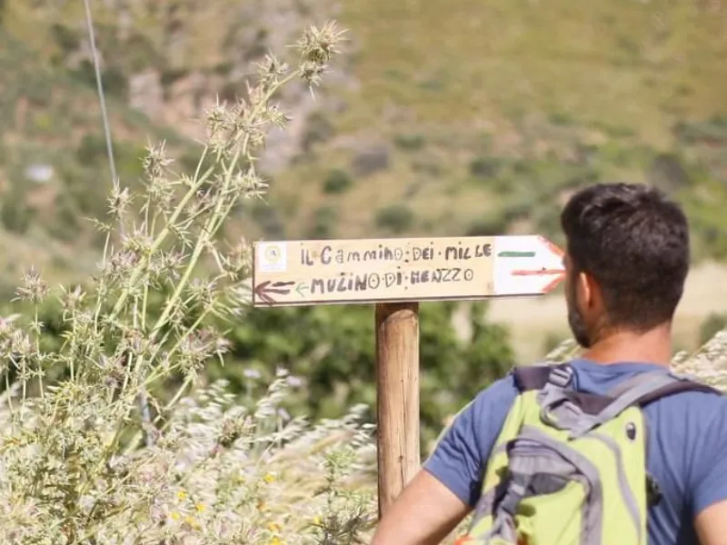
Signage present along most of the way especially at the most complicated points.
DANGERS
None
ROAD BOTTOM.
30%
CREDENTIALS
Credentials can be picked up at the Chiostro dei Benedettini In Piazza Guglielmo in Monreale
At Palazzo Steri in Palermo by Coopculture staff delivery of the testimonium
https://www.prolocomonreale.it/ilcamminodeimille/gli-amici-del-cammino/
TENT WALK
Forbidden The Bivouac is provided for the tent site in the Poplar STAGE at Piano Renda in Marineo at center animal protection league and in Mezzojuso La cardunera of Stefania for contacts go to www.ilcamminodeimille.it


CAMMINO DEI MILLE
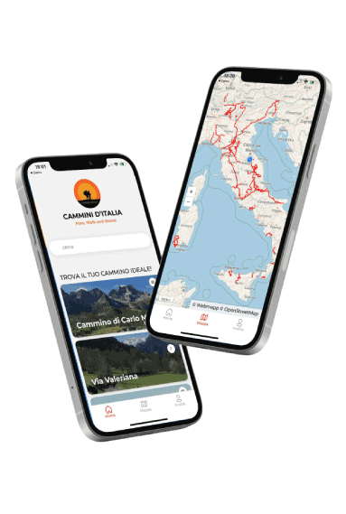
With the free Cammini d’Italia app, you can plan and walk the Cammino dei Mille safely, being able to plan the stages in detail and walk the route thanks to the built-in GPS technology that supports your orientation during your adventure.
⠀Inside the app you will find many other paths present in Italy. Thanks to the georeferenced tracks of many routes you will be able to study the itinerary that suits you best and also download the GPX tracks of the individual STAGEs offline.
The app also includes a complete digital map of all the paths surveyed to date on our portal, giving you a wide range of choices among the many paths in the Belpaese.
⠀⠀
Cammini d’Italia is the perfect app for those who want to explore the beauty of Italy on foot, discovering hidden places surrounded by nature. Download it for free today and start planning your next adventure!
⠀
⠀
 ⠀⠀⠀
⠀⠀⠀