Cammino di Don Tonino
Walking around Puglia among dry stone walls, small villages, Romanesque cathedrals and the wonderful buildings typical of Lecce Baroque.
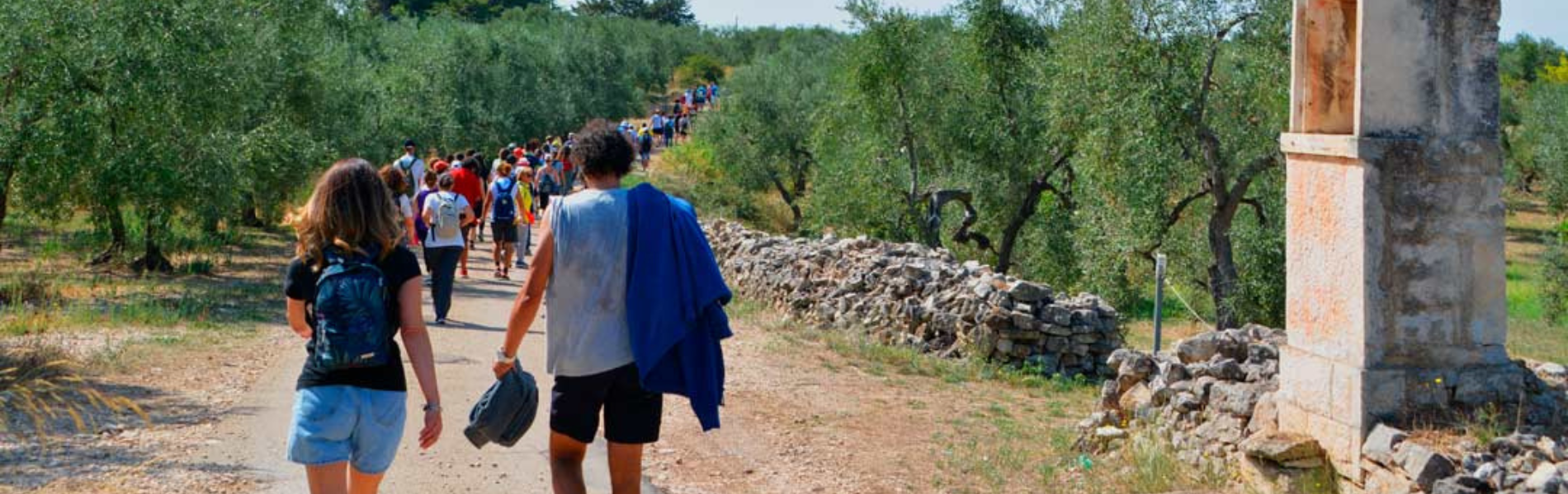
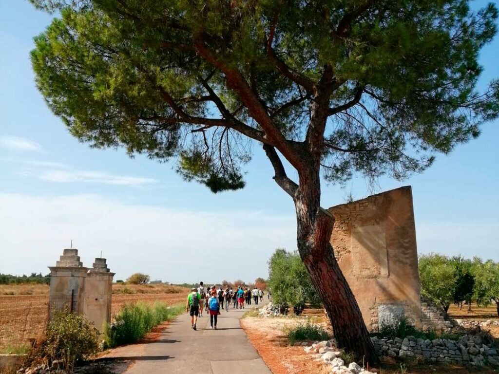
The Cammino di Don Tonino is an itinerary that crosses a long stretch of Apulia, starting from Molfetta and reaching Alessano. It has been conceived in order to make known the figure of don Tonino Bello, as a priest and bishop, but at the same time as a man of the road, narrating his life through the construction of an itinerary that allows to live the dimension of contempl-activity, so dear to the pastor. Following in Don Tonino's footsteps, the wayfarer will immerse himself in the unmistakable beauty and colors of Puglia, skirting the sea and walking among dry stone walls to reach small villages, Romanesque cathedrals and the marvelous buildings typical of Lecce Baroque.
HISTORY
“The road is long, but there is only one way to know where it may lead: to continue on the path.”
So wrote the Servant of God Don Tonino Bello in one of his beautiful meditations.
It is inspired by his figure and his message of great hope and openness to the world and to the other The Cammino di Don Tonino, a project conceived by the Diocese of Molfetta-Ruvo-Giovinazzo-Terlizzi on the occasion of the celebrations of the 25th anniversary of his death in 2018 and supported by the Department of Tourism and Culture of the Region of Puglia through the Special Culture Fund 2019.
The Cammino was created with the desire to raise awareness of the figure of the unforgettable Salento bishop through the discovery of some of the most beautiful places in Puglia, linked to his experience as a pastor.
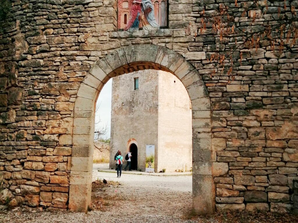
The itinerary departs from Molfetta, episcopal seat of the diocese and a city that holds numerous testimonies related to the figure of Don Tonino Bello and his loving service to the local church, and ends in Salento before his tomb, in the hometown of Alessano.
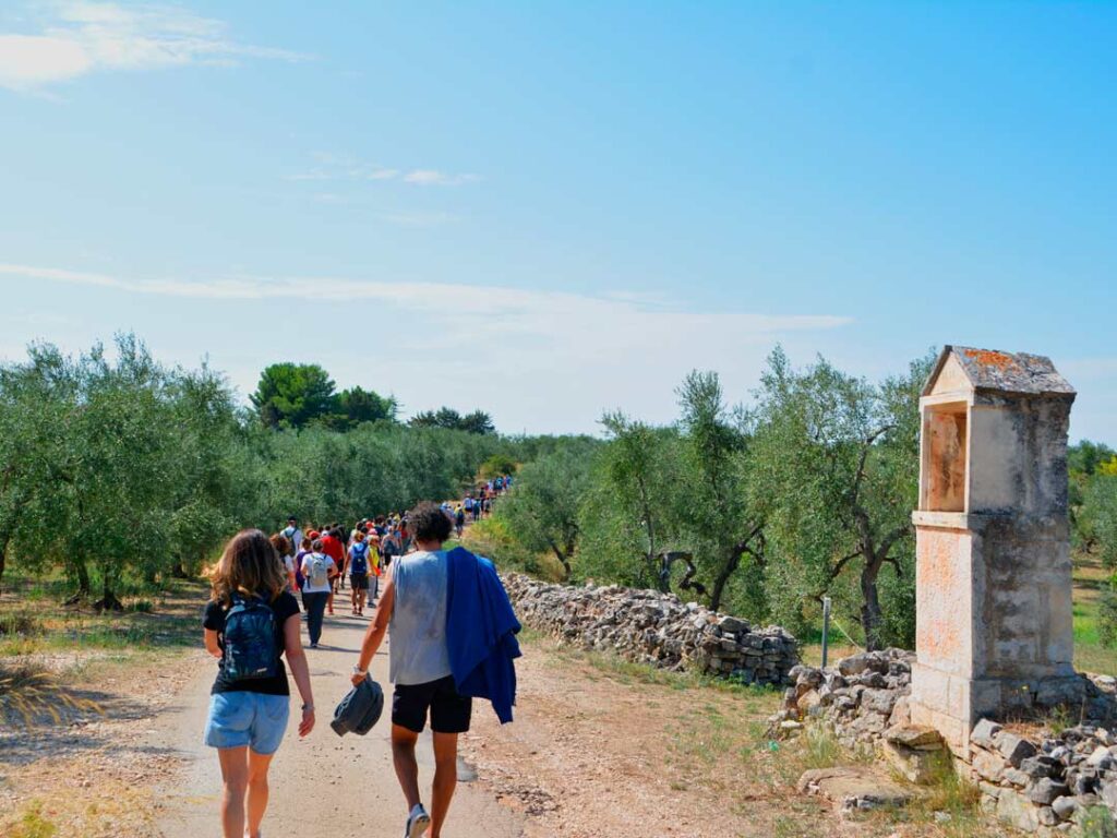
A walk that wishes to connect people with the nature, landscapes, art and traditions of the area. The Camino becomes, therefore, an opportunity to experience a physical and spiritual journey at the same time.
WATER SOURCES.
We are in Apulia, where it is very hot in summer and there are few water supply options along the way. All the STAGES, except for Stage 7, end in urban centers with all major services.
Being equipped with water is of primary importance. Therefore, it is essential to have two one-liter water bottles, possibly lined with insulating material so that the water stays fresh. It is important to leave each morning with full water bottles.
STAGE
STAGE 1: Molfetta – Ruvo di Puglia
Length: 17.2 km
Height difference: ascent 305 m, descent 41 m
The Camino starts from Molfetta, a town overlooking the Adriatic Sea. After visiting the places dear to Don Tonino, we leave the port with the beautiful cathedral and continue, crossing fields of olive trees. After a brief stop in front of the centuries-old olive tree of Antignano, we resume the road to reach Ruvo di Puglia, an ancient town of pre-Roman times, where the STAGE ends. However, the route can continue a few more kilometers, toward the Casa community, a place of peace and welcome.
STAGE 2: Ruvo di Puglia – Terlizzi
Length: 21.5 km
Height difference: ascent 65 m, descent 147 m
Leaving the town of Ruvo behind, we travel along a stretch of the ancient Via Appia-Traiana to reach first the medieval monastic complex of Santa Maria di Cesano and then, through the “Route of Plants and Flowers,” the village of Sovereto, where the Sanctuary of the Madonna is located, which links its history to the discovery of a Sacred Icon depicting a Madonna and Child. From here we arrive in Terlizzi, a town known for its floriculture and ceramics.
STAGE 3: Terlizzi – Giovinazzo
Length: 17 km
Height difference: ascent 29 m, descent 205 m
This STAGE of the Way starts from Terlizzi and crosses the “Route of Churches and Rural Architecture.” Walking to discover towers, villas and small country churches, we reach Giovinazzo, a coastal town that stands on a peninsula, surrounded by walls overlooking the sea. Its narrow streets offer glimpses that open onto elegant Renaissance palaces, churches and squares.
STAGE 4: Giovinazzo – Bari
Length: 23 km
Height difference: ascent 47 m, descent 47 m
The walk continues in the direction of the Apulian capital, strolling pleasantly along the coast. The sea with its colors and scent accompanies the steps. After a short stop in Santo Spirito, we reach Bari, a city rich in culture and traditions linked to the figure of the patron saint Nicholas of Myra, whose relics are kept in the Romanesque basilica, the destination of the STAGE.
STAGE 5: Bari – Rutigliano
Length: 21.8 km
Height difference: ascent 193 m, descent 72 m
This STAGE of the Camino passes through the regional capital, starting from the Basilica of San Nicola. Venturing into the countryside, it reaches Capurso. The small town is famous for its shrine dedicated to Our Lady of the Well. The path enters the countryside of the Terra di Bari and, crossing the town of Noicattaro, reaches Rutigliano, characterized by the production of terracotta whistles and the presence of internationally renowned pasta factories in the area.
STAGE 6: Rutigliano – Castellana Grotte
Length: 27.2 km
Height difference: ascent 309 m, descent 152 m
From Rutigliano the route plunges into the green countryside among centuries-old olive trees. The route leads near the small lake of Sassano, then waiting for pilgrims to take a well-deserved break is the town of Conversano with its castle and the splendid cathedral of Santa Maria Assunta. From here the path goes back through the lush countryside leading to one of the most fascinating places in Puglia: Castellana with its enchanting caves.
STAGE 7: Castellana – Benedictine Abbey of Noci.
Length: 20.6 km
Height difference: ascent 343 m, descent 218 m
This STAGE of the Cammino starts at the church of San Leone in Castellana Grotte, a town famous for its geological and speleological wonders, and passes through the town of Putignano, known throughout Italy for being home to one of the nation’s most important and celebrated carnivals. Arriving in the territory of Noci, the STAGE ends at the Benedictine Abbey of Madonna della Scala.
STAGE 8: Benedictine Abbey of Noci – Alberobello
Length: 19.7 km
Elevation gain: ascent 312 m, descent 292 m
The Path starts again from the Benedictine Abbey of Madonna della Scala in Noci. It crosses the territory of Valle d’Itria, characterized by the presence of trulli, dry-stone constructions known throughout the world. Final destination will be the symbolic city of this architectural structure, Alberobello, which has become a UNESCO heritage site. Here you will be able to admire the largest concentration of trulli, characterizing two neighborhoods and one church, that of St. Anthony of Padua.
STAGE 9: Alberobello – Martina Franca
Length: 20 km
Height difference: ascent 287 m, descent 279 m
On this STAGE we pass through one of the most characteristic areas of the entire Apulia region, the Itria Valley. Alberobello, the town from which we start, has the largest concentration of trulli, with the Monti and Aia Piccola districts. Passing through a rural landscape characterized by olive groves and dry stone walls, we reach Martina Franca, a town known for its Baroque architecture and the Itria Valley music festival.
STAGE 10: Martina Franca – Ceglie Messapica
Length: 22.62 km
Elevation gain: ascent 216 m, descent 334 m
The Cammino winds along the Valle d’Itria, crossing an area rich in trulli, dry stone walls and olive groves, typical of the Apulian rural landscape. From Martina Franca, crossing the characteristic bicycle route of the Apulian Aqueduct, we reach Ceglie Messapica. Here the Ducal Castle with its Norman keep dating back to the 11th century makes a fine show.
STAGE 11: Ceglie Messapica – San Vito dei Normanni
Length: 21.5 km
Height difference: ascent 53 m, descent 241 m
This STAGE of the Camino takes its start in Ceglie Messapica and, crossing rural landscapes characterized by dry stone walls and the typical presence of olive trees and Mediterranean scrub, reaches the gates of San Vito dei Normanni, a small town of very ancient origin, linked to the Norman Bohemond of Altavilla.
STAGE 12: San Vito dei Normanni – Mesagne
Length: 24.1 km
Height difference: ascent 60 m, descent 95 m
The Cammino starts again in San Vito dei Normanni, where the Basilica of Santa Maria della Vittoria, erected after the Battle of Lepanto, dominates the square in front. The route passes through olive groves and wheat fields to reach Mesagne. Here the Chiesa Matrice, rich in sculptures, rises majestically.
STAGE 13: Mesagne – Torchiarolo
Length: 30 km
Height difference: ascent 29 m, descent 65 m
We depart from the town of Mesagne, located along the Appian Way, first skirting Cellino San Marco with its wineries and then following the “Messapi di vino” itinerary that leads to San Pietro Vernotico. The town is part of the Negroamaro Park. Afterwards, we follow a section of the “Messapi di Vino” itinerary to reach the archaeological area of the Messapian and Roman age of Valesio-La Pajara. From here we continue along the Via Francigena – Via Traiana Calabra to reach Torchiarolo, a town between Brindisi and Lecce.
STAGE 14: Torchiarolo – Lecce
Length: 23.2 km
Elevation gain: ascent 31 m, descent 22 m
The Camino starts again along Via Francigena del Sud and we arrive first at the beautiful Abbey of Santa Maria di Cerrate and finally at Surbo. Continuing on we reach Lecce, the ancient Lupiae inhabited since the Iron Age, a Baroque city par excellence, in which a multiplicity of architectural styles coexist, from the Roman age to the 20th century. Lecce is also known for the artistic tradition associated with papier-mâché.
STAGE 15: Lecce – Galatina
Length: 28.3 km
Elevation gain: ascent 132 m, descent 116 m
This STAGE of the Camino starts in Lecce. From here we travel along a section of the Via Francigena – Leucadense and arrive in San Donato di Lecce. We are in Salento, a land embraced by two seas. We leave San Donato di Lecce and, crossing an area rich in dry stone walls, olive groves and prickly pear plants, we reach Sternatia at the Chiesa Matrice dedicated to Santa Maria Assunta and the Dominican Convent with its underground oil mills. From here you reach Soleto and then Galatina with the splendid church of Santa Caterina d’Alessandria, entirely covered with late medieval frescoes.
STAGE 16: Galatina – Ruffano
Length: 29.2 km
Elevation gain: ascent 132 m, descent 116 m
This STAGE of the Camino starts in Galatina, a beautiful city of art. From here we reach Cutrofiano, one of the major centers of ceramic production in Salento. Leaving Cutrofiano behind, we continue to reach the town of Ruffano, crossing the forest of Supersano, a unique stretch along the entire Cammino, characterized by lush vegetation. On the way you will encounter farmhouses, masserias and the small churches of San Giuseppe and Madonna della Serra until you reach Ruffano, whose mother church, dedicated to the Nativity of the Virgin Mary, is one of the most important monuments of Salento Baroque.
STAGE 17: Ruffano – Alessano
Length: 26.6 km
Elevation gain: ascent 210 m, descent 231 m
This STAGE reaches the spiritual goal of this Cammino. It starts from Ruffano and, crossing the route of the Via Francigena – Leucadense, reaches Specchia, a town in Salento mentioned among the Most Beautiful Villages in Italy, then Tricase, where streets, squares and churches are living testimonies of the presence and loving service of Don Tonino Bello. All the way to Alessano, where Don Tonino Bello is buried.
STAGE-BY-STAGE SERVICES
All the STAGES of the Cammino, except for Stage 7, which ends at the Abbey of Madonna della Scala in Noci, end in urban centers with all major services.
SIGNAGE
The Cammino di Don Tonino is indicated by white and blue signage, colors that evoke the main hues of the pastor’s episcopal coat of arms. The route is characterized by horizontal signs made with environmentally friendly paints especially in the suburban sections.
In urban areas, the route is identified by frequent horizontal adhesive signage. Also clearly visible on the adhesive strips is the logo of Il Cammino di Don Tonino represented by a wing composed of the seven colors of the rainbow, the symbol of peace.
ROAD BOTTOM.
The road surface is 80% paved (secondary) roads and 20% dirt/trail.
TENT WALK
The Cammino di Don Tonino Bello is not suitable to be walked in tents.
CREDENTIAL
Before departing, the pilgrim must ensure that he or she comes into possession of the credential. To request it, it is necessary to fill out the online form in the appropriate section of the website www.camminodidontonino.it, following the procedures indicated.
It is essential that the request be submitted at least 20 days before the departure date to allow for on-time shipment. The form should be filled out individually by each pilgrim interested in walking the route, even in the case of organized groups.

GUIDE TO CAMMINO DI DON TONINO
A life dedicated to “walking alongside the last ones.” Don Tonino welcomed the poor and migrants into his home, sided with the laid-off workers at the Giovinazzo steel mills, and created communities to welcome and rehabilitate drug addicts. He has also marched for peace, as in 1992, when he and 500 pacifists crossed Sarajevo under bombardment and siege by the Serbian army.
His example still resonates today among the alleys of Molfetta, the olive trees, baroque works and dry stone walls of his homeland in the heart of Salento. The CAMMINO DI DON TONINO unfolds over 17 STAGES and in “his” Apulia allows people to discover or rediscover the “priest with an apron,” a man who combined words with concrete and human gestures.
The guidebook, enriched with some of Tonino Bello’s most touching texts, takes travelers on a physical and spiritual journey, following in his footsteps. All while waiting for him to be proclaimed blessed after being declared “venerable” by Pope Francis in 2021.