Cammino di San Tommaso
Discover the Cammino di San Tommaso. A route that covers 311 km between Lazio and Abruzzo, starting in Rome and ending in Ortona, in the province of Chieti.
HISTORY
The Cammino di San Tommaso brings with it a thousand-year history.
Along the route it will be possible to visit archaeological sites from the Italic, Roman and medieval periods, many places linked to the mountain people who for centuries based their livelihoods on agriculture and pastoralism.
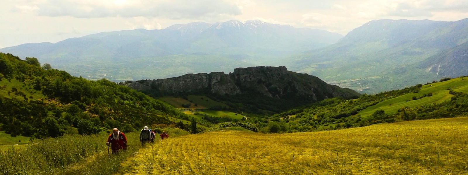
A succession of medieval villages inside which it will be possible to breathe in the genuine and convivial life of the people who still today have decided to live in these places where time seems to have stood still.
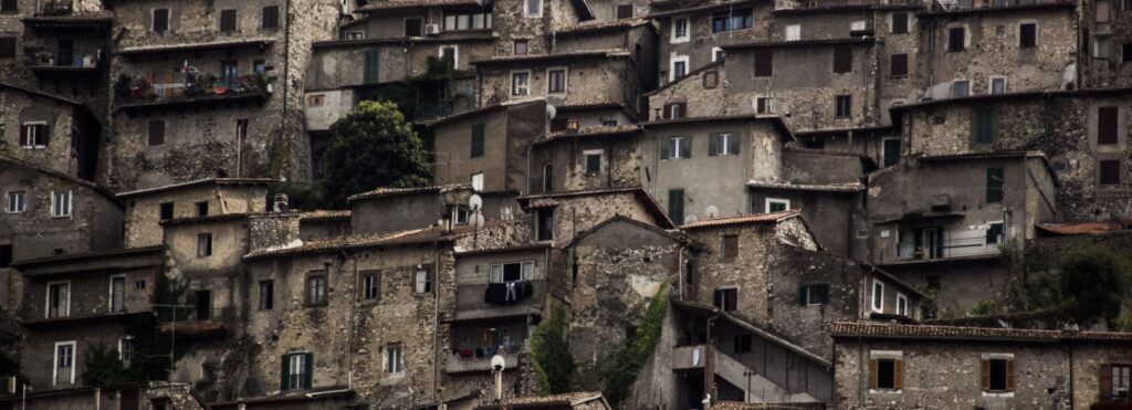
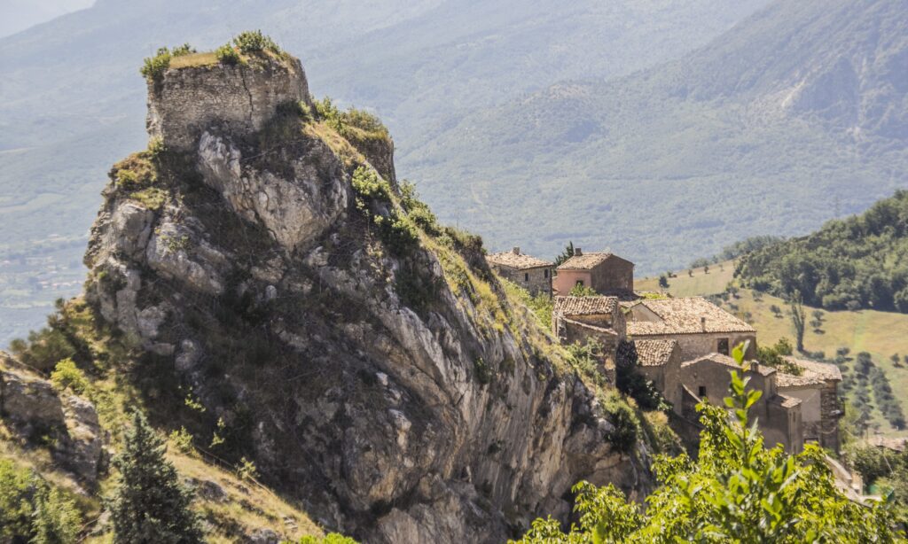
Many of the villages are excellently preserved and rich in valuable historical and artistic evidence. Some examples, excluding the description of Rome, which needs no introduction, are the ancient medieval village of Artena consisting of a labyrinth of steep and narrow alleys among stone houses, Genazzano with the majestic Colonna Castle, Subiaco and its Benedictine monasteries UNESCO heritage candidates, the historic centers of Tagliacozzo, Fontecchio, Capestrano with the beautiful Piccolomini Castle, Pretoro, Ortona and many other small jewels set between the walls of the mountains or on the hilltops between Lazio and Abruzzo.
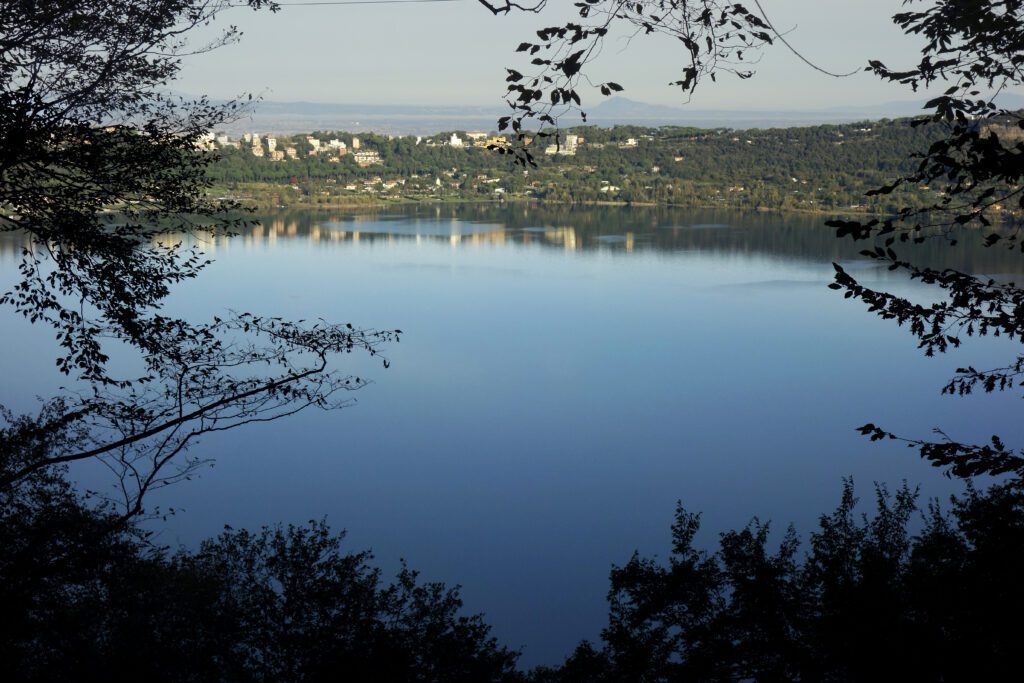
Another characteristic of Cammino di San Tommaso is the presence of pearls of art and culture within natural areas of great value. Examples are, in addition to the Benedictine monasteries of Subiaco that we have already mentioned, the Via Appia Antica within the Regional Park of the same name and in the woods of the Castelli Romani Park, the Sanctuary of the Holy Trinity in Vallepietra carved inside an imposing rock face, the archaeological site of Alba Fucens at the foot of the imposing Mt. Velino, the pagliare of Tione, Fagnano and Fontecchio ancient shepherds “and peasants” dwellings that rise suddenly in the midst of forests or scenic plateaus, the Oratory of San Pellegrino, considered the Scrovegni Chapel of Abruzzo, and the Church of Santa Maria Assunta candidates for UNESCO World Heritage status, and the ancient medieval abbeys of San Clemente a Casauria and San Liberatore a Majella rich in valuable 13th-century sculptures and frescoes.
There is no shortage of important places related to spirituality and Christianity. Again excluding Rome for obvious reasons, we find the Shrine of Our Lady of Good Counsel in Genazzano, the Benedictine Monasteries in Subiaco, The Shrine of the Holy Trinity in Vallepietra, the Shrine of Saint Nuncio in Pescosansonesco, the Shrine of the Holy Face in Manoppello where an important relic is kept, which according to legend turns out to be the veil of Veronica with which Christ’s face was covered after the crucifixion, the Shrine of the Eucharistic Miracle in Lanciano, and the Cathedral of St. Thomas the Apostle in Ortona.
This is the only path in the world that unites the places where the remains of two Apostles are kept, precisely St. Peter in Rome and St. Thomas in Ortona.
There are many other significant historical and cultural emergencies to visit and experience on Cammino di San Tommaso.
WATER SOURCES.
Water sources are available along the entire route. You pass through many settlements that still provide sufficient water.
STAGE
STAGE 1: St. Peter’s Square (Rome) – Albano Laziale
Length: 29.5 km – Uphill elevation gain: 710 m – Downhill elevation gain: 352 m
Departure from St. Peter’s Basilica, passing by Castel Sant’Angelo, the Pantheon, the Altar of the Fatherland, the Imperial Forum, the Colosseum, the Baths of Caracalla, etc. Arriving at the entrance to the Via Appia Antica through Porta San Sebastiano, one follows it entirely until arriving at the hamlet of Frattocchie in the municipality of Marino. From Frattocchie you follow the same route as Via Francigena del sud (several signs) through secondary paved roads until you reach the beautiful square in front of the Papal Palace in Castel Gandolfo and then descend through a bike path to the square in front of the Basilica of St. Peter in Albano Laziale.
STAGE 2: Albano Laziale – Artena
Length: 27.5 km – Uphill elevation gain: 980 m – Downhill elevation gain: 1060 m
Departure from Piazza San Pietro in Albano Laziale. Continue uphill passing by the Roman amphitheater of Albano to come out near the bar Le Fratte Ignoranti; follow the path to enter the Natural Park of the Castelli Romani, again on the same path as the Francigena of the South. After a long stretch on a path along which it is possible to admire stretches of Roman aqueduct and paving stones, you arrive near a Sports Field from where you cross the Provincial Road and head towards Località vivaro in the Castelli Romani plain. Crossing a large wheat field you will enter the dense forest of oak and chestnut trees that will lead you first near the village of Lariano and then through secondary asphalt roads to Artena
STAGE 3: Artena – Genazzano
Length: 18 km – Uphill elevation gain: 637 m – Downhill elevation gain: 548 m
Departure from Artena in the direction of Valmontone mostly on paved road. From Valmontone proceed towards Cave paying attention to the heavier traffic, there are about 1.5 km to be covered on the busy SP 18. You will then proceed on a comfortable dirt road at the bottom of the valley that will lead directly into the lovely historic center of Cave, highly recommended to visit. Once past the commercial area of the town you will again travel a busy stretch of road in the direction of Genazzano, a truly beautiful town with many points of interest to visit.
STAGE 4: Genazzano – Subiaco
Length: 25 km – Uphill elevation gain: 1310 m – Downhill elevation gain: 1296 m
Challenging stage starting from the Colonna Castle in Genazzano. The route winds between continuous ups and downs through picturesque and well-preserved medieval villages such as Ovelano Romano, Roiate, Affile and Subiaco. The STAGE takes place mainly on asphalt surfaces, always on secondary roads, but also features a pungent mountain section on path and cart track. At the municipality of Roiate it crosses the route of Cammino di San Benedetto.
STAGE 5: Subiaco – Mount Livata
Length: 11 km – Uphill elevation gain: 1150 m – Downhill elevation gain: 205 m
Leaving the historic center of Subiaco, the route will be all uphill on path and cart track entirely through woods and clearings within the Simbruini Mountains Regional Park. It will also cross two of the most important places linked to the cult of St. Benedict such as the Monastery of St. Scholastica and the Sanctuary of the Sacro Speco.
STAGE 6: Livata – Camporotondo
Length: 18 km – Uphill elevation gain: 992 m – Downhill elevation gain: 911 m
Departure from the ski resort of Monte Livata. Through a beech forest you will reach Campo dell’Osso locality from which, with an easy cartroad, you will reach the highest peak of Cammino di San Tommaso, namely Monte Autore (1855 m) from which you will enjoy a wonderful panorama. Continue along the ridge until you reach the Sanctuary of the Holy Trinity carved into the rock of an imposing cliff face. We then continue through a cool and beautiful beech forest to the resort town of Camporotondo di Cappadocia, the first Abruzzo municipality on the Cammino.
STAGE 7: Camporotondo – Tagliacozzo
Length: 15 km – Uphill elevation gain: 418 m – Downhill elevation gain: 1085 m
Departure from the tourist resort of Camporotondo from which by means of a descent in a comfortable beech forest we reach the municipality of Cappadocia. It continues on a wide and comfortable cartroad until reaching Verrecchie, a pretty hamlet of the municipality of Cappadocia. After crossing the built-up area, take a path that will lead to another tourist residential locality called Little Switzerland. Passing the sport fishing pond, we go up the valley until we reach one of the most beautiful villages of the entire camino, Tagliacozzo, where the STAGE ends.
STAGE 8: Tagliacozzo – Massa d’Albe
Length: 18.5 km – Uphill elevation gain: 590 m – Downhill elevation gain: 440 m
Departure from the municipality of Tagliacozzo, where through an initial stretch of paved path that then becomes a dirt road we reach the hamlet of Sorbo. From the small town follow what was once the Via Tiburtina Valeria until you reach Scurcola Marsicana with its beautiful castle and well-preserved historic center. From Scurcola a convenient dirt road leads to the town of Magliano dei Marsi, after which, via a convenient and scenic dirt road dominated by the massif of Mount Velino, Massa d’Albe is reached where the STAGE ends. A visit to the archaeological site of Alba Fucens, 4 km from Massa d’Albe and easily reached by public transportation, is recommended.
STAGE 9 – Massa d’Albe Rocca di Mezzo
Length: 24 km – Uphill elevation gain: 1000 m – Downhill elevation gain: 619 m
Departure from the municipality of Massa d’Albe from which through an evocative but uncomfortable path you reach the hamlet of Forme. Continue on a dirt road to the Capo la Maina pass where there is a cool fountain, and continue on a cartroad until reaching the well-known ski resort in the municipality of Ovindoli Campagnolo – Monte Magnola. After passing the tourist residential area, one crosses the Altopiano delle Rocche plateau by means of a long bike/pedestrian path that will lead directly, after passing through the hamlet of Rovere, to Rocca di Mezzo where the STAGE ends.
STAGE 10: Rocca di Mezzo – Fontecchio
Length: 16 km – Uphill elevation gain: 300 m – Downhill elevation gain: 930 m
Departure from the town of Rocca di Mezzo from which, via a bike path, you reach the hamlet of Terranera. Once past the built-up area, take an easy cartroad that leads to the Pagliare di Fontecchio, an ancient and characteristic stone hamlet used in the past by farmers and today partly recovered. With a detour, it is also possible to visit the Pagliare di Tione, even better preserved and positioned in an evocative position from which to enjoy a beautiful view of the vertiginous rocky face of Mount Sirente. From the Pagliare di Tione one takes a steeply descending path that will lead to the base of the Aterno valley. Having forded the river via a beautiful medieval bridge, we reach the historic center of Fontecchio where the STAGE ends.
STAGE 11: Fontecchio – Capestrano
Length: 23 km – Uphill elevation gain: 850 m – Downhill elevation gain: 1050 m
Departure from the town of Fontecchio from which by means of a long path we cross the mountain to enter the historic center of the small hamlet of Bominaco where a short stop is a must to visit the Oratory of San Pellegrino, the Sistine Chapel of Abruzzo and the church of Santa Maria Assunta above. Once past the built-up area of Bominaco, one crosses the lovely historic center of Caporciano to cross downstream the ancient Cinturelle – Montesecco sheep-track, from which one ascends toward Civitaretenga fraction of Navelli, town of the famous Saffron. Once past the small village, you will pass a large quarry and via a long cartroad you will reach Capestrano where the STAGE ends.
STAGE 12: Capestrano – Pescosansonesco
Length: 16 km – Uphill elevation gain: 870 m – Downhill elevation gain: 720 m
Departure from Capestrano where, crossing the historic center and passing the source of the Tirino River downstream, we reach Capodacqua Lake where we refuel with fresh water before the steep uphill path leading to the Forca di Penne pass. A visit to the tower above the pass and a stop to taste real Abruzzo arrosticini are recommended. Once past Forca di Penne via a punga and scenic downhill dirt road you will reach Pescosansonesco old end of the STAGE, where an important place of worship resides as that of the Sanctuary of Santo Nunzio.
STAGE 13: Pescosansonesco – Manoppello
Length: 21 km – Uphill elevation gain: 592 m – Downhill elevation gain: 950 m
Departure from Pescosansonesco, descending from the village first on asphalt then on dirt road to reach the bottom of the valley from which via convenient cartroad to reach the town of Torre dei Passeri. After visiting the Abbey of San Clemente a Casauria, proceed following the aqueduct alternating dirt and asphalt roads. Reaching the town of Scafa, one ascends via a bicycle path to the turquoise springs of the Lavino River, which must be forded to reach the Sanctuary of the Holy Face of Manoppello, the end of the STAGE, via alternating asphalt and dirt road.
STAGE 14: Manoppello – San Martino sulla Maruccina
Length: 22 km – Uphill elevation gain: 1060 m – Downhill elevation gain: 850 m
Departure from the Sanctuary of the Holy Face in Manoppello from which, via a dirt road at first, trail then and eventually asphalt, we reach the Abbey of San Liberatore a Majella, which is definitely worth a visit. Having crossed the cool and picturesque valley of the Alento, one ascends it by an impassable path to the Polegro tower, from where it is possible to admire a dizzying view of the valley. From the tower we continue on an easy cartroad to Pretoro, where past the historic center we descend into the Valle del Foro, where characteristic mills carved out of the rock are visible. Once out of the valley, proceed to the town of Rapino, from which, first on a cartroad and then on a final steep asphalt climb, you reach the town of San Martino sulla Marrucina, where the STAGE ends.
STAGE 15: San Martino sulla Marrucina – Crecchio
Length: 18.5 km – Uphill elevation gain: 650 m – Downhill elevation gain: 880 m
Departure from San Martino from which one reaches the valley below via a steep paved descent. Go up the opposite hill by means of a steep asphalt climb to reach the town of Filetto, after which, still on asphalt, proceed in the direction of the Convent of the S.S. Annuziata overlooking the valley of the same name. From the convent begins a long and comfortable cartroad that will lead near the town of Canosa Sannita, after which, through a dirt road first and then asphalt, we reach the Ducal Castle of Crecchio where the STAGE ends.
STAGE 16: Crecchio – Ortona
Length: 14 km – Uphill elevation gain: 390 m – Downhill elevation gain: 590 m
Departure the historic center of Crecchio where through a dirt road you will descend into the valley until you reach the Parco dei Mulini locality. You go up the valley with a short but steep path and through an easy dirt road among the vineyards you reach the Wine Fountain at the Dora Sarchese winery where you can enjoy a good glass of wine and set off again for the last stretch of the Cammino. You will proceed on a paved road among vineyards until you reach the monument of the Canadian tank at the entrance to the town of Ortona from which in a short time you will reach the Basilica of St. Thomas the Apostle in which, inside a golden sarcophagus kept in the crypt are the relics of the holy apostle. After visiting the Basilica, it is recommended to proceed another few hundred meters to visit the Aragonese castle set in a panoramic position overlooking the Adriatic Sea. It ends here Cammino di San Tommaso.
SIGNAGE
To date, signage is well represented throughout the Abruzzi region, by early summer 2020 the Lazio section will also be completed.
The signage encountered and signaling the walk corresponds to the CAI standard, i.e. red-white horizontal flag in paint, red-white-red CAI flags with the logo of the walk and CST inscription, wooden poles with aluminum plaque on which the logo and name of the walk and CST inscription are displayed , poles with directional arrows near or within urban centers indicating travel times in hours with respect to intermediate and final STAGE points.
ACCESSIBILITY.
There are no particular infrastructures on the Cammino that would allow easy access for the handicapped; however, there are simpler stretches of the path with no particular differences in height that are also accessible with wheelchairs properly equipped to cross roads with a breached or unpaved surface. These could be the stretches from Rome to Albano Laziale, from Artena to Valmontone, from Cappadocia to Tagliacozzo, from Ovindoli to Terranera, from Bominaco to Capodacqua Lake, from Scafa to the Lavino stream, from Pretoro to Rapino, from Orsogna to Canosa Sannita, and from Crecchio to Ortona.
WALK WITH DOGS
It is possible to bring the dog, the important thing is to document well with respect to crossings in park areas that may have internal regulations that allow the leashed passage or even prohibit it, the especially in the Simbruini Mountains area.
SERVICES
Every village always has at least a minimarket and a few bars, most a post office with an associated ATM, in some cases such as hamlets and smaller Apennine centers there may not be the possibility of withdrawing money. On this Cammino it is worthwhile to plan for any service needs in the more important centers such as Albano Laziale, Valmontone, Genazzano, Subiaco, Tagliacozzo, Rocca di Mezzo, Torre dei Passeri, Orsogna, and Ortona.

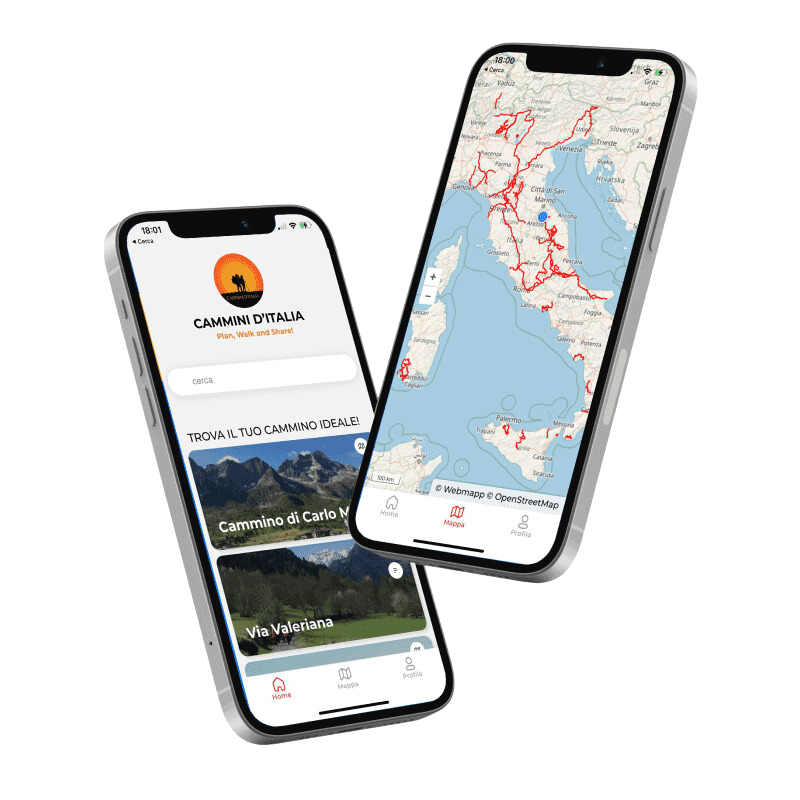
DISCOVER THE STAGES
With the free Cammini d’Italia app, you can plan and walk the Cammino di San Tommaso safely, being able to plan the stages in detail and walk the route thanks to the built-in GPS technology that supports your orientation during your adventure.
⠀Inside the app you will find many other paths present in Italy. Thanks to the georeferenced tracks of many routes you will be able to study the itinerary that suits you best and also download the GPX tracks of the individual STAGEs offline.
The app also includes a complete digital map of all the paths surveyed to date on our portal, giving you a wide range of choices among the many paths in the Belpaese.
⠀⠀
Cammini d’Italia is the perfect app for those who want to explore the beauty of Italy on foot, discovering hidden places surrounded by nature. Download it for free today and start planning your next adventure!
⠀
⠀
 ⠀⠀⠀
⠀⠀⠀