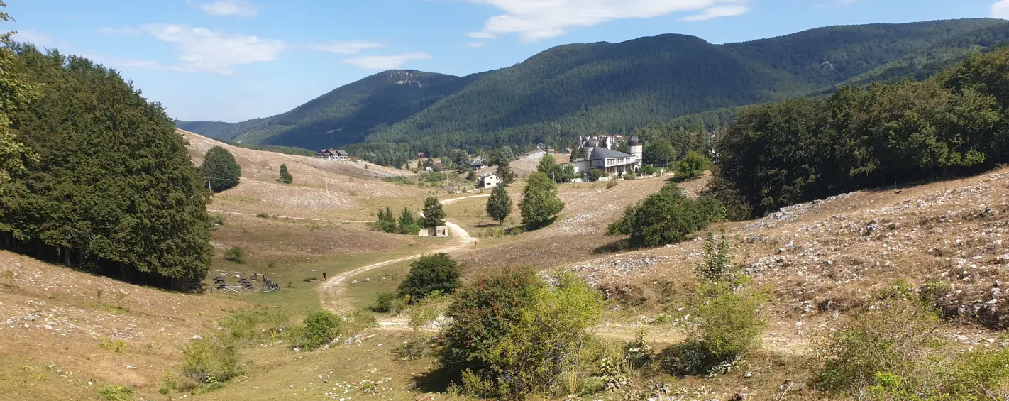
The path is divided into 25 STAGES to be covered in 4 weeks, and crosses three provinces and as many as 42 municipalities, with some of the most beautiful villages in Italy. The route allows you to get to know and appreciate the nature of the places, which is rich and changing over the seasons, protected by no less than 7 natural areas (4 regional parks and 2 nature reserves in Lazio and a national park between the provinces of Rieti and L'Aquila), and characterized by 2 natural monuments and several Natura 2000 sites (of Community Importance SCI/ZSC and Special Protection Areas SPA).
HISTORY
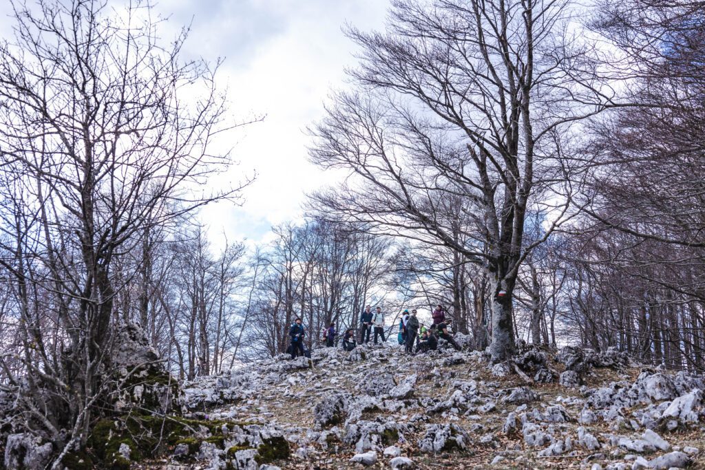
The Cammino Naturale dei Parchi was designed by a group of technicians and park rangers from the protected areas of the Latium Region to facilitate, by promoting slow tourism, the discovery of inland areas, parks and nature reserves, Apennine villages and the rich biodiversity that characterizes those territories, which are home to populations of wolves, deer, golden eagles and the Marsican brown bear.
The trail is designed not only for experienced hikers, but for everyone who wants to have a beneficial experience for body and soul in contact with nature. Slow walking pervades the participants’ sense of things and conception of life, their behavior and psychophysical well-being. It creates a relationship with the environment and the surrounding area, meeting people enriches the human relationships and sociality of those who walk, increasing their knowledge and respect for both nature and the lands of men.
With its itinerary, Cammino Naturale dei Parchi unites the different protected areas along the route between Rome and L’Aquila, creating a network that, passing through different regions, promotes the protection and enhancement of cultural, environmental and even religious heritage, and encourages the development of sustainable tourism. This path also crosses the areas affected by the recent earthquakes in Central Italy: an opportunity to express with physical presence the bonds of solidarity that unite us.
SIGNAGE
Vertical and horizontal signage exists along the Natural Trail.
WATER SOURCES.
Beginning and end of STAGE there are water sources, Only at the End of STAGE No. 6 in Loc. Monte Livata There are no sources.
There are intermediate water sources along the way except on Stages 6, Stage 7, Stage 9, Stage 10, Stage 15, Stage 16, Stage 19, Stage 21, Stage 23, Stage 24, Stage 25.
SERVICES
There are Grocery Stores on all the STAGES. On STAGE 5 before Arriving in Guadagnolo there is the village of capranica prenestina where there is a grocery store. On STAGE 11 Castel di Tora-Marcetelli at the end of the stage there is a Bar that you can support. On Stages 14 – 15 -23-24- there are no grocery stores.
STAGE
STAGES 1-WEEK 1-6
STAGE
STAGE 1:Walking along Via delle Terme di Caracalla and then Via di Porta San Sebastiano, one begins to breathe in history.Past the Cartiera Latina, the path enters the Caffarella valley, the scene of myths and legends perhaps suggested by the soft reliefs that make it a natural boundary, certainly by the presence of the Almone, a small tributary of the Tiber, considered by the Romans to be a sacred river from the earliest times.Having had our fill of nature, passing by the Egeria spring we continue on the left side that runs along Via dell’Almone and then Via Cecilia Metella.We thus find ourselves on the Regina Viarum, where the ancient paving stones, tombs and imperial villas will keep us company. From Frattocchie we ascend toward the Castelli along the secondary roadway, but having arrived at Castel Gandolfo as a prize the view of Lake Albano.
Departure from Rome Circus Maximus arrival in Castel Gandolfo Km 23 D+ 420.
STAGE 2: Leaving the village of Castel Gandolfo, the well-known summer residence of the Popes, you enter the wooded area of the crater of Lake Albano, which in this section is home to Via Francigena of the South. We continue in the direction of Rocca di Papa, among coppice woods of chestnut trees; going up the ancient Via Sacra that led to the Temple of Jupiter Laziale, dear to the Latin and Roman peoples, we reach the crater rim of the Hannibal Fields near the slag cone of Monte Cavo. Nearby is the highest elevation of the entire volcanic structure represented by Maschio delle Faete (956 m a.s.l.). The descent to Pratoni del Vivaro provides access to areas of considerable interest such as the Bosco del Cerquone, a relict of the ancient forest, and the Pantani della Doganella, sites of the Natura 2000 network, with permanent pools that are home to several rare species of amphibians. The arrival at the village of Rocca Priora gives way to breathtaking views stretching from the Tyrrhenian coast to the Apennine mountains.
Departure from Castel Gandolfo arrival in Rocca Priora Km 24,500 D+948
STAGE 3: From the village of Rocca Priora we enter Via della Montagna Spaccata in the chestnut grove The transfer STAGE to the Prenestini Mountains begins. The route first develops on an asphalt road winding through the typical Roman countryside that characterizes the territory of Carchitti with its extensive orchards and typical strawberry crops. Having crossed the consular road Via Casilina, the section continues in the locality of Valvarino (hamlet of Palestrina), along the cartroad that crosses the ancient country estate of the Barberini family, until it reaches Via degli Olmi, which leads directly to the town of Palestrina. In the distance you can already see the city of ancient Praeneste on whose slopes stands the Temple of the Goddess Fortuna (2nd century B.C.) and the Palazzo Colonna Barberini below, which houses the National Archaeological Museum of Palestrina. The route winds through the city’s historic center among small squares and quaint alleys.
Depart Rocca Priora arrival Palestrina Km 16.3 D+ 508
STAGE 4: From the historic city center of Palestrina you will reach Castel San Pietro Romano, The route passes through the Natural Monument of the Valley of Cannucceta, Lazio protected natural area since 1995. Rich in springs, some of them channeled into an underground aqueduct dating back to Roman times, the area has a marked biodiversity in terms of both fauna and vegetation. Next we reach the village of Capranica Prenestina, a small municipality located on the ridge of the Prenestini Mountains that reach and exceed 1,200 m with the Mount Guadagnolo east of Rome, where the eponymous hamlet of Guadagnolo which represents the highest non-municipal settlement in Lazio. Leaving the town of Capranica Prenestina, one finds oneself treading the old transhumance roads, where bare rock environments, pastures and dense oak forests alternate. The path that leads up to Guadagnolo runs along the ridges that unite the two towns, again offering unique views, ranging from the sea to the central Apennine ranges.
Departure from Palestrina Arrival at Guadagnolo Km 20 D+ 1395
STAGE 5: From Guadagnolo we descend on the paved road direction The Shrine of Mentorella. A place so dear to Karol Wojtyla Pope and one of the sites of St. Benedict’s passage. From the shrine the trail becomes a path proper, definitely losing elevation gain with a series of turns, cutting across the eastern slope. Under a series of crags you return to a dirt road to a clearing with a panel. Omitting the right-hand road that descends, continue on the one that initially runs level, to the left. The walk is gentle and goes through a sparse oak forest until eventually you lose some elevation to the provincial road. You cross it to continue on another dirt road. Walking all the way along it, without any turns, and passing some water channels, you flank some manufacturing activities near another paved one. You walk on the same, to the left, until you reach an uphill fork that goes toward Cerreto Laziale. Going along Via Costa sole for about 300 m, you turn right onto Via della Circonvallazione following it for about 1 km and then turn right and take a slightly downhill path that leads to a small level plow. You begin to climb through a chestnut grove until you reach provincial road SP47 and then take a dirt road that leads to the path that leads to Rocca Canterano. At the village, go along Roman Street, which you must leave on the right after about 200 meters by turning onto a side road that leads to the next village of Canterano and again until intercepting provincial road SP47 again. Finally, turn onto a secondary road that leads to the banks of the Aniene River and from here continue in the direction to Subiaco.
Departure from Guadagnolo(capranica Prenestina) arrival in Subiaco Km 24 D+ 638
Stage 6: We leave the center of Subiaco destination Benedictine Monasteries of St. Scholastica and Sacro Speco to stop and visit the historical wonders. We continue with indications of the Park trail markers that will accompany us to our destination. After several kilometers traveled treading white roads that take us up and over the strip of mixed forest, there where the road ends, coinciding with a crossroads we take the path that goes sideways to the left and enters the valley. Leaving the sunnier slopes the beech becomes the dominant tree essence. Climbing steadily up the valley, another junction with trails leading to the Frassigno meadows (681c) is missed on the right. You come to a confluence of two valleys and continue for the one on the left, eventually arriving at beautiful clearings that alternate with dog roses and wild apple trees: we are in the middle of the Apple Valley. Still ahead here is another junction between official trails, and we still straight uphill into the barely noticeable grassy impluvium. Open spaces dominate in this upper part, and after crossing a more thermophilic forest with also oaks and maples, at the height of another small beech forest we enter a dirt road that descends from Colle Rotoli. Follow this to reach the destination, in front of the Park Visitor Center, near the Livata Mountain Ring.
Departure from Subiaco arrival at Monte Livata Km 11 D+1067
STAGES 2ND WEEK 7-13
STAGE 7: We leave the gentle basin of Monte Livata in the direction of Fonte Acquaviva to Campo dell’Osso (CAI trail marker 672a). Continuing on 673c, at first we skirt on the right flank the asphalt road that climbs toward the de la Monna ski lifts, come to a fork in the road, ignore it, pass the downhill slopes and skirt the lower part of the first beautiful alpine pasture of Campo Minio. We go further and with a more sustained ascent here we intercept a dirt road that will let us overlook the panoramic balcony of le Vedute, a prodrome of the remarkable 360-degree vantage point from the summit of Monte Autore, reached from there after just another 20 minutes. Returning to the Vedute, one takes the long and fabulous Vallone dell’Autore in the direction of Camerata nuova, a valley set in an immense beech forest and which in its middle part is dotted with narrow elongated meadows that make one gaze at the sky. Like a tributary in a reservoir, the valley fades into the immense and jaw-dropping karst plateau of Camposecco, shifting from the shadows of the forests to the light of the high-altitude grasslands. You point toward the hut-shelter known as Rifugio di Camposecco and take the handful of Group 664 trail markers that lead toward the Camerata Nuova. Crossing more pastures in a side valley, you will reach the ruins of the old village of Camerata, destroyed in 1881 by fire, and from here with a more challenging descent you will finally reach the village.
Departure from Monte Livata arrival at Camerata Nuova Km 20.6 D+ 590
STAGE 8: We start from Camerata Nuova passing through Rocca di Botte the path unravels along a series of dirt roads through the mostly oak forests at the base of the eastern slopes of the Latium Simbruini mountain range. In the first section we pass alongside the cemetery of Camerata and then a watering hole. Approaching Rocca di Botte you will also encounter a riding school. Passing the village you will climb in the direction of the ridge, reaching it near Mount San Fabrizio. It will come to Oricola playing often on the edge of the ridge, a little to the west and a little to the east. Beyond Oricola and to reach the Tiburtina (SR5) you will face the mountain overlooking Arsoli and home to two quarries. You will cross the three road axes and face the last climb to Riofreddo. Beyond the hamlet, the recovery of an ancient driveway will make it possible to reach Cineto Romano With a slow and not long slope.
Departure from Camerata Nuova Arrival at Cineto Romano Km 18.1 D+ 676
STAGE 9: With this STAGE we cross the eastern part of the Lucretili Mountains. We start from the village of Cineto Romano with its pleasant castle, after an initial stretch of dirt road, the trail becomes a beautiful path and walking through alternating oak woods and clearings with striking panoramic views, you will also look at three streams. The view of Fraturno, a larger lake, invites you to stop for a rest on its banks. Continuing on to the village of Percile, about halfway along the trail, it is all a wide, and rather comfortable walk.From the square, descend the small road below, cross the provincial road, and after a turn, leave the dirt road heading north. After a while the path takes on the appearance of an old mule track serving the land that was cultivated, when the community of these hamlets worked and lived mainly from the products of their own land. A rural archeology that can be perceived and recovered with thought, as one walks and observes the ancient dry stone walls, collapsed, interrupted and transformed in their dimensions and geometries. Continuing uphill, almost as a surprise and where the oak forest thins out, just below the trail level of the crags and rock walls reveal the edges of the wide circumference of the Pozzo dei Casali sinkhole. Suggestive! The trail continues with wide curves, long traverses and gentle slopes until it meets the ridge trail, marker 320i. Beyond, and still heading north, in half an hour you reach Orvinio, picturesque village and the end of the STAGE.
Depart Cineto Romano Arrival Orvinio Km 18 D+ 1018
STAGE 10: Leaving the beautiful village of Orvinio in the best way; traversing its historic center in its entirety, you descend a small road that skirts the remains of ancient walls, and then by a dirt road you reach the equally ruined and partly under restoration: the Abbey of Santa Maria del Piano, with its beautiful bell tower. You traverse wide plains at the water table (quagmire zone) and a stream, and with somewhat muddy boots you climb a main dirt road that enters a mixed forest and after more intersections and windings leads to a cemented road just below Pozzaglia Sabina. When you reach the main square, take, next to the war memorial, the paved road that climbs in the direction of the antennas and beyond, becoming unpaved, to the cross that is already clearly evident from the village. On the saddle near the knoll that houses the cross, take the path that runs along the entire wide, grassy, delightful and very steep ridge. A few steps on a dirt road that comes from just above the village, at the upcoming fork we continue on the one that climbs diagonally to the left and takes us to flank the western slopes of Monte Faito.Suggestive stretch with beautiful views both of the plain crossed and of the distant ridges of the Monti Lucretili, the cartroad draws a path that enters a dense artificial conifer. Other clearing, reached the peak of the climb and moving to the northern slope of the same mountain this is entirely covered with beech trees. And from the recently thinned beech forest, one glimpses over there and in the distance the blue of Lake Turano. In the background is the hump of Mount Navegna and then, to the south, that of Mount Cervia. Coming out of the woods and intercepting the rather ruined mule track that follows for a good part the main and wide ridge, for the entire long descent you will admire the colors, reflections and different inlets that characterize this small and characteristic artificial lake. And there, the picturesque and perched village of Castel di Tora.
Departure from Orvinio Arrival at Castel di Tora Km 13 D +561
STAGE 11: Leaving the beautiful village of Castel di Tora; traversing its entire historic center, go down a road with direction Vallecupola. Deviate to the right into a secondary road that must be traveled for about 300 meters, enter an uphill concrete road for about 1Km, At the end of the concrete road, cross the asphalt road that leads to Vallecupola and travel it uphill for about 1 Km and at a hairpin bend leave it by going right along a dirt road for about 400 m. Having intercepted the Valcupi ditch, where the Cervia and Navegna Mountains Nature Reserve the trail skirts the ditch until it reaches the Forca di Vallecupola at about 1,000 m above sea level and from there it joins the Sentiero Italia for about 1 km towards the village of Vallecupola.Not far from the hamlet of Vallecupola you leave the dirt road that leads there for a continues to the left bordering wide grasslands on the right and on the left having the impluvium not far away. After a while you intersect another cartroad with CAI markings, and from here the path, which follows an old mule track, enters an extensive, centuries-old and striking chestnut forest. This spectacle will accompany you for several kilometers until you come out onto a short bushy section until you reach a wide dirt driveway. From here and until the end of the stage you will always walk on dirt roads. Continuing uphill you come to a nice wide grassy saddle (vè a panel of the Cervia and Navegna Reserve) and continue on the road going to the right. You traverse a forest on a traverse, skirt an entire valley going up without much elevation gain, and then at a narrow hairpin bend climb again to another narrow, forested pass. Just before joining the asphalt road, you leave the main dirt road for a less obvious one on the left and leading to cut a series of curves. You are now upstream from the village of Marcetelli.
Departure from Castel Di Tora arrival in Marcetelli Km 16.9 D+ 992
STAGE 12: We start from Marcetelli to arrive in Pescorocchiano we touch on places and towns grappling with the problem of depopulation. The route starts at the entrance to Marcetelli and through a driveway lined with chestnut groves reaches Girgenti, founded around the mid-12th cent. by exiles fleeing from the city of Gergentum (Agrigento) following the persecutions of William I the Norman, where you can admire the splendid Iacobelli palace, the remains of the medieval fortress and at the church of San Sisto there are two boundary stones from 1847 that marked the border between the Church State and the Kingdom of the Two Sicilies from the surrounding area.A land of brigands, the border often favored escapes and absconding to the Papal States. One of the most famous bandleaders was Berardino Viola, born a few kilometers from Girgenti in the small village of Vallececa.His life and “exploits” were taken up by Ignazio Silone to give life to one of the protagonists of his most famous novels that, precisely, of Berardino Viola in Fontamara. The latter in the novel was the grandson of our Viola, as the character’s mother confirms, “God wants him to be a brigand. It is the Viola’s destiny.” There is no shortage of splendid views ranging from Lake Salto to the Velino-Duchessa mountain range. From Girgenti one descends via a quick path to Lake Salto, and from here, after crossing the bridge on Provincial Road 27, one ascends to the small village of Ospanesco, which is home to a charming church, that of the Madonna dell’Orto dating back to 1500. From Ospanesco, still on a cartroad immersed in chestnut groves, one arrives at the small hamlet of Baccarecce and from here to Pescorocchiano.
Departure from Marcetelli Arrival at Pescorocchiano Km 17.200 D+ 924
STAGE 13: The route in this section creeps toward the Duchess Mountain Nature Reserve. Between nature and history, the itinerary takes us to retrace the steps of some European travelers of the 1800s, such as Sir Edward Dodwell, to whom the archaeological site located above Alzano di Pescorocchiano owes its name, it is in fact known as Knight’s Cave, it was during the surveys of this site that Dodwell struck by sunstroke found his death after a few days. We start from Pescorocchiano, passing to the west of the rocky ridge on which the oldest part of the village stands, descend to the locality “Canale” and from there, having crossed the bridge over the Salto River, go up to Poggio San Giovanni and from there to Sant’Elpidio. From here from “Castagneta” you follow the European path E1, which points decisively to “Grotta del Cavaliere,” an important Italic-Roman archaeological site. The STAGE passes through the villages of Sant’Elpidio, Colle Maggiore, Castelmenardo and Santo Stefano to the fifteenth-century part of the village of Corvaro near Fonte Vecchia.
Departure from Pescorocchiano Arrival in Corvaro Km 22.100 D+ 995
STAGE 3TH WEEK 14-19
STAGE 14: From the Museum of the Duchess, we retrace the route of the previous STAGE to the junction located above Fonte Vecchia where we turn right and immediately left to begin the ascent that through the mixed oak forest will lead to the locality “Croce,” a crossroads, where we will turn right to follow the roadway, locally called “a via e sopre,” immediately immersed in the centuries-old chestnut groves. The Road at the foot of Monte Cava serves the agro-sylvo-pastoral activities that take place here practically all year round, evidenced by the many farmhouses along the way. With the exception of the Fonte del Pidocchio from where you glimpse a trickle of water, the only point of water is “Fonte Cottorino,” halfway along the route, at an elevation of almost 1300 m. There are splendid views in the more open areas, with the Malito Valley below, the mountains of the Rascino Plateau to the northwest and the Simbruini Mountains with the peak of Mount Viglio to the south. The last section of the unpaved road is lined with monumental beech trees, from here follow, turning right, the road that at first paved and then unpaved again, after about 2.8km reaches the church of the small village of Castiglione di Tornimparte (AQ), whose name derives from the presence in medieval times of a castle, that of Sant’Angelo di Castiglione, evidenced by the presence of some remains on a mountain overlooking the valley; the complex was destroyed in 1200 by popular uprisings and was rebuilt, like other castles, because of its strategic position on the border between the Papal States and the Kingdom of Naples, at the behest of Giovanna I of Naples.
Departure from Corvaro Arrival in Castiglione Km 12.8 D+ 600
STAGE 15: The trail, beginning at the church in Castiglione skirts the Amiternina provincial road further down for a few hundred meters until it crosses the road leading to Casale Calabrese, and from there it climbs to take the steep path at the former Cantoniera house. After this initial part, the trail turns onto a cart track, which you follow until you reach a junction (1430 m asl) where you turn left. After crossing the ridge into an open area, descend through a logging track in the middle of the beech forest and then continue into the open grazing areas, leaving the first fountain on the right. When you reach Fonte dell’Ospedale, turn onto the small road that climbs to the right to the next spring where you continue on the paved road that leads to the splendid altopian o of Rascino. The lake and surrounding area are included in the “Piana di Rascino” SCI of the same name.
Departure from Castiglione Arrival at Lago Di Rascino Km 12.8 D+ 600
STAGE 16: For a long stretch you walk on CAI path 486b which is very evident as it coincides with an old logging trail. Then you meet path 486 also very evident as it overlaps a forest track with which you climb for about 250 m. When you reach a small widening, it is necessary to turn to the right, take trail 468b inside a beech forest that leads us into a small meadow that must be crossed keeping a careful eye on the left side so as not to lose the horizontal markings just where the trail begins to regain altitude re-entering inside the beech forest, but alternating with barren areas for about 400 m and finally plunging into the summit meadows until reaching Monte Nuria 1881 m asl. Upon reaching the summit, the Cammino resumes by joining the Sentiero Italia, which is found by keeping your back from where we came on the right side. We descend along the meadows until we cross the beech forest that accompanies us to the De Angelis refuge at 1500 m asl. Here we meet a dirt road that must be crossed to resume the path that leads to cross again a dirt road that must be crossed to proceed along a long meadow for about 800 m that leads in turn to a saddle where we find beech forest. The path at this point begins to descend steadily, losing altitude until sighting the village of Rocca di Fondi, which is reached after about 15 minutes of walking. Having reached the village of Rocca di Fondi we take the asphalt road that leads to Antrodoco.
Departure from Lago Di Rascino Arrival in Antrodoco Km 16.2 D+ 780
STAGE 17: From Antrodoco (720 m) you follow the Natural Path STAGE on the Salaria 150 path identified by CAI, which runs in the valley bottom of Terminillo along the Velino stream, crosses the historic center of the village and then takes the SS4 state road and leaves it after about 150mt taking a dirt road on the right side. The trail continues parallel to the SS4 road skirting the road widening construction site for about 5km, then reaches a section where the trail coincides with the SS4 road for about 1km and again leaves it turning right to rejoin the old state road. The surface on this section is asphalt. Driving alongside the tunnel, you must continue on the asphalt road and walk under an overpass to rejoin the old state road. It crosses the village of Sigillo where we find the presence of water sources to quench our thirst, continue along the asphalt road in the direction of Posta for about 1 hour of walking, and then come to cross the SS4 road again, which followed for about 1.5 km finally leads to turn left entering Mail.
Departure from Antrodoco Arrival at Posta Km 13.9 D+ 332
STAGE 18: From Mail (720 m) you follow the CAI’s Salaria 150 Trail STAGE, which runs along the bottom of the Velino valley, crosses the center of the town and continues along the SS4 state road. At the height of the hamlet of Bacugno the trail continues on a paved road along the ancient Via Salaria route to the hamlet of Santa Croce and that of Soricone in the municipality of Cittareale. From here you turn left and along a hill road you begin to climb among cultivated fields and groves reaching the hamlet of Conca (860 m). Continue by path up the wooded slope to a saddle (1100 m) and then down an increasingly evident mule track to the hamlet of Vezzano just on the slopes of the village of Cittareale.
Departure from Posta Arrival in Cittareale Km 14.8 D+ 435
STAGE 19: From Cittareale (1000 m) you follow the Natural Cammino di Dante STAGE on the CAI trail as you climb up Monte Prato, cross the historic center of the town along the Rocca di Re Manfredi and then cross the Via Comunale where on the right side you can see a dirt road that must be taken. From this point the trail begins to climb until you reach a plateau (1400 m) where the unattended shelter of Pian Periti is located. Here you cross some dirt roads used by local farmers, the trail continues to climb taking an obvious driveway to M. Prato at 1765 m and then enter a magnificent gorge where M. Laghetto (1836 m) can be seen on the right side. The landscape one encounters is a dense meadow on the hillside the trail climbs in a slight shape to reach a small saddle (1800 m) where the trail begins to descend passing through a traverse where the landscape changes appearance in this small section becoming bleak. At a saddle, with an old fountain on the left, continue along a mule track that after a while creeps into a beech grove, first downhill and then at the edge of a sloping pasture. You lose altitude with the lane sandwiched between two close slopes. Another forest and then again on the ridge meadows to a fountain with water and a boundary stone. For a good stretch you walk on gentle elevation meadows always on the wide watershed. You turn an unmanaged building, descend into a grassy basin, follow the road to the left that descends into a wooded valley and becomes more obvious. Then cross over another clearing with a view and through a stretch of beech forest to an important crossing where a dirt road descends to Terracino, a hamlet of Accumoli. Leaving the same almost immediately we continue diagonally to the right rather challenging to another track that with a few long zigzags allows you to overcome a fair amount of elevation gain, continuing always on the various elevations of the long ridge. When the ascent reduces, the enchantment on the new pastures is remarkable with isolated trees and rounded peaks that make the surrounding landscape harmonious. It freezes into a fairy-tale landscape! The road follows the curves of the slopes rising more confidently to another hut with a fountain, overlooking the village of Terracino, and then resumes climbing. It hides in a forest for a longer time and then continues in an alternation of clary and beech forests. It continues this way to the top of a side valley. Just before the saddle there is a sheltered parking area that may be useful.
Departure from Cittareale Arrival in Accumoli Km 26.6 D+ 465
STAGE 4TH WEEK 20-25
STAGE 20: From Fonte del Campo (elevation 730 mt.) take the uphill road that leaves the village and runs along the Salaria nuova; when you reach the fork, take the path on the left that climbs through the beech forest, intercept and walk along a stretch of about 120 mt. of the road to Poggio Casoli and then climb to the left on the path that passes next to the small cemetery of Poggio Casoli and continues to San Tommaso (elevation 1019 mt. 1.40 hours from the start). Continue along the scenic asphalt road in a southerly direction and arrive after 10 minutes at Collalto (elevation 1081 mt.).Start the descent on the asphalt road and after about 500 mt take the path through the woods, bordered by dry stone walls, that leads to the village of Casale (elevation 982 mt.).At the end of the village take the old municipal road on the left downhill and cross the small bridge over the Lagozzo stream, climb until you reach the hamlet of San lorenzo and Flaviano (elevation 926 mt.). Having reached the end of the village, take a mule track on the left that descends to the Meneghella ditch, forded which you climb until you reach the square of the hamlet of Rocchetta (elevation 912 mt.). Continuing on the old municipal road, we rejoin the paved road that, traveled for about 500 meters, reaches the sanctuary of Madonna di Filetta (elevation 861 mt. 3.40 hours from the start). The place deserves a stop, before starting the last stretch of trail that descends into the woods until it reaches the plain and passes in front of what remains of the ancient settlement of Filetta. It skirts for the Tronto River and crosses a wooden bridge to cross the Sommati ditch, then continues uphill along the mule track characterized by the presence of ancient kilns, to the hamlet of Cornillo Vecchio (elevation 887 meters) at whose entrance there is a sacred shrine. Through the village, you descend again toward the Tronto River, which you cross over a wooden bridge. The path continues uphill along the ancient mule track that connected the chief town to the Salaria, until it reaches the Picente state road, which it follows for about 600 mt. until it enters an incised path that runs along the steep rocky spur on which is placed Amatrice. Finally, it climbs up, arriving under the walls of the town of Amatrice (950 meters), which is accessed through the Castello gate.
Departure from Accumoli Arrival in Amatrice Km 15.20 D+ 760
STAGE 21: From Amatrice you will start again with reference from the Church of Sant’Agostino heading east for SR577 to Campotosto. After about 300 mt. you will find the indications for the SI 300 path that runs along Amatrice, passes in front of the cemetery and after about 400 mt. you reach the beginning of path 363 that leads to meet the SR577 road again at the height of the San Cipriano farmhouse. Continue on asphalt for another 200 mt. or so until you find on the right the decisive uphill attack always of trail 363 marked by CAI arrows, which leads to the locality of Serreripa where you join trail 362. Continue uphill until you meet SR577 again, to be followed in a southerly direction for about 200 meters. Take the path marked as 362 and then 362a on the left again to arrive at two buildings usually called Cantoniera. From now on you will be walking on meadows and with little chance of signaling. However, by positioning yourself between the Cantoniera fountain and SR577 (with your back to it) you can locate path 359, which winds along the Cerruglia ditch in an easterly direction for about 1.5 km and then bends sharply to the right to climb to the summit of Mount Cardito, from which you can enjoy one of the most beautiful views of the Laga overlooking the mountains and the Lake Campotosto. From here, the dirt road leading to the village of Campotosto southbound.
Departure from Amatrice arrival in Campotosto Km 13.8 D+ 830
STAGE 22: From the village of Campotosto you descend toward the lake as you leave the village and cross pasture and cropland. After a small ford, follow an inter-modal road that skirts regional road 577 until it intercepts. Continue along the asphalt road of Lake Campotosto until turning left at Casale (1344 m) onto a dirt road that begins to climb the meadowy slope until it reaches the woods and then the ridge at an elevation of 1600 m. The trail continues around the ridge halfway up and into the beech forest, reaching a large clearing in the locality of Coppo. From here the trail begins to descend into the beech forest gradually to the Rio Fucino Dam (1365 mt). It then descends to the ford on the Rio Fucino (1290 mt.) and climbs up the opposite slope coming out of the woods near a meadow-pasture and reaching a dirt road that goes around a ridge overlooking the lneedle of Campotosto and descends to the regional road of the same name near an inn at the junction to Ortolano.
Departure from Campotosto arrival at Lago di Campotosto Km 10.6 D+ 468
STAGE 23: Immediately beside the hotel, take the more direct paved road down to Ortolano and interrupted for several years by a series of major landslides. Past a small church at the first real hairpin bend, continue straight on the path that leads us to the lower turns of the road, past the landslide section. Continue on the same until you come out onto State Road SS 80 at a parking lot upstream from the village of Ortolano. Continue for about two kilometers up the Vomano Valley along SS 80, being very careful of vehicular traffic, to the dam that created Lake Providence. At this point the Chiarino Torrent enters, which gives its name to the valley of the same name and which we will travel to enter the Gran Sasso massif. Towering over the valley is Mount Crow, with its spectacular and enormous folds clearly evident from the stratification. After admiring the enormous force of nature building mountains, we admire the pleasant lake as we cross the dam on the road, which will guide us from here and to our destination. Arriving at Rifugio Fioretti is just a gradual ascent on a dirt road inside a beautiful and extensive beech forest, at first alternating with an oak forest, with the Chiarino Stream keeping us company all the way to the houses of Tenuta Cappelli. The last few meters over pastures introduce us to the high altitude environments that will be explored the next day.
Departure from Lake Campotosto arrival at Rifugio Fioretti Km 11.50 D+ 498
STAGE 24:From the Domenico Fioretti Refuge (1503 m.) the trail crosses the meadow-grassland on the orographic left and begins to follow a well-marked forestry gravel road to Prati della Corte. From here the trail circumvents the wooded slope halfway up, reaches a meadow and continues into beech forest, leaving a path on the right that descends to the Vomano highway. The trail follows an old mule track until it reaches a slightly downhill dirt road (1430 m) that leads from the state highway to the Panepucci Alessandri Refuge. Take a left uphill on the road that hairpin bends up the slope, traverses the wide clearing of Fossa Ranni with a fine view of the walls and glacial cirques of the northern slope of Monte San Franco, and then climbs more steeply on a path to reach the grassy basin that houses the CAI Refuge (1700 mt.). Start again by traversing a grassy valley and climbing halfway up to Belvedere Pass (1789 mt.), reached from the Vasto side by a dirt road. From here the long descent that to the left of the dirt road begins to descend on the grassy slope traverse touching a drinking fountain and going around the rocky overhangs of the Torretta. The trail comes out of the meadows crossing a dirt road that further on is left to cross some shrubs in the direction of a farmhouse where it resumes a dirt road that leads to the provincial road, crossed by which it descends to the Sanctuary of San Pietro della Ienca (1166 mt.).
Departure from Rifugio Fioretti arrival at San Pietro della Jenca Km 14.00 D+ 440
STAGE 25: From San Pietro della Ienca one descends toward the Raiale stream and ascends it until passing the “Masseria Cappelli” and then bends to the west and ascends to the plateaus overlooking L’Aquila; from here downhill one first reaches the small village of Collebrincioni, and then descends toward the Convent of San Giuliano through the pine forest of the same name, unfortunately partially destroyed by fire in years past, and reaches L’Aquila. The last urban part of the route, through the historic center devastated by the 2009 earthquake, leads us to the Basilica of Collemaggio.
Departure from San Pietro della Jenca Arrival in L’Aquila (Basilica Collemaggio ) Km 14.40 D+ 580
DANGERS
No danger to be highlighted
IN TENT
Where you can stay overnight in tents using municipal areas
Do you need permits? You have to send a simple notice to each individual municipality where you want to stay, even a simple email is fine.
ROAD BOTTOM.
Strictly beaten dirt road
Guide to the First Walk
The First Walk Guide is the ideal resource for those who want to embark on an adventure in the wonderful world of trekking. With this comprehensive and exhaustive guide, you can better prepare for your trek, plan every detail, and face the adventure in total safety.
The book is designed primarily for those who are just approaching the world of walking, but we strongly wanted to include very specific focuses that can be very useful to even the most experienced.
The guidebook covers all aspects necessary for your trek, from technical clothing and equipment to orientation techniques and emergency management. This will deepen your knowledge of the world of trekking and help you learn new techniques and strategies for tackling the trek successfully.


Cammino Naturale dei Parchi
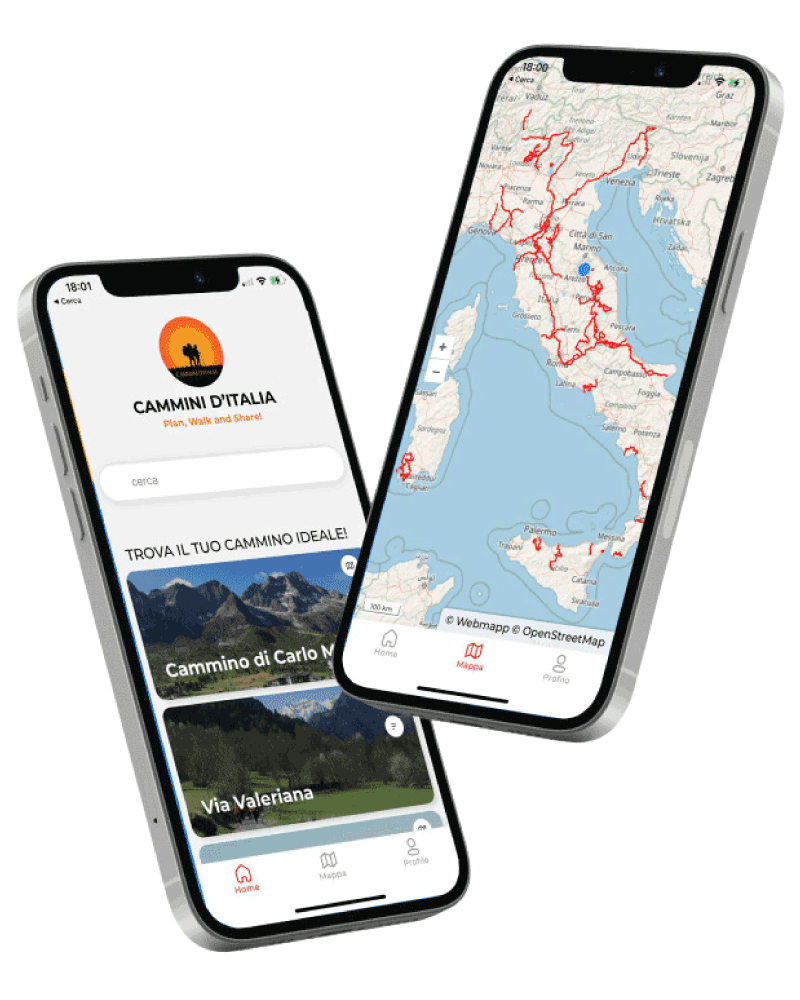
With the free Cammini d’Italia app, you can plan and walk the Cammino Naturale dei Parchi safely, being able to plan the stages in detail and walk the route thanks to the built-in GPS technology that supports your orientation during your adventure.
⠀Inside the app you will find many other paths present in Italy. Thanks to the georeferenced tracks of many routes you will be able to study the itinerary that suits you best and also download the GPX tracks of the individual STAGEs offline.
The app also includes a complete digital map of all the paths surveyed to date on our portal, giving you a wide range of choices among the many paths in the Belpaese.
⠀⠀
Cammini d’Italia is the perfect app for those who want to explore the beauty of Italy on foot, discovering hidden places surrounded by nature. Download it for free today and start planning your next adventure!
⠀
⠀
 ⠀⠀⠀
⠀⠀⠀