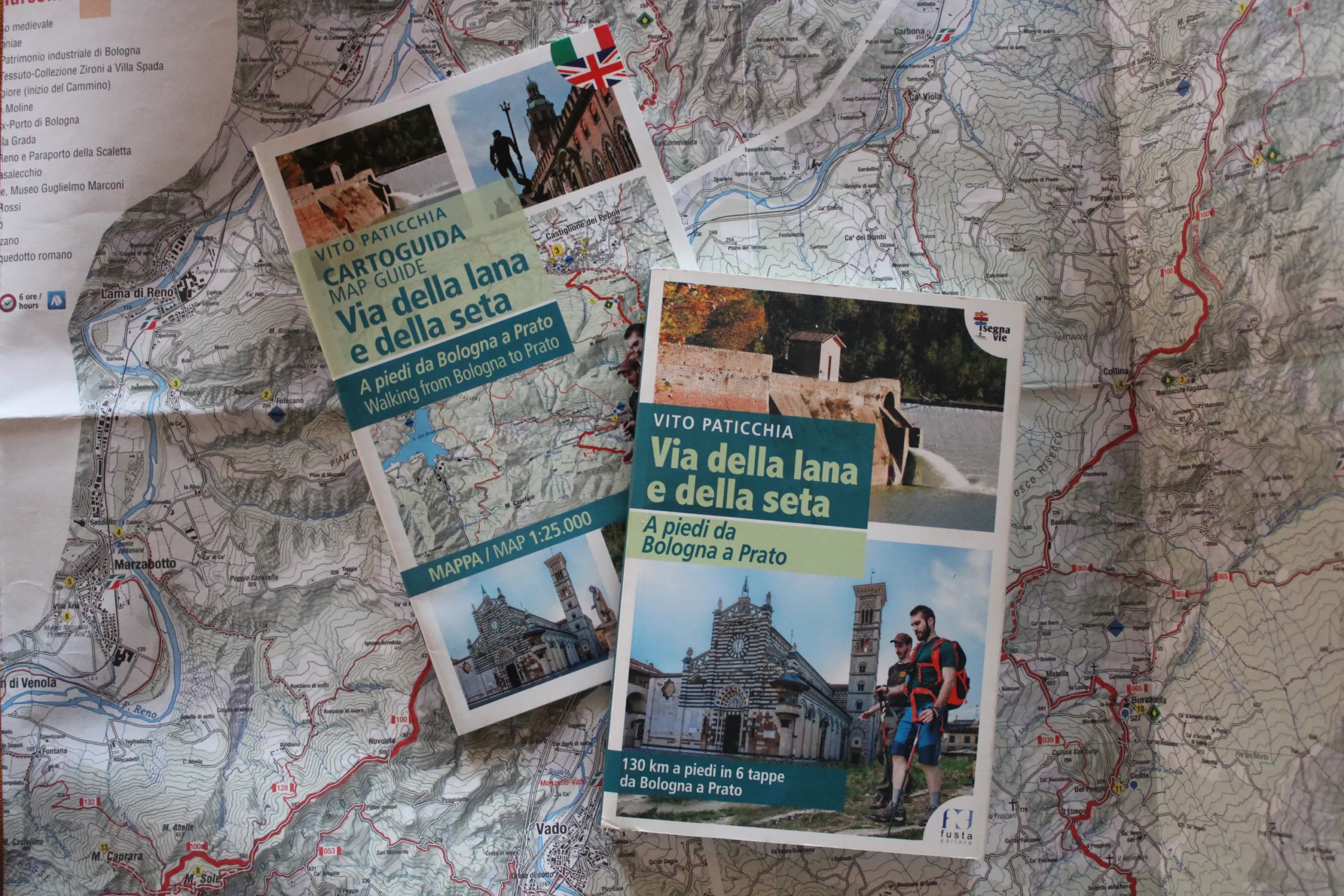
Via della Lana e della Seta
The Via della Lana e della Seta is a 130-km hiking trail that runs between Emilia and Tuscany, through the Tuscan-Emilian Apennines from Bologna to Prato. The name of the path is linked to its distinctive element: the world of industrial archaeology and water, engines of centuries of industrious history and tradition.
The Via della Lana e della Seta is a 130-km hiking trail that runs between Emilia and Tuscany, through the Tuscan-Emilian Apennines from Bologna to Prato. The name of the path is linked to its distinctive element: the world of industrial archaeology and water, engines of centuries of industrious history and tradition.
HISTORY
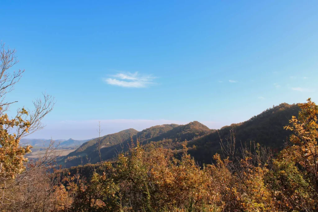
The Via della Lana e della Seta step by step welcomes in its still intimate paths with a particularly wild spirit. We start in Bologna where we find the first impressive traces of silk processing and systems of water use in the industrious city life. Think of the Chiusa di Casalecchio, which is the oldest work of hydraulic engineering still functioning in Europe. Leaving the city, we enter a wilderness of the Apennines made up of welcoming paths and villages with a strong identity. The path leads to cross the Historical Regional Park of Monte Sole, and here the link between the trail and Memory emerges. These are the places of World War II, the Gothic Line and the sad episodes of the fall of ’44, when Nazi troops slaughtered hundreds of inhabitants of these lands making this place sadly known to the world. Here the walker will have one of the most powerful experiences: walking in the places crossed by this wound, sensing its silence and observing the historical evidence, among buildings, rubble and trenches.
As you approach the border between the regions the landscape changes, plunging the hiker into the mountains between Emilia and Tuscany. One arrives in the lands of “border cuisine” where recipes and flavors challenge each other from one side to the other.
One crosses villages where stories of vines and memories are still shared with hikers, where ancient and traditional processes and crops are also preserved, and where time seems almost to have slowed its pace.
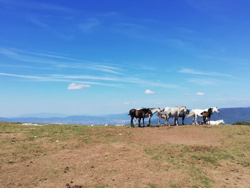
Arriving in Tuscany, the Val di Bisenzio opens up to us, and here awaits another unforgettable experience for the walker: the crossing of the Calvana with its ridge grasslands where horses graze in the wild and semi-wild state, the true masters of these wild lands.
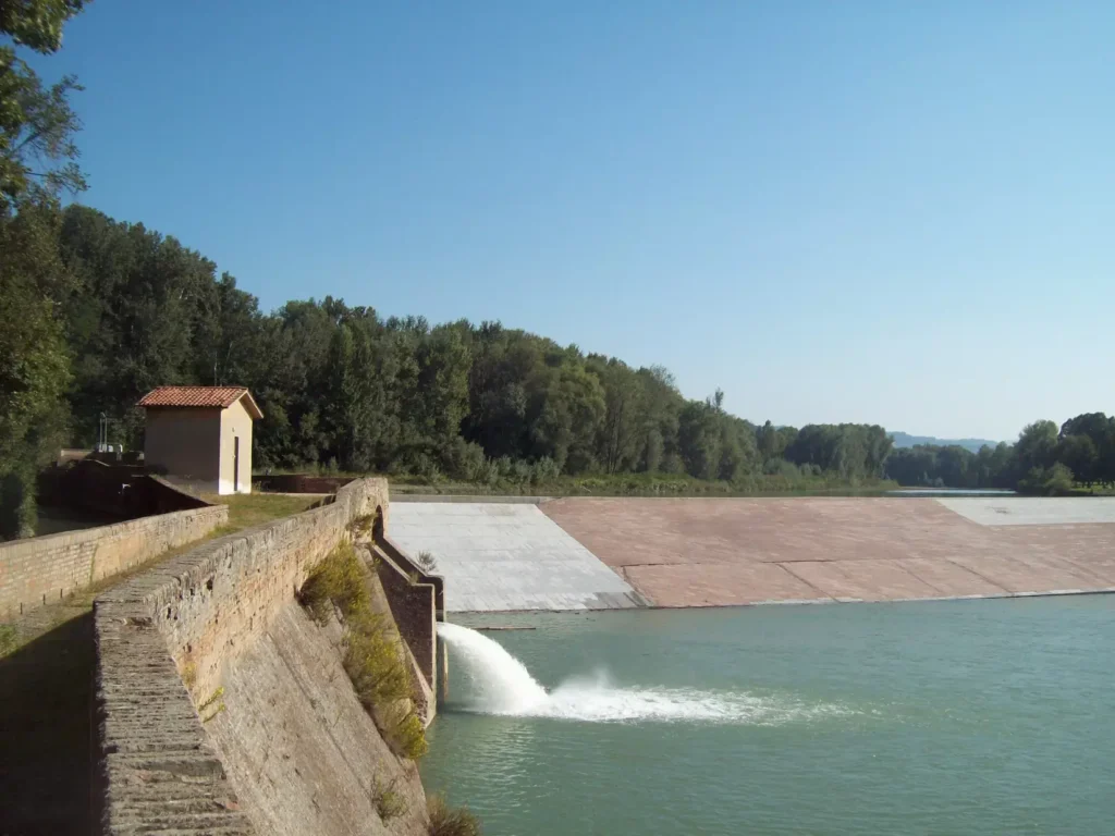
Returning to the “threads” of the Via della Lana e della Seta, in the lands of the Val di Bisenzio there is a succession of buildings of industrial archaeology and museums that tell of the peculiar soul of this path that step by step lead to the outskirts of Prato, accompanied by the course of the Bisenzio River, until the arrival at the Cavalciotto, one of the most important examples of industrial archaeology in the Prato area that, with the Chiusa di Casalecchio, closes the circle of the path of water and industrial archaeology, a fascinating thread running through the Via.
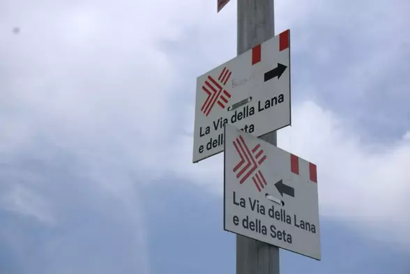
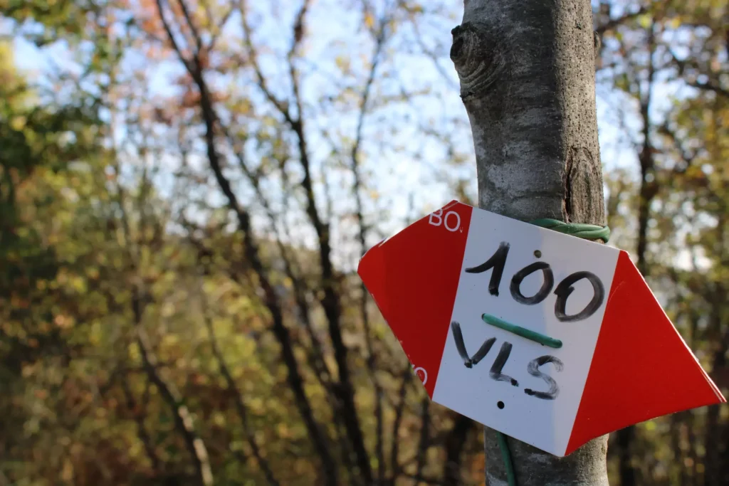
SIGNAGE
Signage present along the entire walk.
The signage is classic CAI, is well marked (more attention to be paid by the Tuscan side), and in support is also the official Walk Plus app and Vito Paticchia’s cartoguide.
WATER SOURCES.
Water sources are present, but not many along the walk except in the cities, it is good to always travel with a liter of water and in the summer months 2 liters,
We are surveying to update our official walk plus app with all the various locations.
(note: as soon as we have all the exact locations and geo-referenced we will send you everything).
SERVICES
Supermarkets: Grocery stores at almost all STAGE points
Pharmacies: Present at almost all STAGE points
CREDENTIALS
The official credential costs €3 and also includes an end-of-walk gift.
TENT
Free camping is prohibited, it is possible to stay in the equipped areas or on the properties of the accommodations.
It is always a good idea to ask the owners of the land for permission to stand.
CONTACTS
WEBSITE: www.viadellalanaedellaseta.com
TELEPHONE: 051 67 58 409 – 379 113 5432
E-MAIL: info@viadellalanaedellaseta.com
STAGE 01
Bologna – Sasso Marconi (BO)
Length: 20 km
Height difference +/-: +230 m/ – 200 m
Time: 6 h
In brief: We start from the historic center of Bologna from where we can admire the earliest traces of buildings and systems related to the use of water in the city, one example for all: the Casalecchio di Reno Lock. We continue as indicated by the signs and mapguide towards Sasso Marconi, skirting the Reno and, before arriving in the town, we can also discover Palazzo de’ Rossi, a Renaissance complex formed by the village, mill, sawmill and paper mill powered by the driving force of the Reno.
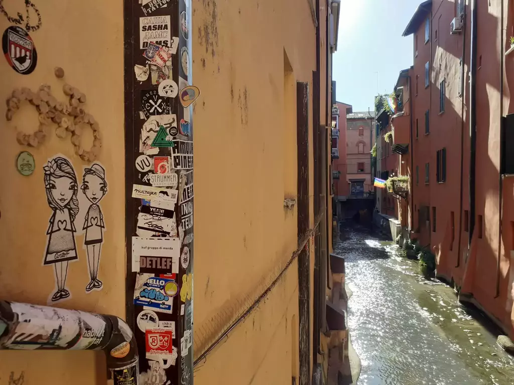
Detailed description: We start from the historic center of Bologna, from Piazza Maggiore. From there we go in the direction of Due Torri and take Via Oberdan (left) and walk along it to the overlook of the Reno Canal. We reach Via Augusto Righi with a STAGE at Via Piella where we can see the very famous little window on the Moline Canal and from there Via Indipendenza – Via dei Falegnami and Via Riva di Reno. After Via San Felice we arrive at Via della Grada (you will see the tower with iron grating for water filtering) and, past “la Filanda” and the power plant, we continue to Via Martinez, a bicycle/pedestrian boulevard, towards Casalecchio.
You go up the canal along the right bank. Cross the Porrettana road to the entrance of the Chiusa consortium and continue to Via Giordani – Little Meadow River Oasis. Climb the ruins of the ancient 14th-century Chiusa to admire the jaw-dropping work of Jacopo Barozzi, the Vignola, which still protects Bologna from the flooding of the Reno.
You enter the Parco della Chiusa by returning back to the Porrettana crossing the red-white CAI 112 sign Via degli Dei. Drive along the tree-lined avenue, past Villa Sampieri Talòn and alongside the Boccaccio, which imprisons the waters of the Reno and then discharges them into the canal. A large wall contains the left bank, with two hatches equipped with sluice gates for hydraulic regulation, removal of silt and gravel, and a system for discharging excess water into the Reno. Leaving the canal, walk in the direction of a floodplain forest until you reach a large iron bridge that will allow you to cross the Rhine in a left-hand direction. Here ancient sand pits have been used to make sport fishing or water holding tanks for use in emergencies,
An underpass tunnel will take you past a factory and then lead you down a tree-lined avenue to the north entrance of Palazzo de’ Rossi, a Renaissance complex formed by the hamlet, mill, sawmill and paper mill powered by the driving force of the Reno. In September, the ancient and renowned Fira di Sdaz, a traditional market, food and crafts event, takes place within these walls.
Variant: With a detour you can visit Colle Ameno, an 18th-century castle village home of majolica tiles. In 44 it was occupied by the Germans and was a camp for civilian prisoners and partisans. Leaving its main entrance, skirting its walls and continuing to the left, take the Vizzano Bridge (inaugurated in 1930 as a ford for schoolchildren). Reaching the crossroads with Via Ancognano, you find the CAI 112 trail again – Via degli Dei with which you share the path to Sasso Marconi. At the junction with provincial road 37, continue towards Sasso Marconi on the right and, past an iron gate, a yellow building (the entrances to Prati di Mugnano), the highway overpasses and the bridge over the Reno, you enter Sasso Marconi.
STAGE 02
Sasso Marconi (BO) – Grizzana Morandi (BO)
Length: 27 km
Height difference: +/-: +1400 m/ – 950 m
Time: 8/9 h
In short: The path continues and rises in altitude. We are in the Memory and History STAGE: inside the Regional Historical Park of Monte Sole in the places and paths of Memory conquering the summit of Monte Termine and Monte Salvaro (826 m). In the direction of Grizzana Morandi the landscapes of Giorgio Morandi and the iconic Fienili, immortalized in the paintings of the Bolognese painter, open up.
Detailed description: From the town hall square turn onto Market Street and then onto Kennedy Avenue. Arriving at the traffic circle of the Marconi monument, cross the bridge over the Reno River and head towards Vado until the bridge over the Setta. After crossing the bridge over the Setta, turn left onto Via Sirano and, having arrived at Casa Bergamini, take a cavedagna to the San Silvestro cemetery where you join the CAI 100 walk-path. From the church and cemetery of San Silvestro (where the variant from Sirano arrives – now not passable due to landslide), an open and panoramic ridge opens with views of the hills and prestigious vineyards of the Bolognese hills. At an altitude of 500, junction CAI 128, you go around the La Volta farmhouse and, still on CAI 100, you reach Monte Santa Barbara (591m). at the top and at the foot of this mountain, during World War II, the Germans made emplacements, shelters and machine-gun nests to control the Val di Setta. At Nuvoleto, it takes 30 minutes to reach a junction between trail marker 100 toward the summit of Monte Sole (668m) and trail marker 100A, toward the star of Monte Caprara (632m) where it rejoins trail marker 100 that descends from Monte Sole and the monument dedicated to the Wolf and the partisans of the Red Star. Past the ruins of Capraia di sopra you reach a dirt road and then a paved road that leads to an important crossroads, a junction between the memorial monuments and the Poggiolo Visitor Center.
We take the path to San Martino-school of peace of Monte Sole- cemetery of San Martino and monument to Don Giovanni Fornasini, the place where citizens and institutions commemorate the Liberation every year. Past the junction to Concola and the monument to Don Ferdinando Grande (Monte Termine)the vegetation changes and the Scots pine, a native and protected nucleus, can be seen.
Keep to the signs for Veggio and after about 100 meters enter the woods to climb to Mount Salvaro (826m). On either side of the path there is a large number of trenches, foxholes, shelters, witnesses to the war and the clashes between the Germans and the Allies.
On the plateau we find an iron cross and a useful shelter in case of rain. We descend along the ridge line to a dense forest of junipers and other specimens of the park’s naturalistic scrub and so to the gates of Grizzana Morandi. Continue toward Monte Pezza (752m) along a rocky bottom trail and cross over Trail 174 to Cà la Fame and Cà la Sete. Continue on 100, passing 2 crossroads, toward the locality Castello. When you will see the CAI markings “Casa di G. Morandi” and “Campiaro” you will know that you are at the height of the Fienili di Campiaro.
STAGE 03
Grizzana Morandi (BO) – Castiglione dei Pepoli (BO)
Length: 22 km
Height difference +/-: +1100 m/ – 1050 m
Time: 7 h
In brief: The trail resumes wild through typical Apennine villages, chestnut woods, streams and brooks. You will touch elevation 930 m and then arrive in Castiglione dei Pepoli, with its beautiful square overlooked by fascinating historic buildings.
Detailed description: From the town hall continue in the direction of Stanco, a 14th-century hamlet, and follow the footpath that runs alongside the monument in memory of the 11 victims of July 22, ’44. When you reach the junction for Tavernola, continue on and arrive in the locality of S. Abramo where path 100 enters a forest of chestnut trees and meadows to the outskirts of Collina, an ancient medieval village. We ascend and skirt the embankment of the Palazzo Vannini and, following a gravel road, reach the top of the ridge and then descend and cross Provincial Road 73. we ascend in the direction of Boscalto and a crossroads of roads that descend toward the Rio Vezzano valley and the center of Burzanella. Here we cross the Via Mater Dei that climbs toward Montovolo and Monte Vigese.
Continue to Matelle Locality and once you reach La Latra past two centuries-old oaks, you come to a crossroads with a majesty. Take a dirt road toward La Rocca and, past the Lagacciolo stream, pass some buildings and enter Burzanella. Reaching the locality Bel Poggio, continue up a cart track to cross the 039 at the locality Il Logo. After leaving a votive shrine behind, you enter a coppice forest up to the 930 meters of Mount Fontanavidola and Cà Terre Rosse. Take 031 to Castiglione dei Pepoli and pass the locality I Muri. After the paved road, take a dirt road that crosses agricultural areas among streams and ditches. From Cà delle Vigne you cross the Brasimone stream, which also feeds Lake Santa Maria here. To get to Castiglione, go straight ahead and walk all the way along the Santa Maria lakefront where it is possible to stop for a break and start climbing along CAI path 031 to Località Ca “di Lenzi and then continue toward Castiglione. You come out on the provincial road near the South African soldiers” cemetery. Here you turn right toward the center of the town is village, which is about 500 mentri away. Follow Via San Lorenzo to arrive in Piazza della Libertà where you can admire the Palazzo dei Pepoli now the town hall.
STAGE 04
Castiglione dei Pepoli (BO) – Vernio (PO)
Distance: 20 km
Height difference +/-: +800 m/ – 1250 m
Time: 7 h
In Brief: We have now reached the “borderlands,” ancient and modern, a geographical boundary and one of amusing culinary rivalries. From the forest we enter the Val di Bisenzio, which still preserves the flourishing textile production. Singular and unique, the villages that one passes through here, with a true mountain flavor, such as Rasora and Storaia, and Montepiano one of the most renowned and popular tourist resorts in Tuscany in the late 1800s with its spectacular Romanesque Abbey.
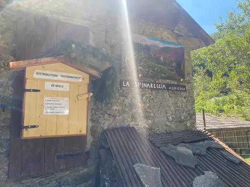
Detailed description: Starting from Piazza della Libertà in Castiglione dei Pepoli (where you can admire the Clock Tower) walk first along Via San Lorenzo, then Via Saliciata and lastly Via Manfredi. This will take you to the intersection with via Dall’Olio from which you can take CAI path 035. This will take you to the top of Monte Bagucci, continuing to a forest road that leads to the Abetina and the Ranuzzi Refuge. From here you will have to change paths, walking along CAI 037 to Bagucci-Rasora-Spinareccia. You will reach Bagucci after a steep section along the borders of the Suviana and Brasimone Lakes Regional Park. You will then have to cross a wooden bridge over the Rio Secco, continuing on a mule track that will lead you to Rasora, a small, typically mountain village. Once you reach the central square (where you can observe the Oratorio and the Casa del Popolo) continue toward the ruins of the Sorgiva Mill and cross the wooden bridge over the Rio Fobbio, until you reach the dirt road that leads to Spinareccia. Here you will have to continue in the same direction, climbing up path 015 toward Storaia and then continuing on CAI 027 toward the Fondovalle Setta. Once you reach Storaia (former border area between the Grand Duchy of Tuscany and the Papal State) cross the bridge over the river and leave trail 027 that goes up to Tavianella, take a right to follow the orographic right of the Setta River on a trail with some short rough sections until you reach Montepiano. a splendid town rich in history and famous for its villas.
Pass the fork that leads on one side to the Badia di Santa Maria and on the other to the Parish Church. Here you will have to turn onto Via Monsignor Risaliti then, after skirting the cemetery and a parking lot, continue to Passo della Crocetta (ignore the fork for Trail 00). From here, among chestnut, fir and beech trees, keep walking until you reach the farmhouse “Casa Portellese” and the fork for CAI Trail 58. At this point keep right until you reach Butia, then Gorandaccio (here you will find the Rocca dei Bardi) and finally San Quirico di Vernio. Reach the main square (where you will find the old Town Hall, a chapel and a “permanent exhibition” themed Gothic Line). and thus the conclusion of the STAGE, at the Circolo Arci Stella Rossa.
Variant: Once you reach the junction with CAI 58 trail, it is possible to reach Vernio via route 00 to Passo della Crocetta and Poggio Torricella, where a monument stands in memory of the battle that took place here in 1944.
STAGE 05
Vernio (PO) – Vaiano (PO)
Distance: 21 km
Height difference +/-: +1000 m/ – 1100 m
Time: 7 h
In brief: Woods and fir forests remain behind the walker as he sets off on the typically karst Calvana ridge trail: rugged and rocky. It crosses the ancient trade routes used by the Etruscans for trade with Marzabotto (Kainua), Bologna (Felsina). Passing then through Sofignano and Le Fornaci (from Roman times) we arrive at the end of the STAGE, in Vaiano.
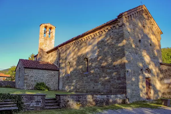
Detailed description: With the fifth STAGE you will leave the woods and fir forests behind, continuing your walk along the rugged and rocky Calvana ridge, which once housed the bed of the ancient Bisenzio River. We begin our route starting at the Circolo Arci Stella Rossa, from here we head to Piazza San Lorenzo and then along Via della Pioggia Alta and Via delle Soda. After the junction for the Corboli farm we reach another one, from which we will take CAI Trail 60 to the Cotone farmhouse and, past the latter, to the locality Le Soda (this is where the ancient Vie per Felsina and Kainua, that is, Bologna and Marzabotto, crossed). At this point take path 20 to Dogana and, from the dirt ridge, reach Montecuccoli. We must continue on CAI path 20 until the junction with a cartroad that leads to the locality Santo Stefano (a place of pastoralism). Here we officially enter the territory of Calvana, and we continue the path passing Poggio Montecuccoli, Poggio Brioli and Masso di Costa, thus entering an area that has small reforestations of pine trees. Arriving at Monte Il Prataccio we continue walking in the same direction on trail 46a, toward Vaiano. Having passed Fosso and Fonte del Favo, the trail descends from Passo della Croce among shrubs and gorse, reaching the village of Sofignano. CAI 46 ends, but it will suffice to continue along Via di Sofignano to reach the hamlet of Le Fornaci, where lime was once produced. At this point we take via di Larciano, a gravel road that then becomes a hilly road winding between dry stone walls, vineyards and hedges. Reaching the junction with via di Moschigiano we turn in that direction to reach the village of Vaiano, where we can admire the ancient Abbey of San Salvatore and the museum dedicated to wool processing.
Variant: At the level of Mount Il Prataccio, it is possible to continue the walk all along the ridge, reaching the plateau of Aia Padre until descending to Passo della Croce, where you will find trail 46 again, which descends toward Sofignano and Le Fornaci.
STAGE 06
Vaiano (PO) – Prato
Distance: 22 km
Height difference +/-: +900 m/ – 1000 m
Time: 7/8 h
In Brief: From the town square of Vaiano you will walk through gentle hilly terrain and then reach the ridge of the Calvana where you will easily spot the wild horses that dwell here. The long descent will then lead to the valley floor, to the Cavalciotto di Santa Lucia, the metal bridge over the Bisenzio River and then continuing on the bike path that will lead to the Piazza Duomo in Prato.
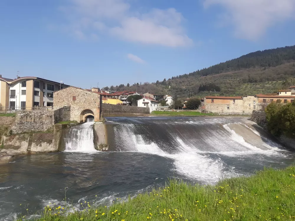
Detailed description: From the town square in Vaiano, walk along Via Alessandro Vannoni to Via Fratelli Rosselli. Continue to the station and then take via Borgonuovo, then via Bronia and again via di Sofignano, to the Villa di San Gaudenzio (which hosted Galileo Galilei!). Continue along the uphill road to the locality of Le Mura and then, after crossing gentle hilly terrain, you will reach Collisassi. From here a Carrareccia will take you to the locality of Le Cave and then to the Passo della Croce, from where you can take the CAI 20 trail again, which continues along the Calvana ridge (here it is not difficult to encounter herds of wild horses) in the direction of Monte Maggiore. The scenery here is extraordinary, both for the view and for the spectacle provided by the numerous blooms in spring. From Monte Maggiore you descend to Foce dei Cerri, where “Calvana” cows graze. Here you leave path 20 in favor of CAI 42 to Valibona and Crocicchio. We must then continue on trail 40, which enters the Rio Buti valley, where 5 horizontal caves with karst springs can be seen. We now begin the descent to the valley floor on Via di Valibona, towards the Cavalciotto di Santa Lucia (a work that was used to channel the waters of the Bisenzio towards the city, allowing the development of the activities of mills and factories). From here we cross a metal bridge over the Bisenzio and then continue on the bike path that, through the Porta Mercatale, will take us to Piazza Duomo in Prato.


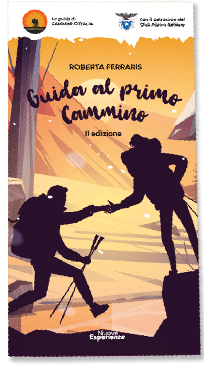
Guide to the First Walk
The First Walk Guide is the ideal resource for those who want to embark on an adventure in the wonderful world of trekking. With this comprehensive and exhaustive guide, you can better prepare for your trek, plan every detail, and face the adventure in total safety.
The book is designed primarily for those who are just approaching the world of walking, but we strongly wanted to include very specific focuses that can be very useful to even the most experienced.
The guidebook covers all aspects necessary for your trek, from technical clothing and equipment to orientation techniques and emergency management. This will deepen your knowledge of the world of trekking and help you learn new techniques and strategies for tackling the trek successfully.


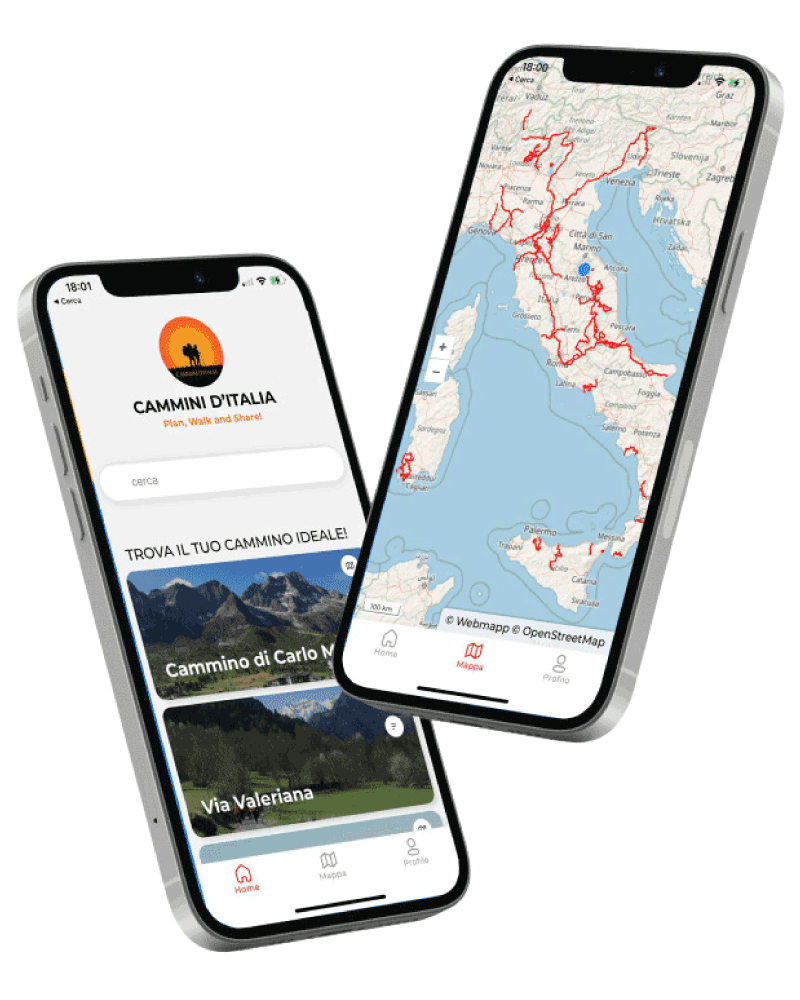
La Via della Lana e della Seta
With the free Cammini d’Italia app, you can plan and walk La Via della Lana e della Seta safely, being able to plan the stages in detail and walk the route thanks to the built-in GPS technology that supports your orientation during your adventure.
Within the app you will find many other paths present in Italy. Thanks to the georeferenced tracks of many routes you will be able to study the itinerary that suits you best and also download the GPX tracks of the individual STAGEs offline.
The app also includes a complete digital map of all the paths surveyed to date on our portal, giving you a wide range of choices among the many paths in the Belpaese.
⠀⠀
Cammini d’Italia is the perfect app for those who want to explore the beauty of Italy on foot, discovering hidden places surrounded by nature. Download it for free today and start planning your next adventure!
 ⠀⠀⠀
⠀⠀⠀