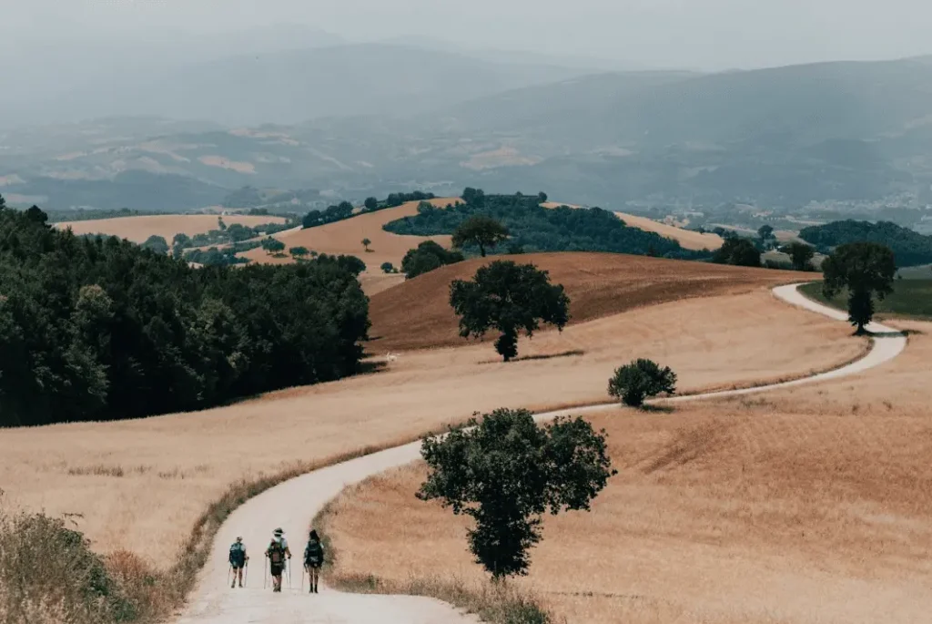
CAMMINO DEI CAPPUCCINI
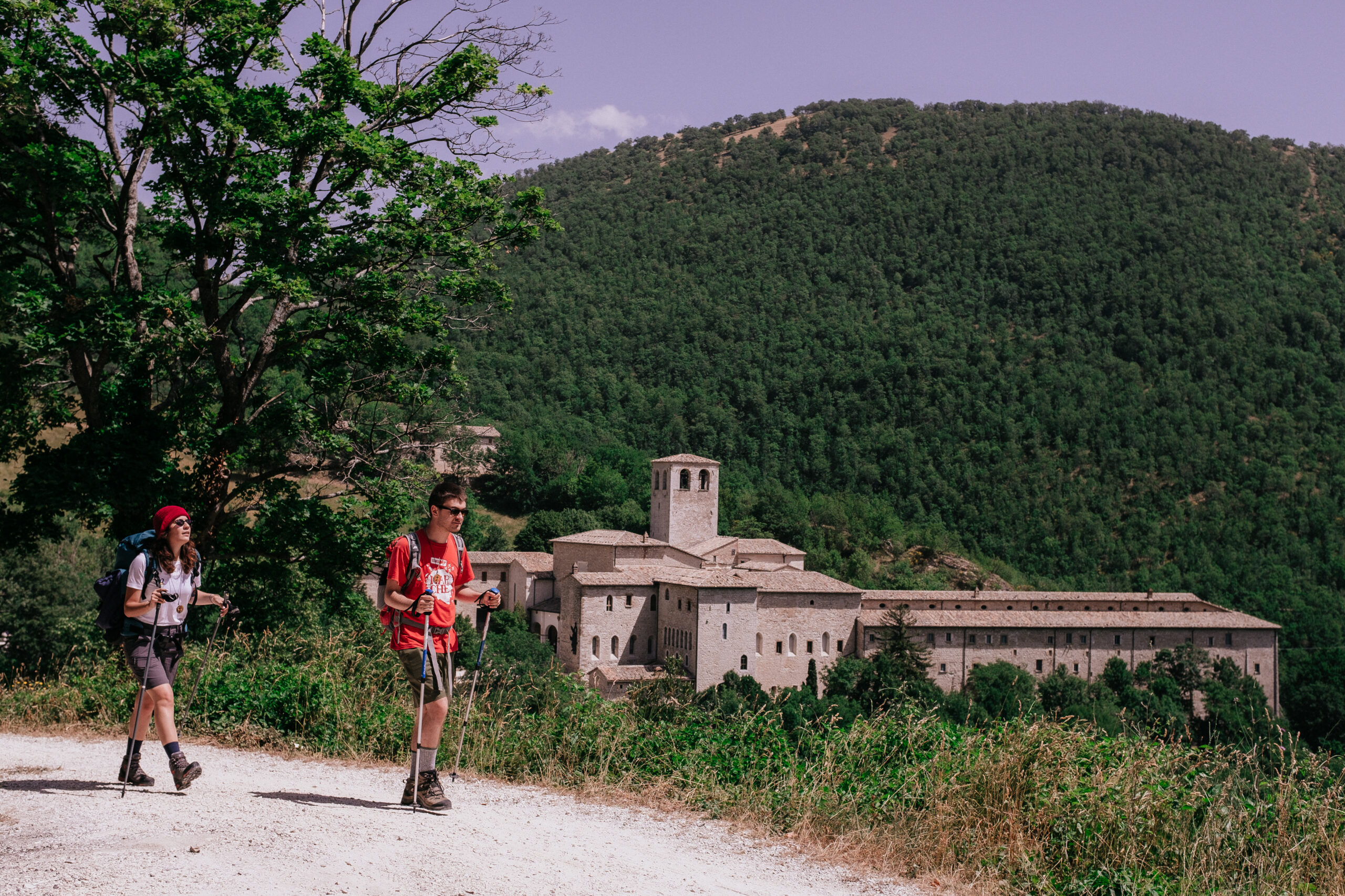
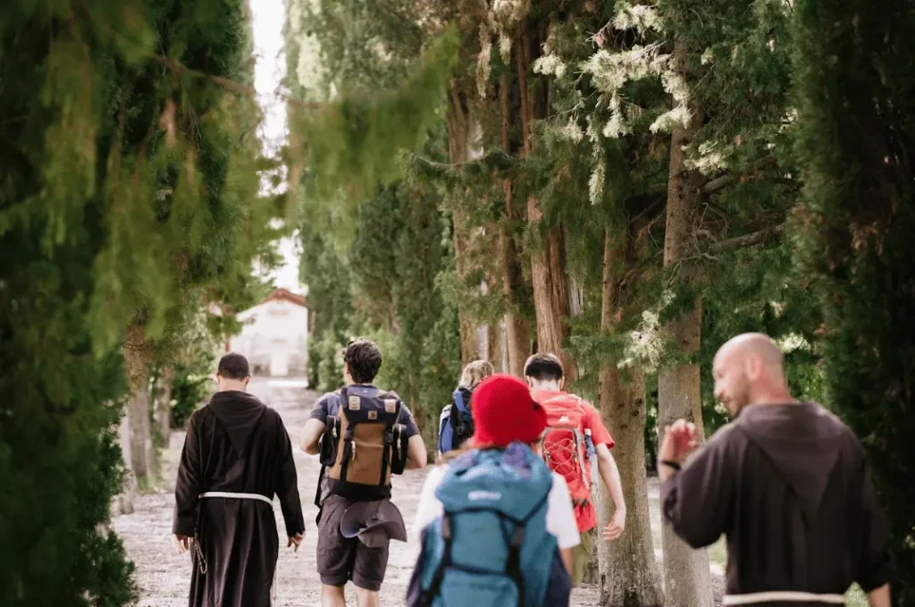
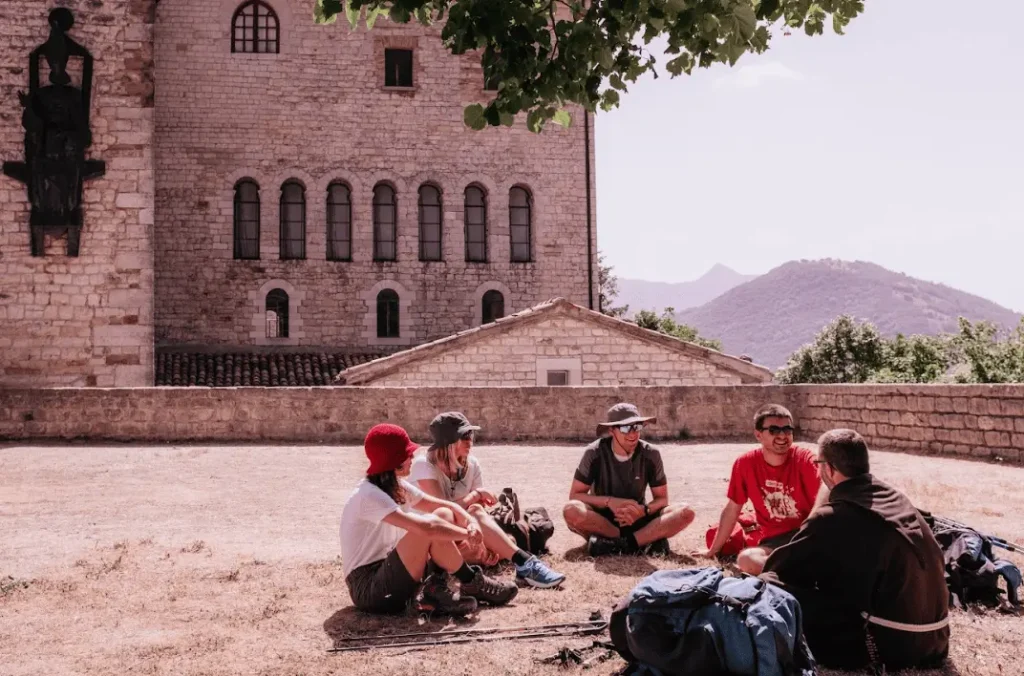
The CAMMINO DEI CAPPUCCINI traverses the inland ridge of the Marche region, moving through a beautiful and varied naturalistic setting, where mountains, hills and the sea merge into a single glance, to discover the places linked to the history of the origins of the Capuchins and their present day, being able to meet today’s Capuchins as well and being welcomed into their convents.
The Cammino has its starting point in Fossombrone (PU), its center in Camerino (MC)-where the first convent of the Order of Friars Minor Capuchin is located-and its arrival point at the Sanctuary of San Serafino in Ascoli Piceno. It is a very rich route from a spiritual, historical, artistic and naturalistic point of view, and very demanding from a physical point of view, because of the physiognomy of the Marche hinterland, which presents a continuous alternation of ups and downs, with numerous STAGES with important differences in height.
The path passes by hermitages hidden in wild forests, Franciscan convents located on the edge of cities, monasteries with millennia of wisdom, and harmonious Romanesque abbeys, places steeped in spirit and history, all linked by a thread of roads that unravel over rolling hills and wild mountains. The paths pass through small historic villages and precious towns, but never too large; of metropolises the Marches lacks for reasons related to history and even more so by vocation, because its inhabitant thinks of himself as enveloped and protected by the land that surrounds him, cultivating it without dominating it.
The walk can be done all at once, or divided into two or more parts. For example: from Fossombrone to Camerino (10 days), and then from Camerino to Ascoli Piceno (7 days); or it can be divided into three parts: from Fossombrone to Fabriano (5 days), from Fabriano to Camerino (5 days), and finally from Camerino to Ascoli Piceno (7 days).
HISTORY
The Cammino dei Cappuccini offers pilgrims the opportunity to retrace the fascinating history that marks the birth of the vital Franciscan reform of the Capuchin Friars, which exploded in the Marche region in the first half of the 1500s and became in the following centuries until today one of the most important religious orders in the world.
Today, there are more than 10,000 Capuchins in the world, spread across 5 continents and 110 nations, but despite the Order’s widespread membership, very few know their decidedly adventurous and engaging history.
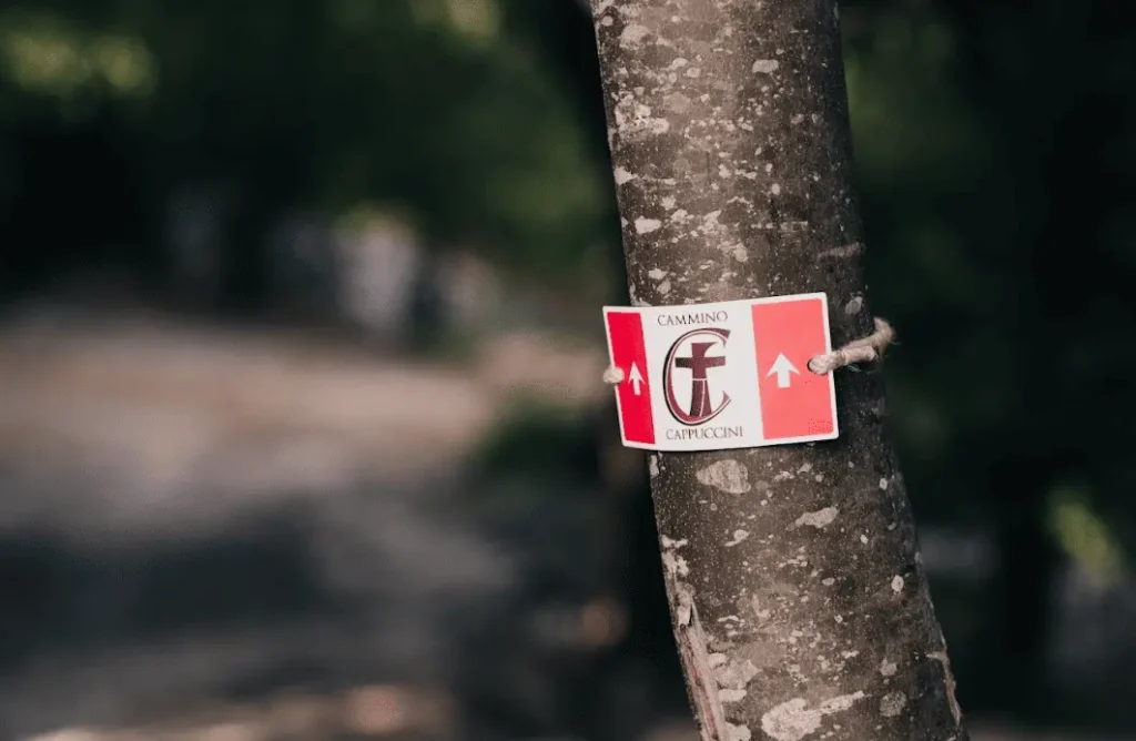
SIGNAGE
The path is regularly and punctually marked along the entire route.
LOGISTICS AND TRANSPORTATION
The Cammino dei Cappuccini is a linear route that starts from the Convent of the Capuchins in Fossombrone, on the Hill of Saints, and ends at the Shrine of St. Seraphim of Montegranaro in Ascoli Piceno. From an organizational point of view, one important detail should be kept in mind: the starting convent is about 3 km above Fossombrone, and it takes about 45 minutes on foot to reach it from the center.
HOW TO REACH THE STARTING POINT
BY CAR
For those coming from the Adriatic coast:
from the A14 highway exit Fano and then take the SS73 Bis to Fossombrone.
Exit at Fossombrone Est and follow the direction to Fossombrone.
For those coming from the Tyrrhenian coast:
> From the north: get as far as Arezzo. Then Città di Castello, Apecchio, Piobbico, Acqualagna, Fossombrone;
> From the south: get as far as Perugia. Then Gubbio, Cagli, Acqualagna, Fossombrone.
BY BUS
For those coming from the Adriatic coast: get to Fano and from there take the Adriabus buses that leave for Fossombrone about every half hour. For bus departure times, see thetimetable.
For those coming from the Tyrrhenian coast:
> From Rome: Mondays, Wednesdays, Fridays, and Sundays there is an Amibus bus that leaves Rome Tiburtina (box 15) at 4 p.m. and arrives Fossombrone at 7:45 p.m. (change at Acqualagna).
> from Rome: there is also the Rome-Marche lines (RML) that leaves daily and arrives in Ancona (FlixBus).
From Ancona you can take the train to Fano station and from there the bus to Fossombrone.
BY TRAIN
Always check train schedules on the Trenitalia website
For those coming from the Adriatic coast:
you arrive by train to Fano Station. From there Adriabus buses leave for Fossombrone (7:40 a.m. – 12:40 p.m. – 4:40 p.m. – 8:40 p.m.). Those who wish to take advantage of buses that leave at other times can walk to Fano il Pincio (about 1 km) and from there take the bus (25R Red Line) to Fossombrone, which leaves about every half hour (from
first at 6 a.m. to last at 8:35 p.m. in the evening). More information can be found at Adriabus.
For those coming from the Tyrrhenian coast:
> From the north:
train with destination Bologna. In Bologna change trains for Fano. At Fano take the bus to Fossombrone.
> From center-south:
train with destination Ancona (or Falconara Marittima) and then from Ancona (or Falconara Marittima) change trains for Fano. At Fano take the bus to Fossombrone. For bus departure times from Fano, see website Adriabus.
HOW TO RETURN FROM FOSSOMBRONE TO CAMERINO
BY BUS
From Camerino you take the bus to Fabriano.
Departure times:
5,50 – 6,15 – 6,40 – 8,00 – 11,55 – 12,50 – 13,35 – 16,50 – 19,40.
For information on this first leg:
Contram mobility: 0737 616846 or toll-free number: 800 037 737.
From Fabriano then a second bus leaves for Fossombrone (departure times from Fabriano “Terminal Dante”: 12:40 p.m. and 1:30 p.m.).
For information: Adriabus 0722 376738 or toll-free number 800 664 332.
Alternatively, one can take the bus to Civitanova (departure times: 6.20 – 11.30 – 14.00 – 16.00). At Civitanova change trains to Fano, and at Fano take the bus to Fossombrone. For bus departure times from Fano, see the Adriabus website.
BY TRAIN
From Camerino, take the public transport bus to Castelraimondo station (for schedules see Contram.
From there take the train to Ancona or Albacina. Then change trains for Fano and in Fano the bus to Fossombrone. For bus departure times from Fano, see the schedules.
HOW TO GET TO CAMERINO (FOR THOSE STARTING THE SECOND PART OF THE WALK)
BY CAR
For those coming from the Adriatic coast:
> From the north: take Highway A14 and exit at Ancona nord. Then take the SS76 to Fabriano. From there take SP 256, which passes through Cerreto d’Esi, Matelica, Castelraimondo and arrives in Camerino.
> From the south: take Highway A14 and exit at Civitanova Marche. From there take the SS 77 to the exit for Camerino.
For those coming from the Tyrrhenian coast: drive to Foligno and then take the SS 77 to the exit for Camerino.
BY BUS
For those coming from the Adriatic coast:
Get to Ancona or Civitanova Marche and from there take the Contram bus to Camerino see schedule Contram.
However, from Ancona or Civitanova Marche you can take less time to reach Castelraimondo station and from there take the bus to Camerino.
For those coming from the Tyrrhenian coast:
> From the north: get to Perugia and from Perugia take the Bus to Camerino (Contram Lines) or to Foligno and from Foligno to Camerino (Rome-Marche
lines).
From Rome: there is a daily bus from Rome Tiburtina (stops at Orte, Terni, Spoleto, Foligno) to Camerino. It usually leaves at 12:50 p.m. and arrives in Camerino at 4 p.m. See timetable Contram.
BY TRAIN
For those coming from the Adriatic coast: arrive at Civitanova Marche station. Change trains with destination Castelraimondo. From Castelraimondo take the bus to Camerino, see schedule Contram.
For those coming from the Tyrrhenian coast:
get to Foligno and from Foligno change trains to Castelraimondo.
From Castelraimondo take the bus to Camerino, see schedules.
HOW TO REACH CAMERINO FROM ASCOLI PICENO
BY CAR
For those coming from the Adriatic coast:
> From the north: take Highway A14 and exit at Ancona nord. Then take the SS76 to Fabriano. From there take SP 256, which passes through Cerreto d’Esi, Matelica, Castelraimondo and arrives in Camerino.
> From the south: take Highway A14 and exit at Civitanova Marche. From there take the SS 77 to the exit for Camerino.
For those coming from the Tyrrhenian coast: drive to Foligno and then take the SS 77 to the exit for Camerino.
BY BUS
For those coming from the Adriatic coast:
Get to Ancona or Civitanova Marche and from there take the Contram bus to Camerino see schedule Contram.
However, from Ancona or Civitanova Marche you can take less time to reach Castelraimondo station and from there take the bus to Camerino.
For those coming from the Tyrrhenian coast:
From the north: get to Perugia and from Perugia take the Bus to Camerino (Contram Lines) or to Foligno and from Foligno to Camerino (Rome-Marche
lines).
From Rome: there is a daily bus from Rome Tiburtina (stops at Orte, Terni, Spoleto, Foligno) to Camerino. It usually leaves at 12:50 p.m. and arrives in Camerino at 4 p.m. See timetable Contram.
BY TRAIN
For those coming from the Adriatic coast: arrive at Civitanova Marche station. Change trains with destination Castelraimondo. From Castelraimondo take the bus to Camerino, see schedule Contram.
For those coming from the Tyrrhenian coast:
get to Foligno and from Foligno change trains to Castelraimondo.
From Castelraimondo take the bus to Camerino, see schedules.
PRIVATE TRANSPORTATION
WATER
All along the Cammino di Dante, in addition to bars, restaurants and private individuals who kindly allow you to fill a water bottle, there are numerous water sources to draw from. The only STAGES where you need to replenish your water supply at the start are the first part of the seventh STAGE, from Poggio San Romualdo to the Abbey of Sant’Urbano, and the following one from Cupramontana to Cingoli.
SERVICES
Most of the towns crossed by the walk are equipped with supermarkets, restaurants, places to sleep and pharmacies. Below are the places equipped with these services:
Fossombrone, Gola del Furlo (no pharmacy), Cagli, Frontone, Fabriano, Cupramontana, Cingoli, San Severino, Camerino, Fiastra, Sarnano, Montefortino, Amandola, Montefalcone Appennino (no pharmacy), Force, Rotella (no pharmacy), Castignano, Offida, Appignano del Tronto, Ascoli Piceno.
DANGERS
There are no particular dangers. On some of the more mountainous STAGES the trails simply become more rugged both uphill and downhill and slippery in rainy weather. In the strictly winter months, the mountainous stages may pass through snow-covered areas. On the last STAGES of the trail, a watchful eye is needed for shepherd dogs watching the flocks.
ROAD BOTTOM.
The basic criterion in plotting the path was to avoid asphalt as much as possible. The percentage is 70% dirt, 30% asphalt.
CREDENTIAL AND TESTIMONIUM
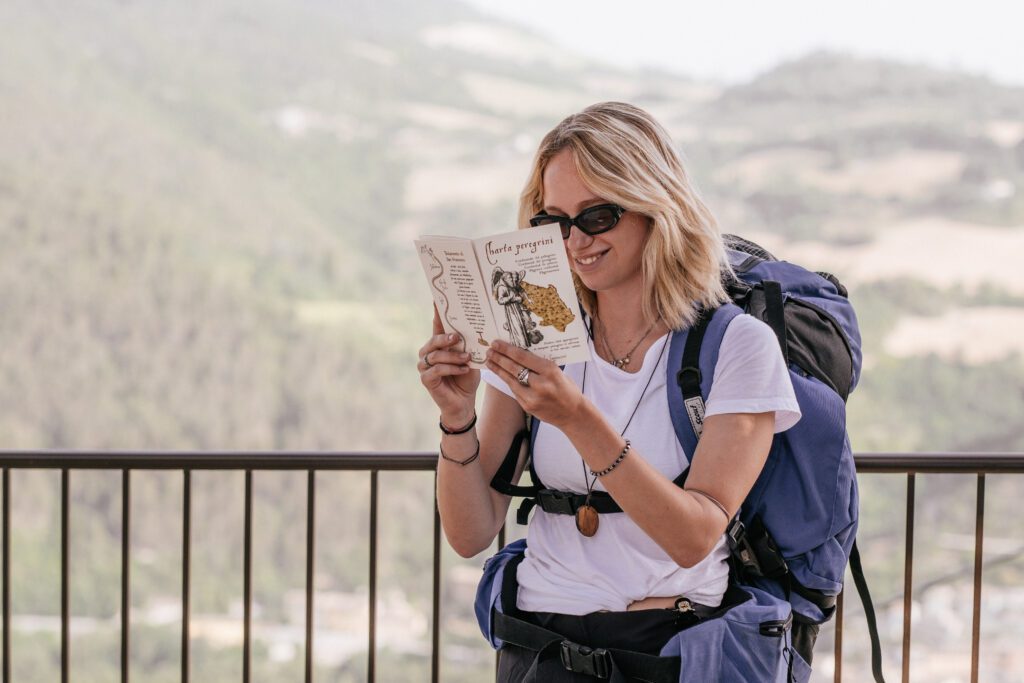
The CAMMINO DEI CAPPUCCINI provides a credential, which can be picked up directly at the starting point, the convent in Fossombrone (tel. 0721 714370) or, for those who decide to walk the second part of the path, at the convent in Camerino (tel. 0737 644480): it is necessary to contact the two convents first or write an email to camminodeicappuccini@gmail.com. Those who decide to start from other points can receive the credential directly at home. Everyone is asked to fill out the form on the camino website in the part about the credential. The credential is stamped in the places at the end of the STAGE where you stop to sleep (not in intermediate places) or in the bars, pro loco, IAT points indicated on the site for each STAGE.
Along with the credential, in which beautiful artistic stamps are affixed, the pilgrim is given a wooden pendant with the icon of the Cammino dei Cappuccini and at the end, whether Camerino or Ascoli Piceno, a Testimonium is issued. There is no set price for this either for the credential, pendant or Testimonium, but an offering is welcome to help defray the cost of maintaining the walk.
IN TENT
In some cases it is possible to use the campsites present in the STAGEs (e.g., Gola del Furlo, Frontone, San Lorenzo al Lago, Montefortino) or in free spaces where no permits are required (e.g., Poggio San Romualdo).
CONTACTS
For any information you can write to: camminodeicappuccini@gmail.com or contact: 334 3845138
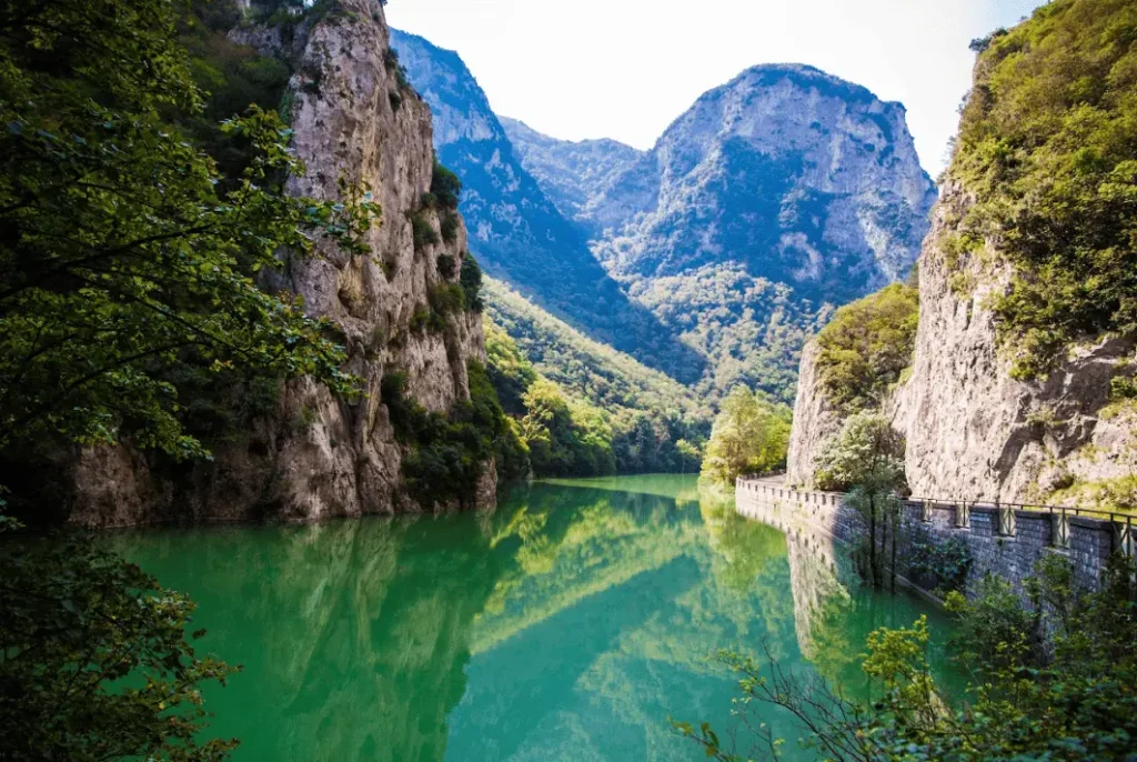
STAGE 01: FOSSOMBRONE - FURLO GORGE
Departure: Fossombrone
Arrival: Furlo Gorge
Distance: 20.5 km
Height difference: +755 m / – 894 m
The walk starts from the Convent of the Capuchins in Fossombrone. The route develops between dirt and paved sections, crossing hills, vineyards and open countryside, with splendid views of the Metauro valley and the mountains that frame the Furlo Gorge. The itinerary alternates between easy and fairly linear sections and more challenging ones, particularly in the clay sections and along the paths in the second part, where the ascent to Mount Pietralata is faced.
Once in the vicinity of the gorge, the pilgrim can choose between two alternatives. The first is the easier route, which follows the course of the river, crosses the Furlo Gorge and leads to the destination in about 14 km. The second is the high variant, more strenuous but also more scenic, which climbs Mount Pietralata and offers spectacular views of the gorge and the Furlo Gorge State Nature Reserve.
Both options eventually lead to the village of Furlo, the conclusion of the first STAGE.
To know before you leave
The Capuchin Convent in Fossombrone is about 3 km from the town center and can be reached in about 45 minutes on foot. The friars welcome pilgrims starting at 5 p.m., so arriving early is not helpful. Those who plan to stay overnight at the friary can take the opportunity to visit Fossombrone first and discover its historical and artistic heritage.
Those who choose to sleep in the city instead can go up to the friary the next morning and attend the 7:30 a.m. Mass. At the end of the celebration, the friars hand out the credential and walking pendant, also imparting the blessing to the pilgrims under the large cross.
Don’t miss
Before going up to the convent, it is worth taking some time to visit Fossombrone. The Corso Garibaldi, the Church of San Filippo, the Ponte della Concordia, the Archaeological Museum, the Pinacoteca Civica, the Casa Museo Quadreria Cesarini and the Marmitte dei Giganti, the latter just outside of town, represent very interesting STAGE stops.
Once you arrive at the Furlo Gorge, the striking Abbey of San Vincenzo al Furlo is also definitely worth a visit.
Information
FOSSOMBRONE
Punto IAT
Piazza Dante 23
Tel: 0721-72.32.63 / 340-82.45.162
Mail: puntoiat@comune.fossombrone.ps.it
Site: visitfossombrone.it
FURLO Gorge
IAT Point Furlo Reserve
Via Flaminia, Furlo
Tel: 0721-70.00.41 / 329-83.18.698
Mail: riservafurlo@provincia.ps.it
Site: www.riservagoladelfurlo.it
MARCHE&BIKE
Via Furlo 9 – La Golena Park, Furlo
For luggage transport and shuttle service in the first STAGE
Tel: 342-52.95.769
Mail: prenotazioni@marcheandbike.it
Site: www.marcheandbike.it
STAGE 02: FURLO GORGE - CAGLI
Departure: Furlo Gorge
Arrival: Cagli
Distance: 21.4 km
Height difference: +838 m / – 748 m
The second STAGE follows a route that runs between the Candigliano and Burano valleys, with a rough course made up of climbs and descents that touch Mount Varco, the valley of the Cherio ditch, Mount Martello and the plain of Cagli. The landscape changes several times along the way, alternating between cultivated fields, pine forests and wooded areas, with frequent glimpses of Mounts Catria and Acuto.
Halfway along the route is the Sanctuary of Santa Maria delle Stelle, a place of great charm and recollection, ideal for a pause for silence, prayer and contemplation. The last part of the STAGE then descends to Cagli, a town rich in history and tradition, where on the hill is the ancient Capuchin Convent, a simple and welcoming destination that keeps alive the link with the Franciscan presence in this area.
To know before you leave
The only refreshment point along the STAGE is Agriturismo Ca’ Pierello, located about 9 km after the start. Here you will also find a water source and a familiar and generous welcome. It is advisable to contact the facility before setting out, so that you can possibly reserve something to eat, at 333-33.15.904.
In the spring and fall periods, it is a good idea to check, through the trail available on the Walk+ App, that the ford of the river in the Screbia ditch, around the 14th km, is actually practicable. If not, it is necessary to follow the alternative route down to Smirra.
Don’t miss
Halfway up the STAGE, on Mount Martello, is the Sanctuary of Santa Maria delle Stelle, a place frequented since the Middle Ages by wayfarers and pilgrims. To visit it, it is necessary to contact Ms. Mariella well in advance at 328-57.21.445.
Once in Cagli, the Convent of the Capuchin Friars, a significant example of early Capuchin architecture, is worth a stop and, if you wish, an overnight stay. Also worth visiting in town are the 1289 Palazzo Pubblico, overlooking the main square, the historic theater and several interesting churches such as San Domenico, Sant’Angelo Minore, San Bartolomeo and San Giuseppe.
Information
SANTA MARIA DELLE STELLE
Loc. Monte Martello
For visits to the shrine, call in advance at 328-57.21.445
CAGLI
IAT Point
Via Alessandri 4
Tel: 0721-78.07.73
Mail: iat.cagli@gmail.com
Site: www.visitcagli.it
STAGE 03: CAGLI - MONASTERY OF FONTE AVELLANA
Departure: Cagli
Arrival: Monastery of Fonte Avellana
Distance: 20.9 km
Height difference: +951 m / – 543 m
The third STAGE does not have a particularly long distance, but still requires a good physical commitment because of the significant elevation gain. The route passes through ancient villages, collected woods and wide views that open up towards the Castle of Frontone and the Catria massif. After about 14 km you reach Frontone, which is an excellent stopping point both for those who wish to break the STAGE into two days and for those who prefer to take a break before tackling the second part of the walk.
The route alternates between breached roads and forest paths, touching on places rich in memory such as Paravento, marked by significant historical events, and offering several water points and small opportunities for refreshment along the way. Climbing toward Mount Roma, the landscape gradually becomes more open and contemplative. The last stretch, which is almost flat, accompanies more gently to the locality of La Forchetta, from which there are splendid views of the Monastery of Fonte Avellana, nestled among beech and hazelnut groves. It is a cozy arrival that naturally invites silence, prayer and rest.
To know before leaving
It may happen that, due to the needs of the monastic community, it is not always possible to stay overnight at Fonte Avellana Monastery. In this case, two alternatives can be considered. The first is to stop to sleep in Frontone, which is about 14 km after Cagli, and resume the journey the next day in the direction of Pascelupo. The second is to choose the Hostel Fronte del Parco in Isola Fossara, located about 8 km beyond the monastery and contactable at 331-77.57.046. The facility also provides a shuttle service, which is useful for retrieving pilgrims at Fonte Avellana and returning them to the trail the following morning.
Don’t miss
In Frontone, especially for those who decide to stop in the village, the medieval village located in the upper part of the town is worth a visit, with its characteristic alleys and the impressive 11th-century Castle of the Gate. Also of interest are the Civic Tower, the Church of Santa Maria Assunta and the Church of Madonna del Soccorso.
The highlight of the STAGE, however, remains the Monastery of Fonte Avellana, an ancient Benedictine coenoby founded in the 10th century and also mentioned by Dante. Inside the complex, the Romanesque church, the crypt and especially the famous Scriptorium, an authentic masterpiece of architecture and light and the spiritual heart of the monastery, deserve special attention.
Information
FRONTON
IAT Point
Town Hall Square 19
Tel: 380-13.77.626
Mail: puntoiat.frontone@gmail.com
Site: www.montecatria.com
MONASTERO DI FONTE AVELLANA
Tel: 0721-73.02.61
Mail: info@fonteavellana.it
Guesthouse: foresteria@fonteavellana.it
Site: fonteavellana.it
FOSSARA ISLAND
Park Front Hostel
Loc. San Benedetto
Tel: 331-77.57.046
Shuttle service available
STAGE 04: MONASTERY OF FONTE AVELLANA - PASCELUPO
Departure: Monastery of Fonte Avellana
Arrival: Pascelupo
Distance: 13.4 km
Height difference: +607 m / – 759 m
This STAGE leaves behind the recollection of Fonte Avellana and immediately enters a wooded environment of ups and downs, open glades and wilder stretches at the foot of the Catria walls. The path partly follows the route of Sentiero Italia, crossing beech forests and mountain pastures that offer sweeping views of the valley and the small villages scattered across the landscape.
The descent toward Piano Sant’Angelo and the meadows of Pian delle Quaglie, within the Monte Cucco Regional Park, gradually accompanies you toward more open and luminous scenery, until you reach Isola Fossara, where you can stop for a rest or overnight stay. In the last part of the STAGE, the route climbs with a gentle slope toward Coldipeccio and then descends to Pascelupo, an ancient village nestled between woods and ravines, the natural threshold of a severe, contemplative territory rich in memories related to hermitism.
To know before you leave
This is the shortest STAGE of the entire camino, at 13.4 km, so it can be tackled without rushing. Before setting off, it is worth taking some time to visit the Fonte Avellana Monastery and its historical and spiritual heritage.
Once on the trail, having reached the high part below the eastern ridge of Mount Catria, at about 960 meters above sea level, it is worth taking a break to calmly enjoy one of the most beautiful views of the entire itinerary. In case of bad weather, however, it is advisable to avoid the climb up the mountain and opt for the safer route along the SP Avellana and then the SP of Isola Fossara.
Don‘t miss
At Isola Fossara, about 8 km after Fonte Avellana, the Hostel Fronte del Parco is worth a stop, both for refreshment and to breathe in the history of the place, as well as possibly for an overnight stay.
Instead, those who continue on and reach Pascelupo well in advance can extend the route slightly to visit the striking Rio Freddo Gorge, located about 1.5 km beyond the village. However, the climb to the Hermitage of San Girolamo, inhabited by the Camaldolese Hermits of Monte Corona, is not recommended, as the site is not currently open to visitors.
Information
FOSSARA ISLAND
Park Front Hostel
Loc. San Benedetto
Tel: 331-77.57.046
Shuttle service available
PASCELUPO
Site: tourism.comune.scheggiaepascelupo.pg.it
STAGE 05: PASCELUPO - FABRIANO
Departure: Pascelupo
Arrival: Fabriano
Distance: 25.8 km
Height difference: +715 m / – 927 m
The first part of the STAGE unfolds along the eastern ridge of Monte Cucco, among dense forests and shady paths that accompany the course of the Rio Freddo, until it reaches the vantage point from which the view opens to the Hermitage of San Girolamo. The path is enriched by small natural surprises, such as the Sturo della Piscia waterfall, and by rural villages such as Piaggiasecca, which gradually introduce towards the Abbey of San Cassiano, reached around the 15th km and an excellent place for an intermediate stop.
From here the route continues with gentler progress on dirt roads and cart tracks, crosses the Marischio area and gradually approaches Fabriano. The last stretch takes place along the streets of the city and leads to the heart of the historic center, where the pilgrim finds welcome, services and a historical heritage that is still very much alive.
To know before leaving
In rainier periods, it is a good idea to check the condition of the ford that is encountered just below Pascelupo before departure. If it should not be crossable, it is advisable to follow the variant that passes through the hamlet of San Felice, marked in the Walk+ App.
The STAGE is quite long. Although there are numerous water sources, there is a lack of refreshment points and real resting places along the way. For this reason, it is a good idea to leave with enough to eat, unless you contact Bar Alimentari Scotini in advance, at 0732-73.299, making arrangements to receive lunch in the hamlet of Vallina, which you meet about 13 km further on.
Leaving early in the morning is also a good choice to allow time for a leisurely visit to Fabriano, a historic city linked to the paper-making tradition.
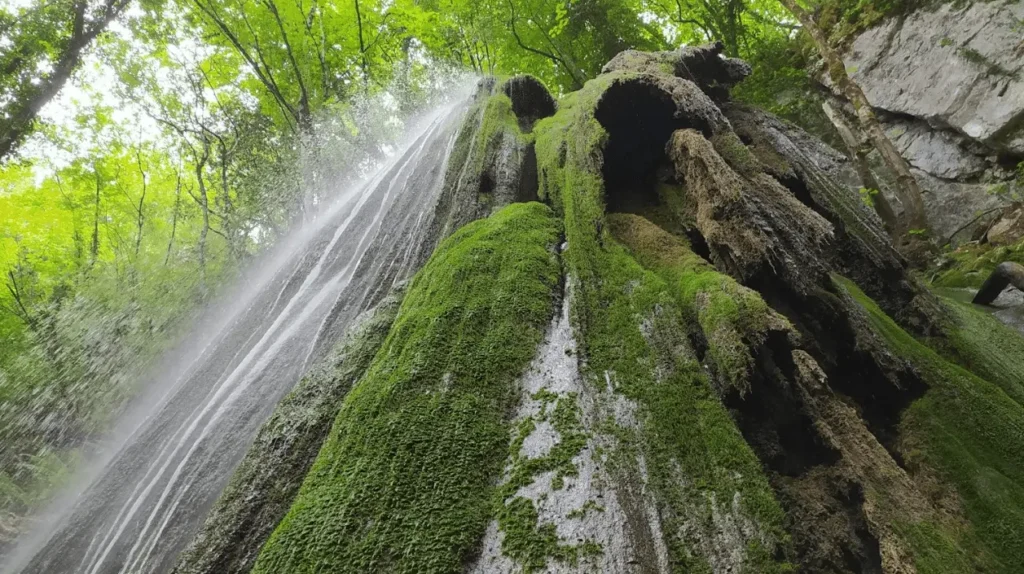
Don‘t miss
After about 5 km from the start of the STAGE you will come across the Sturo della Piscia waterfall, a drop of water of more than 15 meters that creates an evocative environment of reflections, humidity and changing colors. At Piaggiasecca we pass through a small open-air museum dedicated to rural civilization, with alleys animated by ancient work tools that tell the memory of the place.
Around the 15th km you reach the Abbey of San Cassiano, a Benedictine complex founded between the 11th and 13th centuries, which is striking for its sober stone architecture, essential facade and the crypt, which is cozy and particularly striking.
Once in Fabriano, the medieval historic center is certainly worth a thorough visit. Highlights include the Sturinalto Fountain, the Cathedral of San Venanzio, the Pinacoteca Civica and the Oratorio della Carità.
Information
FABRIANO
Punto IAT
Piazza del Comune 38
Tel: 0732-70.94.24
Mail: iat.fabriano@regione.marche.it
Site: visitfabriano.it
ROSSA GOLA E FRASASSI NATURAL PARK
Site: www.parcogolarossa.it
STAGE 06: FABRIANO - POGGIO SAN ROMUALDO
Departure: Fabriano
Arrival: Poggio San Romualdo
Distance: 24.2 km
Height difference: +1148 m / – 532 m
This is one of the most challenging STAGES of the Cammino, both in terms of distance and elevation gain, which is mainly concentrated in the second part of the route. Leaving behind the gentler landscapes around Fabriano, the path crosses countryside and gravel roads until it reaches Cerreto d’Esi and Albacina, two towns that can provide a convenient intermediate stop and also offer an opportunity for a visit.
From here begins the toughest climb of the entire Cammino dei Cappuccini, an ascent that takes place in the silence of the forest and gradually leads to the more intimate and severe environment of the mountain. Among shady paths and glimpses that open up more and more to the surrounding landscape, we come to the Hermitage of Santa Maria dell’Acquarella, a place of quiet and recollection. The last part requires perseverance and steady pace, but accompanies finally to the high meadows and the arrival at Poggio San Romualdo.
To know before leaving
Since STAGES 4, 5 and 6 are particularly demanding, the pilgrim may consider, on this day, stopping in one of the intermediate centers, such as Cerreto d’Esi, after about 10 km, or Albacina, after about 12 km. This choice allows the pilgrim to recover energy and devote more time, in the morning, to visiting Fabriano and the atmosphere of the small villages crossed.
Alternatively, you can reach Cerreto d’Esi directly by train from Fabriano and depart from there. Once you arrive in Poggio San Romualdo, it is important to have checked in advance the availability of an overnight stay at one of the facilities in the area.
Don’t miss
Cerreto d’Esi retains an important medieval layout, with the castle, the characteristic sloping cylindrical tower and the Torrione dell’Agostino, set in a fabric of historic alleys and churches that hold important works of art, such as the Collegiate Church of Santa Maria della Piazza with a crucifix by Fra Paolo da Chioggia.
Albacina, which boasts Roman and medieval origins, also preserves castle ruins and significant places of worship, including the churches of San Venanzo and Santa Maria della Piazza, linked to local devotion and the religious history of the area.
The Hermitage of Santa Maria dell’Acquarella, nestled in the woods, is one of the most evocative places of the STAGE and is closely connected to the origins of the Capuchin experience. Finally, Poggio San Romualdo, located on the hill of the same name, preserves traces of the castle and recalls the memory of St. Romuald, founder of the Abbey of San Salvatore. It is a place of peace, silence and wide views, also popular as a summer vacation destination.
Information
CERRETO D’ESI
IAT Point
Piazza Lippera 4
Tel: 0732-67.90.00
Site: www.visitcerretodesi.it
ROSSA GOLA E FRASASSI NATURAL PARK
Site: www.parcogolarossa.it
STAGE 07: POGGIO SAN ROMUALDO - CUPRAMONTANA
Departure: Poggio San Romualdo
Arrival: Cupramontana
Distance: 24.9 km
Height difference: +787 m / – 1218 m
This is a long, challenging and one of the most meaningful STAGES of the entire Cammino. From Poggio San Romualdo we descend to the Abbey of Valdicastro, a place deeply linked to the figure of Saint Romuald and immersed in a quiet and collected natural setting. The route then continues through woods, ancient mule tracks and scenic stretches until it reaches the splendid Romanesque Abbey of Sant’Urbano, which is an ideal spot for a break.
In the last part, the path crosses fields and hills in the direction of Cupramontana, encountering along the way the ancient hermitages of the White Friars and the Black Friars, evidence of a secluded, essential spirituality deeply rooted in the territory. It is a STAGE that requires energy, attention and a good pace, but one that returns much in terms of beauty, history and opportunities for recollection.
To know before you leave
There are no refreshment stations along this STAGE, so it is necessary to leave with an adequate supply of food. If open at departure time, it may be helpful to stock up at the small refreshment bar located at the back of Valdicastro Abbey.
Within the grounds of the abbey, special care should be taken, as the signage may be inconspicuous, especially near the pond. In this section, it is best to follow the guidebook carefully and, when possible, also rely on GPX tracks or the Walk+ App.
Don’t miss
This is probably the most abbey- and hermitage-filled STAGE of the entire walk. Shortly after the start, you will encounter the Abbey of Valdicastro, a place of great spiritual and historical charm, closely linked to St. Romuald, who lived here for a long time and died in 1027.
Around the 13th km you reach the Abbey of Sant’Urbano, an excellent stopping point thanks to the presence of water and toilets. It is an ideal place to stop and eat and visit one of the most beautiful Romanesque remains in the area, dating back to the 10th-11th centuries and normally open to visitors.
Toward the end of the trail, nestled in the woods, we come to the Hermitage of the White Friars, an ancient 11th-century complex carved into the rock, inhabited over time by monks, fraticelli and Camaldolese. It was here that important steps in the birth of the Capuchin Order also matured. Just beyond is the Hermitage of the Black Friars, linked instead to the presence of the Observant Franciscans and custodian of the body of Blessed Giovanni Righi, an exemplary figure of hermitic life and penance.
Information
ABBEY OF VALDICASTRO
Loc. Valdicastro, 31
Tel: 328-15.10.039
Site: valdicastro.it
ABBEY OF SANT’URBANO
Contrada Sant’Urbano 3, Apiro
Site: vallesanclemente.it
CUPRAMONTANA
IAT Point
Via Leopardi 1
Tel: 0731-78.01.99
Site: www.turismocupramontana.com
STAGE 08: CUPRAMONTANA - CINGOLI
Departure: Cupramontana
Arrival: Cingoli
Distance: 21.6 km
Height difference: +694 m/ – 567 m
This is a medium-difficulty STAGE, made more challenging especially by some climbs concentrated in the second part, to be tackled at an even pace and without haste. The route winds through an open and scenic landscape, among cultivated fields and harmonious hills, offering two possible places to stop along the way. The first is Apiro, where it is possible to refuel, stop for food or even stay overnight. A little further on, however, is Lake Cingoli, an ideal destination for a regenerating break surrounded by nature.
From here, the route continues along paved roads and paths through the undergrowth until it reaches Cingoli, known as the “Balcony of Le Marche” for the breadth of the panorama that opens up from its town center, between sea, hills and mountain ranges. It is a varied and pleasant STAGE, capable of alternating nature, small towns and wide views, accompanying the pilgrim on a relaxed walk rich in glimpses.
To know before you leave
It is useful to budget some extra time to visit Apiro and take a relaxing break near Lake Cingoli. Since Cingoli is a tourist resort, especially during the busiest times it is worth booking overnight accommodations in advance.
Don’t miss
Along this STAGE you will encounter places of considerable historical, artistic and scenic interest. Shortly after leaving Cupramontana you reach the Abbey of the Blessed Angelo, founded by the Camaldolese, which preserves the body of the martyred monk Angelo da Massaccio and a particularly impressive cloister.
In Apiro, the Collegiate Church of Sant’Urbano, with its 18th-century organ, the Palazzo Comunale, which houses a triptych by Allegretto Nuzzi, and the Teatro Mestica, home of the Terranostra international folklore festival, are worth a visit.
Once in Cingoli, it is worth visiting the Cathedral of Santa Maria Assunta, the Church of San Esuperanzio and the Church of San Filippo, among the main sights in the historic center.
Information
APIRO
Pro Loco
Piazza Baldini 11
Tel: 333-12.15.710
Mail: proloco.apiro@libero.it
Site: tourism.comune.apiro.mc.it – www.festivalterranostra.it
CINGOLI
IAT Point
Via Ferri 17
Tel: 733-60.24.44
Mail: iat.cingoli@regione.marche.it
STAGE 09: CINGOLI - SAN SEVERINO MARCHE
Departure: Cingoli
Arrival: San Severino marche
Distance: 28.3 km
Height difference: +820 m/ – 1221 m
The ninth STAGE is the longest of the entire Camino and therefore requires steady pace, good energy management and a few well-distributed stops along the way. However, the fatigue is compensated by very open landscapes and sweeping views. The walk alternates between white roads, stretches in the woods, climbs and descents until it reaches the Cristo delle Marche, a particularly scenic point from which the view sweeps from the Adriatic to the hinterland.
From here the route descends to the Hermitage of Sant’Angelo, a place deeply linked to the origins of the Capuchin Order. The route then continues skirting the slopes of Monte Acuto to San Lorenzo di Treia, which is an excellent intermediate point for a break or to break up the stage. Next, it crosses a stretch of forest that leads to the picturesque Hill of the Cherry Trees, from which there are sweeping views toward the Sibillini Mountains. Among small shrines, rural hamlets and gentle ups and downs, the path finally accompanies you to San Severino Marche.
To know before you leave
Given the length of the STAGE, it may be a good choice to split it into two days, stopping after about 13 km in San Lorenzo di Treia or, after about 19 km, at one of the farmhouses in the Hill of the Cherries, in a particularly scenic location towards the Sibillini Mountains.
Those who choose to stay overnight in the convents or monasteries of San Severino Marche should keep in mind that, once you arrive in Piazza del Popolo, you still have to tackle about 1 additional km uphill, as these facilities are all located in the upper and older part of town.
Breaking up the STAGE in San Lorenzo di Treia also allows more time, at the start, to visit Cingoli and to reach San Severino Marche the following day with greater peace of mind, thus being able to better appreciate the city’s historical and artistic heritage.
Don’t miss
On the southern slope of Monte Sant’Angelo is a very ancient cave dedicated to St. Michael the Archangel, next to which the hermitage of the same name was later built. In this place, between 1525 and 1526, the first Capuchins initiated an experience of reformed life that would later lead to the very birth of the Order.
San Severino Marche is a town of great historical and artistic significance. Among the places not to be missed is the splendid Piazza del Popolo, oval-shaped and remarkably elegant, along with MARec, the Museum of Recovered Art, which houses works saved after the 2016 earthquake. The medieval core with the Castle Tower, the Sanctuary of the Madonna dei Lumi, the San Domenico complex and the Church of San Lorenzo in Doliolo also deserve attention. Also just outside the city is the Capuchin Convent of Colpersito, a place linked to the memory of St. Francis.
Information
TREIA
Pro Loco
Tel: 0733-21.87.78
Mail: prolocotreia.iat@comune.treia.mc.it
Site: www.comune.treia.mc.it
SAN SEVERINO MARCHE
Pro Loco
Piazza del Popolo 43
Tel: 0733-63.84.14
Mail: proloco.ssm@gmail.com
Site: turismosanseverinomarche.it
STAGE 10: SAN SEVERINO MARCHE - CAMERINO
Departure: San Severino Marche
Arrival: Camerino
Distance: 17 km
Height difference: +685 m/ – 299 m
This is a short STAGE with no particular difficulty, to be experienced at a leisurely pace and with time to indulge in stops along the way. From the Convent of Colpersito one descends into the wild Valle dei Grilli, where one encounters caves and the Hermitage of Sant’Eustachio, a place with a strong and intimate charm.
Next, the path climbs back up to the Manfrica refuge, an excellent spot for a break and to refuel with water, and then continues amid wide-open vistas that gradually accompany towards Camerino. The last stretch finally leads to the Convent of Renacavata, the first Capuchin monastery in history and the true spiritual heart of the Cammino, a place that naturally invites meditation and rest.
To know before you start
There are no refreshment stations along the route. Since the reception at the Convent of Renacavata opens only after 3 p.m., it may be worth considering the variant that passes through the hamlet of Crispiero, where it is possible to stop for lunch and refuel.
It is important to notify the friars in advance for an overnight stay, because at certain times, due to community commitments, hospitality may not be available. In this case it will be necessary to continue beyond Camerino for about 2 km, where other accommodations can be found.
Don‘t miss
The Hermitage of St. Eustace in Domora, an ancient 11th-century Benedictine settlement in the Valle dei Grilli, is a place linked to the ancient hospitality of wayfarers. Although it is in a dilapidated condition today, it still retains a remarkable charm and a strong suggestion.
Renacavata Convent, dating back to the 16th century, is the first Capuchin convent in the world and is the symbolic center of the entire Cammino dei Cappuccini. Inside you can visit the church, the ancient cells, the museum and the forest with the friars’ caves.
Camerino is also worth a visit. A university town still scarred by the path of reconstruction following the 2016 earthquake, it retains places of great interest such as the Basilica of San Venanzio, the Civic-Diocesan Museum and the Botanical Garden.
Information
CAMERINO
Tourist Information Pro Camerino
Via Madonna delle Carceri (Sottocorte Village)
Tel: 0737-63.25.34 / 345-88.55.294
Site: www.proloco.camerino.sinp.net
tourism.comune.camerino.mc.it
STAGE 11: CAMERINO - SAN LORENZO AL LAGO
Departure: Camerino
Arrival: San Lorenzo al Lago
Distance: 23.5 km
Height difference: +786 m/ – 750 m
From the quiet of Renacavata the path descends into the undergrowth and continues through fields, scattered houses and alternating stretches of dirt and asphalt, skirting Rocca Varano until it reaches the valley floor. In the locality of La Sfercia, a water source is encountered, a useful reference point before continuing to San Maroto, where there is the splendid Church of San Giusto and a pleasant scenic rest stop.
The route then continues on unpaved roads in the direction of Villarella, to descend again into the valley and climb back up to Colli and Bolognesi, hamlets deeply scarred by the 2016 earthquake. Leaving the woods, the path gradually descends toward Fiastra and finally reaches San Lorenzo al Lago, where the STAGE ends near the lake area in a wide, relaxing landscape of great natural beauty.
To know before you leave
The only refreshment point along the route is located after about 8 km, at La Sfercia locality, at the Frinconi cafeteria-oven, which can be contacted at 389-53.98.130.
Those who wish to break up the STAGE may consider a short detour before San Maroto to reach Lake Polverina, where around the 12th km there are some accommodations. Alternatively, one can continue to the Fonte Rosa farmhouse, near Collevecchio, at about the 15th km, with a slight deviation from the main route.
The Church of San Giusto in San Maroto, which is of special interest, is generally closed. In order to visit it, it is necessary to contact 339-89.90.553 in advance.
In case of bad weather, once you pass Villarella and reach SP 58, it is best to continue along the paved road, avoiding the paths in the underbrush that can become slippery.
San Lorenzo al Lago is a tourist resort, and in July and August it is best to make reservations well in advance, as availability can sell out quickly. Swimming in the lake is also possible in the summer season.
Don’t miss
At the end of the first descent is the ancient stronghold of the Da Varano family, built in the 13th century on a rocky outcrop and still able to dominate the surrounding landscape.
Around mile 11 you reach the extraordinary Romanesque Church of San Giusto, dating from the 12th century and featuring a rare circular plan with a dome. Inside it holds 14th- and 15th-century frescoes, wooden works and panels of great interest, including Our Lady of the Rosary.
Once you arrive at your destination, the abbey church of San Lorenzo, dating back to the 11th-12th centuries, is also worth a visit, preserving some of the oldest Romanesque frescoes in the Marche region.
Information
VALFORNACE
Municipality
Vittorio Veneto Square, 90
Tel: 0737-44.126
Mail: info@lagopolverina.it
Site: www.ilcuoredellemarche.com
POLVERINA LAKE
Site: lagopolverina.it
FIASTRA
Municipality
Via Roma, 1
Tel: 0737-52.112
Mail: info@comune.fiastra.mc.it
Site: www.lagodifiastra.it
www.ilcuoredellemarche.com
SIBILLINI NATIONAL PARK
Site: www.sibillini.net
STAGE 12: SAN LORENZO AL LAGO - SARNANO
Departure: San Lorenzo al Lago
Arrival: Sarnano
Distance: 17.5 km
Height difference: +739 m/ – 878 m
STAGE 12, while not particularly long, leads into the heart of the Monti Sibillini National Park and provides an intense experience, immersed in a mountain landscape that changes face with the changing seasons. The path rises from the very first steps and continues uphill for about 8 km, among mule tracks and grassy paths, skirting the Madonna del Sasso until it reaches the highest point of the entire Cammino, at an elevation of 1,298 meters. Here a panoramic cross marks a visually open place, from which the gaze can sweep over the Sibillini Mountains and much of the Marche region.
From this high-altitude section, the trail continues through meadows and forests, crossing particularly picturesque environments, especially in spring when the route is enriched with blooms. Along the way there are also some water points, which, however, are not always active in the summer months. The long descent then accompanies to the Hermitage of Soffiano, which can be reached with a short detour, before the last, smoother part of the STAGE alternates between dirt and asphalt until the arrival in Sarnano. The entrance to the village is through its uphill streets, closing a challenging but dense day of walking with nature, silence and beauty.
To know before you leave
In case of bad weather, once you reach the highest point of the Cammino it is advisable to continue toward Sarnano following the paved road, thus avoiding sections in the undergrowth that can become slippery and less safe.
There are no refreshment stations along the STAGE, and in the summer months some sources may be closed to limit water consumption. Therefore, it is important to leave with a good supply of both food and water.
Sarnano is a busy tourist resort, so it pays to book overnight stays in advance, especially in July and August and during the busiest periods.
Don’t miss
Sarnano is listed among Italy’s Most Beautiful Villages and preserves a charming medieval historic center, built of brick and organized in concentric circles around Piazza Alta. This space is overlooked by historic civic buildings and the Romanesque Church of Santa Maria di Piazza, which houses important fresco cycles.
The former Convent of St. Clare now houses the Civic Museums and Art Gallery, where works of considerable value are preserved. Also of special interest are the Church and former Convent of St. Francis, now home to the library and archives, which collect valuable ancient codices.
Information
SARNANO
IAT Point
Borgo Giuseppe Garibaldi, 88
Tel: 0733-65.71.44
Mail: iat.sarnano@regione.marche.it
Site: www.sarnanoturismo.it
www.ilcuoredellemarche.com
MONTI SIBILLINI NATIONAL PARK
Site: www.sibillini.net
STAGE 13: SARNANO - MONTEFORTINO
Departure: Sarnano
Arrival: Montefortino
Distance: 24.1 km
Height difference: +976 m/ – 899 m
This is the last mountain STAGE of the Camino and takes place entirely within the Monti Sibillini National Park. Leaving Sarnano, the route follows the Tennacola stream and accompanies the pilgrim along the picturesque Via delle Cascate Perdute (Route of the Lost Waterfalls), among waterfalls and cool, shady vistas. The path alternates between paved roads, sharp climbs and undergrowth paths, ascending first to the hamlet of Garulla Inferiore and then further up to the Campolungo plateaus, where a pleasant resting place provides very wide and spectacular views.
From here the route bends downhill toward the Sanctuary of the Madonna dell’Ambro and, after a possible pause for meditation in one of the most evocative Marian places in the area, continues with a final flat stretch of about five kilometers to Montefortino.
Need to know before leaving
Those who wish to do so can split the STAGE into two days, stopping at Garulla, where the refuge of the same name and an agritourism are located, both of which are valid as intermediate overnight points.
In case of bad weather, alternative routes at lower elevation can be chosen once Garulla is reached to safely reach Montefortino or Amandola.
On weekdays at the Shrine of Our Lady of Ambro, Mass is celebrated at 4:00 pm. On holidays, however, the times are 09:30, 11:00, 12:15, 16:00 and 17:00.
Those who wish to extend the walk, or who do not find availability to sleep in Montefortino, may consider stopping in Amandola, but put about 6 additional km into account. It should be remembered, in any case, that even in its standard version this STAGE already remains quite demanding.
Don’t miss
The Sanctuary of the Madonna dell’Ambro, second in importance in the Marche region only to Loreto, is one of the most significant places in the area. It stands in a recollected position in the valley of the Ambro stream and is often referred to as the “little Lourdes of the Sibillini,” because of its strong devotional appeal and peaceful atmosphere.
Montefortino, a small fortified mountain village, retains several places of interest. These include the Romanesque-Gothic style Church of San Francesco, or Santa Maria del Girone, the Palazzo Leopardi with the Fortunato Duranti Picture Gallery, the Sibillini Wildlife Museum and the Museum of Sacred Art, which houses works by De Magistris, Malpiedi and Perugino.
Information
SANCTUARY OF THE MADONNA OF AMBRO
Loc. Ambro – Montefortino
Tel: 339-19.90.303
Site: www.madonnadellambro.it
MONTEFORTINO
Info Point
Via Roma 21
Tel: 0736-85.91.01
Mail: info@comune.montefortino.fm.it
MONTI SIBILLINI NATIONAL PARK
Site: www.sibillini.net
STAGE 14: MONTEFORTINO - MONTEFALCONE APPENNINO
Departure: Montefortino
Arrival: Montefalcone Appennino
Distance: 24.1 km
Height difference: +806 m/ – 633 m
For the first few kilometers, up to Amandola, which is reached about 6 km after Montefortino, the path develops mainly within wooded stretches. Subsequently, the landscape opens up into a gentler and more relaxed hilly setting, which accompanies the pilgrim as far as the Lake of San Ruffino, around the 12th kilometer, a particularly pleasant place suitable for a regenerating stop. A little further on one encounters the striking Romanesque Abbey of Saints Ruffino and Vitale, after which a long climb on country roads towards Smerillo begins.
Here the famous “Fessa,” a spectacular fissure in the sandstone rock, within which very ancient fossils can be observed, is certainly worth a visit. The last part of the STAGE finally leads to Montefalcone Appennino, a natural balcony from which there are very wide views towards both the Sibillini mountain range and the Adriatic side.
Need to know before leaving
The STAGE offers two good stopping points along the way. The first is in Amandola, after about 6 km, while the second is Lake San Ruffino, reached around the 12th km mark.
Once at the lake, it is good to consider that the second part of the day involves about 6 km of climbing to reach Smerillo. For this reason, it is important to set off with an adequate supply of water, as no other sources are encountered along the ascent until you arrive at altitude.
Once you reach the top, you can choose between two options: the easier route on asphalt or the nature trail, which is more challenging but also decidedly more evocative, winding through forests and ridges until you reach Montefalcone Appennino.
Don’t miss
Amandola’s historic center runs uphill to Piazza Umberto I and preserves places of interest such as the Palazzo del Podestà, the Church of San Francesco, and the La Fenice Theater. In the lower part of the town, however, is the Sanctuary of Blessed Anthony, characterized by a Romanesque-Gothic portal and late Baroque interiors. On the Marrubbione hill also stands the Convent of the Capuchins, from which there is a splendid view of the Sibillini Mountains.
Near the lake is the ancient Romanesque Abbey of Saints Ruffino and Vitale, which houses a crypt, frescoes and impressive underground rooms.
Particularly significant in Montefalcone Appennino is the passage to the Convent of San Giovanni in Selva, today Domus Appennino, the place where in 1525 the escape of Friar Matteo da Bascio occurred, a decisive episode for the birth of the Capuchin Order. The village also preserves the Church of St. Michael the Archangel, Santa Maria delle Scalelle and the Museum of Fossils and Minerals, which houses the famous Polyptych by Pietro Alamanno. To visit the museum, it is necessary to contact the municipality at 0734-79.136 or the Pro Loco at 0734-78.60.25.
Information
AMANDOLA
IAT Point
Piazza Risorgimento 17
Tel: 0736-84.07.31
Mail: turismo.amandola@gmail.com
Site: amandola.info
SMERILLO
Site: vivismerillo.it
MONTEFALCONE APPENNINE
Site: www.comune.montefalconeappennino.fm.it
MONTI SIBILLINI NATIONAL PARK
Site: www.sibillini.net
STAGE 15: MONTEFALCONE APPENNINO - ROTELLA
Departure: Montefalcone Appennino
Arrival: Rotella
Distance: 21.5 km
Height difference: +454 m/ – 832 m
From Montefalcone Appennino the path descends along the Medieval Trail, between ancient paving stones and sections in the woods, until it reaches the valley floor and the bridge over the Aso River. From here begins a long climb to Force, on paved and gravel roads, with steady inclines that require steady pace and good energy management.
Force represents a very pleasant stopping point, both for the value of its historic center and for the views that open up to the sea. Past the halfway point of the STAGE, the route continues in a more relaxed manner on wide, almost flat tracks, among manicured countryside and beautiful views ranging from the Sibillini Mountains to Mount Ascension. The last part is on a paved road and accompanies a gradual descent to Rotella.
To know before you leave
Force, which is encountered after about 9 km, is a good spot for a restorative break and can also be a convenient way to break the STAGE into two days.
Rotella is a small town and has a limited number of beds, so it is advisable to book overnight accommodations in advance. Those who would prefer to stop in Capradosso instead of Rotella should consider about 3 additional uphill kilometers, but these allow them to lighten the next STAGE.
In case of rain or high grass, crossing the fields between Rotella and Capradosso can be difficult. In this situation, once you reach the dirt road after the solar panels, it is preferable to take the paved road after about 200 meters to the right and climb from there to Capradosso.
Don’t miss
In the historic center of Force, the Collegiate Church of St. Paul with its miraculous Crucifix, the Priory Palace, the Church of St. Francis, rebuilt by Giuseppe Sacconi, and Piazza Vittorio Emanuele II with the Town Hall and civic tower deserve attention. The town also holds the birthplace of Blessed Assunta Pallotta, the Museum of Sacred Art, and the Museum of Copperworking, linked to a craft tradition still remembered with the summer event “Antichi Sapori per le vie del Borgo.”
Particularly impressive is the large permanent artistic nativity scene set up in the caves below the monumental Church of St. Francis. It can be visited throughout the year by contacting Massimo in advance at 339-48.01.506 or Fernando at 338-99.09.374.
In Rotella, the Clock Tower, the Nature Museum, and the Collegiate Church of Saints Mary and Lawrence and Saint Viviana, with the adjoining Museum of Sacred Art, rich in reliquaries and testimonies of great interest, are worth a visit.
Information
FORCE
Municipality of Force
Vittorio Emanuele II Square, 2
Tel: 0736-37.31.32
Mail: segreteria@pec.comune.force.ap.it
Site: www.comune.force.ap.it/it
ROTELLA
Municipality of Rotella
Via Umberto I, 11
Tel: 0736-37.41.22
Site: www.comune.rotella.ap.it/it
STAGE 16: ROTELLA - OFFIDA
Departure: Rotella
Arrival: Offida
Distance: 19.8 km
Height difference: +658 m/ – 722 m
From Rotella the path moves away from the town, immediately entering the countryside and, among paths and open fields, climbs toward Capradosso, a scenic place also linked to the memory of the venerable Friar Marcellino. It then reaches the Sanctuary of Montemisio and, continuing through vineyards and cultivated land, arrives after about 11 km at Castignano, an excellent intermediate point for a stop and a moment of refreshment. It is worth climbing into the historic center and looking out from the square of San Pietro, from which there is a very wide panorama of the surrounding area.
Resuming the path, we enter the badlands area, where white roads and sheep-tracks pass through vineyards and rolling hills, with some possible variations useful in case of rain. The STAGE, always open and scenic, finally leads toward Offida. Here the view of Santa Maria della Rocca accompanies the pilgrim’s last steps to the splendid Piazza del Popolo and then to the Convento dei Cappuccini, a place of quiet and welcome.
Need to know before leaving
In case of rain or high grass, crossing the fields in the stretch from Rotella up to Capradosso may be inconvenient or difficult. In this situation, once you reach the dirt road after the solar panels, it is best to detour: after about 200 meters it is advisable to turn right onto the paved road and continue from there directly toward Capradosso.
Those who prefer to tackle the STAGE at a more leisurely pace may choose to stop and stay overnight in Castignano, after about 11 km, taking advantage of both the village’s beauty and the hospitality of the place.
In the second part of the trail, the path crosses farmland at several points. In case of bad weather, or simply to lighten the trail, you can continue along SP 17 and return to the main route later. In this case it is important to follow the guide carefully and refer to the GPX tracks.
It should also be kept in mind that there are no water points between Castignano and Offida, except for the possible availability of private houses or farmers along the way. It is therefore advisable to depart well supplied. Arriving in Offida a little early allows you to devote the time it deserves, given the historic and artistic value of the village.
Don’t miss
Shortly after Capradosso is the Sanctuary of Montemisio, dedicated to Our Lady of Consolation, a pilgrimage destination linked to the tradition of the miracle of rain. Also in its vicinity is a large centuries-old oak tree, by which Friar Marcellino da Capradosso used to retire in prayer.
Halfway through the STAGE we reach Castignano, a village with a medieval layout that preserves the Templar Church of Santa Maria del Borgo and an interesting museum heritage.
Offida represents one of the most significant places on the entire final stretch of the Camino. Dominated by the Church of Santa Maria della Rocca, with its fascinating frescoed crypts, it guards the splendid Piazza del Popolo in the heart of the historic center. Surrounding it are important cultural sites, such as the Serpente Aureo Theater, and sites of strong devotion, such as the Church of St. Augustine, which preserves the relics of the Eucharistic miracle, and the Shrine of Blessed Bernard, particularly dear to the Offidian community.
Information
CASTIGNANO
Pro Loco
Via Borgo Garibaldi 4
Tel: 0736-82.20.60 / 339-83.70.941
Mail: prolococastignano@gmail.com
OFFIDA
Information Center
Corso Serpente Aureo 66
Tel: 0736-88.87.06
Mail: turismo@comune.offida.ap.it
Site: www.turismoffida.com
STAGE 17: OFFIDA - ASCOLI PICENO
Departure: Offida
Arrival: Ascoli Piceno
Distance: 26.2 km
Height difference: +734 m/ – 898 m
The last STAGE of the Cammino connects two Capuchin shrines and accompanies the pilgrim from the Sanctuary of Blessed Bernard to that of San Serafino. Leaving Offida, the route opens into the countryside, among vineyards and olive groves, until it reaches the characteristic badlands that mark this stretch of land and introduce the arrival at Appignano del Tronto. After about 10 km, the town makes a good spot for a refreshment stop or, for those who need it, a possible intermediate stage.
From here, the path resumes with a series of ups and downs that lead progressively to higher altitudes, up to the wide views of Gallo Peak. The last part is a long descent toward Ascoli Piceno, which allows one to enter the heart of the city by crossing some of its most beautiful streets, until reaching Piazza del Popolo and finally the Sanctuary of San Serafino, the Cammino’s final destination.
To know before you leave
This is a long and challenging STAGE. Those who prefer to lighten it can choose to split it into two days, stopping in Appignano del Tronto.
It is important to manage water well and leave already well supplied, because the only safe source along the route is right in Appignano, after about 10 km. From there on, no other water points are encountered, except for the possible availability of private houses or farmers along the way.
Once they arrive at the Shrine of St. Seraphim, the final destination of the Camino, pilgrims are welcomed by the friars and can signal their presence at the Pilgrim’s Mass, celebrated every afternoon at 6:15 pm. At the end of the celebration, a special blessing is given, symbolically marking the conclusion of the walk.
Don’t miss
In Appignano del Tronto, the Church of St. John the Baptist, a Romanesque-Gothic building dating from the 14th-16th centuries, which houses a valuable painting by Simone de Magistris and a 15th-century Pietà, and the Church of St. Michael the Archangel, a Romanesque structure, are worth attention. Just outside the center is also Santa Maria del Piano Santo, which preserves an important medieval fresco cycle.
Ascoli Piceno, known as the city of travertine, welcomes the pilgrim with a historical and artistic heritage of great value. Highlights include Piazza del Popolo, one of the most harmonious squares in Italy, framed by the Palazzo dei Capitani del Popolo and the Gothic-Romanesque Church of San Francesco. Also worth a visit are Piazza Arringo, the Cathedral of Sant’Emidio and the Baptistery, central sites in the city’s religious and civic history.
The journey ends at the Shrine of St. Seraphim of Montegranaro, an important Capuchin place of worship that holds the remains of the Marche saint, an exemplary figure of humility and devotion. The church and convent also preserve Augusto Mussini’s frescoes dedicated to the life of St. Seraphim, which add to the spiritual dimension of the arrival.
Information
APPIGNANO DEL TRONTO
Municipality
Via Roma 98
Tel: 0736-81.77.01
Mail: info@comune.appignanodeltronto.ap.it
Site: comune.appignanodeltronto.ap.it
ASCOLI PICENO
Tourist Reception Office
Piazza Arringo 7
Tel: 0736-29.83.34
Mail: serv.turismo@comune.ascolipiceno.it
Site: comune.ap.it/informazioni-turistiche

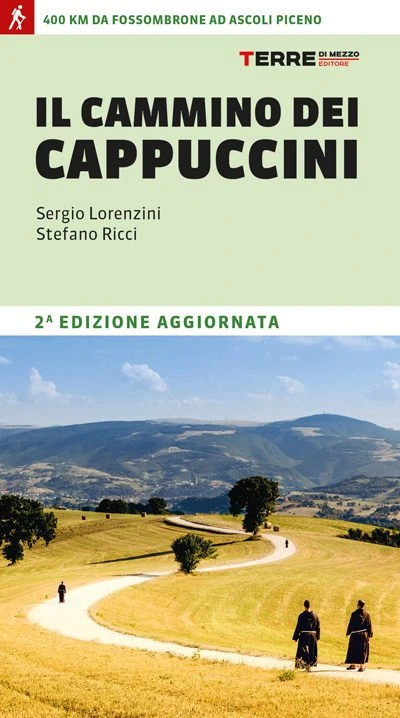
GUIDE TO THE CAMMINO DEI CAPPUCCINI
400 km from Fossombrone to Ascoli Piceno
The history of the Capuchins began as a revolutionary movement, the result of a desire to return to the essence of Franciscanism. At first it was opposed by the Order itself, and is marked by arrests, escapes, solitary refuges and a deep inner quest. Five centuries later, this journey can be relived in 17 STAGES, passing through rolling hills, ancient hermitages and cities of art, along the ridge of the Marche hinterland. A path that, step by step, makes one experience the sincere welcome of a community.
Between parks, nature reserves and the peaks of the Sibillini Mountains, history, culture and spirituality are interwoven, with the possibility of sharing a stretch of the road with today’s friars and experiencing their hospitality by spending one or more nights in the convents along the route.
The guide gathers all the necessary information: maps, elevations, hospitality and the places not to be missed.
Find out all the details of the Cammino dei Cappuccini!

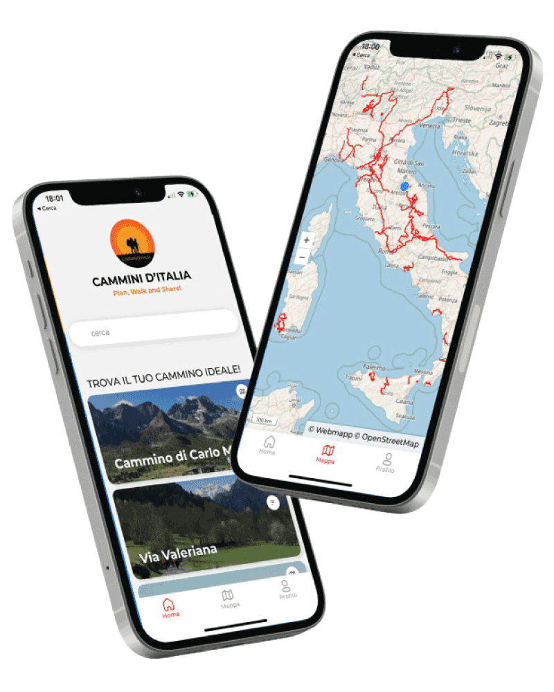
Discover our app!
With the free Cammini d’Italia app, you can plan and walk the Cammino dei Cappuccini in total safety, being able to plan the STAGES in detail and walk the route thanks to the integrated GPS technology that supports your orientation during your adventure.
Within the app you will find many other paths present in Italy. Thanks to the georeferenced tracks of many routes you will be able to study the itinerary that suits you best and also download the GPX tracks of the individual STAGEs offline.
The app also includes a complete digital map of all the paths surveyed to date on our portal, giving you a wide range of choices among the many paths in the Belpaese.
Cammini d’Italia is the perfect app for those who want to explore the beauty of Italy on foot, discovering hidden places surrounded by nature. Download it for free today and start planning your next adventure!
⠀
⠀
 ⠀⠀⠀
⠀⠀⠀