La Via delle Sorelle
Two Sisters, two cities, best known for their businesses and industries. But a path connecting them shows a new face made of nature, history, art and crafts. 130 kilometers, 6 STAGE, bidirectional, linking Brescia to Bergamo: La Via delle Sorelle
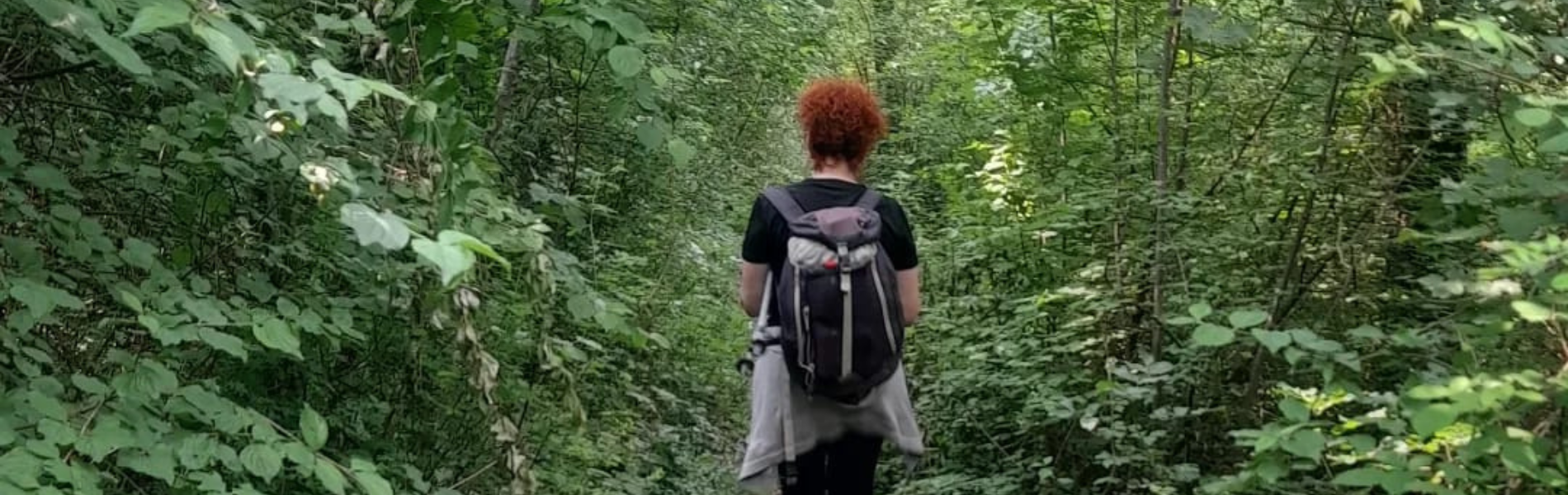
The walk, which is largely on the hilly part of the two provinces, aims to be a green artery to discover lesser-known places, ancient routes and itineraries, traditions and products of the territories, with Art at the center. A path of nature and culture, with as little as possible asphalt, showing a new face of the two cities and its provinces.
An open-air creative worksite between two cities: the La Via delle Sorelle is also this by hosting works of art along the Stages. The works are of a permanent nature; reachable only on foot; related by materials or themes to the natural, historical, social and cultural identity of the territory crossed by the Way; bearers of the values of beauty, solidarity, sustainability, ecology and sharing; able to dialogue harmoniously with the landscape in which they are installed; and be of low or zero environmental impact.
HISTORY
HOW WAS BORN LA VIA DELLE SORELLE?
Brescia and Bergamo are similar cities with different identities and unique peculiarities. Known for the human stubbornness, labor, and businesses that have made them famous but also condemned to a collective imagination linked only to industrialization and the resulting environmental consequences, they represent much more and boast provinces of often unknown beauty.
United and in solidarity, also having lived through the health emergency that sadly saw them as protagonists, the two cities have been reborn even more united as Capital of Culture 2023. An inspiration for this idea: a slow path, among nature and places to be discovered, an artery of other existing paths. A slow and sustainable legacy for all. “La Via delle Sorelle” is a project of the Municipalities of Brescia and Bergamo, the Provinces of Brescia and Bergamo, conceived, designed and coordinated by Slow Ride Italy, an Association that was founded in 2017 with the aim of promoting initiatives and projects in tourism, culture, food and wine, and education in a sustainable way.
WATER SOURCES.
The path passes through 36 countries, so water can be found in all the countries crossed by the La Via delle Sorelle.
STAGE-BY-STAGE SERVICES
LA VIA DELLE SORELLE SERVICES
Are there supermarkets? Yes, along all the stages
Are there pharmacies? Yes, along all the stages
SIGNAGE
La Via delle Sorelle has its own signage, present all along the way:
- Vertical and bidirectional signage
- Horizontal signage: blue and red paint
- Stickers
DANGERS
Be careful in some sections when it rains for mud.
ACCESSIBILITY
Depends on the disability. LA VIA DELLE SORELLE was walked by a visually impaired person with a guide dog and companion. It is not wheelchair-accessible because it is almost all on trails except for a few sections.
ROAD BOTTOM.
Dirt road, Nature trail, Trail and road (asphalt less than 30%)
CREDENTIAL
LA VIA DELLE SORELLE CREDENTIAL
La Via delle Sorelle holds the credential, it can be ordered from the site with a 10 euro donation to the Association that manages it.
With the credential you get: discounted rates at facilities, entry into the Sebino Peat Bogs Nature Reserve, and help support the walk.
TENT WALK
Where can one camp?
There are dedicated areas for tent travelers that are located in the accommodations / In tents
Are permits needed? No
CONTACTS
LA VIA DELLE SORELLE CONTACTS
Slow Ride Italy
E- mail: info@laviadellesorelle.it
Web site: www.laviadellesorelle.it
STAGE 01
DIRECTION BRESCIA – BERGAMO
STAGE 01: Brescia – Gussago
Departure: Brescia
Arrival: Gussago
Municipalities crossed: Brescia, Collebeato, Cellatica, Concesio, Gussago
Length: 20.8 km
Difficulty: medium/easy
Elevation gain: 733 m
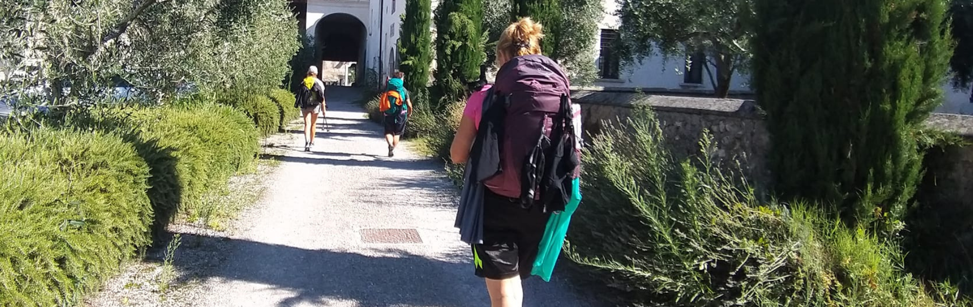
This first STAGE is a journey through Brescia’s history that leads straight to the city’s green lung, Monte Maddalena, and then again inside the enchanting Mompiano Valley, from which we continue to enter the province, passing through the municipalities of Collebeato, Concesio, Cellatica and Gussago. We start from the Capitoline Temple, and then pass through (and well worth a visit) the striking Museum complex of Santa Giulia, a UNESCO World Heritage Site.
DIRECTION BERGAMO – BRESCIA
STAGE 01 – Bergamo – Nembro
Departure: Bergamo
Arrival: Nembro
Municipalities traversed: Bergamo, Ponteranica, Alzano Lombardo, Nembro
Length: 21.4 km
Difficulty on foot: Challenging
Uphill elevation gain: 1215 m
The departure from the ancient UNESCO World Heritage Walls of Bergamo’s Upper City represents only the beginning of a STAGE that never ceases to amaze: it plows through paths, changes landscape and crosses places of other times and other (almost mountainous) altitudes. An immersion in the Regional Park of the Colli di Bergamo, in the Maresana hill, to the small ancient world of Olera, a medieval village in the Lower Seriana Valley. Plus: the ancient Via Mercatorum and its Zuccarello Sanctuary in Nembro. With a STAGE as far as Scanzorosciate, for those who choose to go further.
STAGE 1 VIA TRAVERSA – Bergamo – Scanzorosciate
Municipalities crossed: Bergamo, Ponteranica, Alzano Lombardo, Nembro, Scanzorosciate
From Nembro, continue in the direction of Scanzorosciate, famous for the production of Moscato di Scanzo DOCG. Skirting the Serio River, proceed through the town of Villa di Serio until you reach the village of Scanzo.
STAGE 02
DIRECTION BRESCIA – BERGAMO
STAGE 02: Gussago – Provaglio d’Iseo
Departure: Gussago
Arrival: Provaglio
Locations crossed: Gussago, Rodengo Saiano, Ome, Monticelli Brusati, Iseo, Provaglio d’Iseo
Length: 23.7 km
Difficulty walking: Challenging
Height difference in ascent: 659 m
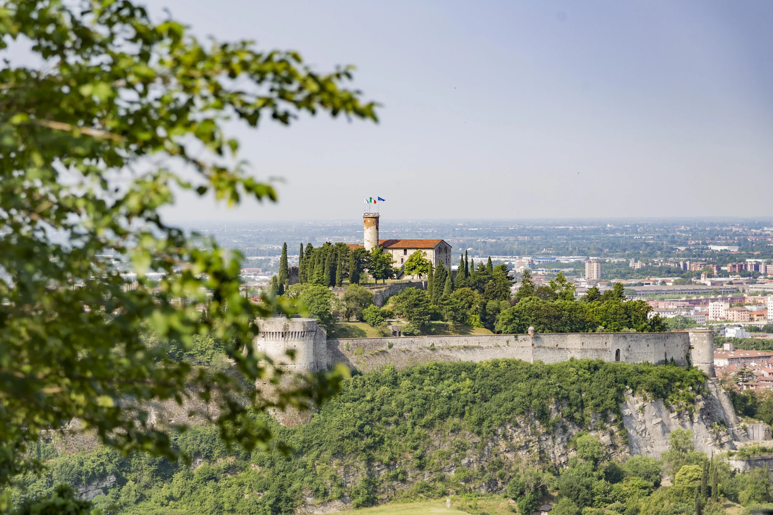
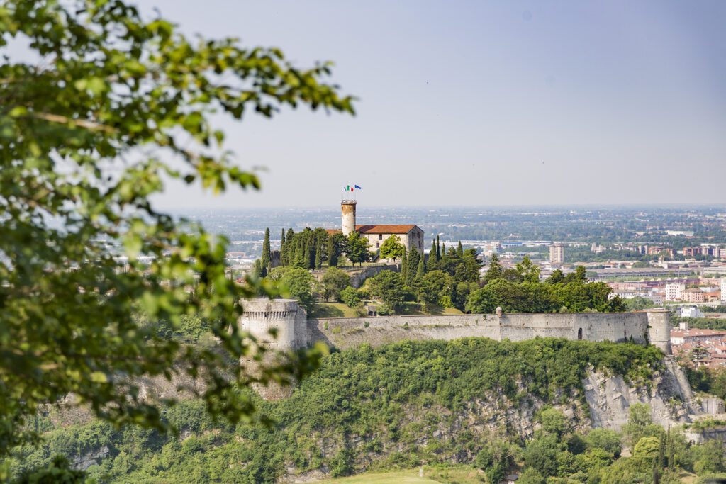
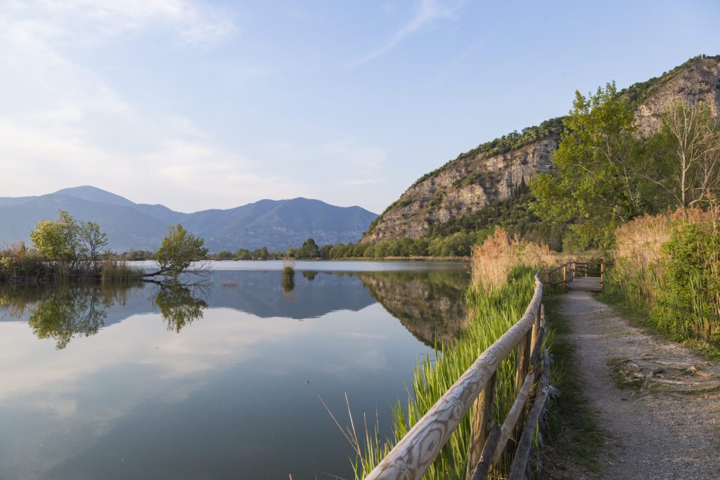
In every walk there is a challenging STAGE that tests legs and mind. This is that of the La Via delle Sorelle: a stage that, after passing through the municipalities of Rodengo Saiano and its historic Abbey, Ome and its Borgo del Maglio, Monticelli and the Sentiero delle Cascate, leads toward the summit of Mount Cognolo to enjoy the most spectacular view of the entire Cammino. From there, the steep descent to Madonna del Corno di Provaglio d’Iseo, a 16th-century church overlooking the Torbiere del Sebino Nature Reserve.
DIRECTION BERGAMO – BRESCIA
STAGE 02: Nembro – Bagnatica
Departure: Nembro
Arrival: Bagnatica
Localities crossed: Nembro, Villa di Serio, Scanzorosciate, Albano Sant Alessandro, Brusaporto, Bagnatica
Length: 17.5 km
Difficulty on foot: Easy
Height difference on ascent: 374 m
STAGE 2 of La Via delle Sorelle features the land of Moscato di Scanzo and its heroic vineyards. A small productive municipality, that of Scanzorosciate, set in a truly picturesque valley. But there is also much more in the surroundings: Mount San Giorgio, the PLIS of the Argon Valleys, the Hermitage of Argon, the small church of San Cristoforo where until the 18th century a relic believed to belong to the Holy Cross was kept, and the woods of Torre de’ Roveri.
STAGE 02: CROSS STREET
Start in the Borgo of Scanzorosciate from where you take CAI trail No. 509 until you reach Villa di Serio where it rejoins the VIA DIRETTA to follow the same route to the final destination of Bagnatica.
STAGE 03
DIRECTION BRESCIA – BERGAMO
STAGE 03: Provaglio d’Iseo – Sarnico
Departure: Provaglio d’Iseo
Arrival: Paratico
Locations traversed: Provaglio d’Iseo, Corte Franca, Adro, Capriolo, Paratico, Sarnico
Length: 19.0 km
Difficulty on foot: Easy
Uphill elevation gain: 375 m
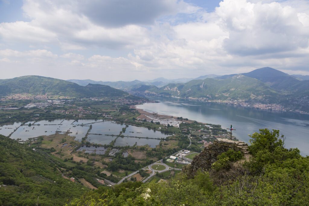
This could be called the water STAGE. Not only because you will be able to listen to the silence as you cross the Torbiere del Sebino, a natural oasis where respect for and protection of living beings is a beautiful duty, but also because, having passed the villages and vineyards of Corte Franca, Adro and Capriolo, waiting for you in Paratico will be the water mirror of the Cammino: Lake Iseo, set between mountains, a natural non-confinement between the two provinces.
DIRECTION BERGAMO – BRESCIA
STAGE 03: Bagnatica – Paratico
Departure: Bagnatica
Arrival: Sarnico
Locations traversed: Bagnatica, Costa di Mezzate, Montello, San Paolo D’Argon, Carobbio degli Angeli, Gorlago, Gandosso, Castelli Calepio, Credaro, Villongo, Sarnico, Paratico
Length: 21.7 km
Difficulty on foot: Medium
Uphill difference: 747 m
STAGE 3 reaches the natural non-boundary between the two provinces, Lake Iseo and the river that feeds it, the Oglio. This is a moderately challenging STAGE because it bypasses two mountains, Monte Castello and Monte Croce. Nature here is wild and sometimes impetuous, but that is also the beauty of a walk.
STAGE 04
DIRECTION BRESCIA – BERGAMO
STAGE 04 – Paratico – Bagnatica
Departure: Sarnico
Arrival: Bagnatica
Locations crossed: Paratico, Sarnico, Villongo, Credaro, Castelli Calepio, Gandosso, Gorlago, Carobbio degli Angeli, San Paolo D’Argon, Montello, Costa di Mezzate, Bagnatica
Length: 21.7 km
Difficulty on foot: Medium
Uphill elevation gain: 810 m
On Stage 4 we leave the province of Brescia and officially enter the province of Bergamo along the banks of the Oglio, the river that gave rise to Lake Iseo. This is a moderately challenging STAGE because it bypasses two mountains, Monte Croce and Monte Castello. Nature here is wild and sometimes impetuous, but that is also the beauty of a walk.
DIRECTION BERGAMO – BRESCIA
STAGE 04 – Sarnico – Provaglio d’Iseo
Departure: Sarnico
Arrival: Provaglio d’Iseo
Locations crossed: Sarnico, Paratico, Capriolo, Adro, Corte Franca, Provaglio d’Iseo
Length: 19.0 km
Difficulty on foot: Easy
Elevation gain on ascent: 389 m
This could be called the water STAGE. Not only because you can listen to the silence as you cross the Sebino Peat Bogs, a natural oasis where respect for and protection of living beings is a beautiful duty, but also because Lake Iseo, an alpine lake nestled between mountains, is the protagonist. Passing through the villages and vineyards of Capriolo, Adro and Cortefranca, the route will lead straight to the final destination of the STAGE: Provaglio d’Iseo.
STAGE 05
DIRECTION BRESCIA – BERGAMO
STAGE 05 VIA DIRECT/TRAVERSA – Bagnatica – Nembro
Departure: Bagnatica
Arrival: Nembro
Places crossed: Bagnatica, Brusaporto, Albano Sant Alessandro, Scanzorosciate, Villa di Serio, Nembro
Length: 17.4 km
Difficulty on foot: Easy
Elevation gain on ascent: 617 m
STAGE 5 features the land of Moscato di Scanzo and its heroic vineyards. A small productive municipality set in a truly picturesque valley. But there is also much more: Mount San Giorgio, the PLIS of the Argon Valleys, the Hermitage of Argon, the small church of San Cristoforo where until the 18th century a relic believed to belong to the Holy Cross was kept, and the woods of Torre de’ Roveri. This STAGE has two directions to choose from: the direct route that leads to the lively town of Nembro, or the side route that leads to the discovery of Scanzorosciate.
STAGE 5 – Via Traversa is the same as that described in STAGE 5 – VIA DIRETTA.
It differs starting from Villa di Serio where it takes CAI trail No. 509 to the small village of Scanzorosciate, home of the famous Moscato di Scanzo, closes the STAGE.
DIRECTION BERGAMO – BRESCIA
STAGE 05 – Provaglio d’Iseo – Gussago
Departure: Provaglio d’Iseo
Arrival: Gussago
Provaglio d’Iseo, Iseo, Monticelli Brusati, Ome, Rodengo Saiano, Gussago
Length: 23.7 km
Difficulty on foot: Challenging
Height difference in ascent: 824 m
In every walk there is a challenging STAGE, one that tests legs and mind. This is that of the La Via delle Sorelle: a stage that starts uphill to the Madonna del Corno di Provaglio d’Iseo, a 16th-century church overlooking the Torbiere del Sebino Nature Reserve, and then reaches, via a steep path, the Corno del Creilì and enjoys the most spectacular view of the entire Cammino. All the effort will be repaid. And then again: the Monticelli Waterfall Trail, the Borgo del Maglio di Ome, the Abbey of Rodengo-Saiano and the village of Gussago with its Santissima.
STAGE 06
DIRECTION BRESCIA – BERGAMO
STAGE 06 – Nembro, Alzano Lombardo, Ponteranica, Bergamo
Departure: Nembro
Arrival: Bergamo
Locations crossed: Nembro, Alzano Lombardo, Ponteranica, Bergamo
Length: 21.4 km
Difficulty on foot: Challenging
Elevation gain: 1215 m
The arrival from the Hills, which gives a unique view of the Upper City, represents just one of the wonders of this last STAGE. From the encounter with the ancient Via Mercatorum to the Zuccarello Sanctuary, from the small ancient world of Olera, a medieval village in the Lower Seriana Valley, to the entrance to the Colli di Bergamo Regional Park. After ploughing paths, changing landscapes, crossing places of other times and other altitudes, the splendid Upper City welcomes the walker through its alleys to admire its gates, its churches and its ancient UNESCO World Heritage Walls.
The sixth STAGE, for those who chose the TRAVERSA route, starts from Scanzorosciate and proceeds northward through the municipality of Villa di Serio until it reaches the Serio River. It skirts to Nembro where the two alternative routes reconnect into a single route.
DIRECTION BERGAMO – BRESCIA
STAGE 06 – Gussago, Concesio, Cellatica, Collebeato, Brescia
Departure: Gussago
Arrival: Brescia
Locations crossed: Gussago, Concesio, Cellatica, Collebeato, Brescia
Length: 20.9 km
Difficulty on foot: Medium
Height difference in ascent: 869 m
This last STAGE is a journey through Brescia’s history that leads straight to the Capitoline Temple and the striking Museum complex of Santa Giulia, a UNESCO World Heritage Site (well worth a visit). But not before passing through the towns of Gussago, Cellatica, Concesio and Collebeato, being enchanted by the Mompiano Valley and overlooking Mount Maddalena, the mountain of the Brescians and the green lung of the city.

Journey diaries
LA VIA DELLE SORELLE
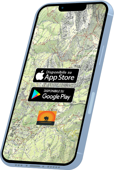
With Cammini d’Italia’s free app, you can plan and walk the La Via delle Sorelle in total safety, being able to plan the stages in detail and walk the route thanks to the built-in GPS technology that supports your orientation during your adventure.
⠀Inside the app you will find many other paths present in Italy. Thanks to the georeferenced tracks of many routes you will be able to study the itinerary that suits you best and also download the GPX tracks of the individual STAGEs offline.
The app also includes a complete digital map of all the paths surveyed to date on our portal, giving you a wide range of choices among the many paths in the Belpaese.
⠀⠀
Cammini d’Italia is the perfect app for those who want to explore the beauty of Italy on foot, discovering hidden places surrounded by nature. Download it for free today and start planning your next adventure!
⠀
⠀
 ⠀⠀⠀
⠀⠀⠀