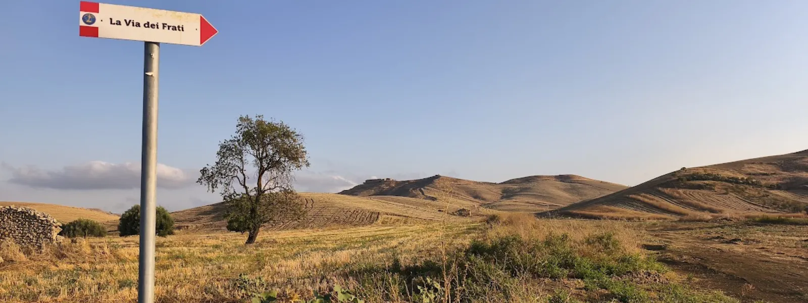
Via dei Frati
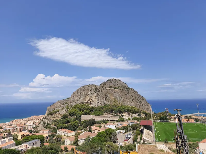
The Via dei Frati is a 166-kilometer route that starts in central Sicily, from the city of Caltanissetta, the world’s sulfur capital until the 1970s, and heads north, following a winding course through countryside and mountains, ending on the coast of the Tyrrhenian Sea at the Norman Cathedral of Cefalù.
The path retraces the roads traversed by the monks of “Cerca,” questing friars who traveled miles on foot or on the backs of mules and other pack animals to reach the Sicilian hinterland from the major monasteries of the Province of Palermo, Messina and Catania. They were men who, animated by the Franciscan charism of questing, lived for long months in remote villages or in the countryside, working alongside farmers to gather the necessities that the land could offer them for the sustenance of the convent community, to which they returned at the end of the season.
The path is 166 km long and can be walked in 8 days. Alongside the official route there is a variant departure from San Cataldo, a town a few kilometers from Caltanissetta, from which the first stage variant called “of the mines,” three variants called winter, for the third , fourth and seventh stages, and a variant called “pilgrim” of stage no. 8. Next to the walking route there is one for cyclists in 5 recommended STAGES. The signage is indicated by yellow arrows on a blue field with the wording La Via dei Frati, by tile with the logo of the path in built-up areas, and by white-red signage of the C.A.I. type. In support of the signage, it is possible to follow the official guide and GPS tracks for walkers and cyclists.
HISTORY
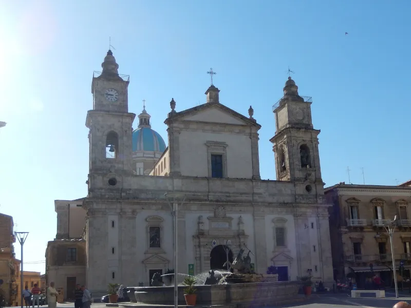
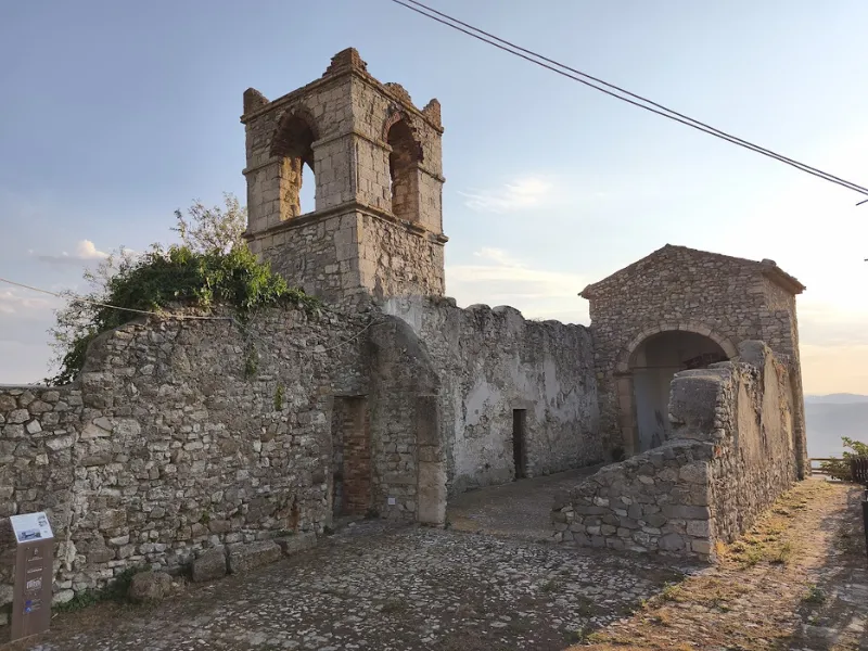
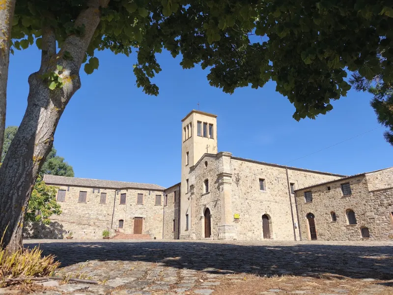
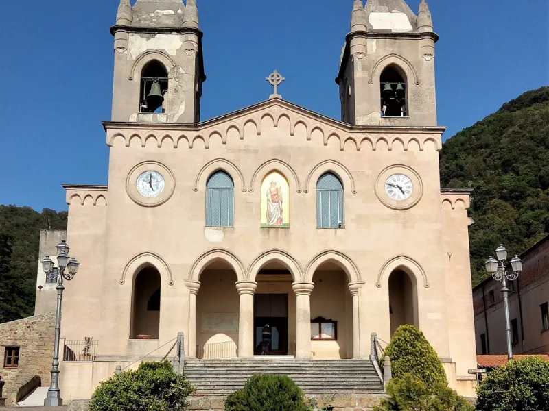
The Cammino is configured as a collage of itineraries and sacred routes in the Sicilian hinterland to shrines and places of faith often located in areas outside population centers. The first shrine is that of the Signuri of Bilici to which devotees from neighboring towns , Caltanissetta, San Cataldo, and Resuttano, as well as those from many towns in the Madonite area, go on pilgrimage. In fact historically the territory , although geographically distant, has always dialogued since for centuries it was under the common rule of the Ventimiglia family. The second shrine is that of the Madonna dell’Olio near the center of Blufi, with its characteristic oil fountain to which pilgrims repute beneficial properties. The third shrine is the most mountainous with its 1819 meters above sea level, that of the Madonna dell’Alto, founded by Blessed Guglielmo Gnoffi of Polizzi Generosa, who died in Castelbuono where he became co-patron of the town, capital of the Ventimiglia family. The Fourth Shrine is that of the Holy Spirit placed at the centers of the sumptuous village of Gangi. The Fifth is that placed annexed to the convent of Gibilmanna, 8 km from Cefalù, where a sumptuous marble altar contains the image of the Virgin with the Child in her arms. Nature, culture, Faith, and Science intersect along the Way of the Friars.
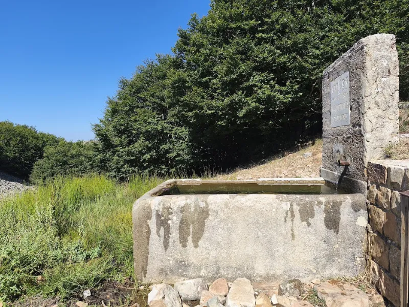
WATER
Water sources can be found along the way in the towns and in the mountainous area in the route. More limited in the first two stages, although still present.
SERVICES
There are grocery stores, bakeries and supermarkets in every town.
There are also pharmacies in every town crossed There is a Hospital in Caltanissetta , Petralia Sottana and Cefalù.
ROAD BOTTOM.
- 40% asphalt
- 60% other background (dirt, paved, dirt road, etc.)
CONTACTS
Mail: viadeifrati@gmail.com
tel. : 3284687434
STAGE 01
STAGE 01: Caltanisetta to Marianopoli.
Departure: Caltanisetta
Arrival: Marianopoli
Distance: 24.2 km
Height difference: +674 m / – 558 m
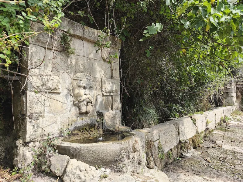
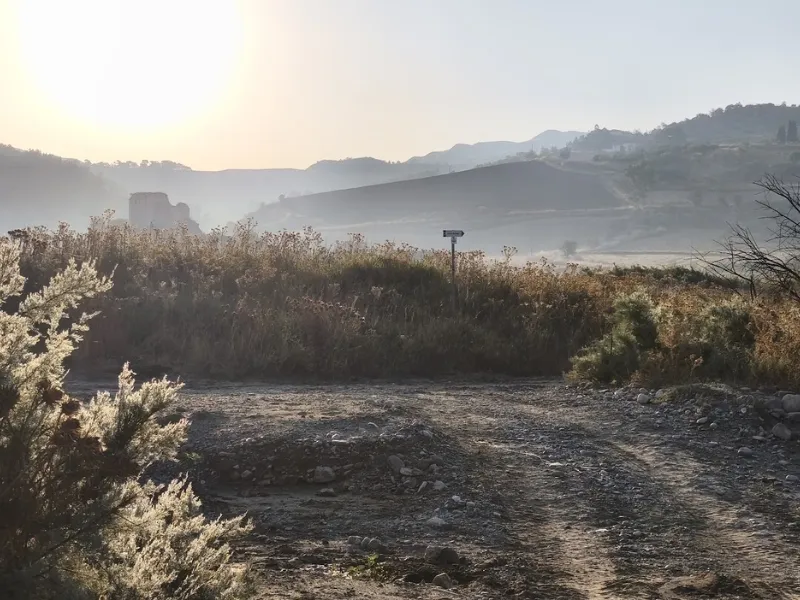
The path starts from Via Pietro Leone (S.P. 128) in Caltanissetta and continues following S.P. 155. At the intersection with S.P. 44 we take a left and find the entrance to a path marked by yellow arrows. We rejoin S.P. 44 and later leave it to take S.P. 145. At the next intersection we follow the direction Marianopoli on S.P. 42 to the Mimiani railway tunnel. Here we leave the asphalt and continue along the uphill path through a centuries-old olive grove . We pass the ancient fountain with the moro head (the only water point) and the Masseria Mimiani. We continue after the masseria, find a fork with a small chapel high up on a rocky outcrop, and from here we can continue to the right and return to the provincial road for a kilometer and a half and then leave it again and follow the small paved road on the left that takes us to the gates of Marianopoli.
STAGE 02
STAGE 02: Marianopoli to Resuttano
Departure: Marianopoli
Arrival: Resuttano
Distance: 23.7 km
Height difference: +484 m / – 611 m
The STAGE begins in the town of Marianopoli and dives into the countryside toward the rural sanctuary of Castel Bilici, a place of faith for many towns in the Madonie area and the province of Nissena. It continues for a stretch of asphalt passing the village of Vicaretto where there is a possibility of a water point inside the village. . We take the path again in the direction of Resuttano, passing an old Waterfall Mill and reaching the Ciampannella area, where there is a drinking trough with water at all times of the year, before reaching our destination.
STAGE 03
STAGE 03: Resuttano to Polizzi Generosa.
Departure: Resuttano
Arrival: Polizzi Generosa
Distance: 24 km
Height difference: +757 m / – 466 m
We proceed downhill toward the Imera River, which we ford to reach the ancient castle of Resuttano, an ancient farm fortified with cannons by the Ventimiglia family. You go back up to Blufi and can admire the mountains that in a few days will be crossed along the way. You visit the second shrine , that of the Madonna dell’Olio in Blufi and the mineral oil fountain believed to be miraculous. Via a stretch on asphalt you reach Castellana sicula, a town of murals with bars and rest stops. We continue on the main street and after the chapel of MAdonna della catena , through Via Frazzucchi, a characteristic Madonite road made of paving stones, we reach the natural pass that separates the valley we crossed and that of northern Imera, dominated by the town of Polizzi generosa.
STAGE 04
STAGE 04: From Polizzi Generosa to Petralia Sottana
Departure: Polizzi Generosa
Arrival: Petralia Sottona
Distance: 18.8 km
Height difference: +1072 m / – 992 m
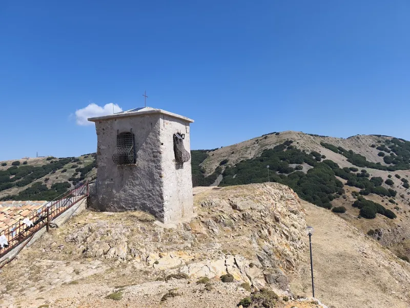
It is one of the most challenging STAGES touching 1810 m.a.s.l. It starts by crossing the arches of the Roman aqueduct next to the large bevaio and reaching the entrance to the Sanguisughe picnic area. From here you continue inside the coniferous forest until you climb in altitude and enjoy the wide views of the Imera valley. Halfway along the trail you will come across the spring near the Madonna dell’Alto. The shrine is reached by climbing the steep and craggy slope, from the end of which there is a 360-degree view of the Madonie mountains, the villages below, as far as Enna, Caltanissetta, Etna and the Aeolian Islands. Returning back, we continue along the pilgrims’ path (Sentiero Italia) and descend toward Petralia Sottana.
STAGE 05
STAGE 05: Petralia Sottana to Gangi
Departure: Petralia Sottona
Arrival: Gangi
Distance: 13.8 km
Height difference: +469 m / – 691 m
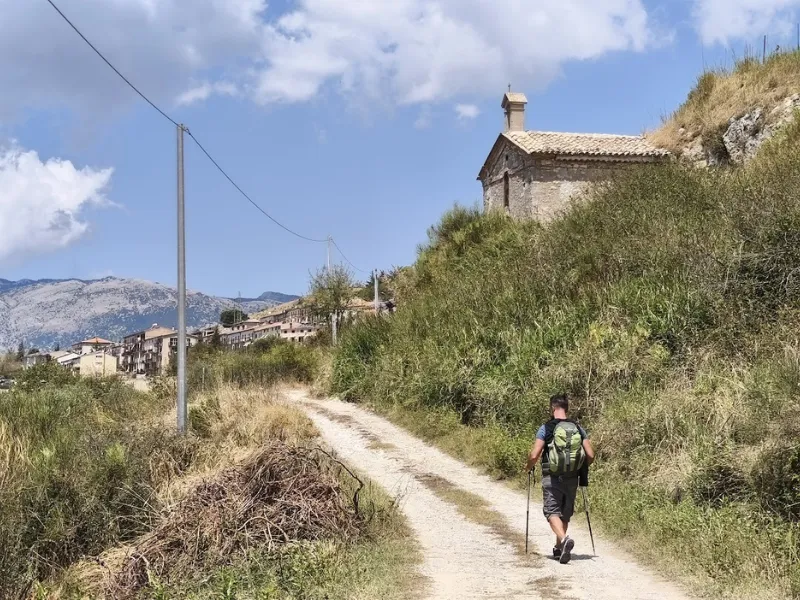
Resting STAGE compared to the previous one. We start from Corso Agliata, in front of the war memorial, and climb to the area known as the “Cross.” From here we cross the Provincial Road and continue uphill on the trazzera towards Petralia Soprana: reference point the tennis court. When you arrive at the bevaio, proceed toward Via Acquedotto Romano to the Center of Petralia Soprana and the Church of Loreto. From here begins the descent to the ItalKali Plant . We follow the stream uphill and resume the climb toward the Pira area. At the edge of the state highway we continue the path toward Gangi downhill and after touching the lowest elevation a small climb, after an area with sheds, leads us to the Sanctuary of the Holy Spirit. From here it is all uphill to the top of the village where the Town Hall and the Mother Church are located.
STAGE 06
STAGE 06: Gangi to Geraci Siculo
Departure: Gangi
Arrival: Geraci Siculo
Distance: 13.8 km
Height difference: +601 m / – 268 m
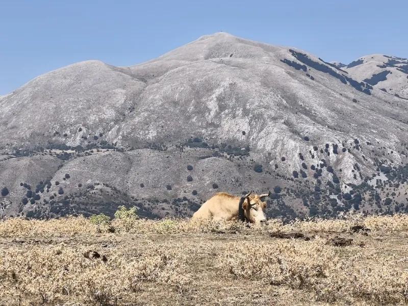
From the cathedral one descends down Via Madrice to Via Anteria and finally to Via Porta di Conte to the State Highway. After the octagonal drinking trough we leave the S.S. and follow the path to the San Giovanni district. From here we plunge into a narrow path with traces of a mule track and at the lowest point a stone bridge. Climbing up toward Geraci we encounter cow pastures and small cultivated plots. The finish is on the state road near the Bevaio della Trinità. Having reached under the spur of the Castle we take the uphill road, Via Biscucco, then Via Cervo and finally Via Roma until we reach the Mother Church of Geraci Siculo.
STAGE 07
STAGE 07: Geraci Siculo to Castelbuono
Departure: Geraci Siculo
Arrival: Castelbuono
Distance: 21.4 km
Height difference: +428 m / – 1118 m
From the Piazza del Popolo, we walk in front of the large Trinity Bevaio. From here the path goes on to the small country church of San Cosimano. The church is located at the end of a large meadow. After visiting it, turn back and continue the path a little hidden by vegetation, following the profile of the mountain . After passing a rocky area and some animal gates we come to the front of the Serre d’Alfano and from here we go left cutting across the meadow uphill and following the white-red CAI markings and the Via dei Frati arrows to the entrance of the path that goes in and out of the vegetation, crosses a holly grove and comes out on the open-air path to the rocky summit of the pass and from there downhill to the south where we intercept the Provincial Road. After a few hundred meters we arrive at the new trailhead on the left and enter a dense and varied shady area until we reach Rocca di Gonato, where there is an elegant agriturismo, From here we reach the equipped area of San Foca and shortly after the historic Hermitage of Liccia , where we can make the STAGE point or continue with a long descent to Castelbuono.
STAGE 08
STAGE 08: Castelbuono to Cefalù
Departure: Castelbuono
Arrival: Cefalù
Distance: 25.7 km
Height difference: +949 m / – 1315 m
The concluding stage of the Via dei Frati Way is proposed in its entirety although, as with other longer stages, it can be divided according to the wishes and needs of the Viandante to stop one more night along the Way or to reach the final destination. One can in this sense take the last steps by planning a stop in Isnello, or at the convent of Gibilmanna, or finally continuing on to Cefalù. Start from Piazza Margherita, the heart of Castelbuono, and walk downhill along Via Isnello and then uphill to the little church of the “santuzza” and from there along the route of the old Regia Trazzera until it intercepts S.P. 9. Once we reach Isnello we walk along Via Roma, Via S.S. Annunziata and Via Celso. After the steep descent to the valley we climb back up to Gibilmanna along the pilgrims’ way. From the shrine we proceed to the Salvabosco path and after a mountainous stretch we travel downhill toward Cefalù, cutting across the hairpin bends of S.P. 54 bis at several points.


DISCOVER THE STAGES
With the free Cammini d’Italia app, you can plan and walk the Via dei Frati in total safety, being able to plan the stages in detail and walk the route thanks to the built-in GPS technology that supports your orientation during your adventure.
⠀Inside the app you will find many other paths present in Italy. Thanks to the georeferenced tracks of many routes you will be able to study the itinerary that suits you best and also download the GPX tracks of the individual STAGEs offline.
The app also includes a complete digital map of all the paths surveyed to date on our portal, giving you a wide range of choices among the many paths in the Belpaese.
⠀⠀
Cammini d’Italia is the perfect app for those who want to explore the beauty of Italy on foot, discovering hidden places surrounded by nature. Download it for free today and start planning your next adventure!
⠀
⠀
 ⠀⠀⠀
⠀⠀⠀