
Anello del Nisi
The Anello del Nisi walk is a gentle and environmentally sustainable route to be experienced over several days, in the mode of slow tourism, to be done in solitude or in company.
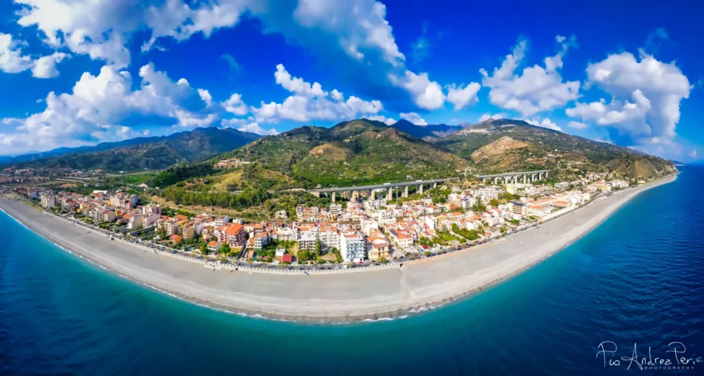
The territory covered by the path includes the two valleys of the Alì and Fiumedinisi torrents, and connects through ancient communication routes, and where there are no alternatives, the state and provincial roads, the four municipalities that are located in this Ionian area of the province of Messina: Alì, Alì Terme, Fiumedinisi and Nizza di Sicilia. The entire route is a loop, departing from the Institute of the Daughters of Mary Help of Christians in Alì Terme and arriving at the D'Alcontres Castle in Nizza di Sicilia, it will suffice to continue for about a kilometer on the SS 114 or on the waterfront that joins the two municipalities, to complete the loop. The route, including variants, can be done on foot, MTB or horseback, assessing the appropriate elevation differences and lengths of the various sections. This walk can be done in a single day or in three stages, so that the first part of the day is dedicated to hiking while the second part is dedicated to visiting the villages, with their monuments and tasting local products.
HISTORY
HISTORY OF THE FOUR MUNICIPALITIES INVOLVED IN THE ROUTE
ALI’
The only information about the ancient and medieval history of Ali is reported by the Capuchin friar Brother Serafino d’Alì (1701–1768), who in 1754 drew up a valuable manuscript entitled: Of the History of Ali and its Territory, full of news about the origins of the town.
According to the text, Ali was founded, in 638 BC., by Greek colonists fromIlia, a region of Greece located in the western part of the Peloponnese. The original settlement was located on today’s Piano Mollerino, very close to the Promontorio d’Alì and a short distance from the sea. Subsequently, possibly due to pirate raids, the settlement of Piano Mollerino was abandoned, and a site undoubtedly safer was chosen: the plateau at the top of Mount Scuderi. That settlement proved unsuitable, being extremely exposed to winds and weather, especially during the winter. It was decided to move the settlement to a third site, on the slopes of Mount St. Helena, where the town grew and prospered to the present day.
Among the hypotheses regarding the founding of the country, it has also been suggested that this was done by the Muslims. The name could therefore derive from Ali ibn Abi Talib, son-in-law and cousin of Muhammad.
In 1093, King Roger I of Sicily, granted the villages of Ali and Itala to the Basilian monks of the monastery of Saints Peter and Paul of Itala. L’abbot of that monastery thus became baron of Alì and Itala, exercising over the two villages the power of mero et mixto imperio. The centers of Ali and Itala were placed under the ecclesiastical jurisdiction of thearchimandrite of Messina. In the 1468, Ali was incorporated into the tiny diocese archimandrite of Savoca.
Throughout the 16th century, Ali experienced a period of great economic, building and population development, thanks to income from mining and the cultivation of theolive tree. It was in this century that the present Cathedral of St. Agatha arose (1565) and the Capuchin Convent (1574). There were privileged relations between Alì and Messina, so much so that the Straits city “did not disdain to admit Ali to the enjoyment of many of its privileges and even to the contest of the annual senatorial election.” Moreover, ties were strengthened by the many Alì families of the wealthier classes related to those of the Messina aristocracy.
On the occasion of the Anti-Spanish rebellion in Messina of 1674/’78, Ali, like Fiumedinisi e Savoca, remained loyal to the Spanish monarchy. The consequence was that Ali had to suffer devastation and looting at the hands of the Messinians. There were privileged relations between Alì and Savoca. Because of such events, as Brother Seraphim reports, “he fell without rising to his primitive greatness.” It must be remembered that relations between Ali and the Basilian monastery of Itala were never idyllic. In fact, a serious dispute arose over the issue of income, the bitterest being the one concerning the rights claimed over the sansa which dragged on throughout the eighteenth century, concluding only in 1799.
Friar Seraphim’s sources report that it was precisely in 1746 that in the locality of Piano Mollerino, numerous archaeological finds were discovered consisting of the remains of buildings, ceramics, coins, burials and human skeletons.
The earthquake of 1783 caused some damage to the settlement but the town recovered. Subsequently, a process of depopulation and exodus began, benefiting Ali Marina. Between the eighteenth century and thenineteenth century Marina di Alì became a destination for European travelers for its hot springs that are still active today.
Nel 1812, a new constitution In fact, a serious dispute arose over the issue of income, the bitterest being the one concerning the rights claimed over the feudalism nel Kingdom of SicilyAlì’s land became municipality of Alì; the town was included in the Castroreale District and became the capital of the eponymous district of Ali. In the 1910 the hamlet of Alì Marina was detached from the main town, giving rise to the current municipality of Alì Terme (from 1928 to 1946, however, they were merged into a single municipality). Since then, to distinguish the two centers, the hill town was also called Alì Superiore, a name, however, that was never officially adopted.
Between the end of the nineteenth century and the beginning of the twentieth century the town of Ali was home to several industries: recall that of the ice, of gypsum and packaging boxes.
ALI’ TERME.
The country of Alì Terme boasts a very ancient origin, and several historical theses have been made in this regard. Some scholars claim that Alì boasts its origins from Ilia, a city in Greece. From the manuscript “The History of the Land of Alì” by Father Serafino, a Capuchin and novice master of the convent of Alì, the narrative begins as follows: “The colony founded its first dwelling in the Marina of Alì, near the Argeno promontory known as ‘Capo Grosso,’ on the top and plain of this promontory called today Migliorvino or Mollerino. There the remains of that distant era were found: a floor made of mosaic, ancient bricks, remains of human bones, underground galleries, coins, terracotta lamps and more…”
The presence of the ancient settlers is also demonstrated by the discovery on the two headlands Agresti and Impromile of remains of fortresses that were built to defend the nearby colony. However, these inhabitants were continually harassed by pirates, with invasions and looting. So, many years passed, to exempt themselves from these harassments, they retreated above Mount Saturnio or Nepturnio (later called Sparverio, Spaverio and finally Scuderi). This mountain, a wonderful mass of limestone rock, is mentioned by many authors of Sicilian history, among whom is the Abbot Vito Amico who, in the ‘Topographical Dictionary of Sicily’, describes it as follows: ‘… Scuderio, it stretches somewhat downhill over a plain abundant with herbs and plants. Ruined remains, traces of buildings, and an empty mill can be seen, signs of ancient dwellings Father Serafino also recounted that in the middle of the plane of this mountain was a winding hole, into which curious people descended, drawn by the lure of finding treasures. Among them, Giuseppe Panarello, an old nivarolo, claimed to have found a coin of the finest gold coined on both sides and a brass pin about a palm long with a diamond head. So all these finds, some of which are now kept in the Palermo Museum and others with Messinian families, testify to the presence of that ancient population, which built a town on Mount Scuderi. But if their dwelling located above the mountain was more protected from abuse, violence from pirate raids, the inhabitants had to fight the constant bad weather, strong winds and abundant snow (…cf. Samperi – “Messana Naturae Prodigium”). Eventually, having abandoned that inhospitable site, they decided to descend to lower ground, three miles from the sea. Here they built the third dwelling (the present village), which was named Elim in honor of the ancient homeland from which their ancestors had departed. This name was later, in time, changed to Ali.
Among the hypotheses regarding the founding of the country, it has also been suggested that this was done by the Muslims. The name could therefore derive from Ali ibn Abi Talib, son-in-law and cousin of Muhammad.
Finally, if we are to lend credence to some writers, this name might derive from Ali (without accent) since Mount Scuderi seemed to have two wings on its sides and so the town, in its honor, was called “Country of the Wings,” and later the ancient name Ali was transformed into Ali (with accent). In fact, as evidence of this, the Coat of Arms of Alì Terme depicts a Sparrowhawk on a blue background with open silver wings in the act of rising from the mountain.
In 250 B.C. the new town stood on the slopes of a hillock with a mild climate, with numerous hamlets housing some 14,000 inhabitants. When Messina was besieged by the Carthaginians, the Aliesi rushed to its aid and, together, defeated the enemy. Returning to the town they found it burned and looted by the Saracens. It was then the Messinesi who helped the Aliesi to rebuild it, and it seems that at that time the population reached 38,000, remaining so large until 1600. In 1674-78, when Messina was at war with Spain, Ali was again sacked by the Saracens, who ruled here until 1800. After the expulsion of the Saracens, Count Ruggiero had the Abbey of St. Peter and Paul of Itala built, granting the first Abbot Gelasius, in commendation, the villages of Alì and Itala. Thus, these two localities had for several centuries, as Temporal Lord, the Abbot of this Monastery. In 1886, the monastic property was suppressed and the extensive forest of the commenda was divided among the aforementioned villages.
Originally and until 1910, the town was called Ali Marina because of its proximity to the sea. It was a district of the nearby municipality of Ali, located at the foot of the Sant’Elena Hill, 450 m above sea level. By Law No. 394 of June 30, 1910, this hamlet was detached from the original municipality of Alì and constituted into an autonomous municipality called Alì Marina, an autonomy that it in fact obtained in 1911, thus also becoming the chief town of the province of Messina. Subsequently, because of the growing development of tourism and balneo spa and the importance assumed by this center that had become the seat of studies and important public offices, by Royal Decree No. 2040 of August 18, 1928, the two municipalities were reunited under the name of Alì but with Alì Marina as its capital. In 1946, by virtue of Decree No. 181 of February 22, the original municipality of Alì (called “Superior” to distinguish it) was reconstituted with the pre-existing district and consequently Alì Marina also returned to its previous situation. As a result of Regional Law No. 250 of July 31, 1954, the name was finally changed to Alì Terme, to enhance the presence of therapeutic waters famous since the 18th century.
FIUMEDINISI
In the 7th century B.C. Greek Chalcidian settlers, attracted by the mineral deposits, founded the colony of Nisa on high ground near the present town of Fiumedinisi and gave the local river the name Chrysorhoas (Aurea Corrente). In Norman times the settlement was relocated at the present site with the name “Flumen Dionisyi.” In this valley, in 1197, found the cause of his death Emperor Henry VI Hohenstaufen, father of Frederick II (the “Stupor Mundi”). In 1392 Fiumedinisi became a fief of the Romano Colonna family and experienced a period of wide splendor. During the anti-Spanish revolt of Messina in 1674-78 Fiumedinisi remained loyal to the Crown and the people of Messina saw Fiumedinisi as the “most enemy country of Messina.” (Laloy). For this reason the country was plundered by the Messinesi who plundered everywhere, “committing on the population unspeakable excesses.” (Galati). Reconstruction took place through the work of King Charles II, who expressed his “royal gratitude” in a message still legible today on a plaque placed on the main façade of the Matrice church. Fiumedinisi was severely affected by the plague epidemic of 1743 and deeply devastated by the tremendous flood of 1855 which caused the loss of important productive structures including the Mussola factory, which employed more than a thousand people, and the foundry while the paper mill of S. Giorgio suffered damage. Mining was active in Fiumedinisi until the early 1960s.
NIZZA DI SICILIA
The location of this site is quite controversial as well as uncertain is the toponym. Tamaritio Palmarum or Palma Tamerici or Tamaricium Palmarum, identified by various authors with Phoinix, location in which according to Appian Alexandria Pompey’s army stayed overnight before the naval battle against Octavian in 36 B.C., is located by several authors along a rather extensive strip of the Ionian coast of Messina between Sant’Alessio Siculo and Alì Terme. According to Cluverio, however, the site could be located ‘at Nisi ostium’, that is, at the mouth of the Fiumedinisi stream, based on what is reported in the ‘Itineraria’ of Antoninus Pius (3rd century A.D.), which places it 20,000 paces from Messina and 15,000 paces from ‘Per Tauromenion Naxo’ This area was traversed by the Consular Valeria road and thus traveled by travelers at least as far back as Roman times as evidenced, among other things, by the discovery on the beach of coins dating from that period. It is important to point out that, regarding the localization of Phoinix, the theory of Philip Cluverio. In fact, all scholars agree in stating that Phoinix was located a little further south of the current territory of Nizza di Sicilia, that is, near the present-day municipalities of Santa Teresa di Riva e Furci Siculo. Al Igiasah or Al Iggasah (“the plum tree” according to Michele Amari; or “the pear” from the Arabic “I-gasa”) is supposed to be the name of today’s Nice of Sicily. Michele Amari, in translating the work of the Arab geographer Idrisi, identifies this locality with Marina di Fiumedinisi. Surnames like Elemicch, place names like the Saracen Quarter, which takes its name from Via Saraceni, now Via Medici, and the Bedouin Quarter, located near the Fiumedinisi stream, suggest that an Arab group lived in this area.
May 15 1392, the King and Queen of Sicily Martin I e Mary, grant the farmhouse and castle of Fiumedinisi a Tommaso Romano Colonna for reducing to their obedience the city of Messina. These, for the services rendered to the Crown, will also own the territory from Fiumedinisi creek to S. Alessio. He gave up as early as 1408 to his son Filippo the barony of Fiumedinisi, which includes the territory between the eponymous stream and the present-day Allume stream. The stretch of the riviera between these two streams is the so-called marina of Fiumedinisi. It will retain the name until 1613, the year in which the widow of Antonino Romano Colonna, Duke of Fiumedinisi, marries Giovanni La Rocca, owner of Lumera or Alumera. With that marriage that part of the Marina of Fiumedinisi extending to today’s Castello d’Alcontres to the Allume creek becomes Marina di Roccalumera. The part, on the other hand, that extends from the castle to the Fiumedinisi creek will still retain the name Marina di Fiumedinisi for over 200 years.
Following the petition of a hundred citizens of the two navies, headed by Don Emmanuele (sic) Interdonato, Ferdinand II of the Two Sicilies issues Royal Decree no. 1405 of December 18, 1849 by which it united the two navies under the name of San Ferdinando. The new municipality will receive from Fiumedinisi 241 hectares of the forest land, which will assume and retain the name San Ferdinando forest.
By Royal Decree 1218 of May 11, 1863, issued by the King of Italy Victor Emmanuel II, San Ferdinando changed its name to Nizza di Sicilia in honor of the Hero of the Two Worlds Giuseppe Garibaldi, who had already named it so in 1860 in a receipt he gave to a delegation of Sanferdinandesi, who had handed him a cash contribution for the national cause. In 1929, as a result of R.D. 655 of March 28, Nizza became a hamlet of Roccalumera and would be so until December 25, 1948, when Regional Law No. 42 of 3/12/1948 came into effect.
WATER
Water sources are present.
SERVICES
Supermarkets – butcher shops – bakery:
- Ali:
- Alimentare “da Cettina” di Raneri Domenico, via S. Giuseppe – tel. 0942/700060;
- Flavia’s Food, Domenico Ferrantello Street;
- Pantò Giuseppe’s butcher shop, 13 Via Roma – tel. 0942/7000079;
- Macellerai da Nino, 12 Brunaccini Street – tel. 0942/700051;
- Raconà Gianfranco’s Bakery, 3 Pietro Famà Street – tel. 0942/700024.
- Alì Terme:
- Deco Supermarket of De Luca Gabriele, 29/E Lungomare Street – tel. 0942/715172;
- ARD Discount supermarket, 3 Alcide De Gasperi Street – tel. 0942/89.312;
- La Bottega del Gusto, via Francesco Crispi no. 142.
- Macelleria-Salumeria da Biagio, 14 Nino Prestia Square – tel. 334/7715496;
- Macelleria Minimarket Agnello, 315 Francesco Crispi Street – tel. 0942/715177;
- Macelleria Rasconà, 439 Francesco Crispi Street – tel. 0942/715155;
- Mazzucco fish market, 373 Francesco Crispi St. – tel. 380/3622572;
- Rasconà Sandro’s Bakery, 143 Francesco Crispi Street;
- Guarnera Giovanni Bakery, via Tiro a Segno – tel. 0942/715961.
- Fiumedinisi:
- Alimentari Rao Grazia, 16/bis Umberto I Street – tel. 0942/771031;
- Alimentari Natoli Rosaria, Via Roma – tel. 0942/771415
- Puglisi Orazio Butcher Shop, 44 Umberto I Street – tel. 0942/771254;
- Alimentari lo Conte Paola via Ruagrande – tel. 0942/771491;
- Fleri/Nucita butcher shop via Umberto I – tel. 3407695422;
- Butcher’s shop Nucita via salita San Pietro – tel. 339/3269349.
- Nice of Sicily:
- Despar, 15 Astronauts Street – tel. 0942/090410;
- Savings Shop, 399 Umberto I Street- tel. 0942680119;
- Macelleria P.B.C. s.r.l. via Giuseppe Mazzini No. 80 – tel. 0942/715809;
- Macelleria Crudo, Cooked and Eaten, 397 Umberto I Street – tel. 0942/701696;
- Macelleria Bottega della Carne, 423 Umberto I Street – tel. 0942/682422;
- Biagio Nucita’s Fish Market, 352 Umberto I Street – tel. 0942/701603;
- Gregorio Bakery, 13/A Commander S. Todaro Street – tel. 0942/701229;
- Bakery Il Forno dei Desideri, 379 Umberto I Street – tel. 0942/715347.
Pharmacies:
- Ali:
- Medical Watch: Holy Spirit Street – tel. 0942700171
- “Chimicata Dr. Ambrose” Pharmacy: Via Roma, No. 51 – tel. 0942557863
- Alì Terme:
- Medical Watch: Master William Street – tel. 0942715212 – 336245612
- “Laganà Dr. Rosalba” Pharmacy: Via Francesco Crispi, no. 200 –
tel. 0942715143
- Fiumedinisi:
- Medical Watch: Matrix Square, No. 1 – tel. 0942771164
- “Dr. Vincenzo Pietropaolo” Pharmacy: St. Peter’s Multipurpose Center, St. Peter’s Square – tel. 0942771512
- Nice of Sicily:
- Medical Watch: Via Comandante Todaro – tel. 0942715986
- “Dr. Zahami Arena” Pharmacy: 309 Umberto I Street – tel. 0942716161
SIGNAGE
YES
ROAD BOTTOM.
Asphalt: 16.400 km / 47%
Dirt: 18.500 km / 43%
TOTAL: 34.900 KM / 100%
CREDENTIALS
The credential exists regarding the path “The Way of the Marian Shrines in the Anello del Nisi.”
A religious path that connects the Maria Asuliatrice Shrine in Alì Terme (Me) to the Maria SS. Annunziata Shrine in Fiumedinisi (Me), a ring path that through some paths of the Anello del Nisi, affects the religious communities of the municipalities of Alì, Alì Terme, Fiumedinisi and Nizza di Sicilia.
IN TENT
It is possible to bivouac in tents at different points along the route.
Permits are needed.
CONTACTS
CREDENTIALS
There is a credential regarding the path “The Way of Marian Shrines in the ‘Anello del Nisi”.
A religious path that connects the Sanctuary Maria Asuliatrice of Alì Terme (Me) to the Sanctuary Maria SS. Annunziata of Fiumedinisi (Me), a ring path that through some paths ofAnello del Nisi, affects the religious communities of the municipalities of Alì, Alì Terme, Fiumedinisi and Nizza di Sicilia.
STAGE 01
STAGE 01: From Maria Ausiliatrice Institute (Alì Terme) to at St. Agata Cathedral (Alì)
Departure: Mary Help of Christians Institute
Arrival: Saint Agatha Cathedral
Distance: 9.4 km
Height difference: +1 m / – 446 m
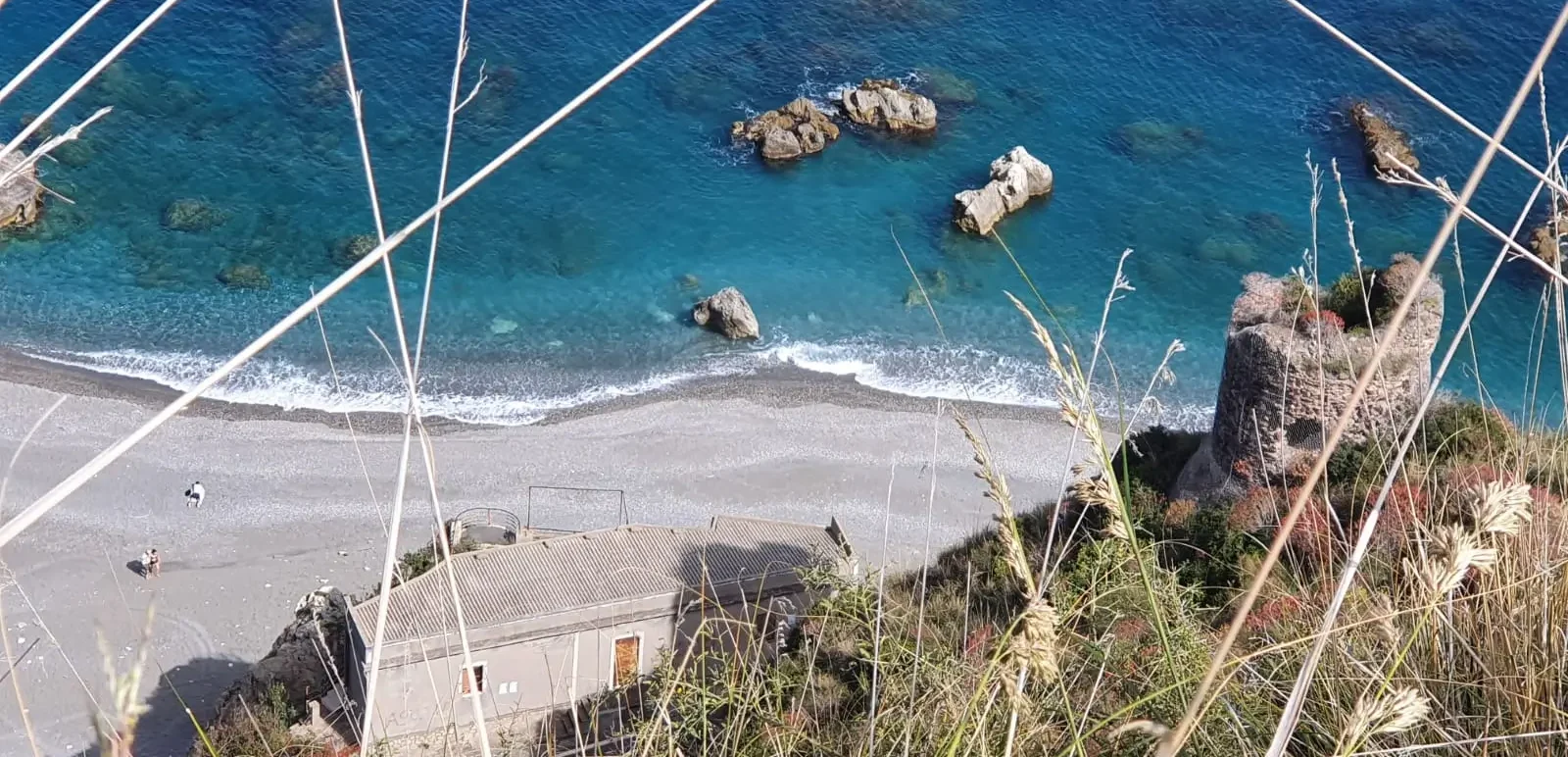
Starting point is the Maria Ausiliatrice Shrine, at the Istituto Figlie di Maria Ausiliatrice in the town of Alì Terme. From the SS114 you enter the seafront and follow it north to the end where you can choose to continue on the SS114, recommended for those who move with fatigue on long sandy stretches or, alternatively you can follow the beach line until you reach Capo Alì or Capo Grosso. In the vicinity of the Cape you will catch a glimpse of the ancient tower, called Saracen by some. Once past Capo Grosso continue to the mouth of Vallone Calamaci, which can be traveled along a small path. When you reach SS114, turn back until you take, on the right, the wide paved road that passes under the uphill highway viaducts. For those traveling the entire SS114, this is the point at which you begin to climb toward Alì. Leaving a shrine dedicated to Our Lady of Carmel on the right, continue on a dirt road, thus reaching a scenic flat area. Take the detour to the left that descends slightly in altitude to the area affected by the war installations of the Margottini Battery. Turn back to the junction and continue left uphill. You pass through agricultural-rural localities admiring olive groves, vineyards and orchards, and typical Mediterranean scrub. Continuing on, you reach the SP28 Alì Terme-Alì. You ride the last few hairpin bends reaching a panoramic lay-by with seats. Continue toward the center to arrive in front of the majestic and artistic facade of Alì Cathedral dedicated to St. Agatha.
STAGE 02
STAGE 02: From the Cathedral of Sant’Agata (Alì) to the Mother Church SS. Annunziata (Fiumedinisi)
Departure: Cathedral St. Agatha (Ali)
Arrival: Mother Church SS. Annunziata (Fiumedinisi)
Distance: 10.2 km
Height difference: +196 m / – 445 m
Starting from the Cathedral Square of Alì, one descends along Via S. Zaccaria that runs alongside the Church. In the first parking lot located below the churchyard of the Mother Church is a nice fountain of fresh water; continuing downhill, before turning right to head toward the Alì Stream, you will encounter a second fountain. Toward the right, you follow the agricultural road that crosses the Alì Stream and continues as a dirt road on the other side of the valley. Deviations to the right and left are left out, continuing on the main road, also skirting a small residential area. Arriving in the valley, the road widens and becomes paved. We are in the Tripi and Grotte districts, where until the beginning of the last century metalliferous mines were exploited from which Antimony, Blenda and Galena were extracted. Continuing for about 700 m on the wide asphalt road, at a sharp bend it veers to the right to enter the landscape of the Fiumedinisi Valley. Continuing on a dirt road, slightly up and down you continue upstream as you approach the village of Fiumedinisi. You reach the Vallone D’Armi and, after crossing the bridge over the valley and following the bridge over the Fiumedinisi Torrent, you reach, through Via Corso S. Bottari and some narrow lanes, the Chiesa Matrice dedicated to the Madonna Annunziata. Of note, in the passage of the bridge over the Vallone d’Armi, is an interesting stand of Pteris vittata fern, characterized by erect or arched fronds with narrow linear leaflets.
ALTERNATIVE ROUTE
Distance: 9.5 km
Height difference: +196 m / – 623 m
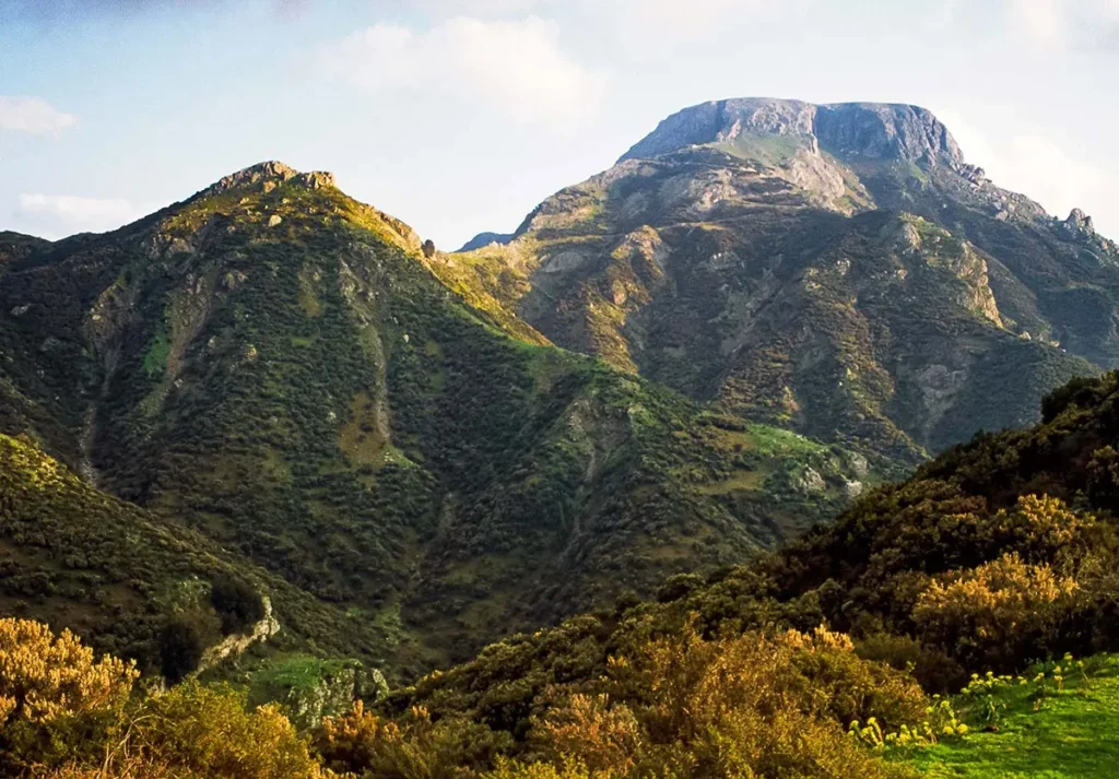
The route described represents an alternative of the second STAGE. From Piazza Duomo in the village of Alì, one follows the road that runs along the north side of the church’s nave, following the sign indicating the small church Spirito Santo. Continue, leaving out the various side streets on Via Flomara. Before leaving the settlement, it is possible to pay a visit to the Spirito Santo church by taking the side street of the same name on the right. Continue on Via Flomara for about 2 km until you reach the creek where a footbridge allows you to reach the other side. The ascent begins and after crossing the Corvo Stream continue uphill and at the hairpin bend continue to the right. After a little more than 200 m it is advisable to make a detour from the main route to reach, via an easy dirt road on the level, after about 400 m, the Contrada Gerasìa, characterized by a dense cultivation of Walnut trees and the presence of the springs of the same name. Turning back to the junction, one continues to the right uphill. After about 250 m you meet another fork where you continue to the right uphill. Continue on to the ruins of Case Ranati, at 590 m, once a well-cultivated and pleasant site as can be seen by the presence of a rich network of dry stone walls. At 60 m from the ruins, within the small valley, there is a valuable water source. This leads to the pleasant locality of S. Nicola. When you reach the junction indicating the locality of Naghi Baghi upstream, you can decide whether to start descending toward Fiumedinisi via the convenient road, or make a detour to enjoy the splendid panoramic views by walking along the ridge or the mule track, toward the sea, to reach as far as the houses S. Nicola. Once the views have been admired, take the road that, heading back upstream below the coast, continues toward the countryside and the town of Fiumedinisi. Omitting all side detours, you descend for about 3 km until you reach the village in the valley of the same name.
ALTERNATIVE ROUTE (LONGER)
Distance: 16.3 km
Height difference: +196 m / – 576 m
Starting from the Cathedral Square of Alì, one descends along Via S. Zaccaria that runs alongside the Church. In the first parking lot located below the churchyard of the Mother Church is a nice fountain of fresh water; continuing downhill, before turning right to head toward the Alì Stream, you will encounter a second fountain. Toward the right, you follow the agricultural road that crosses the Alì Stream and continues as a dirt road on the other side of the valley. You omit the detours to the right and left, continuing on the main road, also skirting a small residential area. Arriving in the valley, the road widens and becomes paved. We are in Contrada Tripi and Grotte, where until the beginning of the last century metalliferous mines were exploited from which Antimony, Blenda and Galena were extracted. Before descending toward Contrada Tripi, where the paved road begins, take a dirt road uphill on the right that heads toward Contrada Cardona and Monte Piadaci. You walk through an area with an evocative landscape with erratic boulders of crystalline limestone, detached from a large rocky ridge at the base of which there is a vast ingrowth that characterizes it throughout its extension. The path makes a left turn and an almost sharp bend to the right, leaving out a small road that leads to houses and cultivated gardens on private property. We are in Contrada Cardonia, below Monte Piadaci (555 m). Now the road is flat, and we meet on the right a beautiful sunken plateau, circular in shape, resembling sinkholes in limestone terrain. Take a small road on the right that heads into a small gorge where the rocky ridge already mentioned begins. Here it is possible to pay a visit to the ingrottos. Turn back toward the sinkhole and resume the path first on the level and then uphill. Passing several twists and turns, on the road that zigzags a bit for about 1 km, you reach the vast plateau of Case S. Nicola (575 m). Having traveled the linear stretch for about 500 m, past the houses and repeaters, leave out the trazzera going to the right and proceed under the coast in the now Nisano slope. From this point continue as in the previous itinerary.
STAGE 03
STAGE 03: From the Mother Church SS. Annunziata (Fiumedinisi) to Castello d’Alcontres (Nizza di Sicilia)
Departure: Mother Church SS. Annunziata (Fiumedinisi)
Arrival: Castello D’Alcontres (Nizza di Sicilia)
Distance: 9.2 km
Height difference: +14 m / – 445 m
From Fiumedinisi’s Piazza Matrice, one descends toward St. Peter’s Church through the paved Via Umberto I, traveled by the faithful on their knees during devotional rites related to the Feast of the Annunciation. Going around the apse of St. Peter’s Church, climbing to the right, Salita S. Pietro, Vico S. Pietro and Vico Roma, you reach Via Convento and Salita S. Francesco. Turning right onto SP27, one passes some old houses that have been recently renovated, until reaching the Church of Carmine, where there is a fountain before taking the steps, to the left, that lead onto the paved agricultural road that connects Fiumedinisi with the village of Allume. Continue to the left, always following the paved road. At the crossroads with the
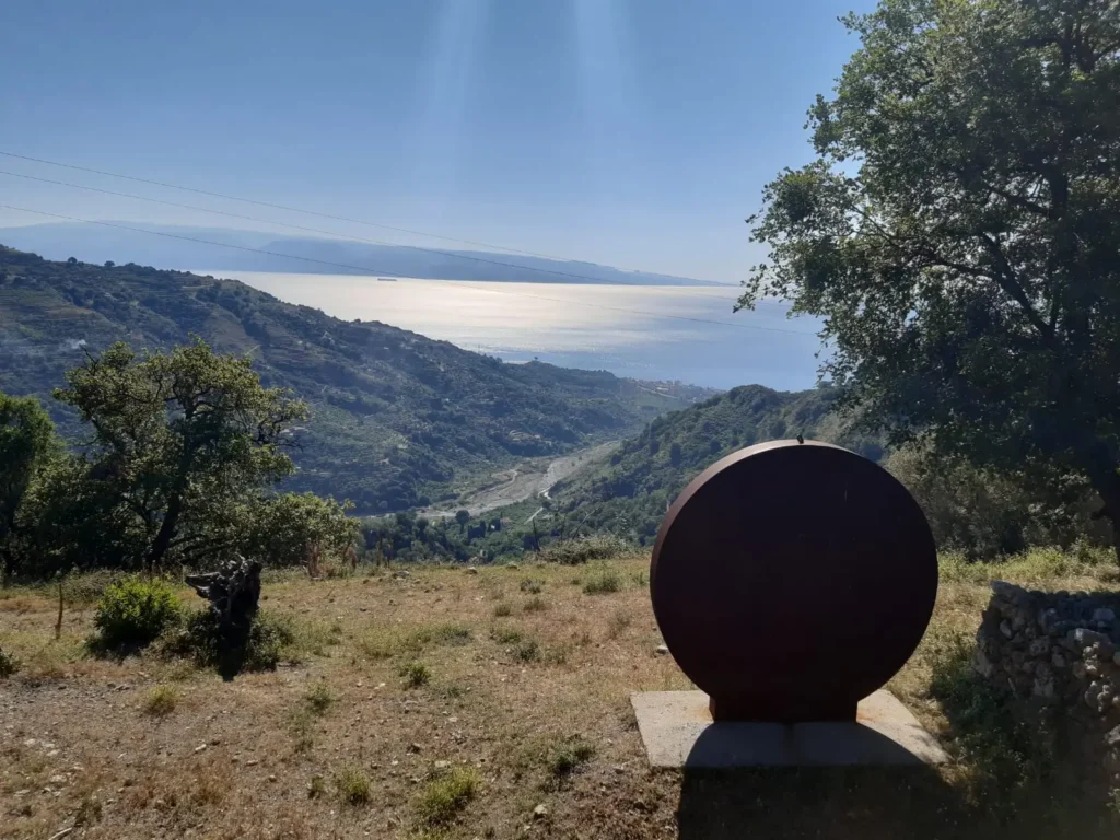
sign Castello Belvedere, proceed straight on, leaving the detours, to reach the Fonte Acqua Rossa spring, also equipped with a drinking trough for animals. On the level, continue to the small village of Buticari, characterized by the presence of a reddish-colored farmhouse, hence the name “Palazzo Rosso.” At that dwelling you keep left downhill. After passing a couple of hairpin bends, proceed for a little more than 200 m until intercepting the upper entrance to the Rocca di Buticari Suburban Park, in the municipal territory of Nizza di Sicilia, landmark is the presence of a pylon. Once you enter the park area, you intercept the small road paved in concrete and stone work of the interventions related to the creation of the park itself and follow it to the gazebo at the viewpoint. You descend to the plateau equipped as a rest area and playground for children. Take the beaten earth path that leads to the wooden watchtower for birds that, in large numbers, nest in the ravines of the Rocca di Pancaldo to reach the ancient watchtower, in a very scenic spot with the Land Arte work “Sentinels” next to it. Continuing toward the sea, one leaves the International Shooting Range area on the left and, in a steep descent on a panoramic ridge, reaches the first residential dwellings of the town of Nizza di Sicilia. You reach the SS114 to the left encountering the Piazza Colonnello Interdonato, the Municipal Palace and the small Church of S. Francesco di Paola. After about 100 m, continue straight on Via Garibaldi to the D’Alcontres Castle and the adjoining S. Giovanni Church where the third STAGE ends.

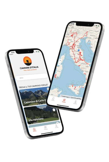
DISCOVER THE STAGES
With the free Cammini d’Italia app, you can plan and walk the Anello del Nisi in total safety, being able to plan the stages in detail and walk the route thanks to the integrated GPS technology that supports your orientation during your adventure.
⠀Inside the app you will find many other paths present in Italy. Thanks to the georeferenced tracks of many routes you will be able to study the itinerary that suits you best and also download the GPX tracks of the individual STAGEs offline.
The app also includes a complete digital map of all the paths surveyed to date on our portal, giving you a wide range of choices among the many paths in the Belpaese.
⠀⠀
Cammini d’Italia is the perfect app for those who want to explore the beauty of Italy on foot, discovering hidden places surrounded by nature. Download it for free today and start planning your next adventure!
⠀
⠀