Il Cammino di Sant’Ercolano
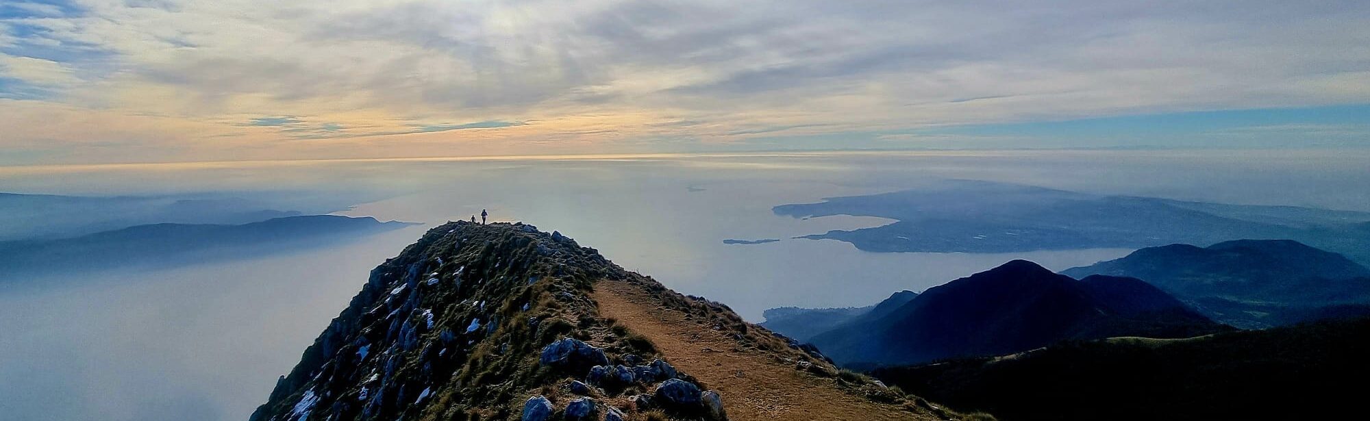
The Cammino di Sant’Ercolano is a path, within the municipality of Toscolano Maderno, divided into three loops by degree of difficulty and touching all the churches in the area.
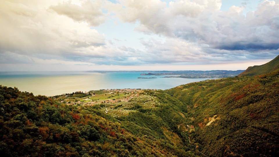
This path was created at the behest of the Municipality of Toscolano Maderno, which entrusted the task to the Le Vie del Benaco Association, which once again turned to the SantaGiulia Academy of Fine Arts of Brescia, consolidating the collaboration already begun previously for the “Credential of Lake Garda.” The name chosen pays homage to St. Herculaneum, the patron saint of the town, who was Bishop of Brescia and found his burial in the beautiful Church of Sant'Andrea in Maderno. The territory over which it winds is incredibly varied: from the flat mouth of the Toscolano stream, one ascends the moraine hills, passing along the beautiful Valle delle Cartiere and Valle delle Camerate, to the peaks of the Lombard Pre-Alps, namely Mount Pizzocolo and Mount Spino. The vastness of the territory and the difficulty given by the difference in altitude have made it necessary to create three different loop routes, so as to offer a path suitable for the needs of everyone, from those who are approaching trekking to those who are already experienced and want to discover hidden and fascinating corners of Lake Garda. The tools produced are a printed guidebook, a web page hosted within the Ecomuseo Valle delle Cartiere website also containing gpx tracks and a virtual map, and vertical and horizontal signage scattered along the paths that make up the walk.
HISTORY
The name chosen pays homage to St. Herculaneum, the patron saint of the town, who was Bishop of Brescia and found his burial in the very beautiful Church of St. Andrew in Maderno
STAGE
Urban Route:
From Piazzale S. Maria del Benaco,
Length: 7.2 km,
Positive elevation gain: 95.9 m,
Negative elevation gain: 96.3 m,
Background: asphalt.
It is developed around the promontory of Toscolano Maderno.
Medium Route:
Bezzuglio’s,
Length: 29.7 km,
Positive elevation gain: 1204 m,
Negative elevation gain: 1050 m,
Surface: Asphalt, concrete, dirt road and trails.
It is spread over the hamlets and the headland.
Full Pathway:
Bezzuglio’s,
Length: 63.5 km,
Positive elevation gain: 3221 m,
Negative elevation gain: 3229 m,
Surface: Asphalt, concrete, dirt road and trails.
The route touches the entire territory of Toscolano Maderno.
For more information visit: https://www.ecomuseovalledellecartiere.it/it/Percorsi
SERVICES PRESENT STAGE BY STAGE
Supermarkets and pharmacies are present in urban STAGES
SIGNAGE
The path is marked by signs along all three routes
DANGERS
The full route, which reaches the summit of Mount Pizzocolo (1581m) is the most challenging route.
ACCESSIBILITY
The urban route is passable by people with disabilities
CREDENTIALS
The credential for the walk is free of charge and can be picked up at the infopoint in Via Ugo Foscolo (during closed periods at the City Hall)
ASSOCIATION CONTACTS
Infopoint: 0365 515114 – infopoint@comune.toscolanomaderno.bs.it
Municipality Tourism- Culture Office: 0365 546064 – cultura@comune.toscolanomaderno.bs.it


Saint Herculaneum Walk
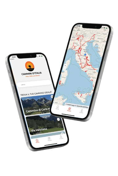
With Cammini d’Italia’s free app, you can plan and walk the Il Cammino di Sant’Ercolano in total safety, being able to plan the stages in detail and walk the route thanks to the integrated GPS technology that supports your orientation during your adventure.
⠀Inside the app you will find many other paths present in Italy. Thanks to the georeferenced tracks of many routes you will be able to study the itinerary that suits you best and also download the GPX tracks of the individual STAGEs offline.
The app also includes a complete digital map of all the paths surveyed to date on our portal, giving you a wide range of choices among the many paths in the Belpaese.
⠀⠀
Cammini d’Italia is the perfect app for those who want to explore the beauty of Italy on foot, discovering hidden places surrounded by nature. Download it for free today and start planning your next adventure!
⠀
⠀
 ⠀⠀⠀
⠀⠀⠀