Cammino dei Sette Laghi
A walking tour of in the heart of Trentino, immersed in the unspoiled nature of the Valle dei Laghi, between the Bondone and Paganella mountains. A slow tourism experience among crystal clear lakes, ancient villages, medieval castles and local traditions.
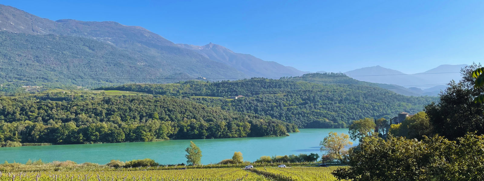
The Cammino dei Sette Laghi is a five-stage trail, with a minimal percentage of asphalt, immersed in nature. This itinerary is located in Trentino, precisely in the Valle dei Laghi, a small valley of wonders, distinguished by a multitude of lakes, set between the Bondone and Paganella mountain ranges; a real jewel, an ideal place for all those who wish to spend an active vacation under the banner of slow tourism that respects the environment, in contact with the host community. An area where knowledge, flavors, traditions and landscapes intersect studded with seven lakes, each with its own characteristics, ancient villages and medieval castles.
HISTORY
The Valle dei Laghi, where the walk is located, stretches from the threshold of Terlago to Basso Sarca in an unprecedented natural setting composed of lakes, villages, ancient castles, mountainous and hilly relief, and accompanies the walker on the descent to Riva del Garda. The Valley enjoys a unique climatic variety that, declining from Alpine to Mediterranean climate, offers an ideal alternation of natural environments. The spectacle on offer is a historical and natural mosaic of inestimable beauty, welcoming walkers in every season of the year. The path also winds through the Nosiola cultivations where, skirting the masterfully arranged rows of vines, sloping gently toward the valley floor and contained by ancient dry-stone walls, we are restored to that past knowledge passed down with passion and diligence from generation to generation.
SIGNAGE
Signage along the trail is represented by the standard SAT arrow, or the signage of the Society of Mountaineers Tridentineers. These are usually red or white/red arrows with indications of destinations, trail numbers and walking times;
There are also stickers with the path logo or drawings of the same logo on stones.
SERVICES
There are supermarkets both at the start and in the villages of Vezzano, Drena and Dro.
There are also pharmacies in Sarche, Vezzano, Dro and Pietramurata.
WATER
There are water sources in all the villages you pass through.
IN TENT
There are two campsites, one at the end of STAGE 1 and one at the end of STAGE 4.
As for the other STAGES, the tent can be set up but in secluded areas, as free camping is prohibited.
CREDENTIAL
Credentials are available and have a cost of € 5,00. Contact the managing agency for any further information.
CONTACTS
The email to contact for information is info@camminodeisettelaghi.it while the secretary’s number is 349-3365446.
For each STAGE, there are contact persons to contact.
STAGE 01
STAGE O1: Sarche to Mount Terlago
Departure: Sarche
Arrival: Mount Terlago
Distance: 13.4 km
Height difference: +588 m / – 145 m
Road surface: paved road for about 4.4 km, dirt road 0.8 km, trail 7.3 km; other 0.9 km.
The initial stage of the walk leads from Sarche to Monte Terlago, ascending the northernmost section of the Valle dei Laghi. In the initial part, the landscape is dominated by the picturesque presence of the lakes of Toblino and S. Massenza; along the way we are brought increasingly into the presence of the very steep mountain slopes of Monte Gazza, Canfedin, and Paganella, culminating in impressive rock walls. Along the STAGE the environment is very diverse and is a rich mosaic of pleasant lake surfaces, vineyards and fields, deciduous and coniferous forests, hay meadows and more. The terrain is hilly, very favorable for agriculture, with numerous small settlements including Sarche, S. Massenza, Fraveggio, Lon, Ciago, Covelo and Monte Terlago. These settlements are of very ancient origin and present a great wealth of historical, architectural and artistic evidence.
The medium-length STAGE leaves time for a highly recommended visit to the towns along the route, which are small but rich in historical, artistic and architectural evidence.
STAGE 02
STAGE O2: from Mount Terlago to Vezzano
Departure: Mount Terlago
Arrival: Vezzano
Distance: 18 km
Height difference: +272 m / – 590 m
Road surface: paved road for about 8.4 km, dirt road 1.5 km, trail 6.5 km; other 1.6 km.
The second STAGE ,in the first section, winds across the picturesque grassy plateau of Prada, at the foot of Mount Paganella, which looms to the west with its steep slopes. It then reaches the Lamar Lakes, two small but picturesque lake basins set in conifer and beech forests. The route, with forest roads, then climbs over the wooded hump of Selva Faeda and descends to Lake Terlago, another basin of karst origin naturally subject to wide changes in level. After passing through the town of Terlago — rich in historical and artistic heritage — the trail gently descends southward through a landscape of fields and orchards along the shared pedestrian and cycle path, until reaching the stage destination, the village of Vezzano.
Notes to the route: The frequentation of brown bears in the area of the first part of the STAGE requires that attention be paid to the instructions on the signposts placed along the route and in particular to keep any dogs on a leash at all times.
STAGE 03
STAGE O3: Vezzano to Cavedine
Departure: Vezzano
Arrival: Cavedine
Distance: 16.6 km
Height difference: +801 m / – 684 m
Road surface: paved road for about 3.2 km, dirt road 0.4 km, trail 13 km;
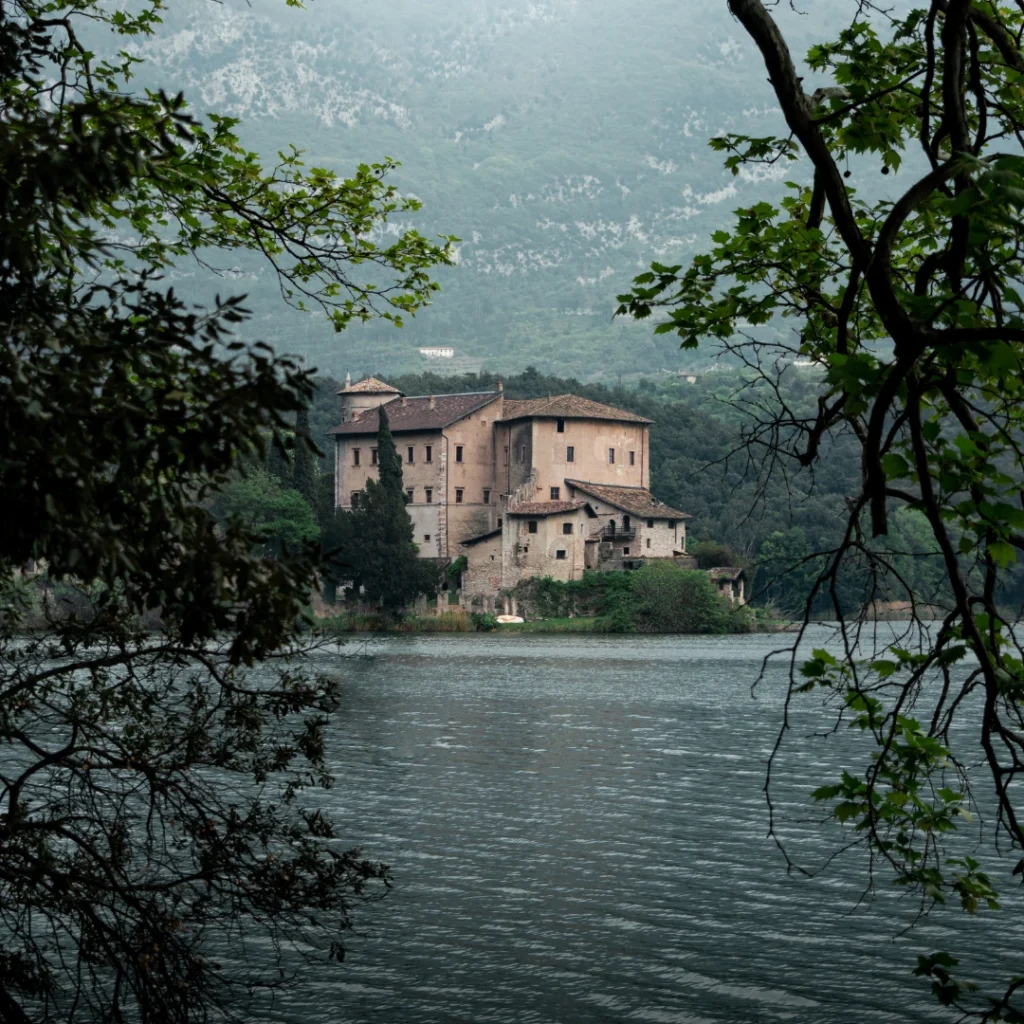
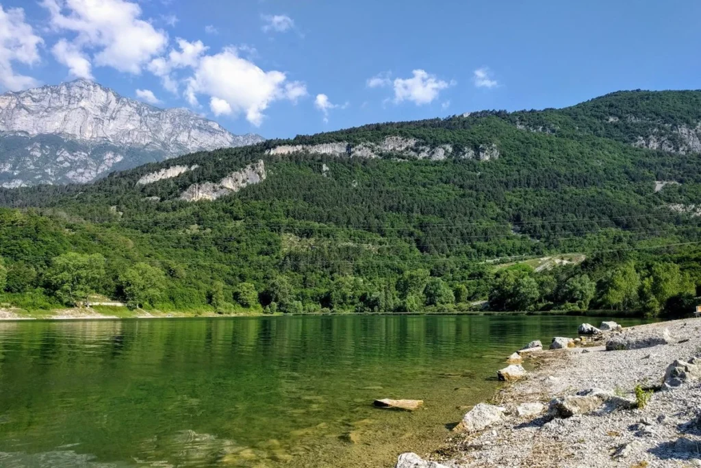
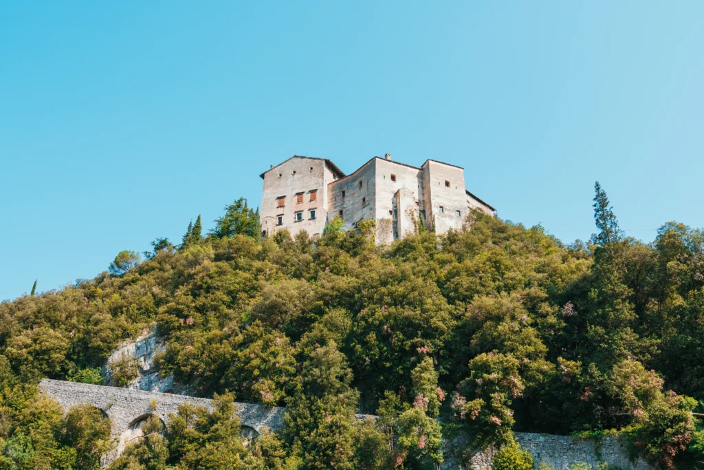
The third STAGE is the most “mountainous” of the walk’s stages; in fact, in its first half it winds along the western slope of Monte Bondone, facing a significant elevation gain, first uphill and then downhill. The ascent from the village of Vezzano, along a path immersed in coniferous and deciduous forests, leads to Lake Lagolo, an enchanting small lake basin located at 930 meters above sea level. From the lake, the subsequent descent leads to Madruzzo, a tiny village gathered at the foot of the cliff on which the ancient castle of the same name towers. The second part of the STAGE runs with modest gradients in the Cavedine Valley, partly along the roads that run through the countryside, partly through the sparse woods crossed by the so-called “Roman road.” The route to Cavedine is easy and rich in points of interest, both from a naturalistic and a historical-cultural perspective.
Notes to the route: The STAGE is quite challenging because of the elevation gain, but still leaves time to visit the small but interesting villages along the way. For those who wish to avoid the climb up to Lagolo, there is the possibility of walking the section between Vezzano and Madruzzo using the well-marked trails that run along the base of the slope and passing through the village of Calavino.
STAGE 04
STAGE O4: Cavedine to Pietramurata.
Departure: Cavedine
Arrival: Pietramurata
Distance: 23.5 km
Height difference: +376 m / – 635 m
Road surface: paved road for about 9.7 km, dirt road 0.9 km, trail 12.8 km;
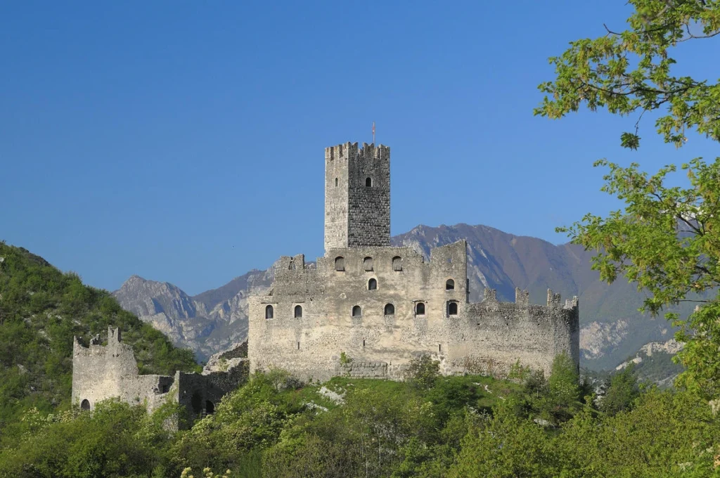
Day four with the longest STAGE of the route: it winds in its first section through the Cavedine Valley and then along the valley floor of the Valle dei Laghi, crossing a great variety of landscape and environmental situations. From Cavedine, the trail winds gently through the countryside of the valley floor, touching on quiet villages, until it reaches Drena, watched from above by its ancient castle. From here, the path descends the slope sharply until it reaches the area of Dro, an important village that is reached along the bike/pedestrian path. At Dro, the path reverses its direction, pointing north; with dirt roads immersed in woods and countryside, it reaches the historic hydroelectric power plant of Fies and then the Marocche di Dro, an impressive hilly area composed of a giant accumulation of landslide boulders. The route between the Marocche di Dro, an important protected natural area, follows stony paths immersed in a very special plant landscape composed of plants resistant to the marked aridity of the soil. The STAGE continues along the shores of the enchanting Lake Cavedine and then through the deciduous and pine forests of Gaggio, then reaching the countryside of Pietramurata, a town that is the destination of the stage.
Route notes: The STAGE is rather long; for those who might need to shorten it, two variants are recommended, bypassing the Dro area and reconnecting with the path further north. Both variants start from the point where the path down from Drena reaches the main valley floor, on the southern edge of the Marocche di Dro. The first variant traverses the Marocche di Dro from south to north to Lake Cavedine using the well-marked Marocche Nature Trail.
The second variant instead heads back up the valley along the left bank of the Sarca River on the shared pedestrian and cycle path, as far as the Fies hydroelectric power plant, where it rejoins the main trail.
STAGE 05
STAGE O5: Pietramurata to Sarche
Departure: Pietramurata
Arrival: Sarche
Distance: 12.4 km
Height difference: +165 m / – 164 m
Road surface: paved road for about 5.6 km, dirt road 1.3 km, trail 5.1 km;
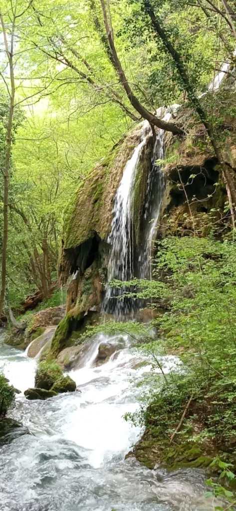
The fifth and final STAGE is relatively short and allows the route to conclude in the early afternoon, then having time to make any returns at leisure. The route leaves Pietramurata and heads north, using the bike/pedestrian path that runs along the left bank of the Sarca River; along country roads between orchards and vineyards it then reaches the small town of Pergolese and then continues for a good stretch on level ground along the Rimone Canal, on the eastern edge of the vast Sarca Plain. From the village of Pergolese, the trail climbs with dirt roads through groves and vine-grown plots until it bypasses the hump and leads near the village of Calavino. From Calavino, a center particularly rich in historical, architectural and artistic evidence, the Cammino descends into the Canevai Gorge tracing the Roggia di Calavino Trail, among spectacular waterfalls and ancient mills. Reaching the locality Due Laghi, near Padergnone, the trail travels along the northwest shore of Lake Toblino, ending in Sarche, the STAGE destination and conclusion of the Seven Lakes Trail.
Notes to the route: The STAGE is fairly short and allows for appropriate stops at points of interest; the village of Calavino is particularly worth a visit because of its wealth of historical, artistic and architectural evidence.
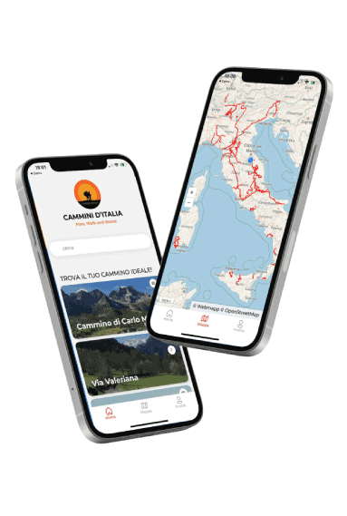
Seven Lakes Walk
With Cammini d’Italia’s free app, you can plan and walk the Cammino dei Sette Laghi in total safety, being able to plan the STAGES in detail and walk the route thanks to the built-in GPS technology that supports your orientation during your adventure.
Within the app you will find many other paths present in Italy. Thanks to the georeferenced tracks of many routes you will be able to study the itinerary that suits you best and also download the GPX tracks of the individual STAGEs offline.
The app also includes a complete digital map of all the paths surveyed to date on our portal, giving you a wide range of choices among the many paths in the Belpaese.
⠀⠀
Cammini d’Italia is the perfect app for those who want to explore the beauty of Italy on foot, discovering hidden places surrounded by nature. Download it for free today and start planning your next adventure!
 ⠀⠀⠀
⠀⠀⠀