Cammino degli Aurunci
The CAMMINO DEGLI AURUNCI is a trail in the heart of a little-known area south of Lazio, the Aurunci Mountains. 5 days of walking , through two parks, the Riviera di Ulisse Park and the Monti Aurunci Park.
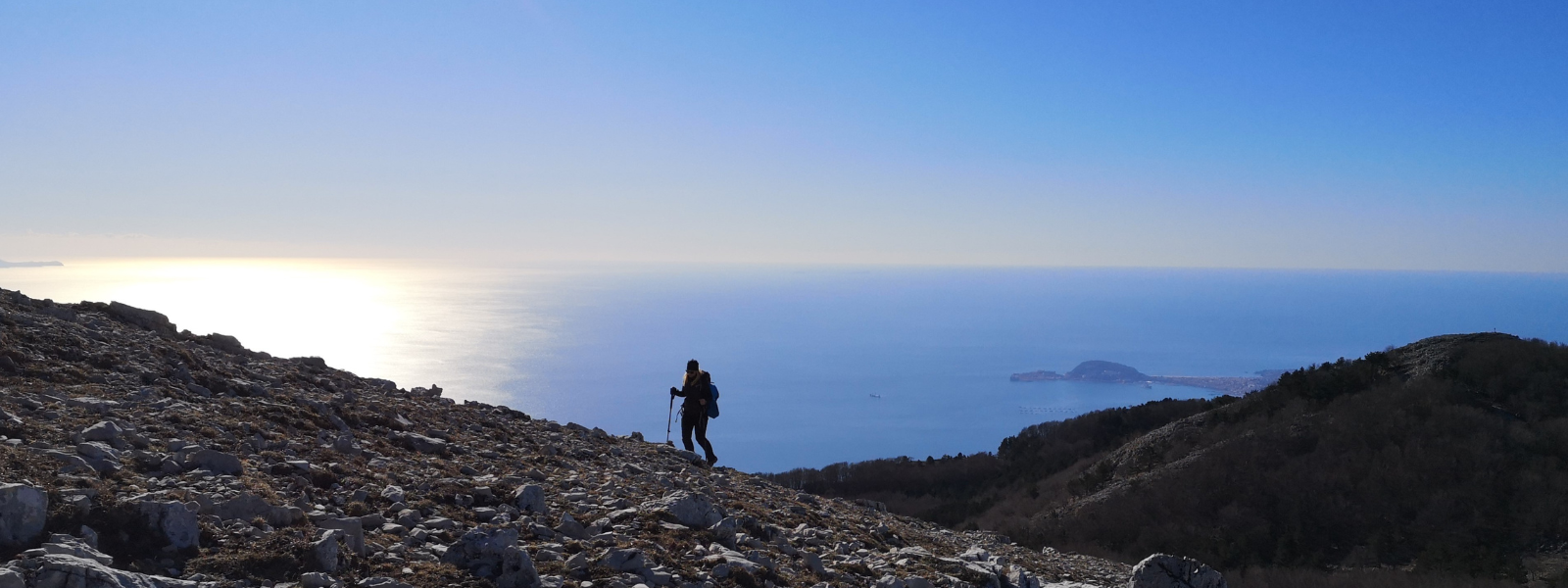
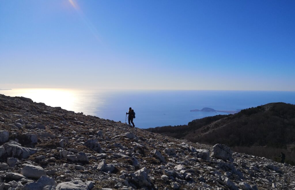
Its characteristic feature is its proximity to the sea-in fact, it enjoys a great record in all of Europe: Mount Petrella, the highest peak of the Aurunci Mountains, at 1540 m. asl, close to the Gulf of Gaeta, is the highest and closest mountain to the sea in Europe.
The Camino includes a walking route of about 90 km and a mountain bike route of 150 km. and can be covered in 4 or 5 STAGEs.
The quaint medieval town of Minturno is the starting point of the walk, and the final destination is the Sanctuary of the Madonna della Civita in Itri, already a destination for pilgrims. The Aurunci Mountains are the way, crossing the paths of the Monti Aurunci Nature Park.
Views of the gulf range from Vesuvius to Ischia to the Pontine Islands and the Circeo promontory.
HISTORY
As early as the 1700s, the territory of the Aurunci Mountains was configured as a borderland suspended between the Kingdom of the Two Sicilies and the Papal State. This condition deeply influenced the development and identity of those who inhabited these mountainous areas and, at the same time, close to the sea.
The landscape of the Aurunci Mountains has undergone a slow and gradual transformation due to human activities that have produced works that have shaped the land such as terracing and dry stone walls, called macere, made for the cultivation of olive groves. The millennial human presence on the Aurunci is even better witnessed by the ancient monasteries and small shelters, the remains of forgotten towns and the echoes of past legends that mark the park’s territory.
The territory of the Aurunci Mountains is not only nature, but also history, culture and traditions that constitute the peculiarities of places that preserve their charm unchanged
WATER
The Aurunci Mountains are a karst area and there are numerous springs scattered throughout the mountains. With a detour on the second STAGE you can reach Fontana Canale, in the Acquaviva locality there is the Acquaviva spring and along the descent of the third STAGE Fontana di Tozze. However, in the summer time all springs are dry, so on the second, third and fourth STAGE, you need to bring a good reserve of water (at least 3 liters). With the stop at Rifugio Acquaviva, it is possible to request water for refueling before the third STAGE. There is a water fountain at the Sanctuary of Madonna della Civita. Water sources along the first and second stages are not a problem because you pass through the villages.
SERVICES
The Walk passes through villages close to the Aurunci Mountain range where it is possible to find hospitality and refreshment in b&b’s and restaurants that have an agreement. You can contact the association that designed the walk for services: guide, mountain bike rental, luggage transport, route reduction, assistance, GPS
SIGNAGE
The Cammino degli Aurunci uses dedicated signage with a red arrow and the wayfarer and/or biker symbol. Signage is present in territories outside the Aurunci Park, where CAI signage is present instead. It is highly advisable to use a GPS device and to request the tracks of the Camino
DANGERS
There are no particular dangers except those typical of mountain trails that are not particularly difficult except for very short stretches. Especially in the spring-summer period, encounters with flocks of goats protected by shepherd dogs are frequent. It is advisable to avoid approaching the herd. The park is also heavily frequented by wild boars, which, if not disturbed, generally move away without creating danger
IN TENT
It is possible to walk the Camino in a tent using the designated spaces on the route. Some facilities offer camping opportunities.
CREDENTIAL
Walkers can apply for the Cammino degli AURUNCI credential, at a cost of €5, which allows the use of the hospitality and refreshment circuit under agreement.
ROAD BOTTOM.
About 70 % of the route is on dirt roads and trails. The remaining 30 % is on very low-traffic paved roads. For very few sections it is necessary to cross the Appian Highway
CONTACTS
The association that promoted the implementation of the Cammino is A.S.D. Maremoto of Formia. It provides services of assistance, guiding, bike rental, luggage transport, GPS tracks
Maria Letizia Grella 3396687913
E-Mail: il@camminodegliaurunci.org
STAGE 01
STAGE 01: From Minturno to Spigno Saturnia Superiore
Departure: Minturno
Arrival: Spigno Saturnia Superiore
Distance: 27.6 km
Height difference: +703 m
The Cammino starts from the main square of Minturno, just below the Castle. It follows the two main roads, one parallel to the other, through the most characteristic part of the village. The Church of St. Peter the Apostle (photo) and the Church of the Annunziata are worth a short stop. From Castle Square continue in the direction of Solacciano along a side road that descends toward Scauri. Continuing on you reach the coast and Gianola Park where you can admire the Roman remains of the Villa of Mamurra, the Grotta delle Janare, and ancient cisterns. (Check the opening hours of the Villa of Mamurra). Leaving the park behind, one begins the climb toward Spigno Saturnia Superiore.
STAGE 02
STAGE 02: From Spigno Saturnia Superiore to Acquaviva Location – Formia
Departure: Spigno Saturnia Superiore
Arrival: Acquaviva Location – Formia
Distance: 22.6 km
Height difference: +1492 m
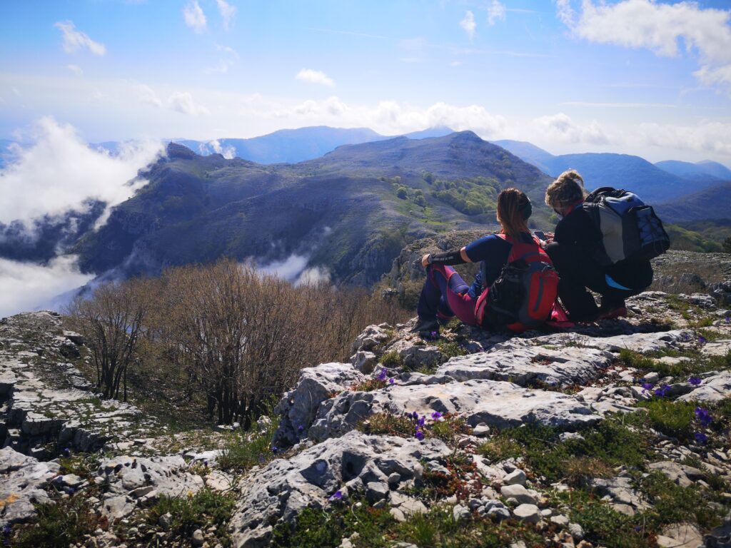
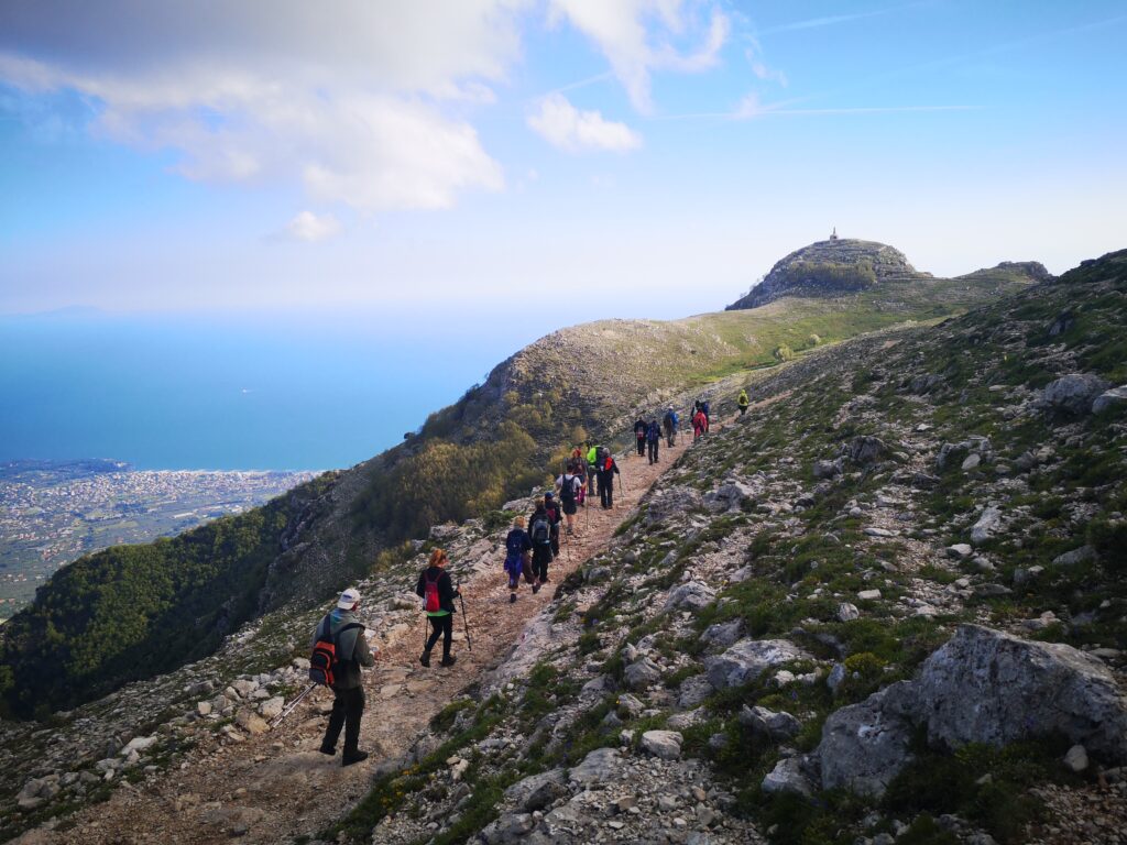
The most challenging and most scenic STAGE of the Camino! Three peaks will be reached: Monte Petrella, Monte Sant’Angelo and Redentore. All-mountain route between CAI trails
From the small square of Spigno Vecchio, we proceed on the paved road toward the Football Field, past which we reach the characteristic La Ripa Spring where we can glimpse the remains of the frescoes of the rupestrian Church of Our Lady of the Snows. the road continues uphill toward the mountains on the CAI trail n. 968. This is a challenging route, especially because of the elevation gain to be overcome. After about two hours of ascent we reach the Stampaduro Saddle. Continuing left along the same path, after about an hour and a half of walking in the woods, the dolina di Juanna Pit. After about 500 meters, having reached the Fossa Juanna fork, follow the path to the left along the n. 963 which will lead us after a short time to the summit of Mt. Petrella.
It continues along the path n. 913 up to Mt. St. Angelo where the view is really impressive. Going through the dense forest in a westerly direction following the trail n. 961 e 962 we arrive at the top of Mount Redeemer where we can admire the statue of the Christ the Redeemer and the view of the entire Gulf, from Vesuvius to Circeo.
Just below the Redeemer you continue along the CAI trail. n. 960 where shortly afterwards you can make a stop at the Church of San Michele Arcangelo before continuing downhill to the Pornito Shelter (which offers reception for refreshments only, but you need to check openness and make reservations) before continuing for another 1.5 miles along the dirt road to reach Acquaviva Locality, the destination of the second STAGE where you will find reception at the Acquaviva Refuge for overnight stay and refreshments (reservation required).
STAGE 03
STAGE 03: From Località Acquaviva – Formia to Madonna della Civita Itri
Departure: Acquaviva Location – Formia
Arrival: Madonna della Civita – Itri
Distance: 21.4 km
Height difference: +1035 m
With your back to the Acquaviva Refuge, take the path to the right after the spring of the same name, the path n. 955 which runs through the Valle Cupa forest to a very scenic point overlooking the Gulf of Gaeta at Ventosa.Continuing along the same trail you reach the fork to Monte Tuonaco. Be careful, you must follow the trail and continue along an ancient path, one of the ancient “snow routes” that follow a gully below Monte Tuonaco until you reach the characteristic Valle di Sciro, with its moonscape rich in karst sinkholes. Continue on the right side of the valley until you reach the summit of Monte Ruazzo and enjoy the view of the sea and the Pontine islands with Ponza, Zannone, Palmarola and the Circeo promontory. From the summit, take the path on the opposite side, the n. 956 to the next fork where you continue along the trail n. 956b. Attention, a little further on you need to turn left to continue on the trail n. 958. spotting a small gate, typical of shepherds, where it is necessary to open for passage and then close again. Continue along a downhill path to Campello Vecchio and the Rifugio di Tozze (currently closed). A downhill cart track will lead onto the Civita Farnese road where you continue along the pilgrims’ path, the n. 949, to the Shrine of the Madonna della Civita in Itri, the destination of the third STAGE.
STAGE 04
STAGE 04: From Madonna della Civita Itri to Itri borgo
Departure: Madonna della Civita – Itri
Arrival: Itri village
Distance: 21.6 km
Height difference: +389 m
From the Sanctuary of the Madonna della Civita descend to the junction for the Civita Farnese road. Shortly before, take a dirt path on the left (Cai path not yet marked). After a descent of about 500 meters you take a right along an uphill path that leads to the Ruderi di San Vennitto. From here you continue along the path n.919 to the Botanical Garden. It continues along the path n. 923 along the Forest of St. Archangel until you get onto the Via Appia where you turn left after a few meters to the Via Appia Antica marked with the path n. 925. We travel about 2 km of ancient road, on the ancient Roman paving where it is possible to see the ruins of the ancient Fortino di Sant’Andrea. After a second stretch of Appia Antica we reach the Cemetery of Itri and continue to the right behind the Cemetery to reach a section of the Via FRANCIGENA that will lead us to Itri village, the destination of the fourth STAGE.
STAGE 05
STAGE 05: From Itri to Gaeta
Departure: Itri
Arrival: Gaeta
Distance: 19 km
Height difference: +498 m
From the main square of Itri follow the via Appia to the junction for Sperlonga where you must turn left. After a few kilometers turn left onto an uphill paved road to the locality Le Vignole.
As you continue for a few kilometers, with the view toward the western slope, pay attention to the signs (path signs) that will make you turn left onto a side road that leads toward the ancient Greek Way. The paved road becomes unpaved and you will be able to make out the ancient steps of the ancient road. Once past the terraces, a detour to the right leads you onto a convenient cartroad that descends toward Gaeta with views of Formia and the Gulf of Gaeta. At the end of the descent we are already in Gaeta territory. The route continues along ancient narrow streets until you reach the city center, crossing Via Indipendenza, full of stores with typical products (try the Tiella di Gaeta). Continue towards Monte Orlando and you will reach the Montagna Spaccata. Continuing to climb you will cross the many Bourbon batteries and can reach the summit and the mausoleum of Lucius Munazio Planco. The path continues downhill to Gaeta Vecchia and the Angevin Aragonese Castle, the destination of the Walk.
A visit to the Castle is worthwhile here, which, with the convention of the credential, costs €5.


Cammino degli Aurunci
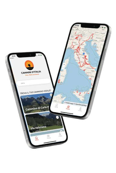
With the free Cammini d’Italia app, you can plan and walk the Cammino degli Aurunci safely, being able to plan the stages in detail and walk the route thanks to the built-in GPS technology that supports your orientation during your adventure.
⠀Inside the app you will find many other paths present in Italy. Thanks to the georeferenced tracks of many routes you will be able to study the itinerary that suits you best and also download the GPX tracks of the individual STAGEs offline.
The app also includes a complete digital map of all the paths surveyed to date on our portal, giving you a wide range of choices among the many paths in the Belpaese.
⠀⠀
Cammini d’Italia is the perfect app for those who want to explore the beauty of Italy on foot, discovering hidden places surrounded by nature. Download it for free today and start planning your next adventure!
⠀
⠀
 ⠀⠀⠀
⠀⠀⠀