
CAMMINO DEI CAPPUCCINI
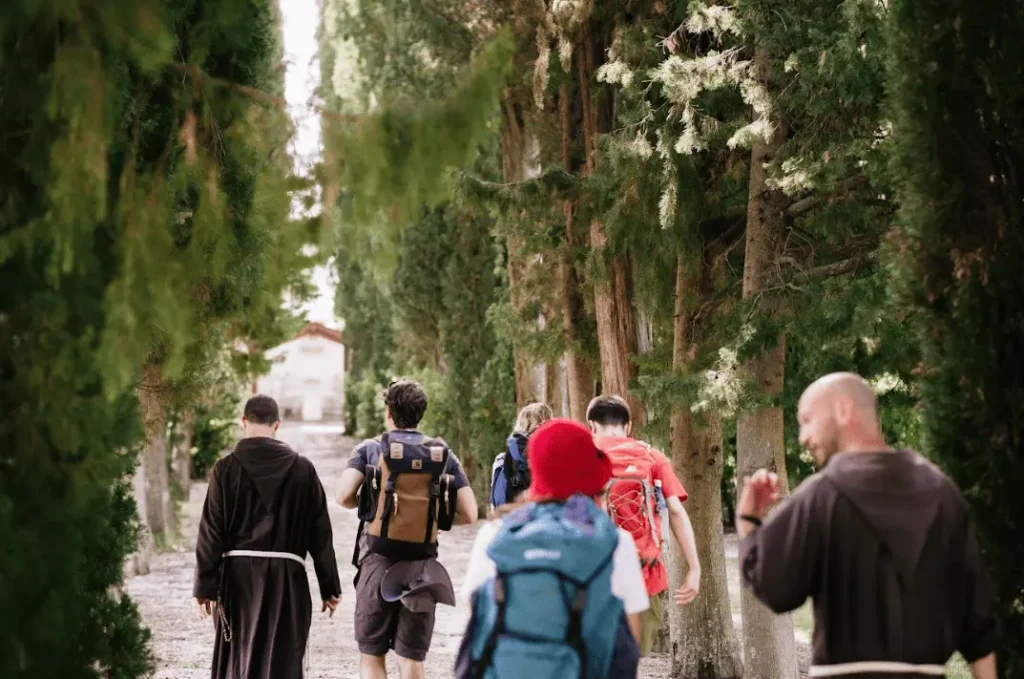
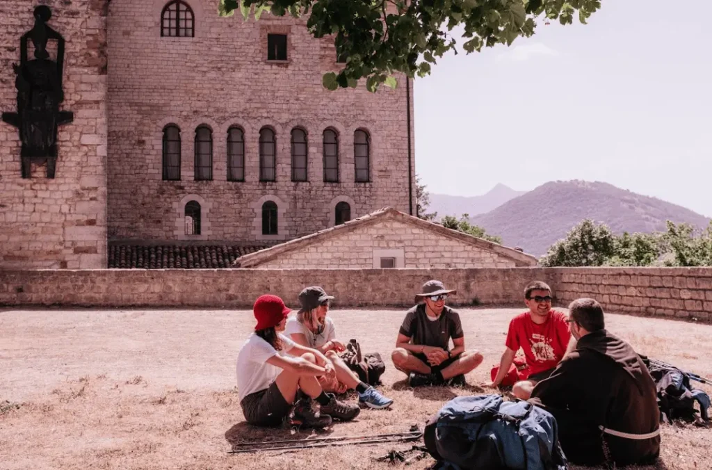
The CAMMINO DEI CAPPUCCINI traverses the inland ridge of the Marche region, moving through a beautiful and varied naturalistic setting, where mountains, hills and the sea merge into a single glance, to discover the places linked to the history of the origins of the Capuchins and their present day, being able to meet today’s Capuchins as well and being welcomed into their convents.
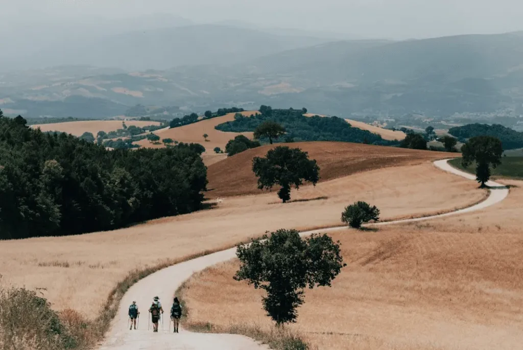
The Way has its starting point in Fossombrone (PU), its center in Camerino (MC)-where the first convent of the Order of Friars Minor Capuchin is located-and its arrival point at the Sanctuary of St. Seraphim in Ascoli Piceno. It is a route that is very rich from a spiritual, historical, artistic and naturalistic point of view, and very demanding from a physical point of view, due to the physiognomy of the Marche hinterland, which presents a continuous alternation of ups and downs, with numerous stages with significant differences in height.
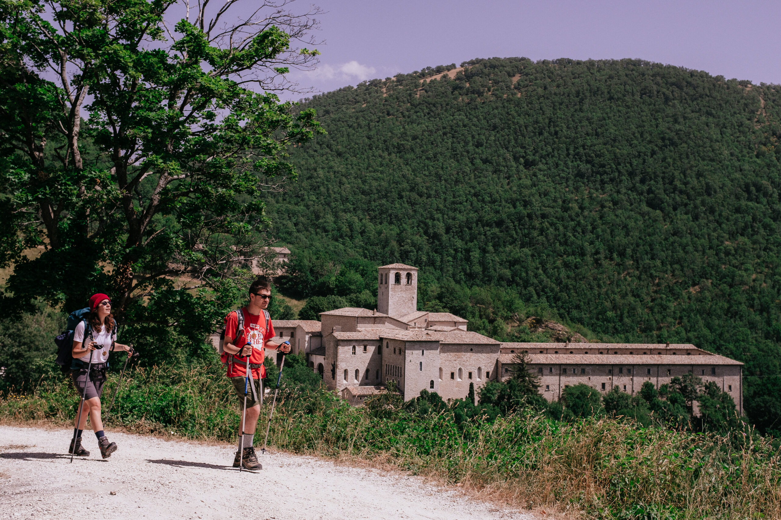
The path passes by hermitages hidden in wild forests, Franciscan convents located on the edge of cities, monasteries with millennia of wisdom, and harmonious Romanesque abbeys, places steeped in spirit and history, all linked by a thread of roads that unravel over rolling hills and wild mountains. The paths pass through small historic villages and precious towns, but never too large; of metropolises the Marches lacks for reasons related to history and even more so by vocation, because its inhabitant thinks of himself as enveloped and protected by the land that surrounds him, cultivating it without dominating it.
The walk can be done all at once, or divided into two or more parts. For example: from Fossombrone to Camerino (10 days), and then from Camerino to Ascoli Piceno (7 days); or it can be divided into three parts: from Fossombrone to Fabriano (5 days), from Fabriano to Camerino (5 days), and finally from Camerino to Ascoli Piceno (7 days).
HISTORY
The Cammino dei Cappuccini offers pilgrims the opportunity to retrace the fascinating history that marks the birth of the vital Franciscan reform of the Capuchin Friars, which exploded in the Marche region in the first half of the 1500s and became in the following centuries until today one of the most important religious orders in the world.
Today, there are more than 10,000 Capuchins in the world, spread across 5 continents and 110 nations, but despite the Order’s widespread membership, very few know their decidedly adventurous and engaging history.
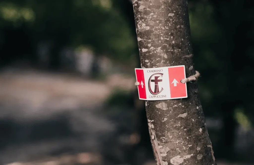
SIGNAGE
The path is regularly and punctually marked along the entire route.
WATER
All along the Cammino di Dante, in addition to bars, restaurants and private individuals who kindly allow you to fill a water bottle, there are numerous water sources to draw from. The only STAGES where you need to replenish your water supply at the start are the first part of the seventh STAGE, from Poggio San Romualdo to the Abbey of Sant’Urbano, and the following one from Cupramontana to Cingoli.
SERVICES
Most of the towns crossed by the walk are equipped with supermarkets, restaurants, places to sleep and pharmacies. Below are the places equipped with these services:
Fossombrone, Gola del Furlo (no pharmacy), Cagli, Frontone, Fabriano, Cupramontana, Cingoli, San Severino, Camerino, Fiastra, Sarnano, Montefortino, Amandola, Montefalcone Appennino (no pharmacy), Force, Rotella (no pharmacy), Castignano, Offida, Appignano del Tronto, Ascoli Piceno.
DANGERS
There are no particular dangers. On some of the more mountainous STAGES the trails simply become more rugged both uphill and downhill and slippery in rainy weather. In the strictly winter months, the mountainous stages may pass through snow-covered areas. On the last STAGES of the trail, a watchful eye is needed for shepherd dogs watching the flocks.
ROAD BOTTOM.
The basic criterion in plotting the path was to avoid asphalt as much as possible. The percentage is 70% dirt, 30% asphalt.
CREDENTIALS
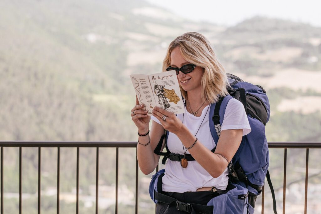
The CAMMINO DEI CAPPUCCINI provides a credential, which can be picked up directly at the starting point, the convent in Fossombrone (tel. 0721 714370) or, for those who decide to walk the second part of the path, at the convent in Camerino (tel. 0737 644480): it is necessary to contact the two convents first or write an email to camminodeicappuccini@gmail.com. Those who decide to start from other points can receive the credential directly at home. Everyone is asked to fill out the form on the camino website in the part about the credential. The credential is stamped in the places at the end of the STAGE where you stop to sleep (not in intermediate places) or in the bars, pro loco, IAT points indicated on the site for each STAGE.
Along with the credential, in which beautiful artistic stamps are affixed, the pilgrim is given a wooden pendant with the icon of the Cammino dei Cappuccini and at the end, whether Camerino or Ascoli Piceno, a Testimonium is issued. There is no set price for this either for the credential, pendant or Testimonium, but an offering is welcome to help defray the cost of maintaining the walk.
IN TENT
In some cases it is possible to use the campsites present in the STAGEs (e.g., Gola del Furlo, Frontone, San Lorenzo al Lago, Montefortino) or in free spaces where no permits are required (e.g., Poggio San Romualdo).
CONTACTS
For any information you can write to: camminodeicappuccini@gmail.com or contact: 334 3845138
STAGE 01
STAGE 01: from Fossombrone to the Furlo Gorge.
Departure: Fossombrone
Arrival: Furlo Gorge
Distance: 22 km
Height difference: +880 m / – 808 m
After receiving the credential, the walking pendant and the friars’ blessing, the pilgrim departs from the cross of the Cammino dei Cappuccini convent, walks along the walls for 100 meters and turns left. After 450 meters he leaves the asphalt and takes a dirt road uphill to the right, next to a bar (often lowered, but surmountable). After 1 km, skirting a vineyard on the left, continue on the dirt road on the right to the top of the hill, from which there is a splendid view of the mountains and the Marche Sea. Past the vineyard, continue straight on: Urbino can be glimpsed on the right, the Furlo Gorge in front. After 600 meters, at the fork, descend to the right (possible shortcut if the central passage is open), reach the asphalt road, follow it for 1.1 km, then take a downhill path on the right. After 300 meters, at the fork, it climbs to the left and, 200 meters later, takes a cart track on the right that descends for 1.6 km along a steep, rutted section. Reaching the paved road again, turn right and continue for 1 km to the fork for “il Barco,” an ancient reserve of the dukes of Urbino. After crossing the bridge, go up to the fork for Montalto-Tarugo, turn right, then straight on for 2 km to the waterworks near Sant’Anna del Furlo (important to refuel: at least 1.5-2 liters). After 300 meters, past the freeway, turn left onto the old Flaminia for 700 meters, then take CAI 440A on the right, a steep trail about 4 km. Alternatively, you can continue on the Flaminia for 3.5 km to Furlo. After 1 km on 440A, take CAI 440 to the left, then right at the fork. The climb becomes steeper along the Pietralata side, on an old forest road. After 2.1 km you reach an esplanade (elevation 658 m), from which you take 449B to the panoramic terrace of the “Testa del Duce”. The trail then descends: after 900 meters you meet “Il Furlo” Refuge, then take the breached road to the left that leads, in 4.4 km of descent plus 800 meters, to the village of Furlo.
STAGE 02
STAGE 02: from the Furlo Gorge to Cagli
Departure: Furlo Gorge
Arrival: Cagli
Distance: 21.5 km
Height difference: +750 m / – 700 m
From the Flaminia, immediately after Hotel La Ginestra, the path continues left on the paved road that descends to the Candigliano River. Crossing the bridge, you follow the road to Monte Paganuccio and, shortly after, take an uphill brecciata on the right. Follow it for about 2.2 kilometers, passing a fountain, a shrine and a cultivated field, until you reach a pine forest with a three-way fork: take the left way up a hill.
After a barbed-wire gate (to be closed), continue uphill and leave the dirt road for a path to the right that leads to another gate, then descend along a mule track. The trail passes a ruined house, turns right at two successive junctions and continues to Ca’ Rio, where it rejoins the asphalt road.
The climb resumes for 2.2 km to the Ca’ Pierello farmhouse, an excellent refreshment point with water facilities. From there, you can detour to the Sanctuary of Santa Maria delle Stelle (300 m to the left), otherwise continue on the road that climbs to the right. In case of rain, the dirt road variant leading to the Vellaneta farmhouse is recommended. From there, follow a path through fields and groves to a hamlet and a bridge. After the bridge, take an uphill path to the left, which then becomes a mule track and leads to the fork where you continue to the right. After several forks and downhill and forest sections, you come to a water source in a small hamlet. Continue left, then cross a breached road: here turn left, then immediately right crossing a bridge. After 500 m you reach the ruined church of San Giovanni in Offagna. The path continues between ups and downs, crosses a stream and reaches a ruined house, then continues to the right. After another 2 km you return to the asphalt road near Cagli. You descend, cross the small bridge and enter the River Arena area, at the foot of the historic center. Those who still have energy can climb to the Capuchin monastery on the hill: a place of great historical and spiritual value, among the best preserved of the order and with remains of Francesco di Giorgio Martini’s fortress.
STAGE 03
STAGE 03: from Cagli to the Monastery of Fonte Avellana
Departure: Cagli
Arrival: Monastery of Fonte Avellana
Distance: 18 km
Height difference: +850 m / – 450 m
The path starts from Piazza Cagli and follows Via Leopardi to the Torrione, then turns left onto SP29 and then onto Via della Vittoria. After 400 m, take via Flaminia sud for 900 m to the church of San Geronzio. Just before, go up a path to the left, then take the Frassati Trail. After skirting a field, follow the sign for Fonte Avellana at the junction, continue for 1.3 km ignoring the detours, then descend to the left and immediately climb a small path ahead. After a short descent between fields and houses, you come to a fountain. Cross the road from Acquaviva and take a dirt road downhill to Ca’ Ventura (with water). Continue in the direction of Frontone, which already appears in view, taking a dirt road marked “Molinaccio.” You cross the Devil’s Bridge and the village of Calamello, then skirt a field until you reach a path that climbs to the left into the woods. After a few uphill and flat sections, you reach the hamlet of Paravento, where there is a washhouse with a spring. Shortly after, take a dirt road marked by a plaque on the Battle of Paravento and climb toward Buonconsiglio. Passing some hamlets and the locality Ca’deguido, go down the CAI path toward the “Madonna dell’Acqua Nera.” After crossing a small bridge and a gate, continue flat in the woods, then downhill with a view of Frontone Castle. When you reach the road to Foce, you are in the vicinity of Frontone. Here you can stop for supplies, lunch or overnight stay, especially in case of bad weather or if you do not find availability at Fonte Avellana. From Via Valbona, take the aqueduct road that climbs steeply for 1 km, then follow the scenic dirt road on a falsopiano until you reach a fork called “la Forchetta,” where you intercept the asphalt road. From here, take an immediate left onto the path that descends toward the monastery, passing through a gate. You can see the monks’ cemetery on the left, before arriving at the guesthouse and hermitage of Fonte Avellana. Here you can eat, sleep and, if time permits, visit the scriptorium and participate in the liturgy with the monks.
Note: The safest refueling point is Frontone, 6 km before the hermitage. Fonte Avellana offers refreshments and, upon contact, sandwiches for the next day.
STAGE 04
STAGE 04: from the Monastery of Fonte Avellana to Pascelupo
Departure: Monastery of Fonte Avellana
Arrival: Pascelupo
Distance: 13 km
Height difference: +650 m / – 700 m
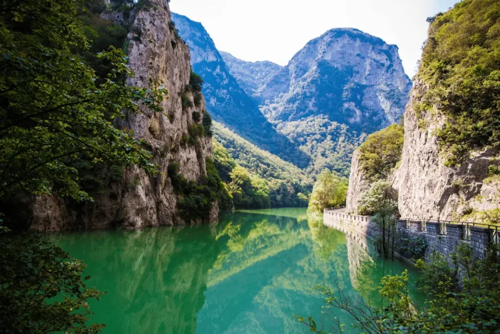
From Fonte Avellana Monastery descend 900 m on asphalt to the shrine of Sant’Albertino, then another 400 m to the fork on the right for “Valle Calecchie” (watch out for the sign). In case of rain, it is recommended to stay on asphalt until Sitria Abbey and then continue to Isola di Fossara. Take the path to Sella Valle di Nocria, and after 300 m climb left into the woods on CAI 232. In 700 m you reach the pass, with a nice view of the monastery, and continue right toward Isola di Fossara. After 1.5 km you reach Piano di Sant’Angelo, from which you descend slightly to the right, with views of Monte Catria and the Coldipeccio valley. After 700 m turn carefully right onto a CAI path and, after another 900 m, you come to a small house with a drinking trough. From there go straight down 1.5 km into the valley to Isola di Fossara, where there is a water source, grocery store and parish bar. Crossing the road, continue straight on CAI 232, skirting the Sentino River for a stretch. After 1.8 km you leave the dirt road for a steeply ascending path to the right. Go up two 300 m sections, the second very steep, to the pylon, then continue right toward Coldipeccio, clearly visible in front. After 700 m you reach the junction to Castellaro and turn left. In 1.6 km you reach Coldipeccio, where there is a spring. Past the church, you descend 1 km to Pascelupo, where you can STAGE and leave your backpack. Those who wish can take a 1.5-km detour on foot to visit the picturesque Rio Freddo Gorge. It is not recommended, however, to climb to the hermitage of San Girolamo, which is inaccessible to visitors. However, the view of the hermitage will be visible the next day on the first ascent.
Note: refueling possible at Isola di Fossara (7 km after Fonte Avellana) and refreshment at Pascelupo.
STAGE 05
STAGE 05: Pascelupo to Fabriano
Departure: Pascelupo
Arrival: Fabriano
Distance: 26.5 km
Height difference: +650 m / – 920 m
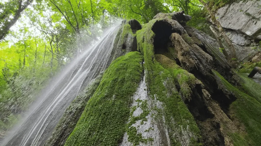
From Largo Umberto I in Pascelupo, the path descends to the right, skirting the church of San Bernardino (in case of rain, the paved alternative is recommended). After a short detour to the viewpoint over the hermitage of San Girolamo, take the old steep path on the left that descends for 600 m to the “Casa il Sasso” junction. Turn right toward the hermitage and, after 300 m, take CAI 230 on the left towards the Forra di Rio Freddo. Having forded the stream, go up into the woods always following CAI 230. After about 1.3 km total, you reach a viewpoint over the hermitage, then continue left downhill for 700 m to San Felice. Past the hamlet, take the dirt road to the left, cross the asphalt and continue on the dirt road for 1.7 km, crossing a stream. Shortly afterwards you reach the waterfall “Lo sturo della piscia.” Continue uphill to the Fontecelle junction, go right and follow the main cart tracks to a viewpoint with a shrine. Go downhill to the left on CAI 136B and then turn right on a dirt road to Piaggiasecca, with a fountain and open-air peasant museum. From Piaggiasecca continue on asphalt for 500 m, then dirt road, then uphill on SP47 to Rucce. After the first houses leave the asphalt to take CAI 136 toward Viacce. After passing the church of San Nicolò and the cemetery, you reach Viacce, where you turn right, then left after 50 m. At the first house in Morentella turn right and continue on a dirt road. After a few turns and climbs you come to a meadow field with a view of Fabriano. Descend carefully, following the signs, until you intercept a path that leads to Vallina. Past the small church of San Giorgio, go right to Palombara. You cross Cupo, then take CAI 127 downhill to San Cassiano Abbey (visitable). From there you follow a dirt road, which then becomes asphalt, to SP16. Turn left and after 100 m turn right towards Melano. After 500 m take a dirt road with a bar, continue for 600 m, passing a second bar, then right at the fork. Continue on asphalt, with water source on the left, turn right again and continue on dirt road uphill for 1.5 km to the Marischio industrial area. Turn right, then right again at the stop sign, walk 600 m to the cemetery, turn right and then left toward Marischio. After 300 m take Via Serramaggio, then turn right twice and finally left onto Via della Vena. Another 300 m, continue straight on a dirt road, then on asphalt. After 900 m you enter the outskirts of Fabriano, go down Via Romualdo Sassi, pass the traffic circle, and follow Via Martiri della Libertà to Via Enrico Cialdini, which leads into the city center along Corso della Repubblica to Piazza Fabriano.
STAGE 06
STAGE 06: Fabriano to Poggio San Romualdo
Departure: Fabriano
Arrival: Poggio San Romualdo
Distance: 23 km
Height difference: +900 m / – 350 m
From the square in Fabriano the path continues for 350 m along Corso della Repubblica, then turns left onto Via Serraloggia, which climbs for 600 m. Continue straight on a steeper climb to the former seminary, where you turn left onto a downhill paved road. After 900 m, passing under the freeway, turn left and continue on the brecciata that crosses a stream.
After 2 km, take a left at the fork with a cross, continue slightly downhill and, shortly after, turn right onto a small road that becomes a sheep-track, to be followed for 1.2 km to the asphalt. You immediately turn right, then left at the wash house. After 150 m you cross the road and take a downhill track on the left.
After 400 m climb to the right into a small hamlet, cross the houses and continue uphill to the left. After 1.3 km you cross the state highway and continue straight on a semi-paved road. At the bend, you leave the asphalt road for a breached road on the left. After 900 m continue straight downhill for another 1.1 km to the bridge over the Esino River. At the fork, turn left, then on the asphalt take the state road to the right, cross it after 100 m and take the road to Albacina.
After 900 m, at the intersection with the concrete cross, climb left toward Albacina Castle. Here begins a challenging climb of about 6 km. You pass the church of San Venanzo and find a fountain under the walls. Continue for 300 m and take the brecciata marked CAI 116 to the right.
After 400 m, at a shrine in the shape of a small church, turn right on the path to the Eremo dell’Acquarella, reached after about 2.5 km. Here there is a fountain and a place of deep Franciscan memory: according to tradition, the first chapter of the Capuchins was held there in 1529.
Continuing on, after 1.2 km you come to a post with a sign for Poggio San Romualdo. Leave the road and take a left on a meadow, then at the fork again left downhill. After 900 m you leave the main trail and take an uphill path to the right. Continue through meadows and CAI markings, avoiding the front brecciata and climbing to the left.
After about 1 km turn carefully onto a small path to the left that skirts some rocks and then enters the woods. Follow it for 800 m to a breached road uphill that leads to Poggio San Romualdo.
STAGE 07
STAGE 07: from Poggio San Romualdo to Cupramontana
Departure: Poggio San Romualdo
Arrival: Cupramontana
Distance: 26 km
Height difference: +750m / – 1100 m
From the square of the “Norma” Hotel, go downhill to the right for 300 m and turn left after the church. Shortly after, turn right and then immediately left on a path through the woods marked Valdicastro. After 800 m you come out onto a meadow and descend to the right until you intercept the paved road, which you follow for 750 m to Valdicastro Abbey. If the gate is open, you can pass through the abbey, otherwise you skirt it on the left. Upon reaching a small lake, avoid going straight ahead and instead cross a meadow on the left (look for the sign on a large oak tree), entering a barely visible path that climbs into the woods. After about 1 km you reach an open meadow. Continue slightly to the left, skirting a hill and taking a new path that becomes a pleasant downhill mule track. After about 2 km you reach the “Ginocchielli di San Romualdo,” a stone with the alleged footprints of the saint. Continue downhill, rejoin the mule track and descend for 1 km to the bottom of the valley. At the crossroads take a left on CAI 178A for 600 m, then a right (CAI 178B) to the paved road, which you follow to the left for 1.5 km to the locality “Palazzo.” After houses and a PV field, you turn right onto a road that, after 650 m, becomes breached and descends for 2 km to SP117. Turn left, then straight on at the fork for 900 m to the Abbey of Sant’Urbano, where a stop and visit to the Romanesque church is recommended. After 800 m you leave the asphalt road to take a brecciata on the left: take the right road, which climbs to a photovoltaic field. You skirt it and climb for 600 m to a pink house with a swimming pool. Turn right and go downhill for 200 m, then take a path to the left at the beginning of an olive grove. Go up into the woods for 400 m, keep right at the fork, and after another 250 m you come to a house. Go around the white house (No. 11) and descend toward Castellaro. After passing the cemetery and the church of San Lorenzo, go left, then straight on toward Serra San Quirico. After 500 m turn right downhill at the sign for Fontegeloni (at km 17.8 there is a spring on the right). The road continues for 2.6 km with beautiful views of Cupramontana, descends to the bottom of the valley and, after a bridge, crosses the provincial road to climb to Eremo dei Frati Bianchi. After 600 m you leave the asphalt road, turn left, then immediately right passing a gate (sign Agriturismo “La Distesa”). After 900 m you arrive at the Hermitage of the White Friars, with a fountain and the possibility of stopping. Here, in 1526, the first Capuchins found refuge with Blessed Paolo Giustiniani. You skirt the hermitage and climb up a small road for 1 km. At the top, you take a brecciata to the right, then a small asphalt road. After 700 m, a 100 m detour to the right allows a visit to the Romita di San Giacomo (“the black friars”). Back on the track, continue for 1.2 km, then turn right into Via Lazio, then into Via Annibaldi, crossing the main. Follow Via Bonanni, then Via Giacomo Matteotti for 500 m until you reach the central square of Cupramontana.
STAGE 08
STAGE 08: Cupramontana to Cingoli
Departure: Cupramontana
Arrival: Cingoli
Distance: 17 km
Height difference: +600 m/ – 450 m
From Piazza Cavour in Cupramontana, the pilgrim descends along Via Roma, passes the church of Santa Maria della Misericordia and immediately turns left. At the crossroads he follows the sign for Apiro and, after 200 m, enters the park on the left. After crossing the park, continue straight on the asphalt road, come to the main road and continue left for 700 m to Beato Angelo Abbey. After passing the abbey, continue for 400 m and leave the asphalt turning right onto a brecciata in the direction of “Contrada Malcupa.” The road descends and then climbs for 1.8 km to Contrada Cerretine, where you turn left. After another 1.7 km you reach a paved road that you take to the right slightly uphill. After 1.2 km, downhill, turn left to “Ca’ di Chiocco” and continue for 1 km to the small church of Santo Stefano, with panoramic views of Cingoli. From the square, take the path on the right downhill to “Vallelunga.” Keep left at the fork and, after 700 m, continue on the main downhill winding path. After another 600 m you cross a field of olive trees and, still following the main road, you reach the asphalt road. You turn left toward Cingoli, cross a bridge and continue for 1.4 km until you take an uphill brecciata on the right. After 300 m at the fork, keep right, then turn left onto “The Hornbeam Trail,” which climbs for 1.8 km to the church of San Bonfilio. From there continue uphill to the right. After 700 m you pass a barrier and turn immediately right. In 100 m you reach the “Carlo Bernabei” polygon, where the road becomes paved again. Continue straight uphill for 200 m to the sports hall, then straight again on San Giuseppe Street for 1 km. At the large intersection turn left onto Viale Valentini, which leads to Porta Piana, the entrance to Cingoli‘s historic center.
STAGE 09
STAGE 09: Cingoli to San Severino marche
Departure: Cingoli
Arrival: San Severino marche
Distance: 28 km
Height difference: +900 m/ – 1130 m
Coming out of Porta Piana in Cingoli, turn left and walk for 150 m, then continue straight another 150 m to the turnoff on the right for the church of San Giacomo (which can be visited with a short detour). Continue for 1.3 km to the turnoff for Capo di Rio, where you turn right. After 400 m, you take a breached path to the right that climbs into the woods. Follow the main trail for 2.7 km until you come out onto a meadow with a view of the Conero. After a gate, take a left downhill and continue for 1.1 km. At the fork, go straight, descend for another 600 m, and continue straight again for 1.1 km until you reach the Domus San Bonfilio, from which there is a beautiful panoramic terrace. Take the path to the right of the Christ of the Marches and, after 200 m, keep left to descend to theHermitage of Sant’Angelo (historic site of Capuchin reform in 1525-1526). From here you descend for 900 m to the asphalt road, which you abandon after 150 m for a right-hand breccia. You ignore the turnoffs, pass a large oak tree, keep right, then left, then walk for 800 m on a level path. At the fork you climb for a few meters and turn immediately left. After 600 m you skirt a house, continue for 350 m and reach the paved road uphill. Follow it for 1.1 km to Paterno di San Lorenzo (drinking fountain on the left, bar on the right), then turn right, and at the fork turn left downhill for 900 m to the Scout Park (with water). Continue uphill for 500 m on asphalt and take a brecciata to the right. After 600 m, on a bend, veer right, pass a house and take the small road to the left. Past a gate, go straight and walk 700 m into the woods. Coming out of the woods, turn right onto a small road that descends steeply for 100 m. You turn left onto a breached road that descends for 2.3 km along the cherry tree hill. At the fork, take the asphalt road to the left, then to the right and descend for 2.7 km to the hamlet of Cesolo. Turn left, cross the village for 700 m and before the church take Via della Villa, uphill for 200 m to a kindergarten. From there, next to the wash house, take via Don G. Cruciani, go uphill for 500 m, then take a scenic flat breached road on the left. After 2.1 km you reach the Sanctuary of the Glorious. From the shrine turn right, walk for 700 m to the traffic circle, then right and after 100 m take Settempeda Street to the left. Walk 350 m, cross the river and continue straight on Viale Eustachio for another 400 m until you enter Piazza del Popolo in San Severino Marche. Those who wish can continue to the Convent of the Most Holy Savior: cross the square, go up next to St. Augustine’s, take Via Salimbeni to Porta Romana, then left and immediately right for the final ascent (400 m) along the Via Crucis that leads to the convent where Francis of Assisi passed twice, leaving a peculiar spiritual imprint.
STAGE 10
STAGE 10: San Severino Marche to Camerino
Departure: San Severino Marche
Arrival: Camerino
Distance: 17 km
Height difference: +650 m/ – 300 m
From the square of San Severino Marche, the pilgrim heads toward the church of Sant’Agostino, takes Via Nazario Sauro and then Via Salimbeni uphill. Passing the picture gallery, he exits Porta Romana and immediately after, on the right, crosses a small bridge marked “Convento Cappuccini.” It climbs along the Via Crucis to the Convent of SS. Salvatore in Colpersito, where you can admire a precious living crucifix on the altarpiece. Continue alongside the convent to the left on a brecciata, go downhill for 200 m and take the paved road to the left. After 400 m, turn left onto an uphill dirt road. After 900 m turn right and climb for about 6.5 km to Rifugio Manfrica, with water fountain. Continue for another 1.7 km to the end of the climb. Cross the paved road and take the dirt road opposite. After 350 m, turn right following the electricity pylons, and then right again uphill. After 400 m, continue left: a wide panorama opens up with views of Camerino and the surrounding mountains. You reach the asphalt road and turn left. After 800 m, you take a breached road to the left for 600 m, then return briefly to the asphalt and continue straight following the sign for Camerino. After 400 m you reach the main road, turn left and after 800 m enter the locality of Torrone. Shortly after, on the left, you will find a fountain. You leave the main road to go up to the left towards San Gregorio. After 400 m you take a right onto the brecciata and continue straight ahead to the church of San Gregorio, then turn left and immediately right onto asphalt. Continue for 700 m, then at the fork go right and descend for another 700 m (noting the signs in both directions, useful for the next STAGE). When you come to a large wooden cross, turn right: after a few bends, you reach the Convent of Renacavata, the first convent of the Capuchin Order and the spiritual center of the path. It is advisable to contact the friars in advance to visit the church, convent and museum. Here it is possible to receive the Testimonium for those completing the first part of the walk (otherwise you will receive it in Ascoli Piceno).
STAGE 11
STAGE 11: Camerino to San Lorenzo al Lago.
Departure: Camerino
Arrival: San Lorenzo al Lago
Distance: 24 km
Height difference: +850 m/ – 700 m
From the forecourt of the convent of Renacavata, the pilgrim descends to the road and turns left. After 500 m he leaves the asphalt road for a breached road on the right. Continue for 900 m, turn right and follow the main road downhill to Paganico, where you turn left. After 700 m continue left, then right after another 300 m. Continue for another 700 m and, at the fork, go left to a gate, which you pass. The road returns to asphalt for a short distance (50 m), then you take a broken road straight ahead. After 500 m you return to the asphalt and follow it for 1.6 km to the junction for Rocca Varano. Turn left, skirting a house, then continue on a dirt road for 300 m to the provincial road. Turn left, then right passing a bridge. After 300 m, at the Sfercia group of houses, turn left through the hamlet (there is a water source). At the end of the hamlet, just past a bridge, go right down a flight of steps under the freeway, then up a paved road. After 300 m you take a path to the right. Go uphill for 1.2 km to a breccia, which you take to the left. After 400 m turn right downhill, then after 500 m take a right between two poplars, cross a stream and turn left onto a meadow. After 200 m you reach the asphalt road, climb left to the hamlet of San Giusto, where you can visit the Romanesque church (by prior contact). Continue uphill for 1 km, then, after a ruined church, take a scenic dirt road on the right that descends for 2 km toward Villarella. When you reach the asphalt communal road, turn left and after 1.4 km take, on a bend, a path on the left that enters the woods. Go up 2 km on a path through the woods to the hamlet of Colli, where there is a water source. At the fork outside the village go left (another spring is 20 m away). After 600 m you enter Bolognesi. Leaving the village, just before the yellow house No. 2, take a slightly downhill path on the right that enters the woods. After 1.8 km (downhill and then uphill), you exit the woods and take the path to the right. After 100 m you meet the asphalt road, which you follow to the right for 800 m to a downhill dirt road on the left. After 1.8 km you reach the cemetery of Fiastra. You cross the road and take the descent in front towards San Lorenzo al Lago. After 300 m you leave the main road for a detour to the left marked by a “Boccioni” sign. After 400 m you cross a bridge and here is San Lorenzo al Lago.
STAGE 12
STAGE 12: San Lorenzo al Lago to Sarnano
Departure: San Lorenzo al Lago
Arrival: Sarnano
Distance: 18.5 km
Height difference: +800 m/ – 950 m
From San Lorenzo al Lago, with the church of San Lorenzo on the right, continue for 200 m and turn left following the sign for Madonna del Sasso Bianco. The road, all uphill, becomes a mule track after 600 m. After passing the small church, continue straight ahead for 2.2 km to a fountain: here take the path that climbs slightly to the right of the watering hole. After 1.5 km you come to a paved road and turn left. After 600 m you leave the asphalt road for a breached road to the left, which becomes a path over grassland: continue following the visible tracks, keeping straight ahead for about 1.7 km to another breached road. Turn right for 50 m, then immediately left on a level grassy path that passes an alpine-style cottage. After 800 m you reach the asphalt road, turn right and, after 100 m, left to a stylized cross. Go down the ridge to a watering hole, then turn left to rejoin the asphalt. After 400 m you will find a spring, continue for another 800 m, then leave the asphalt for a brecciata on the right (in case of rain, you can continue on the asphalt for about 2 km following the signs for Eremo di Soffiano). Go down into the woods for 800 m following the signs (red-white and symbols of the path), until you reach Fonte Murello. Shortly after, take the flat dirt road to the right. After 350 m take a downhill path to the left for 600 m, then turn left onto a flat road for 1.8 km. You pass a few houses and a small bridge, then turn right onto a gravel road, following it for 2.5 km. You reach a wider road, but take the small path to the left that runs alongside it. After 400 m you reach the asphalt road, turn right towards Sarnano (there is a spring immediately afterwards). Continue for 500 m, continue straight on Via Fontemarta, eventually turn right for 30 m and then immediately left downhill. After 50 m turn right to join the main road, then left to the small square of Sarnano.
STAGE 13
STAGE 13: Sarnano to Montefortino
Departure: Sarnano
Arrival: Montefortino
Distance: 20.5 km
Height difference: +850 m/ – 750 m
From the square in Sarnano, the pilgrim takes the road next to the bank and descends to the right along Via Corridoni. After 400 m, at the fork, continue straight on via Monti Sibillini. Past the church of San Rocco, continue for 700 m and turn left, following the signs for Bisio-Garulla. After the bridge, you can detour right to visit the picturesque Cascatelle waterfalls, then return to the main road. After 200 m turn left on a breached road uphill towards Collina. Go straight for two forks (900 m + 900 m), then turn right uphill, and right again at the next one. After a short stretch you come out on a scenic meadow. Continue for 700 m, then straight ahead again for 300 m until you reach the asphalt, which you take right uphill toward Garulla (water source present). After 700 m you pass the Garulla Refuge, continue on the dirt road downhill to the left for 200 m, cross the asphalt road and take the track in front (signposted for San Salvatore Abbey). The road becomes a path through the woods for 1 km, then at the fork, go downhill to the right and continue for 1.4 km. At the fork continue straight ahead slightly downhill for 700 m to theAbbey of San Salvatore. Just before the abbey you take a right onto a breached road going uphill (signposted Capovalle-Rubbiano). After 400 m you ignore the turnoff for the “Casa del Beato Antonio” and continue straight for another 600 m to Casalicchio. After passing the small village, go uphill crossing a meadow under pylons: here begins the most challenging climb of the STAGE, which leads to the Amandola Refuge. After 800 m you turn slightly right and take the dirt road to the left. After another 600 m into the woods turn left, and then after 100 m turn right uphill. Continue for 800 m to Rifugio Amandola, where there is a fountain. The climb ends here. Turn left along a meadow path with splendid views of hills, Sibillini Mountains and the sea, overlooking Montefortino and the Montefalcone Appennino ridge. After 1.1 km you reach an esplanade, turn right and pass under Balzo Rosso. At the next fork, turn left (CAI path) and continue following CAI signs. At km 14.4 be careful: do not follow the path that seems to go straight ahead, but take the second of the two small roads downhill on the left. After 200 m you pass in front of the aqueduct house, then descend another 1 km to the Sanctuary of Madonna dell’Ambro (visitable, with water and resting point). From here walk for 5 km on asphalt road slightly downhill towards Montefortino. At km 20.5, just after the bend signposted “Gole dell’Infernaccio,” continue for 200 m, cross an overpass and take a dirt road on the right uphill for 400 m to the historic center of Montefortino.
STAGE 14
STAGE 14: Montefortino to Montefalcone Appennino
Departure: Montefortino
Arrival: Montefalcone Appennino
Distance: 25 km
Height difference: +850 m/ – 750 m
From Piazza di Montefortino, take via Fratelli Duranti and continue for 300 m to the town gate. Past the school and the church of Madonna della Fonte, turn left onto Via Rio, which you immediately leave on a straight path. After 400 m continue straight ahead, go through some houses and take a path to the left. After several detours, always follow the main trail for about 2 km, through fields and undergrowth, to a paved road. Turning left, you enter Amandola along Via Cesare Battisti (with the Rimembranza trees) to Piazza Risorgimento, where the Sanctuary of Blessed Anthony and the Town Hall are located. Leave the arch of the square and turn left onto Via Bora, continuing for 400 m, then right again for 500 m. At SP 239 turn left downhill for 350 m, then leave to take a dirt road on the left that passes by the church of Santa Maria a Piè d’Agello (15th cent.). After a descent, the path becomes flatter. It continues for about 2.5 km on breached roads in rural landscapes, until it reaches the Lake San Ruffino bike/pedestrian path, which it follows for 1.1 km. Having passed the dam and reached the refreshment area, continue for another 300 m on SP 239 to the splendid Abbey of Saints Ruffino and Vitale (10th cent.). Continue 400 m on asphalt, then descend left onto a dirt road that leads to the ford of a sulfur river (to be crossed with caution). Go up 300 m and take a right on asphalt for 500 m, ignore a first detour and then take a right onto a dirt track that climbs and then descends. After a bridge and an ascent, you return to the asphalt and turn left. You immediately take an uphill asphalt road on the right that you follow for 4.5 km, admiring the Sibillini Mountains on the right. When you reach a wooden cross (with a “give way” sign), turn left onto a path that leads to the Smerillo spring, then left again onto the asphalt for 200 m to the junction with the “nature trail.” Here you can:
-
Continue on the asphalt road toward Montefalcone Appennino (1.3 km), or
-
Climb to the right on the nature trail (recommended), which in 1.7 km of scenic undergrowth leads to the Domus Appennino (former monastery of the Observants, related to Friar Matthew of Bascio, founder of the Capuchins).
From the Domus, take the road to the right, ignore the first turn, and after 600 m turn right (signposted Comunanza), skirt the church of St. Anthony of Padua, and enter the historic center of Montefalcone Appennino (758 m).
STAGE 15
STAGE 15: Montefalcone Appennino to Rotella
Departure: Montefalcone Appennino
Arrival: Rotella
Distance: 22 km
Height difference: +500 m/ – 900 m
From Piazza di Montefalcone Appennino, descend past the church of San Michele Arcangelo and take the medieval, stone-paved path to the right. After 400 m you reach a dirt road, turn left and continue for another 300 m, keeping then on the uphill path to the left. Reaching a house, turn left for 50 m and then right on a path that enters the woods. After a meadow and a short climb you come to a flat road, where you turn right. Near an abandoned house, you leave the road for a sheep-track on the right, and after a series of branches (all to the right), you come to a small road that you follow for 700 m to a paved road. You turn right and then immediately left, following the sign “Valdaso.” After 1.2 km downhill you reach the provincial road, which you follow to the left for 700 m to the bridge on the right. After crossing the bridge, continue on the paved road for 1.2 km. At the fork continue to the right and after 500 m take another right. After another 500 m turn left and begin the ascent towards Force, between fields, until you reach Villino Verrucci Bey (648 m). At Force, after a stop at the water source and a scenic stop at the viewpoint, continue on via Roma (SP 93) and turn left onto via Rampi, then left again onto contrada Lame. Passing the last houses, the road becomes paved and descends gently through the S. Taddeo district. When you reach a crossroads on a straight road, take the road on the right that descends to the Tesino stream, which is crossed by a small bridge. Then continue on a paved road for about 3 km until you reach Rotella (390 m).
STAGE 16
STAGE 16: Rotella to Offida
Departure: Rotella
Arrival: Offida
Distance: 21 km
Height difference: +750 m/ – 950 m
From Rotella (390 m) follow SP17 for 400 m, then turn right onto a dirt road that climbs for about 3 km between fields and solar panels to Capradosso (640 m). From the drinking fountain in the square, take the dirt road on the left that descends for 1.5 km to the Sanctuary of the Madonna di Montemisio (448 m). From there continue to the right along a dirt road that descends and ascends, skirts Casa Galanti, and reaches SP73. Turn left for 350 m and then right behind a former factory to climb to San Martino (438 m). With the church on the right, you turn left and take a right onto a breached road between fields. After 350 m turn right into Contrada Moglie, which you follow uphill for 1.3 km until you come out on SP17. Follow Via Alcide De Gasperi to climb into the historic center of Castignano (473 m). After visiting the upper part of the village and the church of San Pietro, go down to Piazza Umberto, take via Corso Garibaldi and then SP17. After the church of Sant’Egidio, you descend to the right and then to the left; past a house, take a dirt road to the right that runs alongside a spring and, after an up and down between vineyards and fields, you reach contrada S. Serafino (483 m). After 50 m turn left onto the road to the Sanctuary of San Bernardino (possible detour). At an iron cross, you leave the asphalt road for a sheep-track that descends among vineyards, olive groves and rural houses. Continue along paths and sheep-tracks, between fields and small groups of houses, crossing the Fiorenire farm, until you intercept SP17. Follow it for 150 m, then climb left between olive groves and electric poles to a house on the summit. Past the house, follow the fence and face a steep climb to a scenic knoll. From there you descend on trail, cross SP17 and take the dirt road to the rural church of Madonna della Sanità (325 m). Continue for more than 1 km on a scenic dirt road, descend through vineyards and cross a small bridge over the Lama stream. It climbs up through the woods to the church of Santa Maria della Rocca, then enters the center of Offida, crossing Piazza del Popolo and Corso Serpente Aureo, to finally climb to Via Borgo Cappuccini and reach the Sanctuary of Beato Bernardo (320 m), the final destination of this STAGE.
STAGE 17
STAGE 17: Offida to Ascoli Piceno
Departure: Offida
Arrival: Ascoli Piceno
Distance: 24.5 km
Height difference: +750 m/ – 920 m
From the Sanctuary of Blessed Bernardo (320 m) go downhill along Via Nenni, past the stadium and Via Martiri della Resistenza, taking Via I Maggio, which becomes SP176. Passing the junction with via De Gasperi, take a dirt road on the left downhill through contrada San Lazzaro, among vineyards and olive groves, to the “La Valle del Sole” farm. After crossing SP176, you descend on a brecciata for 1 km, ford the Lama stream and reach SP43, near the birthplace of Blessed Bernard. After a short ascent, take a brecciata to the left that descends into the Porchia ditch, climb back up toward Palazzo di Cappella, and ride along the ridge of contrada Palazzi. Descending along the edge of a field and crossing the Prato Grande ditch, you reach Appignano del Tronto (194 m). You pass through the historic center via Via Roma and Via Rimembranze, flanking the church of S. Maria del Piano Santo. Continue along Colleguardia Street to a junction from which a scenic dirt road starts with a small cone tied to the ancient church of San Casciano. Continue on brecciata downhill for 1.6 km to SP73 at Il Colle (348 m), with views of Mt. Ascensione. From here a steep descent leads to the Bretta stream (156 m), which is crossed over a small bridge. You skirt the former Reclamation Consortium house and take a left on the long climb on brecciata that, for 3 km, leads to the closed fountain of Cima Gallo. Just beyond, at an elevation of 421 m, you reach the highest point of the stage. The descent towards Ascoli Piceno then begins: you ride through Valle Fiorana, cross the Chiaro stream, then Viale Federici, via Rigantè, the Ponte Romano, and via San Serafino da Montegranaro. The Cammino dei Cappuccini finally ends at the Shrine of St. Seraphim of Montegranaro, where the tomb of the saint beloved by the friars of the Marche region is kept.

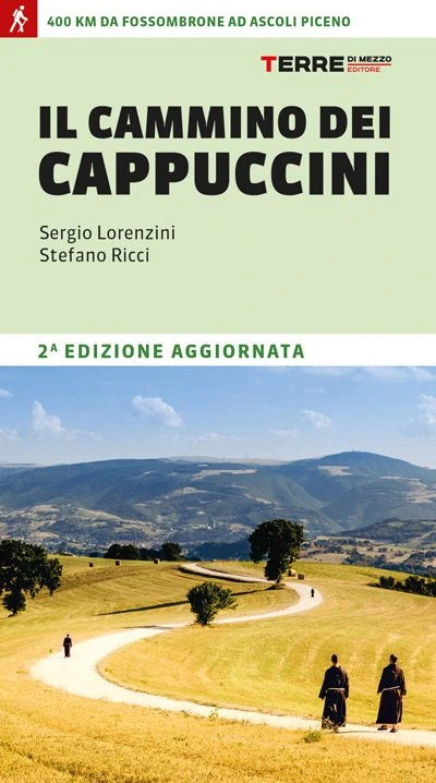
GUIDE TO THE CAMMINO DEI CAPPUCCINI
400 km from Fossombrone to Ascoli Piceno
The history of the Capuchins began as a revolutionary movement, the result of a desire to return to the essence of Franciscanism. At first it was opposed by the Order itself, and is marked by arrests, escapes, solitary refuges and a deep inner quest. Five centuries later, this journey can be relived in 17 STAGES, passing through rolling hills, ancient hermitages and cities of art, along the ridge of the Marche hinterland. A path that, step by step, makes one experience the sincere welcome of a community.
Between parks, nature reserves and the peaks of the Sibillini Mountains, history, culture and spirituality are interwoven, with the possibility of sharing a stretch of the road with today’s friars and experiencing their hospitality by spending one or more nights in the convents along the route.
The guide gathers all the necessary information: maps, elevations, hospitality and the places not to be missed.
Find out all the details of the Cammino dei Cappuccini!

Cammino dei Cappuccini
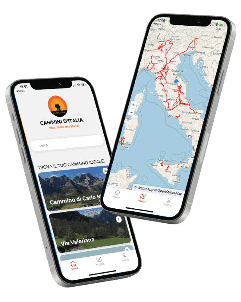
With the free Cammini d’Italia app, you can plan and walk the Cammino dei Cappuccini in total safety, being able to plan the STAGES in detail and walk the route thanks to the integrated GPS technology that supports your orientation during your adventure.
⠀Inside the app you will find many other paths present in Italy. Thanks to the georeferenced tracks of many routes you will be able to study the itinerary that suits you best and also download the GPX tracks of the individual STAGEs offline.
The app also includes a complete digital map of all the paths surveyed to date on our portal, giving you a wide range of choices among the many paths in the Belpaese.
⠀⠀
Cammini d’Italia is the perfect app for those who want to explore the beauty of Italy on foot, discovering hidden places surrounded by nature. Download it for free today and start planning your next adventure!
⠀
⠀
 ⠀⠀⠀
⠀⠀⠀