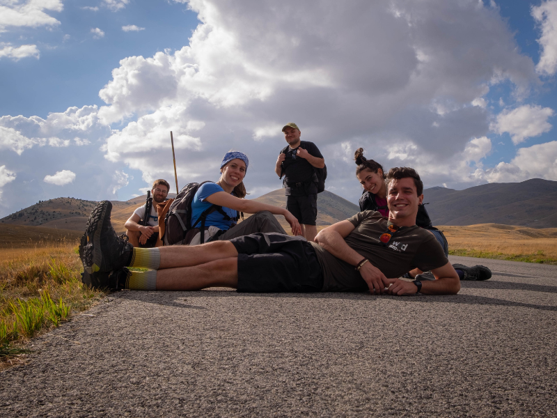
CAMMINO DEL GRAN SASSO
Sixty-one kilometers in five STAGES through the breathtaking landscapes of L’Aquila’s Gran Sasso and its villages, amid authentic flavors and unspoiled settings.
A loop trail that starts from Fonte Cerreto, at the base of the Gran Sasso cable car in the municipal territory of L'Aquila, and develops in the following stages: the first starts from the arrival of the cable car at Campo Imperatore and arrives up to Castel del Monte crossing the Campo Imperatore plain and the suggestive Scoppaturo Canyon, natural set of numerous films; the second stage goes from Castel del Monte to the Rocca di Calascio, crossing the Pianoro di San Marco and passing the Colle della Battaglia; the third leads from the Rocca di Calascio to Santo Stefano di Sessanio; the fourth goes all the way to Barisciano; and the fifth and last allows you to return from Barisciano to Fonte Cerreto via the slopes of Mount Ruzza, the Montecristo refuge and the Valle Fredda ridge.
HISTORY
The recognized association “Il Cammino del Gran Sasso” was founded as a community of tourism operators in the territory of the most important peak of the Apennines. The members, all of whom operate within the municipalities of the so-called Baronia di Carapelle (Castel del Monte, Calascio, Santo Stefano di Sessanio and Barisciano), offer hospitality, catering and tourism services. Operating in an area such as the Gran Sasso is never just a matter of business, but also and above all a matter of passion for the mountains and love of the area. From these common feelings came the desire and vision to build a Cammino that would organically and comprehensively showcase the territory with an experiential route that would showcase the nature and history of the places.
The Association aims to be a point of reference both for operators in the area and for all those who would like to discover the heart of the Apennines. The services we offer involve all aspects of the tourism experience: in fact, the association’s members include 4 accommodations, 4 restaurants, an association of mountain guides registered with the College of Mountain Guides, a food and wine publishing operator, and an association of tour guides. All members not only represent excellence in absolute value but offer the added value of being territorially rooted. This approach guarantees professional assistance combined with a deep love for the area that will welcome tourists and travelers who want to visit this corner of Abruzzo and convey all the beauty of the Cammino to those who can grasp it.
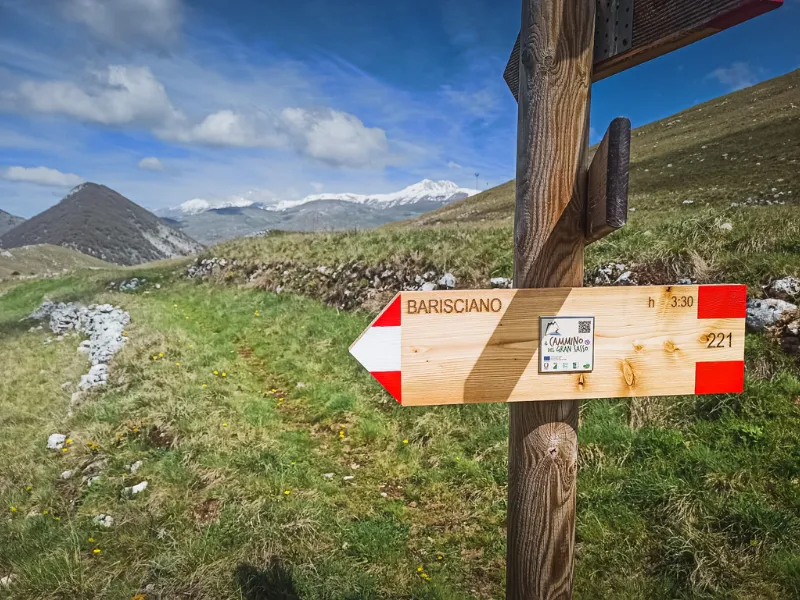
SIGNAGE
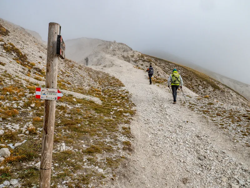
Signage present along the path following CAI standards with the addition of the Cammino del Gran Sasso Logo.
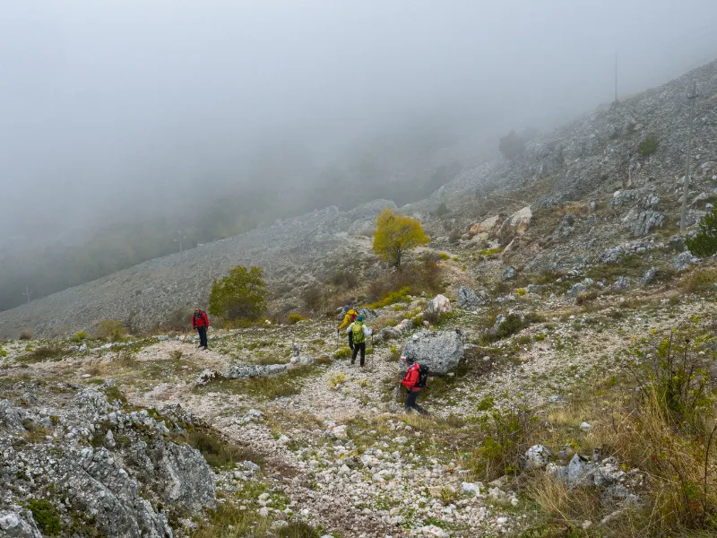
NB during the first STAGE many walkers reported that they had some problems with the signage. We recommend that you download theCammini d’Italia app and download the STAGES in offline mode already.
WATER
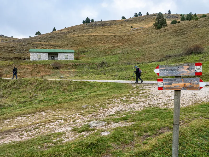
Water sources present at the ‘finish and start of each STAGE. Along the first STAGE it is possible to buy water at the Fontari Refuge (42.440208, 13.570445) and at the Racollo Refuge (42.3935264, 13.6563649). in the last STAGE it is possible to buy water at the Montecristo Refuge (42.4138748, 13.5586363)
SERVICES
Are there supermarkets?
At all the villages where the stages of the Cammino del GRAN SASSO arrive, it is possible to find grocery stores with local and other products.
Are there pharmacies?
Pharmacies are present in the towns of Castel del Monte and Barisciano
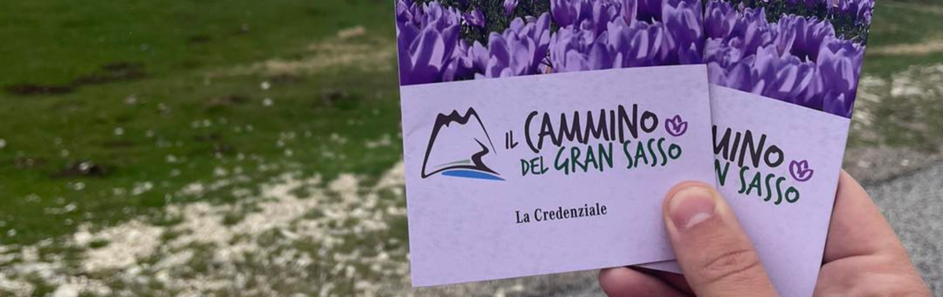
CREDENTIALS
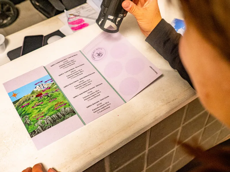
Credentials and maps of the walk are available at all facilities affiliated with the Cammino.
Where to stamp your Cammino del Gran Sasso credential?
We recommend you read the in-depth discussion: Cammino del Gran Sasso credentials: where and how to stamp it?
IN TENT
CAMMINO DEL GRAN SASSO IN A TENT
No camping is allowed within the Gran Sasso Park.
In the municipality of Santo Stefano di Sessanio, the campsite will reopen in 2024.
ROAD BOTTOM.
Road surface of the Cammino del Gran Sasso:
5% asphalt
CONTACTS
Path Mail: info@camminodelgransasso.it
STAGE 01
STAGE 01: Piana di Campo Imperatore to Castel del Monte
Departure: Piana di Campo Imperatore
Arrival: Castel del Monte
Distance: 21.9 km
Height difference: +358 m / – 1153 m
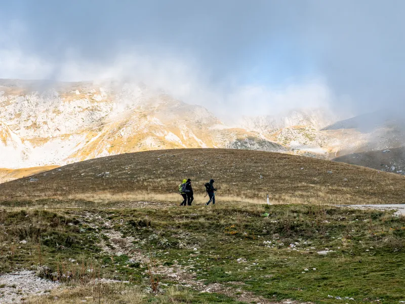
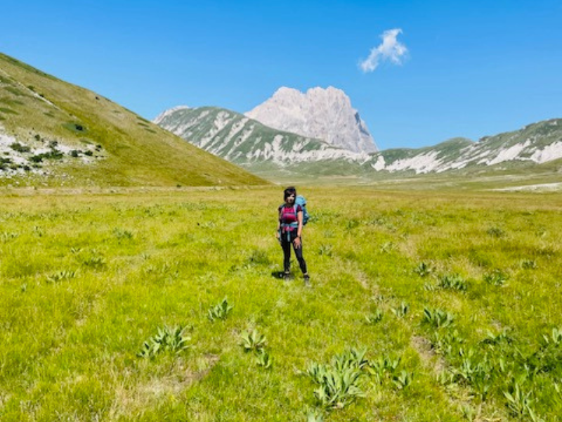
The Cammino del Gran Sasso begins at Campo Imperatore, in the heart of the Gran Sasso and Monti della Laga National Park. Here we find ourselves in the presence of the Gran Sasso d’Italia, the highest mountain range of all the Apennines.
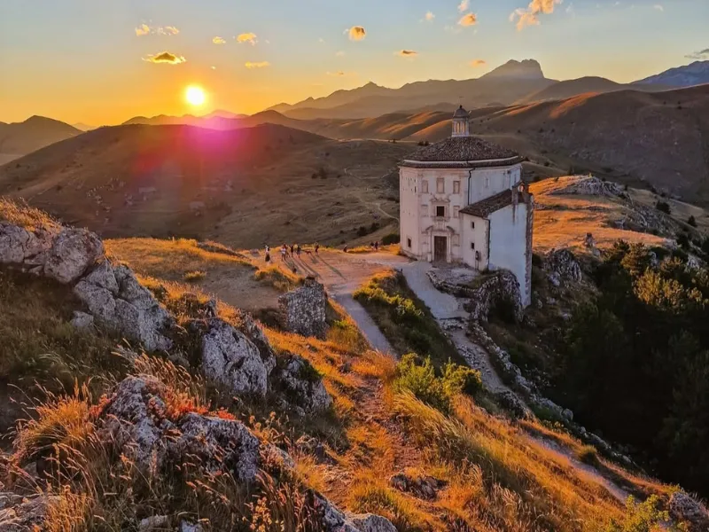
The arrival of the Cable Car * takes us to the Piazzale di Campo Imperatore (2100 m), where we find the little church of Madonna della Neve and the Astronomical Observatory of Abruzzo.
Leaving the esplanade behind us, we begin the trail in a northeast direction, following the Cammino signs. Reaching Vado di Corno (1924 m), we enjoy a breathtaking panorama, with a view of the two sides, Aquila and Teramo, of the Gran Sasso chain. From here, on days of good visibility, we can see the Adriatic Sea and behind us, towering imposingly are Corno Grande (2912 m), with its majestic “Paretone” and Monte Aquila (2494 m).
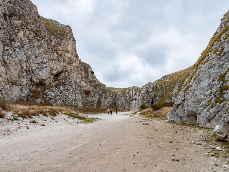
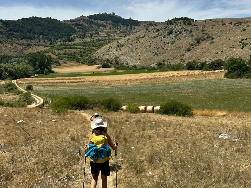
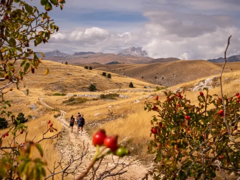
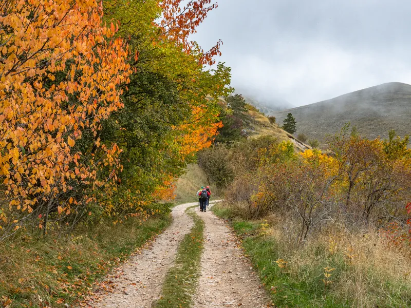
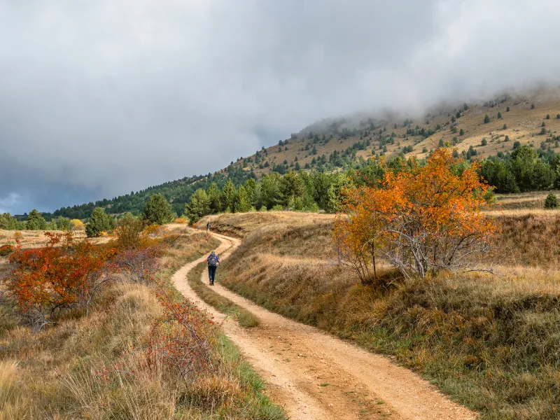
As we walk toward Laghetto Pietranzoni (1660 m) we can observe herds of cattle and horses grazing. In the stillness and silence of the plain, we glimpse the ruins of the Church of Sant’Egidio and then take, without delay, the Scoppaturo or Valianara Canyon (1475 m). The setting for numerous films including, …They kept calling it Trinity, the Desert of the Tartars and King David, the Canyon represents the most interesting and original naturalistic attraction of this STAGE.
With quick steps we end the day’s walk by arriving at Castel del Monte (1346 m), the village of shepherds, of “witches,” which gives its name to the Slow Food Presidium of Canestrato pecorino cheese.
* there are two ways to reach the plaza: the first is to arrive by public transportation or by one’s own car at Fonte Cerreto and then take the cable car. The second is to arrive with one’s own car directly to the square. We recommend the first option.
STAGE 02
STAGE 02: Castel del Monte to Rocca Calascio
Departure: Castel del Monte
Arrival: Rocca Calascio
Distance: 8.96 km
Height difference: +455 m / – 382 m
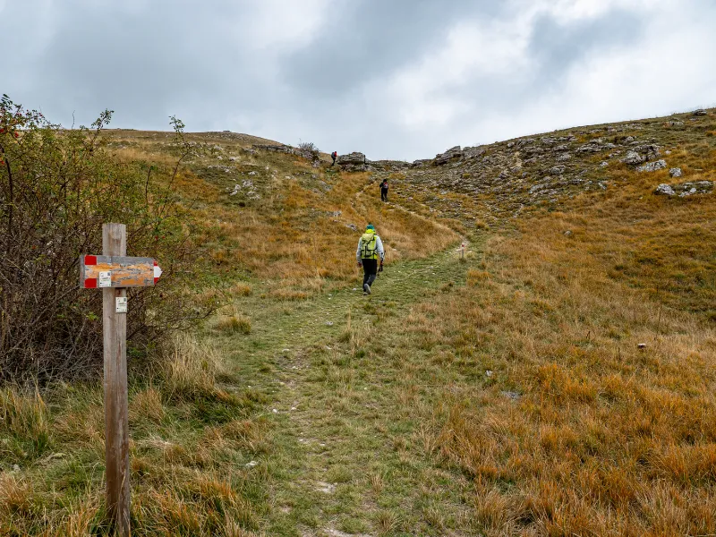
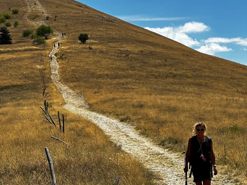
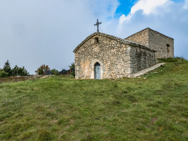
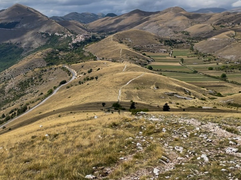
The second STAGE of the CAMMINO DEL GRAN SASSO guides us through the discovery of two beautiful villages, Castel del Monte (1346 m) and Calascio (1210 m) and reveals the mysteries of the Rocca di Calascio (1464 m).
Following the Cammino signs, we head south along a cart track that runs alongside the provincial road. We pass cultivated fields and farms until we climb toward Colle della Battaglia (1180 m). An ancient settlement of the Italic Vestino people, Colle della Battaglia was completely destroyed in 324 B.C. by the Roman Consul Brutus Sceva; today only a few traces of the triple walls that defended the settlement are visible.
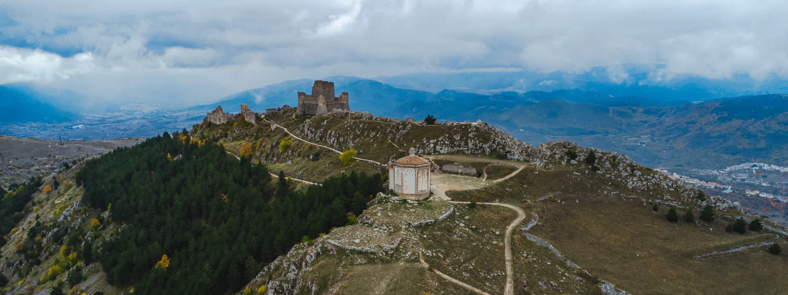
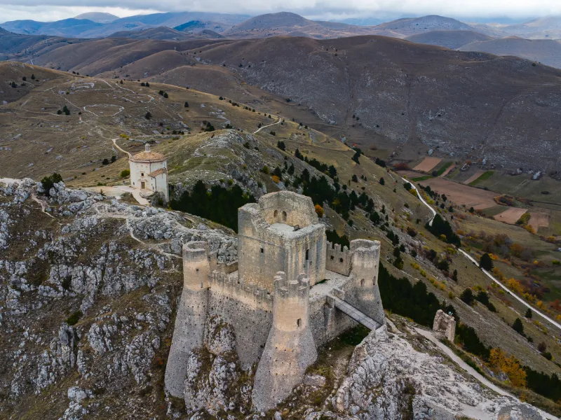
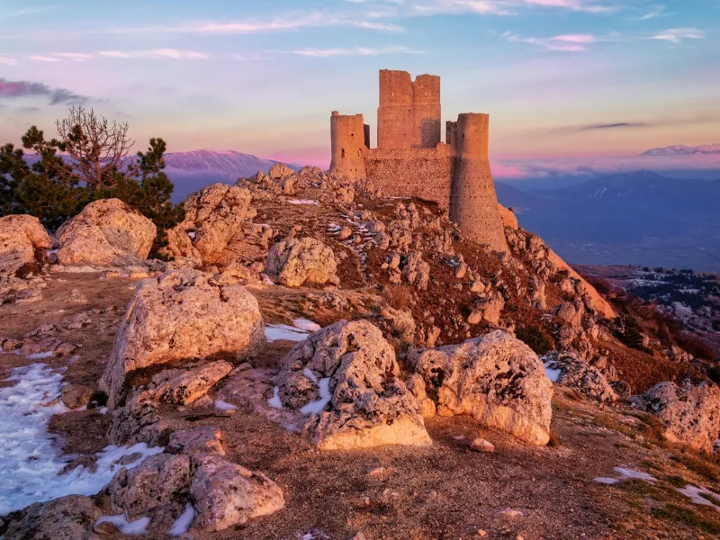
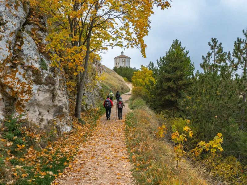
We continue on our way and, with a few strides, reach Calascio, a splendid village perched on the southeastern ridge of the mountain where the imposing Rocca stands. An architectural masterpiece of Norman origin, enlarged and equipped with four cylindrical towers in the late 15th century, it has been listed by National Geographic as one of the 15 most beautiful castles in the world.
Exploring the ancient fortification, a favorite setting for numerous film films, and visiting the Renaissance Church of Santa Maria della Pietà, we are transported to distant times, savoring the cultural richness of these mountain lands.
STAGE 03
STAGE 03: Rocca Calascio to Santo Stefano di Sessanio
Departure: Rocca Calascio
Arrival: Santo Stefano di Sessanio
Distance: 5 km
Height difference: +177 m / – 322 m
We are about to walk the third STAGE of the Cammino del Gran Sasso: it will be short but full of wonders ready to amaze us.
Before leaving Rocca di Calascio (1464 m), we indulge in a thorough tour of the fortification and enjoy a breathtaking view of the highest mountains in the Gran Sasso range. The section of the trail that separates us from our destination today is simple and scenic, suitable even for families with children.
We walk on path for five kilometers and overlook the valley located to the south, elegantly and geometrically shaped by terraces once cultivated with lentils and cereals such as spelt, Solina wheat, Rosciola, and Saragolla, the only floristic species that could withstand these altitudes.
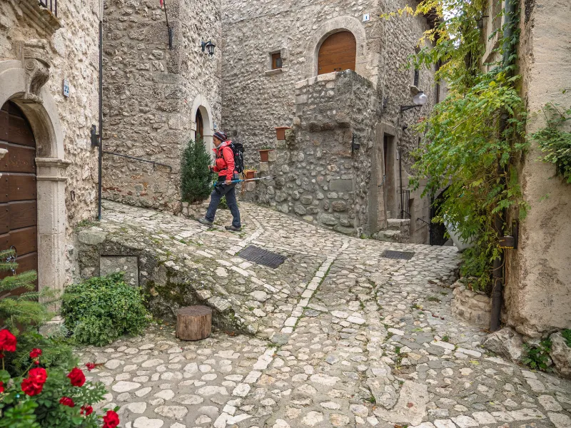
Upon reaching the village of Santo Stefano di Sessanio (1251 m), the end of the third STAGE, we will have no need to rest, as we will be hopelessly attracted by the picturesque and narrow alleys of the small town of medieval origin but characterized by Renaissance architectural overlays of Tuscan taste that testify to the domination in the territory of the Piccolomini and Medici families.
STAGE 04
STAGE 04: Santo Stefano di Sessanio to Barisciano
Departure: Santo Stefano di Sessanio
Arrival: Barisciano
Distance: 7.6 km
Height difference: +546 m / – 795 m
After scouting out every enchanted glimpse of Santo Stefano di Sessanio (1251 m) we set off, backpack on our shoulders, to tackle the fourth STAGE of the Cammino del GRAN SASSO, which, mostly downhill, will take us to Barisciano (940 m), which preserves some architectural glimpses from the 16th century, evidence of the presence of the Caracciolo family. Here we can visit the small church of Buon Consiglio or Capo di Serra dating back to the 13th century and decorated inside with valuable votive frescoes.
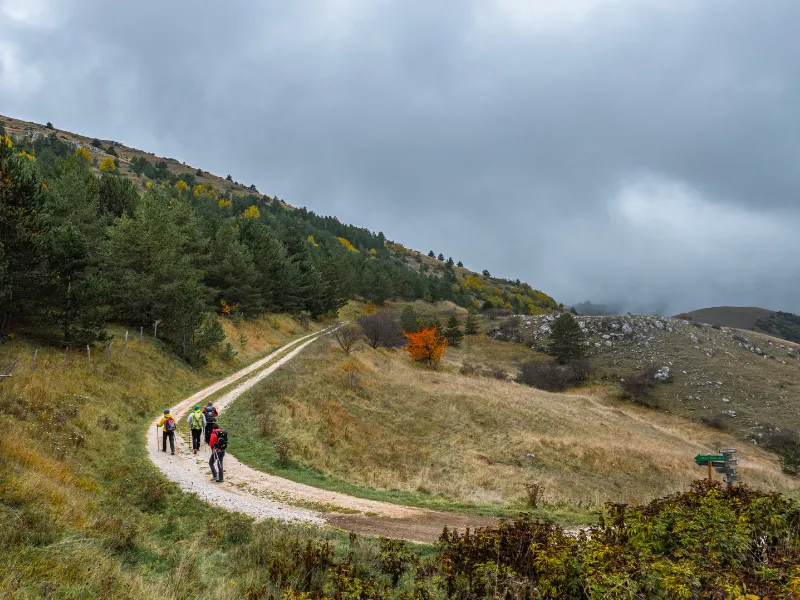
In a five-hour itinerary, we face a scenic route that skirts the Piana delle Locce (1230 m), where we encounter numerous shelters carved into the rock, called Locce. These served as support for agro-pastoral activities that took advantage of the arable plateaus and the very wide moors dedicated to grazing.
Accompanied by the constant presence of the majestic peak of Corno Grande, we continue on our route to the former Convent ofSan Colombo (1088 m). From here we are close to the town of Barisciano, the gateway to the Park and the final destination of today’s STAGE.
STAGE 05
STAGE 05: Barisciano to Fonte Cerreto
Departure: Barisciano
Arrival: Fonte Cerreto
Distance: 17.5 km
Height difference: +770 m / – 634 m
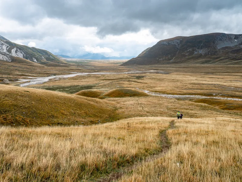
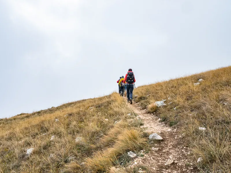
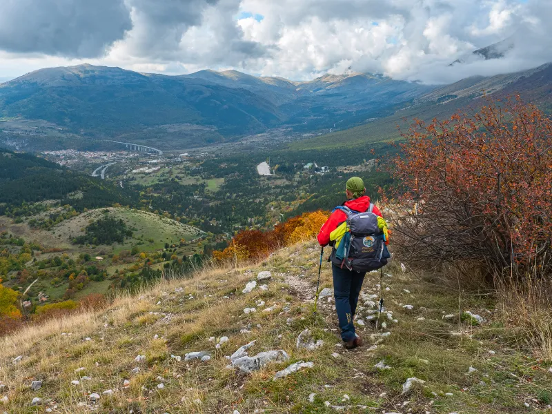
On the fifth day, our Cammino allows us to explore the beautiful highlands of the Park, framed by the high mountains of the Gran Sasso Range. We leave the village of Barisciano (940 m) heading north, following the Camino signs.
We proceed slightly uphill for most of the stage, crossing a valley that takes us to a junction with a small lake, Fonte Vedice, used to water grazing animals. From here we follow in a northwesterly direction a slightly uphill cart track that will lead us to the lonely and silent Tempietto di Sant’Eusanio (1402 m).
oco ahead, we cross the Piano di Fugno (1373 m), a wide and spectacular plateau where rainwater flows to form the small Filetto Lake, almost always frozen in winter. We cross and cross the provincial road that climbs from the Aquila side and follow the valley that leads us to the Montecristo Refuge, just in time for a snack. From here we climb slightly and arrive at the ridge, just above Valle Fredda. We thus begin to descend and, in just four kilometers, arrive at Fonte Cerreto (1115 m) where there are refreshments, overnight facilities and the base of the Cable Car.
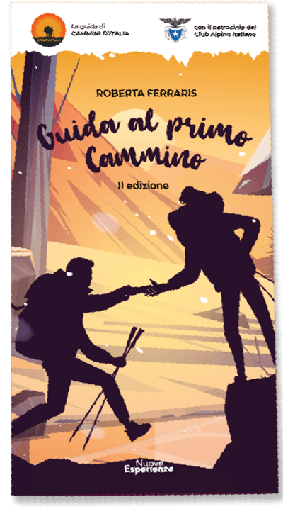
Guide to the First Walk
The First Walk Guide is the ideal resource for those who want to embark on an adventure in the wonderful world of hiking. With this comprehensive and exhaustive guide, you will be able to better prepare for your journey, plan every detail and face the adventure in total safety.
The book is designed primarily for those who are just approaching the world of walking, but we strongly wanted to include very specific focuses that can be very useful to even the most experienced.
The guidebook covers all aspects necessary for your trek, from technical clothing and equipment to orientation techniques and emergency management. This will deepen your knowledge of the world of trekking and help you learn new techniques and strategies for tackling the trek successfully.


Journey diaries
Insights
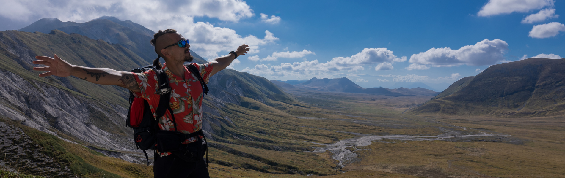
Cammino del Gran Sasso
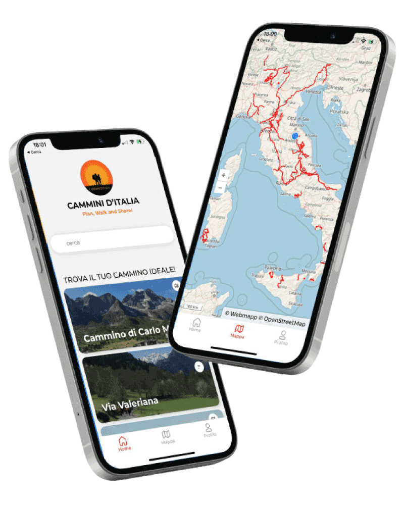
With Cammini d’Italia’s free app, you can plan and walk the Cammino del Gran Sasso in total safety, being able to plan the STAGES in detail and walk the route thanks to the built-in GPS technology that supports your orientation during your adventure.
Within the app you will find many other paths present in Italy. Thanks to the georeferenced tracks of many routes you will be able to study the itinerary that suits you best and also download the GPX tracks of the individual STAGEs offline.
The app also includes a complete digital map of all the paths surveyed to date on our portal, giving you a wide range of choices among the many paths in the Belpaese.
⠀⠀
Cammini d’Italia is the perfect app for those who want to explore the beauty of Italy on foot, discovering hidden places surrounded by nature. Download it for free today and start planning your next adventure!
⠀
⠀
 ⠀⠀⠀
⠀⠀⠀