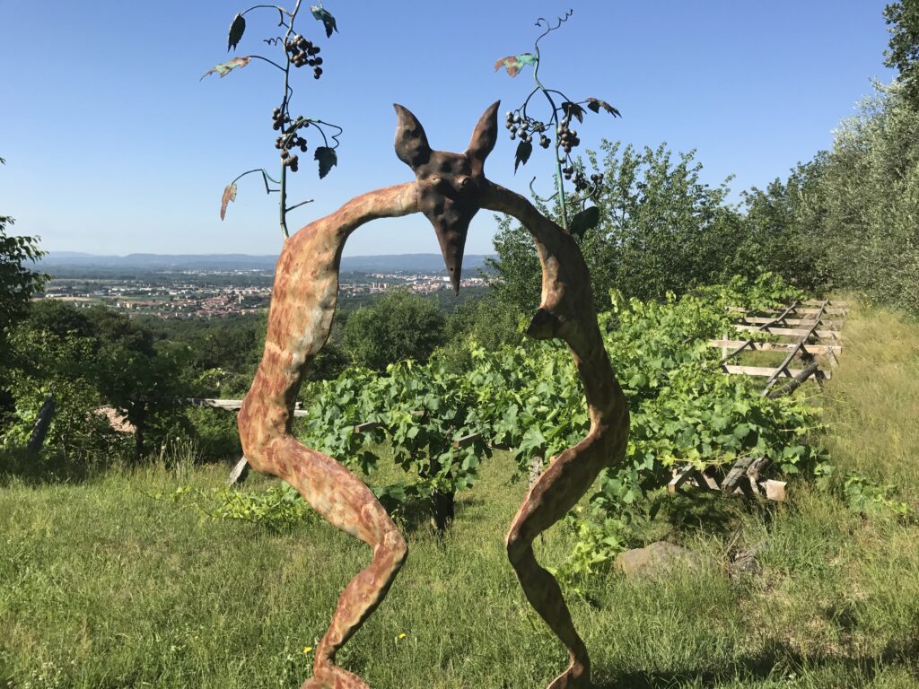
Cammino di Oropa Canavesano
The western branch of the Oropa Trail connects the territory of the Canavese, in the province of Turin, with the Biella region, crossing an area of great scenic, natural and cultural interest. Il Cammino unites three sites of the UNESCO heritage sites: the Sacred Mount of Belmonte, the city of Ivrea and the Sanctuary and Sacred Mount of Oropa.
The Cammino di DANTE Canavese is the longest of the Cammino di Oropa Canavese routes (about 85 km in 5 stages compared to 61 km in 4 stages on the main route) and the most challenging, not only because of its length and elevation differences, but also because there are fewer water and food supply points along the way.
It is a recommended itinerary for wayfarers with a minimum of experience in staged walks, and for those who have already walked the Santhià-Oropa route and want to get to know a new piece of Piedmont territory, equally beautiful and surprising.
Once in Oropa, it is possible to continue the journey along the Cammino di Oropa ORIENTALE, extending the trip by 3 days, following the markers with black arrows on a yellow background.
HISTORY
The Oropa Trail was conceived in 2012 by Alberto Conte, president of theAssociation Movimento Slow, who still personally supports and promotes it, working with local associations. The Cammino di Oropa Canavesano branch of the Cammino di Oropa CANAVESANO was born in 2022, and unites three UNESCO heritage sites. : the Sacred Mount of Belmonte, the city of Ivrea and the Shrine and Sacred Mount of Oropa.
WATER
STAGE 1 :
Valperga center
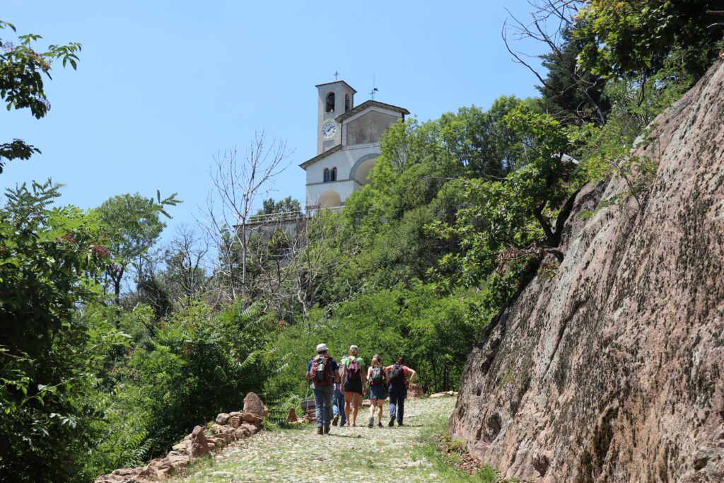
Along the ascent to the Sacro Monte di Belmonte
Shrine of Belmonte
Cuorgné center
STAGE 2:
Cuorgné center
St. Anne Woods
Along the road that skirts the Bric Filia
Campo Canavese center
Vidracco center
STAGE 3:
Vidracco center
Vistrorio center
Fiorano Canavese
Ivrea
STAGE 4:
Ivrea
Cascinette, Lago di Campagna
Chiaverano, Santo Stefano di Sessano
Donato, 2B Martyrs of Liberty Street
Donato, church of San Rocco
Graglia-Sanctuary
STAGE 5:
Graglia-Sanctuary
Sordevolo, Mario Germano Street, 1
Sordevolo, Antonio Petiva Street (two fountains)
Sordevolo, via lawyer camillo vercellone 68
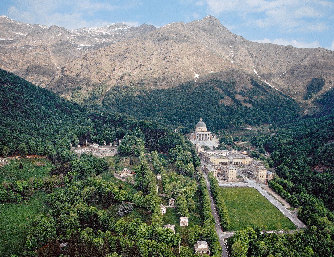
Oropa – Sanctuary
SERVICES
STAGE 1: in Valperga and Cuorgnè present bars, supermarkets, restaurants and pharmacy;
STAGE 2: in Vidracco bar, small grocery store, pharmacy;
Stage 3: in Ivrea bars, restaurants, grocery store and pharmacy;
STAGE 4: in Donato and Graglia small grocery stores, bars and pharmacies;
STAGE 5: in Sordevolo, Favaro and Oropa small grocery stores , bars and pharmacies.
DANGERS
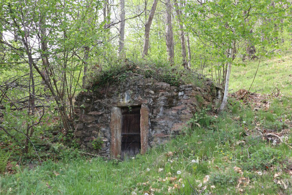
The areas you pass through along the way are very quiet and you are always near a village. The path during the good season is quite busy and the telephone coverage is quite good, so it is also suitable for single walkers. There are no obvious dangers on the routes to be walked.
ACCESSIBILITY
The pedestrian route of the Cammino di Oropa is unfortunately not accessible with wheelchairs, the ground is often uneven and in part on the path there are several sections with high gradients that can reach 12% on asphalt ground. The bike route is mostly on asphalt or on undemanding dirt roads, and it is generally accessible with an all-terrain wheelchair but only if equipped with electric traction. We have favored cart tracks and roads that allow two people to walk side by side, trying to avoid exposed sections. For the final stage, we still recommend taking the tramway variant.
ROAD BOTTOM.
60% dirt (dirt roads or small roads in the woods/mountains), 40% asphalt
CREDENTIAL
The credential can be obtained in Valperga at the Tabaccheria di Caruso Caterina, Via Giuseppe Mazzini, 18, Valperga (also open on Sundays, mornings only). Tel: 0124658110. Only the official credential entitles the holder to special prices in hospitality facilities, and to receive the “Testimonium” at the end of the walk. Anyone can walk the route without the credential, but they will be charged the rates reserved for tourists, not the discounted rates for pilgrims.
IN TENT
There are no campsites along the route, so it is recommended that you contact the municipalities where you plan to stay overnight in case you want to undertake the Camino in a tent.
FOOD AND WINE
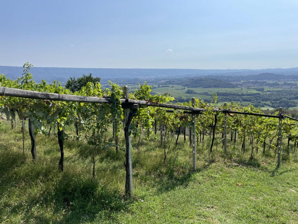
The Cammino di Oropa Canavesano passes through places where you can taste local products such as the cheeses of the Valle Sacra and Valchiusella. The finest local wines include Erbaluce di Caluso and Nebbiolo di Carema (a Slow Food presidium).
Valchiusella is also famous for its use of wild herbs in cooking, with which the typical “Ajucche soup” is prepared in spring. In Ivrea, it is recommended to try the “eporediesi” biscuits and, for those with a sweet tooth, the traditional “Torta 900”, made using a secret recipe by the historic “Balla” pastry shop.
CONTACTS
Email: oropa@movimentolento.it
STAGE 01
STAGE 01: Valperga to Cuorgnè
Departure: Valperga
Arrival: Cuorgnè
Distance: 10.4 km
Height difference: +388 m / – 365 m
The first STAGE of the Camino is a short tour to discover the Sacro Monte di Belmonte and the nature reserve that surrounds it. From the parish church of Valperga, we cross the beautiful historic center and climb toward the church of San Giorgio and the Castle of Valperga. Continue toward the Sanctuary of Belmonte, alternating between stretches in the woods and open stretches that offer beautiful views of the plains and the Ivrea morainic amphitheater. After visiting Sacro Monte, you descend down the valley and reach the village of Piemonte. From here the trail re-enters the woods. The last stretch to Cuorgnè takes place along the provincial road, a temporary detour pending the restoration of a small bridge.
STAGE 02
STAGE 02: Cuorgnè to Vidracco
Departure: Cuorgnè
Arrival: Vidracco
Distance: 19.4 km
Height difference: +514 m / – 433 m
The STAGE goes through the Sacred Valley on a “wild” route through the woods and ends in Valchiusella.
From the center of Cuorgné, cross the Orco stream to reach the spectacular bridge over the Piova stream, which must be crossed with great care as it has no shoulders. Having passed through the villages of Sant’Anna Boschi and Campo Canavese, you enter the forest to face the wildest stretch of the day: having reached the small church of Sant’Antonio, you continue straight to the top of Bric di Muriaglio. In this area the route becomes less and less legible, and it is worth keeping an eye on the App or GPS to get your bearings, because in places the signage may not be clear.
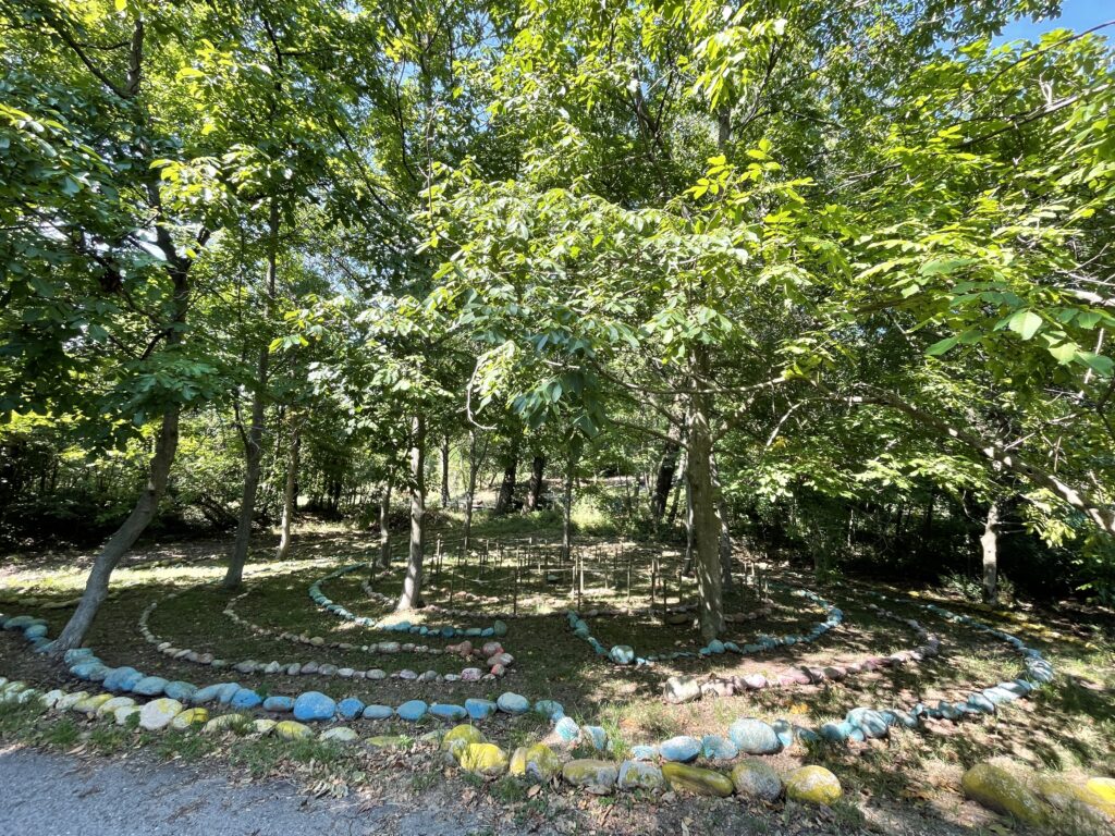
We then descend toward Vidracco, passing by the stone labyrinths laid out by members of the Damanhur community.
STAGE 03
STAGE 03: Vidracco to Ivrea
Departure: Vidracco
Arrival: Ivrea
Distance: 17.3 km
Height difference:+320 m / – 545 m
We cross the Valchiusella Valley and descend towards the Dora Valley to reach the beautiful historic center of Ivrea
From Vidracco the route resumes near the Tempi dell’Umanità. From here we skirt the villages of Issiglio and Vistrorio, and then climb toward the Nonani pass, following the ridge that separates Valchiusella from the Dora valley. We begin the descent on a beautiful route that alternates between stretches on asphalt and dirt road and path, where beautiful views of the valley open up.
When you reach the village of Fiorano, you can stock up on water and food before reaching the beautiful trail that follows the Dora Baltea embankment, which arrives near the historic center of Ivrea.
STAGE 04
STAGE 04: Ivrea to Graglia
Departure: Ivrea
Arrival: Graglia
Distance: 22 km
Height difference: +875 m / – 292 m
The Serra Morenica of Ivrea is the protagonist of a STAGE in which we enter the territory of Biella and enter the main branch of the Cammino di Oropa.
Leaving the historic center of Ivrea and following the Via Francigena as far as Lake Campagna, we skirt the beautiful Romanesque church of Santo Stefano di Sessano, set in a panoramic position near the village of Chiaverano. Continuing through the woods, you reach the summit of the Serra Morenica, near Roc Basariund, a spectacular erratic boulder, an ancient pagan place of worship. Arriving at the road to Andrate, we join the third STAGE Cammino della Serra, to reach Donato. After a challenging up and down, you reach the Sanctuary of Graglia, set in a spectacular location overlooking much of the Po Valley plain.
STAGE 05
STAGE 05: From Graglia to Oropa Sanctuary
Departure: Graglia
Arrival: Sanctuary of Oropa
Distance: 15.1 km
Height difference: +800 m
The trail runs along the side of Mombarone and descends on a steep mule track until it crosses the Elvo River, before climbing back up to the beautiful old town of Sordevolo. From here it takes a rather challenging up-and-down route, through woods to pastures from which there are beautiful views of the Po Valley, to Favaro and then along path D1, which climbs to the final destination of the Cammino, the scenic Sanctuary of Oropa, set among the mountains in a small valley of the Biellese Alps.


Cammino di Oropa Canavesano
With Cammini d’Italia’s free app, you can plan and walk the Cammino di Oropa Canavesano in total safety, being able to plan the stages in detail and walk the route thanks to the integrated GPS technology that supports your orientation during your adventure.
⠀Inside the app you will find many other paths present in Italy. Thanks to the georeferenced tracks of many routes you will be able to study the itinerary that suits you best and also download the GPX tracks of the individual STAGEs offline.
The app also includes a complete digital map of all the paths surveyed to date on our portal, giving you a wide range of choices among the many paths in the Belpaese.
⠀⠀
Cammini d’Italia is the perfect app for those who want to explore the beauty of Italy on foot, discovering hidden places surrounded by nature. Download it for free today and start planning your next adventure!
⠀
⠀
 ⠀⠀⠀
⠀⠀⠀