Cammino di San Bartolomeo
The Cammino di San Bartolomeo is a devotional path that unites the localities straddling the Apennines of Modena and Pistoia (between Fiumalbo and Pistoia) where the cult of the saint is handed down.
A “Lucchese variant” in the direction of Bagni di Lucca was also later proposed. The path runs mainly in the middle and high mountains, crossing woods and places of great scenic as well as historical and artistic interest; the stretches on asphalt are very limited. In Pistoia the path intertwines with other paths, which allow it to connect to the VIA FRANCIGENA.
HISTORY
The Cammino as such is of recent institution (2016); however, it takes up ancient paths surely traveled in the past. The cult of St. Bartholomew in the area has Longobard origins, specifically attested by the church of San Bartolomeo in Pantano in Pistoia, the arrival point of the Cammino. In Fiumalbo, Cutigliano and Spedaletto the cult also has centuries-old traditions, and is still very much present today.
WATER SOURCES.
In general, in the first STAGES there are no problems with water supply, due to the presence of some sources along the route and in the villages crossed. In the Spedaletto-Baggio section (last STAGE), however, there is a shortage of water; an adequate supply is recommended.
STAGE
Traditionally, the route has been proposed in five stages (the second and third with variations), plus the “Lucchese variant” which is considered as a single stand-alone stage (it can be integrated with the second stage of the main Camino). Moreover, several pilgrims have opted for a four-stage solution, usually lengthening the second stage to Prataccio or Prunetta and the third to Spedaletto. The following description refers to the traditional division.
STAGE-BY-STAGE SERVICES
1st STAGE.: various stores (including pharmacy) in Fiumalbo, Abetone and Cutigliano
STAGE 2: Shops and pharmacy in Popiglio
STAGE 3: Wide range of stores (including pharmacy and supermarket) and hospital garrison in San Marcello; other stores in Gavinana, Maresca (small supermarket), Prataccio, Prunetta, Campo Tizzoro, Pontepetri; pharmacies in Gavinana, Maresca, Prunetta, Campo Tizzoro.
STAGE 4: services only at the starting location
STAGE 5: services only in Pistoia
Lucca bypass: services in Popiglio and Bagni di Lucca
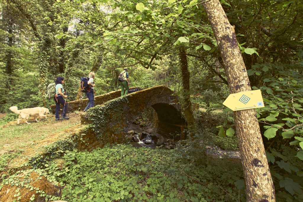
SIGNAGE
Signage present along the path: arrows and yellow signs. The trail is marked in the Fiumalbo-Cutigliano direction.
SIGNAGE
The trail presents no hazards for those with a minimum of mountain walking practice. Wildlife, including wild boar and wolves, is documented along the route; however, there are no reports of any real dangerous situations.
ACCESSIBILITY
Unfortunately, few sections are accessible to people with disabilities
ROAD BOTTOM.
Mostly trails and forest/rural roads; asphalt approx.
TENT WALK
Organized campsites are encountered only on the first STAGE (Abetone località Secchia, Cutigliano località Casotti); free campsites are possible upon contact
CREDENTIAL
The credential is distributed free of charge, and can be downloaded from the website. The final testimonium for those who have walked the entire Camino is also produced free of charge at the request of interested parties
CONTACTS
The Cammino is run by a network of associations scattered throughout the area; Simone Breschi is listed as the contact person, hotelmiramonte@hotelmiramonte.it, 3401084364; Piero Lattanzi, gds.altavaldilima@gmail.com, 3482930973; Pia Benedetti, 3335206940; Massimo Nesti, 3384571309; Adriano Mori, 3407341911
STAGE 01
STAGE 1: Fiumalbo – Cutigliano, km 23; elevation gain
From Fiumalbo one climbs rather steeply to Abetone (locality Uccelliera), from here one continues slightly uphill within the Abetone forest reserve to the highest point of the trail; from here one begins a long descent to Bicchiere and Rivoreta. From this locality, along a pleasant path (c.d. “strada degli Albinelli”) with modest gradients, you reach Cutigliano. Very interesting STAGE for the scenic and naturalistic aspects.
STAGE 02
STAGE 2: Cutigliano to Piteglio, km 16
You leave Cutigliano for the traditional “San Vito walk,” which you shortly abandon by descending on the right to the Lima stream. Here there are two options: cross the Volata tributary and go up toward Pratale, or cross the Lima (can be problematic in case of heavy flooding). In the first case, continue toward Monte Castello, where you meet a path that descends toward Mammiano; from here, an almost level path leads to Castruccio’s Bridge over the Lima; in the second, go up the slope (watch out for crossing the SS12!) until you meet SP 20, which you follow for a few kilometers to the vicinity of the Popiglio Towers, which you reach by rural road; a steep descent to the village of Popiglio and Castruccio’s Bridge below follows. From the Ponte di Castruccio with a steep climb you reach Piteglio.
STAGE 03
STAGE 3: Piteglio to Pontepetri
From Piteglio you reach the Migliorini locality, from here two variants are possible. A: one continues slightly uphill in the direction of Prataccio and Prunetta, from here one descends to Le Piastre, and with a flat route along the Reno reaches Pontepetri. B: go uphill towards San Marcello, from here follow the route of the former FAP railroad touching Gavinana, Maresca and Campo Tizzoro, from here shortly to Pontepetri.
STAGE 04
STAGE 4: Pontepetri to Spedaletto
Short, undemanding STAGE except for an initial uphill section. Beautiful panoramic views of the Pistoian plain.
STAGE 05
STAGE 5: Spedaletto to Pistoia
Rather challenging stage in terms of length, although mostly downhill. From Spedaletto we head toward Badia a Taona, but before reaching the ruins of this ancient building we turn sharply south in the direction of Baggio, and from there to Pistoia.
Lucchese variant: Popiglio to Pieve di Controne. Path a bit winding, sometimes difficult due to vegetation. Very scenic, different environment from the main path. Several beautiful medieval churches are worth mentioning. From Popiglio one ascends in the direction of the locality Canali, from here one descends to cross a ditch and ascend the opposite slope to reach Vico Pancellorum. From here you descend almost to the SS12 and then climb back up to Limano. A nice, almost flat trail with a final downhill section leads to Cocciglia, then ascends to Palleggio and San Cassiano, and finally reaches Pieve di Controne. From here you can descend to Bagni di Lucca.


Cammino di San Bartolomeo
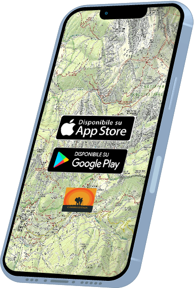
With the free Cammini d’Italia app, you can plan and walk the Cammino di San Bartolomeo safely, being able to plan the stages in detail and walk the route thanks to the built-in GPS technology that supports your orientation during your adventure.
⠀Inside the app you will find many other paths present in Italy. Thanks to the georeferenced tracks of many routes you will be able to study the itinerary that suits you best and also download the GPX tracks of the individual STAGEs offline.
The app also includes a complete digital map of all the paths surveyed to date on our portal, giving you a wide range of choices among the many paths in the Belpaese.
⠀⠀
Cammini d’Italia is the perfect app for those who want to explore the beauty of Italy on foot, discovering hidden places surrounded by nature. Download it for free today and start planning your next adventure!
⠀
⠀
 ⠀⠀⠀
⠀⠀⠀