
Cammino di San Nilo
The Cammino di San Nilo in Byzantine Cilento is an itinerary of just over 100 km divided into 8 STAGES.
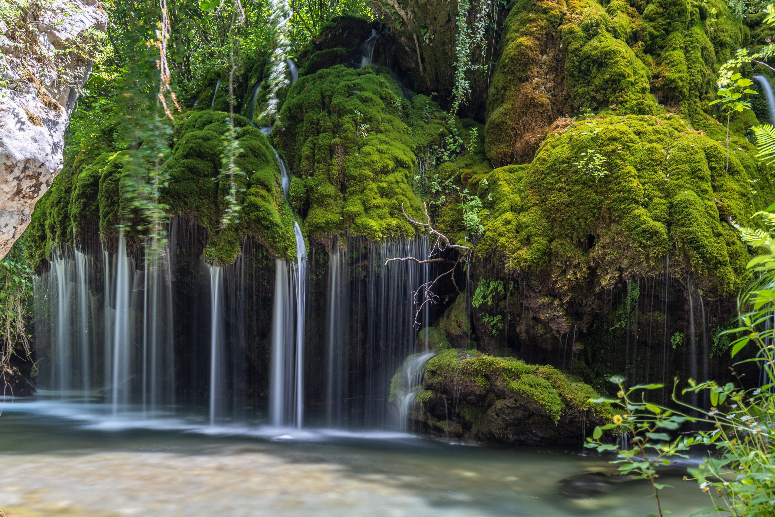
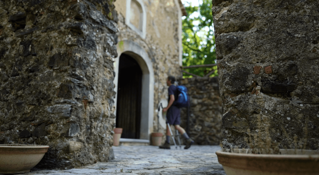
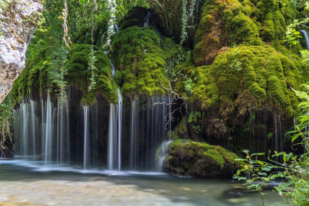
The route dedicated to Nilo originates from a spiritual motivation and follows the traces of Byzantine history in the lower Cilento area to lead the walker to discover a particularly evocative territory. It starts in the municipality of Sapri and winds almost entirely through greenery until it reaches Palinuro, in the municipality of Centola, passing through 13 villages immersed in the nature of the Cilento, Vallo di Diano and Alburni National Park. Rivers, streams and waterfalls enrich the Walk, allowing a close encounter with the still unspoiled nature of the park, the only one that can boast four UNESCO recognitions: world heritage, Mab biosphere, geo-site and intangible heritage for the Mediterranean Diet.
HISTORY
What makes Cammino di San Nilo unique is the meeting of history, spirituality, nature and traditions. The Cammino traces the path that led the young Nicholas, a native of Rossano Calabro, to don the monastic habit and receive the name “Nilo” in San Nazario – currently a hamlet of the municipality of San Mauro la Bruca – where he realized his monastic vocation. In 1004 A.D., at the edge of his earthly adventure, near Tuscolo (Frascati), he initiated the building of what was to become the most important Italo-Greek institution in the Christian West, still a powerful beacon of Eastern spirituality and culture at the gates of Rome, Santa Maria di Grottaferrata.
The CAMMINO DI SAN NILO is part of the wider network of Byzantine paths ( www.camminibizantini.com) , a project that aims to recover the wanderings of the Italo-Greek saints who were contemporaries of St. Nilus. The climate of exchange and respect between Western and Eastern monastic traditions is evidenced by St. Nilus’ presence at the Benedictine monastery of Montecassino, where he composed a Greek hymn in honor of St. Benedict.
WATER SOURCES.
There is no shortage of water along the way, and fountains are present in all villages except for the first and last stages, which lack sources to refill water bottles. The fourth STAGE after the Sicilì hamlet is also without sources. In any case, it is recommended to always carry at least 2 liters of water with you at the start.
STAGE
Stage 01: Sapri – Torrara
Stage 02: Torrara – Casaletto Spartano
Stage 03: Casaletto Spartano – Morigati
Stage 04: Morigati – Caselle in Pittari
Stage 05: Caselle in Pittari – Rofrano
Stage 06: Rofrano – Montano Antilla
Stage 07: Montano Antilla – San Nazario
Stage 08: San Nazario – Palinuro
STAGE-BY-STAGE SERVICES
Supermarkets: yes
Pharmacies: yes
ROAD BOTTOM.
STAGE 1: 3 km asphalt
STAGE 2: 2.5 km asphalt
STAGE 3: 4 km asphalt
STAGE 4: 3.5 km asphalt
STAGE 5: 5.5 km asphalt
STAGE 6: 3 km asphalt
STAGE 7: 6 km asphalt
STAGE 8: 4.5 km asphalt
TOTAL Pavement KM 32 out of 104km total
CREDENTIALS
The credential is obtained by filling out the form at the link https://camminibizantini.com/credenziale/ and simultaneously making a donation to the Gazania Association, the managing entity of the walk
TENT WALK
Where can one set up camp? Within the guide you can find all the references
Do you need permissions? No, just give prior notice by contacting

GUIDE TO CAMMINO DI SAN NILO
Cammino di San Nilo: In 940, a young aristocrat named Nicholas made a radical choice, abandoning everything to take up a monastic life under the name of Nile.
Today, we immerse ourselves in his footsteps, in just over a week, traversing the natural beauty of the Cilento National Park, Vallo di Diano and Alburni Mountains.
We set off from Sapri to discover Byzantine monasticism, fascinated by the warm welcome and proud spirit of this land, as we savor the flavors of the Mediterranean diet. Our journey will finally lead us to Palinuro, with a postcard-perfect arrival where the sea embraces our gaze.
This is the best way to explore an area that boasts four UNESCO awards.
We will provide you with all the information you need to start your journey: detailed maps, elevation gain, elevation gain, route descriptions, places to visit, and options for overnight accommodations, including for those who wish to sleep in tents.
In addition, for each STAGE of our journey, we will discover a fascinating story related to the places we pass through.
This route is ideal for those who wish to connect with nature and seek to break away from traditional tourist routes.


Cammino di San Nilo
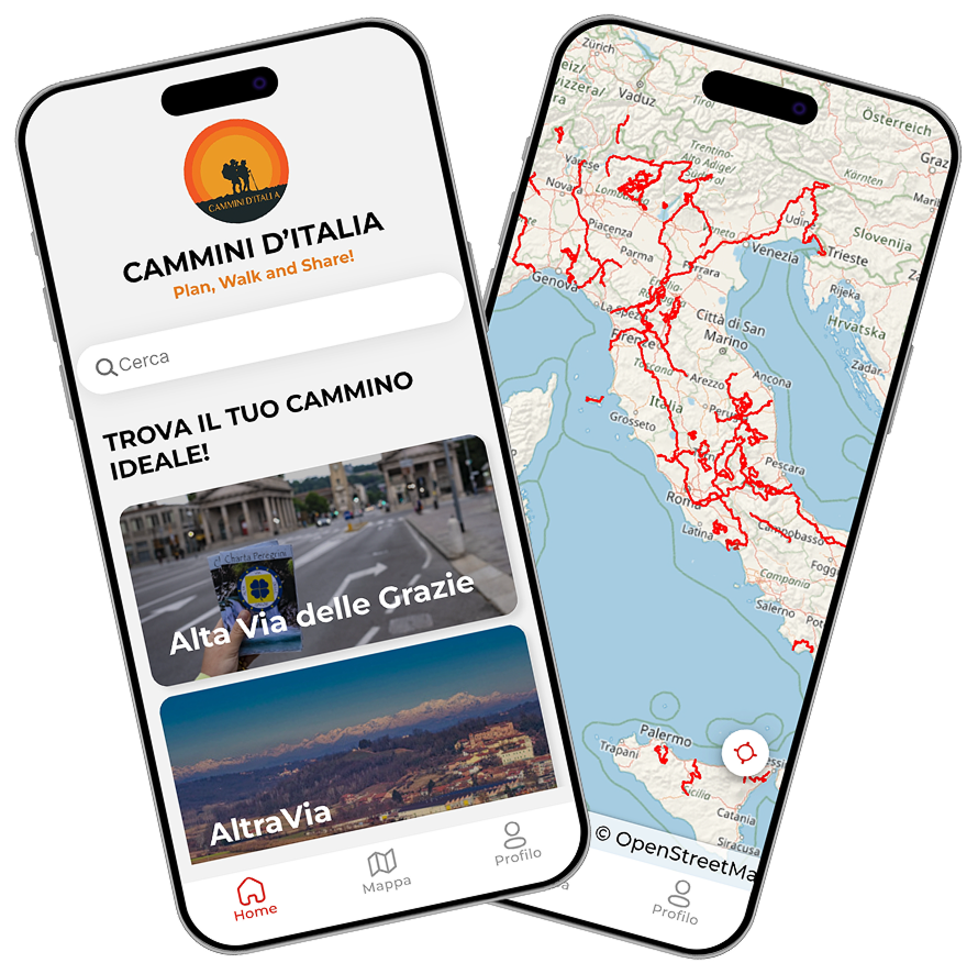
With the free Cammini d’Italia app, you can plan and walk the Cammino di San Nilo safely, being able to plan the stages in detail and walk the route thanks to the built-in GPS technology that supports your orientation during your adventure.
⠀Inside the app you will find many other paths present in Italy. Thanks to the georeferenced tracks of many routes you will be able to study the itinerary that suits you best and also download the GPX tracks of the individual STAGEs offline.
The app also includes a complete digital map of all the paths surveyed to date on our portal, giving you a wide range of choices among the many paths in the Belpaese.
⠀⠀
Cammini d’Italia is the perfect app for those who want to explore the beauty of Italy on foot, discovering hidden places surrounded by nature. Download it for free today and start planning your next adventure!
⠀
⠀
 ⠀⠀⠀
⠀⠀⠀