
CAMMINO DI SAN VALENTINO
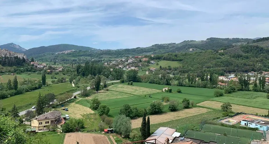
The Cammino di San Valentino is a loop route with departure and arrival in Terni, which, in 187 km and 10 STAGES, connects and enhances all the points of excellence that wind around the Conca Ternana: from its most renowned and visited site, the Marmore Falls, to smaller and lesser-known sites.
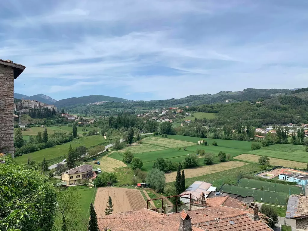
Southern Umbria, and in particular the Terni area, is an area not at all “spoiled” by the tourism of large numbers and therefore still intact in its authenticity: the Cammino di San Valentino allows you to immerse yourself in this beautiful territory and enjoy to the fullest - in a single experience - the generous nature in which it is immersed, the picturesque villages that dot it, its rich historical-artistic and eno-gastronomic heritage, but also the meeting with its genuine and hospitable people.
HISTORY
The project of Cammino di San Valentino is the brainchild of Environmental Hiking Guide, Marco Cincinelli (president of A.S.D. Tribe on the Move A.P.S.). Assisting him in his work and intent is the work of a Promoting Committee whose members are united by a passion for walking, a love for the area and a firm belief that the Camino is the best way to discover it and the highroad to enhance it in its entirety and variety.
Why in the name of Valentine’s Day?
Known and celebrated worldwide as the Saint of Love, St. Valentine was bishop of Terni and to this day is the city’s patron saint. His body is enshrined in the Basilica dedicated to him, the same Basilica that is the starting and ending point of the Way, the route of which touches, among other things, all the places linked to the name and figure of the saint.
The decision to name the Cammino after Saint Valentine thus has an identity and territorial value, but it is anything but provincial: rather, it represents an element of universal appeal, gives the Cammino added and iconic value, and-among other things-makes it symbolically the ideal path for all lovers.
STAGE
STAGE 01 – Basilica of St. Valentine (Terni) > Stroncone
Length: 12.9 km
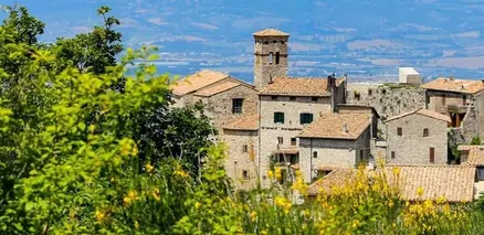
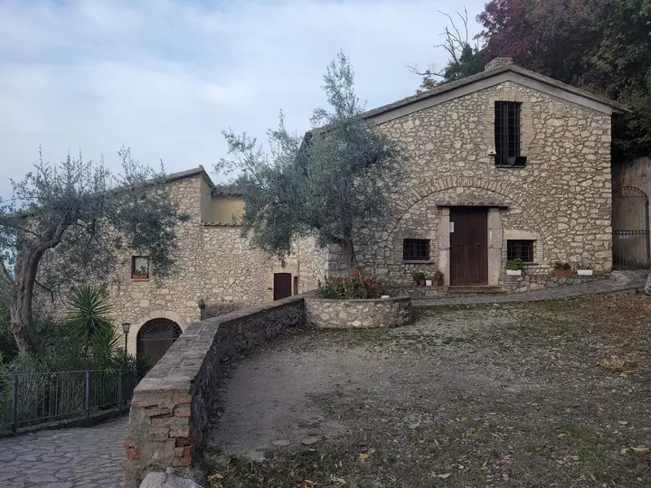
Description: The Basilica is located in the first outskirts of the city, immediately abutting a hilly area, so the trail immediately climbs into the green (first among olive trees and then into the woods), touches the fascinating ruins of the abbey of San Benedetto in Fundis (km 8.1), surrounded by vegetation, and then the monastery of San Simeone, rebuilt and inhabited by the lively community of “Reconstructionists” (km 10.2), finally leading to the Franciscan monastery of Blessed Antonio Vici, on the outskirts of Stroncone, a jewel-village intact in its medieval structure and architecture.
STAGE 02 – Stroncone > Marmore
Length: 23 km
Description: Leaving the town of Stroncone, the path travels the entire length of the beautiful Franciscan Path in the woods, along which are the chapel of Our Lady of the Tresto and several traces of the passage of St. Francis and St. Bernardino. The trail climbs until it reaches, at an altitude of 900 m, the mountain grasslands of the locality “I Prati” (km 8.2); from here, the trail continues through chestnut groves and then descends, in the last stretch, to the village of Marmore, where you can visit the famous Waterfall.
STAGE 03 – Marmore > Precept
Length: 23.4 km
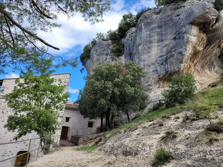
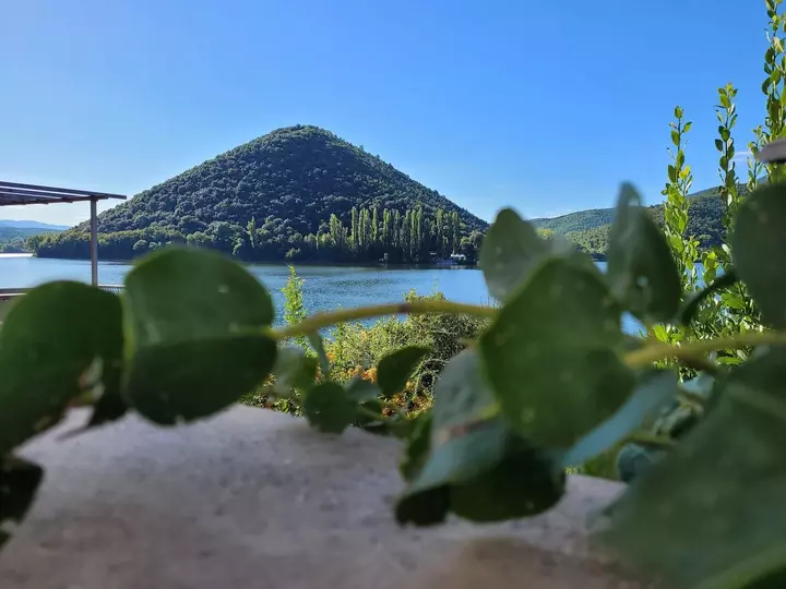
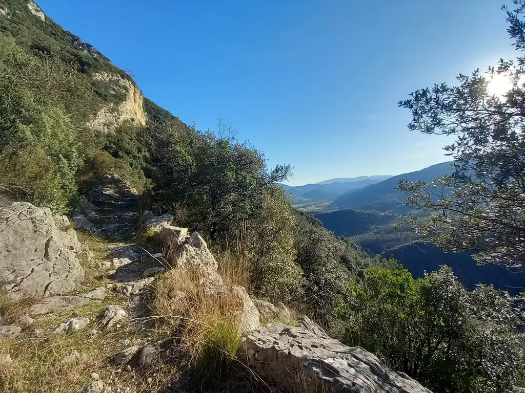
Description: the first part of the STAGE runs flat along the placid banks of the Velino River and the picturesque natural lake of Piediluco, nestled in the green mountains. Still staying on the lakeshore, one crosses the picturesque hamlet of Piediluco (km 6), then climbs gently to the pass point that connects the Rieti plain with the Nera River valley. Along the subsequent descent, one touches the rock hermitage of the Madonna dello Scoglio (km 13.7), in a panoramic position, and continue toward the bottom of the Valnerina valley, skirting the beautiful villages of Casteldilago e Arrone (km 18). In the last section of the STAGE, we ride along the pleasant Greenway of the Nera, along the river bank, leading all the way to the square in Precetto.
STAGE 04 – Precept > Ferentillo
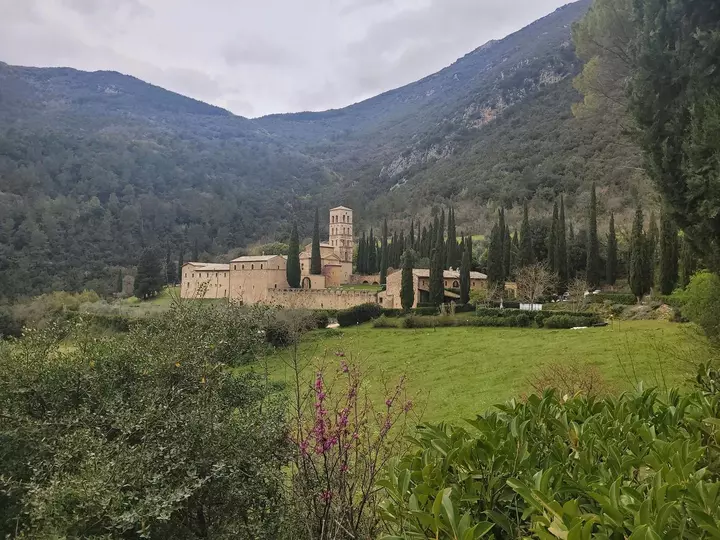
Length: 15.7 km
Description: After walking a short section of the Nera Greenway, the trail climbs into the woods to reach the charming ghost town of Umbriano (km 4), from which it then descends to the village of Macenano (km 5.2), nestled on the banks of the river. From here, passing on the other side of the valley, you reach the magnificent Abbey of San Pietro in Valle (km 7.4) and then take a challenging but pleasant climb, still in the woods, to the hamlet of Lorino (km 12), at an altitude of 700 meters, from which there are breathtaking views of the Valnerina Ternana and the mountains that overlook it. The last stretch of the STAGE, downhill, winds along the Path of the Nativity Scenes (dotted with small nativity scenes placed among the rocks and vegetation) and, after touching the hamlet of Gabbio (km 14), quickly leads to the square of Ferentillo.
STAGE 05 – Ferentillo > Torreorsina
Length: 16.4 km
Description: moving from the village of Ferentillo, the STAGE runs mostly along the asphalt road, remaining very pleasant, however, both for the modest amount of traffic, the possibility of walking comfortably on the side of the road, and the constant panoramic view of the Valnerina; however, there is no shortage of pleasant stretches of forest.
The trail touches the beautiful semi-inhabited (but perfectly preserved) village of San Mamiliano (km 3.7), touches thearchaeological area of Monte Moro (which can be visited with a very short detour from km 4.7) and then crosses the village of Montefranco (km 7.3), finally reaching the characteristic village of Torreorsina.
STAGE 06 – Torreorsina > Madonna dell’Ulivo Shrine
Length: 17.8 km
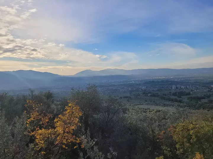
Description: Shortly after leaving the village of Torreorsina, you reach the historic village of Collestatte (km 2 approx.), then climb to the hamlet of San Liberatore (at 420 m a.s.l.) and from there, leaving the Valnerina, descend to touch the district of Rocca San Zenone (at the foot of the village of the same name, in the eastern part of Terni). After this brief urban passage, one ascends again to cross (always walking halfway up the hillside) the olive-grove belt that extends to the foot of the Martani Mountains, from which there are beautiful views of the Conca Ternana. Thus we reach the suggestive and panoramic Shrine of Our Lady of the Olive Tree, set in the rock among the olive trees, where pilgrims can sleep and use the communal kitchen (as well as the wonderful outdoor space).
STAGE 07 – Sanctuary Madonna dell’Ulivo > Sangemini
Length: 19.6 km
Description: Leaving the Sanctuary, the first part of the STAGE leads, on very quiet paved roads, to the gates of the precious village of Cesi: a veritable balcony over the Conca Ternana, clinging to the rock on the slopes of Mount Aeolus (at 437 m a.s.l.), which it is possible, and highly recommended, to visit with a detour of about 500 km from the ordinary route (for a total of about 3 km before resuming the trail).
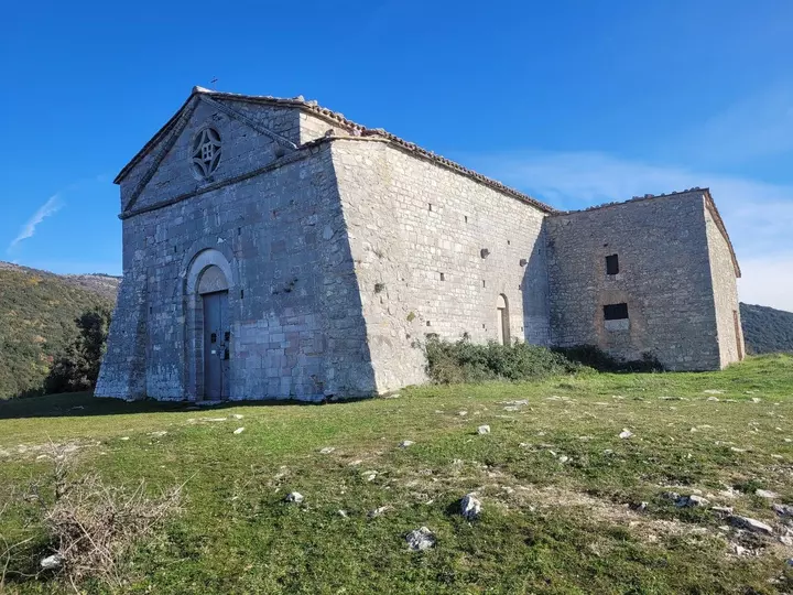
From here, we enter the forest and begin the challenging but very pleasant climb through the woods that, after touching the small church of San Biagio, reaches the plateau dominated by the church of Sant’Erasmo (km 6, at an altitude of 780 m), from which there is the widest possible view of Terni and its territory. We continue always in the shadow of the woods of the Martani Mountains, touching the ruins of the church of Santa Caterina and then the extraordinary complex of the Hermitage of the Romita (km 13 approx).
From here we start to descend to reach – and visit – the archaeological park of Carsulae (km 15), one of the most relevant sites on the Cammino to then arrive at the historic town of Sangemini, known for its waters, which is one of the “Most Beautiful Villages in Italy.”
STAGE 08 – Sangemini > Narni
Length: 21.5 km
Description: the first part of the STAGE winds along quiet country roads through cultivated and olive-grown hills until we reach Narni Scalo (km 14 approx) where there are stores and services. Past the built-up area, the trail leads to the banks of the Nera River, at the point where you can admire the majestic remains of the Augustus Bridge. From here, we go into the Nera Gorge, route of the old railway that – walking along the river – leads to the village of Recentino (km 19).
At this point, if time and strength permit, it is possible (continuing along the former railway, with a major detour of about 4 km A/R) to reach the very small village of Stifone, where the incredible characteristics of the water (between river and springs) make the place one of the most remarkable and singular natural wonders of the territory crossed by the Camino.
Returning to the locality of Recentino, crossing the S.S. and climbing steeply up the rocky outcrop, one arrives (entering from Porta Pietra) at the beautiful town of Narni, which can be visited at leisure the following morning.
STAGE 09 – Narni > Itieli
Length: 12 km
Description: the intentional brevity of the STAGE allows you to comfortably devote the morning (or part of it) to the not-to-be-missed visit to the city of Narni (and, if desired, also to the tour of Narni underground).
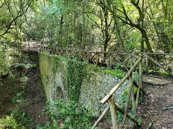
After leaving the town, we then climb up to the Rocca, in a dominant position over the whole Conca Ternana, and then walk always in the woods, crossing the park of Ponte Cardona (from km 2.9). The park trail follows the route of the Formina Roman aqueduct (several elements of which are visible) and leads to the geographical center of Italy (marked by an IGM milestone) where the Roman bridge stands, intact and majestic over a gully.
Continuing through the ilex forest, the trail reaches the gates of Itieli (perched at an altitude of 600) but before returning, and ending, in the village, it crosses the park of Colle Censo, which houses, in the thick greenery, curious works all to be discovered (such as, for example, the giant “bench of Polyphemus” or the sword in the rock).
STAGE 10 – Itieli > Basilica of St. Valentine
Length: 23 km
Description: After leaving the village of Itieli, you will reach the Valentine’s Cross (km 3.4) and then reach theFranciscan hermitage of Sacro Speco (km 7.4), one of the most fascinating sites on the entire Camino, and certainly the one most imbued with spirituality.
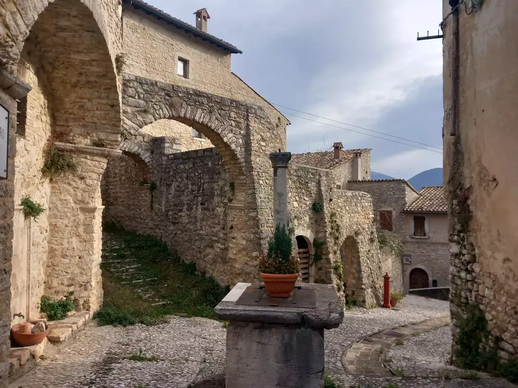
From the Speco we continue downhill to the village of Sant’Urbano (km 8.6) and then, for the next 10 km you walk through the countryside on very quiet driveways (only in some short stretches, punctually marked, you have to watch out for traffic). Right at the end of the STAGE, the last gift of the Camino: the small village of Collescipoli (km 18.5), which stands isolated on a hill on the outskirts of the city of Terni and whose walls – intact – guard a remarkable historical-artistic heritage, especially for a village of this size.
After the visit to Collescipoli, with a last short downhill stretch on small back roads through the greenery, you arrive in front of the Basilica of San Valentino, where the Cammino di San Valentino concludes and you can collect your Testimonium.
SIGNAGE
The signage consists of nameplates white plates with red arrows (affixed mostly on trees) and stickers with CSV name and logo (on road poles, guardrails and the like).
WATER SOURCES.
Water sources are present at all STAGES.
STAGE 1:
- Basilica (beginning of STAGE)
- San Simeon
- Loc. Hill
- Stroncone (end of STAGE)
Stage 2
- Sanctuary (beginning of STAGE)
- Stroncone
- Location Meadows
- Miranda (200 m off course)
- Marmore (end of STAGE)
Stage 3
- Marmore (start of STAGE)
- Piediluco
- Our Lady of the Rock
- Casteldilago
- Arrone
- Precept (end of STAGE)
Stage 4
- Precept (beginning of STAGE)
- Macenan
- Loreno
- Gabbio
- Ferentillo (end of STAGE)
STAGE 5
- Ferentillo (start of STAGE)
- San Mamiliano
- Montefranco
- Torreorsina (end of STAGE)
Stage 6
- Torreorsina (beginning of STAGE)
- Collestatte
- San Liberatore
- Rocca San Zenone
- Almond Fountain
- Gold Hill
- Our Lady of the Olive Tree (end of STAGE)
Stage 7
- Our Lady of the Olive Tree (beginning of STAGE)
- Cesi
- St. Erasmus
- Romita of Cesi
- Carsulae
- San Gemini (end of STAGE)
STAGE 8
- San Gemini (start of STAGE)
- Narni Scalo
- Stifone (500 m A/R off route)
- Narni (end of STAGE)
STAGE 9
- Narni (start of STAGE)
- Itieli (end of STAGE)
STAGE 10
- Itieli (beginning of STAGE)
- Sacred Speco of Narni
- St. Urban
- Dry Hill
- Fiaiola
- Collescipoli
- Basilica (end of STAGE)
SERVICES
At 7 out of 10 STAGE points, and in some cases even along the route, there are grocery and/or supermarkets, pharmacies, and other useful stores or services (post office, tobacco shop…), as well as catering activities.
For the 3 STAGE points that lack them (Torreorsina, Madonna dell’Ulivo, Itieli), the Promoting Committee provides pilgrims, along with the list of accommodations, with all useful directions for eating.
CREDENTIALS
The Credential is mailed to pilgrims, upon request through the appropriate form on the website, at a cost of 10 euros.
PAPER GUIDE.
The Cammino di San Valentino does not yet have a printed guidebook; pilgrims who request one are provided, along with their credential, with a list of host structures with all the practical information for each STAGE.
The website www.camminodisanvalentino.it also has detailed stage-by-stage route descriptions as well as gpx tracks, which are also available on Wikiloc.
ACCESSIBILITY
The Trail is 100% walkable in Joelette.
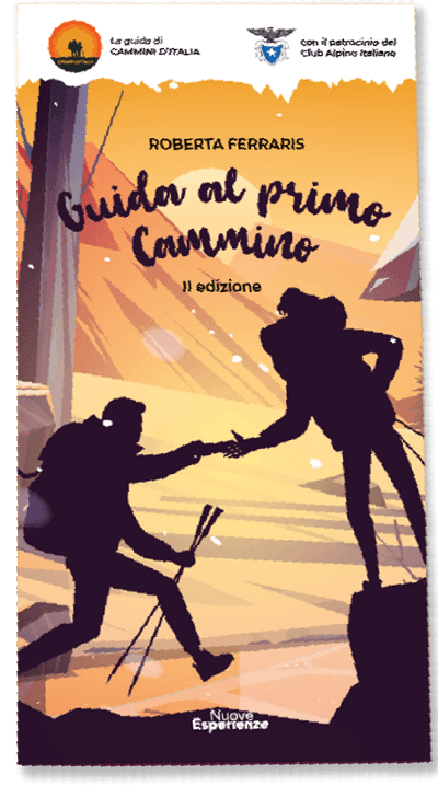
Guide to the First Walk
The First Walk Guide is the ideal resource for those who want to embark on an adventure in the wonderful world of trekking. With this comprehensive and exhaustive guide, you can better prepare for your trek, plan every detail, and face the adventure in total safety.
The book is designed primarily for those who are just approaching the world of walking, but we strongly wanted to include very specific focuses that can be very useful to even the most experienced.
The guidebook covers all aspects necessary for your trek, from technical clothing and equipment to orientation techniques and emergency management. This will deepen your knowledge of the world of trekking and help you learn new techniques and strategies for tackling the trek successfully.


Download our App
With the free Cammini d’Italia app, you can plan and walk the Cammino di San Valentino safely, being able to plan the stages in detail and walk the route thanks to the built-in GPS technology that supports your orientation during your adventure.
Within the app you will find many other paths present in Italy. Thanks to the georeferenced tracks of many routes you will be able to study the itinerary that suits you best and also download the GPX tracks of the individual STAGEs offline.
The app also includes a complete digital map of all the paths surveyed to date on our portal, giving you a wide range of choices among the many paths in the Belpaese.
⠀⠀
Cammini d’Italia is the perfect app for those who want to explore the beauty of Italy on foot, discovering hidden places surrounded by nature. Download it for free today and start planning your next adventure!
 ⠀⠀⠀
⠀⠀⠀