Cammino nel Tigullio
The Cammino nel Tigullio between Mountains, Sea and Villages is a 65-km loop itinerary through mountain ridges offering views of the Gulf of Tigullio
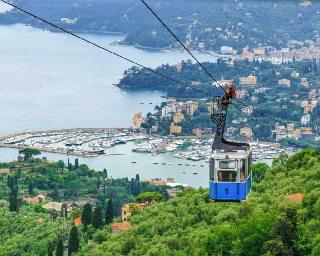
The Cammino nel Tigullio tra Monti, Mare e Borghi is a fascinating 65-km loop itinerary that starts in Chiavari, winds through mountain ridges offering spectacular views of the Gulf of Tigullio, reaches the Sanctuary of Nostra Signora di Montallegro 612m. a.s.l. and then arrives at Manico del Lume, the Gulf's highest peak at 812m. a.s.l, traverses ancient paths, rural villages and historic sites, climbs to Mount Portofino, touches on the Abbey of San Fruttuoso di Capodimonte and allows you to explore coastal locations such as Portofino, Santa Margherita Ligure, Rapallo and Zoagli. A slow tourism experience that respects the environment and is rich in history, culture and scenic beauty.
HISTORY
Origin of Cammino nel Tigullio:
The “Cammino nel Tigullio” was conceived in 2019 by a sports family residing in Zoagli, Genoa. The family consists of Massimiliano and Barbara, along with their children Gaia and Emanuele, then ages 15 and 11.
Activities carried out by the family:
- Itinerary study: The family carefully studied the itinerary of Cammino nel Tigullio.
- Route mapping: They mapped the route in detail, identifying points of interest and natural beauty along the way.
- Website and social media: They created a dedicated website and managed social media channels to promote Cammino nel Tigullio and share information with hiking enthusiasts.
Hiking Map and GPX Tracks:
They made the first hiking map at a scale of 1:22,000 to provide cartographic support for participants along with GPX tracks.
WATER SOURCES.
Water sources in the first two STAGES are scarce as you are traveling on the pre-Apennine ridge. So it is appropriate to make a major supply at the beginning of the Camino. While in the remaining STAGES there are numerous water points.
STAGE-BY-STAGE SERVICES
There are supermarkets: third, fourth and fifth stages.
There are pharmacies: third, fourth, and fifth stages.
SIGNAGE
Along the Cammino nel Tigullio there is signage indicated by the two ‘Tt’s” in Light Blue.
ROAD BOTTOM.
The road surface is 28km out of 65km, about 40 percent
DANGERS
The descent from the 800 of the lumen handle to the 380 of the hamlet of Chignero, which takes less than an hour, requires attention as it is steep. We advise against it and suggest another route in case of heavy rains.
IN TENT
Only through Tigullio Trekking, which has permission to have tents pitched in private areas and in regional park areas.
CONTACTS
STAGE 01
STAGE 01: Chiavari – Our Lady of Montallegro
Length: 12 km
Height difference: D+ 1650m. D- 1100.
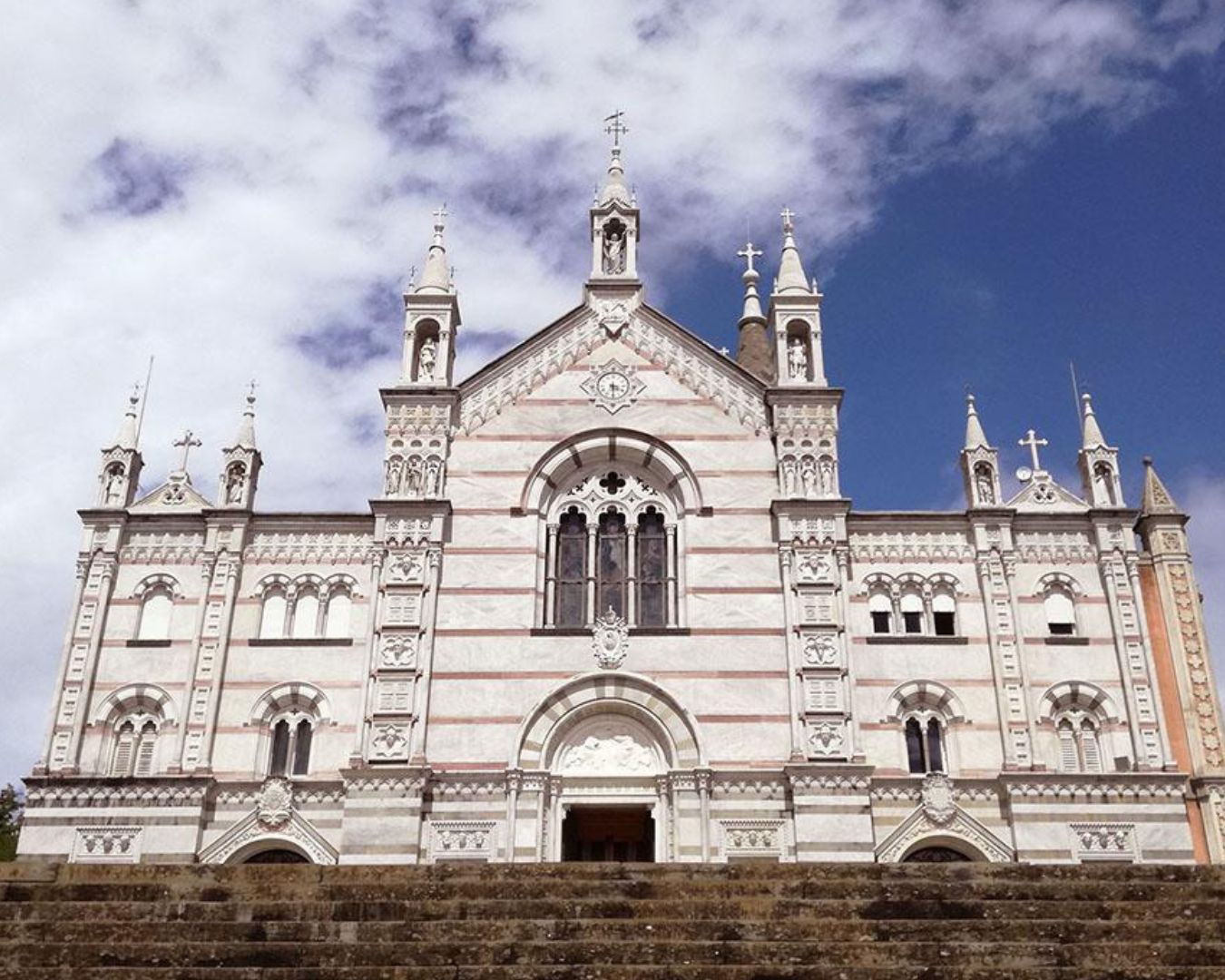
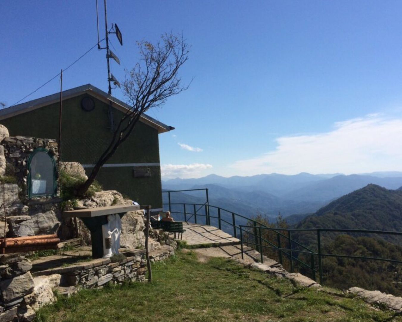
Montana typology. Breathtaking views. Nature and Flora: Mediterranean scrubland. Mount Anchetta at 450 m. a.s.l. after about two hours of ascent, offers an ideal place to catch your breath and enjoy a good brunch. On arrival, the Shrine of Montallegro with the view it offers and its long history for all believers, alone rewards all the exertions of today’s ascent.
STAGE 02
STAGE 02: Montallegro – Sant’Andrea di Foggia / San Pietro di Novella
Length: 11 km
Height difference: D+ 480 D- 675.
Montana type almost all on ridge. The trail is never exposed and there are no via ferrata or chain-assisted passages to be climbed. High ground views with 360° sea views (STAGE “EE” – in the last kilometer downhill).
STAGE 03
STAGE 03: Sant’Andrea di Foggia – Mount Portofino Park
Length: 11/13 km
Height difference: D+ 300 D- 385.
Type Technical STAGE on Asphalt and Creuze (mule tracks). Various historical and cultural sites to see: the Ancient ruins of the Valle Christi Monastery, the Ancient Lazzaretto of Rapallo, the Millenary Church of Ruta di Camogli, and the Madonnina del Clacson in the centuries-old tunnel of Ruta di Camogli.
STAGE 04
STAGE 04: Mount Portofino Park – Santa Margherita Ligure
Length: 14/15 Km
Height difference: D+ 380 D- 700.
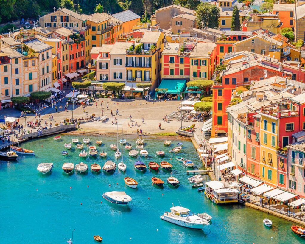
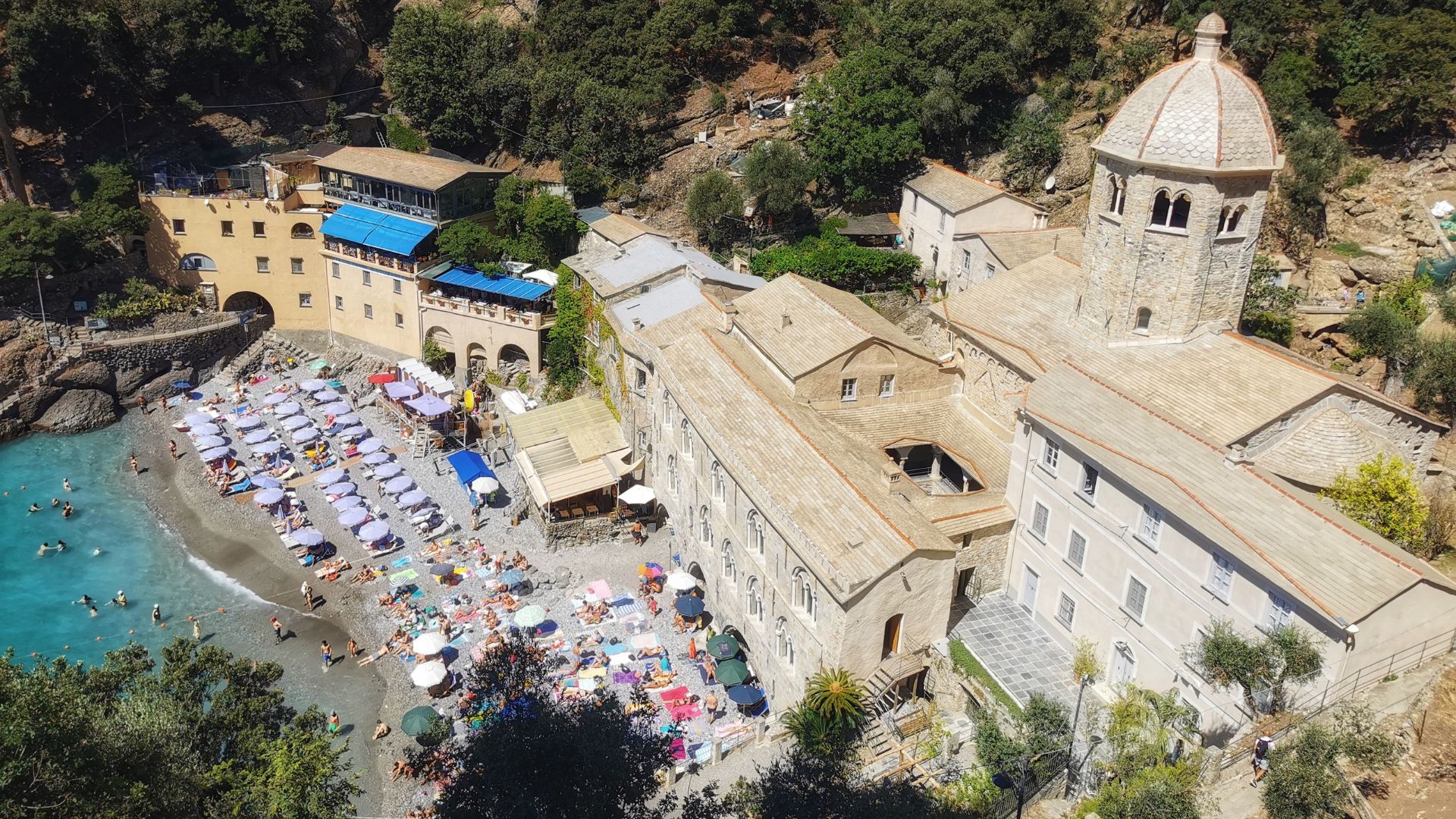
Trail types grass, dirt and mixed. Unique views, important sites and fabulous locations: San Fruttuoso di Camogli, the Abbey of the Dorias, the Water Mirror in front (from a Caribbean location), Portofino with its historic Piazzetta, the tourist loc. of Paraggi and finally the magnificent village of Santa Margherita Ligure.
STAGE 05
STAGE 05: Santa Margherita Ligure – Chiavari
Length: 16/17 Km
Height difference: D+ 650 D- 570.
Asphalt and creuze type. Today’s STAGE is all beside the sea and therefore offers various opportunities to be able to soak in the waters you deem most appropriate and least crowded. San Michele di Pagana immediately offers the extraordinary Van Dyck in the parish of San Michele Arcangelo, then Rapallo with its famous Castello delle Carceri, Sant’Ambrogio di Zoagli that enraptures with unique panoramas at 200 m. above sea level, and finally Zoagli with its crystal-clear waters.