
Cammino Tre LAGHI
The Cammino Tre Laghi is a loop trail of about 100 km that runs through the geographical area of the Mountain Community of the Bergamasque Lakes.
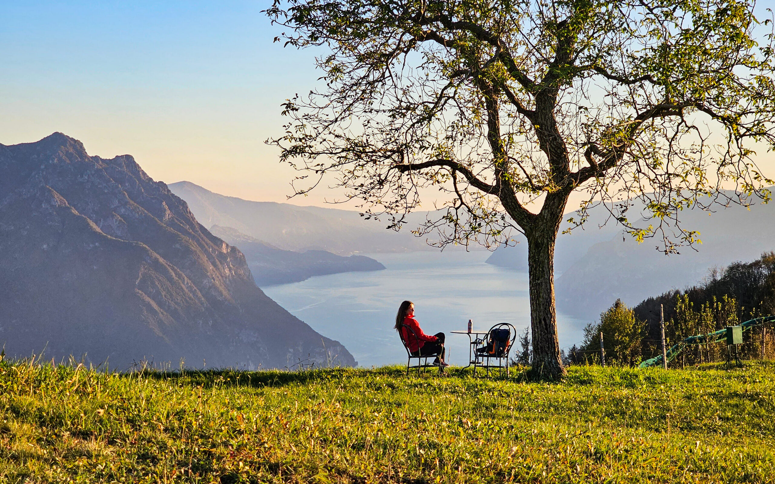
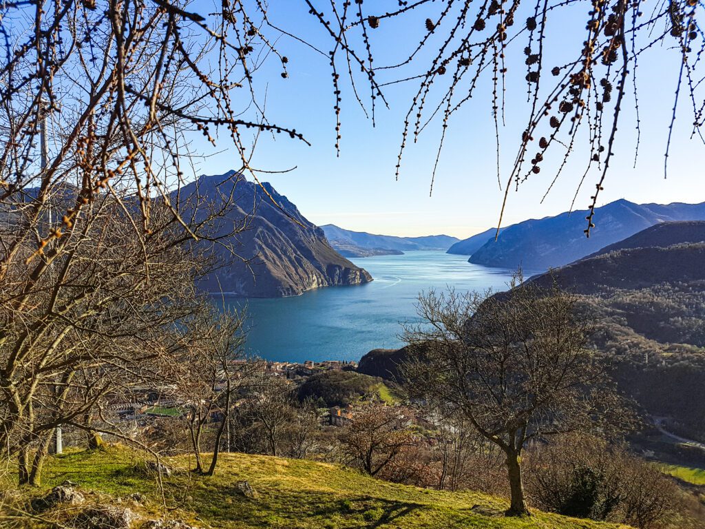
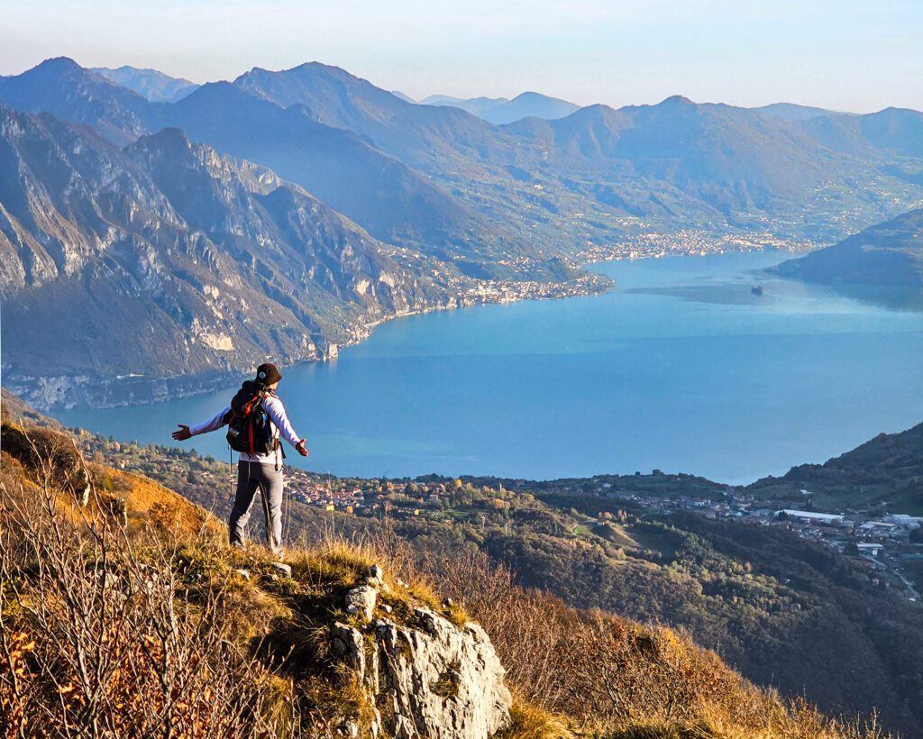
It is therefore located in Lombardy, in the part east of the province of Bergamo. Specifically, in the Alto Sebino area, where the Borlezza, Cavallina and Camonica valleys intersect. The common thread of the Cammino is water; in fact, the route touches as many as three lakes: Lake Iseo, Lake Endine and the small Lake Gaiano. the route also connects the major places of interest and the most beautiful viewpoints in the area so that the wonders of the area can be fully experienced and from multiple perspectives!
The route of Cammino Tre Laghi can be considered as a hybrid between a classic walk and a trek; it is very varied and alternates wide flat stretches with others of decided uphill and downhill. Specifically, the route goes from the minimum altitude of Lake Iseo (185 mt) to the maximum altitude of Mount Colombina (1458 mt). By virtue of this range, the vegetation encountered is highly variable: from olive groves to spruce and larch forests at the highest elevations. Due to its almost complete southwest to south, southeast exposure, the trail provides ample sunshine and thus a walkability that retains its charm in all seasons!
HISTORY
The walk was born in the summer of 2023 because of a strong passion for walking and a great love for this area. The Cammino Tre LAGHI is not a religious pilgrimage, although we often come across churches, shrines, chapels and votive shrines; it does not even lead to a well-defined destination since we start and arrive at the same place. The destination of this path is the journey itself. The beauty of nature is a common thread that is intimately linked with an element that is very consistently present: water. Water to admire, to touch, and, why not, to dive into and enjoy a swim in the warmer season.
The route connects the most characteristic, curious and interesting corners of the Alto Sebino and Val Cavallina while almost always maintaining a view of at least one of the three lakes: either from up close by following the paths that run along them, or from afar by climbing to higher elevations, where you can enjoy panoramic perspectives that provide breathtaking views.
WATER SOURCES.
The abundant presence of springs, springs and fountains ensure an almost constant supply of water. Sources are scarce only in a section of the third STAGE (Riva di Solto – Castro) and in the sixth STAGE; otherwise, numerous fountains can be found in every village crossed.
SIGNAGE
Yellow logo stickers on blue background for city centers, logo or drop drawn with yellow paint on natural media (rocks, trees, stone men…)
DANGERS
The route shows no particular dangers; the trails are normally traveled by hikers. In a couple of sections, the route comes close to the edge of some cliffs, while always maintaining a safe distance (the trail climbing up the Bӧgn gorge in the third stage, and the final approach to the summit of Corna Lunga in the sixth stage).
ACCESSIBILITY
The Cammino Tre LAGHI developing mostly on mountain paths and mule tracks, alternating continuous ascents and descents is only in a few sections accessible to people with major disabilities.
ROAD BOTTOM.
The entire route is almost exclusively on trails, mule tracks or agro-silvo-pastoral roads, except for crossing the urban areas of villages and a few other suburban sections. The percentages vary from stage to stage. The average percentage of asphalt is about 15%.
CREDENTIALS
Credentials can be purchased through the site or by requesting them from the email camminotrelaghi@gmail.com
The cost is €5 each
TENT WALK
The Cammino Tre LAGHI can also be traveled in tents; for each STAGE at least one solution has been found that is suitable for this type of travel. Points of interest are indicated in the list of approved accommodations that comes with the guidebook.
CONTACTS
Website: www.camminotrelaghi.com
Mail: camminotrelaghi@gmail.com
Tel: +39 3406024035 (Rudi Bianchi) / +39 3427698590 (Sara Bianchi)
STAGE 01
Sovere – Monasterolo del Castello
Cavallina valley and the serpentine lake of Endine via the medieval village and castle of Bianzano.
- Distance: 17 km
- Route type: 90% dirt, 10% urban.
- Height difference in ascent: 740 mt.
- Downhill elevation gain: 730 mt.
- Maximum altitude: 734 m above the village of Bianzano.
Leaving the village of Sovere, the STAGE unfolds following a path through what is
called the “Valley of the Fountains.” This first part is entirely in the woods and occasionally offers
some glimpses of Lake Gaiano and, in the distance, Lake Iseo. Continuing on, you leave the woods and
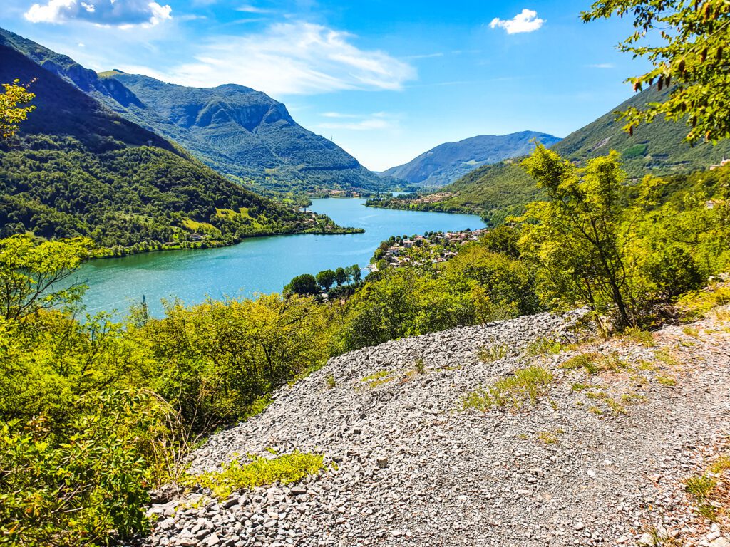
arrive at the small and quaint village of Fanovo from which you also begin to catch a glimpse of Lake Endine.
Continuing on, you then reach the village of Ranzanico and, once you have crossed it, climb further until
you reach the “differently giant bench” with a spectacular view of the entire Lake
Endine. After that, the trail begins to descend toward the medieval village of Bianzano, characteristic for
the presence of the Suardi castle. Continue downhill on an old mule track until you reach Spinone
al Lago and the shores of Lake Endine. From here you take the pedestrian lakefront, cross via a
bridge the Cherio River (emissary) and reach Monasterolo del Castello where the first STAGE ends.
STAGE 02
Monasterolo del Castello – Fonteno
Along the shores of Lake Endine and Gaiano. From the reed beds to the “Hill” with a view of Lake Iseo.
- Distance: 20 km
- Route type: 75% dirt, 10% urban, 15% asphalt.
- Height difference in ascent: max 580 mt.
- Downhill elevation gain: 325 mt.
- Maximum altitude: 615 m at Fonteno.
The second STAGE starts from Monasterolo and goes up the shores of Lake Endine largely on the lakeside
pedestrian promenade and for 2 km on a provincial road with little traffic. It crosses the built-up area of Endine Gaiano and
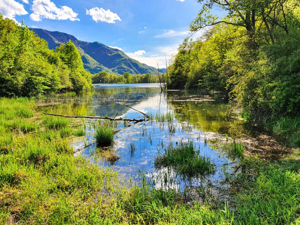
proceeds on a dirt road until it reaches the “Valle del Ferro” with the cool waters of the Cherio stream.
Proceeding you reach the small lake of Gaiano, which you skirt on a bicycle/pedestrian path until you reach
Riserva della Valle del Freddo (visitable only with a hiking guide). From here begins an ascent on
path on the slopes of Monte Nà to then descend near the small village of Esmate and degrade
subsequently to the village of Solto Collina. Crossing its districts with medieval architecture, we
take a dirt road that climbs first to the very scenic “giant bench” and then to the
historic center of the village of Fonteno.
STAGE 03
Fonteno – Lovere
The evocative atmosphere of the Bögn gorge, the serenity of San Defendente, and Lovere, one of the most beautiful villages in Italy.
- Distance: 16 km
- Route type: 70% dirt, 25% urban, 5% asphalt.
- Height difference in ascent: 600 mt.
- Downhill elevation gain: 1000 mt.
- Maximum altitude: 670 mt at San Defendente.
From Fonteno begins a descent that leads through the pretty hamlet of Xino and, via a beautiful
mule track through the woods, to the romantic lakeside village of Riva di Solto. From here you take the lakeside
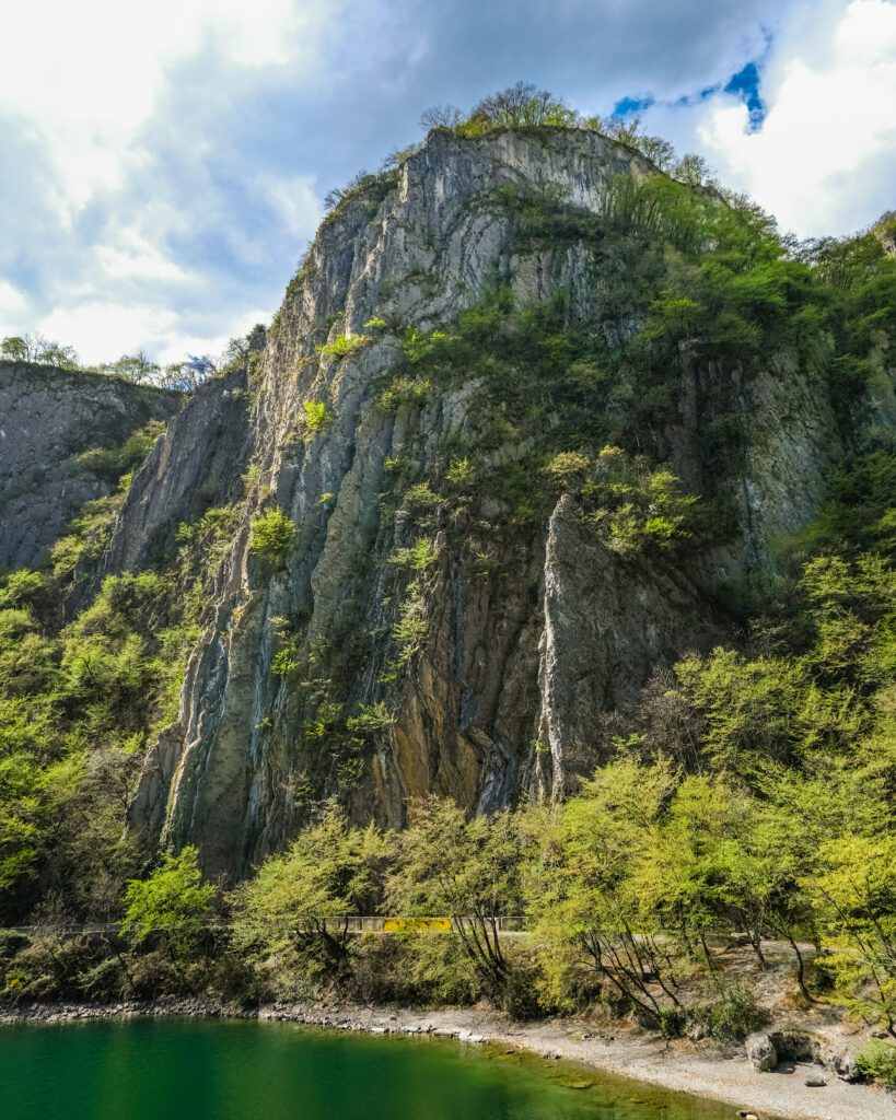
and follow it until you reach the “Baia del Bögn,” which can be visited by walking on the site of the old
coastal road carved into the rock. After about half a kilometer, you take a very steep path that
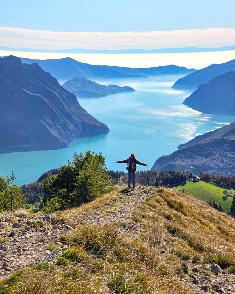
climbs up the gorge offering a striking and adrenaline-pumping view of Lake Iseo. The climb continues until
you reach the small church of San Defendente from which you can admire the Brescian side of the lake with
Montisola, Corna Trentapassi and Mount Guglielmo. Northward the Camonica valley with in the background
the Adamello and its glaciers. Here begins a gradual descent by mule tracks and paths that leads to the village of
Castro, from which you then continue along the lakefront until you reach the Tredici Martiri square in Lovere: one
of Italy’s Most Beautiful Villages.
STAGE 04
Lovere – Bossico
From the lake to the mountains with views of Lake Iseo kissed by the sun of the Bossico plateau.
- Distance: 14 km
- Route type: 80% unpaved trails, 15% urban, 5% paved roads.
- Elevation gain: 1100 mt.
- Downhill elevation gain: 450 mt.
- Maximum altitude: 1050 m in the locality of Monte di Lovere.
The fourth STAGE leaves the lakeside square to traverse the streets of the medieval historic center of Lovere.
Leaving the village, one undertakes a climb initially paved and then on a mule track that leads to San
Giovanni atop Monte Cala, also a very scenic spot. Then you will descend
passing through a wooded coastline, pass through the small hamlet of Qualino and climb the
old mule track until you reach the hamlet of Flaccanico and the higher one of Ceratello. Reaching
the hamlet of Ciàr, you take another mule track that passes the peculiar Faggio dell’Amore and leads
to a steeper section adorned with works by local artists who have recreated a Stations of the Cross. It finally descends
over the mountain of Lovere to drop onto the so-called Seven Hills of Bossico. Enjoying the beauty of the
sunny and scenic plateau, we make our way to the town center where the fourth STAGE ends.
STAGE 05
Bossico – Sovere
Ascent to the summit of Columbina with 360° panoramic views of the lakes and the Alps.
- Distance: 15 km:
- Trail type: 95% dirt, 5% urban
- Height difference in ascent: 650 mt.
- Height difference in descent: 1150 mt.
- Maximum altitude: 1458 mt at the top of Mt. Columbine.
Starting from the village of Bossico, climb first on a small asphalt road and then on agro-silvo-pastoral roads
crossing sheep and beech forests inhabited by beautiful farmsteads and agritourism farms. As you ascend, you reach a
wide viewpoint from which the steep path begins that leads up to the very panoramic summit of Mount
Colombina, the highest point of the Cammino Tre LAGHI. You then descend from the opposite slope from which you can
admire the Orobie chain in which the dolomitic mass of Pizzo della Presolana is clearly recognizable.
Descending, you first reach the locality of S. Fermo and then Pozza d’Ast. Start descending again among
spruces and beeches alternating with vast pastures until you reach Corno Maelì, which you bypass by taking a path
characteristic for its countless little stone men. At the end, you reach the village of Piazza (hamlet of
Sovere) and the Borlezza stream below, which you ford by passing over a lock and then follow its course.
Finally, you cross the stream again on a metal footbridge and ascend to the hamlet of S. Gregorio di Sovere to
descend it to the pedestrian bridge from which you started the first STAGE.
STAGE 06
Sovere – Corna Lunga – Sovere
Ascent to Corna Lunga, passage to the Malga Lunga museum ref. and Mount Grione: the Cammino Tre LAGHI as seen from the mountains of Sovere.
- Distance: 14~18 km:
- Route type: 90% dirt, 10% urban
- Height difference in ascent: 1000~1280 mt.
- Downhill elevation gain: 1000~1280 mt.
- Maximum altitude: 1360 m at Mt. Grione.
Starting from the village, you follow the trail of the Cammino as for the first STAGE but, this time, you
keep to the right to climb up to the Sanctuary of the Madonna della Torre. Next, climb up a
steep asphalt road that leads to the entrance of the trail to Corna Lunga. The trail continues steep and
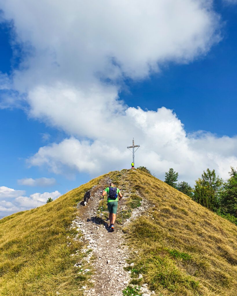
winding under the forest canopy to the cross placed on the summit. This place, too, is an impressive
natural balcony set on sheer walls with immense views of the surrounding lakes and valleys
. From the cross, follow the trail along the ridge in a continuous up and down until you enter
a spruce forest, magical and evocative in all seasons. Leaving a clearing, continue on
towards Malga Lunga: a refuge that was the scene of dramatic battles between partisans and Nazi-fascists. The
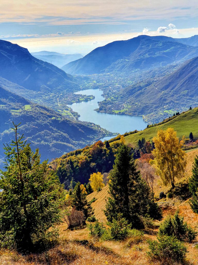
next destination is Mount Grione, a knoll from which it is possible to enjoy a superb view of a good
part of Lake Endine and the Cavallina valley, Lake Iseo with Montisola and the ubiquitous Corna Trentapassi,
on the horizon the Po Valley and on clear days the chain of the western Alps up to the Ligurian and Tuscan-Emilian Apennine ridge
. From here then begins the descent that rides a long and always
scenic ridge and leads to the wide pastures of Possimo. Having crossed the plateau, one descends into the
valley and resumes the path from which one ascended to return to the starting point and, therefore, to the end of the
Cammino.


Journey diaries

Cammino Tre LAGHI
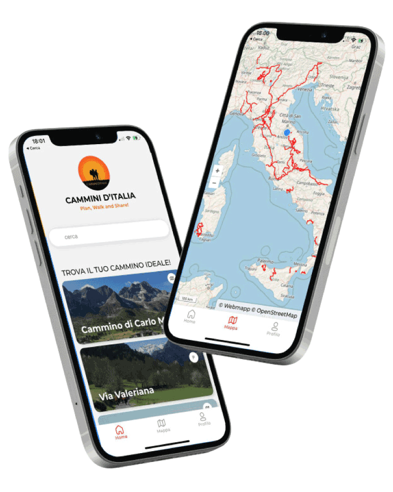
With Cammini d’Italia’s free app, you can plan and walk the Cammino Tre LAGHI in total safety, being able to plan the stages in detail and walk the route thanks to the built-in GPS technology that supports your orientation during your adventure.
⠀Inside the app you will find many other paths present in Italy. Thanks to the georeferenced tracks of many routes you will be able to study the itinerary that suits you best and also download the GPX tracks of the individual STAGEs offline.
The app also includes a complete digital map of all the paths surveyed to date on our portal, giving you a wide range of choices among the many paths in the Belpaese.
⠀⠀
Cammini d’Italia is the perfect app for those who want to explore the beauty of Italy on foot, discovering hidden places surrounded by nature. Download it for free today and start planning your next adventure!
⠀
⠀
 ⠀⠀⠀
⠀⠀⠀