La Rotta dei due Mari
Slowly, through the most beautiful rural pearls of Apulia: Castellana Grotte, Alberobello, Locorotondo, Martina Franca,Crispiano, each of which welcomes the traveler according to the millenary tradition that coats the guest with a ‘sacred aura and makes him or her a temporary inhabitant of the community.
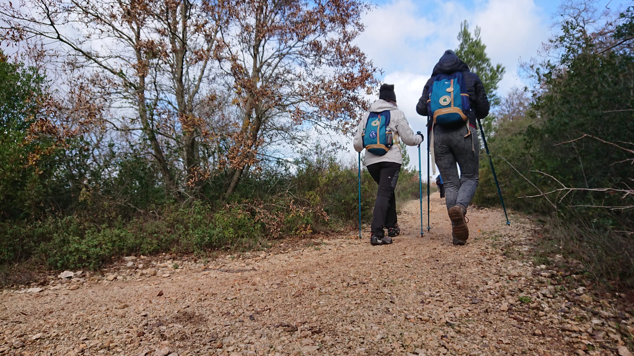
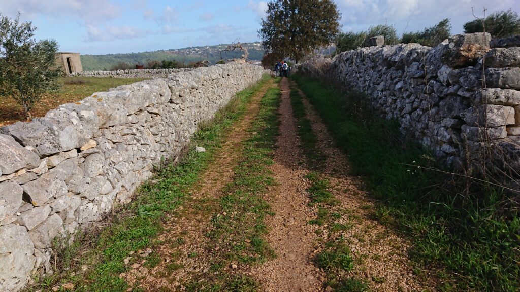
The Route of the Two Seas was born out of a deep love and desire for the redemption of the land we inhabit and also delivers to Apulia a route that can be traveled on foot and by bicycle through ancient roads made of history, nature and extraordinary peoples.
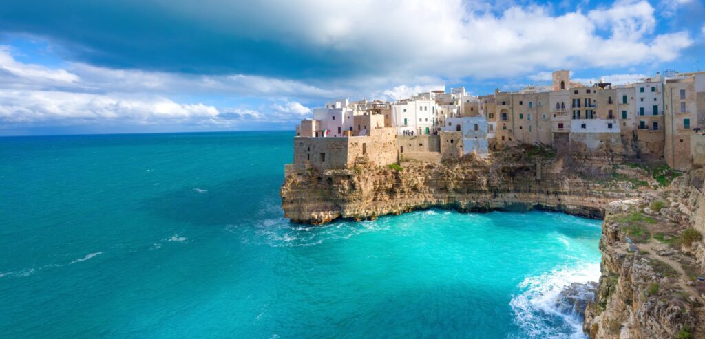
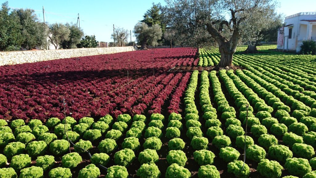
All year round from the Adriatic to the Ionian, slowly, traveling along ancient sheep-tracks, crossing centuries-old olive groves and enjoying the rare beauty of the sea that bathes the cliffs of Polignano a Mare until you reach the city of two seas, Taranto and its thousand-year history.
HISTORY
Legend has it that in the 8th century B.C. the Spartan hero Phalanthus, consulting the Delphic oracle, learned that he would come to the land of Saturus and found a city at the place where he saw rain falling from a clear, cloudless sky. The oracle came true when Phalanthus arrived at the mouth of the river Tara and fell asleep leaning on the lap of his wife Ethra, who bathed his face with her own tears.
Traditional chronology assigns the date of the founding of Tarentum to 706 BC.
Sources handed down by the historian Eusebius of Caesarea speak of the transfer to this area of the Spartan Falanthus, son of the noble Aratus and descendant of 8th generation Heracles and other compatriots called Partheni, sons of the virgins of Sparta.
WATER
In all the STAGES you are able to refuel with water. The only STAGE with difficulties is Stage 6: Crispiano – Taranto.
DANGERS
While crossing the fish market, just before entering Taranto, there are a few dogs barking but they are by no means harassing.
CREDENTIALS
There is the Coaster Passport
ROAD BOTTOM.
Gravel path 51 % 67 km
Road with mixed surface, deteriorated asphalt or cemented 9% 18km
Low-traffic asphalt road 32% 42km
Low-traffic asphalt road 8% 9 km
CONTACTS
APS LA ROTTA DEI DUE MARI
Helium Rome +39 3294277438
Francesco Consoli +39 3475813552
https://instagram.com/larottadeiduemari?igshid=ZDdkNTZiNTM=
https://www.facebook.com/groups/719488685053548/?mibextid=HsNCOg
STAGE 01
STAGE 01: Polignano a Mare – Castellana Grotte
Length: 19.9 km
Travel time: 5.17 h
Height difference: +315/-35
Legend has it that in the 8th century B.C. the Spartan hero Phalanthus, consulting the Delphic oracle, learned that he would come to the land of Saturus and found a city at the place where he saw rain falling from a clear, cloudless sky. The oracle came true when Phalanthus arrived at the mouth of the river Tara and fell asleep leaning on the lap of his wife Ethra, who bathed his face with her own tears.
Traditional chronology assigns the date of the founding of Tarentum to 706 BC.
Sources handed down by the historian Eusebius of Caesarea speak of the transfer to this area of the Spartan Falanthus, son of the noble Aratus and descendant of 8th generation Heracles and other compatriots called Partheni, sons of the virgins of Sparta.
STAGE 02
STAGE 02: Castellana Grotte – Alberobello
Length: 18.55 km
Walking time: 4.50 h
Height difference: +220/-100
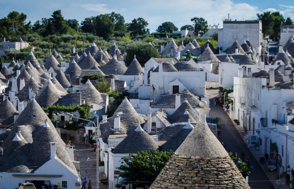
A city famous throughout the world for its trulli, there are more than a thousand of them scattered among the narrow streets of the Monti and Aia Piccola districts, so much so that the historic center has been included by UNESCO in the World Heritage List. The settlement is named after “Silvia Arboris Belli” because it was originally surrounded by oak forests. You will be enchanted by the small village, and photography lovers will have a thousand ideas for their scrapbook. Let yourself get lost in its narrow streets and take advantage of the night to enjoy the magical atmosphere. Only caution: the magic of Alberobello is addictive!
STAGE 03
STAGE 03: Alberobello – Locorotondo
Length: 20 km
Walking time: 5.30 h
Height difference: +140/-150
The town stands out on the hilltop overlooking the Valle d’Itria The characteristic old town, which spreads out in a circular fashion, hence its particular name, is characterized by many narrow streets surrounded by rows of low whitewashed houses A gem of Locorotondo, and you will see this as you walk through its vozze, are the countless colorful flower pots that seem to protrude from the balconies and balustrades.
Another distinctive feature of this town is the so-called cummèrse, the very steep roofs typical of Locorotondo’s houses, made with locally sourced stone.
In its charming historic center you can visit the Mother Church of St. George Martyr and the older Church of the Madonna della Greca. Don’t miss an aperitif on the “Lungomare” where you can enjoy a magnificent view of the Itria Valley and the sea breeze that accompanies the summer evenings enlivened by the LOCUS FESTIVAL.
STAGE 04
STAGE 04: Locorotondo – Martina Franca
Length: 16.23 km
Walking time: 4.30 h
Height difference: +170/-140
Situated on the Murge plateau in southern Italy, the town was founded in the 10th century, when some citizens fleeing the Saracen devastation of Taranto built a village on Mount San Martino.
Martina Franca retains a timeless beauty, showcased especially by its illustrious Baroque-style buildings that are its crowning glory. Its monumental symbol is the beautiful Basilica of San Martino. The historic center of Martina Franca holds many other marvels created by human ingenuity; in addition to its noteworthy churches, the town also offers numerous civic buildings that have played a key role in its history.
There is no shortage of shopping opportunities in Martina Franca, and the nightlife is characterized by clubs of all kinds and for all kinds of evenings, Highly recommended to get lost through its intricate cobbled streets and then find yourself to enjoy at every corner, at every turn an infinity of notes, scents, and lights that will leave you in love with this beautiful town.
STAGE 05
STAGE 05: Martina Franca – Crispiano
Length: 29.05 km
Walking time: 7.30 h
Height difference: +200/-390
Just 15 km from Taranto as the crow flies, Crispiano is known as the land of “The Hundred Masserie,” and the town still preserves its simple character, deeply rooted in the land.
The area of Crispiano has been inhabited since prehistoric times, as evidenced by numerous artifacts from the Greek period, including a very interesting “grave goods” from the 4th century that constitutes one of the most important pieces of the famous “Ori di Taranto.” The small town stands on both sides of the Vallone Lizzitello, where the Vallone Caves can be admired, once a refuge for Basilian monks.
In December 2015, the European Community awarded the territory of “Le Cento Masserie” in Crispiano the prestigious recognition of “European Destination of Excellence for Tourism and Local Gastronomy.”
STAGE 06
STAGE 06: Crispiano – Taranto
Length: 27.88 km
Walking time: 6.30 h
Height difference: +90/-330
Just 15 km from Taranto as the crow flies, Crispiano is known as the land of “The Hundred Masserie,” and the town still preserves its simple character, deeply rooted in the land.
The area of Crispiano has been inhabited since prehistoric times, as evidenced by numerous artifacts from the Greek period, including a very interesting “grave goods” from the 4th century that constitutes one of the most important pieces of the famous “Ori di Taranto.” The small town lies on both sides of the Vallone Lizzitello, where the Vallone Caves can be admired, once a refuge for Basilian monks.
In December 2015, the European Community awarded the territory of “Le Cento Masserie” in Crispiano the prestigious recognition of “European Destination of Excellence for tourism and local gastronomy.”


La Rotta dei due Mari
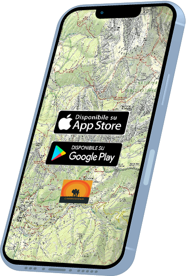
With Cammini d’Italia’s free app, you can plan and walk the La Rotta dei due Mari in total safety, being able to plan the stages in detail and walk the route thanks to the built-in GPS technology that supports your orientation during your adventure.
Within the app you will find many other paths present in Italy. Thanks to the georeferenced tracks of many routes you will be able to study the itinerary that suits you best and also download the GPX tracks of the individual STAGEs offline.
The app also includes a complete digital map of all the paths surveyed to date on our portal, giving you a wide range of choices among the many paths in the Belpaese.
⠀⠀
Cammini d’Italia is the perfect app for those who want to explore the beauty of Italy on foot, discovering hidden places surrounded by nature. Download it for free today and start planning your next adventure!
⠀
⠀
 ⠀⠀⠀
⠀⠀⠀