La Via del Tratturo
One hundred and twelve kilometers to discover the tratturi, the great grass roads, which connected the Abruzzi Apennines and the Tavoliere delle Puglie and were traveled by shepherds and their flocks.
A 112-kilometer route that retraces the great sheep-tracks, the ancient grassy roads that joined the Abruzzo Apennines to the Tavoliere delle Puglie, once ploughed by shepherds and their flocks. Among the most important are the Pescasseroli-Candela and the Castel di Sangro-Lucera, two historic routes that marked the lives of entire communities.
In 1447, Alfonso of Aragon regulated these routes by creating a large network of “Regi Tratturi,” with a standard width of 111 meters. The proposed route follows a section of each of these historic routes, alternating between mountain paths in the first part and secondary dirt and paved roads in the second, walking through the heart of these ancient paths, which are protected as state heritage.
La Via del Tratturo offers an immersion in the culture, traditions and spirituality of Molise's communities, which are deeply connected to pastoralism and transhumance. To tackle the walk, it is recommended to use GPS tracks, navigable for free from the Cammini d'Italia app.
This section, from Pescasseroli to Campobasso, is an introduction to the world of sheep-tracks, with the goal of preserving and enhancing these ancient routes, and with the aim of extending the trail and continuing in the future as far as Apulia, evoking the centuries-old tradition of transhumant shepherds.
HISTORY
La Via del Tratturo is a project born from an idea of Luca Gianotti, in collaboration with the Compagnia dei Cammini and Ecotur. This first section, from Pescasseroli to Campobasso, is designed to introduce walkers to the world of the sheep-tracks, with the goal of enhancing and preserving these ancient routes related to transhumance.
“Our commitment is to build a network of local realities to keep the path alive. If the project grows as we hope, the idea is to extend the trail as far as Apulia, following the centuries-old tradition of the sheep-tracks. ” – Luca Gianotti.
WATER SOURCES.
There are water sources along each STAGE and sources for sheep in each village crossed.
SERVICES
Groceries and Bars: present in most of the villages crossed:
-Pescasseroli, Civitella Alfedena, Villetta Barrea, Barrea, Alfedena, Roccasicura, Pescolanciano, Civitanova del Sannio, Castropignano
Where to stay: here you can find the updated list of all accommodations along La Via del Tratturo https://viadeltratturo.it/dormire/
Pharmacies: along the route you will encounter one a day, maximum every 2 days.
SIGNAGE
LA VIA DEL TRATTURO is marked with red-white paint and plaques with the path’s logo.. Although in the first two STAGES within the Abruzzo National Park, the path marked white-red and RT(Regio Tratturo) is followed.
DANGERS
There are no hazards to report along La Via del Tratturo
ROAD BOTTOM.
About 25% asphalt.
TENT WALK
It is possible to walk the La Via del Tratturo in a tent, taking some basic precautions.
In the Abruzzo National Park, camping is allowed only in equipped areas: you will find campsites in Pescasseroli, Opi, Villetta Barrea, Civitella Alfedena and Barrea.
In Molise, on the other hand, it is possible to bivouac freely on the tratturo, but always follow the rules of the good walker: choose places far from inhabited centers, pitch your tent only at sunset and take it down at dawn, and … leave no trace behind.
CREDENTIALS
The Salvacondotto is a nice souvenir of the walk and can be picked up in Pescasseroli at Ecotur (Mon-Sat: 9 a.m.-1 p.m. and 4-7 p.m.) or, on Sundays, at Gaia’s Bottega under Ecotur (10 a.m.-1 p.m. and 4-7 p.m.). To arrange other times, you can contact Cesidio at 328 8658488.
Stamps to complete the Salvacondotto are collected at official walk facilities or in municipalities, pro loco, bars and restaurants. At the end of the walk, collecting the stamps will enable you to obtain the certificate, which can be picked up in Campobasso.
Certificate pickup
In Campobasso, the certificate can be picked up at the Chocolat/Il Molise non esiste store in Piazza Pepe, 21 (near the cathedral). Hours: 10 a.m.-1:30 p.m. and 5-8:30 p.m. For pickups at other times or on Sundays, contact Andrea at 366 3955766.
CONTACTS
E-mail: info@viadeltratturo.it
STAGE 01
STAGE 01: Pescasseroli – Villetta Barrea
Length: 19.5 km
Height difference: 580 m uphill, 700 m downhill
The walk starts from the main square of Pescasseroli, following Via Piave and Via delle Pinete for 1.5 km, with a slight ascent to Residence Primula. From here you take the D6 mule track and, after 500 meters, the E2 trail that leads in about 45 minutes to SR 83. Follow the state road for 1.5 km below the village of Opi, reaching the junction with SS 509.
From this point, follow trail TR toward Fonte Visco, descending to Val Fondillo. After the refreshment point, walk on SR 83 for 4.5 km to the Camosciara junction, where you take path G1 for 1.4 km, then path I2 that crosses the Torrente Scerto. Continue for 1.3 km to the Jajaque Spring and another 1.5 km to reach the village of Civitella Alfedena, with its Wolf Center.
From Civitella, continue on a paved road for 2 km to Villetta Barrea, where a visit to the Museum of Transhumance is recommended.
STAGE 02
STAGE 02: Villetta Barrea – Villa Scontrone
Length: 17 km
Elevation gain: 380 m uphill, 450 m downhill
Starting from Villetta Barrea, follow the footpath along the Sangro River for 2 km to the bridge over Lake Barrea. Crossing the bridge, take path I3, next to the bar, which runs along the lake for about 4 km. Continue on an uphill mule track, crossing SR 83, until you reach Barrea, where a visit to the historic center and the Medieval Castle is recommended.
From Corso Duca degli Abruzzi, cross SR 83 again and take trail K1, ascending to Valico dell’Aia and descending to the Colle Faratto watering hole. It continues up and down, passing an 18th-century boundary stone and crossing sections near SR 83, until it reaches Alfedena. From here, continue on SR 83 to the cemetery, and then follow a dirt road for 3 km, in the direction of Villa Scontrone.
STAGE 03
STAGE 03: Villa Scontrone – Roccasicura
Length: 26 km
Elevation gain: 800 m uphill, 600 m downhill
STAGE 04
STAGE 04: Roccasicura – Civitanova del Sannio
Length: 18.5 km
Elevation gain: 500 m uphill, 660 m downhill
From Roccasicura start from Piazza Sant’Antonio, passing the sports facilities and some houses, until you take a mule track on the left, before the quarry. Cross a meadow and continue on a cart track to the Merocco Pass (960 m), rejoining the sheep-track. You descend for 1.7 km to Masseria Gismundo, then another 1.2 km to Colle Tavernola and, crossing SP 21, reach Masseria Fischietto.
From here, the trail ascends to the Capo d’Acqua plateau, where wild orchids can be seen in spring. After 4.2 km, you reach Pescolanciano, a village that follows the route of the sheep trail. At the entrance, you will find the ancient fountain and medieval castle. Going through the center, continue toward the train station, passing two underpasses to SP 31. You walk for 2.5 km on the provincial road toward Chiauci, then turn right onto the SP Bagnolese for 1.5 km. You turn left skirting the Chiauci reservoir, following it almost entirely until you rejoin the sheep-track 300 meters before the dam gate.
You reach the pass with a trattural cippus and cross SP 74 on a downhill path marked by a large protruding rock. After about 45 minutes you reach Civitanova del Sannio, a quaint village that is well worth a visit.
STAGE 05
STAGE 05: Civitanova del Sannio – Castropignano
Length: 16 km
Elevation gain: 530 m uphill, 550 m downhill
From Civitanova del Sannio go down to the SP Civitanova-Bagnoli, following it for 2.7 km to the Fiumarella Bridge. After the bridge, continue left for 50 m, then take a steep mule track uphill, following it for 600 m to the SC for Duronia, which you follow for 300 m. Continue on trail tracks, marked by Tratturo signs, crossing the road several times, until you reach the Faito locality. From here, continue on the road for 1.4 km to Duronia.
Leaving Duronia, walk on a track parallel to SP 46 toward Molise, cutting a hairpin bend after 2 km thanks to a marked trail. After another 2 km, ignore a sign for Taverna del Sannio and follow the Tratturo signs, alternating between asphalt and trail. After about 1 km, Torella del Sannio appears, where you continue toward Contrada Pietrale, skirting the sports field. You cross SP 169, heading toward the picnic area of Contrada Fonte Vecchia.
From here, continue on the Tratturo for 1.8 km, crossing the provincial road several times. At Crocella, you finally leave the SP for a cart track that leads to Castropignano in 1.6 km. The entrance to the village is marked by the Tratturale Church of Santa Lucia. The well-preserved historic center and the Castello d’Evoli are worth visiting.
STAGE 06
STAGE 06: Castropignano – Campobasso
Length: 17 km
Elevation gain: 560 m uphill, 460 m downhill


La Via del Tratturo
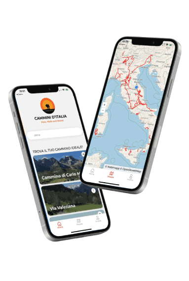
With Cammini d’Italia’s free app, you can plan and walk the La Via del Tratturo in total safety, being able to plan the stages in detail and walk the route thanks to the built-in GPS technology that supports your orientation during your adventure.
⠀Inside the app you will find many other paths present in Italy. Thanks to the georeferenced tracks of many routes you will be able to study the itinerary that suits you best and also download the GPX tracks of the individual STAGEs offline.
The app also includes a complete digital map of all the paths surveyed to date on our portal, giving you a wide range of choices among the many paths in the Belpaese.
⠀⠀
Cammini d’Italia is the perfect app for those who want to explore the beauty of Italy on foot, discovering hidden places surrounded by nature. Download it for free today and start planning your next adventure!
⠀
⠀
 ⠀⠀⠀
⠀⠀⠀