
VIA RAETIA
A walk through the landscapes of the Camonica Valley, with chestnut groves, Romanesque churches and UNESCO World Heritage rock carvings. Five STAGES from Boario Terme to Edolo to discover, step by step, the millennial history of a unique territory. A slow journey, between nature and archaeology, in the footsteps of ancient prehistoric men, inhabitants of the area.
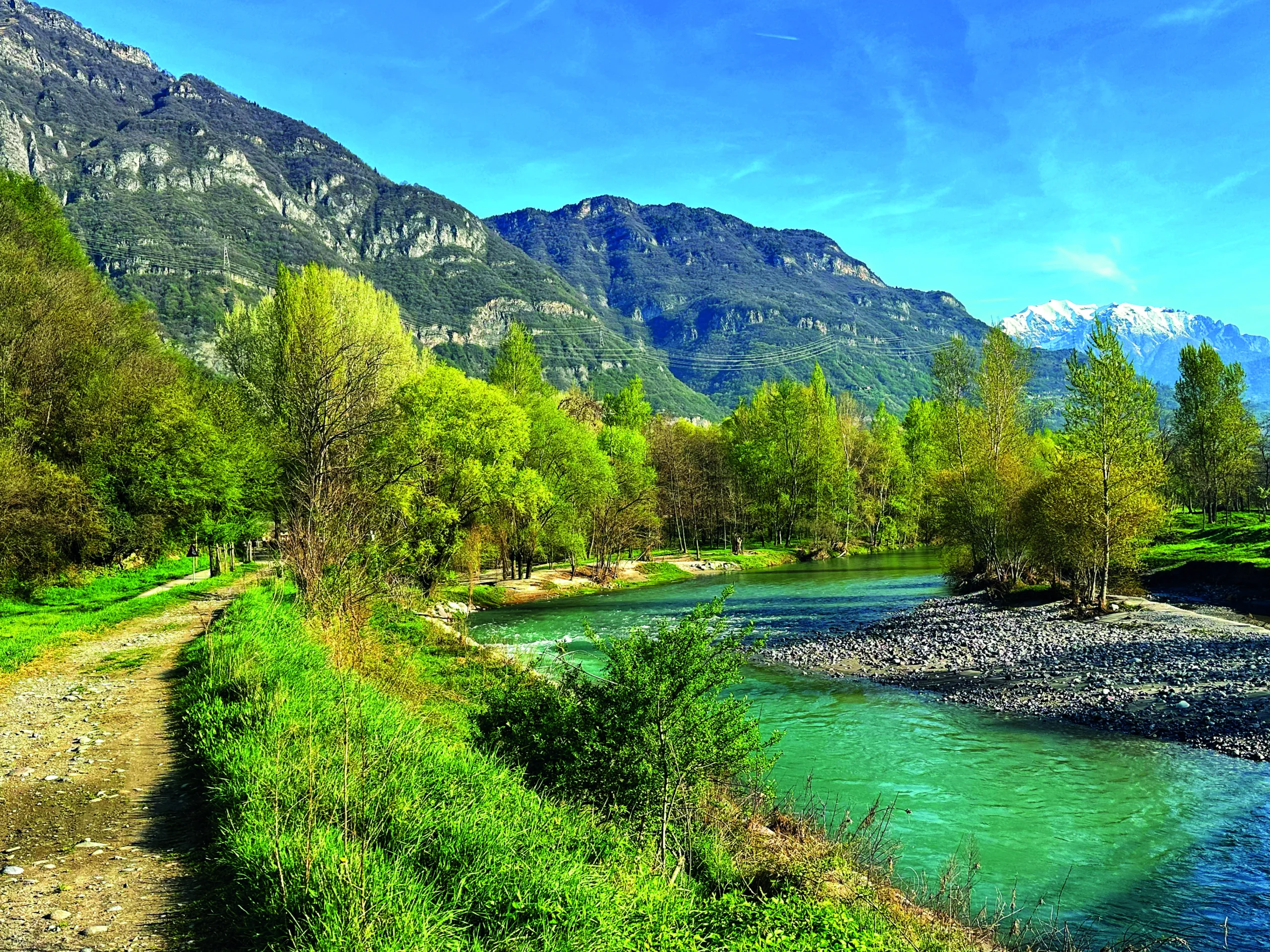
In the heart of northern Italy, among the majestic mountains of Lombardy, an ancient route winds through the Camonica Valley: the Via Raetia.
This approximately 95-kilometer walk, divided into five stages from Boario Terme to Edolo, is a journey through time and space.
This itinerary narrates the exciting journey of mankind, from the earliest depictions of religiosity and daily life to the present day, leading the traveler past imposing medieval castles and striking Romanesque parish churches, through dense chestnut groves and wide scenic glades.
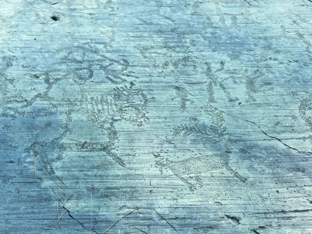
As many as 13 extraordinary archaeological sites with rock carvings, recognized by UNESCO as World Heritage Sites, are encountered along the way.
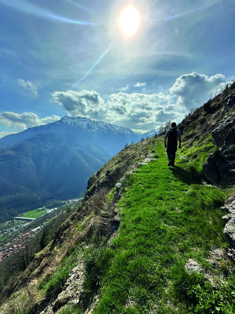
The Via Raetia represents a unique opportunity to discover the extraordinary Camonica Valley through slow and conscious tourism. A walk that invites you to slow down, listen to the territory and walk in the footsteps of the ancients, rediscovering the sense of travel as an experience of discovery and connection with history and nature.
HISTORY
Via Raetia was born in 2011, by Carlo Zani, from the desire to ideally retrace the path that prehistoric man took in ascending the Camonica Valley more than thirteen thousand years ago, enriching it with numerous megalithic sanctuaries and thousands of rock engravings, recognized by UNESCO as a world heritage site to be protected and enhanced.
Suspended in 2020, Via Raetia returns today with a new route that touches on new archaeological sites, following a route that is immersed in nature but does not neglect visits to typical mountain villages.
SIGNAGE
At present, the Via Raetia does not have specific signage in the area. To properly orient yourself along the route, we recommend using the GPS tracks in combination with the stage-by-stage descriptive of the printed guidebook. It is essential to know how to use the GPS and tracks correctly in order to follow the route safely.
WATER
The abundant presence of springs, springs and fountains ensures an almost constant supply of water along the route. The only situation of scarcity is in STAGE 5 (between Cevo and Zazza).
IN TENT
We are currently working to identify suitable areas for tent walking.
CREDENTIAL
The Passport (equivalent of a credential but with the page format, similar to a passport) can be purchased on the website, at a cost of €5 each , at this link: https://viaraetia.org/passaporto.php
The Memoria Itineris (equivalent of the Testimonium) can be requested at the end of the route, from those who provide copies of the stamped pages of the Passport.
CONTACTS
Website: viaraetia.org
Email: info@viaraetia.org
Facebook: facebook.com/ViaRaetia.ValleCamonica
Instagram: instagram.com/ViaRaetia
STAGE 01
STAGE 01: from the Boario Hot Springs to the Sunshine Plateau.
Departure: Boario Terme
Arrival: Borno
Distance: 17.3 km
Height difference: +1138 m / 576 m
Difficulty: Medium
The walk begins at the fascinating Luine Archaeological Park, where you can admire some of the oldest rock engravings in the valley. It continues to the spa town of Boario, then climbs through lush forests to the impressive Annunciata monastery with its precious frescoes. The STAGE ends in the ancient village of Borno after visiting the mysterious sanctuary of Valzel de Undine.
STAGE 02
STAGE 02: From the Sunshine Plateau to the heart of the UNESCO World Heritage Site: the rock carvings
Departure: Borno
Arrival: Capo di Ponte
Distance: 28.3 km
Height difference: +763m / -1297 m
Difficulty: Challenging
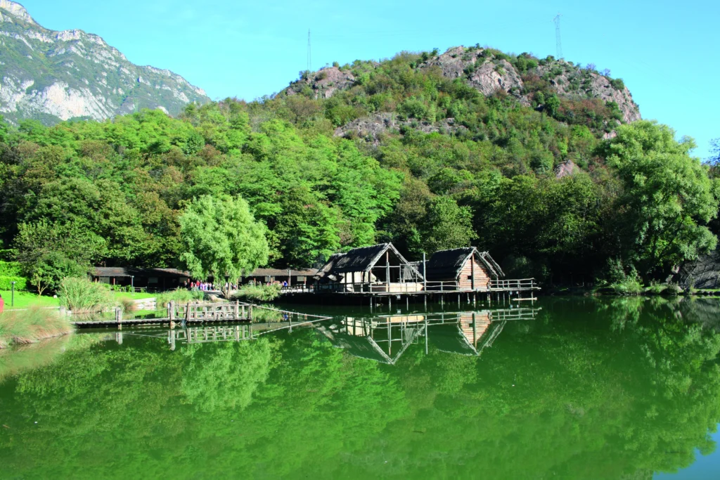
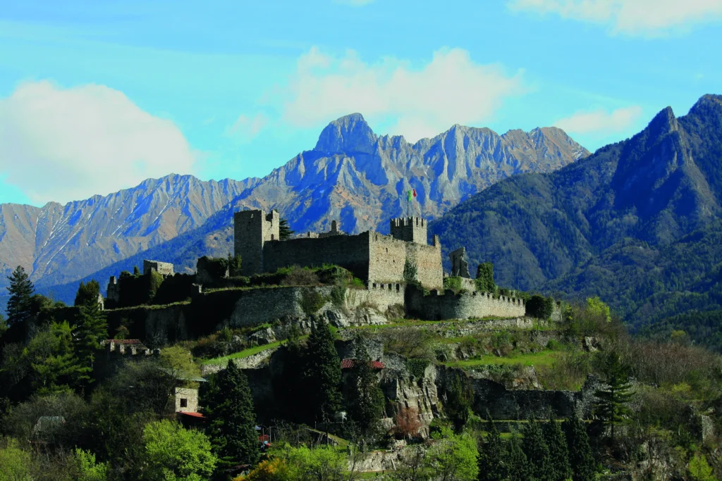
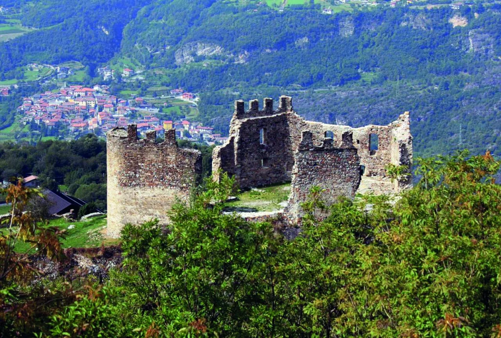
A fascinating STAGE to discover the Romanization of the valley, leading from the prehistoric sanctuary of Asinino Anvoia down to Cividate Camuno, the ancient Civitas Camunnorum, where the National Archaeological Museum houses priceless Roman artifacts. The walk continues along the Oglio River to Breno, dominated by its imposing medieval castle, and finally reaches Capo di Ponte, the heart of the UNESCO archaeological heritage.
Note on the breakdown of STAGE 2 and 3: Stages 2 and 3 of the route can be adjusted: for example, Stage 2 can be shortened by finishing in Breno, thereby dividing the walk differently. The original subdivision, with a very short STAGE 3, was designed to give walkers enough time to visit all the archaeological parks in this area, which represents the heart of rock engravings in the Camonica Valley.
STAGE 03
STAGE 03: In the heart of the Unesco World Heritage Site: the main rock carving sites in the valley
Departure: Capo di Ponte
Arrival: Cimbergo
Distance: 7.9 km
Height difference: +779 m / -287 m
Difficulty: Easy
A day entirely dedicated to the extraordinary Camuna rock art in the famous archaeological parks of Naquane, Foppe di Nadro and Massi di Cemmo. The highest density of rock engravings in Europe is concentrated here, with more than 140,000 engraved figures depicting hunting scenes, warriors in combat, cosmic symbols and sacred rituals covering a time span of 8,000 years. The trail ends at the striking ruins of the medieval castle of Cimbergo.
Note on the breakdown of STAGE 2 and 3: Stages 2 and 3 of the route can be reorganized: for example, Stage 2 can be shortened by finishing in Breno, thus breaking up the journey in a different way. The original subdivision, with a very short STAGE 3, was designed to give walkers enough time to visit all the archaeological parks in this area, which represents the heart of rock engravings in the Camonica Valley.
STAGE 04
STAGE 04: From the bread tree forests to the extraordinary Saviore Valley
Departure: Cimbergo
Arrival: Cevo
Distance: 21.5 km
Height difference: +1236 m / -966 m
Difficulty: Challenging
The path follows an ancient route that halfway up the mountainside joined the villages of Val Saviore, passing through centuries-old forests and alpine pastures of extraordinary beauty. It encounters the isolated rock of the Capitello dei Due Pini, considered an ancient prehistoric astronomical observatory, continuing on to the disused Isola hydroelectric power plant, an important example of industrial archaeology. The STAGE touches the characteristic villages of Valle, Ponte and Saviore before reaching Cevo.
STAGE 05
STAGE 05: From the Pian della Regia, the last bastion of World War I, to the industrious center of Edolo
Departure: Cevo
Arrival: Edolo
Distance: 20.7 km
Height difference: +905 m / -1351 m
Difficulty: Challenging
The last STAGE passes through centuries-old chestnut groves and travels along the significant Sentiero della Memoria (Path of Remembrance), a historic trail that preserves evidence of World War I among fortifications, trenches and military posts carved into the rock. The path continues to the enigmatic Coren delle Fate archaeological park, ending the journey in historic Edolo.


Via Raetia
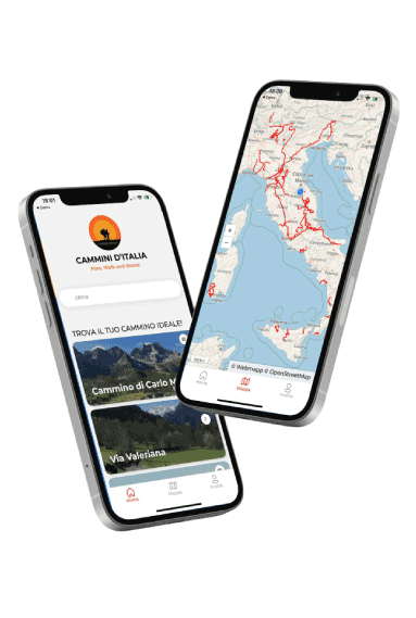
With the free Cammini d’Italia app, you can plan and walk the VIA RAETIA safely, being able to plan the stages in detail and walk the route thanks to the built-in GPS technology that supports your orientation during your adventure.
Within the app you will find many other paths present in Italy. Thanks to the georeferenced tracks of many routes you will be able to study the itinerary that suits you best and also download the GPX tracks of the individual STAGEs offline.
The app also includes a complete digital map of all the paths surveyed to date on our portal, giving you a wide range of choices among the many paths in the Belpaese.
⠀⠀
Cammini d’Italia is the perfect app for those who want to explore the beauty of Italy on foot, discovering hidden places surrounded by nature. Download it for free today and start planning your next adventure!
 ⠀⠀⠀
⠀⠀⠀