
Via Romea Nonantolana
The Via Romea Nonantolana rediscovers a historic route connecting the Po Valley with the Tuscan-Emilian Apennines.
Beginning in the early Middle Ages and for several centuries, the Italian peninsula was traversed by a dense network of roadways used by merchants, pilgrims, armies and wayfarers from northern Europe to reach Rome. The itinerary of Via Romea Nonantolana starts from Nonantola, the heart of the province of Modena and the site of the important Benedictine abbey, and travels up the Panaro River valley to the border with Tuscany. There are two routes: an eastern and a western one, which join at Fanano to continue towards the ridge. Today, as then, this ancient route is able to draw wayfarers into the 21st century to discover villages, parish churches, castles and all the precious traces that history has given us. Relying on the care of the many local tour operators, the visitor will feel enveloped by a sincere, Emilian-quality welcome.
HISTORY
The history of this street stems from one man’s life choices, Anselm duke of Cividale, who in 750 A.D. decided to abandon his role of power and retire to a monastic life. In the beginning he founded a monastery a Fanano, in the heart of theTuscan-Emilian Apennines, but this place, though rich in charm, was very remote, and so two years later his brother-in-law Astolfo, Lombard king, convinced Anselm to found another monastery in Nonantola, a center that was certainly more accessible and in a strategic position for crossing the Emilian territory.
The connection between the two places of worship remained constant over the years, and the strong power of theAbbey of Nonantola created a safe route for the pilgrims headed first to Fanano and then to Rome. In addition to spiritual journeys, it was also used by the wayfarers and by the armies, was in fact initially located in the border area with theByzantine empire. It later became a crossing axis in the middle of the peninsula, and thus assumed central importance until the emergence of the modern routes.
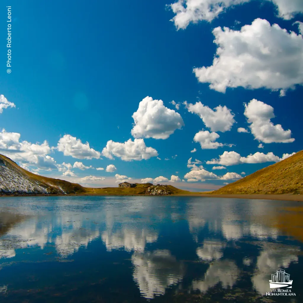
The Via Romea Nonantolana is part of the Via Romea Strata and provides a connection with the Via Francigena all the way to Rome. With his double track (eastern and western) the Romea Nonantolana stands in the rose of the Italian and European historical paths, characterized by a route of great scenic and naturalistic charm, enriched in addition by hospices, parish churches and numerous historical-artistic jewels of the Modena Apennines..
WATER
There are drinking fountains at all the STAGE points. In addition, a project is in the works with HERA to include additional drinking fountains at each STAGE point.
SERVICES
There are supermarkets, except stage 4 and 6 western
There are pharmacies, except stage 4 and 6 western
SIGNAGE
Signage present along the way
DANGERS
NO
ROAD BOTTOM.
10% approx.
CREDENTIALS
Yes, credentials are distributed by the association and tourist information offices.
To date, they are free of charge
IN TENT
No tent.
Permits are needed.
CONTACTS
VIA ROMEA NONANTOLANA ASSOCIATION
info@viaromeanonantolana.org
info@saveitalianbeauty.it
STAGE 01 - WEST STREET
STAGE 01: From Nanantolana to Modena
Departure: Nanantolana
Arrival: Modena
Distance: 17 km
Of the length of about 17 km, a first short STAGE starts from theAbbey of Nonantola. Pivotal to this route, the Abbey has served over the centuries as a spiritual and temporal reference point for the area. The portal, crypt, and apse are of great value, while an impressive collection of relics, historical documents and works of great artistic value can be visited in the Benedictine and Diocesan Museum of Sacred Art set up in the rooms of the old monastery. At the Museum of Nonantola, set up inside the 14th-century Torre dei Bolognesi, it is possible to have a comprehensive view of the history of the monastery thanks to the results that have emerged from archaeological excavations.
Leaving the historic center of Nonantola, where the village‘s medieval architecture is still visible, the route continues on level ground through secondary roads with little traffic and bike lanes in their own lanes approaching the provincial city center.
Modena is certainly a place worth an extended stop, taking advantage of the short travel time on this first STAGE. The UNESCO-listed Duomo, Palazzo Ducale, Palazzo dei Musei, the Church of Sant’Agostino and the Monastery of San Pietro are certainly worth a visit, as are other places that have shaped the city’s history and character such as the Albinelli Market, the Enzo Ferrari Museum and the Luciano Pavarotti Municipal Theater.
STAGE 02 - WEST STREET
STAGE 02: From Modena to Castelvetro di Modena (Levizzano Rangone)
Departure: Modena
Arrival: Castelvetro di Modena
Distance: 26.5 km
At 26.5 km, the second STAGE is undoubtedly longer than the previous one, but without ever being monotonous. Along the bike path built on the former Modena-Vignola railroad and the bike path along the Guerro stream, it crosses the city outskirts, arriving almost immediately in the countryside.
Traveling through the streets of the municipality of Castelnuovo Rangone, famous for its gastronomic excellence, we reach Castelvetro, a picturesque village surrounded by the Lambrusco Grasparossa vines that accompany the Via all the way to Levizzano Rangone. Here stand theOratory of San Michele, a Romanesque gem of the area, and the castle of Levizzano, a stately palace of the Rangoni family.
STAGE 03 - WEST STREET
STAGE 03: From Modena to Castelvetro di Modena (Levizzano Rangone)
Departure: Castelvetro di Modena
Arrival: Pavullo nel Frignano
Distance: 19 km
The third STAGE, from Levizzano Rangone, leads to Coscogno, a hamlet of Pavullo nel Frignano. The route is 19 km long and climbs along the hydrographic right of the Guerro stream. The first ascent leads through hills of incredible scenic beauty, then touches in succession the villages of Denzano and Ospitaletto. The place name of the latter suggests to us the welcome that pilgrims were to find there.
This leads to Coscogno, whose church is dedicated to St. Apollinaris. Despite the various remodeling it has undergone over the centuries, it still shows its Romanesque origins on the façade.
STAGE 04 - WEST WAY
STAGE 04: From Pavullo nel Frignano (Coscogno) to Pavullo nel Frignano (Monte Cuccolo Castle)
Departure: Pavullo nel Frignano (Coscogno)
Arrival: Pavullo nel Frignano (Castle of Monte Cuccolo)
Distance: 13.3 km
The fourth STAGE, 13 km in length, passes through the town center of Pavullo nel Frignano. Here you can visit the park, with its monumental trees, and the Galleries of the 19th-century Ducal Palace.
Past the center, the route rises rapidly and the built-up area gives way to forest until the top of the hill, where stands the castle of Montecuccolo. The fortress, with the adjoining medieval village, was originally owned by the Montecuccoli family, which for centuries dominated the Apennine territories and held prestigious positions at the Este court. It is currently home to an important art and nature museum center housing several collections by local artists.
STAGE 05 - WEST STREET
STAGE 05: From. Pavullo nel Frignano (Castle of Monte Cuccolo) to Fanano
Departure: Pavullo nel Frignano (Castle of Monte Cuccolo)
Arrival: Fanano
Distance: 20.3 km
With a distance of 20 km, the fifth STAGE crosses the valley of the Scoltenna stream transversely and then reaches the town of Fanano. Initially the route descends to the medieval village of Renno, where there is a splendid Romanesque parish church dedicated to St. John the Baptist, until it reaches the valley.
From here, crossing the Scoltenna stream, the main tributary of the Panaro River, we ascend along the valley, beating trails and roadways to the ancient village of Rocchetta Sandri, already mentioned in Lombard documents at the end of the eighth century. Passing through several mountain hamlets we encounter the small Oratory of Sant’Anna in Lotta, from which a spectacular view of the valley can be appreciated.
The STAGE ends with the arrival in Fanano, another center among the largest and liveliest in the Apennines, at the gateway to the Alto Appennino Modenese regional park.
STAGE 06 - WEST STREET
STAGE 06: From Fanano to Arcana Cross Pass
Departure: Fanano
Arrival: Cross Arcana Pass
Distance: 12.5 km
With a distance of 20 km, the fifth STAGE crosses the valley of the Scoltenna stream transversely and then reaches the town of Fanano. Initially the route descends to the medieval village of Renno, where there is a splendid Romanesque parish church dedicated to St. John the Baptist, until it reaches the valley.
From here, crossing the Scoltenna stream, the main tributary of the Panaro River, we ascend along the valley, beating trails and roadways to the ancient village of Rocchetta Sandri, already mentioned in Lombard documents at the end of the eighth century. Passing through several mountain hamlets we encounter the small Oratory of Sant’Anna in Lotta, from which a spectacular view of the valley can be appreciated.
The STAGE ends with the arrival in Fanano, another center among the largest and liveliest in the Apennines, at the gateway to the Alto Appennino Modenese regional park.
STAGE 01 - EASTERN STREET
STAGE 01: From Nonantola to Spilamberto
Departure: Nonantola
Arrival: Spilamberto
Distance: 22.3 km
About 22 km long, the first STAGE starts from theAbbey of Nonantola, the pivotal place of this route.
Leaving the medieval village of Nonantola, where the Benedictine Museum and the Museum of Nonantola can be visited, the route continues on level ground along country roads, encountering some ancient historic residences such as Villa Sorra, with its splendid English garden, and the Castle of Panzano.
Arriving in Castelfranco Emilia, famous for being the birthplace of tortellino, continue south to San Cesario, skirting the town center on the right. Reaching Spilamberto you can admire the Rocca Rangoni and its park, visit the Museum of Balsamic Vinegar (also home to the Consorteria dell’Aceto Balsamico Tradizionale di Modena) and the town’s medieval keep, which houses theOrder of Modena Nocino.
STAGE 02 - EASTERN STREET
STAGE 02: From Spilamberto to Giuglia (Pieve di Trebbio)
Departure: Spilamberto
Arrival: Giuglia (Pieve di Trebbio)
Distance: 24.6 km
The second STAGE, about 25 km long, is mainly along the Nature Trail that runs along the Panaro River. From Spilamberto the route remains flat until the arrival in Vignola. The route is made particularly pleasant by the landscape, which, on the left follows the placid flow of the river while, on the right, is outlined first in cultivated fields and then in the famous cherry or chards , a symbol of the area.
Upon arriving in Vignola, it is possible to visit the famous Rocca, a symbol of Este power and guardian of 15th-century artistic excellence, such as the small but precious Cappella dei Contrari. At the height of the Muratori Bridge, you can take a detour of about 3.7 km that takes you to the ancient village of Savignano sul Panaro, one of the most evocative medieval centers in Emilia-Romagna. It is characterized by the presence of two of the most significant historical relics of the place: the elephant of Savignano , a female specimen that lived nearly two million years ago, and the very famous Venus, a votive statuette attributed by scholars to the Paleolithic period.
Having resumed the Nature Trail from Vignola, it continues to the locality of Casona in the municipality of Marano sul Panaro. From here, the route joins Via Fondovalle at the bridge, which allows you to cross the Panaro. From this point, the first noteworthy climbs begin, which, along narrower paths, allow you to reach the Pieve di Trebbio, in the heart of the Sassi di Roccamalatina Regional Park..
The parish church, probably built between the 11th and 12th centuries, still presents itself in its typical Romanesque appearance. Inside it is possible to admire some original bas-reliefs and capitals.
STAGE 03 - EASTERN STREET
STAGE 03: From. Giuglia (Pieve di Trebbio) to Montese
Departure: Giuglia (Pieve di Trebbio)
Arrival: Montese
Distance: 22.3 km
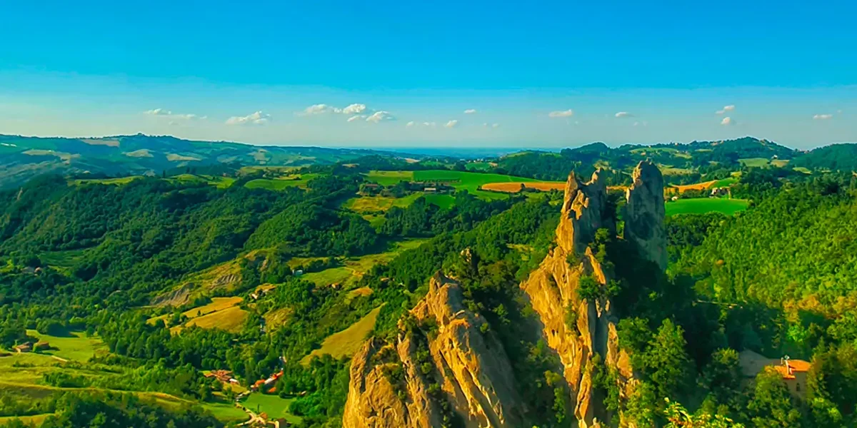
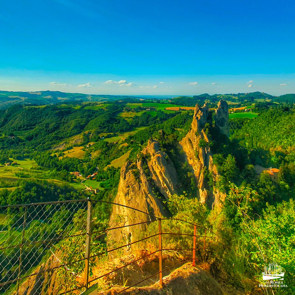
There are 22 kilometers for the third STAGE, which, from the Sassi di Roccamalatina Regional Park, takes us to Montese. Crossing the park and its hills, you can admire the amazing sandstone spires that soar up to 70 meters high in the heart of the forest. During the open season it is possible to climb up to Sasso della Croce, passing through the characteristic Borgo dei Sassi Visitor Center.
The route continues alternating between dirt paths and provincial roads and passes through charming villages such as Samone, Montalbano and Rosola in the territory of Zocca. Following a long stretch of CAI trails marked by markers 400, 434, 440, we skirt the Riva mountains, the natural border between the provinces of Modena and Bologna. Arrival is in Montese, in the heart of the Modenese Apennines, renowned for its villages and the remains of the Gothic Line, in some places still visible.
STAGE 04 - EASTERN STREET
STAGE 04: From Montese to Fanano
Departure: Montese
Arrival: Fanano
Distance: 23.8 km
From Montese, the fourth STAGE leads, after about 24 km, to Fanano. Passing through the hamlets of Castelluccio, Rocca Corneta and Trignano, we encounter several stops at the Museum of the Gothic Line diffuse museum and the Museum of the Riva Mountains. The latter facility offers a remarkable overview of information on the ancient and recent history of the area. This STAGE also amazes from a landscape point of view, thanks to the presence of the imposing and fascinating Monte della Croce.
The STAGE ends with the arrival in Fanano, another center among the largest and most important in the Apennines, at the gateway to the Alto Appennino Modenese Regional Park.


DISCOVER THE STAGES
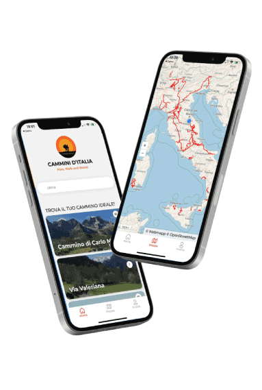
With the free Cammini d’Italia app, you can plan and walk the Via Romea Nonantolana in total safety, being able to plan the stages in detail and walk the route thanks to the integrated GPS technology that supports your orientation during your adventure.
⠀Inside the app you will find many other paths present in Italy. Thanks to the georeferenced tracks of many routes you will be able to study the itinerary that suits you best and also download the GPX tracks of the individual STAGEs offline.
The app also includes a complete digital map of all the paths surveyed to date on our portal, giving you a wide range of choices among the many paths in the Belpaese.
⠀⠀
Cammini d’Italia is the perfect app for those who want to explore the beauty of Italy on foot, discovering hidden places surrounded by nature. Download it for free today and start planning your next adventure!
⠀
⠀
 ⠀⠀⠀
⠀⠀⠀