
Via Valeriana
IL CAMMINO DELLE VALERIANA runs from the City of Brescia, passing through Franciacorta, Lake Iseo, Valle Camonica and ends in Tirano (Valtellina).
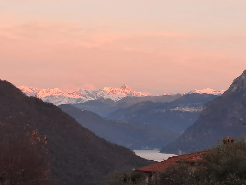
The route starts in Brescia and reaches Edolo where it splits into two sections, one to Aprica Pass and Tirano and one to Tonale Pass. It covers about 200 km and is divided into 12 stages. For the most part, the route runs along the half coast of the mountain ranges. Although it is an itinerary of medium difficulty, it still has several ups and downs with some quite challenging climbs and descents. The direction of the Path is unidirectional: starting from the City, it follows the paths of the Brescian and Fraciacorta hills, reaches the left bank of Lake Iseo, then the orographic left of the Camonica Valley to the center of Boario Terme, where it crosses the town, passes on the orographic right, and then returns on the left side from Edolo to the Tonale Pass or the Aprica Pass.
HISTORY
Since ancient times, Lake Iseo and the Camonica Valley have been crisscrossed by numerous paths that joined them and allowed the passage of men and goods to the plains, the city of Brescia, and the Alpine passes to reach neighboring valleys.
Some routes used as early as prehistoric times were then widened and settled in later periods, both in Roman times with the construction of the town of Cividate Camuno and in the Middle Ages with the building of numerous settlements. These routes fell into disuse only in the 19th century with the construction of a more convenient road on the valley floor.
On the origin of the term “Valerian” there are two hypotheses. The first would date the route back to Roman times, built in the 3rd century at the behest of Consul Gaius Publius Licinius Valerianus. The second hypothesis has the name derived from “Vallesiana or Valleriana,” a term for a route that winds within a valley. The same term is also found in Valtellina and other mountain areas.
WATER
In Val Camonica, water is abundant; in every village you pass through, there are several fountains where you can refill your bottles. Generally, there are water sources on average every 4 km along the route;
SERVICES
Supermarkets are present in the large centers such as Brescia-Rodengo Saiano-Pisogne-Boario-Malonno-Edolo-Ponte di Legno-Aprica- Tirano (end of STAGE).In the villages of Malegno-Ono san Pietro(end of STAGE) there are small grocery stores.
Pharmacies are present in all the STAGE ends.
SIGNAGE
Signage present along the way.
DANGERS
Along STAGE No. 7 Ono San Pietro-Malonno is 20 meters of exposed trail on the valley floor, the passage is safe chains are also present to allow safe passage.
IN TENT
Along the trail it is forbidden to camp with tents, as evidence of this within the picnic areas there are also many prohibition signs. In addition, all land along the trail is private.
ROAD BOTTOM.
1 STAGE: asphalt 50% – dirt 50%.
2 STAGE:asphalt 50%- dirt 50%
3Tappa: 50% asphalt – 50% dirt.
4tap: 95 percent asphalt – 5 percent dirt.
STAGE 5: 25 percent asphalt -75 percent gravel
STAGE 6: 30% asphalt -70 unpaved
STAGE 7: 25% asphalt- 75% dirt road
STAGE 8: 15%asphalt-85% dirt road
9 STAGE : 35%asphalt -65% dirt road
10tap : 50asphalt- 50 dirt road
9bis STAGE: 45%asphalt-55% dirt road
10bis STAGE: 5% asphalt-95% dirt road
CREDENTIAL
The Way has a credential, free of charge
To apply for the credential fill out the format on the website:
https://www.viavaleriana.it/credenziale/
CONTACTS
email: amiciviavaleriana@libero.it
www.viavaleriana.it
STAGE 01
STAGE 01: Brescia to Rodengo Saiano
Departure: Brescia
Arrival: Rodengo Saiano
Distance: 17.7 km
The walk starts from the archaeological site of the Capitolium in the city of Brescia, passes through the center, reaching the Parco delle Colline in Urago Mella where the climb up the hills begins. It continues with views of Franciacorta and its vineyards until reaching the Sanctuary of the Madonna della Stella in Cellatica. The route descends to Gussago following secondary roads, with views of the hill of the Santissima, proceeding through vineyards and fields until reaching the Olivetan Abbey of Saints Nicholas and Paul VI in Rodengo Saiano. The complex is worth a visit for its artistic beauty and as a place of meditation.
STAGE 02
STAGE 02: Rodengo Saiano to Pilzone d’Iseo.
Departure: Rodengo Saiano
Arrival: Pilzone d’Iseo
Distance: 16 km
Leaving the abbey, passing through the village of Rodengo Saiano, we head toward the Maglio Averoldi in Ome. The route crosses the Ome Oak Forest Park and continuing slightly uphill we reach the village of Monticelli Brusati and the locality of Gaina. It continues along forest paths climbing in altitude to pass the mountain between Franciacorta and Lake Iseo. Reaching the top, the descent begins, still in the woods, toward Pilzone d’Iseo. We recommend a stop at the giant bench by the church of San Fermo just before the end of the STAGE with views of the lake and Monte Isola.
STAGE 03
STAGE 03: Pilzone d’Iseo to Pisogne.
Departure: Pilzone d’Iseo
Arrival: Pisogne
Distance: 23 km
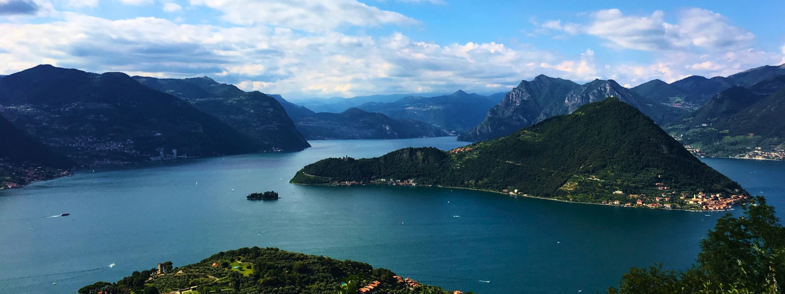
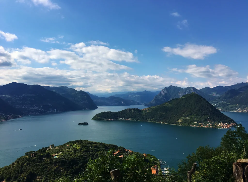
The STAGE starts at the Church of Pilzone, where it crosses the road and begins the ascent along the historic route of the Lake Iseo’s Via Valeriana. The route remains in a dominant position over the lake the whole time and climbs in altitude to arrive at Zone and cross the Passo di croce di Zone, from where the descent to Pisogne and then almost the lakeshore begins. The route offers beautiful scenic views of the lake area and Montisola. The first stage of the Via Valeriana is mostly immersed in nature, among olive trees and woods. Descending to Pisogne, the STAGE ends at the Church of Santa Maria della Neve, famous for its frescoes by Romanino. From here the second stage of the Via Valeriana begins, entering the Camonica Valley.
STAGE 04
STAGE 04: Pisogne to Boario Terme.
Departure: Pisogne
Arrival: Boario Terme
Distance: 15.4 km
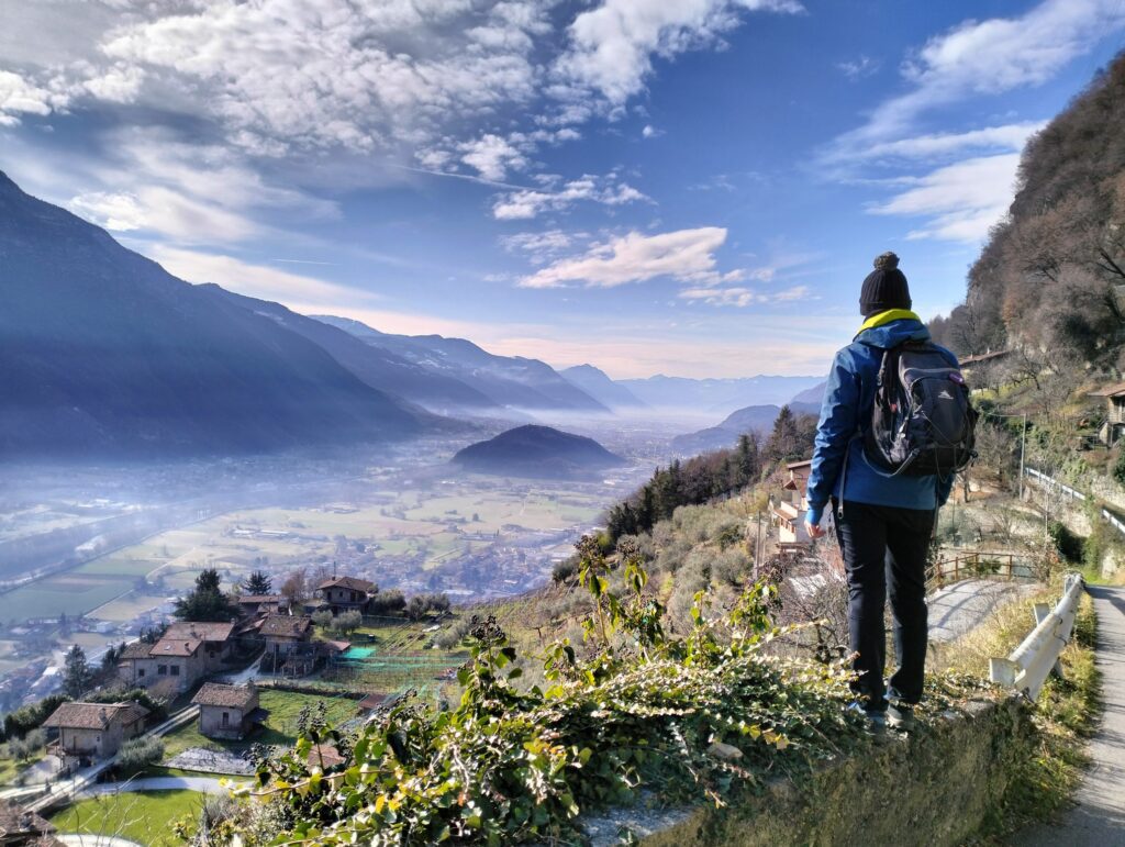
Starting from Pisogne, a small medieval village on the shores of Lake Iseo where you can admire the church of Santa Maria della Neve with frescoes by the painter Girolamo Romanino, crossing some stretches of countryside you reach the villages of Gratacasolo, Beata, Pian Camuno and Artogne. Continuing uphill, the route crosses plateaus and wooded areas from which the landscape below can be seen. When you reach the village of Gianico, you can make a small detour to the Sanctuary of Madonna del Monte, built in 1500. Leaving Gianico, one continues to the hamlets of Darfo (Pellalepre and Fucine) where one crosses the Oglio River on the ancient Montecchio bridge. The STAGE ends in Boario where you can admire the thermal baths. This is an easy STAGE that does not present great differences in height and is the most urbanized of the entire Cammino, the Lower Valley being rich in inhabited centers.
STAGE 05
STAGE 05: From Boario Terme to Malegno
Departure: Boario Terme
Arrival: Malegno
Distance: 15.6 km
The STAGE begins at the Terme di Boario spa and climbs to the medieval village of Erbanno where you can visit the church of Santa Maria del Restello with frescoes by painter Callisto Piazza. Leaving the village, you follow a mid-coast path with vine terraces. After a few kilometers the climb begins, among woods and streams, leading to the Santuario dell’Annunciata di Piancogno, a 15th-century monastic complex, rich in artistic testimony and famous throughout the world for having hosted Blessed Innocenzo da Berzo. Continuing on to the village of Ossimo, the descent through the Bosco del Cerreto begins to reach the village of Malegno. If you wish at the end of the STAGE you can make a small detour, less than 2 km, to visit the village of Cividate Camuno, famous for its Roman remains.
STAGE 06
STAGE 06: Malegno to Ono San Pietro
Departure: Malegno
Arrival: Ono San Pietro
Distance: 10.5 km
The trail winds up gentle slopes among cultivated terraces, votive shrines and cottages. Wide open spaces allow striking views of the valley floor and the castle of Breno. Remaining at altitude, the road reaches the historic center of Losine, continuing northward the route crosses wine cultivations and woods to the village of Cerveno, where the Sanctuary of the Way of the Cross can be visited. Maintaining altitude with views of the Concarena and Pizzo Badile mountains, called the “Sacred Mountains of the Camonica Valley,” we cross naturalistic areas peculiar to this area. An easy walk takes us to the last stretch until we reach our destination. From Ono San Pietro with a detour of 2 km you can get to Cemmo and Capo di Ponte.
STAGE 07
STAGE 07: Ono San Pietro to Malonno
Departure: Ono San Pietro
Arrival: Malonno
Distance: 17 km
Starting from Ono San Pietro, you begin the route between an up and down in the woods until you reach the quaint village of Pescarzo, leaving it to continue along comfortable paths shaded by chestnut trees. Maintaining the elevation and passing through historiated areas, you pass Sellero. The route continues on a comfortable bicycle/pedestrian path surrounded by trees and meadows to Forno Allione. Passing this area, crossing the Oglio River, we continue along the bike/pedestrian path, again entering the woods and then the meadows until the conclusion of the STAGE in Malonno.
STAGE 08
STAGE 08: Malonno to Edolo
Departure: Malonno
Arrival: Edolo
Distance: 10 km
Leaving Malonno behind and maintaining altitude, the route passes through lush chestnut forests. The STAGE has a more naturalistic than cultural context as it traverses thick forests. The route has some steep climbs and descents until the finish near the center of Edolo.
STAGE 09
STAGE 09: Edolo to Aprica Pass.
Departure: Edolo
Arrival: Aprica Pass
Distance: 16.7 km
From Edolo, the crossroads between the two main passes of the Camonica Valley, we reach the Ogliolo route (a river that will accompany us all the way). The route, initially flat, is almost all uphill to reach the 1200 meters of the pass. The STAGE passes through several villages surrounded by nature, including Corteno Golgi, home of Camillo Golgi. The section alternates between forests, meadows, typical mountain villages and votive shrines, all accompanied by the sound of flowing water and the sounds of nature. The STAGE ends at Aprica.
STAGE 09bis
STAGE 09bis: Edolo to Ponte di Legno
Departure: Edolo
Arrival: Ponte di Legno
Distance: 20.5 km
Starting from Edolo, we begin a short climb through the hamlet of Mù, from which we can see the plain below. From this point, the route proceeds all the way along a comfortable bicycle/pedestrian path with some not-too-demanding ups and downs. The mainly naturalistic STAGE passes through many wooded areas typical of the upper valley, skirting the Oglio River, which is narrower in this area as we approach its source. Inhabited areas are few and mostly located on the opposite side of the valley. The route ends at the village of Ponte di Legno, an important summer and winter tourist resort due to the presence of numerous mountain trails, ski slopes, and the Tonale Pass.
STAGE 10
STAGE 10: Aprica Pass to Tirano
Departure: Aprica Pass
Arrival: Tirano
Distance: 15.7 km
The STAGE starts from the Shrine of Mary Help of Christians and crosses Aprica down into Valtellina in the province of Sondrio. From the church of Santa Maria Assunta we take the historic Zapei D’Abriga trail through woods, votive shrines and views of the valley below. It reaches the hamlet of Motta in the municipality of Villa di Tirano and continues until walking along the Adda banks. The trail continues flat along the Valtellina path, among apple orchards and fields, ending the walk in front of the Sanctuary of the Blessed Virgin of Tirano
STAGE 10bis
STAGE 10bis: Ponte di Legno to Passo del Tonale
Departure: Ponte di Legno
Arrival: Tonale Pass
Distance: 9 km
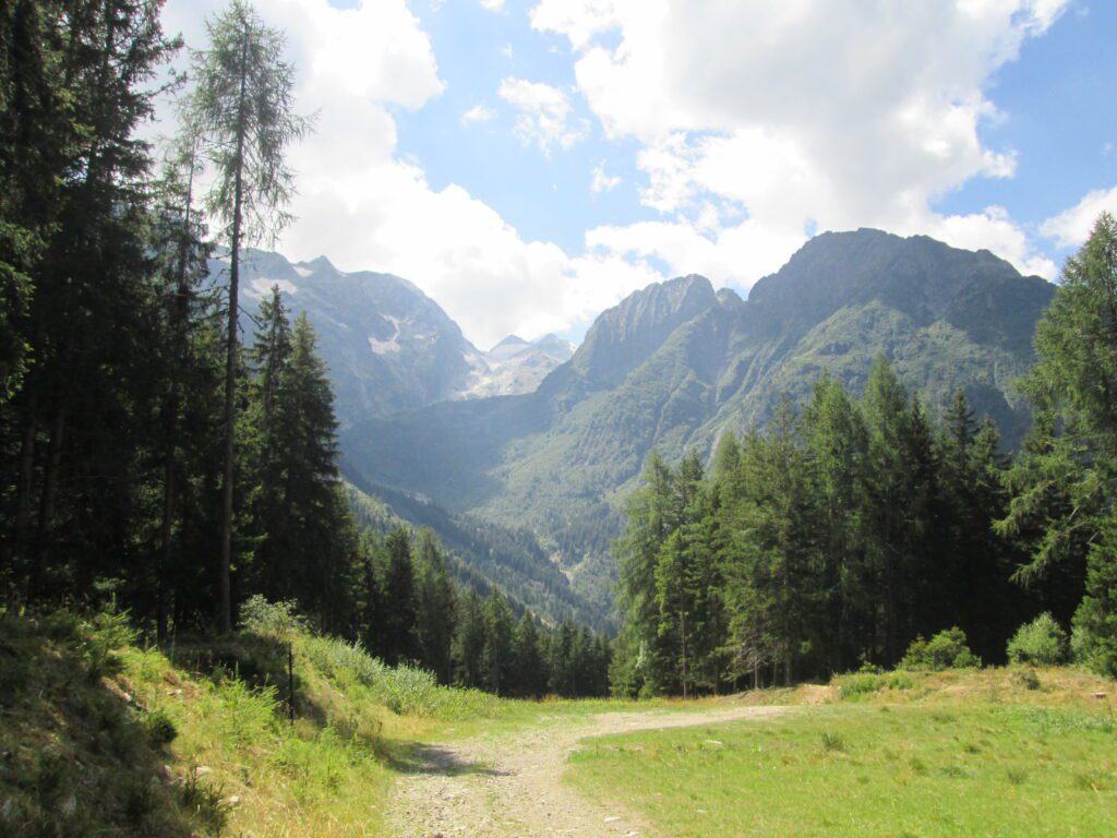
The last STAGE is short but quite difficult because of the steep elevation gain, going from 1260 meters to 1883 meters above sea level. The route takes place completely in nature, the first part in forests and the second part in high altitude meadows. The STAGE ends at Tonale.


Journey diaries
Via Valeriana
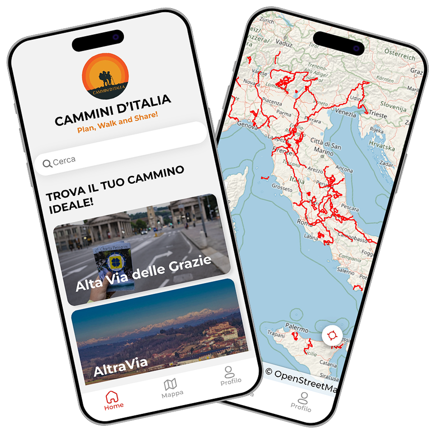
With the free Cammini d’Italia app, you can plan and walk the Via Valeriana in total safety, being able to plan the stages in detail and walk the route thanks to the built-in GPS technology that supports your orientation during your adventure.
⠀Inside the app you will find many other paths present in Italy. Thanks to the georeferenced tracks of many routes you will be able to study the itinerary that suits you best and also download the GPX tracks of the individual STAGEs offline.
The app also includes a complete digital map of all the paths surveyed to date on our portal, giving you a wide range of choices among the many paths in the Belpaese.
⠀⠀
Cammini d’Italia is the perfect app for those who want to explore the beauty of Italy on foot, discovering hidden places surrounded by nature. Download it for free today and start planning your next adventure!
⠀
⠀
 ⠀⠀⠀
⠀⠀⠀