Le Vie del Viandante
Le Vie del Viandante is an international historical walk of about 220 km, rich in culture, breathtaking landscapes, sports and wellness proposals.
A network of trails connecting Milan to San Bernardino in Switzerland, and vice versa, through the Mesolcina Valley, Valchiavenna, Lake Como and the Adda River.
Twelve paths united by a common destiny: that of becoming one of the most beautiful and special paths that wayfarers have traced over the centuries.
Scheda Tecnica
-
Lunghezza:
220 km -
Tappe:
12 -
Partenza:
Milano -
Arrivo:
San Bernardino, Svizzera
HISTORY
The area has a rich history related to trade between northern and southern Europe: routes traveled by wayfarers, traders, smugglers, pilgrims and armies that over the centuries allowed men and goods to circulate despite geographic and political boundaries.
WATER SOURCES.
Depends on the tracts (information at the Lecco Infopoint – Infopoint of the Wayfarer).
You can find more information at: www.fontanelle.org
STAGE
STAGE 1 – VIA SAN BERNARDINO
A historic route, probably already active in Roman times, repurposed and much used for commercial traffic in the medieval period. The itinerary is divided into three routes.
The first, from Roveredo to Cama, is 6.8 km long and can be covered in 2h. The second section, from Cama to Soazza, is 13.8 km long and can be covered in 4h. The last, from Soazza to San Bernardino, is 15.9 km long and can be covered in 5h 30m.
STAGE 2 – BALDISH/BALNISH PASS
A long traverse linking Valchiavenna and the Mesolcina Valley via the Baldiscio/Balniscio and Serraglia passes. From Isola to Pian San Giacomo (CH), the route is 14 km long.
STAGE 3 – FORCOLA PASS
The route along the Forcola Pass, a link between the Valchiavenna Valley (Gordona, Mese and Chiavenna) and the Mesolcina Valley (Soazza), was known and practiced since the Middle Ages (and probably even earlier), for military purposes. The route from Gordona to Soazza is 20.5 km long and can be walked in 10-12h.
STAGE 4-NOTAR’S VENT.
The Bocchetta del Notar connects, at a high altitude, the Bodengo Valley to which the
accesses from Gordona on the Italian side and the Cama Valley on the Swiss side. The route is known as the “Via dei Crotti” and offers opportunities for gourmet stops at the many typical mountain restaurants. The route from Gordona to Cama is 24.5 km long and can be covered in 13h.
STAGE 5- AGNON VENT.
Bocchetta d’Agnon (also known as Bocchetta di Cama) is the high altitude pass between Italy and
Switzerland that makes it possible to reach the Cama Valley from the Darengo Valley (via the Bear Pass) by a rather long route, reserved for experienced hikers familiar with high altitude mountains. The first section crosses the Bretella Bocchetta della Crocetta, a 2.5-kilometer-long connecting trail. The second section, from Peglio to Cama is 25.4 km long and can be hiked in 14h.
STAGE 6 – CAMEDO VENT.
This is a historically secondary route, beaten mainly by herdsmen and hunters, joined later by the “spalloni,” the smugglers who used it intensively for their cross-border trade from Gravedona and Dongo to Roveredo. From Rifugio Vincino to Roveredo, the trail is 14.8 km long and can be walked in 7h.
N.B.: please note that the STAGE – challenging – has no intermediate facilities for overnight stay.
STAGE 7 – VIA SPLUGA
The Via Spluga was a Roman consular road, built at the end of the first century B.C. at the behest of Augustus, connecting Milan with Lindau via the Splügen Pass. The pass was known by the name Cunus Aureus, as gold was mined along it in mines carved out of the mountain massifs; hence the other name Via Aurea by which this route was known. From Splϋgen to Isola di Madesimo, the route is 17.4 km long and can be walked in 6h. The second section, from Isola di Madesimo to Chiavenna, is 18.3 km long and can be covered in 5h 45m.
STAGE 8 – FRANCISCA STREET
The Via Francisca is a section of the ancient Via Regina from Sorico to Valchiavenna, crossing the watershed between the provinces of Como and Sondrio, east of Mount Berlinghera. The STAGE is divided into two routes. The first, from Chiavenna to Samolaco, is 12.8 km long and can be covered in 3h (4h 15m high variant). The second, from Samolaco to Sorico, is 13.5 km long and can be covered in 5h. The latter includes a 1.5km variant to reach the small church of San Fedelino, and a 1.1km variant to see the church of San Miro.
STAGE 9 – WAYFARER’S PATH
The Sentiero del Viandante retraces an ancient mule track along the eastern coast of Lake Como (from Lecco to Colico), offering an alternative route across the lake and the Via Regina to Valtellina and to the Spluga, Settimo and Julier Alpine passes. The STAGE is divided into 8 routes. The first, from Sorico to Colico, is 11.5 km long. The second, from Colico to Dorio, is 9.5 km long, with a 5.3 km variant to reach Madonna di Val Pozzo. The third, from Dorio to Dervio, is 3.9 km long. The fourth section, from Dervio to Bellano, is 4.8 km. long. The fifth, from Bellano to Varenna, is 4.8 km long. The sixth, from Varenna to Lierna is 8.5 km long, while the high variant reaching the splendid Vezio Castle is 9.7 km long. The seventh section, from Lierna to Abbadia Lariana, is 10.5 km long. Finally, the last one, from Abbadia Lariana to Lecco, is 7 km long and in about 2h leads to the city center.
STAGE 10 – LEONARDO’S TRAIL
An easy route from Lecco to Milan, mostly flat or slightly downhill, on mostly paved surfaces. It can be walked by anyone, either on foot or by bicycle, even with children since it presents very few safety problems. For the most part it is a wheelchair accessible route. It has a length of 78.6 km and can be divided into 4 STAGES, with a degree of difficulty Easy (T). The first section from Lecco to Imbersago is 21.3 km long and can be covered in 5 h, arriving at Leonardo’s Adda Ecomuseum. The second, from Imbersago to Cassano d’Adda is 25.8 km long and can be covered in 6 h. The third, from Cassano d’Adda to Cernusco sul Naviglio, is 15.9 km long and can be covered in 4h. The last section, from Cernusco sul Naviglio to Milan Piazza Duomo, is 16.2 km long and can be covered in 4h.
STAGE 11 – LEONARDO’S TRAIL
The Via dei Monti Lariani is a hiking route that is part of the Lombardy section of the Sentiero Italia, an approximately 6,000-km route that crosses the entire country. The Via dei Monti Lariani connects Cernobbio to Sorico, running along the entire western shore of Lake Como at high altitude. The route is divided into 7 routes. The first, from Como to Schignano, is 19.1 km long and can be covered in 7h 30m. The second, from Schignano to San Fedele d’Intelvi, is 19.5 km long and can be covered in 6h 30m. The third, from San Fedele d’Intelvi to Lenno, is 18.9 km long and can be covered in 6h 30m. The fourth section, from Lenno to Plesio, is 21 km long and can be covered in 8h 30m. The fifth, from Plesio to Garzeno, is 17 km long and can be covered in 6h. The sixth, from Garzeno to Peglio, is 23.6 km long and can be covered in 8h 30m. The last section, from Peglio to Sorico, is 25.7 km long and can be covered in 8h 30m.
STAGE 12 – DIRECTOR’S ROAD
The Strada Regia is a historical route about 35 km long that connected all the towns on the eastern shore of the Larian Triangle from Como to Bellagio, allowing shepherds, wayfarers and traders to cross the entire territory. The first section of the route, from Como Piazza Cavour to Nesso, is 21.7 km long and can be covered in 8h. The second section, from Nesso to Bellagio, is 15.5 km long and can be covered in 5h 30m, with a low variant to reach the lakeshore of 1.5 km.
SERVICES PRESENT STAGE BY STAGE
Supermarkets:
Many, certainly in all the towns touched by the Camino.
Pharmacies:
Many, in all towns touched by the Camino.
SIGNAGE
Signage present along the path plus photos to be uploaded to the dedicated Drive folder.
Individual trails maintain their own identity and signage, but are connected by the project signage Le Vie del Viandante (white arrow on blue background to indicate direction to Milan, blue arrow on white background to indicate Switzerland).
DANGERS
Ravines: yes, some sections are exposed.
Dangerous animals: vipers, processionaries, ticks.
ACCESSIBILITY
The Leonardo Trail is the most accessible trail, but some sections are still not perfectly paved.
CREDENTIALS
The Wayfarer’s Passport is the document that allows you to collect official stamps along the itinerary.
The first stamp will be at the Wayfarer’s Infopoint, also the place to pick up the passport. Thereafter, each wayfarer will be able to stamp his or her credential at accommodations, restaurants and services. It can currently be picked up free of charge at the Lecco Infopoint every day (Sundays and holidays included) from 9:00 a.m. to 1:00 p.m. and 2:00 p.m. to 6:00 p.m. (closed December 24 afternoon, December 25 and 26 all day, December 31 afternoon, January 1 all day).
TENT WALK
Not possible to do this in tents. Need to lean on the accommodations found along the Camino.
ASSOCIATION CONTACTS
Wayfarer’s Infopoint:
Piazza XX Settembre, 23 – Lecco (LC) – Italy
tel. +39 0341 481485 – email: leviedelviandante@comune.lecco.it
-
 STAGE 10 - Leonardo's Trail
 -
 STAGE 9
WAYFARER’S PATH GUIDE
Le Vie del Viandante
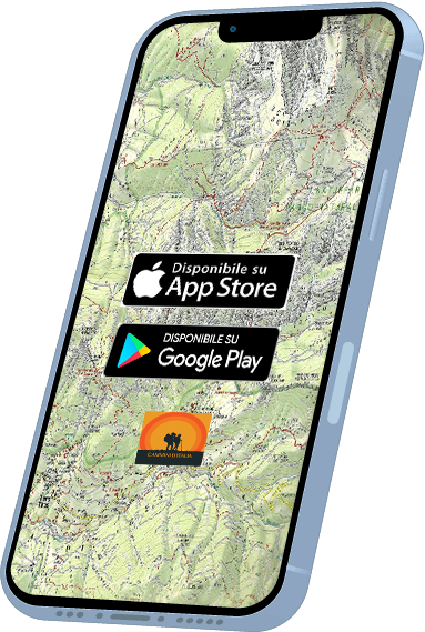
With the free Cammini d’Italia app, you can plan and walk the Le Vie del Viandante safely, being able to plan the stages in detail and walk the route thanks to the built-in GPS technology that supports your orientation during your adventure.
⠀Inside the app you will find many other paths present in Italy. Thanks to the georeferenced tracks of many routes you will be able to study the itinerary that suits you best and also download the GPX tracks of the individual STAGEs offline.
The app also includes a complete digital map of all the paths surveyed to date on our portal, giving you a wide range of choices among the many paths in the Belpaese.
⠀⠀
Cammini d’Italia is the perfect app for those who want to explore the beauty of Italy on foot, discovering hidden places surrounded by nature. Download it for free today and start planning your next adventure!
⠀
⠀
 ⠀⠀⠀
⠀⠀⠀