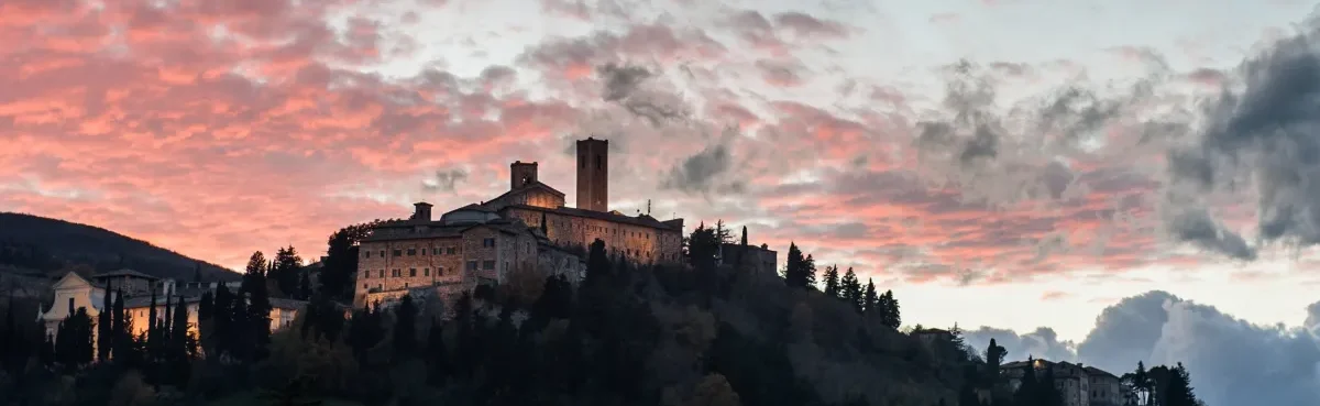
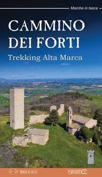
CAMMINO DEI FORTI
The Cammino dei Forti is a 120-km-long loop route that starts and ends in San Severino Marche (MC). The route passes through the towns of San Severino, Serrapetrona, Castelraimondo, Gagliole and Matelica.
The Cammino dei Forti is a 120-km-long loop route, divided into 5 STAGES, that starts and ends in San Severino Marche. The route passes through the towns of San Severino, Serrapetrona, Castelraimondo, Gagliole and Matelica. Get your backpack ready, the high Marca is waiting for you!
HISTORY
The Cammino dei Forti passes through the municipalities of San Severino Marche, Serrapetrona, Castelraimondo, Gagliole and Matelica, in the heart of the upper Marca Macerata.
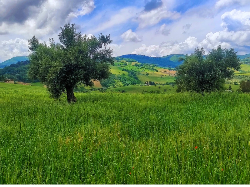
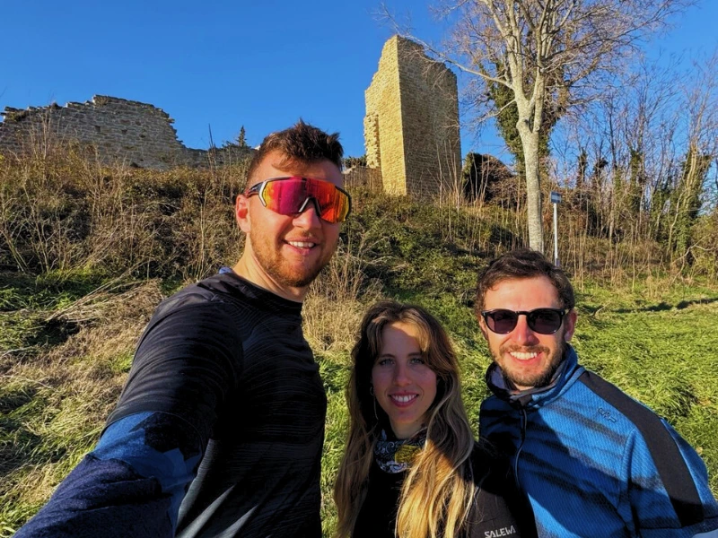
The itinerary unites and rediscovers the evocative fortresses that in ancient times formed the first line of defense of these territories, which were once rivals.
As a backdrop, the lush and colorful nature typical of the Marche Apennines.
SIGNAGE
You will find a signage present along the way
WATER SOURCES.
STAGE 1:
In the square of San Severino Marche near the Pro Loco office, right where the walk begins. 1 km or so before Crispiero. Upon arrival in Crispiero.
STAGE 2:
In the town of Castelraimondo, near the Cassero Tower, and also in the town of Gagliole, near the Rocca dei Varano.
Along the route there will be two natural springs. One at Roti Abbey and one at a place called Acqua dell’Olmo, just before arriving at Aie di Macciano.
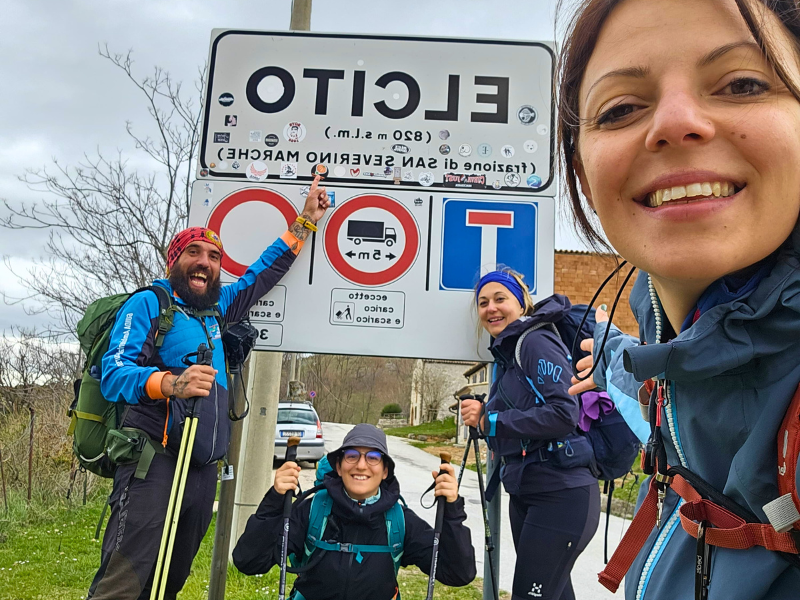
STAGE 3:
Below Mount San Vicino you will find a fresh spring along Trail 209. Even when you arrive in Elcito you will find a spring waiting for you.
STAGE 4:
At the departure from Elcito you will find the first spring. Arriving in Chigiano you will find another spring. At Corsciano you will find a Bar and Grocery, then continuing to Aliforni, before you start the climb to the tower, there will be a fountain waiting for you. On your arrival in Pitino you will also find a fountain.
STAGE 5:
At the start from Pitino you will find the same fountain, then there will be water sources in Marciano and St. Helena.
SERVICES
STAGE 1:
In San Severino present all services such as supermarkets, pharmacies, tobacconists, restaurants and B&Bs.
STAGE 2:
In Castelraimondo present all services such as supermarkets, pharmacies, tobacconists, restaurants and B&Bs.
STAGE 3:
There is a bar in Elcito.
STAGE 4:
In Elcito there is a bar and two B&Bs (there are no restaurants or agriturismi); in Crosciano there is a grocery bar; in Pitino there are B&Bs and agriturismi where you can eat and stay overnight.
STAGE 5:
In Pitino there are B&Bs and farmhouses where to eat and sleep, in San Severino present all services such as supermarkets, pharmacies, tobacconists, restaurants and B&Bs.
CREDENTIALS
Free credential, which can be picked up at the Pro Loco of San Severino Marche.
DANGERS
Possibility of finding grazing cows, sheep and sheepdogs. It is worth noting the presence of wild boars along certain sections of the route.
ROAD BOTTOM.
20% asphalt
TENT
There are dedicated areas provided by some facilities that are marked in the guidebook, plus you will be able to take advantage of the kindness of local people to pitch your tent.
It is not possible to pitch your tent within the Mount Canfaito and Mount San Vicino Regional Reserve (in Elcito you can camp with the help of a private facility)
ACCESSIBILITY
At present no, we will study a suitable path in the future.
CONTACTS
associazionepranzoalsacco@gmail.com associazionepranzoalsacco@gmail.com
Association president: Guido Pacella
Vice president: Alessio Ancillani
Secretary and social manager: David Dignani
STAGE 01
STAGE 01: San Severino Marche to Crispiero
Departure: San Severino Marche
Arrival: Crispiero
Distance: 14.1 km
Height difference: +835 m / – 468 m
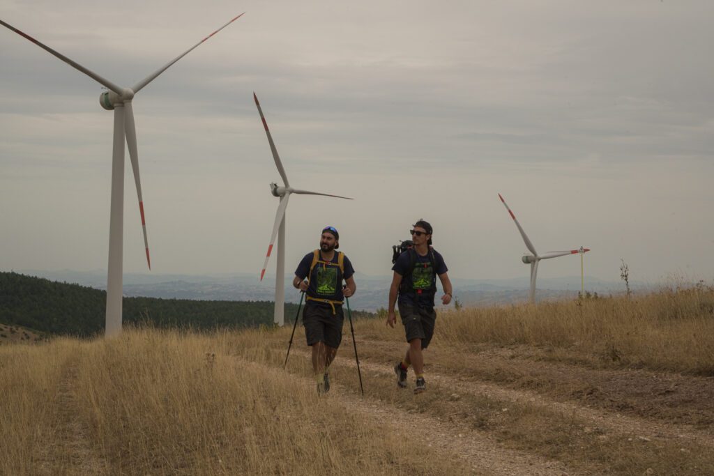
A not particularly long first STAGE, suitable for breaking your breath. From San Severino Marche Castle to the quaint village of Crispiero, passing through Buca D’Aria and the impressive Serrapetrona wind farm.
STAGE 02
STAGE 02: Crispiero to Rastia
Departure: Crispiero
Arrival: Rastia
Distance: 27.8 km
Height difference: +1176 m / – 1358 m
More challenging and strenuous, the second STAGE will take you through the places of the Regional Park Del Monte San Vicino and Canfaito where nature and history coexist in harmony.
STAGE 03
STAGE 03: Rastia to Elcito.
Departure: Rastia
Arrival: Elcito
Distance: 24.8 km
Height difference: +1638 m / – 1212 m
A route surrounded by greenery with the San Vicino peak as a backdrop: the third STAGE will leave you breathless! Both for the beauty and, perhaps, for the elevation gain.
STAGE 04
STAGE 04: Elcito to Pitino
Departure: Elcito
Arrival: Pitino
Distance: 24.4 km
Height difference: +891 m / – 1085 m
The fourth STAGE tells us of an ancient past in which the San Severino area was protected by the three strategic fortresses you will encounter along the way: the Tower of Aliforni, the Castle of Serralta and the Castle of Pitino.
STAGE 05
STAGE 05 from Pitino to San Severino Marche.
Departure: Pitino
Arrival: San Severino Marche
Distance: 25.3 km
Height difference: +746 m / – 1091 m
With the fifth STAGE closes the Cammino dei Forti, we return to San Severino after a long journey of climbs, descents and fantastic places, with the hope that these Km will enrich and entertain you.
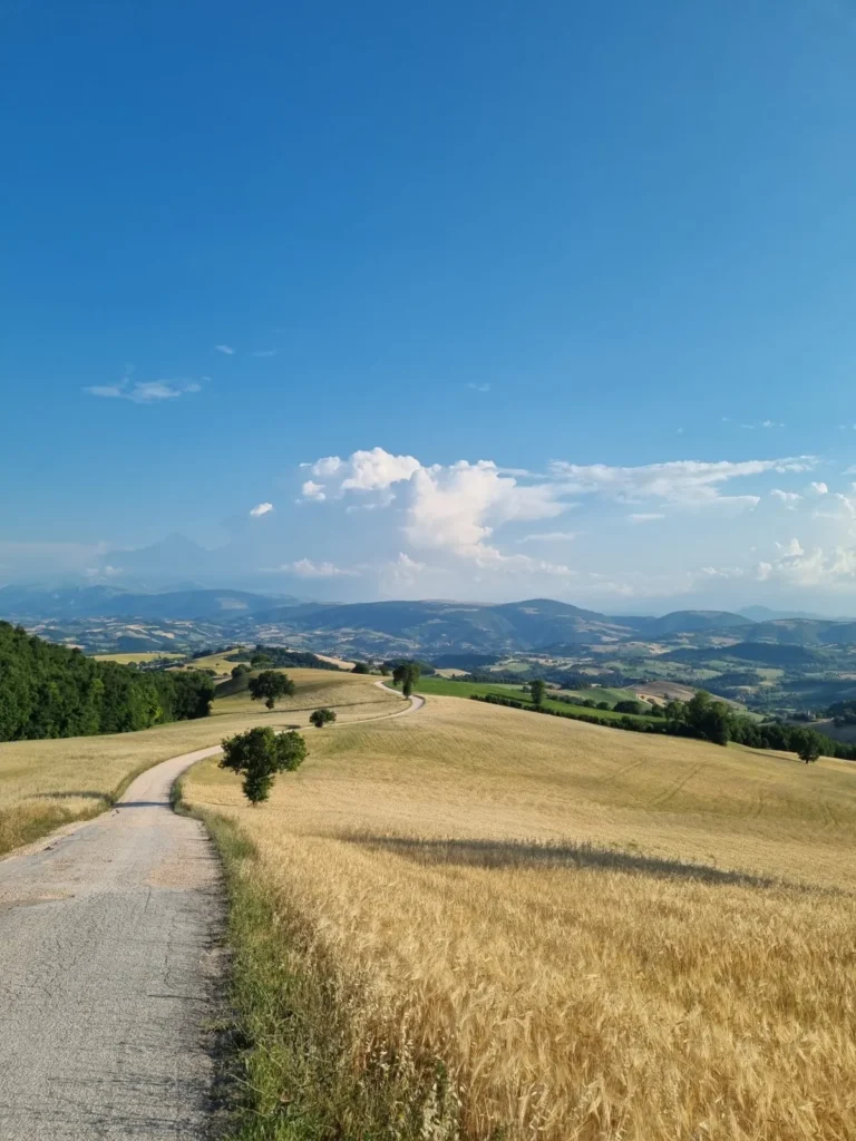

The Pranzo al Sacco Association conceived the Cammino dei Forti project with the main objective of enhancing and promoting the area of San Severino Marche, located in the province of Macerata, and the surrounding municipalities, including Serrapetrona, Castelraimondo, Gagliole and Matelica. This exciting route runs for a considerable distance, stretching 120 kilometers through the fascinating, rolling hills of the Marche region, offering a unique opportunity to explore numerous historic and scenic sites of great interest.
This path, however, is by no means a walk in the park; it requires adequate preparation and a good dose of determination. The route follows the natural sinuosities of the terrain, presenting significant elevation changes that can be a challenge for less experienced walkers. The climbs and descents must be approached with patience and care to ensure a safe and rewarding walk.
To help walkers make the most of this unique experience, the “Guide to the Cammino dei Forti,” which is part of the prestigious series “Marche in Tasca,” published by Claudio Ciabochi Editore, is available. This guide, created by the Sacco Lunch Association, provides a detailed description of each STAGE, including points of interest along the way. In addition, the guidebook tells the story of the seven fortresses that the route passes through, shedding light on the historic rivalry between the Smeducci and Da Varano families.
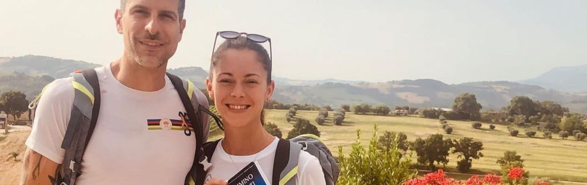
So get your backpack ready, because Alta Marca is ready to welcome you with a rich experience of exploration and adventure!

Journey diaries
Listen to our podcast
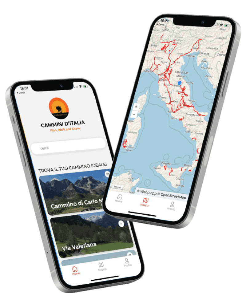
Download our App
With Cammini d’Italia’s free app, you can plan and walk the Cammino dei Forti in total safety, being able to plan the stages in detail and walk the route thanks to the built-in GPS technology that supports your orientation during your adventure.
Within the app you will find many other paths present in Italy. Thanks to the georeferenced tracks of many routes you will be able to study the itinerary that suits you best and also download the GPX tracks of the individual STAGEs offline.
The app also includes a complete digital map of all the paths surveyed to date on our portal, giving you a wide range of choices among the many paths in the Belpaese.
⠀⠀
Cammini d’Italia is the perfect app for those who want to explore the beauty of Italy on foot, discovering hidden places surrounded by nature. Download it for free today and start planning your next adventure!
⠀
⠀
 ⠀⠀⠀
⠀⠀⠀