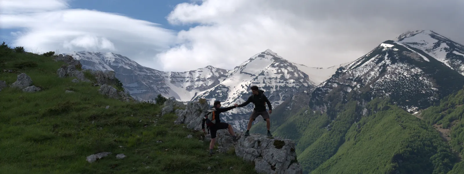

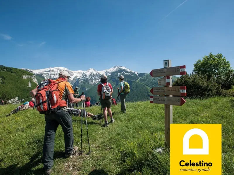
Cammino Grande di Celestino
The Cammino Grande di Celestino traverses Abruzzo from the Apennines to the Trabocchi Coast, following the footsteps of Celestine V among villages, rock hermitages and breathtaking landscapes.
HISTORY
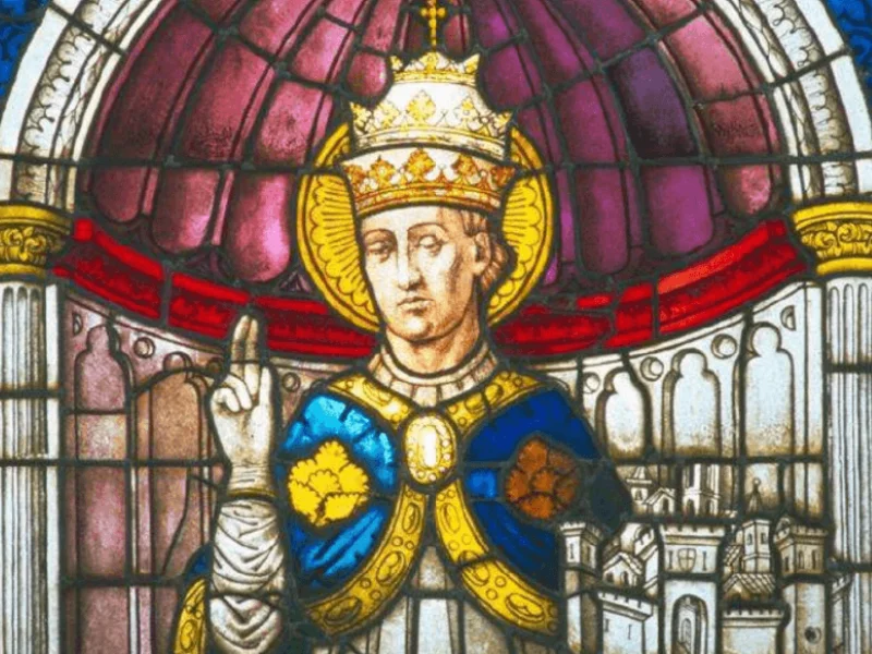
A singular journey, on the back of a donkey and escorted by Charles of Anjou, was that of July 1294 for the old Maiella hermit Pietro Angelerio, who reached L’Aquila from the hermitage of Morrone to be crowned pope with the name Celestine V.
Days of extraordinary changes for poor Peter that would leave an indelible mark on the Church. We all know the story: four months of pontificate, renunciation and flight to the east, capture at Vieste and death as a prisoner in the fortress of Fumone.
As for so many men of the Middle Ages, Peter’s was a life of long journeys on foot between continual wandering through the caves of the Maiella and strenuous travels from Molise to Naples, Rome, and, via the Via Francigena, to Lyon when he reached the Council in 1273 to prevent the suppression of the order he had founded.
Precisely on the steps of this extraordinary personage starting in 2018, the Maiella National Park in Abruzzo has devised the Cammino Grande di CELESTINO joining L’Aquila to the Maiella and then to the sea.
SIGNAGE
The Cammino Grande di CELESTINO is entirely marked albeit in sometimes different ways depending on the territories traversed.
The official marking was made respecting the direction of travel that goes from Aquila to Ortona, but of course the Trail can be freely walked in either direction. Red and white markings and flags (CAI signs) are prevalent both on the ground and in vertical signage.
In the section between L’Aquila and the Peligna Valley, new vertical signage, both directional and informative, was recently placed with an updated graphic concept by the USRC (Special Office for the Reconstruction of the Crater Municipalities)
WALK WITH DOGS
The entire stretch of the Cammino from L’Aquila to Caramanico Terme can be walked with the dog on a leash (from STAGE 1 to STAGE 6). Entering the heart of the Maiella National Park, however, not all the STAGES of the Cammino in the Maiella National Park can be walked in the company of one’s dog. In fact, the national norm (L. 394/1991) states that in Zone A (Area of Integral Reserve) access with dogs is prohibited, while in Zone B (General Oriented Reserve) and Zone C (Protection Area) entry with dogs is allowed only with a leash.
The STAGES where the prohibition applies are 7 through 9, and in fact from Macchie di Coco to Ortona it is possible to continue with the dog.
DANGERS
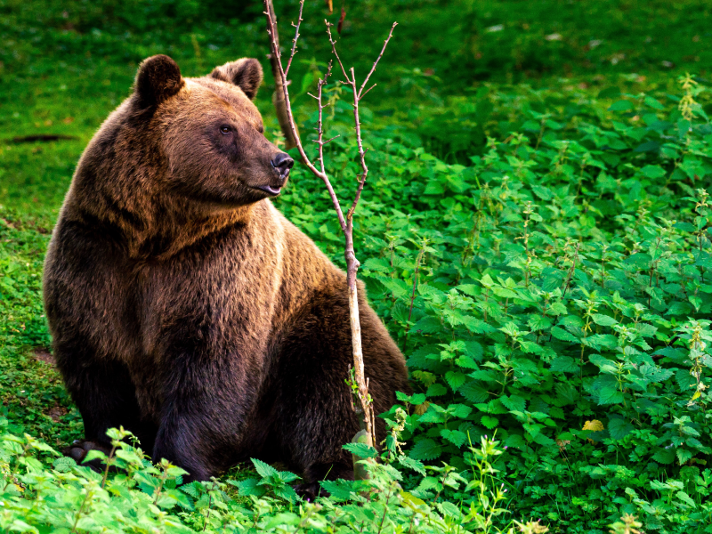
As you walk the Cammino Grande di Celestino you will come into contact with a natural environment, at times wild, where the presence of the Apennine fauna and the morphology of the territory, together with the variable weather and/or terrain conditions, should always prompt the utmost attention. Gli elementi contenuti in questa pubblicazione hanno carattere divulgativo, non sono idonei per l’attività escursionistica e non si sostituiscono alle necessarie technical-hiking knowledge, to a suitable clothing and equipment, to a psycho-physical preparation appropriate to the chosen itinerary. Only the possession of these elements will enable you to plan an enjoyable and as safe as possible Camino on an area that must consider itself, even in its seemingly simplest areas, a real adventure ground. Seguite sempre le official trail networks and respect the rules present on the signs placed at the beginning of the trails; plan your hike with the help of the staff of the Information Centers and/or by consulting the information on the website www.camminodicelestino.it. Use the updated GPS tracks found on theApp. by Paths of Italy.
Maiella National Park Authority assumes no responsibility for accidents, route errors, delays or other mishaps that may occur during the excursions.
YOU ARE PERSONALLY RESPONSIBLE FOR YOUR OWN SAFETY.
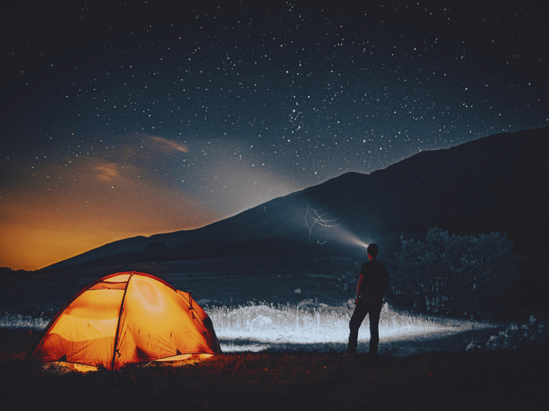
IN TENT
Temporary bivouac in tents or outdoors from dusk to dawn with overnight stays of only one night per location is allowed in the territory of the Maiella National Park. It being understood that: in order to avert the danger of forest fires, with the exception of rooms inside the Refuges, lighting fires is prohibited;
Multi-day camping in the same area of the Park is allowed instead in the authorized areas only by writing to: info@parcomaiella.it.
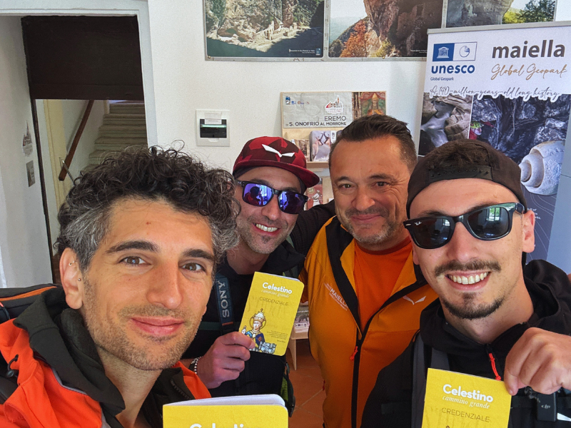
CREDENTIALS
The Credential is the document that certifies the status of pilgrim/traveler along the Camino and the passage through the villages and hermitages along the Camino with a stamp.
Stamps can be found at the hermitages, information offices or where you are staying (to get the stamp, simply show a photo or video of yourself in front of the hermitage).
The Credential allows for discounts and concessions for services and reception (when and where these are provided).
It can be requested free of charge by mail by writing to promozione@parcomaiella.it (giving the pilgrims’ names and a mailing address where to deliver it and at the following places of departure of the Camino:
L’AQUILA:
-IAT Tourist Information and Reception Office 1, Alpine Battalion Square (Bright Fountain), 0862.1910737, infopoint.ctgs@ilgransasso.it(open daily).
-IAT Tourist Information and Reception Office 2, “The Gates,” Simeonibus Street snc, 0862.295927,3791508492, iat.aquila2@abruzzoturismo.it, (open daily).
SULMONA:
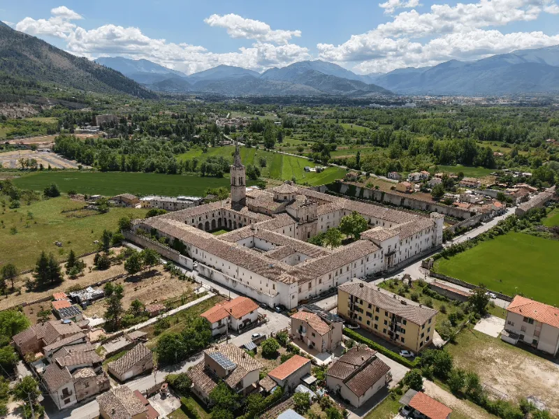
-Abbey of Santo Spirito al Morrone, Via Badia, 28 (operational headquarters of the Park – Center for Reception and Documentation of Paths of Abruzzo), 08642570800 – 3498474470, promozione@parcomaiella.it
The Testimonium of the End of the Way
The Testimonium is the free certificate that the pilgrim receives at the end of the Cammino Grande di Celestino by showing the Credential with the stamps duly affixed. It is issued to those who complete the entire Camino from L’Aquila to Ortona, or who complete sections:
-Sulmona – Serramonacesca
-L’Aquila – Serramonacesca
-Sulmona – Ortona
The Testimonium can be requested upon arrival in Serramonacesca at the Abbey of San Liberatore a Maiella – Park Information Center 328.7710754, serramonacesca@parcomaiella.it or in Ortona at the IAT office located in the town hall in Piazza della Repubblica, 085.9063841, iat.ortona@abruzzoturismo.it
Alternatively, by writing to promozione@parcomaiella.itallegando photos of the Credential complete with stamps and a mailing address you will receive the Testimonium at home free of charge.
All information about the Camino can be found on the official website of the Cammino Grande di Celestino © : www.camminodicelestino.it
CONTACTS
Maiella National Park – Governing Body of the Trail
Contact person: John Forcone
Email: john.forcone@parcomaiella.it
For info on the walk
Centro di Accoglienza e documentazione dei Cammini d’Abruzzo c/o
Abbey of Santo Spirito al Morrone, Via Badia, 28 – Sulmona (AQ)
0864.2570800 promozione@parcomaiella.it
STAGE 01: L'AQUILA - FONTECCHIO
Departure: L’Aquila
Arrival: Fontecchio
Distance: 26 km
Height difference: +250 m / – 280 m
In the presence of the Basilica of Collemaggio, the Cammino Grande di CELESTINO begins. We start on the left side of the basilica passing in front of the Holy Door where every year between August 28 and 29 the Perdonanza Celestiniana is perpetuated, established in 1294 and which from 2019 is an intangible heritage of UNESCO. By asphalt road we reach the valley floor and head toward Monticchio where we continue through fields and passing near the necropolis of Fossa. Discovered by chance in 1992 this is one of the largest necropolis in central South with about 500 excavated tombs. At the height of Villa S. Angelo there is a detour to San Demetrio ne’ Vestini and the tratturo Magno (Vestini Way). However, you continue on to Stiffe where you can visit the caves of the same name ( www.visitsandemetrio.it). A little further on, the Path touches the Roman Bridge of Campana located over the Aterno River and at the foot of the town of the same name. The bridge dates from the 1st century AD and was erected along with 11 others in the valley by Emperor Claudius. Slightly uphill along a narrow dirt road and finally on the path you reach the beautiful Fontecchio.
NOT TO BE MISSED ON THIS STAGE:
In L’Aquila
– The Historic Center of L’Aquila with:
– The Basilica of St. Bernardine of Siena
– The Fountain of the 99 Spouts
– National Museum of Abruzzo – MuNDA
– The necropolis of Fossa
In Stiffe (AQ)
– The caves of Stiffe
– The Roman bridge at Campana
In Fontecchio (AQ)
– Historic center of Fontecchio and its medieval spring
STAGE 02: FONTECCHIO - CASTELVECCHIO SUBEQUO
Departure: Fontecchio
Arrival: Castelvecchio Subequo
Distance: 20 km
Height difference: +380 m / – 400 m
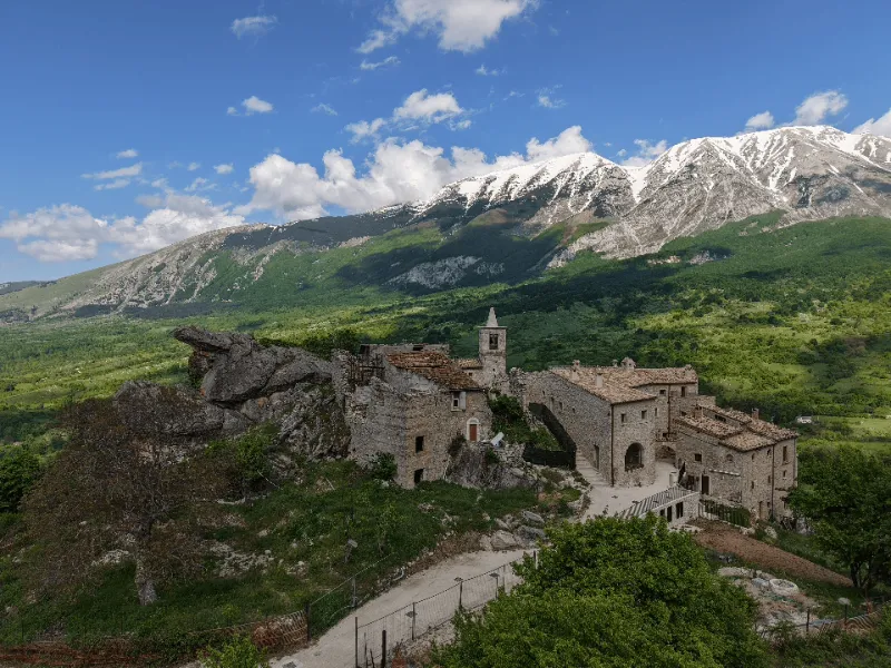
From Fontecchio you return to the valley on the river. With the horse trail on an asphalt surface, the station of Beffi is reached. Here begins the trail that reaches the base of the hill on which Beffi, a hamlet of Acciano, stands. About 15 minutes on foot are needed to climb back to the built-up area, but just before the last steep ascent another path leads back to the river where it is possible to admire the Roman bridge over the Aterno River, which, according to legend, was crossed by Celestine V in the company of Charles II D’Anjou on his way to L’Aquila where he was to be crowned pope. On reaching Beffi, the view of the wooded slopes of the Aterno Valley is extraordinary, as is the structure of the fortified village with its 12th-century pentagonal tower (Ass. Aternostrum, 3479048731). Near the tower begins the path that leads back to the river and the Acciano Station (about 1 hour’s walk). After a short stretch on asphalt at the church of Madonna della Sanità (picnic area) with a nice path you walk along the railroad track to Molina Aterno. After crossing the historic center and the Aterno River, a short climb leads upstream to the village of Castelvecchio Subequo, which is reached along the paved road.
NOT TO BE MISSED ON THIS STAGE:
In Acciano (AQ)
– Village and tower of BeffiA Castelvecchio Subequo (AQ)
– Church and Convent of St. Francis
– Catacomb of Svperaeqvvm
– Museum of Sacred Art
– Church of Sts. John the Baptist and Evangelist
STAGE 03: CASTELVECCHIO SUBEQUO - RAIANO
Departure: Castelvecchio Subequo
Arrival: Raiano
Distance: 10.2 km
Height difference: +400 m / – 520 m
This STAGE starting in Castelvecchio Subequo gradually leaves the Aterno Valley and the Sirente – Velino Regional Park to descend into the Peligna Valley in view of Morrone and Maiella. From the village you descend back to the plain on the asphalt road and reach Castel di Ieri, where it is worth stopping to visit its beautiful “spindle-shaped” historic center and where you can taste micischia (or mcischia), a dish made from sheep, or goat, dog that is not young and not too fat and is boned, salted, peppered, seasoned with various flavorings and dried by exposure to smoke. Leaving the village, continue to the cemetery where you turn left, but before this detour it is advisable to continue straight on to the church of Our Lady of Relief and further on to the Italic temple dating back (the part visible today) to the end of the second century B.C. and dedicated to Jupiter Hegiacus. Back to the cemetery where the ascent to the pass between Mt. Urano and Mt. Ventola begins (about 1 hour ascent). Once over the pass, an extraordinary view of the Peligna valley opens up. Here a steep path cuts the hairpin bends of the road and descends to the center of Raiano.
NOT TO BE MISSED ON THIS STAGE:
In Castel di Ieri (AQ)
– City gate
– Medieval Tower
– Archaeological Park / Italic Temple
– Hermitage Madonna of Pietrabona
– Church of Our Lady of Relief
For tours and openings Pro loco the Tower of Castel di Ieri, 350.5949184, prolocolatorre@gmail.com
In Raiano (AQ)
– Hermitage of San Venanzio and trail along the river gorge in Raiano
– Aqueduct of the Birds in Raiano
– Ancient Fantasia Oil Mill in Raiano
– Sagaria/Rossi House residence of Benedetto Croce
STAGE 04: RAIANO - BADIA MORRONESE
Departure: Raiano
Arrival: Badia Morronese
Distance: 13.7 km
Height difference: +150 m / – 170 m
Leaving the built-up area of Raiano, one heads toward Corfinio along a comfortable straight road, arriving shortly at the Abbey of San Pelino, which, built in 1075, is among the most beautiful Romanesque churches in Abruzzo. Singular is the history of ancient Corfinium, which more than 2,000 years ago was elected capital of the Italic peoples engaged in social warfare against Rome. Here the coin was minted where the word Italy appeared for the first time. From behind the ancient walls of Corfinio you descend through hills until you reach the valley floor where you take the path between the Vella and Sagittario rivers to Pratola Peligna (you reach the base of the town and in a few minutes you reach the historic center and the church of Madonna della Libera. Continue in the direction of Morrone and past the busy ss 17 through small roads and a last stretch on asphalt to reach the imposing Badia Morronese in the district of the same name.
TO KNOW: Sulmona is 5 km from the Badia hamlet and can be reached by TUA buses www.tuabruzzo.it.
NOT TO BE MISSED ON THIS STAGE:
In Corfinio (AQ)
– The Civic Archaeological Museum “A. De Nino” and Lapidarium, 349.0707367, prolococorfinioaq@gmail.com
In Pratola Peligna (AQ)
– Church of St. Peter Celestine V (open Monday through Friday from 9 a.m. to noon)
In Sulmona (AQ)
– The Cathedral of San Panfilo (which preserves the relics of Celestine V in the crypt)
– The medieval aqueduct
– The Complex of the SS. Annunziata
– The Diocesan Museum
– The confetti flower stores
STAGE 05: ABBEY MORRONESE - PACENTRO
Departure: Badia Morronese
Arrival: Pacentro
Distance: 11.5 km
Height difference: +600 m / – 260 m
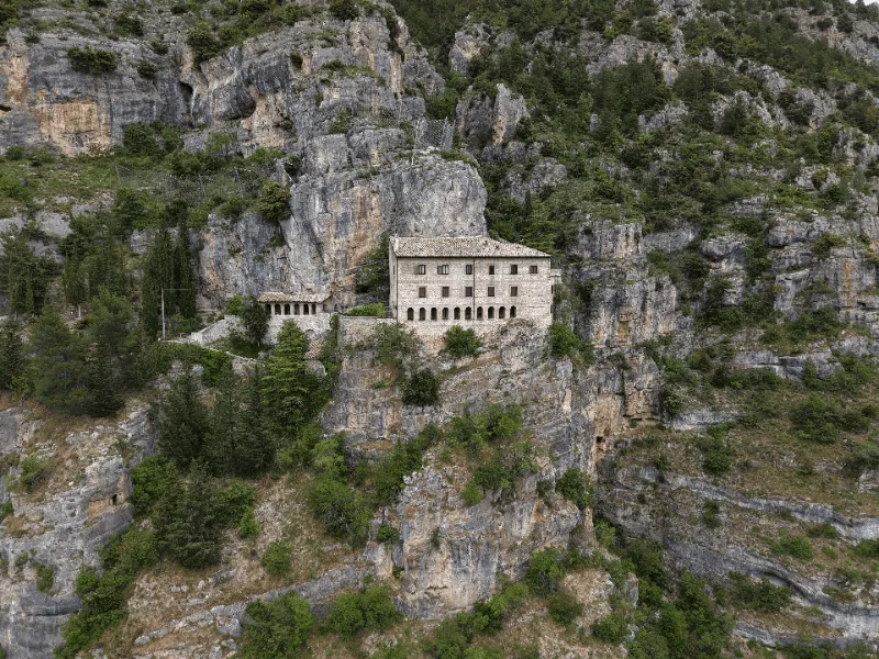
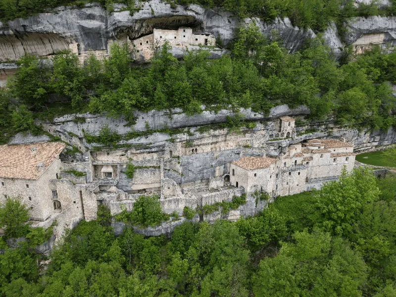
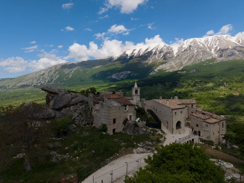
This STAGE is short, allowing you to visit Sulmona, leisurely reach the Badia hamlet and then Pacentro. It begins at the largest complex that the Celestines left in Abruzzo: the wonderful Badia Morronese. From the abbey one ascends along the asphalt road(S) in the direction of the Morrone mountain and immediately after a small chapel on the right begins the path that leads to a small square, here one ascends for about 20 minutes more to the hermitage of S. Onofrio al Morrone(janitor Stefano 339.2396322). Back at the small square, descend to the Italic temple of Hercules Curino where trail R8 begins, first reaching Fonte d’Amore and then skirting the mountain to the hamlet of Marane. A piece on asphalt toward the mountain and turn right (Q10) onto the dirt road that gradually between cultivated fields and dry stone walls leads to the medieval village of Pacentro.
TO KNOW: This is where the “Classic Path” begins, which reaches Serramonacesca in 5 days. This is original route of the Camino that was born in 2008.
NOT TO BE MISSED ON THIS STAGE:
In Sulmona (AQ)
-The Temple of Hercules Curino
In Pacentro (AQ)
-The Caldora Castle with its towers.
-The Medieval Quarter
-The House of Marlurita
-The Old Morrone Pasta Factory
-People’s Square
STAGE 06: PACENTRO - CARAMANICO TERME
Departure: Pacentro
Arrival: Caramanico Terme
Distance: 19 km
Height difference: +750 m / – 800 m
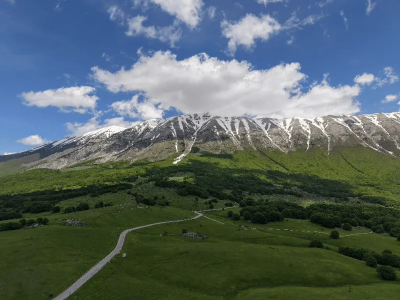
At last we pass from the Peligna Valley to the Orta Valley bypassing Morrone for the San Leonardo Pass entering the heart of the Maiella. We start upstream from the Pacentro towers on path Q1 leading to the San Leonardo Pass. Along the trail the climb is steady, but the effort is never excessive and is repaid by the grandiose panorama that gradually opens up over the Maiella massif and its raves (the steep channels leading to the summit of Mount Amaro). From Passo di San Leonardo (trails Q8 and then Q6) the Cammino is practically all downhill with the summit of Monte Amaro looming and the Gran Sasso chain framing the horizon; a stop at the village of Roccacaramanico is a must and then we set off again skirting Mount Morrone (Q7) until we intercept the trail (S) to Caramanico. On reaching the church of S. Vittorino, continue along the paved road to the destination. In Caramanico the historic center (lower part of the town) with the church of San Nicola and the San Maurizio quarter are worth seeing.
NOT TO BE MISSED ON THIS STAGE:
-The Paolo Barrasso Museum of Nature and Archaeology
-The Otter Wildlife Area.
-The St. Maurice district and the Nasse gate.
-The Pisciarello Park
STAGE 07: CARAMANICO TERME - DECONTRA
Departure: Caramanico Terme
Arrival: Decontra
Distance: 15.5 km
Height difference: +780 m / – 600 m
CURRENTLY THIS SECTION IS NOT PASSABLE.
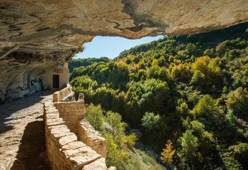
The CamMINO DELLE VALLI on this STAGE goes all the way up the valley of the Orfento River to Ponte della Pietra (m. 975), passes the hermitage of S. Onofrio and ends at the village of Decontra (m. 810 – refreshments and accommodation). From the Ponte di Caramanico bridge on S.S. 487 (km. 1.35 from the center) by path S you descend directly into the Orfento gorge. You pass a series of characteristic small wooden bridges, the ancient Ponte di San Cataldo until you reach the Ponte di S. Benedetto. Here, due to the temporary prohibition of path B2 (Ordinance of the mayor of Caramanico Terme – See below), you continue on the same side of the valley for path S, which enters the beech forest. With about an hour’s ascent you reach the detour to the left for the hermitage of S. Onofrio all’Orfento (5-minute walk). Return to the valley on the same trail as the outward journey to the St. Benedict’s bridge where you continue further downhill (10 minutes) to the turnoff for Decontra (B8 – 1 hour uphill).
TO KNOW: From the hermitage of St. Onofrio continue further upstream for another 30 minutes (S) to reach the Ponte della Pietra gorge.
*ATTENTION – TEMPORARY CLOSURE OF PATH B2 (Loc. Piscia Giumenta):
Temporary closure of path B2 (loc. Piscia Giumenta)
Following the report received by the Mayor of the Municipality of Caramanico Terme from the Commander of the Carabinieri Biodiversity Department Caramanico Terme, the Mayor of Caramanico Terme has ordered by his own order. the temporary prohibition of the use of the section of the path called “Piscia Giumenta” within the nature reserve “Valle dell’Orfento” in Caramanico Terme, until the positioning of the metal cable is restored.
DON’T MISS IN THIS STAGE:
– The Scalelle Trail
– The San Cataldo Bridge
– The Piscia Giumenta Equipped Trail
– The Stone Bridge
STAGE 08: DECONTRA - COCO SPOTS
Departure: Decontra
Arrival: Spots of Coco
Distance: 22 km
Height difference: +1,350 m / – 1,270 m
From Decontra one ascends the P trail until turning onto the B1 trail that leads to Pianagrande. When you reach the barrier at Pianagrande, you cannot deviate to the right (S) (path closed – Caramanico Mayor’s ordinance). Therefore continue straight on past the barrier (B1) until you come out of the woods where on the right a second S path descends to the Hermitage. A few bends in the woods and you reach the top of a steep rock staircase that you need to descend carefully (handholds dug in). In a few minutes you reach the Hermitage of San Giovanni. After visiting by the same path you return to the dirt road of Pianagrande descend left again back to the iron bar and back to the right turnoff to the Hermitage of S. Spirito (S). Descend into beech forest and at the bottom of the gorge at the junction of trails go right to the hermitage (P-S). The last stretch on asphalt is very steep and tiring. Having visited the hermitage, turn back to the bottom of the gorge and continue right to Macchia Di Abbateggio P-S. Coming out of the woods, after a stretch on a dirt road, turn right onto a steep path among the ferns that descends into the valley of S. Bartolomeo. From the hermitage it is a short climb to Macchie di Coco (S).
Alternative solutions to the full route of STAGE 8
STAGE 8 is 22 km long with significant elevation gain both uphill and downhill.
For those who do not want to take two days to visit the three hermitages, perhaps at a more leisurely pace, there is this alternative:
DAY 1
Total km. 13 round trip
Departure from Decontra (trails P and then immediately B1), arrival at Pianagrande and descent to the hermitage of San Giovanni all’Orfernto. Return to Decontra by the same trail with a second overnight stay at this location.
DAY 2
Total km. 17.4
Departure from Decontra (trails P and then Pe S) to the hermitage of Santo Spirito a Maiella. From here return to the valley by the same path but continuing to the bottom of the Vallone (S) and the Hermitage of San Bartolomeo in Legio. Having visited the hermitage we continue to the end of the STAGE at Macchie di Coco (S).
What to know about visiting the hermitage of San Giovanni all’Orfento:
The hermitage of San Giovanni is set in the middle of a cliff face at 1227 meters above sea level in the Orfento Valley and is among the most striking of the entire Cammino, but also the most “aerial.” The path S that can be walked today from Pianagrande (The one near the iron bar is currently closed) to the hermitage has a staircase carved in the rock (to be done both up and down) that although short should be considered as a passage of EE (Experienced Hikers) difficulty. The entrance to the hermitage of San Giovanni is via a staircase and then via a narrow horizontal ledge (about 15 meters in length) to be traversed in the final stretch belly to the ground (see photo). The passage placed several meters above the ground and about 40 cm. wide is not protected, so entry is reserved for properly prepared and equipped people. However, the hermitage can be observed from the outside by continuing under the cave and ascending along the trail placed in front.
Before you leave, ask for more information at the Caramanico Terme Park Information Center: caramanico@parcomaiella.it
NOT TO BE MISSED ON THIS STAGE:
-The unique view from the top of the Orfento Valley.
-The dry-stone huts
-The blooms of the meadows of Pianagrande.
-The Magdalene Oratory at the Hermitage of St. Spirit
-The icy water of the 3 ditches
-The Giumentina Valley with its Eco-Museum (348.4945829)
STAGE 09: COCO SPOTS - SERRAMONACESCA
Departure: Spots of Coco
Arrival: Serramonacesca
Distance: 15.5 km
Height difference: +480 m / – 950 m
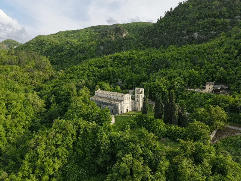
You are in the northernmost sector of the park. The first part of the itinerary (always on the S marker until the end of the day) is on a paved road until you reach a hill (Acquafredda), turn onto a dirt road and then onto the path that gradually descends inside the Fosso Sant’Angelo di Lettomanoppello. Arriving at the bottom of the ditch (Garzillo spring), you cross to reach in the shadow of imposing walls the Sant’Angelo Cave. From the gorge, go up a winding track and continue on a dirt road until you touch the provincial road that connects Lettomanoppello to Passo Lanciano; go up to the right and after Fonte Pirella at a right bend enter a dirt road on the left. With the sea in sight you traverse halfway up and then downhill between low walls and ancient stazzi to a picnic area. Here you leave the dirt road for a mule track to the right and then a path to the left that descends to the hermitage of Sant’Onofrio di Serramonacesca. From the latter here, continue further downhill to the Abbey of San Liberatore (328.7710754) and the rock tombs along the Alento River.
NOT TO BE MISSED ON THIS STAGE:
-Dry-stone agro-pastoral complexes
-Remains Acquafredda prison camp.
-Fonte del Garzillo
-Alento rock tombs.
VARIANT FOR MANOPPELLO
Length: 20 km
Uphill elevation gain: 730 m. approx.
Downhill elevation gain: 1200 approx.
Starting point altitude: 837 m.
Arrival point altitude: 370 m.
Difficulty: long STAGE with the upper part to be avoided in hot weather.
Classification: E (Hiking)
MACCHIE DI COCO – MANOPPELLO (loc. Cappuccini – Volto Santo) – SERRAMONACESCA
From Macchie di Coco, the first section of the itinerary (always on trail marker S until the end of the day) is on an asphalt road until it reaches a hill (Acquafredda), turns onto a dirt road and then onto the path that gradually descends inside the Fosso Sant’Angelo di Lettomanoppello. Arriving at the bottom of the ditch (Fonte del Garzillo), you cross to reach in the shadow of imposing walls the Sant’Angelo Cave. From the gorge, go up a winding track and continue on a dirt road until you reach the provincial road that connects Lettomanoppello to Passo Lanciano; go up to the right and after Fonte Pirella at a right bend enter a dirt road on the left. After about 15 minutes you descend to the left on the long path (always initialed S) that leads to the Shrine of the Holy Face of Manoppello.
From the shrine, continue along path S in the direction of Serramonacesca with short but steep uphill sections. Thus we reach the base of the Ciumina hill on which stands the Castel Menardo, a defensive structure erected between the 12th and 14th centuries. After the visit we return to the valley where we continue to the Abbey of San Liberatore a Maiella.
NOT TO BE MISSED ON THIS STAGE:
-Sanctuary of the Holy Face
-Castel Menardo
-Abbey of San Liberatore a Maiella
-Rock Tombs Alento River
STAGE 10: SERRAMONACESCA - SAN MARTINO SULLA MARUCCINA
Departure: Serramonacesca
Arrival: San Martino on the Maruccina
Distance: 15.8 km
Height difference: +500 m / – 450 m
This STAGE and the next two take place on the same route on the Cammino di San Tommaso (www.camminodisantommaso.org). A Cassinese prepositura, the Romanesque Abbey of San Liberatore is among the most beautiful in Abruzzo with an ambo dated 1180 and a cosmatesque floor from 1275. Just below the abbey the Alento River flows through a small green gorge and hosts rock tombs on its walls dating back to the first monastic settlement. The day begins on the paved road that passes upstream from the abbey and soon becomes unpaved. Continue until you find on the left the steep path (S) that climbs to the tower of Polegro (about 30 minutes) from which you reach by a dirt road and then by asphalt Pretoro. From the village you descend to the bottom of the Foro valley (rock mills) where you continue downstream to Rapino. Reaching the bottom of the valley a final climb leads to San Martino sulla Marrucina.
NOT TO BE MISSED ON THIS STAGE:
– the tower of Polegro
– The historical center of Pretoro
– The rock mills of Pretoro
– Museum of Ceramics in Rapino 0871.800642
– Snow Cave in San Martino S.M.
STAGE 11: SAN MARTINO SULLA MARUCCINA - CRECCHIO
Departure: San Martino on the Maruccina
Arrival: Crecchio
Distance: 18.5 km
Height difference: +450 m / – 680 m
The Maiella is now far away and the sea is getting closer. The forests are increasingly giving way to cultivated fields and vineyards that dominate the landscape.
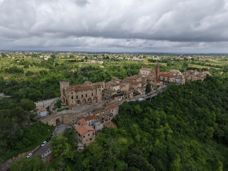
From San Martino sulla Marrucina you descend down the valley and then climb up to Filetto, the town of the hot chili pepper festival. A few more descents and climbs and you reach the Convent of the Santissima Annunziata and the Territorial Equipped Park below. It continues toward Canosa Sannita to finally reach Crecchio. The ducal De Riseis-D’Aragona castle in Crecchio was enlarged in several phases starting in the 1600s and was bombed in June 1944, sustaining severe damage. On Sept. 9, 1943, it housed the royal family of Savoy fleeing to Brindisi. Today it houses the Museum of Byzantine and Early Medieval Abruzzo (Archeoclub, 0871 941392).
NOT TO BE MISSED ON THIS STAGE:
-Convent of the SS Annunziata
-Ducal castle of Crecchio (Museum of Byzantine and Early Medieval Abruzzo)
-Historic center of Crecchio
-Sanctuary of St. Elizabeth
-Mill Park Valley
STAGE 12: CRECCHIO - ORTONA
Departure: Crecchio
Arrival: Ortona
Distance: 14 km
Height difference: +130 m / – 330 m
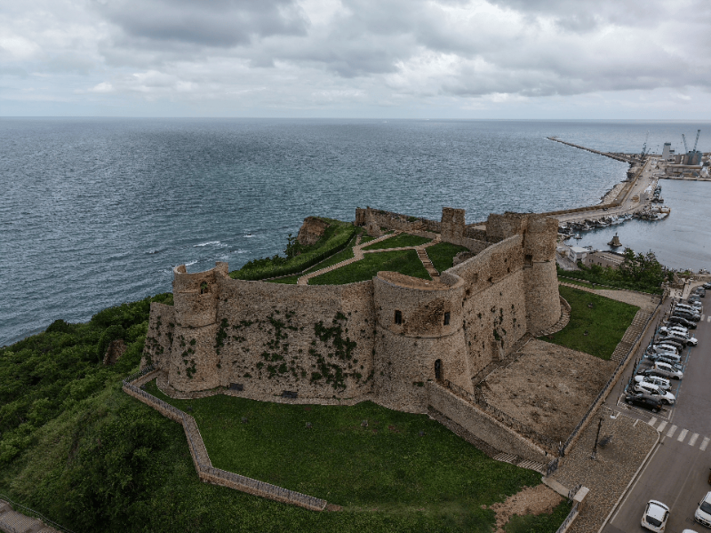
The Camino has come to an end and to the sea! From the magnificent historic center of Crecchio you descend into the valley below to Contrada Baccile – Parco dei Mulini where the trail leaves the asphalt and climbs steeply through the vineyards. Back on the flat and past a crossroads, continue again among the vineyards until you come out on the busy SS 538 where you continue for a few hundred meters toward the valley to deviate immediately to the right for the Macinini road. From here, still on asphalt, you will reach the center of Ortona as far as Piazza della Repubblica where the IAT office is located (see info below). Here you will be able to pick up your testimonium. Next to the office by Corso Matteotti you will be able to reach the Cathedral of St. Thomas the Apostle (348.5183686, 085 9062977) and with a last effort the Aragonese castle and the sea. From the castle, a flight of steps leads up the 42-km-long Via verde della Costa dei Trabocchi bike path and from Ortona down along the old Adriatic railway track to Vasto. Perhaps you can rent a bike in town and continue your journey!
NOT TO BE MISSED ON THIS STAGE:
-Wine Fountain Winery Dora Sarchese
-The Places of the Battle of Ortona.
-The Aragonese Castle
-The eastern sea view promenade
-The Diocesan Museum of Ortona
-The Regional Wine Shop (tastings and events)
-The beach of “returns”


Journey diaries
Insights
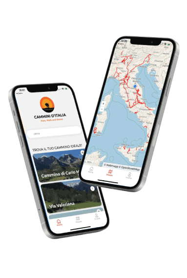
Discover our app!
With the free Cammini d’Italia app, you can plan and walk the Cammino Grande di Celestino in total safety, being able to plan the stages in detail and walk the route thanks to the built-in GPS technology that supports your orientation during your adventure.
Within the app you will find many other paths present in Italy. Thanks to the georeferenced tracks of many routes you will be able to study the itinerary that suits you best and also download the GPX tracks of the individual STAGEs offline.
The app also includes a complete digital map of all the paths surveyed to date on our portal, giving you a wide range of choices among the many paths in the Belpaese.
Cammini d’Italia is the perfect app for those who want to explore the beauty of Italy on foot, discovering hidden places surrounded by nature. Download it for free today and start planning your next adventure!
⠀
⠀
 ⠀⠀⠀
⠀⠀⠀