
Cammino dei Briganti
The CAMMINO DEI BRIGANTI is a loop trail, which starts from the small village of Sante Marie, which has just over a thousand inhabitants, located in the province of L’Aquila in Abruzzo, Italy.
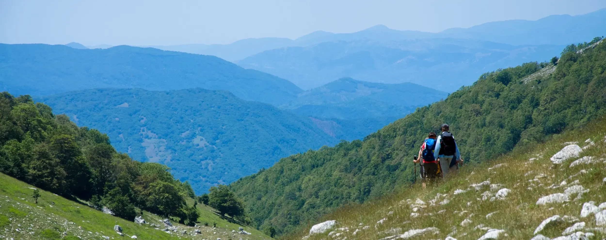
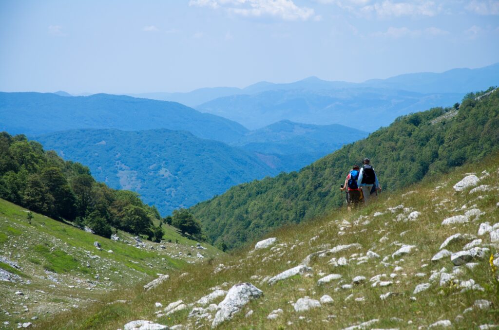
This marvelous path retraces the roads traversed by the brigands of the Band of Cartore through the Velino and Sirente Park, who moved through the valleys on the border between Lazio and Abruzzo to escape the Sabaudis. However, the term “brigands” is not quite correct; we can call them free spirits, who did not want to bend to the will of royalty. The path is 108 km long and can be walked in 7 days. STAGE number 4, which in itself is additional, as it starts from Cantore and through a loop route that passes through Duchess Lake (1920 meters above sea level) reaches the starting point. To complete this STAGE you will have to choose between STAGE 4a for Valle di Fua - Valle della Cesa and STAGE 4 which passes through Valle di Fua - Val di Teve.
Below, in the “STAGE” and “ALTIMETERS AND LEVELS” sections, you can find details on the length, elevations, and elevation differences.
The signage is red-and-white, and everything is well marked, even with signposts showing timings. For this reason, we recommend that you equip yourself with the official guidebook, the official map and/or the free GPS tracks downloadable from the website.
If you enjoy traveling in a group, the “Compagnia dei Cammini” association organizes excursions in which everyone can participate.
HISTORY
The Cammino dei Briganti is the brainchild of Luca Gianotti, a walking expert, professional guide, and writer, who has previously created two other paths: the Spallanzani Trail in the Reggio Emilia Apennines, and the Cretan Way on the island of Crete.
Luca Gianotti, a native of Modena, has lived in Marsica for 20 years, and for more than a decade has been offering donkey walks on the Velino trails. The Cammino dei Briganti was born from that experience and work.
Gianotti writes:
“As I walked, I learned stories that our history books do not tell. Like the truth of what happened with the unification of Italy, that is, with the descent of the Piedmontese army to the South. I discovered that the Bourbons were not so hated by their people and that the Sabaudis were immediately an army of violent and overbearing invaders. And that the brigands very often were men and women (brigands and brigantesses) who did not accept this new invader, so they went into hiding, went into hiding, became partisans in some way. History as one reads it in books is always that written by the victors, one knows. Instead, by walking one can learn the counter-truths, and here, along the Cammino dei BRIGANTI, there are many stories. Good and bad.”
WATER
The route is well served by fountains and water sources, both in the many villages crossed and in the midst of nature. Here is the webpage that provides the detailed locations of the springs and fountains: https://camminodeibriganti.it/info-pratiche/fonti-e-fontane/
SERVICES
Supermarkets and pharmacies in Magliano de’ Marsi and Tagliacozzo.
SIGNAGE
The signage is red-white, and everything is well marked, even with signposts showing timings. For this reason, we recommend that you equip yourself with the official guidebook, the official map and/or the free GPS tracks downloadable from https://camminodeibriganti.it/ or found on the Cammini d’Italia APP.
If you enjoy traveling in a group, the “Compagnia dei Cammini” association organizes excursions in which everyone can participate.
CONTACTS
Mail reference: info@camminodeibriganti.it
CREDENTIALS
The credential is called a safe-conduct and is collected only at departure, at the safe-conduct office in the municipality, and is free of charge. On return you can pick up the certificate of successful journey.
IN TENT
At each STAGE there are designated tent areas for those sleeping in tents. With essential services. But you can also sleep in the woods, away from the villages. Regulations for sleeping in tents are on the Camino website.
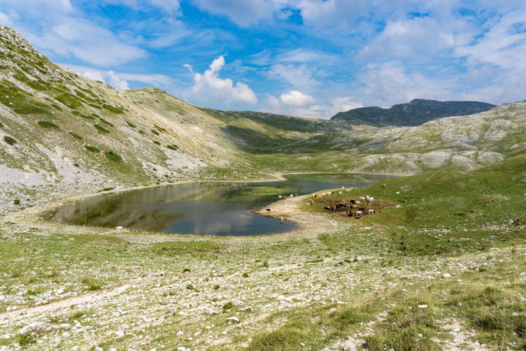
Permits are only needed for those who want to sleep in the Duchess Reserve near the lake (but not at the lake, it is prohibited!).
STAGE 01
STAGE 01: Sante Marie to Santo Stefano
Departure: Sante Marie
Arrival: St. Stephen’s
Distance: 6 km
Height difference: +380 m / – 160 m
Short STAGE that allows you to arrive in Sante Marie by car or train and walk a bit to get into the spirit of the journey.
STAGE 02
STAGE 02: Santo Stefano to Nesce
Departure: St. Stephen’s
Arrival: Nesce
Distance: 13.9 km
Height difference: +400 m / – 625 m
The path leads to the charming medieval village of Nesce, where it is possible to stay overnight in either a B&B or tourist accommodation. Alternatively, you can choose Valdevarri, where some families offer hospitality in simple private rooms and with a home-cooked dinner. From here you continue into Val de Varri, one of the most authentic and less frequented areas of the entire route: think that the road through it has only been paved in recent years. Once past the valley, the route climbs and descends over a small mountain, entering the Salto Valley. At this point the main route remains at altitude, while a variant diverts to the village of Poggiovalle, once known as a brigands’ refuge. We preferred to maintain the main route, which follows the mountain along a scenic trail capable of leading directly to Nesce.
STAGE 03
STAGE 03: Nesce to Cartore
Departure: Nesce
Arrival: Cartore
Distance: 17 km
Height difference: +440 m / – 330 m
The route continues, skirting the Salto River for a stretch, then passing at the foot of Mount Rose to reach Spedino. From here we follow a dirt road that leads to the charming village of Cartore, once known as the refuge of a feared band of brigands.
Alternative for Corvaro (from Spedino)
If in Cartore you do not find availability for sleeping, or you prefer an itinerary that does not involve spending two nights in the same place, you can choose the variant to Corvaro. Today a new path, well marked and perfectly passable, extends the CAMMINO DEI BRIGANTI passing right through here.
In practice: from Spedino you turn left following the white-red markings, descending through the woods to Corvaro. In the village you will find both accommodations and areas to pitch your tent, as well as several options for dinner (pizzerias, pubs and restaurants).
The next day you ascend to Duchessa along a beautiful, wild but well-marked forest path that leads to Duchessa Lake. From here, over the course of the day, you can descend back into the valley by choosing from several options: toward Cartore (via Val di Fua or Prati di San Leonardo), or toward Rosciolo (via Val di Teve).
Villerose variant – Grotti – Torano – Spedino
This option is ideal for those who prefer to cross villages, with the possibility of eating and staying overnight without tackling the mountains-a useful solution especially in case of bad weather or mud. Along the way you can stay overnight in apartments in Grotti or facilities in Torano, then reconnect in Spedino.
STAGE 04
STAGE 04: From Cartore to Duchessa Lake (by Val di Fua and back Prati San Leonardo)
Departure: Cartore
Arrival: Duchess Lake
Distance: 12 km
Height difference: +940 m / – 940 m
From Cartore
From here the path offers two options: an easier route of about 12.3 km and a second route of 15 km, which is definitely more challenging because of the steep gradients and suitable only for experienced hikers. Both options are precisely described in the guidebook.
From Corvaro
The trail starts from the L’Anguizzola farmhouse and climbs steadily through the woods: first along a mule track, then through a winding path. This leads to some high-altitude clearings, from which there is a view of the valley and Mount Morrone, which dominates from above.
The route continues on a mule track that cuts through the mountain until it leads to Fonte Salomone and, a little further on, to Lago della Duchessa. From here it is possible to choose one of three descent routes: the Val di Fua, Prati di San Leonardo or the Val di Teve, the latter being ideal for reaching Rosciolo directly.
Mountain variant (not included in the guidebook)
From Lago della Duchessa you can take a detour off the main Cammino, tackling the ascent to Monte Velino (2489 m). The itinerary includes an overnight stay at Rifugio Sebastiani and a return the next day along another trail leading to Santa Maria in Valle.
This is a summer variant reserved for very trained walkers accustomed to moving over severe and poorly marked high mountain terrain. It is essential to have a topographic map of Mount Velino with you and to use GPS tools to follow the trail and avoid getting lost.
STAGE 05
STAGE 05: Cartore to Massa d’Albe.
Departure: Cartore
Arrival: Massa d’Albe
Distance: 14 km
Height difference: +500 m / – 600 m
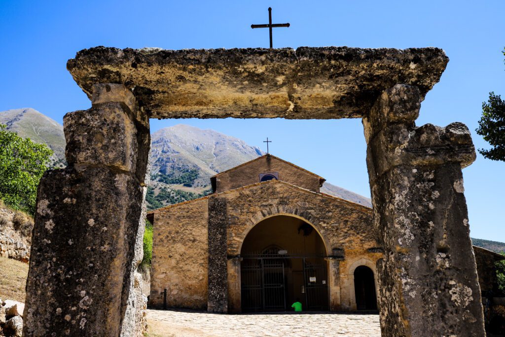
From Cartore, the path climbs to Passo Le Forche, at the foot of Mount Velino, and then descends to Santa Maria in Valle Porclaneta, an extraordinarily evocative place that holds a splendid 10th-century Romanesque church, an authentic masterpiece of art. A little further on is the medieval village of Rosciolo (8.5 km), perfect as a STAGE point for those who want a more relaxed day: here there are cozy accommodations and excellent restaurants. Those who choose to continue, however, take a scenic uphill gorge that leads back under the Velino, before descending to the village of Massa d’Albe.
STAGE 06
STAGE 06: From Massa d’Albe to Casale le Crete
Departure: Massa d’Albe
Arrival: Casale le Crete
Distance: 21 km
Height difference: +250 m / – 300 m
From Massa d’Albe the route climbs back up to Alba Fucens (8.5 km), an ancient Roman city that is definitely worth a stop and a thorough visit. It then continues downhill to Magliano de’ Marsi, the largest and best-equipped center along the entire route.
From here the route continues towards Scurcola (or, if you choose the variant, towards Sorbo) until it reaches Le Crete.
STAGE 07
STAGE 07: From Casale le Crete to Sante Marie
Departure: Casale le Crete
Arrival: Sante Marie
Distance: 22 km
Height difference: +570 m / – 480 m
From Le Crete the route continues along scenic dirt roads that lead to San Donato, where you climb to the ruins of an ancient castle. From here it descends to Scanzano and then, still following small roads and paths, it crosses Tubione and finally Sante Marie, the final STAGE of the Cammino, where it is possible to collect one’s certificate of completion.
Variants
The route has several variants, all of which are included in the GPS tracks available free of charge on the official website. These alternate routes are marked with white and blue paint and special signs.
Villerose – Grotti – Torano – Spedino variant.
The detour to Grotti and Torano begins shortly after the bridge over the Salto River that leads to Villerose. Here you leave the main route of the Cammino dei BRIGANTI, which bends to the left, and instead continue straight along an obvious dirt road that goes up the river until you reach the asphalt road.
New white-blue signage accompanies this section. When you reach the asphalt road, turn right, cross a bridge and reach a drinking fountain on the right. From here take the dirt road opposite, lined in part with oak trees, which in about half an hour leads to the entrance to Grotti. Passing a small bridge on the left and turning right, you enter the village. To return to the main route, simply retrace the same route in the opposite direction.
From Grotti the path continues along the river on the right bank until it reaches Torano, crossing it to the center of the village. To continue to Spedino, turn back to the church of San Pietro in Piazza Vittorio Emanuele, then take Via Spedino: a dirt road that goes through a grove of oaks, passes the San Paolo spring on the right and, after about 45 minutes, rejoins the Cammino dei Briganti in the village of Spedino.


Journey diaries
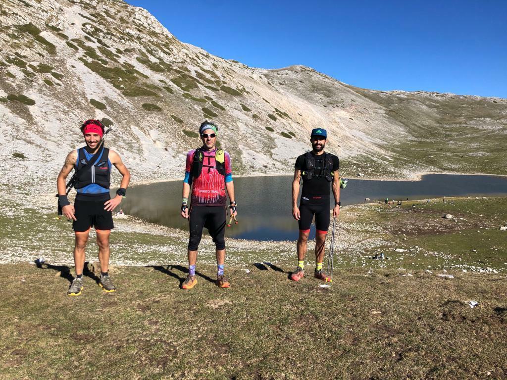
Cammino dei Briganti
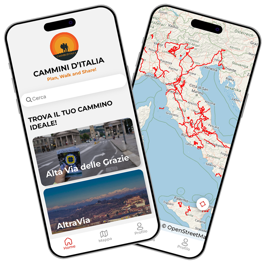
With Cammini d’Italia’s free app, you can plan and walk the Cammino dei BRIGANTI in total safety, being able to plan the stages in detail and walk the route thanks to the built-in GPS technology that supports your orientation during your adventure.
⠀Inside the app you will find many other paths present in Italy. Thanks to the georeferenced tracks of many routes you will be able to study the itinerary that suits you best and also download the GPX tracks of the individual STAGEs offline.
The app also includes a complete digital map of all the paths surveyed to date on our portal, giving you a wide range of choices among the many paths in the Belpaese.
⠀⠀
Cammini d’Italia is the perfect app for those who want to explore the beauty of Italy on foot, discovering hidden places surrounded by nature. Download it for free today and start planning your next adventure!
⠀
⠀
 ⠀⠀⠀
⠀⠀⠀