Cammino del Salto
A loop trail of about 100 km immersed in the beauty of Cicolano and the Salto Valley. Amid breathtaking views, charming villages and local specialties, it is the ideal way to get to know the area surrounding the province of Rieti.
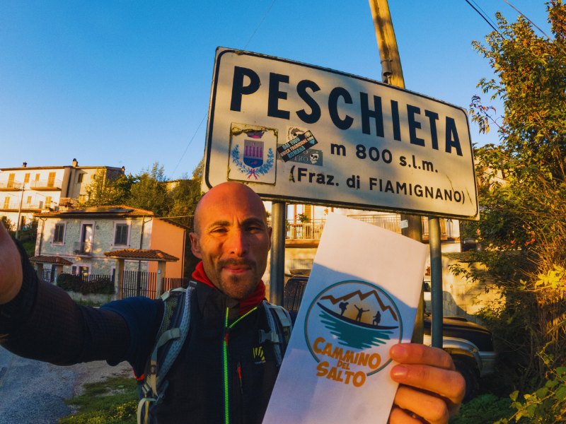
The Cammino del Salto begins and ends in Peschieta, a small hamlet in the municipality of Fiamignano, in the Province of Rieti. This loop route, about 95 km long and divided into 5 or 6 STAGES, is immersed in the beauty of Cicolano and the Salto Valley, passing through the municipalities of Fiamignano, Petrella Salto, Varco Sabino and Pescorocchiano.
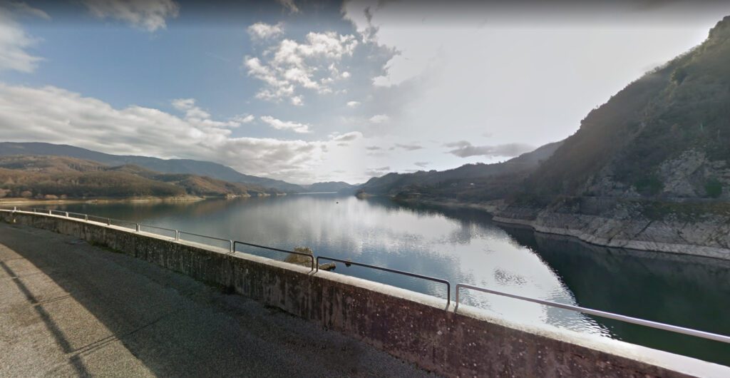
Lake del Salto, a reservoir created by damming the river of the same name, is the undisputed star of this walk. On the way, you will be able to cross the imposing 90-meter-high dam and enjoy spectacular views, Mediterranean scrub forests and chestnut trees. You will have the opportunity to discover numerous places of natural and historical interest, making this the ideal adventure for those who love to explore the nature and culture of the area.
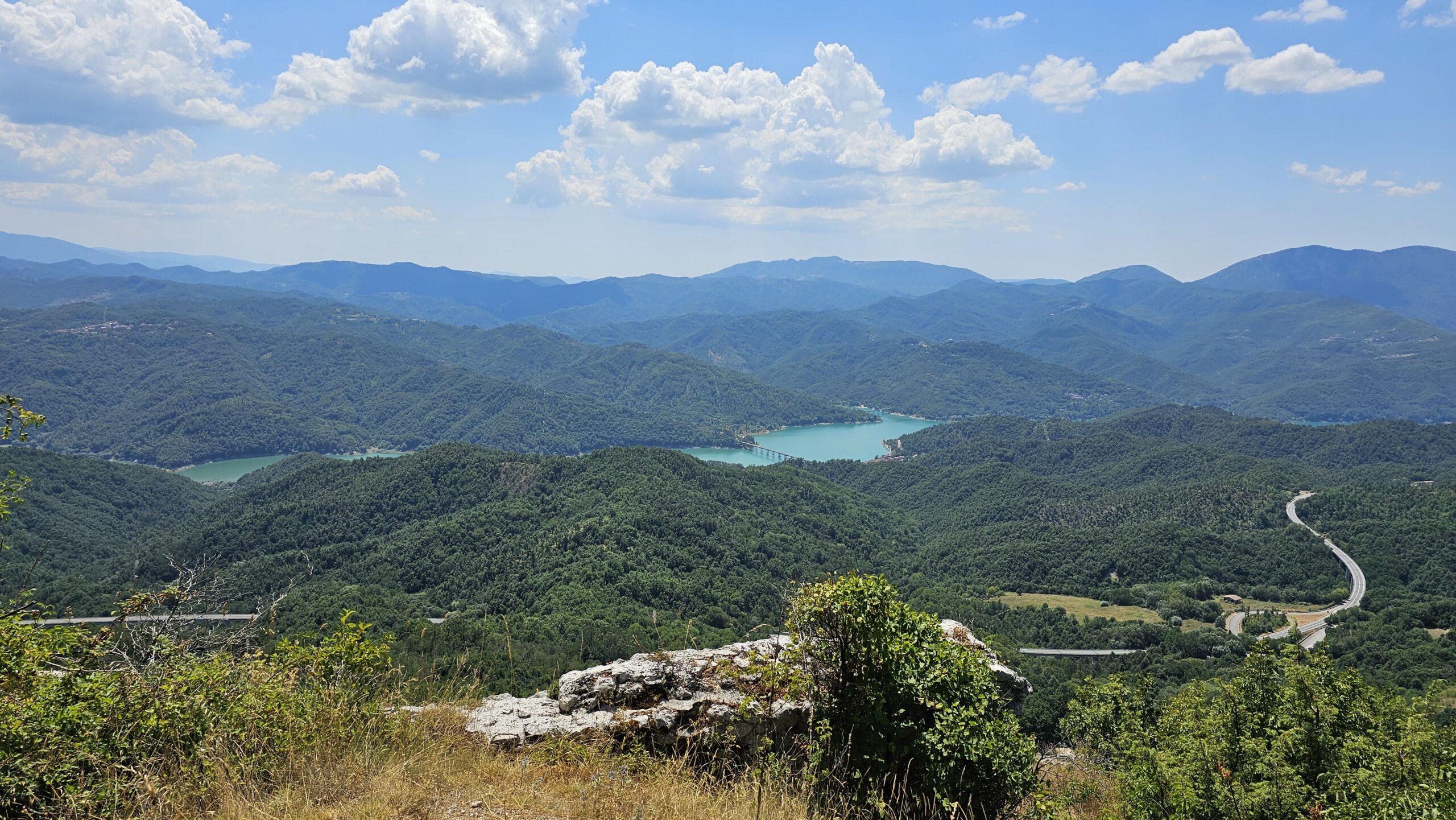
You'll also encounter charming villages and friendly people, enjoy local specialties, and if you want to add spice to your adventure ... an optional loop with a 1,000-meter elevation gain is available that will take you to Mount Navegna, from which you can admire both Lake Salto and its twin Lake Turano.
HISTORY
The idea for the walk came from the president of the project, who has always loved to share fascinating stories about the territories surrounding his and his grandparents’ hometown.
In memory of the hikes he made as a child with family members, and the many memories linked to those places… after exploring different paths and personally understanding what it takes to tackle a route, he decided together with other enthusiasts of the area to create this new itinerary, which would enhance the wonderful landscapes of the area.
WATER
SERVICES
Supermarkets: refreshment stand is provided at each stop.
Pharmacies: only in Pescorocchiano.
SIGNAGE
Signage is present, there are orange signs along the Path(CAI style).
CREDENTIAL
The Cammino del Salto is equipped with a lifeline; contact the association to purchase it(see CONTACTS).
CONTACTS
STAGE 01
Tappa 01: Peschieta – Fiamignano
Lunghezza: 17 km
Dislivello: +875 m/ -508 m
The shortest STAGE of the walk begins in Peschieta.
Once you reach the Shrine of SS. Maria Assunta, you continue on a trail to the abandoned village of Roccarandisi and from there, still on a dirt road, you reach the village of Santo Stefano(practically uninhabited for most of the year).
Once on asphalt road you reach Santa Lucia, then Collemazzolino where taking the Sentiero Italia you reach the end of the stage village which is Fiamignano. Here it is possible to end the STAGE (about 13 km) or to reach the Castle of Poggio Poponesco and the tower overlooking Fiamignano, from which the lake is visible, and then back to the village (about 17 km).
STAGE 02
Stage 02: Fiamignano – Petrella Salto
Length: 16 km
Height difference: +1588 m/ -1014 m
From the village of Fiamignano we take the paved road Via Rascino. After 800 m, we take the Sentiero Nestore (Nestore Path) that ends at the Chiesetta Alpina: a small church built in memory of the fallen Alpine soldiers in all wars. From here, we will reach the summit of Monte la Serra (1607 m) where we can admire the Salto Lake in all its grandeur. We then descend to the Rocca di Beatrice Cenci, which rises above Petrella Salto and where the second stage of the walk ends.
STAGE 03
Tappa 03: Petrella Salto – Varco Sabino
Length: 16 km
Height difference: 831 m/ -866 m
From Petrella Salto we follow the asphalt road to Casali Pietrangeli. From here, after a nice stretch in the woods, we will reach the asphalt road that runs along the perimeter of the lake to the Salto Dam. From here, taking the signs on asphalt road to Rocca Vittiana, we find a path that will take us first to a waterfall, and then to Rocca Vittiana.
From Rocca Vittiana, through Sentiero Italia, we will first reach Valle Cupola and then Varco Sabino where the STAGE ends.
STAGE 04 (Optional)
STAGE 04: Mount Navegna Ring
Height difference: +1011m/ -1011m
This is the optional STAGE of the walk. It starts and ends in Varco Sabino, and it is a 14km loop that takes us to the summit of Mount Navegna (1506 m), which, also called the mountain between the two lakes, in fact allows views of both Lake Salto and Lake Turano.
STAGE 05
Tappa 05: Varco Sabino – Ospanesco
Length: 18.5 km
Height difference: +1118 m/ -1032 m
From Varco Sabino we will take the first stretch, previously done by those who have done the Mount Navegna loop, and then cross a beautiful stretch of forest to reach the church of Santa Maria in Villa and the beautiful oak(the oldest tree in Cicolano). Next, still on a dirt road, we will reach the village of Girgenti, and from here we will descend through the woods to the lake.
For those who wish, with a small detour of a few hundred meters, it is possible to reach a bathing spot, or cross a driveway bridge, and take the dirt road back to Ospanesco.
STAGE 06
Tappa 06: Ospanesco – Peschieta
Length: 18 km
Height difference: +865m/ -871 m
From Ospanesco we will continue on a dirt road to the church dedicated to the Holy Trinity. Continuing on, we will then reach the village of Baccarecce and from here, by white road, we will reach Pescorocchiano: the largest village on the entire path. From Pescorocchiano, going around the cemetery, we will take another white road that, passing under Arapetrianni, reaches Collaralli. From here, on a beautiful path, we will reach the end of our walk: Peschieta.