Cammino della Regina Camilla
The CAMMINO DELLA REGINA CAMILLA, Camilla, the protagonist of the legend recounted by Virgil in the Aeneid, which unites all the villages in the Valley, and is aimed at fostering processes of socio-spatial inclusion among the populations, strengthening their identity awareness and connection with the territory.
The Cammino della Regina Camilla is a Project initiated by the Ass.ne A Piedi Liberi in December 2019 as a result of a study regarding the opportunities for eco-sustainable use of the Amaseno Valley and its territorial heritage, carried out within the Smart Enviroments project. The study was carried out by one of the founders of A piedi liberi, Sara Carallo, creator of the Cammino, and funded by the Lazio Region - Training, Research, School and University Department - the Department of Humanistic Studies and the Giuseppe Caraci Laboratory of the University of Roma Tre, which led to the creation of a web portal dedicated to the Amaseno Valley(www.valledellamaseno.it).
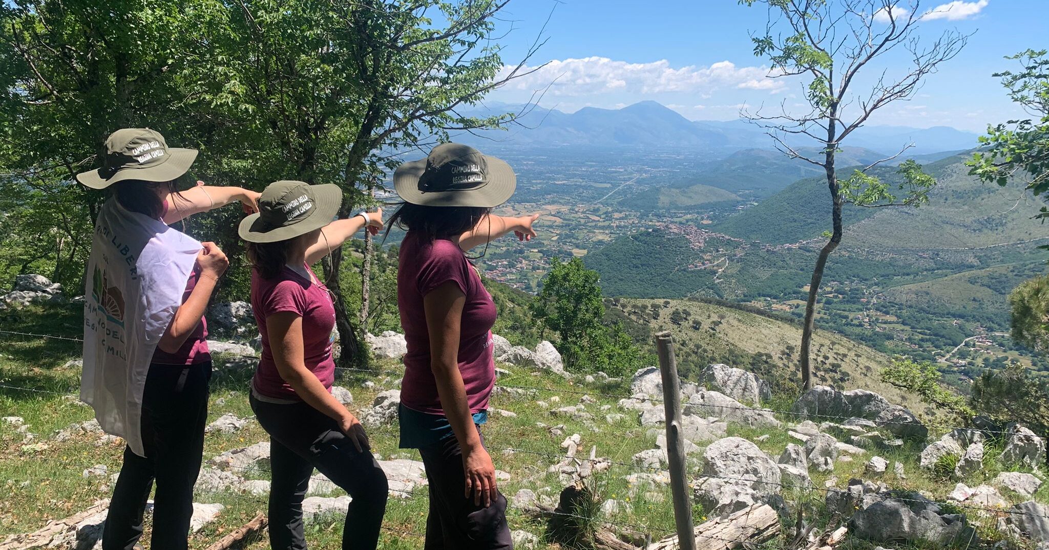
The Cammino takes its name from the Queen of the Volscians, Camilla, the protagonist of the legend narrated by Virgil in the Aeneid, which unites all the villages in the Valley, and is aimed at fostering processes of socio-spatial inclusion among the populations, strengthening their identity awareness and connection with the territory.
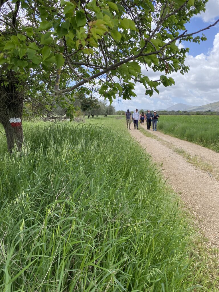
The Cammino della Regina Camilla includes a loop route of about 175 kilometers, divided into 13 STAGES that starts and ends at the Priverno-Fossanova train station or at the Castro- Pofi-Vallecorsa station and passes through all the villages of the Amaseno Valley (Abbey of Fossanova, Priverno, Roccagorga, Maenza, Prossedi, Giuliano di Roma, Villa Santo Stefano, Castro dei Volsci, Vallecorsa, Amaseno, Pisterzo, Roccasecca dei Volsci, Sonnino).
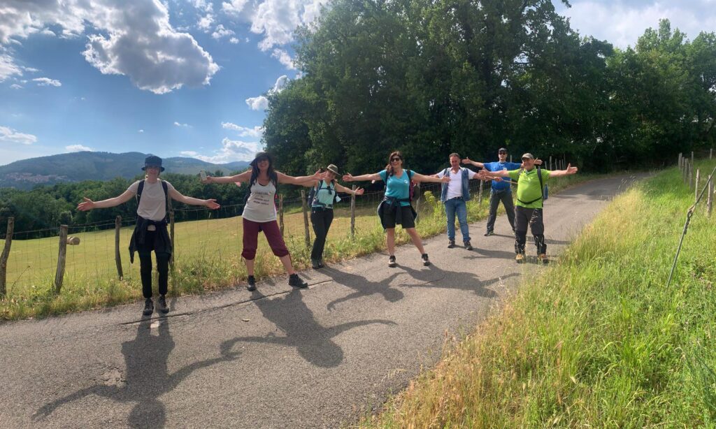
The path connects to other existing paths in the area (such as Via Francigena in the South) and follows ancient transhumance routes, mule tracks, historical routes and pilgrimage routes to value all the heritage already existing in the Valley. It can be traveled on foot, mountain bike or horseback. The Cammino Construction Project was born with the active involvement of the local communities of the Amaseno Valley who decided to join this Project also through the signing of a Memorandum of Understanding. A large number of young people have joined the project from the very beginning, deciding to stay and live in the countries where they were born and which they love viscerally. With us, they helped to identify the territorial heritage to be enhanced, to create the traces of the STAGEs, to mark them with paint, so that they could be traveled safely. This simple gesture was very meaningful to them, a small seed for a more sustainable future.
The Cammino della Regina Camilla Project is coordinated by the A piedi liberi association and the XVIII Comunità Montana Lepini e Ausoni and currently has the involvement and adherence of the Italian Alpine Club (Frosinone and Latina sections) together with the municipalities of all the villages involved, the Privernum archaeological park, the Monti Ausoni and Lago di Fondi Regional Natural Park, the Compagnia dei Lepini, the “Giuseppe Caraci” Geocartographic Laboratory of the University of Roma Tre, the Italian Geographic Society, Federtrek, citizens and local associations.
HISTORY
The itinerary is dedicated to the Queen of the Volsci, Camilla, the protagonist of a legend shared by all the villages in the Valley.
Camilla, legendary Queen of the Volscians, was a strong and courageous woman, referred to by some historians as the “progenitor of the Ciocian people.”
Its genesis begins with the episode of the escape of her father, the Volscian king Metabus, who took her with him while still in swaddling clothes as he fled the city of Privernum.
Having reached the bank of the Amaseno River that was in flood due to heavy downpours and impossible to swim across with little Camilla in his arms, the ruler made a drastic decision.
He asked for the protection of Diana, goddess of the hunt, to whom he consecrated little Camilla, then wrapped her with the bark of a tree and fastened her to his spear, hurling her to the other side of the river. It was thus that the little one was saved and the ruler was able to reach the bank by swimming.
Young Camilla was raised by her proud father in the lush forests of the valley, in ásperious and inaccessible places.
Metabo made Camilla a brave warrior. She was fed mare’s milk, dressed in wild animal skins and was trained from an early age in the art of archery, becoming more skilled than many male warriors.
The able and courageous daughter of Metabo became very popular among her people, who clamored for her to become their queen.
Camilla was forced to go into battle with the people of southern Latium to defend her kingdom from the assault of Aeneas, who had fled the burning city of Troy.
During the battles, she failed to notice Arunte, a cunning and swift Trojan warrior, who knocked her off her horse and hurled his javelin at her, striking her to death.
The figure of Camilla, remembered by Virgil in the Aeneid, is still today an example of a courageous woman.
And it is precisely by drawing inspiration from Camilla’s strength, courage and determination, but above all from the love that the people of this Valley had for her by choosing her as their queen… that we decided to build the Cammino della Regina Camilla!
STAGE
STAGE CAMMINO DELLA REGINA CAMILLA
STAGE 01: FS Station – Priverno
Degree of difficulty: E
Length: 11, 5 km
Positive elevation gain: 162 m.
Negative elevation gain: -58 m
STAGE 02: Priverno – Roccagorga
Degree of difficulty: E
Length: 11.5 km
Positive elevation gain: 337 m.
Negative elevation gain: -178 m.
Walking time: 3.5 hours
STAGE 03: Roccagorga – Maenza
Degree of difficulty: E
Length: 7.5 km
Positive elevation gain: 320 m
Negative elevation gain: -279 m
Walking time: 2.5
STAGE 04: Maenza – Prossedi
Degree of difficulty: EE
Length: 22 km
Positive elevation gain: 1150 m
Negative elevation gain: 1269 m
Walking time: 7.5 hours
STAGE 05: Prossedi – Giuliano di Roma
Degree of difficulty: E
Length: 7 km
Positive elevation gain: 307 m.
Negative elevation gain: -172 m.
Walking time: 2.5
STAGE 06 Giuliano di Roma – Villa Santo Stefano
Degree of difficulty: E
Length: 8 km
Positive elevation gain: 245 m
Negative elevation gain: -368 m
Walking time: 2.5 hours
STAGE 07: Villa Santo Stefano – Castro dei Volsci
Degree of difficulty: EE
Length: 21 km
Positive elevation gain: 1004 m.
Negative elevation gain: -854 m.
Walking time: 7 hours
STAGE 08 Castro dei Volsci – Vallecorsa
Degree of difficulty: E
Length: 11 km
Positive elevation gain: 582 m.
Negative elevation gain: -533 m.
Walking time: 4.0 hours
STAGE 09 Vallecorsa – Amaseno
Degree of difficulty: E
Length: 14 km
Positive elevation gain: 519 m.
Negative elevation gain: -805 m.
Walking time: 4.5 hours
STAGE 10 Amaseno- Pisterzo
Degree of difficulty: E
Length: 13 km
Positive elevation gain: 637 m.
Negative elevation gain: -280 m.
Walking time: 5 hours
STAGE 11 Pisterzo – Roccasecca dei Volsci
Degree of difficulty: E
Length: 15.5 km
Positive elevation gain: 528 m.
Negative elevation gain: -643 m.
Walking time: 5 hours
STAGE 12 Roccasecca dei Volsci – Sonnino
Degree of difficulty: EE
Length: 25.5 km
Positive elevation gain: 1150 m.
Negative elevation gain: -1100 m.
Walking time: 8.5 hours
STAGE 13 Sonnino – FS Station
Degree of difficulty: E
Length: 17 km
Positive elevation gain: 180 m.
Negative elevation gain: -562 m.
Walking time: 5 hours
WATER SOURCES.
This is a karst area so water sources along the route are very scarce. It is recommended to refuel at the start of each STAGE.
STAGE-BY-STAGE SERVICES
There are supermarkets, pharmacies, bars and food services in every village.
SIGNAGE
The path has road markings at all the STAGES. Horizontal signage has yet to be completed. To walk it, it is necessary to have the georeferenced routes and a Smartphone application with which to read them or a GPS satellite tracking tool. We do not recommend relying solely on the signage on the ground.
DANGERS
The territories encountered along the way are quiet, with the presence of villages nearby, and telephone coverage is quite reliable. No obvious hazards are present along the paths to be traveled.
TENT WALK
It is advisable to contact the Cammino’s facilities and make arrangements with them for overnight accommodations in tents.
The list of agreed facilities can be found here: https://www.camminoreginacamilla.it/accoglienze/
ACCESSIBILITY
In cooperation with the Free Wheels onlus association, the project involves establishing STAGES that are also accessible to people with special needs. This is a different route from the pedestrian route, which runs mainly on paved roads or with a surface suitable to be traveled by handbike. The STAGES are the same.
CREDENTIALS
The Credential is not technically required to walk the Camino, it does, however, allow access to discounted rates at affiliated facilities.
To apply for the credential you must fill out the form attached below and we invite you to want to support our activities through a donation contribution that is at the discretion and according to the possibilities of each walker (a minimum donation of 10 euros is suggested). Through the Credential you will help promote the project of Cammino della Regina Camilla, of which you will become an active part.
The credential can be requested by filling out the following form:
https://docs.google.com/forms/d/e/1FAIpQLSc4OKAgmAnr6-M_CEdlbbDshRBjh49LP0NiRRPIuYZe3Anpqw/viewform
IMPORTANT. The credential will be mailed to the email address given in the form only if the approximate departure date is at least 15 days after the request, so that you have time to receive it. Otherwise, we will direct you to the place where you can pick up the credential on the route.