
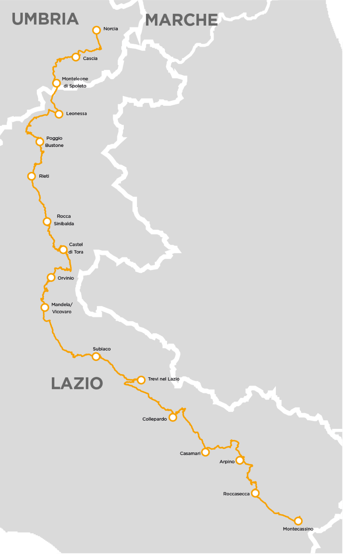
CAMMINO DI SAN BENEDETTO
An itinerary of more than 300 kilometers that starts in Norcia, at the foot of the Sibillini Mountains, crosses the upper Aniene valley to Subiaco, and then descends into the Liri valley to Cassino: a path that unites the most significant places in the life of St. Benedict of Norcia.
An extraordinary 300-kilometer journey connecting Norcia, birthplace of St. Benedict, to Montecassino, where the saint founded the famous abbey. It traverses Umbria and Lazio, exploring places symbolic of Benedictine spirituality and touching on the breathtaking landscapes of the central Apennines.
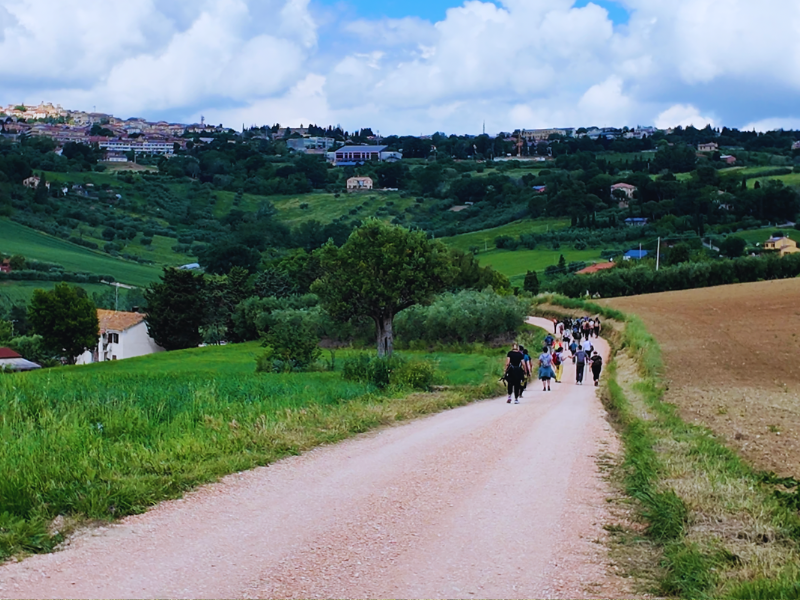
Consisting of 16 STAGES, the path winds through paths, cart tracks and low-traffic roads, crossing lush valleys and striking mountains. In addition to immersing oneself in the Benedictine tradition, the route offers a unique opportunity to learn about other important places of worship linked to saints such as Rita of Cascia, Francis of Assisi and Thomas Aquinas, as well as lesser-known figures, including Giuseppe da Leonessa and Agostina Pietrantoni.
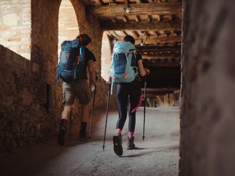
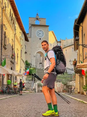
Ideal for those seeking an experience of faith, culture and nature, Cammino di San Benedetto can be traveled on foot or by bicycle, in a single adventure or divided into several STAGEs. Each step is an invitation to discover the spiritual and scenic beauty of central Italy, in a journey that celebrates simplicity, reflection and contact with nature.
HISTORY
The CAMMINO DI SAN BENEDETTO is a cultural itinerary linking two regions, Umbria and Lazio, along the main stages in the life of St. Benedict of Norcia. Created to enhance territories rich in history, spirituality and unspoiled landscapes, the walk connects medieval villages, thousand-year-old monasteries and ancient paths, from Norcia to Montecassino.
In addition to its religious value, it represents a journey into the Benedictine tradition, which profoundly influenced European culture through art, architecture and the transmission of knowledge in the dark ages of the early Middle Ages.
The trail was born in the early 2000s. Inspired by the biographical itinerary of St. Benedict of Norcia, an excursion route was mapped out, linking the most emblematic places of the saint’s life: Norcia, Subiaco and Montecassino. The path was designed not only as a religious pilgrimage, but also as a cultural and tourist proposal, capable of enhancing inland Italy and its historical landscapes.
Over the years, thanks to the work of the regions of Umbria and Lazio, local associations, volunteers and administrations, the route has been signaled, improved and promoted, becoming one of the most important paths on the Italian scene.
SERVICES
The Camino runs in mountainous areas, mostly through villages and small towns. At each STAGE there are multiple lodging options, one or more grocery stores, and at least one pharmacy. In contrast, ATMs are not always available, and not all facilities are equipped with POS: so it is suggested to bring a cash reserve.
SIGNAGE
There are 55×15 cm marker boards along the route, showing directions to the next destination, intermediate destinations and the stage destination, along with kilometer distances.
During the Cammino di San Benedetto, walkers will find water sources available for each stage.
DANGERS
There are no dangerous sections, although a little more care is required on mountain trails, especially on downhill sections.
CREDENTIAL
The credential can be requested on the site related to the Way Association to receive them at home before departure; or pick them up in Norcia at the Capisterium Hostel. The credentials are FREE OFFER.
The testimonium of successful pilgrimage is collected at Monte Cassino by presenting the stamped credential (there is no minimum distance).
TENT WALK
There are no equipped campsites on the route; however, it is possible to pitch your tent at most of the farmhouses, or in other areas in the villages: ask the “Friends of the Trail” Association present on each STAGE.
THE MAP.
READ MORE
REGIONAL PORTALS
OTHER USEFUL SITES
“Cammini Aperti” Initiative – An initiative financed by the Development and Cohesion Fund, Development and Cohesion Plan under the Ministry of Culture, “The Religious Paths of St. Francis, St. Benedict and St. Scholastica – Cross Actions” of which the Ministry of Tourism is a beneficiary.
STAGE 01
STAGE 01: Norcia to Cascia
Departure: Norcia
Arrival: Cascia
Distance: 17.3 km
Height difference: +535m / – 461 m
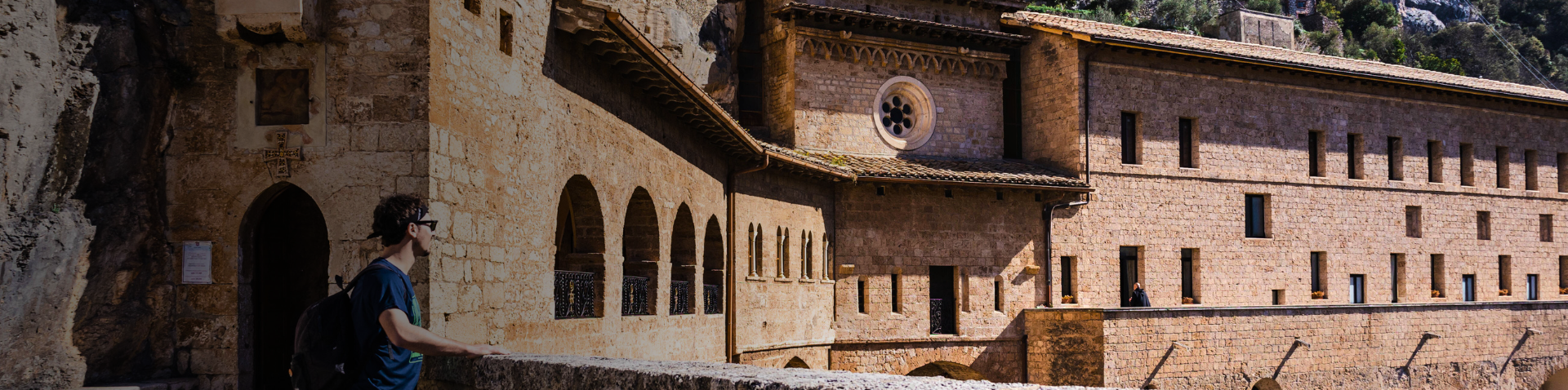
The path starts in Norcia, birthplace of St. Benedict, nestled at the foot of the Sibillini Mountains. The town, famous for its salubrious air and gastronomy ranging from pork products to mushroom and truffle dishes, welcomes pilgrims with the evocative square dedicated to the saint, overlooked by the Basilica of St. Benedict, whose elegant Gothic facade survived the earthquake. In the center, the statue of the saint appears to show the way forward. The first section unfolds on the plateau of Santa Scolastica, among cultivated fields and open landscapes. You proceed at a leisurely pace, surrounded by the undulating profiles of the Apennines. You then face a saddle to cross: a challenging but rewarding climb, introducing you to a panorama that gradually opens up to the valley below. The descent to Cascia accompanies the pilgrim in an increasingly gentle environment, among rural villages and glimpses of great quiet. Cascia, birthplace of Saint Rita, is a destination of intense devotion. The Basilica and Monastery dedicated to the “Saint of the Impossible” welcome thousands of pilgrims each year, especially on May 22, her feast day. A stop at this place of faith is an opportunity to gather thoughts and prayers, amid the silence of the convent and the echo of the mountains.
STAGE 02
STAGE 02: From Cascia to Monteleone di Spoleto
Departure: Cascia
Arrival: Monteleone di Spoleto
Distance: 17.9 km
Height difference: +688 m/ – 413 m
Leaving Cascia, the path takes the striking Santa Rita Trail, a path carved into the rock overlooking the Corno stream. The view is exciting and the pace becomes meditative as you reach Roccaporena, the village where Santa Rita was born in 1381. Here pilgrims can visit the house where the saint was born and climb the 300 steps that lead to the Sacro Scoglio, a rocky outcrop where Rita used to retreat in prayer. Tradition has it that she prayed there so intensely that she left the imprints of her knees and elbows etched in the rock. Through silent forests and paths surrounded by greenery, the path becomes more solitary and gains altitude until it reaches Monteleone di Spoleto, a medieval village perched more than 1,000 meters above sea level. Surrounded by unspoiled nature and dominated by an ancient castle, the village welcomes with the charm of its ancient stones and alleys. A faithful reproduction of the famous Biga of Monteleone, a fine parade chariot from the 6th century B.C. found in 1902 near the village, is preserved here. The original artifact, stolen at the time, is now on display at the Metropolitan Museum in New York. A fragment of very ancient history that testifies to the importance of these lands well before the Franciscan era.
STAGE 03
STAGE 03: Monteleone di Spoleto – Leonessa
Departure: Monteleone di Spoleto
Arrival: Leonessa
Distance: 13.1 km
Height difference: +256 m/ – 238 m
A relaxing, climb-free STAGE, marking the transition from Umbria to Lazio by crossing the Leonessan plateau, at an altitude of 1,000 meters, with the imposing backdrop of the Reatini Mountains. The landscape opens up, the walk is wide and bright, accompanied by the quiet of the plateau and the distant profiles of the Apennine peaks. The destination is Leonessa, a town founded in 1278 by Charles of Anjou on the northern border of the Kingdom of Naples. Its intimate and well-preserved historic center testifies to the ancient prosperity achieved in the 16th century, when Emperor Charles V gave it to his daughter Margaret of Austria. The heart of the town is Piazza VII Aprile, where St. Peter’s Church stands, with its Gothic bell tower and two overlapping churches. Next door, the Collegiate Church offers a splendid view of the valley. A short distance away is the Church of St. Francis, built shortly after the founding of the town and a valuable testimony to the spirituality of the time. Completing the cultural itinerary are the Sanctuary of St. Joseph and the church of Santa Maria del Popolo, along the elegant Corso San Giuseppe. Leonessa welcomes the pilgrim with its history, architecture and an atmosphere suspended in time.
STAGE 04
STAGE 04: Leonessa – Poggio Bustone
Departure: Leonessa
Arrival: Poggio Bustone
Distance: 14.1 km
Height difference: +550 m/ – 700 m
This STAGE gives the experience of high altitude, reaching 1,500 meters above sea level: it is the highest point of the entire Camino. It crosses the Reatini Mountains, along a challenging but extraordinarily evocative route, amidst extensive beech forests and spectacular views of the Sacred Valley. After the initial climb, you reach the Prati di San Bartolomeo, a wide clearing where an oratory once stood and today horses and cattle graze freely. A little further along the ridge is a stone boundary stone that once marked the border between the Kingdom of Naples and the Church State. Nearby is also the only spring on the STAGE, the Petrinara spring, useful for a restorative stop. The descent leads to the village of Poggio Bustone, known for being the birthplace of Lucio Battisti and for its tasty porchetta, but especially dear to Franciscan memory. Here stands the convent of St. James, built near the caves where Francis used to retire in prayer. From the convent, a path through the woods leads to the Sacro Speco: the cave where the saint received forgiveness for his youthful sins. The view from up there, over the Reatina Valley, is among the most beautiful on the path.
STAGE 05
STAGE 05: Poggio Bustone – Rieti
Departure: Poggio Bustone
Arrival: Rieti
Distance: 17.4 km
Height difference: +200 m/ – 610 m
A STAGE through the Sacred Reatine Valley, the heart of Franciscan spirituality, among shady forests and breathtaking panoramic views, with destination Rieti, the ancient capital of Sabina. The path descends gently from Poggio Bustone and reaches Cantalice, a village surprising for its vertical structure, clinging to the mountainside. Below, outside the town, is the Sanctuary of San Felice all’Acqua, dedicated to the first Capuchin saint: tradition has it that he made water gush from a rock with his staff to quench the shepherds’ thirst. Continuing along paths and shady stretches, one arrives at the Sanctuary of “La Foresta,” a place dear to St. Francis, who found refuge here while awaiting treatment for his eyes. In the silence of nature, the saint supposedly composed the Hymn of Creatures, one of the highest spiritual songs in history. The STAGE concludes in the city of Rieti, passing through its medieval city walls and touching on monuments from Roman times, such as the ancient bridge over the Velino River and the evocative underground passageways of the Via Salaria. In the center, the Cathedral of Santa Maria Assunta welcomes pilgrims: in the crypt, according to tradition, Francis also prayed during his stays in the Sacred Valley.
STAGE 06
STAGE 06: Rieti – Rocca Sinibalda
Departure: Rieti
Arrival: Rocca Sinibalda
Distance: 20.2 km
Height difference: +450 m/ – 320 m
Leaving Rieti, the path follows a stretch of the ancient Via Salaria, among rows of linden trees and the quiet of the Sabine countryside. It skirts for a stretch the Turano River, whose clear waters accompany the steps to the beginning of the challenging climb to Belmonte in Sabina. The small village climbs up a ridge that divides two valleys, giving wide views of the surrounding landscape. A brief stop in Belmonte is an opportunity to rest and savor the silence of the mountains. From here we set off again on a scenic, slightly downhill route through olive groves and woods until we reach Rocca Sinibalda. The village is overlooked by an imposing eagle-shaped fortress, built in 1084 and transformed over the centuries into a fine Renaissance castle. From 1200 to 1500 it belonged to the Mareri family, from which descended Filippa Mareri, the first Franciscan saint, a contemporary of Francis of Assisi. The presence of her spirit can still be felt within the walls of the village, which seems to keep time intact.
STAGE 07
STAGE 07: Rocca Sinibalda – Castel di Tora
Departure: Rocca Sinibalda
Arrival: Castel di Tora
Distance: 15 km
Height difference: +300 m/ – 250 m
The STAGE winds through the green and silent valley of the Turano River, where time seems to flow more slowly. We walk through woods and cultivated fields until we reach the tiny village of Posticciola, nestled on a rocky spur. Here, the rural past lives again in the premises of the ancient washhouse and the small but valuable Museum of Traditions. Just below the village, the Roman Bridge — actually a medieval reconstruction from the 11th century on an earlier Roman artifact — tells stories of travelers and trade along the ancient valley. Past the dam on the river, the path continues along the shores of Lake Turano. For about ten kilometers, the path follows the sinuous line of the water, amid wooded reflections and silences interrupted only by the wind. Castel di Tora appears almost suddenly, clinging to the hillside like a stone crib. Listed among the most beautiful villages in Italy, its historic center is a labyrinth of alleys and enchanting views, where every corner offers a different view of the lake below. The pace becomes slow to fully enjoy the unspoiled beauty of this place.
STAGE 08
STAGE 08: Castel di Tora – Orvinio
Departure: Castel di Tora
Arrival: Orvinio
Distance: 13.5 km
Height difference: +750 m/ – 540 m
The STAGE opens with a determined ascent along a scenic trail, offering spectacular views of Lake Turano. Among gorse bushes and free-roaming animals, the pace slows naturally, inviting frequent stops to admire the landscape. After a short stretch in the woods, you reach the pass at 1,160 meters above sea level: the view opens onto vast valleys, and a little further down you can see Pozzaglia Sabina, a mountain village linked to the figure of St. Agostina Pietrantoni, patron saint of nurses. In the small village it is possible to visit her birthplace and the church that holds her remains. We then continue to the Piano di Orvinio, a wide and silent clearing where stands the abbey of Santa Maria del Piano, a fascinating testament to 9th-century Romanesque architecture, built – according to tradition – to celebrate a victory of Charlemagne against the Saracens. The day ends in Orvinio, one of the most beautiful villages in Lazio, set in the Monti Lucretili Regional Park. Don’t miss the church of Santa Maria dei Raccomandati and that of San Giacomo, with an octagonal plan and attributed to Gian Lorenzo Bernini. A place suspended between art, spirituality and nature.
STAGE 09
STAGE 09: Orvinio – Mandela
Departure: Orvinio
Arrival: Mandela
Distance: 20.1 km
Height difference: +600 m/ – 940 m
We leave Orvinio walking almost exclusively on paths immersed in the Monti Lucretili Regional Park. The route begins uphill to the locality of Praterelle, then enters a dense oak forest that leads to an altitude of 1,100 meters. Once the ridge is reached, a long and pleasant descent opens among gorse bushes and wide views of the Sabine countryside to the village of Licenza. Here is the famous villa of the poet Horace, immersed in the nature that so inspired his verses. Leaving the village, it climbs briefly to a scenic ridge overlooking the Aniene River valley, with views ranging from the nearby Ruffi Mountains to the more distant Simbruini peaks. From Pian di Papa, a wide clearing where Pope John Paul II loved to pause in meditation, we descend through the woods to Mandela, a small village dominated by an imposing medieval tower. The last part of the STAGE leads to Vicovaro, where on the cliff of San Cosimato stands a striking monastery, built over an ancient complex of Benedictine hermitages and the remains of Roman aqueducts, at the narrowest and most spectacular point of the Aniene Valley.
STAGE 10
STAGE 10: Mandela – Subiaco
Departure: Mandela
Arrival: Subiaco
Distance: 29.2 km
Height difference: +250 m/ – 200 m
An entirely flat STAGE, winding on paths through the woods following the course of the Aniene River, in a silent and regenerating landscape. No built-up areas are crossed along the way, but short detours make it possible to visit charming villages such as Anticoli Corrado, with its colorful houses overlooking the valley, Marano Equo and Agosta, clinging to the rocks. The destination is Subiaco, a key place in the spiritual story of St. Benedict. Here the saint lived for thirty years: first in solitude, then as leader of small monastic communities. The heart of his journey is the Sacro Speco, the monastery built on the original hermitage. A unique complex, leaning against the face of Mount Taleo, it encloses two overlapping churches, entirely frescoed in the 14th century with episodes from the life of St. Benedict and Gospel scenes. The cave where the saint lived for three years in prayer is still visible today-a place of deep recollection. On one wall, a fresco depicting St. Francis of Assisi, who came here on pilgrimage in 1224, stands out. A little further down, the Monastery of St. Scholastica welcomes visitors with its cosmatesque cloister, the oldest bell tower in Lazio and a library of more than 150,000 volumes. It was here, in 1465, that the first book in Italy was printed by two of Gutenberg’s pupils, marking another milestone in European culture.
STAGE 11
STAGE 11: Subiaco – Trevi nel Lazio
Departure: Subiaco
Arrival: Trevi nel Lazio
Distance: 17.1 km
Height difference: +430m/ – 150m
With the 11th STAGE we enter the heart of Ciociaria, a land of ancient traditions, authentic flavors and villages rich in history. The route follows a quiet forest road along the course of the Aniene River, immersed in the protected nature of the Monti Simbruini Park. Along the way, places of extraordinary natural beauty are encountered. Shortly after the start, the small lake of San Benedetto surprises with its clear, emerald waters, which have earned it the nickname “the Caribbean of Rome.” A little further on, you come across the Cascata di Trevi, among the most scenic waterfalls in Lazio, hidden in the woods and set in an evocative place where, in Roman times, the Anio Novus, the main aqueduct that supplied Rome, originated. Continue through woods and trails until you reach Trevi nel Lazio, a village of ancient origins perched on a rocky outcrop. In Roman times it was so important that it earned the title of Augusta because of the abundance of its water. Visit the Caetani Castle, with its severe and panoramic bulk, and the Collegiate Church of Santa Maria Assunta, which houses a fine monumental organ from 1634. Trevi is the ideal place to end a day’s walk, amid ancient silences and glimpses that tell millennia-old stories.
STAGE 12
STAGE 12: Trevi nel Lazio – Collepardo
Departure: Trevi nel Lazio
Arrival: Collepardo
Distance: 22 km
Height difference: +600 m/ – 820 m
We leave Trevi nel Lazio by ascending a mule track immersed in the woods until we reach the Arch of Trevi, a majestic stone arch from Roman times, an ancient customs post located on the border between the territory of Rome and the lands of the Equi, an Italic population with deep roots. The path continues through wide pastures, where one often encounters animals in the wild and enjoys glimpses of a generous and unspoiled nature. The first intermediate STAGE is Guarcino, known as the “water village” for its abundance of fountains offering high-quality mineral water, still bottled today. The village is also famous for its amaretti, delicious almond-based sweets with a long tradition of craftsmanship. Continuing on, you reach Vico nel Lazio, enclosed by an imposing, perfectly preserved medieval city wall, which has earned it the nickname “Ciociaria’s little Carcassonne.” The towers and gateways to the town create an atmosphere out of time. The STAGE destination is Collepardo, the “town of herbs,” known for a centuries-old herbal tradition developed by the Carthusians, once present in the nearby monastery of Trisulti. Not far from the village are two spectacular geologic phenomena: the Pozzo d’Antullo, a karst sinkhole with a circumference of more than 300 meters and a depth of more than 70, and the Grotte dei Bambocci, so named for the peculiar stalactites with shapes reminiscent of childlike figures, creating an almost fairy-tale atmosphere. However, as of today, the caves are closed until spring 2026.
STAGE 13
STAGE 13: Collepardo – Casamari
Departure: Collepardo
Arrival: Casamari
Distance: 25 km
Height difference: +680 m/ – 970 m
From the center of Collepardo we start uphill again along an ancient Roman track, entering a splendid forest reserve. The route leads to the majestic Carthusian Monastery of Trisulti, immersed in centuries-old woods and monastic silence. Founded in 1204 at the behest of Pope Innocent III, it is one of the highest examples of Carthusian architecture in Italy. Inside are frescoes, wooden carvings and the 18th-century pharmacy, a small masterpiece with original furnishings and ancient stills. A little further down is the Sanctuary of the Madonna delle Cese, set in the rock, where popular devotion is combined with the intimate atmosphere of the place. However, the shrine is currently closed due to beginning restoration work. The walk continues in a hilly environment, among woods and glimpses of the Ciociaria countryside, until it reaches Casamari, one of the most important and best-preserved Cistercian abbeys in Italy. Founded in the 12th century, it is an admirable example of Cistercian Gothic: its abbey church, austere and luminous, is a forest of arches and pillars that astonishes with its balance and harmony. Even today the abbey is inhabited by a community of monks, who welcome pilgrims and the faithful and celebrate liturgies in Gregorian chant, making the visit a deeply spiritual experience.
STAGE 14
STAGE 14: Casamari – Arpino
Departure: Casamari
Arrival: Arpino
Distance: 21.9 km
Height difference: +350 m/ – 180 m
The route winds through a rather anthropized area, but there is no shortage of surprises: Isola del Liri welcomes the pilgrim with an extraordinary sight. Right in the heart of the urban center, between palaces and squares, a 30-meter-high waterfall thunders down, creating a unique natural spectacle. A break here, perhaps with coffee or ice cream, is almost a must. Those who wish to shorten the STAGE can choose a shorter variant that shortens the route by about 6 km and leads directly to Arpino. Otherwise, the walk continues along the Liri River to the striking Abbey of San Domenico in Sora, founded in 1011 by St. Dominic of Sora on the site that tradition says was the birthplace of Marcus Tullius Cicero. Of great charm is the crypt, where the Saint’s remains rest. The walk continues along the course of the Fibreno River, amid river landscapes and lush vegetation, until it climbs sharply back toward Arpino. Here you can visit the majestic acropolis of Civitavecchia, surrounded by imposing megalithic walls and embellished by a rare pointed arch, the only one of its kind in Italy. Arpino is a city dense with history, the birthplace of Cicero, but also the custodian of panoramas and atmospheres that speak to the traveler’s soul.
STAGE 15
STAGE 15: Arpino – Roccasecca
Departure: Arpino
Arrival: Roccasecca
Distance: 17.7 km
Height difference: +440 m/ – 650 m
The STAGE enters the Melfa Gorge, a wild and spectacular stretch where silence and nature reign. The high rock walls are home to golden eagles and guard ancient rock hermitages dating back to the first centuries of Christianity, such as the Hermitage of the Holy Spirit, set in the rock. Along the way, only one town is encountered: Santopadre, perched on a rocky outcrop and overlooking a breathtaking landscape. After a well-deserved rest, you descend to the bottom of the gorge to continue along the Tracciolino, an ancient Bourbon road carved into the valley wall, to be traveled carefully but also with wonder. Finally we reach Roccasecca, dominated by the remains of the medieval castle where St. Thomas Aquinas was born around 1225. An imposing statue of the philosopher-theologian welcomes the pilgrim at the entrance to the village. The well-kept and welcoming historic center also preserves the oldest church in the world dedicated to the saint, closing the STAGE with a strong spiritual and cultural appeal.
STAGE 16
STAGE 16: Roccasecca – Montecassino
Departure: Roccasecca
Arrival: Monte Cassino
Distance: 19 km
Height difference: +450 m/ – 200 m
The final STAGE of the Camino winds initially on secondary asphalt roads, passing through small towns such as Caprile, where the ancient hermitage of Sant’Angelo in Asprano stands, and then Castrocielo, Piedimonte San Germano and Villa Santa Lucia, in a hilly landscape increasingly dominated by the presence of the imposing Montecassino. As one leaves the asphalt to take the final path, anticipation grows. After a bend, the abbey of Montecassino suddenly appears, majestic and solemn, perched on top of the mountain like a vision. The entrance greets the pilgrim with a single word carved in large letters: PAX, an invitation to peace that encapsulates the meaning of the entire path. The journey ends inside the basilica, in front of the high altar, under which rest St. Benedict and St. Scholastica, brothers in blood and spirit. After many days of walking, toil and beauty, the pilgrim finds here a destination and a beginning: a place where body and soul can finally stop, and breathe peace.


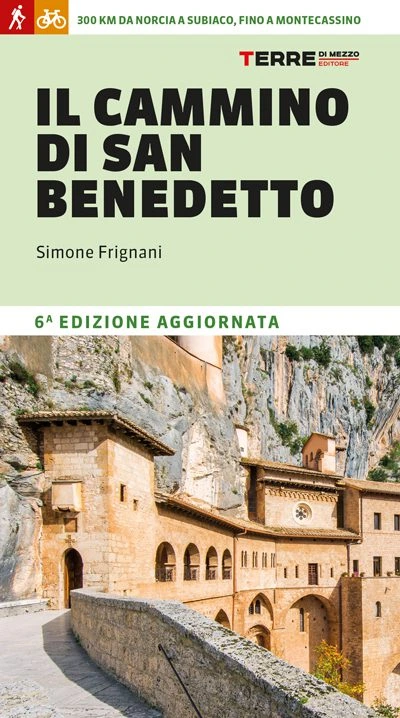
CAMMINO DI SAN BENEDETTO GUIDE.
Sixth updated edition
On foot or by bicycle along a unique itinerary between Umbria and Lazio, in the footsteps of St. Benedict, touching on the three most significant places of his life: Norcia, where he was born; Subiaco, where he drew up his Rule; and Montecassino, where he founded the abbey capable of rebirth after four destructions. A sixteen-stage route that follows ancient transhumance routes and paths, passing through evocative valleys, fortresses, medieval castles and hilltop villages.
The guidebook offers all the practical information for setting out on the trail: best times to set out, preparation, detailed route description, maps, elevations, GPS tracks, hospitality and places to visit. There is no shortage of historical and naturalistic insights, a technical section dedicated to cyclists and the most suitable variants for two wheels.


Journey diaries

CAMMINO DI SAN BENEDETTO
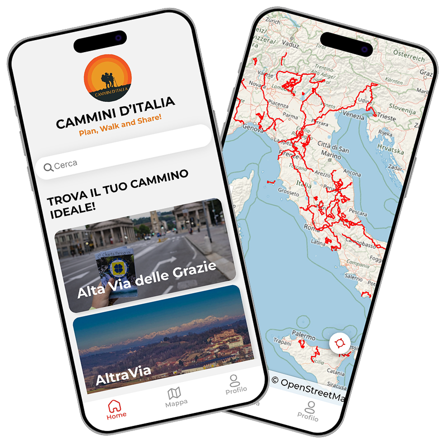
With the free Cammini d’Italia app, you can plan and walk The CAMMINO DI SAN BENEDETTO in total safety, being able to plan the stages in detail and walk the route thanks to the integrated GPS technology that supports your orientation during your adventure.
⠀Inside the app you will find many other paths present in Italy. Thanks to the georeferenced tracks of many routes you will be able to study the itinerary that suits you best and also download the GPX tracks of the individual STAGEs offline.
The app also includes a complete digital map of all the paths surveyed to date on our portal, giving you a wide range of choices among the many paths in the Belpaese.
⠀⠀
Cammini d’Italia is the perfect app for those who want to explore the beauty of Italy on foot, discovering hidden places surrounded by nature. Download it for free today and start planning your next adventure!
⠀
⠀
 ⠀⠀⠀
⠀⠀⠀