Cammino Tuscia 103
The route, runs from east to west through Tuscia starting from Orte Scalo train station.
After reaching Vasanello and Soriano nel Cimino it climbs Mount Cimino, the largest of the Cimini mountain range covered on the summit by the beautiful Mount Cimino Beech Forest recently listed as a UNESCO World Heritage Site. Following the well-maintained Cai signs through the woods after a visit to the splendid village of San Martino al Cimino with its Cistercian Abbey, it reaches Monte Fogliano with the Natural Reserve of Lake Vico with its evocative panoramic views of the lake, beautiful woods and the characteristic Hermitage of San Girolamo carved into the volcanic rock. Still in the Viterbo municipal territory, we cross the Via Francigena, both the normal and the uphill variant. Continuing along the itinerary, you reach the heart of ancient Etruria, the towns of Barbarano Romano, the necropolis of San Giuliano and considerable centers of historical - archaeological interest such as Barbarano Romano, The Marturanum Park, the archaeological areas of San Giovenale, Luni on the Mignone until you reach Monte Romano and Tarquinia passing through the ancient Etruscan city with the temple of the Ara della Regina dated around the 4th century BC. For the crossing it is possible to make use at the departure and arrival of the FF.SS railway lines of Orte Scalo and Tarquinia, the Vetralla railway station halfway along the route, and the Cotral lines to reach all the towns along the route.
I walk in the ancient land of southern Etruria from the valley of the Tiber River to the Tyrrhenian Sea.
It starts from the Orte FFS station and arrives in Tarquinia.
It passes through archaeological areas of Etruscan-Roman times, medieval villages, the beech forest of Mount Cimino World Natural Heritage Site, skirts the Vico Reserve with the highest lake of volcanic origin in Italy, and crosses the Latium Maremma.
Countries crossed : Orte Scalo, Vasanello, Sant'Eutizio, Soriano nel Cimino, San Martino al Cimino, La Botte di Vetralla, Barbarano Romano, Civitella Cesi, Monte Romano and Tarquinia.
Archaeological areas traversed: Palazzolo, San Giuliano, San Giovenale, Luni sul Mignone, Civita di Tarquinia.
The Cammino is served by no less than 4 train stations: Orte Scalo FFS Station, Tarquinia FFS Station, Vetralla FFS Station and Soriano nel Cimino ATAC Station, all of which are connected with Rome, allowing various stretches to be organized independently without making use of private vehicles.
The Path is all marked with CAI signs (path No. 103) and can be walked in either direction.
HISTORY
The Cammino Tuscia 103 was created on the initiative of the Italian Alpine Club, Section of Viterbo, which traced it and takes care of the signage. The participation and contribution to the project of entities and administrations affected by the route (Municipalities, Parks and Reserves, Volunteer Associations) was fundamental.
WATER SOURCES.
The Cammino passes through numerous villages with services and drinking water fountains: Orte Scalo, Vasanello, Sant’Eutizio, Soriano nel Cimino, San Martino al Cimino, La Botte (Vetralla), Barbarano Romano, Civitella Cesi, Monte Romano and Tarquinia.
Drinking water points are available and marked along the route:
– Pinetina rest area: 33T 268094 – 4697151
– St. Angelo rest area: 33T 263033 – 4688961
– Caiolo rest area: 33T 269454 – 4683150
– Canalicchio rest area: 32T 743373 – 4678934
STAGE
STAGE 1:
Orte Scalo to Vasanello (9.2 km and 378 m elevation gain). From Orte FFS Station (Orte Scalo) cross Corso Garibaldi, Via Puccini and Via del Poggio and then climb up a steep asphalt road (very little traffic); pass the junction with path 198 to Orte and continue to Provincial Road 30. Continue to Località Bagnolo (possibility of lodging) then always following the provincial road to Vasanello (very little vehicular traffic). The STAGE ends in the main square of Vasanello.
STAGE 2:
Vasanello to Soriano nel Cimino (14.4 km and 380 m elevation gain). From Piazza della Repubblica in Vasanello, take Strada Vasanellese and, following CAI signs, immediately turn right onto Via Taglione, Via dei 4 Venti, Via Fontana Vecchia and Via Palazzolo, which leads to the Palazzolo Archaeological Area and the Morticelli necropolis. Continue along a dirt road through countryside until you cross a forest that leads to the village of Sant’Eutizio in the Municipality of Soriano nel Cimino, skirting the Church and Convent of Sant’Eutizio.
Drive through the village and take a paved road with little vehicular traffic that climbs to the village of Soriano nel Cimino. The following itinerary is recommended in Soriano: coming from Sant’Eutizio, take Via della Galleria and then turn left going up Viale Ernesto Monaci, which you continue up to a flight of steps on the left (in front of the school) that leads to the belvedere; walk along the belvedere (Via Vittorio Emanuele III) to the main square of Soriano.
STAGE 3:
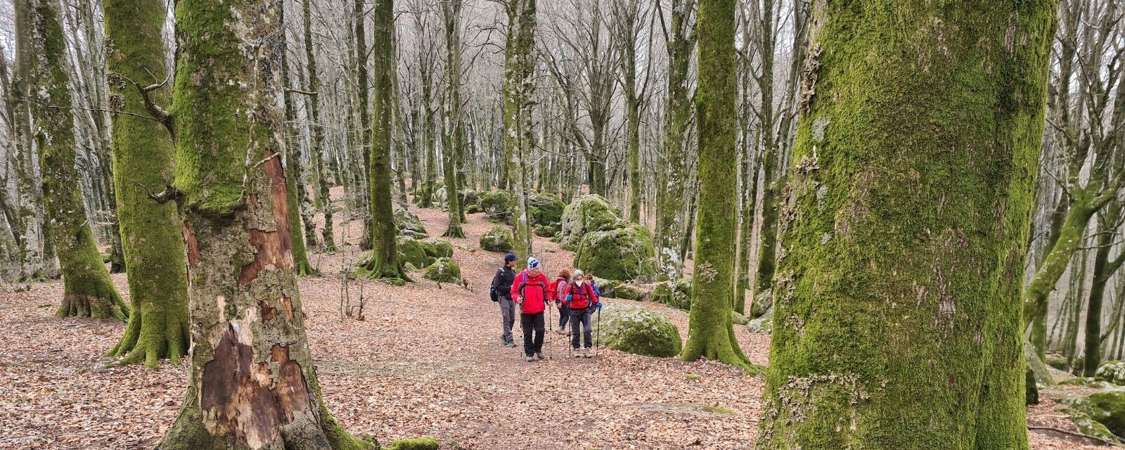
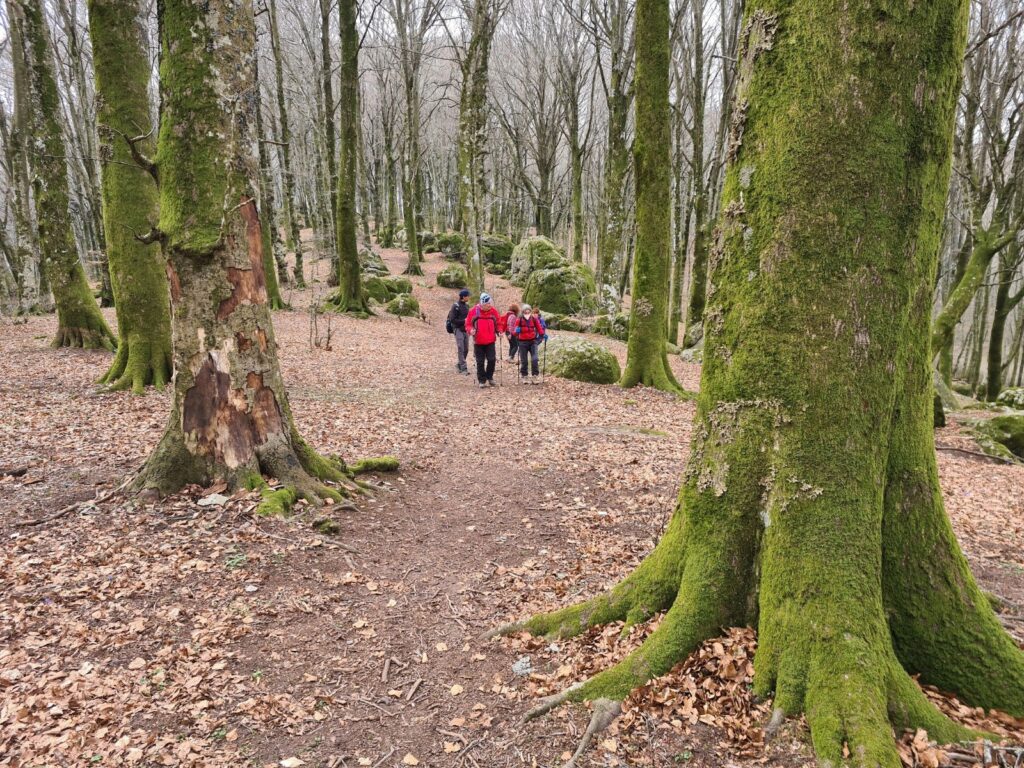
Soriano nel Cimino to San Martino al Cimino (19.7 km and 940 m elevation gain). This is a challenging STAGE in terms of elevation gain, passing through beautiful forests of the Cimini Mountains and Lake Vico. Start in Soriano nel Cimino, from Via Roma to Via delle Bandite from where a dirt road begins that climbs to Mount Cimino crossing the Faggeta provincial road. The last part of the climb is a path in the chestnut woods and then enters the monumental beech forest, a UNESCO heritage site. The trail arrives near the summit of Mount Cimino, which can be reached with a short detour, and then begins the descent to Valle Gelata and the woods of the Comunità Montana dei Cimini. You ascend until you reach Poggio Nibbio and then cross a plateau from which you can enjoy a beautiful panorama in a northerly direction, the Cimini Mountains and the mountains of Lake Bolsena. Follow a forest road that skirts Lake Vico and then turn right onto path 120D, which descends to San Martino al Cimino.
STAGE 4:
San Martino al Cimino to La Botte (12.3 km and 461 m elevation gain). From the village of San Martino al Cimino, take path 120D that climbs to Lake Vico and joins Path 103. With suggestive panoramic views of Lake Vico, the beautiful woods of Mount Fogliano, you reach the Hermitage of San Girolamo and the Convent of Sant’Angelo (accommodation available). Descending further along the Fogliano woods, you reach La Botte.
Along the way, just before La Botte, we cross Via Francigena.
STAGE 5:
La Botte to Barbarano Romano (9.8 km and 165 m elevation gain). At La Botte there is a connection with the Roma Viterbo railway (Vetralla FFS station). From La Botte you take Via Valle Carbona and continue through the Macchia delle Valli forest; you then pass through white roads that slope down to the Necropolis of San Giuliano, which you cross skirting some of the most beautiful and representative tombs: there is the possibility, following the Park signs, to visit all the other tombs as well as the Romanesque church of San Giuliano. We then reach the village of Barbarano Romano where the Marturanum Park has its administrative headquarters.
Stage 6:
Barbarano Romano to Civitella Cesi (7.3 km and 137 m elevation gain). From the built-up area of Barbarano Romano you meet the route of the abandoned Orte Civitavecchia railway and enter the Marturanum Park; continue along 103 in the Park territory in a very wild area among woods and pastures meeting the junctions of trails No. 105 for Blera and No. 105 for Vejano. At the exit of the Park is the junction with path 138b and then the municipal road to Civitella Cesi.
STAGE 7:
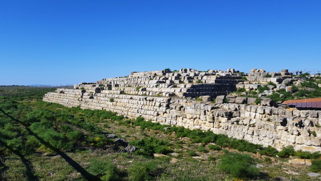
Civitella Cesi to Monte Romano (18.6 km and 410 m elevation gain). From the Piazza del Castello in Civitella Cesi follow the CAI signs downhill until you join the provincial road 42 for a beve stretch, which you leave by turning left after the bridge over the Vesca River. You skirt the Vesca for about 1 1/2 km in the wilderness until you divert to the Archaeological Area of San Giovenale. Proceed to the old Monte Romano station where, with a detour, it is possible to visit the archaeological area of Luni on the Mignone. It goes up to Monteromano passing by the old mill and crossing wild areas of the Latium Maremma with beautiful views towards the sea.
WARNING! The route passes through beautiful wilderness areas where cell phone signal is absent for a few kilometers. It is highly recommended that you equip yourself with a satellite phone or radio so that you can communicate. In any case notify someone of your departure for the STAGE.
STAGE 8:
Monte Romano to Tarquinia (18.5 km and 320 m elevation gain). From the village of Monte Romano, you walk along Via Vittorio Emanuele and then Via Giovanni XXIII. You then cross the
picturesque countryside with beautiful views toward the sea. After about 12.5 km you reach Tarquinia Vecchia, a very important archaeological area with the famous Ara della Regina. You descend to Fosso San Savino, which you skirt and then turn left and then climb up Via di Fontana Nuova and Via di Porta Castello.
SERVICES PRESENT STAGE BY STAGE
STAGE 1: Supermarkets in Orte Scalo.
STAGE 2: Supermarkets in Vasanello
STAGE 3: Supermarkets in Soriano nel Cimino
STAGE 8: Supermarkets in Tarquinia
Pharmacies in the countries of: Orte Scalo, Vasanello, Soriano nel Cimino, San Martino al Cimino, Barbarano Romano, Monte Romano and Tarquinia
SIGNAGE
CAI signage present along the way
DANGERS
There are no dangers along the way.
WARNING. Along the Civitella Cesi – Monte Romano STAGE, the route passes through beautiful and wild areas where cell phone signal is absent for a few kilometers. It is highly recommended that you equip yourself with a satellite phone or radio so that you can communicate. In any case notify someone of your departure for the STAGE.
ACCESSIBILITY
The first 2 STAGES are walkable by people with disabilities.
ROAD BOTTOM.
Percentage of asphalt: about 10 percent
CREDENTIALS
Credentials are available at a cost of 3 euros, which are stamped at each STAGE point.
TENT WALK
Organizers of the Camino are studying the possibility of having authorized spaces to stay in tents.


Cammino Tuscia 103
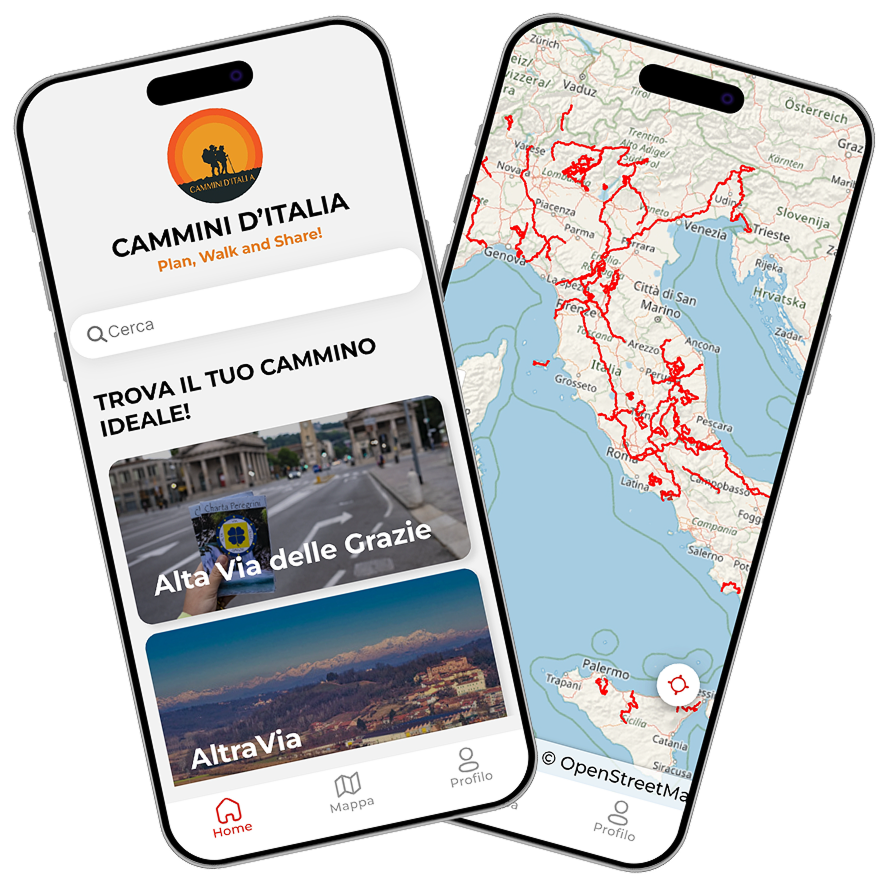
With Cammini d’Italia’s free app, you can plan and walk The Cammino Tuscia 103 safely, being able to plan the stages in detail and walk the route thanks to the built-in GPS technology that supports your orientation during your adventure.
⠀Inside the app you will find many other paths present in Italy. Thanks to the georeferenced tracks of many routes you will be able to study the itinerary that suits you best and also download the GPX tracks of the individual STAGEs offline.
The app also includes a complete digital map of all the paths surveyed to date on our portal, giving you a wide range of choices among the many paths in the Belpaese.
⠀⠀
Cammini d’Italia is the perfect app for those who want to explore the beauty of Italy on foot, discovering hidden places surrounded by nature. Download it for free today and start planning your next adventure!
⠀
⠀
 ⠀⠀⠀
⠀⠀⠀