Il cammino delle Valli
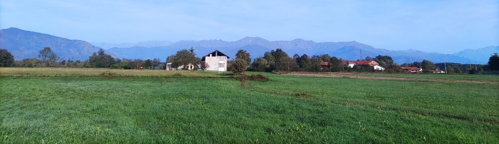
The route passes through the picturesque Lanzo Torinese Valleys, including Val di Viù, Val d’Ala, Val Grande and Tesso, Malone and Fandaglia. Along the way, you can see as many as five parks, reserves and sites of great natural interest, all managed by the Royal Parks Authority.
The Cammino delle Valli is the brainchild of Beppe Lianza in early 2022. The walk is 103 km long and is a loop route with departure and arrival in Caselle Torinese, the location of the headquarters, at the Stella Polare Association in Piazza Garambois 4.
The four Valli di Lanzo Torinese valleys-Viù, Val d'Ala, Val Grande and Tesso, Malone and Fandaglia-are traversed, and it touches as many as five parks, reserves and sites of interest all managed by the Royal Parks Authority. The least involved is Mandria Park, barely lapped along the bank of the Stura. It goes up the bank along the contiguous area to Devil's Bridge Park, as well as through the Pugnetto caves and Vauda Park. It is a path that travels along mountain paths, white roads...passing by mule tracks, ancient bridges dating back to the 16th century (such as Ponte il Ponte di Vana or Ponte Barolo) and small hamlets where time seems to stand still such as Pugnetto, Cresto and Fornelli.
HISTORY
The Lanzo Valleys are three valleys in the Piedmontese Graian Alps between the Orco Valley to the north and the Susa Valley to the south. Furrowed by several streams, which flow into the Stura di Lanzo River, they take their name from the town of Lanzo Torinese, located on an ancient glacial moraine at the end of the valleys.
The territory was subject to little Romanization, mainly because the Romans preferred to use the nearby Susa and Aosta valleys for transalpine trade for geographical and orographic reasons, which led to poor development and investment from an infrastructural point of view. A road was built from Augusta Taurinorum (Turin) to the Autaret and Arnas passes in Val di Viù, but these were very little used except by the local population for exchanges and meetings with people from beyond the Alps.
In the Middle Ages the valleys were called Mategasche, precisely from the town of Mathi, located before Balangero. Fortifications were built in the villages at the base of the valleys such as Lanzo Torinese and Balangero. It was precisely at this time that the lordship of the bishop of Turin extended into these valleys; meanwhile, the Savoy had already settled in Caselle and Ciriè and took over the valleys shortly after the 13th century.
From June 25, 1944 to the end of September of the same year, the Lanzo Valleys were protagonists in the establishment of the partisan republic of the same name.
WATER SOURCES.
Yes, present at every stage, both as fountains and catering
SERVICES
Stage 1
Present supermarkets, pharmacies, hotels, bars,restaurants and banks
Stage 2
- Lanzo: present supermarket, pharmacies, hospital, restaurants, bars, banks
hotels; - Traves: present restaurant, b&b, supermarket, bar, pharmacy, fountains;
- Mezzenilesono: present restaurant, supermarket, b&b, vacation homes, post office, bank, bar;
- Ceres: present bar, restaurant, b&b, post office, bank, pharmacy.
Stage 3:
- Crest: various fountains;
- Chiaves: supermarket and bar;
- Monastery of Sottoristorante: bar and post;
- Coassolo: hotel and various b&b, restaurant, bar, post office, fountain;
- Corio: bar, restaurant, hotel, post office, bank, pharmacy
Stage 4:
- St. Charles: bars, restaurants, post office, bank;
- St. Francis: bars, restaurants,post office, bank, hotels and various b&b;
The path is served by rail service in the first two stages, and by bus service
in the third and fourth stages.
SIGNAGE
The path is marked with brown and white tourist signs with the words Path of the Valleys. All signs with the path logo or blue sticker with yellow arrow.
DANGERS
The path does not present any particular dangers, but still pay close attention. There are no dangerous animals present, except for animals that frequent the forest: wild boar, deer, foxes.
TENT WALK
Along the way you can camp in tents. Piedmont provides a maximum stay of 48 hours in the same place.
ROAD BOTTOM.
80% dirt 20% asphalt
CREDENTIALS
There is a credential at a cost of €5.
ACCESSIBILITY
Since the walk association is made up of people with disabilities, the walk for some sections can be
walked by people with disabilities.
CONTACTS
E- mail: info@bepamiciincammino.it
Mobile: 3471123328
Website: https://camminodellevalli.it/
STAGE 01
Stage 1: Caselle- Lanzo, km 24, travel time 7 hours, elevation gain 230 mt approx.;
Completely flat stage, skirting the Stura River, on dirt road mostly
in the woods
STAGE 02
Stage 2: Lanzo- Ceres, km 24, travel time 10 hours, elevation gain 990 mt;
Stage with continuous ups and downs, requires excellent preparation for this section, does not present
however grandidifficulty. There are refreshment points and overnight stays to shorten the
stage.
STAGE 03
Stage 3: Ceres- Corio, km 25, travel time 9 hours, elevation gain 840 mt;
This stage reaches the highest point of the walk 1070 m at Cresto, municipality of Monastero
of Lanzo. It presents two big climbs, but not challenging except for the length. Here again there are several refreshment and overnight stops to subdivide the stage.
STAGE 04
Stage 4: Corio- Caselle, km 30, travel time 9 hours, elevation gain 90 mt;
Completely downhill stage in the Canavese countryside. There are also refreshment and overnight stops here until the conclusion of the walk in Caselle Torinese.


Il cammino delle Valli
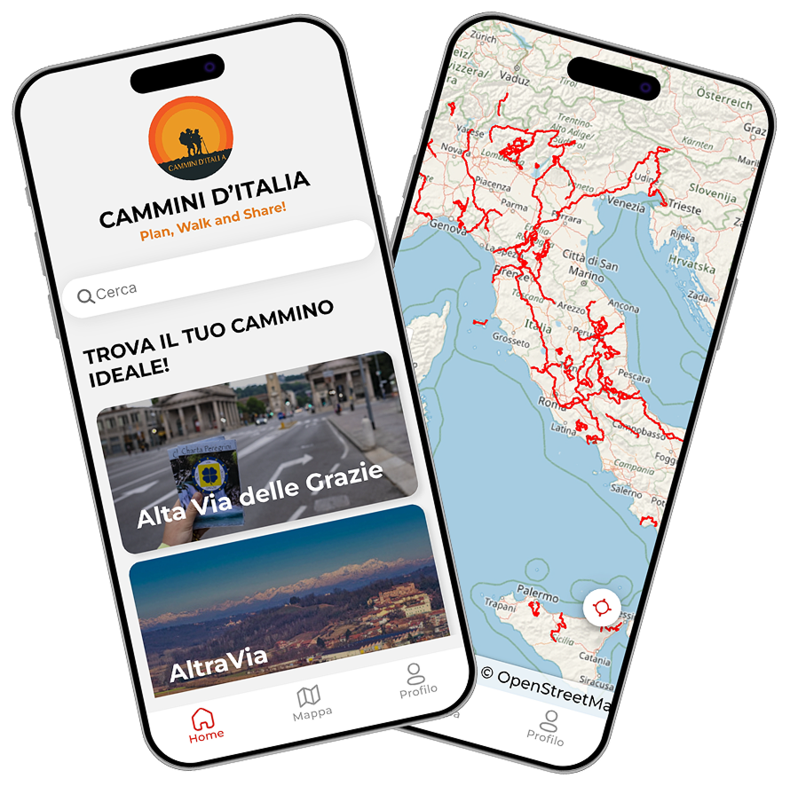
With the free Cammini d’Italia app, you can plan and walk the Cammino delle Valli in total safety, being able to plan the stages in detail and walk the route thanks to the integrated GPS technology that supports you in orientation during your adventure.
⠀Inside the app you will find many other paths present in Italy. Thanks to the georeferenced tracks of many routes, you will be able to study the itinerary that suits you best and also download the GPX tracks of the individual stages offline.
The app also includes a complete digital map of all the paths surveyed to date on our portal, giving you a wide range of choices among the many paths in the Belpaese.
⠀⠀
Cammini d’Italia is the perfect app for those who want to explore the beauty of Italy on foot, discovering hidden places surrounded by nature. Download it for free today and start planning your next adventure!
⠀
⠀
 ⠀⠀⠀
⠀⠀⠀