Via Francigena Lukmanier
An ancient Roman-Longobard route from Constance in central Europe to Pavia via Switzerland.
The Via Francisca del Lucomagno originates in Constance at the German-Swiss border and bypassing the Alps, thanks to the Lukmanier Pass, enters Italy, after 375 km, at Lavena Ponte Tresa and then continues to Pavia by joining the Via Francigena towards Rome.
In Italy, the route is 138.6 km long and runs along forests, bike paths, trails and secondary roads, all in safety, touching important cultural, artistic and religious sites including two Unesco sites and several art cities. The Via Francisca del Lucomagno can be traveled year-round, on foot or by bicycle, thanks to the fact that the Lukmanier Pass in Switzerland, at 1915 meters high, is the lowest in the Alpine area and hardly presents adverse conditions to walkers.
HISTORY
Many illustrious men walked the Via Francisca del Lucomagno, especially the kings and emperors of the Holy Roman Empire such as Otto I the Great, Otto III, Henry II and Frederick Barbarossa, who were also kings of Italy. In fact, this Way in the transalpine territory is also called the Emperors’ Way.
For those coming from central Europe, the Lukmanier Pass was the easiest route, not only because of its low height, but also because of the frequency of villages encountered along its route. The period of greatest use of the route by pilgrims/walkers was between the 8th and 13th centuries.
WATER
Along the way there are several hamlets where you can stock up on water and other foodstuffs.
STAGE
STAGE VIA FRANCISCA DEL LUCOMAGNO
STAGE 01: Lavena Ponte Tresa to Ganna
Description: The first STAGE runs from Lake Lugano to the forests on the slopes of the Varesotto mountains. The departure is from the customs in Lavena Ponte Tresa. After skirting the lake, we ascend via the bicycle path laid on the route of the old tramway and arrive at Argentera Park, an interesting green area full of mills, small streams and majestic trees.
From Cadegliano continue through Marchirolo and Cugliate Fabiasco to Ghirla, with its natural oasis that frames a small lake. Past an ancient mallet, take the bicycle path to the Badia di San Gemolo in Valganna.
Length: 14.2 km
Elevation gain: ascent 363m / descent 135m
Difficulty: medium
Bottom: 100% asphalt
STAGE 02: Ganna to Varese
Description: Next to the Badia San Gemolo in Ganna begins Path 15 of the Campo dei Fiori Park, which leads to Brinzio. From there, continue further through the woods to Rasa and, after a section of provincial road, take a dirt road to Oronco and then arrive at the locality Prima cappella.
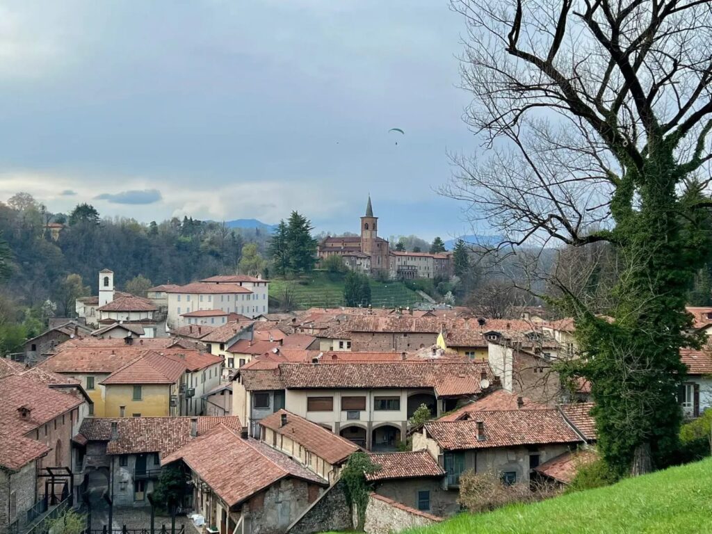
The Via delle Cappelle is a wide cobblestone avenue leading to the village and the Sanctuary of Santa Maria del Monte di Varese punctuated by fourteen chapels dedicated to the Mysteries of the Rosary. The monumental complex has been a Unesco property since 2003. From there, retracing the avenue downhill, after a few kilometers, you reach the center of Varese.
Length: 18.8 km
Elevation gain: ascent 552m / descent 632m
Difficulty: medium
Fund: 37% dirt and 63% asphalt
STAGE 03: Varese to Castiglione Olona
Description: The third STAGE, despite heavy urbanization and many arterial roads, leads us to discover new green areas. From the city center we cross Varese passing by the Estensi Gardens to Villa Recalcati with its park. At Casbeno we take a bicycle path to Capolago and then continue to Gazzada Schianno and Morazzone. The route continues into the RTO (Rile Tenore Olona) Park to reach Caronno Corbellaro passing through a plain from which there is a full view of Seprio and on clear days the Milan skyline. It then continues, with a fair descent, to the art village of Castiglione Olona.
Length: 14.8 km
Elevation gain: ascent 223m / descent 328m
Difficulty: easy
Fund: 17% dirt and 83% asphalt
STAGE 04: Castiglione Olona to Castellanza
Description: The fourth STAGE of the Via Francisca is a succession of “pearls” to be discovered. The departure is from Castiglione Olona, an art village of ancient historical origins located on the course of the Olona River. The trail follows the old Valmorea railroad track leading to Castellanza.
Soon you reach the Monastery of Torba, a UNESCO property nestled in the woods and managed by the FAI. Not far from the road is the monastery of Cairate. The area around the Olona Valley was a flourishing of economic activity in the last century, and as we walk we encounter many examples of industrial archaeology. The route then continues to Castellanza, home of the Liuc University.
Length: 20.7 km
Elevation gain: ascent 44m / descent 100m
Difficulty: easy
Fund: 26% dirt and 74% asphalt
STAGE 05: Castellanza to Castelletto di Cuggiono
Description: On the fifth STAGE we leave the province of Varese and arrive in Castelletto di Cuggiono, in the area of the metropolitan city of Milan. The first part of the route follows the paths of the Alto Milanese park, which covers about 360 hectares, divided between the municipalities of Legnano, Busto Arsizio and Castellanza.
After passing through Buscate, one arrives in Cuggiono, home to the prestigious Villa Annoni, which has the second largest enclosed park in Lombardy. From there you reach Castelletto di Cuggiono positioned on the bank of the Naviglio Grande.
Length: 18 km
Height difference: ascent 0 m / descent 74m
Difficulty: easy
Fund: 45% dirt and 55% asphalt
STAGE 06: from Castelletto di Cuggiono to Abbiategrasso
Description: The sixth STAGE runs all along the towpath of the Naviglio Grande on the plains. After an initial stretch immersed in nature, we pass through several villages characterized by beautiful villas built next to the waterway.
The first village one encounters is Bernate Ticino where it is possible to admire the Rectory of San Giorgio. Then Boffalora Sopra Ticino, a town rich in history that owes its growth precisely to the proximity of the Naviglio. After Ponte Vecchio in Magenta, you arrive at Cassinetta di Lugagnano, one of the oldest villages in the Po Valley. The destination is Abbiategrasso, a town that is a hub of flourishing agricultural and industrial activities where a beautiful Visconti castle is located.
Length: 17.5 km
Height difference: ascent 0 m / descent 35m
Difficulty: easy
Bottom: 100% asphalt
STAGE 07: Abbiategrasso to Bereguardo
Description: The seventh STAGE winds all along the Bereguardo Canal. The first point of interest encountered is Morimondo, which is reached after a 7-km walk. Its Abbey, founded by Cistercian monks in 1134, dominates the valley of the Ticino Park, an area that is a real jewel from an environmental point of view, and has always been a place of worship and spirituality, as well as a place of great interest for agricultural activity, developed thanks to the great works of reclamation of the marshy areas and the presence of the production companies called “Grancie.” The STAGE destination is Bereguardo where a Visconti Castle is encountered.
Length: 18.7 km
Height difference: ascent 0 m / descent 25m
Difficulty: easy
Bottom: 100% asphalt
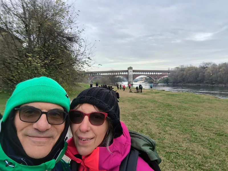
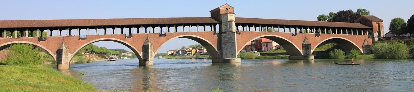
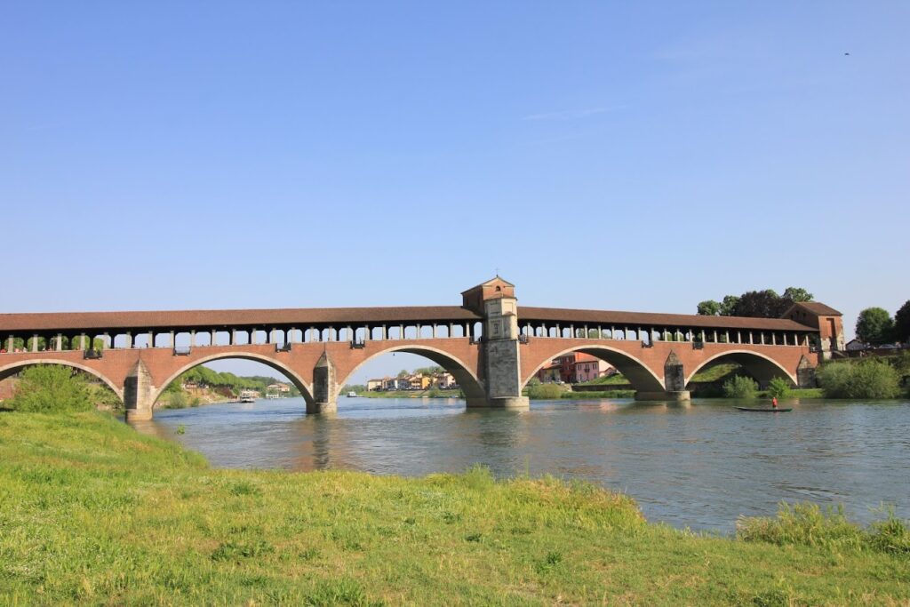
STAGE 08: Bereguardo to Pavia
Description: The eighth STAGE takes us to the province of Pavia. After a few kilometers of walking we arrive in Casottole, which, together with Massaua, is part of the municipality of Torre d’Isola, the last village before the final destination. The walk concludes by collecting the testimonium at the tomb of St. Augustine in the Church of San Pietro in Ciel d’Oro, in Pavia, which is a major junction for several paths. Here the Via Francisca converges with Via Francigena, which heads toward Rome.
Length: 15.9 km
Elevation gain: ascent 34m / descent 42m
Difficulty: easy
Fund: 28% dirt and 72% asphalt
SERVICES
SERVICES VIA FRANCISCA DEL LUCOMAGNO
The path passes through several hamlets and villages where all essential services for personal needs are present.
SIGNAGE
SIGNAGE VIA FRANCISCA DEL LUCOMAGNO
The path is well marked with appropriate markers and ties between one sign and the next.
ACCESSIBILITY
The Way has been mapped out to be walked, biked, and e-biked. The route is therefore also passable by people with reduced mobility.
The information is provided by the managing body of the path; before embarking on the path, it is advisable to contact the contact persons and see if the path meets your needs.
TENT WALK
It is not possible to travel Via Francisca del Lucomagno in a tent.
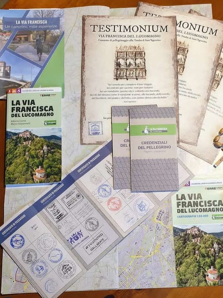
CREDENTIAL
CREDENTIALS
Via Francisca del Lucomagno has its own credentials, which can be requested free of charge.
WHERE TO REQUEST THEM?
The credentials of Via Francisca del Lucomagno can be requested on the walk’s website or to be picked up independently at the start of the walk on the Lavena Ponte Tresa lakefront

GUIDE OF THE VIA FRANCISCA DEL LUCOMAGNO
The Italian section of an ancient path that, starting from Constance, crosses the Swiss Alps via the Lukmanier Pass and winds its way to Pavia. Eight STAGES to be traveled on foot, by bike or by special bike, crossing extraordinary places rich in art and history, including UNESCO and FAI World Heritage properties. From Lake Lugano to the summit of Varese’s Sacro Monte, to the abbey of Morimondo and the basilica of San Pietro in Ciel d’Oro.
An itinerary dotted with rivers and bodies of water: from the land of the seven lakes, to the Milanese canals and the Ticino, to explore Lombardy and land at the Via Francigena.
Includes detailed mapping, hospitality contacts, and all useful information for trip planning.
In addition, an appendix devoted to STAGE in Germany and Switzerland, with instructions for connecting to Via Francigena.