
Grande Traversata Elbana
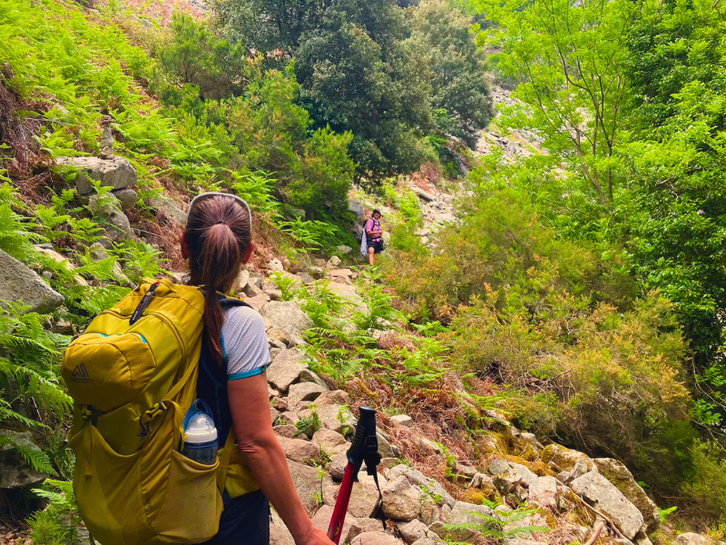
The Grande Traversata Elbana (GTE) is a nature trek that traverses the entire Isle of Elba!
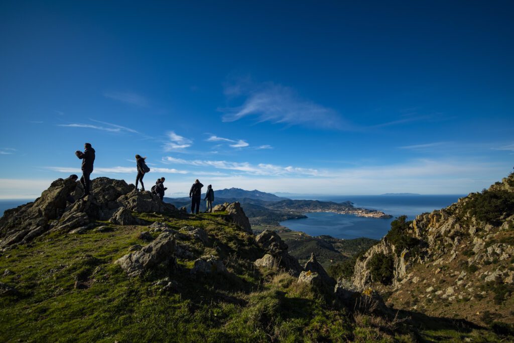
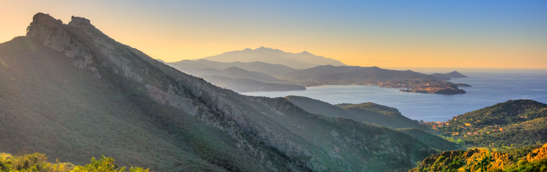
The Grande Traversata Elbana (GTE) runs along the Elba ridge from Cavo to the extreme northeast, passing the highest peaks of the eastern ridge, the gentler reliefs of the central part and granite massif of Monte Capanne before bifurcating and descending back to the sea with a choice between the northwest of Patresi (GTE north, slightly longer) and the southwest of Pomonte (GTE south, slightly shorter).
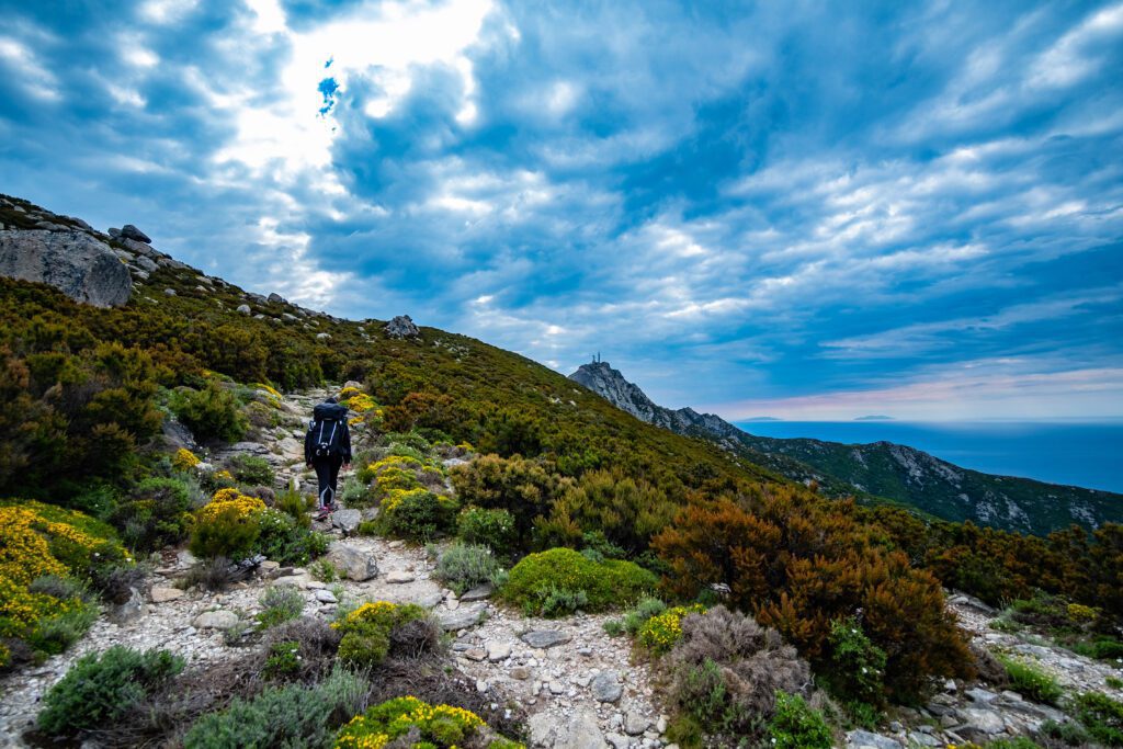
The trek takes place outside built-up areas - to stop to sleep or eat you will have to leave the ridge and descend - and overlooks from time to time the seas to the north, east and south with spectacular views of villages, beaches, the mainland, and islands near and far. The route also allows you to appreciate the incredible geological, landscape and vegetal variety that distinguishes Elba, alternating in the same day's walk between garrigue, low and high scrub, bare stony ground, and forests of holm oak, chestnut and yew.
The path can be walked indifferently in either direction, keeping in mind that Monte Capanne, the massif on the western side, constitutes the most challenging climb, and one can therefore decide to get there in stages starting from the east, or face it immediately with a steep ascent, but with fresher legs. There are four classic STAGES (Cavo - Porto Azzurro, Porto Azzurro - Procchio, Procchio - Poggio, Poggio - Pomonte or Poggio - Patresi; however, there is nothing to stop elsewhere), but regular walkers can reduce them to three by merging the two shorter ones, especially if you stay overnight in some of the facilities closer to the route that save having to descend and ascend from the towns.
HISTORY
The GTE was conceived in the 1980s by Renato Giombini and Mario Ferrari, experienced walkers and connoisseurs of the area and authors of one of the first guidebooks to Elba’s trails. The idea was to unite existing trails to create a route that would cross Elba from east to west while keeping as close as possible to the watershed and avoiding asphalt; in the following decades there were then slight modifications to the route, then since 2017 the GTE has been marked as such on the signage affixed by the Tuscan Archipelago National Park, which maintains most of the island’s trail network.
The route itself is not a historical one – those who had to go from Cavo to Patresi or Pomonte in the past would certainly have traveled more easily by sea – but several sections take up ancient routes connecting the villages, to be traveled on foot or on donkey backs, or the paths traveled daily by those who went to cultivate the fields and vineyards that covered the island, and sometimes preserve the paving stones; much of the stretch between Porto Azzurro and Procchio, on the other hand, passes through one of the military carriage roads built from scratch in the 1930s to move men and materials between the various lookout and defense posts at a time when motorized vehicles on Elba were still a rarity, as indeed were the carriages themselves.
In recent years, the trails of Elba have attracted an increasing number of trekking enthusiasts, and especially in spring and autumn it is easy Cross paths with other walkers. The GTE, largely exposed, is Strongly discouraged in midsummer. November is the rainiest month; in winter the days are short, there can be strong winds on the ridges, at higher altitudes you can find ice and sometimes snow: to face the GTE in winter it would be good to already have experience of similar environments, keeping in mind that on the trails we may not meet anyone and that there are far fewer facilities open.
WATER
Aside from the towns in which it stops, the only water point is Fonte Schiumoli (coordinates 42.78486, 10.32047), between Porto Azzurro and Procchio, along the second STAGE. In summer, Fonte Schiumoli may also be dry.
SERVICES
Supermarkets: in Porto Azzurro; in Procchio in the summer season
Pharmacies: in Porto Azzurro and Procchio
Bars at all STAGES (in Poggio and Patresi closed in winter)
Bus stops at the start, finish, and at points where provincial roads cross: routes 117 and 118 at Campo ai Peri / Casa Marchetti, along SP 26 between Portoferraio and Porto Azzurro (42.77914, 10.34712); route 116 at Colle di Procchio, along SP 25 between Procchio and Marina di Campo (42.77846, 10.24647); stops are also indicated on the timetable as “GTE.”
SIGNAGE
Signage is present along the Grande Traversata Elbana:
- White-red markers to CAI standards;
- White-and-red GTE flags;
- GTE vertical signage (arrows);
- Some wooden arrows.
DANGERS
There are no particular dangers, but it is advisable to avoid approaching wild goats, mouflon and wild boar, which may feel threatened. Vipers are rare; the usual advice applies: wear long trousers and pay attention to where you place your hands and feet among the rocks.
The granite on the western slope is particularly slippery when wet. None of the sections are properly in the open or on overhangs, but some of the scree, both on the eastern ridge and especially mid-slope on Mt. Huts, requires attention.
ACCESSIBILITY
Route not equipped for people with disabilities
ROAD BOTTOM.
ROAD BOTTOM.
95% trails or dirt roads; very short stretches of asphalt in the central part.
IN TENT
The regulations of the Tuscan Archipelago National Park and the municipalities prohibit free camping or bivouacking outside authorized campsites on the entire island. It is forbidden to light fires in the Park. It is not per se forbidden to spend the night there.
CREDENTIALS
Credentials have not yet been realized
PAPER GUIDE.
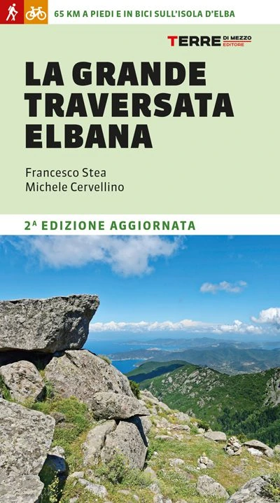
A guide to GTE for Terre di Mezzo editions came out in 2024 (www.terre.it/prodotto/la-grande-traversata-elbana ).
The Tuscan Archipelago National Park has produced a map hiking map that can be purchased at Infoparks or on the website of 4LAND, as well as in island bookstores and various stores. The same map can be downloaded for free from the app (also free) Avenza Maps and allows geolocation in real time, even in the absence of signal.
CONTACTS
Italian Alpine Club – Elba Island Subsection www.caielba.it
Tuscan Archipelago National Park www.islepark.it/rete-sentieristica/gte
STAGE 01
STAGE 01: Cavo to Porto Azzurro
Departure: Cable
Arrival: Porto Azzurro
Distance: 18 km
Height difference: +950 m
You get to Cavo (hamlet of Rio) from Piombino by hydrofoil or rarer ferries. From the seafront, one climbs inland; after a few hundred meters one meets a very short detour to visit the Tonietti Mausoleum. The route then climbs to Monte Grosso (344 mslm), once the site of a military observation post, from where there is a stunning panorama. It then descends until it laps the Parata road, flanking the Vignolo ditch in a pleasant shady up and down; it crosses the Valle delle Fiche and reaches the rest area at Aia di Cacio, where several paths cross the paved road. From here with a detour of a few minutes on path 203 you can reach the Orto dei Semplici at the hermitage of Santa Caterina. After crossing the road, the trail resumes: a steep scree slope leads to La Croce (396 m), above the village of Rio nell’Elba, then to Monte Capannello (407 m), another beautiful vantage point from which the eastern and western sides of the island can be admired simultaneously. A few meters further down the trail enters a pine forest and almost immediately crosses the Volterraio road, whose castle majestically dominates the gulf of Portoferraio. The route then climbs to Cima del Monte, the highest peak in the eastern half (502 m). Continue on the GTE to the junction with path No. 210 on the left, which, gliding through the vineyards, allows you to descend to Porto Azzurro in about 30 minutes.
STAGE 02
STAGE 02: Porto Azzurro to Procchio
Departure: Porto Azzurro
Arrival: Procchio
Distance: 21 km
Height difference: +400 m
The second STAGE takes place largely on an old military carriage road and has a wide walking surface with little elevation gain. After a little more than 3 km from the junction with Trail 210 and a short stretch of asphalt, it crosses Provincial Road No. 26 to climb up near Monte Orello (376 m), a viewpoint reached by a short detour, with some 1930s bunkers at the summit.
Next, the route passes by Fonte Schiumoli, the only water point along the GTE, and skirts the Colle Reciso quarry, after which you will have to turn left and walk about 200 meters of asphalt and then turn right again on the wide dirt road through the scrub. Just before the junction with path 221, you can make a detour to the left to visit the ruins of an old windmill on the ridge and admire the view of Lacona. Past the entrance to path 244, which we find on our left, we descend with some difficulty on a dirt road heavily eroded by water to the damp valley floor and the Literno locality; here we continue until we cross the provincial road that, taken north, descends to Procchio, less than a kilometer away.
STAGE 03
STAGE 03: Procchio to Poggio
Departure: Procchio
Arrival: Knoll
Distance: 12 km
Height difference: +950 m
The third STAGE of the GTE leads from Procchio to Poggio. Having abandoned the paved road, the trail climbs Mount Castello (226 m) where it is interesting to do a brief exploration to discover, hidden by the scrub, the ruins of a large Etruscan fortress and a small military outpost used in World War II as an observation point. The route continues as a tunnel through the vegetation until it crosses the junction with path 180 to Poggio and path 121 to Sant’Ilario. It begins the steep ascent that leads in less than an hour to Mount Perone (630 m) and then to a large and convenient rest area along the road. From here the GTE travels through the “Butterfly Sanctuary,” an important breeding area, to the Malpasso locality where the GTE fork is located in the woods.
From here, if you want to descend to Poggio, you can either take a section of the northern GTE and then the steep trail 105, or take a longer but less strenuous loop via trails 101 or 106. However, the detour from the main route is not too easy or quick, and this is the shortest STAGE of the common section of GTE, so you may consider shortening it to the next one (descent to Patresi from GTE north or to Pomonte from GTE south) making the crossing in three stages instead of four and saving the detour, descent and ascent.
STAGE 04 (north)
STAGE 04 GTE North: Poggio to Patresi
Departure: Poggio
Arrival: Patresi
Distance: 16 km
Height difference: +550 m
From the junction with Trail 105, the trail heads west, keeping around an elevation of 600 to 700 m, to the junction with Trail 110, where it turns left steeply up the western ridges of Monte Capanne to the Table, at the maximum elevation of 921 m.
From here begins an almost uninterrupted descent, which takes a curious turn northward, skimming past the ruins of the small Romanesque church of San Frediano to the pastoral neighborhood of Serraventosa with its caprili, then down to the destination of Patresi – Mortaio with views of Capraia and northern Corsica. Peculiar are the granite-paved stretches of what was once the mule track that connected Marciana and Pomonte, the almost surreal silence of the areas farthest from civilization, the spectacular flowering of different species of broom between spring and summer.
STAGE 04 (south)
STAGE 04 GTE South: Poggio to Pomonte
Departure: Poggio
Arrival: Pomonte
Distance: 10 km
Height difference: +50 m
From the bifurcation, follow the GTE south in a southwesterly direction, following the ridge that divides the broad Pomonte valley from the Vallebuia valley. Stones and boulders require attention but the view is worth it: the location was already exploited in prehistoric times, Bronze Age artifacts have in fact been found in the area, and the experienced eye spots near the ridge the remains of large boulder walls.
In the descent from 839 m to the sea, one will encounter Colle della Grottaccia (645 m), Le Mure (629 m) – where the experienced eye spots near the ridge the remains of large prehistoric boulder walls – Monte Cenno (589 m), Monte Orlano (549 m), and some caprili with “grottino,” stone structures built by shepherds in the early 20th century. Having passed the last caprile located a short distance from Monte Orlano, we take a narrow lane between magnificent terraces recaptured by wild vegetation and in a few dozen minutes of walking among a few surviving vineyards among those that once carpeted the entire valley, we reach Pomonte with its church, fountain, a couple of bars and, if we descend further, a beach of large pebbles.
Grande Traversata Elbana
Four days of walking (two if tackled by bicycle) to cross Elba from east to west, largely following the ridge immersed in the nature of the Tuscan Archipelago National Park. At the end of each STAGE you descend to coastal villages, with the possibility of indulging in a rejuvenating swim in the sea.
A mountain trek a stone’s throw from the beach: it is this contrast that makes the GTE one of Italy’s most beautiful and well-known hiking traverses.
Pearl of the Tyrrhenian Sea, Elba is a true paradise for those who love trekking and those who want to combine an active vacation with relaxation by the sea. The guide offers all the practical information: route descriptions on foot or MTB, variants, STAGE and hospitality, GPS tracks to download, and tips for experiencing the island not only in summer, but throughout the year.
Authors: Francesco Stea, Michele Cervellino
Publisher: Terre di Mezzo


Journey diaries
Insights
Grande Traversata Elbana
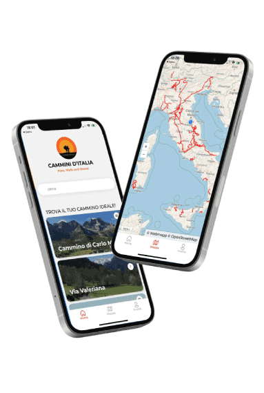
With Cammini d’Italia’s free app, you can plan and walk the Grande Traversata Elbana in total safety, being able to plan the stages in detail and walk the route thanks to the built-in GPS technology that supports your orientation during your adventure.
Within the app you will find many other paths present in Italy. Thanks to the georeferenced tracks of many routes you will be able to study the itinerary that suits you best and also download the GPX tracks of the individual STAGEs offline.
The app also includes a complete digital map of all the paths surveyed to date on our portal, giving you a wide range of choices among the many paths in the Belpaese.
⠀⠀
Cammini d’Italia is the perfect app for those who want to explore the beauty of Italy on foot, discovering hidden places surrounded by nature. Download it for free today and start planning your next adventure!
⠀
⠀
 ⠀⠀⠀
⠀⠀⠀