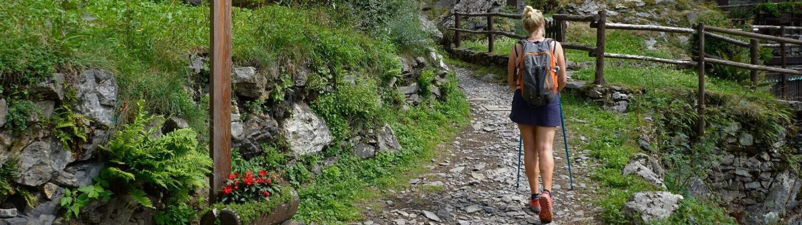
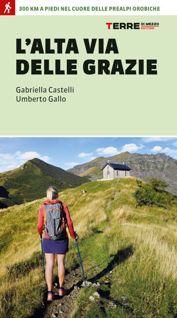
Alta Via delle Grazie
A loop walk in the Orobic heart of Lombardy, from Bergamo to the most evocative places in the Seriana Valley and Alto Sebino. Shrines, churches, trails, nature, art, cuisine and hospitality in the magnificent natural theater of the Serio River.
The Path “Alta Via delle Grazie” is the brainchild of Gabriella Castelli and Giovanni Battista Merelli. Inspired by Santiago de Compostela, they decided that even on the outskirts of home one could undertake the busqueda, the inner quest. They created a route in whose stages there are as many as 18 Marian shrines, each with a wonderful story and a spiritual message to be discovered. The project Alta Via delle Grazie, carried out with the generous contribution of several volunteers, absolutely free from any profit motive, pursues the purpose of discovering and enhancing an area of Lombardy particularly rich in multiple and extraordinary attractions, all enclosed in a loop tour, which touches the city of Bergamo, the Seriana Valley and the Alto Sebino with Lake Iseo.
It is proposed to anyone who wants to become a “Pilgrim” in search of beauty, in a simple and shareable way, for a new and rewarding life experience. Waiting for the first ray of sunshine in the morning, breathing in the scent of clean air, in solitude or in company, freely telling stories to the unexpected traveling companion, being carried away by the wind, regenerating at the water of a stream, admiring the beauty of art, from the simple artifacts to the most precious works, until being surprised by the warmth of a door open to welcome, finally being able to express and share all these feelings; for relationships are the of the project.
SIGNAGE
Signage present along the path: blue arrow with path logo
DANGERS
Since it is a purely mountain path, good training and a minimum of experience walking at high altitudes, adequate equipment is advisable, although it does not present via ferratas or other steps proper to mountaineering.
In spring and fall it is good to inquire about the transitability from the Della Manina pass, which especially at
beginning of the season may be snow-covered.
It is advisable to organize the walk between May and October.
IN TENT
Possible to do this? Yes
Should a permit be applied for? No
The information was provided by the managing body of the walk. To receive more information about it, send an e-mail to altaviadellegrazie@gmail.com
ROAD BOTTOM.
40% asphalt
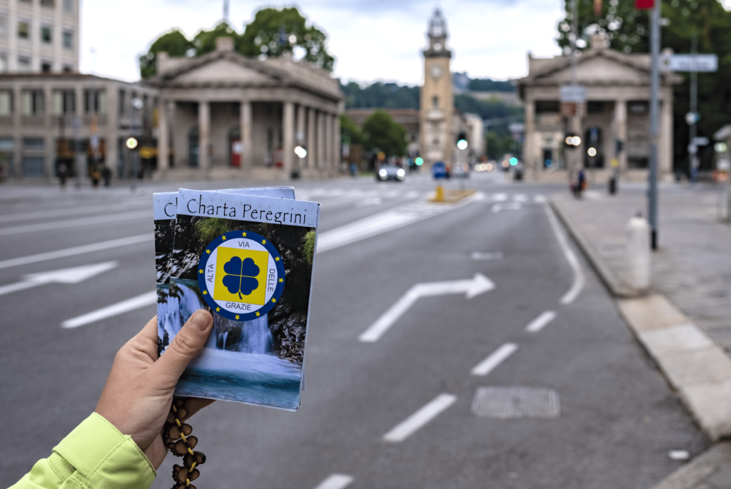
CREDENTIALS
The Alta Via delle Grazie has its own Credential.
The Credential is the fundamental document of the Pilgrim. It represents the “Pilgrim’s Passport,”
attesting to his or her identity and motivations. The Pilgrim must have it with him or her to be identified as such and
have access to the reception facilities provided along the itinerary. He/she will receive a stamp at
tourist offices, accommodation and refreshment facilities, parishes, until the completion of the walk. Many facilities welcome pilgrims with Credential by requesting a simple offering, which is useful to support operating expenses; in other cases, when it comes to accommodation facilities that offer more services, reductions are generally applied.
To pick up the credential, contact the church Santa Maria delle Grazie in Viale Papa Giovanni XXIII,
first contact Don Valentino by phone at +39 3335793798
C0s the credential? Leggi l’articolo completo.
It can be requested from www.altaviadellegrazie.com and sent by mail.
The credential is issued upon free offering.
https://www.altaviadellegrazie.com/copia-di-la-credenziale-the-credent
WATER
STAGE 1:
It can be found in the hamlets of Olera, Monte di Nese, and Santuario del Perello.
STAGE 2:
Drinking water can be found in Val de Gru and Vertova Valley.
STAGE 3:
It can be found in Bondo di Colzate and in Chignolo d’ Oneta. At the bar-restaurant Poli the possibility of making a stop (convention for pilgrims and possibility of credential stamping).
STAGE 4:
It can be found in the Plazza locality near the church.
After about 1 hour’s walk to Zambla Pass possibility of breakfast and provisions at the Valle Sports Center (agreement for pilgrims).
STAGE 5:
It can be found on the path near the church of St. James and Vincent in Gromo near the church of St. Lawrence in Valbondione.
STAGE 6:
It can be found in the Sedornia Valley
STAGE 7:
Possibility of encountering bars and restaurants as you pass through several villages.
STAGE 8:
Possibility of encountering bars and restaurants as you pass through several villages
STAGE 9:
It can be found in the locality of Rusio, in the square in Onore. Crossing the villages refreshment possibilities in the various bars – restaurants
STAGE 10:
It is found in Lovere at the fountain near the Convent of the Capuchin Friars and in the historic village both of Lovere.
STAGE 11:
STAGE 12:
Stage 13:
CONTACTS
STAGE 01
STAGE 01: Bergamo Selvino
Departure: Bergamo – Church of Santa Maria delle Grazie
Arrival: Selvino (BG) – Selvino Parish Church
Length: 22.7 km
Height difference: + 1452 m / -694 m
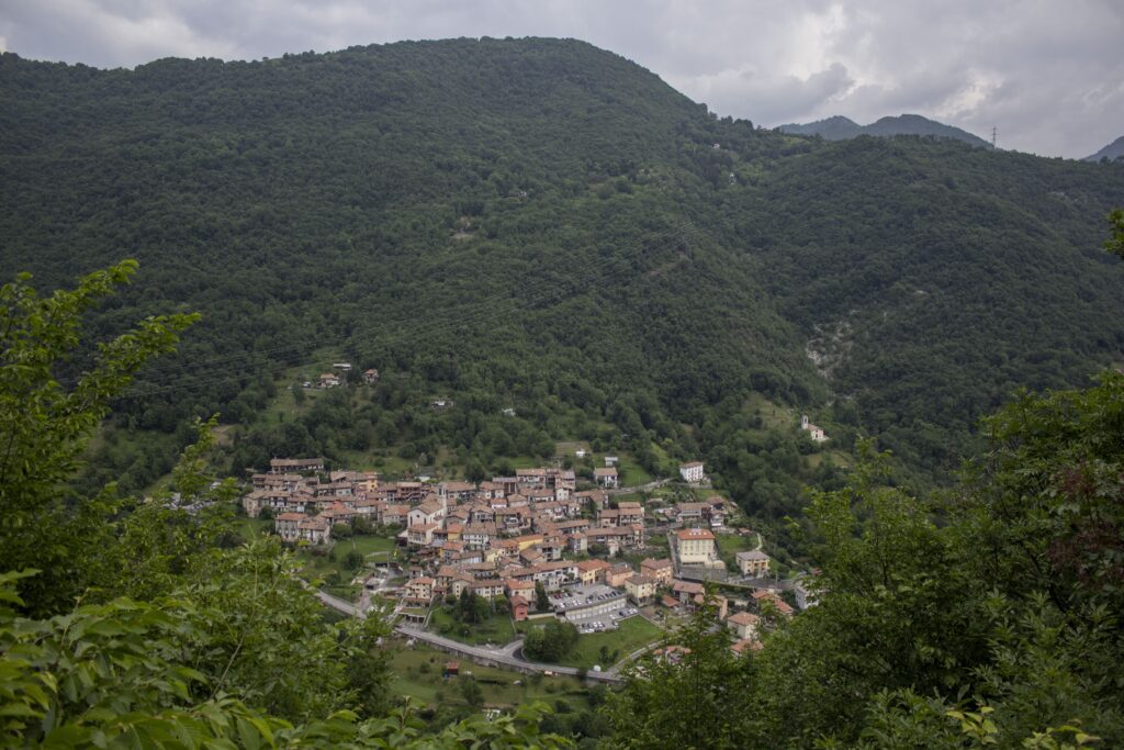
From the sanctuary of Santa Maria Immacolata delle Grazie, the skyline of “Città Alta” is presented in the background and the topography of the city is well understood, characterized by the ancient historic core on the hill with the Venetian walls, the dome of the cathedral and the silhouette of the basilica of Santa Maria Maggiore, the destination of our final arrival and the more recent “Città Bassa” located at the foot of the rise. Having crossed the “sentierone” “living room of the city” and passed the Atalanta sports field, the uphill route begins that reaches the Maresana, a green area, a summer destination for Bergamasks. Along the ups and downs of the wooded paths, you reach the medieval village of Olera. It continues through Monte di Nese and Salmezza, the highest point (1030 m a.s.l.) of today’s STAGE to reach the sanctuary of Madonna del Perello and finally the tourist town of Selvino.
STAGE 02
STAGE 02: Selvino – Vertova
Departure: Selvino (BG)
Arrival: Vertova (BG)
Length: about 16.6 km
Height difference: + 620 m / – 1177 m
Leaving Selvino for the nearby village of Ama, one begins to climb along a path that winds through a broadleaf forest and leads to the summit of Mount Cornagera. Crossing between rock walls the narrow gorge known as the “büs de la Carolina you reach the refuge of Mount Poieto where you can stop. In a succession of ups and downs in the forest, you reach the Val del Gru, a secluded world of nature and traditions to arrive in the naturalistic corner of the Val Vertova, at the end of which you reach the historic center of Vertova and the parish church.
STAGE 03
STAGE 03: Vertova – Sant. Frassino
Departure: Vertova (BG)
Arrival: Sant.Frassino (BG)
Length: about 17.3 km
Height difference: + 1196 m / -725 m
The Alta Via delle Grazie continues, from Vertova a mule track leads to the sanctuary of San Patrizio. Between grassy falsopiani and wooded paths passing through Bondo and among the few houses of Barbata, you reach the church of Madonna della Mercede with a view of the Orobie and the Riso valley. We pass by Christ the Redeemer, a bronze statue, three meters high to descend to Riso and climb back up to “Ortel” a group of houses where time seems to stand still. At the hamlet of Chignolo d’Oneta, you can stop for lunch at Mrs. Renata’s. Continue on the path at altitude, among beech and spruce forests, to the destination: the sanctuary of Madonna del Frassino.
STAGE 04
STAGE 04: Sant. Frassino – Oneta
Departure: Sant.Frassino-Oneta (BG)
Arrival: Parre (BG)
Length: about 19.2 km
Height difference: +576 m / – 984 m
Starting from the sanctuary of the Madonna del Frassino on an uphill path you reach the Crocetta pass. Continuing through the forest that contours the entire Val del Riso, one sees the sanctuary embedded on the opposite slope again. Past the hamlet of Plaza one walks among the rails of the Costa Jels mining site, with dark tunnels overlooking the trail. On the long journey through the lonely forests, one glimpses from afar the cementing of the entire valley floor. Descending one arrives in the villages of Gorno and Premolo, which preserves the crypt of the Servant of God Don Antonio Seghezzi (here for those who wish, a shorter route starts that reaches the arrival site). Beyond we reach the Madonna delle Lacrime sanctuary in Ponte Nossa and ascend to the historic village of Parre, the end of the STAGE.
STAGE 05
STAGE 05: Parre – Novazza
Departure: Parre (BG)
Arrival: Novazza (BG)
Length: about 18.5 km
Height difference: + 867 m / – 655 m
Climbing from Parre, one touches the sanctuary of the Holy Trinity and along a path that enters the woods descends to the locality of Sant’Alberto. Over a dancer bridge you cross the Serio River, arriving on the bicycle/pedestrian path alongside the river, which leads after a paved section to the beginning of Ardesio. It climbs up from the valley floor to reach high altitude, where you return to walking among paths. You travel along a section of Valcanale, nestled between mountains within the Orobie bergamasche park, among meadows and woods guarded by the high rocky peaks of the Arera massif, and reach the nucleus of Bani to continue to Novazza, the end of today’s walk.
STAGE 06
STAGE 06: Novazza – Valbondione
Departure: Novazza (BG)
Arrival: Valbondione (BG)
Length: about 20.7 km
Height difference: + 931 m / – 583 m
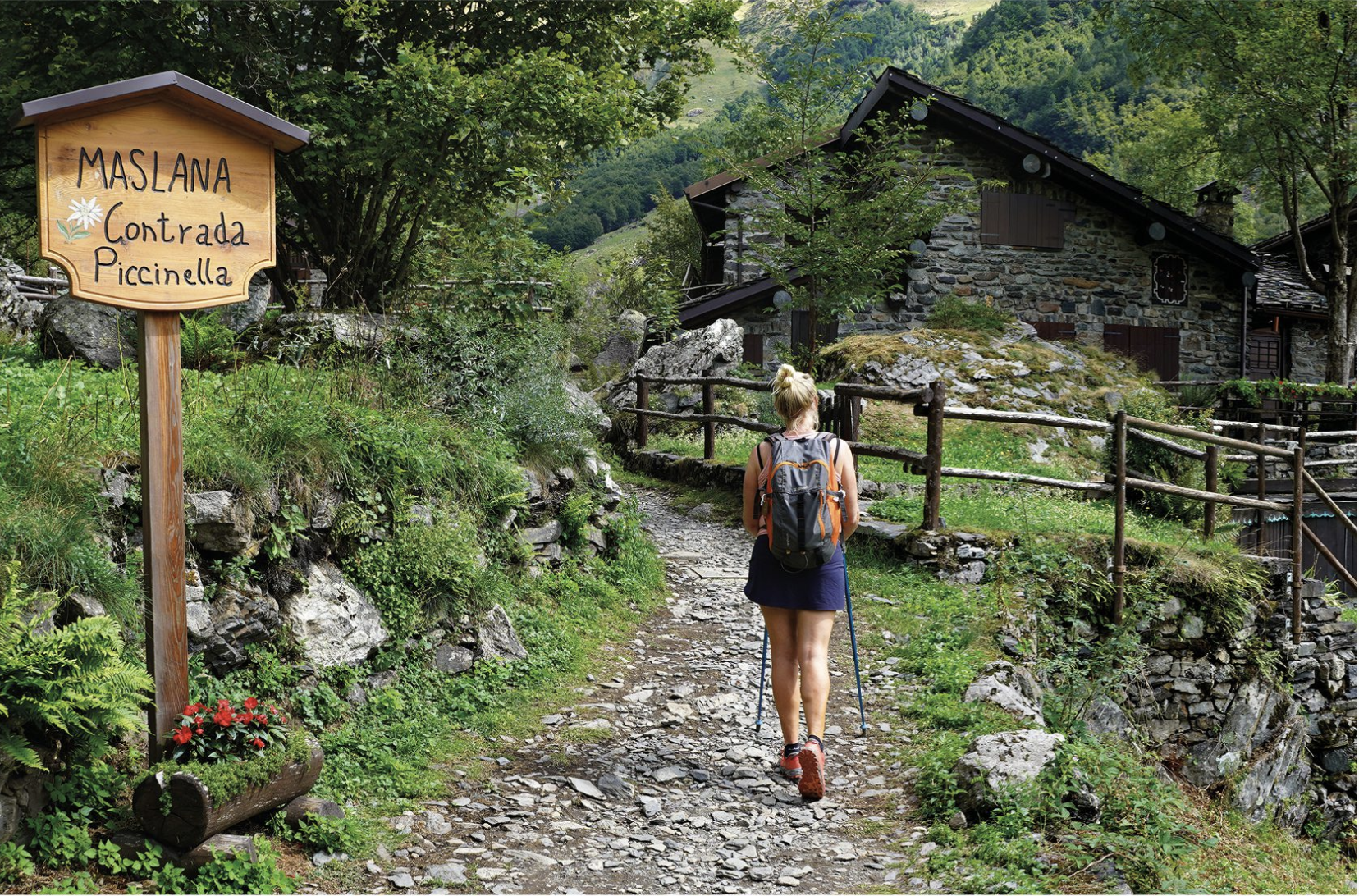
STAGE 6 of the Alta Via delle Grazie starts from Novazza to nearby Colarete and the small church of St. Michael the Archangel to arrive in Gromo. On the bike/pedestrian path that runs along the Serio River, one crosses Gandellino and Bondo to reach Valbondione. A path leads to the ancient village of Maslana, and going up you reach the head of the valley, in the heart of the highest peaks of the Orobie, where Lizzola, a place of welcome, is located.
STAGE 07
STAGE 07: Lizzola – Ardesio
Departure: Lizzola (BG)
Arrival: Ardesio (BG)
Length: about 23.1 km
Height difference: + 502 m / -361 m
We ascend from Lizzola to reach the Manina Pass where the little church of the Madonna Pellegrina stands solitary, surrounded in the distance by the high peaks of the Orobie Mountains. Continuing on, we touch 2,000 meters above sea level, the highest place on the walk, where the return journey begins. Among steep ups and downs you reach the small Spigorel lake, continue at length crossing the Sedornia valley to arrive among fir trees and green spaces at Gromo di Boario. It descends from the “del Botto” path to reach the sanctuary of Madonna delle Grazie and the hospitality of Ardesio.
STAGE 08
STAGE 08: Ardesio – Castione della Presolana
Departure: Ardesio (BG)
Arrival: Castione della Presolana (BG)
Length: about 20.3 km
Height difference: + 659 m / -414 m
Leaving Ardesio, the route proceeds on the paved road that runs along the Serio River. It passes through the village of Ogna and into the woods, to the small church of San Rocco. On the trail we reach the town of Clusone and its famous monuments. Going further into the Borlezza valley, we reach the sanctuary of Madonna delle Grazie in Sommaprada and then Rovetta, town of the well-known Fantoni workshop. We cross between pastures and woods the small valley of Romentaregh and finally to Castione della Presolana, site of our rest.
STAGE 09
STAGE 09: Castione della Presolana – Lovere
Departure: Castione della Presolana (BG)
Arrival: Lovere (BG)
Length: about 30.5 km
Height difference: + 630 m / – 1312 m
From Castione, in a short time you are at the rural village of Rusio and continuing past the villages of Bratto and Dorga. After the shrine of Our Lady of Grace in Lantana, one travels through the Tede valley until reaching Onore and with a wide loop to Songavazzo. It continues to the shrine of the Nativity of the Blessed Virgin Mary in the hamlet of Novezio and to Cerete, where the chapel of the Annunziata is located. We follow the partly paved partly unpaved road through meadows, woods and rare dwellings to reach Sovere and from here on an ancient mule track to the locality of Lovere, our arrival point.
STAGE 10
STAGE 10: Lovere – Monte Isola
Departure: Lovere (BG)
Arrival: Monte Isola (BG)
Length: May vary depending on the route you decide to follow
From Lovere by boat to Peschiera Maraglio on the lake island of Monte Isola.
Here you can opt to stroll through the villages and along the narrow streets of the island, or reach the Madonna della ceriola shrine at the summit of the mountain. Back at the pier you sail
returning to the harbor, to visit Lovere.
STAGE 11
STAGE 11: Lovere – Gandino
Departure: Lovere (BG)
Arrival: Gandino (BG)
Length: about 29.1 km
Height difference: + 1694 m / – 1350 m
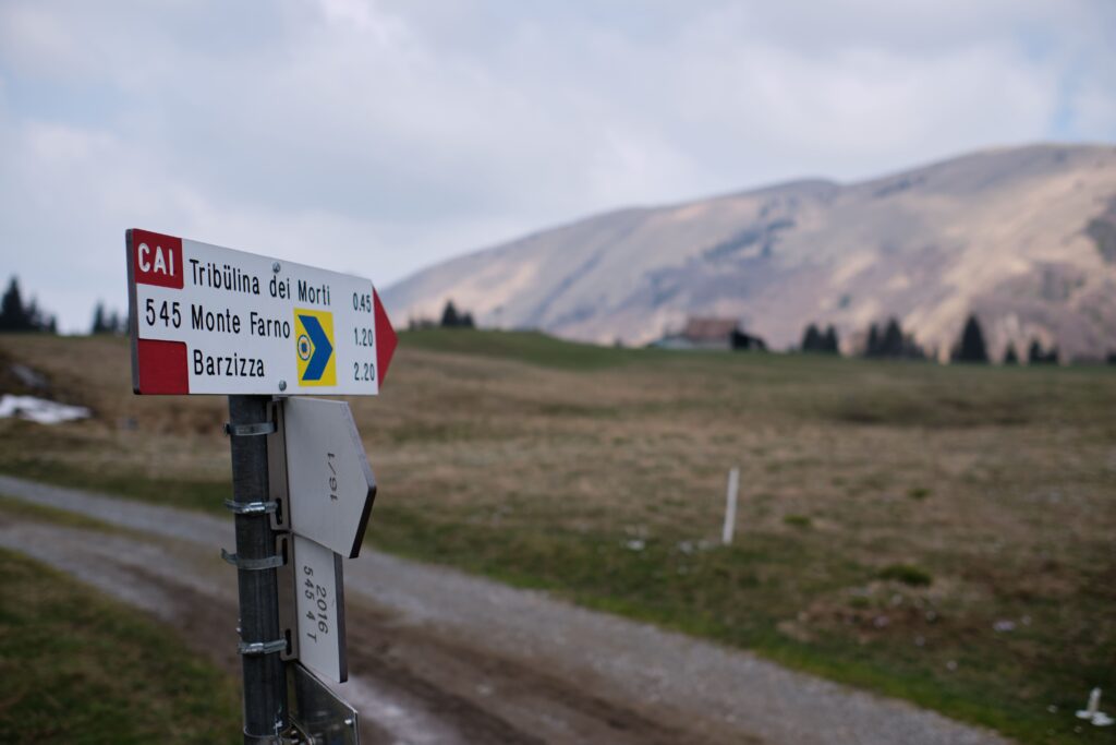
Back in Sovere, the climb to the shrine of the Blessed Virgin of the Tower begins. The long and sometimes difficult path proceeds further to Malga Lunga, where the view sweeps over Lake Iseo and the mountains on the opposite shore. On a silvopastoral road, you arrive at the grassy plateau of Campo d’Avene. From here another ascent leads to the little chapel of the tribulin of the dead. It descends to the shrines of the Madonna d’Erbia and the Holy Trinity both in Casnigo, finally reaching Gandino.
STAGE 12
STAGE 12: Gandino – Fiobbio
Departure: Gandino (BG)
Arrival: Fiobbio (BG)
Length: about 19.4 km
Height difference: + 819 m / -934 m
From Gandino one climbs among plateaus and scattered huts to trespass into Val Cavallina. It continues to the Forcella pass, to arrive on a pastoral path with low-elevation vegetation, in the Rossa valley to then reach the Beata Vergine di Monte Altino shrine. It descends again to Abbazia, in the Lujo valley, where an ancient abbey of St. Benedict stands. Further on is Fobbio where the body of Blessed Pierina Morosini is kept in the parish church.
STAGE 13
STAGE 13: Fiobbio – Bergamo
Departure: Fiobbio (BG)
Arrival: Bergamo – Basilica Santa Maria Maggiore
Length: about 26.7 km
Height difference: +398 m / -437 m
This last day, which returns to Bergamo, holds several important intermediate stops. In Albino, town of the painter Moroni, there are the shrines of the Madonna del Miracolo (known as “della Gamba”) and Madonna del Pianto.
In Nembro the sanctuary “of the Zuccarello” and in Villa di Serio that of the Madonna del buon Consiglio. Alzano Lombardo exhibits the basilica of St. Martin with adjoining museum, then one encounters in Bergamo the last and citywide shrine of Our Lady of Sorrows in the village of Santa Caterina to arrive in the Città Alta complex at the basilica of Santa Maria Maggiore.
This is the oldest and most precious testimony of faith in the city where it is possible to stamp the last stamp on the credential as a seal of a journey that is certainly challenging but equally rich in many suggestions, different landscapes and personal surprises.
ALTA VIA DELLE GRAZIE GUIDEBOOK
From Bergamo to the mountains and back: a seven- or thirteen-day loop adventure to explore the entire Seriana Valley.
A journey that connects villages and passes, rediscovering the spirituality enshrined in the woods, among the rocks and in silence, and visiting the most significant sanctuaries of the Orobie bergamasche. A journey that celebrates devotion, Alpine traditions and the beauty of an extraordinary nature, enriched each evening by the authentic welcome of pilgrims.
A special opportunity to discover Bergamo, Italian Capital of Culture 2023 together with Brescia, and to immerse yourself in the green landscapes of its valleys. Complete with all the necessary information: detailed maps, elevation gain, elevation gain, descriptions of trails and places of interest, as well as suggestions for hospitality.
For those with less time, it is possible to tackle the itinerary in a single week, choosing shorter STAGES and reduced elevation gain, without giving up the magic of theAlta Via.


Insights

Alta Via delle Grazie
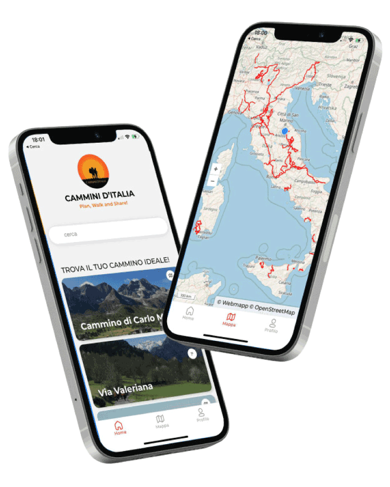
With Cammini d’Italia’s free app, you can plan and walk the Alta Via delle Grazie in total safety, being able to plan the stages in detail and walk the route thanks to the integrated GPS technology that supports your orientation during your adventure.
Within the app you will find many other paths present in Italy. Thanks to the georeferenced tracks of many routes you will be able to study the itinerary that suits you best and also download the GPX tracks of the individual STAGEs offline.
The app also includes a complete digital map of all the paths surveyed to date on our portal, giving you a wide range of choices among the many paths in the Belpaese.
Cammini d’Italia is the perfect app for those who want to explore the beauty of Italy on foot, discovering hidden places surrounded by nature. Download it for free today and start planning your next adventure!
⠀
⠀
 ⠀⠀⠀
⠀⠀⠀